
Bear Valley Trail
Trailheads Bear Valley Trailhead 108 ft Drive there · Rift Zone Trailhead 107 ft Drive there · Woodpecker Nature Trailhead 109 ft Drive there
Hike the Muddy Hollow Trail 4 mi round trip · the Park Service's write-up
1-3 Hours · no dogs · season <h2>Winter</h2> <p>The heaviest rainfall occurs in the winter months. Come prepared for rain and drizzle to possibly last for several days. In between winter rains, it is often sunny, calm, and cool.</p> <h2>Spring</h2> <p>Most spring days are windy and the Limantour Beach area frequently experiences fresh to strong breezes. Expect cool temperatures in March. By late May and early June, temperatures can be quite pleasant, even warm.</p> <h2>Summer</h2> <p>Although there is very little rain during summer months, there is often dense fog throughout the day in July, August and September with temperatures often 20 degrees cooler than at Bear Valley.</p> <h2>Fall</h2> <p>The coastal areas of Point Reyes experience some of the clearest days in late September, October and early November. The occasional storm will start rolling through in late October, bringing clouds, wind, and rain. The strongest winds occur in November and December during occasional southerly gales.</p>
Start Muddy Hollow Trailhead or Limantour Beach Trailhead, Point Reyes National Seashore
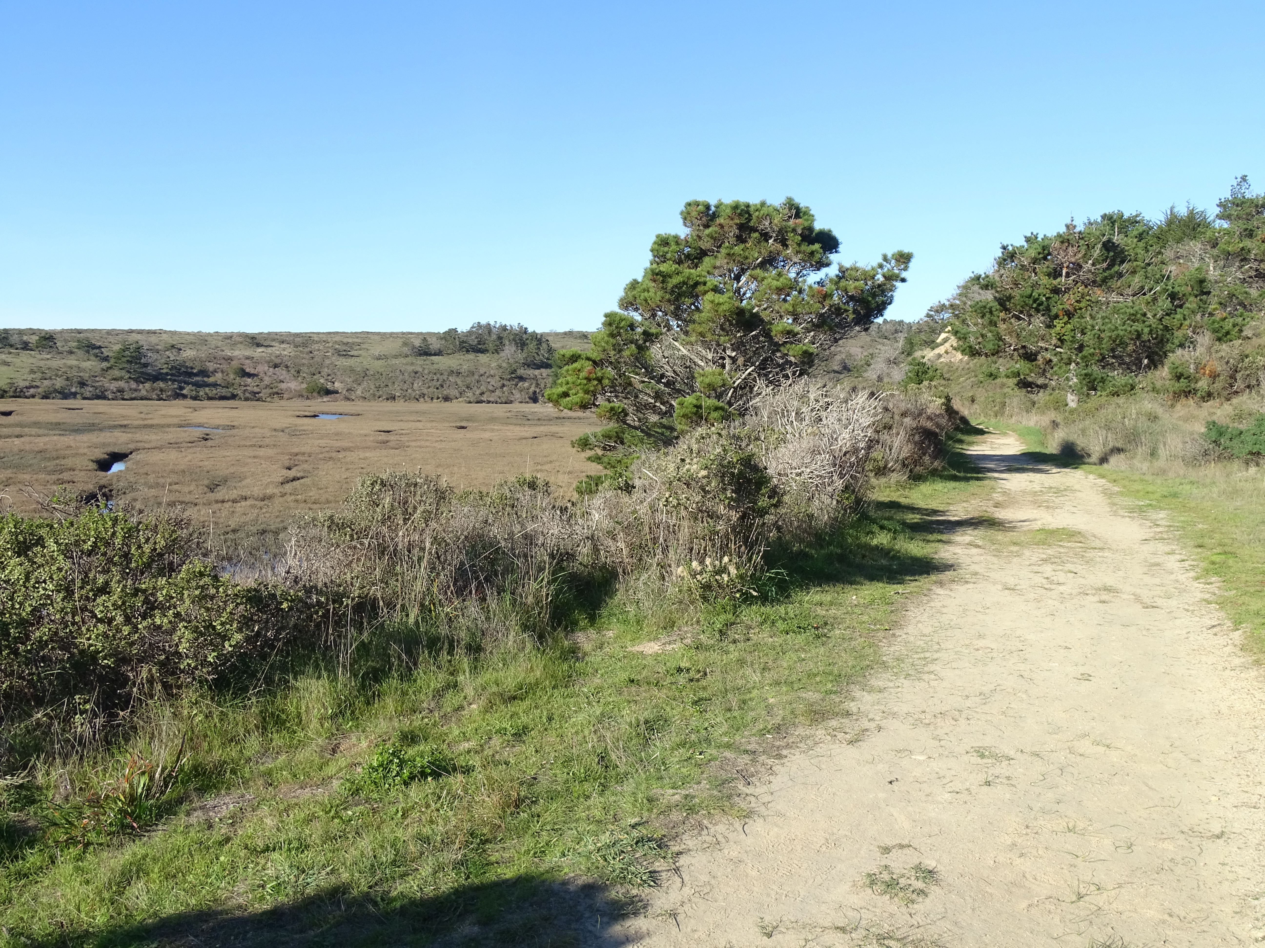
Distance: 4 mi (6.4 km) roundtrip
This out-and-back trail offers an easy hike with opportunities to see diverse bird life, wildflowers, and possibly tule elk ! One can either start at the Muddy Hollow Trailhead at the trail's north end and hike to and from Limantour Beach , or start at trail's southern terminous at the Limantour Beach Trailhead and hike north and up the Muddy Hollow drainage.
Beginning at the Muddy Hollow Trailhead, follow the path downstream through lush riparian habitat of red alder and willow. After 1.4 miles (2.2 km), one arrives at a pond, which is a good location for birding. The next 0.4 miles (0.7 km) of trail skirts along the southern edge of an arm of Estero de Limantour before eventually arrive at the picnic area just south of Limantour Beach parking lot. Vault toilets are available at this location. From here, you can continue for ~0.2 miles (~350 meters) to the edge of Drakes Bay at Limantour Beach. Retrace your route back when you are ready.
Alternatively, some prefer to start their hike by parking at the Limantour Beach lot and following the Muddy Hollow Trail north from the Limantour Beach Trailhead. This offers the possibility of relax at the beach upon one's return. To find the southern end of the Muddy Hollow Trail from the large gravel parking lot at Limantour Beach, follow the path from the southern end of the parking lot past the vault toilets, keeping to the right. Just before the picnic area, the trail heads off to the west (to the right) through a small copse of pines.
In the spring and early summer months, tall grasses and new plant growth encroach along sections of the Muddy Hollow Trail. Pants and long sleeves are advised.
This route description alone is not a substitute for a trail map. Print out the park's North District trail map (3,409 KB PDF) before your visit, or pick one up at a visitor center on your way.
Always check current conditions before heading out into the park and familiarize yourself with park regulations . Please practice Leave No Trace principles.
Visit the park's Hiking at Point Reyes National Seashore page for hiking tips and information about trail etiquette and safety.
Visit the park's Trail Advisories and Closures page for current information about closed trails, trails blocked by trees, or other temporary hazards or advisories.
Pets Pets are prohibited on the Muddy Hollow Trail. However, pets on a six-foot-or-shorter leash are permitted on Limantour Beach east of the main Limantour Beach Access Trail. Visit the park's Pets page to learn more about where pets are welcome at Point Reyes National Seashore.
Accessibility The trail has a flat or mild grade for its duration. The trail surface is packed dirt, and is approximately 3 to 8 feet wide, depending on the section. There are several narrow footbridges on the path. The vault toilets at Limantour Beach do not meet the criteria for accessibility.
Hike the Rift Zone Trail 2–8.6 mi round trip · the Park Service's write-up
1-4 Hours · no dogs · season <h2>Winter</h2> <p>The heaviest rainfall occurs in the winter months. Come prepared for rain and drizzle to possibly last for several days. In between winter rains, it is often sunny, calm, and cool.</p> <h2>Spring</h2> <p>Most spring days are windy. Expect cool temperatures in March. By late May and early June, temperatures can be quite pleasant.</p> <h2>Summer</h2> <p>Although there is very little rain during summer months, there is often dense fog, which tends to burn off by mid-day. Afternoons are often sunny and warm to hot with a light breeze.</p> <h2>Fall</h2> <p>Point Reyes experience some of the clearest days in late September, October, and early November. The occasional storm will start rolling through in late October, bringing clouds, wind, and rain. The strongest winds occur in November and December during occasional southerly gales.</p>
Start Bear Valley Trailhead or Five Brooks Trailhead, Point Reyes National Seashore
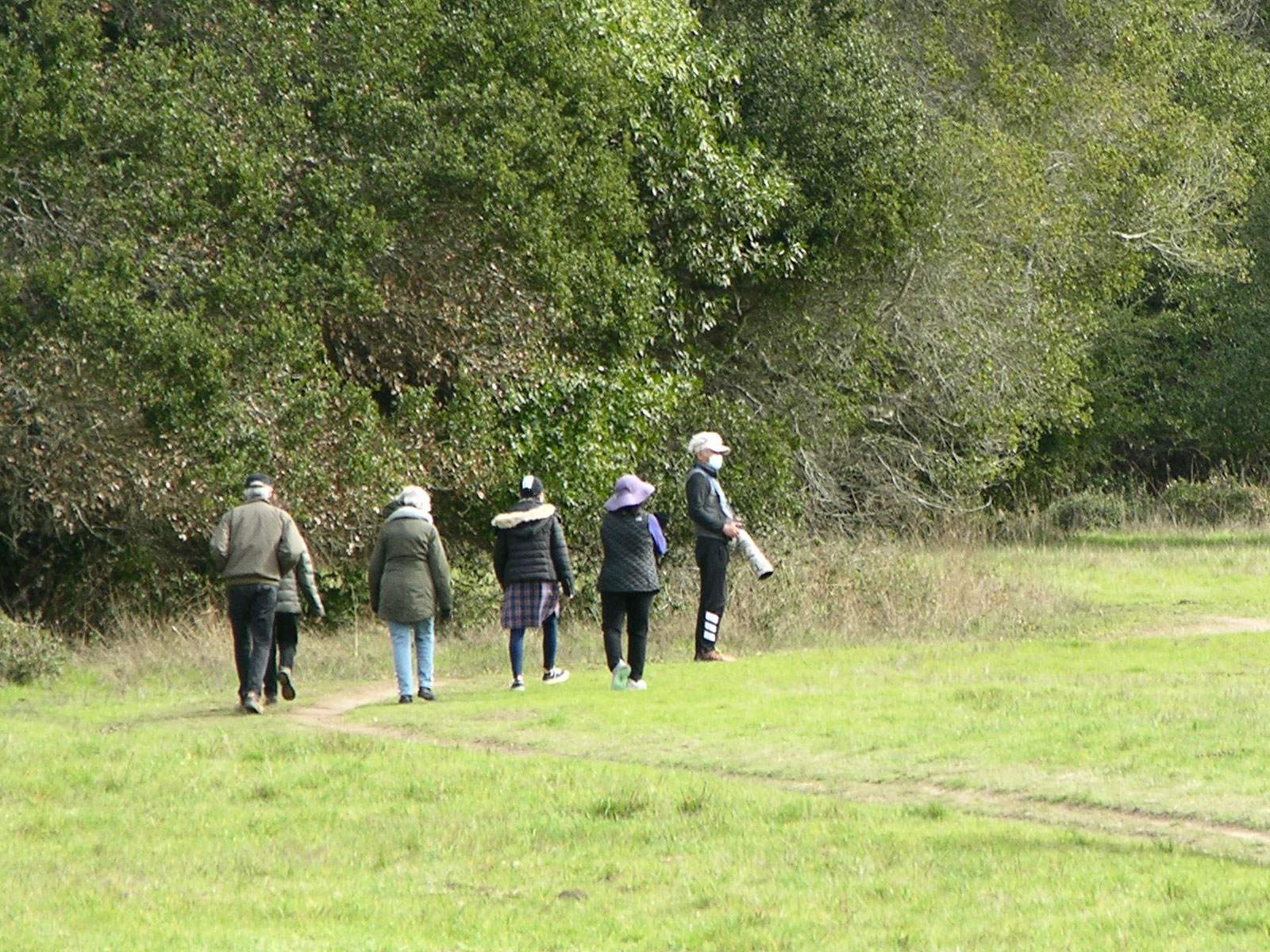
Distance: 2 to 8.6 miles (3 to 13.8 km) roundtrip
Explore the floor of a valley that follows the San Andreas Fault , passing through meadows and woods. Evidence of former earthquakes are rather subtle, coming in the form of diverted streams, shutter ridges, and sag ponds that most visitors overlook. One will only find a fresh scar on the surface of the ground if there has been a large earthquake recently; the last one was on April 18, 1906.
Start at either the Bear Valley Trailhead at the trail's north end, or the Five Brooks Trailhead at its south. The description below proceeds from north to south.
From the southwestern corner of the Bear Valley Trailhead, the Rift Zone Trail heads east through a meadow for 0.3 miles (0.5 km) before crossing a bridge over the tree-lined Bear Valley Creek. Those paying attention may notice that the creek is deflected by a low ridge just upstream from this location—one of the first indications one will encounter of the valley's seismic history. After crossing the bridge, the trail climbs up and over a partially wooded shutter ridge and then crosses through another meadow, which, until relatively recently, served as a cattle pasture.
After another 0.5 miles (0.8 km) [0.8 miles (1.3 km) from Bear Valley], the trail crosses the access road for the Vedanta Society Retreat. The trail beyond this road is only open to the general public from 8 am until 2 hours before sunset. Please be sure to close the gates after you pass through. South of the road, the trail passes through private property for the next couple miles (few kilometers); please treat both the private land and public park lands with respect and practice Leave No Trace principles. Take only pictures and leave only footprints.
From the access road, the trail turns south and passes through two active (and sometimes muddy) cattle pastures. The trail may be difficult to distinguish from the cattle paths, but, so long as the cows haven't pushed them over, there should be posts with small signs along the designated path to help you find your way. After 0.3 miles (0.5 km), the trail pass through a gate in the fence separating the pastures. Again, please be sure to close any gates you open. The trail then turns south-southwest for another 0.3 miles (0.5 km) before heading west through a gate near the southwest corner of the pasture. Follow the trail ~235 feet (~70 m) west between the fence line and the tree line. Pass through the smaller gate to the left (closest to the tree line) and keep to the left to stay on the Rift Zone Trail, which intersects in this immediate area with ranch roads and fences.
From this junction, the trail (an old ranch road) heads south a bit before bending south-southeast to travel between a fenced meadow on the west and trees to the east. After another 0.2 miles (0.3 km), the trail enters the woods. After another hundred yards/meters or so into the woods [1.8 miles (2.9 km) from Bear Valley], one will encounter a shallow sag pond. Young redwoods grow east of the trail to the south of the pond for a few hundred yards. Beyond the pond, the terrain becomes more hilly, but the trail should be easier to follow with only a couple junctions with other ranch roads that are rarely used (and are closed to the general public). Follow the Rift Zone Trail through woods and a few meadows until you reach the Five Brooks Horse Camp, located 4.0 miles (6.4 km) from Bear Valley Trailhead.
The southernmost 0.2 miles (0.3 kilometers) of the Rift Zone Trail are closed due a severe washout of the trail. Due to the presence of these hazardous conditions, use of the trail by anyone is not safe until these hazards are mitigated. Please do not use this section of trail until the trail has been repaired. There is a detour route available:
To get from the the Rift Zone Trail at the north end of the Horse Camp to Five Brooks Trailhead:
head south on the Rift Zone Trail through the Horse Camp for 460 feet (140 m) to the Stewart Trail-Horse Camp Connector Trail/Road;
turn right and follow the Stewart Trail-Horse Camp Connector Trail/Road for ~0.3 miles (0.5 km) past the horse camp's bath house and up the hill past the water tank to the Stewart Trail;
follow the Stewart Trail south ~0.4 miles (0.7 km) to the Five Brooks Trailhead.
To get from Five Brooks Trailhead to the Rift Zone Trail:
follow the Stewart Trail north ~0.4 miles (0.7 km) to its junction with the Stewart Trail-Horse Camp Connector Trail/Road;
turn right and follow the Stewart Trail-Horse Camp Connector Trail/Road for ~0.3 miles (0.5 km) down the hill past a water tank and the horse camp's bath house to the junction with the Rift Zone Trail;
turn left onto the Rift Zone Trail and head north through the horse camp for 460 feet (140 m) to a gap in the split rail fence.
This route description alone is not a substitute for a trail map. Print out the Point Reyes National Seashore's South District trail map (3,422 KB PDF) before your visit, or pick one up at the Bear Valley Visitor Center on your way.
While designated as part of Point Reyes National Seashore, the trails on the Vedanta Society Retreat property are managed by Marin County Parks .
This trail is shared with horse riders. It also traverses open rangeland, and grazing cattle may be present. Give them plenty of space when passing.
Always check current conditions before heading out into the park and familiarize yourself with park regulations . Please practice Leave No Trace principles.
Visit the park's Hiking at Point Reyes National Seashore page for hiking tips and information about trail etiquette and safety.
Visit the park's Trail Advisories and Closures page for current information about closed trails, trails blocked by trees, or other temporary hazards or advisories.
Pets Pets are prohibited on the Rift Zone Trail. Visit the park's Pets page to learn where pets are welcome at Point Reyes National Seashore.
Accessibility The northern 0.3 miles (0.5 kilometers) of the Rift Zone Trail from the Bear Valley Trailhead is fairly flat, but narrow, only a couple feet across. The trail surface is packed dirt. As the trail progresses, it becomes narrower and rutted in places, and frequently muddy. Short sections of moderate to steep grade exist.
Hike the Sky–Bear Valley Loop 10.8 mi · the Park Service's write-up
4-6 Hours · no dogs · season <h2>Winter</h2> <p>The heaviest rainfall occurs in the winter months. Come prepared for rain and drizzle to possibly last for several days. In between winter rains, it is often sunny, calm, and cool.</p> <h2>Spring</h2> <p>Most spring days are windy. Expect cool temperatures in March. By late May and early June, temperatures can be quite pleasant.</p> <h2>Summer</h2> <p>Although there is very little rain during summer months, there is often dense fog, which tends to burn off by mid-day. Afternoons are often sunny and warm to hot with a light breeze.</p> <h2>Fall</h2> <p>Point Reyes experience some of the clearest days in late September, October, and early November. The occasional storm will start rolling through in late October, bringing clouds, wind, and rain. The strongest winds occur in November and December during occasional southerly gales.</p>
Start Bear Valley Trailhead, Point Reyes National Seashore
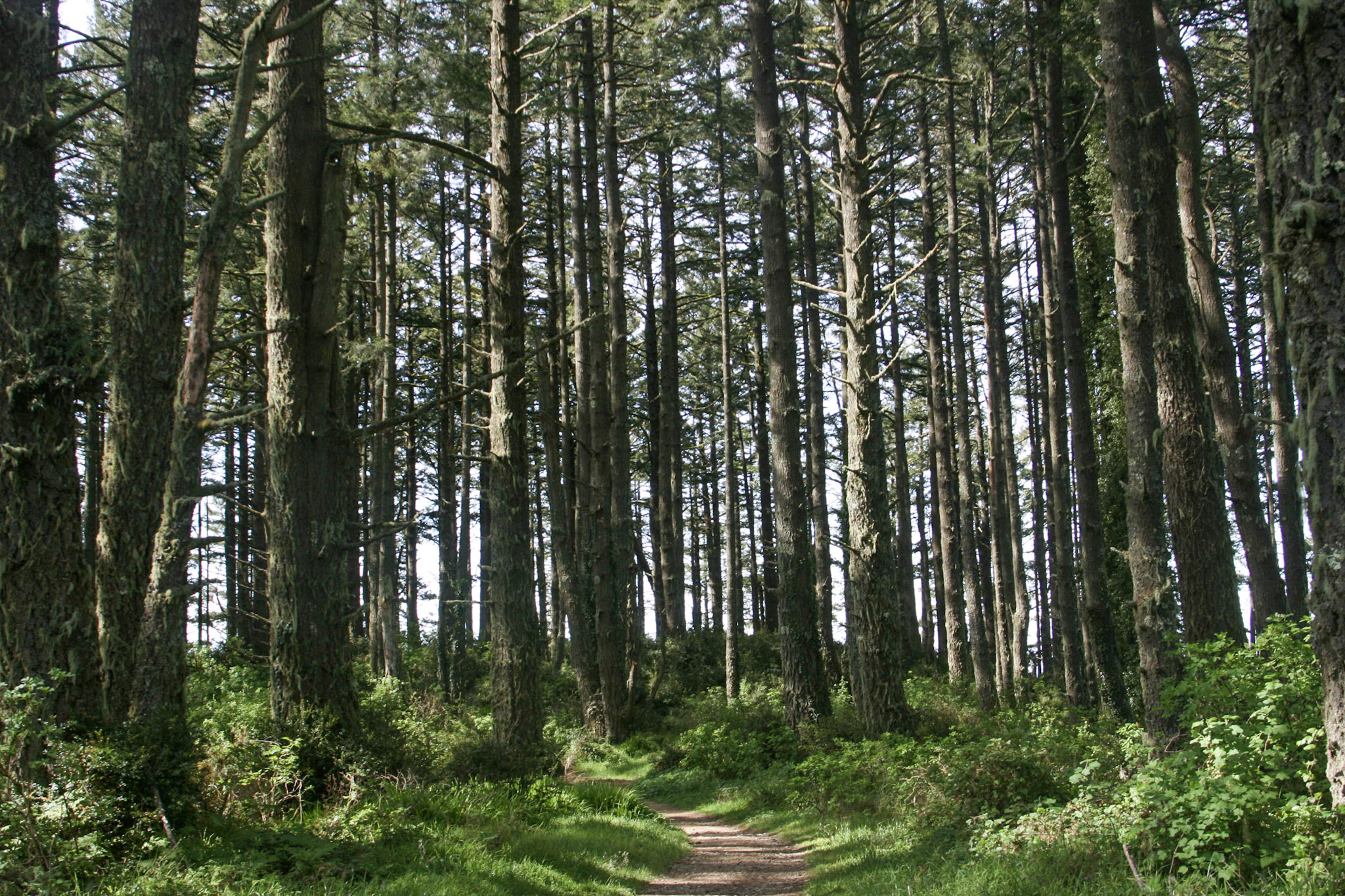
Distance : 10.8 miles (17.4 km) total
This varied hike takes you through dense forest, meadows, coastal scrub, and coastal grasslands, starting with an uphill climb on the east side of Inverness Ridge to a ridgetop with ocean views. Follow the forested ridgeline to the coastline, and return on a mostly flat trail through Bear Valley. This area was burned in 2020, when lightning strikes in the Woodward Valley started what became the Woodward Fire .
Start at the Bear Valley Trailhead and follow the relatively flat Bear Valley Trail south. A short distance beyond a sign indicating you are entering the Phillip Burton Wilderness , you will get to choose between two routes that will lead you to the Sky Trail along the crest of Inverness Ridge.
Turn right on to the Mount Wittenberg Trail 0.2 miles (0.3 km) from the trailhead if you want a more strenuous ascent of about 1,130 feet (~340 m) over a distance of 1.8 miles (2.9 km). While the Woodward Fire burned along most of the length of the Mount Wittenberg Trail, it primarily burned in the understory and left most of the canopy of the Douglas fir forest intact. As a result, there are very few far-reaching views from this trail until you reach the ridge crest. Remain on the Mount Wittenberg Trail at the Z Ranch Trail junction, which is located at the highest point along this route with an elevation of 1270 feet (385 m).* From the crest of Inverness Ridge along the western 0.4 mile-long (0.6-kilometer-long) leg of the Mount Wittenberg Trail, you may be rewarded (weather dependent) with views looking west across the peninsula to the Pacific Ocean. The Mount Wittenberg Trail intersects with the Sky Trail 0.4 miles (0.6 km) beyond the Z Ranch Trail junction and 2.4 miles (3.8 km) from the Bear Valley Trailhead.
*From Mount Wittenberg–Z Ranch Trail junction, the 0.3-mile-long (0.5-kilometer-long) Mount Wittenberg Summit Trail leads, as its name suggests, to the summit of Mount Wittenberg (elevation 1407 feet (426 m). The once unobstructed views from near the summit have, since 2000, become obstructed by dense Douglas fir thickets that sprouted shortly after the 1995 Vision Fire . While the 2020 Woodward Fire burned through much of the forest around Mount Wittenberg, the view-obstructing Douglas fir thickets were largely left unscathed. So, without being rewarded with views for their effort, many hikers pass on ascending the Mount Wittenberg Summit Trail.
Turn right on to the Meadow Trail 0.8 miles (1.3 km) from the trailhead if you want a slightly easier climb over Inverness Ridge. Similar to the Mount Wittenberg Trail, the Woodward Fire mostly impacted the understory of the forest along the Meadow Trail. While the trail does pass through a fairly large meadow (after which the trail was named), views from the meadow are of forested hillsides less than a mile distant. The Meadow Trail ascends about 840 feet (~255 m) over a distance of 1.6 miles (2.6 km) before intersecting with the Sky Trail 2.4 miles (3.8 km) from the Bear Valley Trailhead. The elevation at this intersection is ~1080 feet (~327 m).
Both the Mount Wittenberg Trail and the Meadow Trail intersect the Sky Trail at the same large trail junction. Turn left (south) on to the Sky Trail and follow it for 3.9 miles (6.2 km) to its junction with the Coast Trail. Once hemmed in by a ~six-foot-tall (~two-meter-tall) hedge of huckleberry bushes, the Woodward Fire cleared out most of the shrubs and a lot of the lower branches of the trees in this area so that this section of trail feels a bit more open than it did before 2020. And, as a result of the fire, there are many more far-reaching views from the Sky Trail.
Turning south on to the Coast Trail leads in 0.5 miles (0.8 km ) to the Coast Trail-Bear Valley Trail junction. Turn left on to the Bear Valley Trail and follow it 4 miles (6.4 km) east and north back to the Bear Valley Trailhead parking lot. The Bear Valley Trail has a gentle grade as it first follows Coast Creek to Divide Meadow and then gradually descends along Bear Valley Creek for the final 1.6 miles (2.6 km) of this hike. The trail passes through a beautiful forest of buckeyes, oaks, and Douglas firs, aside from the large meadow at Divide Meadow.
Restrooms and water are available at the Bear Valley Trailhead parking lot. Otherwise, there are no other facilities along this route until you reach Divide Meadow, at which there are vault toilets, but no potable water.
This route description alone is not a substitute for a trail map. Print out the Point Reyes National Seashore's South District trail map (3,422 KB PDF) before your visit, or pick one up at the Bear Valley Visitor Center on your way.
Always check current conditions before heading out into the park and familiarize yourself with park regulations . Please practice Leave No Trace principles.
Visit the park's Hiking at Point Reyes National Seashore page for hiking tips and information about trail etiquette and safety.
Visit the park's Trail Advisories and Closures page for current information about closed trails, trails blocked by trees, or other temporary hazards or advisories.
Pets Pets are prohibited on all of the trails that are described on this page. Visit the park's Pets page to learn where pets are welcome at Point Reyes National Seashore.
Accessibility The Bear Valley Trail is wide, mostly flat, and has a substrate of dirt and gravel. The other trails described on this page vary in width from two to six feet (0.6 to 1.8 meters) and have surfaces of mostly compacted dirt that may be rutted and have exposed roots and rocks in places.The total elevation change from Bear Valley to the crest of Inverness Ridge is about 1200 feet (360 meters) over a distance of 1.6 to 1.8 miles (2.6 to 2.9 km), depending on which route one follows. The vault toilet building at Divide Meadow on the Bear Valley trail does not meet accessibility standards.
Hike to Mount Wittenberg from Bear Valley 4.8–6.5 mi round trip · the Park Service's write-up
2-3 Hours · no dogs · season <h2>Winter</h2> <p>The heaviest rainfall occurs in the winter months. Come prepared for rain and drizzle to possibly last for several days. In between winter rains, it is often sunny, calm, and cool.</p> <h2>Spring</h2> <p>Most spring days are windy. Expect cool temperatures in March. By late May and early June, temperatures can be quite pleasant.</p> <h2>Summer</h2> <p>Although there is very little rain during summer months, there is often dense fog, which tends to burn off by mid-day. Afternoons are often sunny and warm to hot with a light breeze.</p> <h2>Fall</h2> <p>Point Reyes experience some of the clearest days in late September, October, and early November. The occasional storm will start rolling through in late October, bringing clouds, wind, and rain. The strongest winds occur in November and December during occasional southerly gales.</p>
Start Bear Valley Trailhead, Point Reyes National Seashore
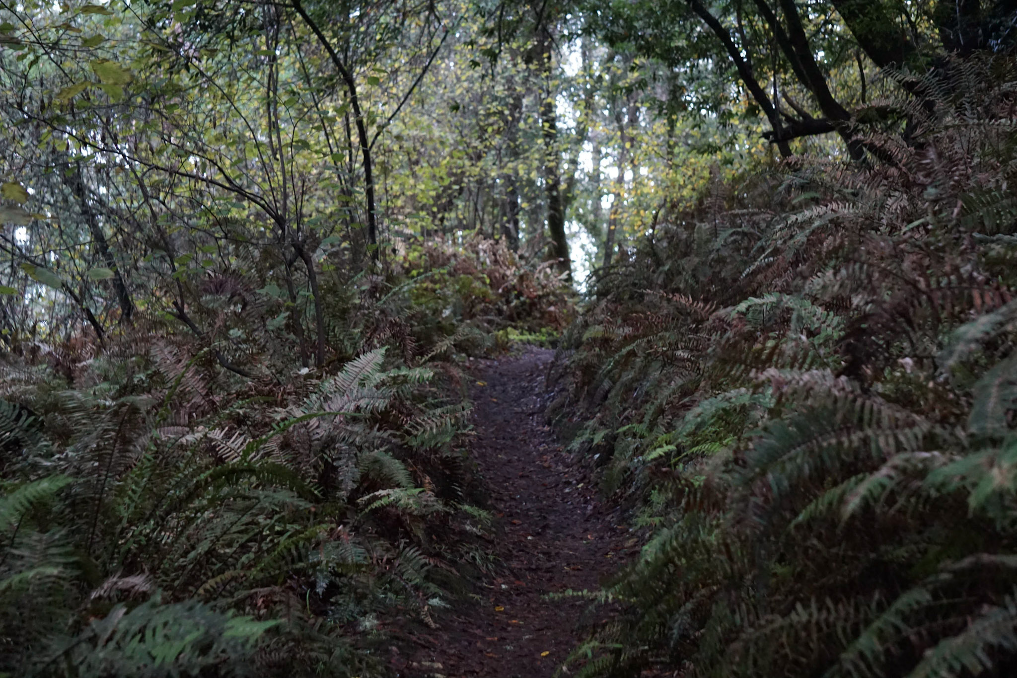
Distance: 4.8 to 6.5 miles (7.7 to 10.4 km) roundtrip, strenuous
The hikes described on this page feature steep 400 meter (1300 feet) climbs to Mount Wittenberg, the highest point on the Point Reyes Peninsula at 1407 feet (426 meters) in elevation, with a few limited views of the ocean and Olema Valley near the ridge crest. These routes pass through a dense mixed Douglas fir and oak forest and a few open meadows. These routes are also mostly within the Phillip Burton Wilderness . Please practice Leave No Trace principles.
Start at the Bear Valley Trailhead and follow the relatively flat Bear Valley Trail south through a meadow for 0.2 miles (0.3 km), passing into the Phillip Burton Wilderness. Turn right on to the Mount Wittenberg Trail and ascend through the forest, passing through a few meadows, for a distance of 1.8 miles (2.9 km) to the Mount Wittenberg-Z Ranch trail junction, which is located in a meadow along the ridge crest.
From this junction, the 0.3-mile-long (0.5-kilometer-long) Mount Wittenberg Summit Trail leads, as its name suggests, to the summit of Mount Wittenberg. The once unobstructed views from near the summit have, since 2000, become obstructed by dense Douglas fir thickets that sprouted shortly after the 1995 Vision Fire . While the 2020 Woodward Fire burned through much of the forest around Mount Wittenberg, the view-obstructing Douglas fir thickets were largely left unscathed.
Return back to the Mount Wittenberg-Z Ranch trail junction where there are a few options to return to the trailhead:
Retrace your route back to the Bear Valley trailhead for a total of 4.8 miles (7.7 km) roundtrip.
Return via the Meadow Trail for a 5.4-mile-long (8.6-km-long) loop. From the Mount Wittenberg-Z Ranch trail junction, continue west along the Mount Wittenberg Trail for 0.4 miles (0.6 km) to its junction with the Meadow and Sky trails. Along this section of trail, one may be rewarded (weather dependent) with views looking west across the peninsula to the Pacific Ocean. From the Meadow-Sky trail junction, descend the Meadow Trail through forest and a couple meadows for 1.6 miles (2.6 miles) to the Bear Valley Trail. Turn left and follow Bear Valley Creek downstream for 0.8 miles (1.3 km) to return to the Bear Valley Trailhead.
Return via the Horse Trail for a 6.5-mile-long (10.4-km-long) loop. From the Mount Wittenberg-Z Ranch trail junction, turn north and follow the Z Ranch Trail through a thicket of Douglas fir for 0.7 miles (1.2 km) to the Horse Trail. Turn right and follow the Horse Trail downhill for 2.4 miles (3.8 miles) to its junction with the Morgan Trail. Along this section, there are a few gaps in the forest canopy that provide views to the north of Inverness Ridge and Bolinas Ridge and just a little bit of Tomales Bay. Turn right and follow the Morgan Trail around the west side of the Morgan Horse Ranch to return to the Bear Valley Trailhead.
This route description alone is not a substitute for a trail map. Print out the Point Reyes National Seashore's South District trail map (3,422 KB PDF) before your visit, or pick one up at the Bear Valley Visitor Center on your way.
Always check current conditions before heading out into the park and familiarize yourself with park regulations . Please practice Leave No Trace principles.
Visit the park's Hiking at Point Reyes National Seashore page for hiking tips and information about trail etiquette and safety.
Visit the park's Trail Advisories and Closures page for current information about closed trails, trails blocked by trees, or other temporary hazards or advisories.
Pets Pets are prohibited on all of the trails that lead to Mount Wittenberg. Visit the park's Pets page to learn where pets are welcome at Point Reyes National Seashore.
Accessibility The Mount Wittenberg, Meadow, Z Ranch, and Horse Trails vary in width from three to six feet (0.9 to 1.8 meters). The total elevation change from Bear Valley to the summit of Mount Wittenberg is about 1300 feet (400 meters) over a distance of 2.4 to 4.1 miles (3.8 to 6.6 km), depending on which route one follows. The trail surface is mostly compacted dirt with exposed roots and rocks.
Walk the Woodpecker Nature Trail the Park Service's write-up
25-40 Minutes · no dogs · season <h2>Winter</h2> <p>The heaviest rainfall occurs in the winter months. Come prepared for rain and drizzle to possibly last for several days. In between winter rains, it is often sunny, calm, and cool.</p> <h2>Spring</h2> <p>Most spring days are windy. Expect cool temperatures in March. By late May and early June, temperatures can be quite pleasant.</p> <h2>Summer</h2> <p>Although there is very little rain during summer months, there is often dense fog, which tends to burn off by mid-day. Afternoons are often sunny and warm to hot with a light breeze.</p> <h2>Fall</h2> <p>Point Reyes experience some of the clearest days in late September, October, and early November. The occasional storm will start rolling through in late October, bringing clouds, wind, and rain. The strongest winds occur in November and December during occasional southerly gales.</p>
Start Woodpecker Nature Trailhead at Bear Valley, Point Reyes National Seashore
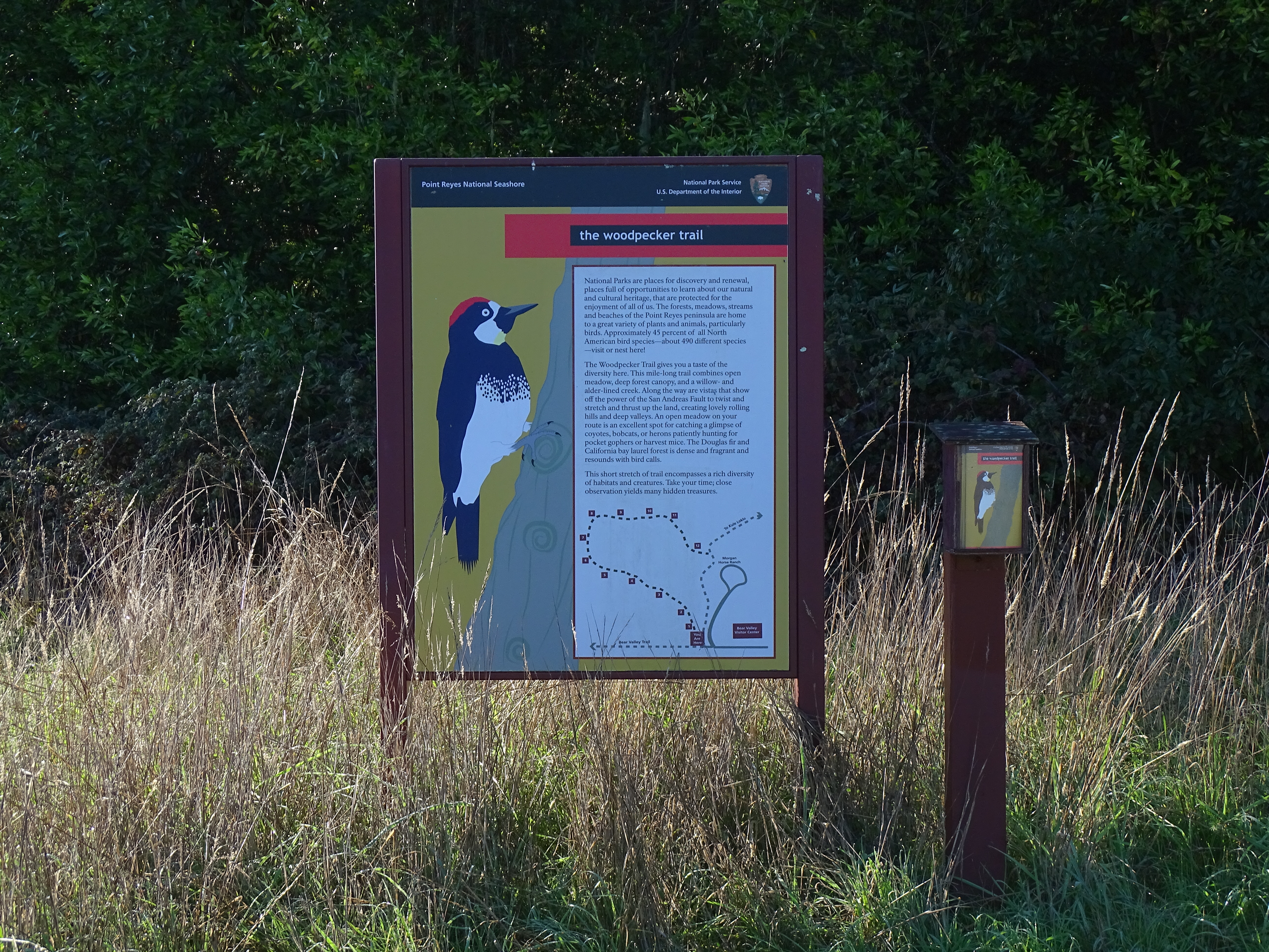
Distance: 0.9 mi. (1.5 km) roundtrip
The Woodpecker Nature Trail is a loop trail that explores the beautiful local forest and meadow ecosystems of Bear Valley. It will give you a taste of the rich biodiversity of this area. It combines open meadow, deep forest canopy, and a willow- and alder-lined creek. Along the way are vistas that show off the power of the San Andreas Fault to twist and stretch and thrust up the land creating lovely rolling hills and deep valleys. An open meadow on the route is an excellent spot for catching a glimpse of coyotes, bobcats, or herons patiently hunting for pocket gophers, deer mice, and meadow voles. The Douglas fir and California bay laurel forest is dense and fragrant and resounds with bird calls. An interpretive trail guide describing some of the plants and animals you may see can be obtained at the trailhead or at the Bear Valley Visitor Center .
The Woodpecker Trail begins at the Bear Valley Trailhead , at the south end of the Bear Valley Parking Lot. It exits the wooded section of the loop near the Morgan Horse Ranch .
Download the Bear Valley Area Map . (427 KB PDF)
Download the Woodpecker Trail Guide. (6,943 KB PDF)
Always check current conditions before heading out into the park and familiarize yourself with park regulations . Please practice Leave No Trace principles.
Visit the park's Hiking at Point Reyes National Seashore page for hiking tips and information about trail etiquette and safety.
Visit the park's Trail Advisories and Closures page for current information about closed trails, trails blocked by trees, or other temporary hazards or advisories.
Pets Pets are prohibited on the Woodpecker Trail. Visit the park's Pets page to learn where pets are welcome at Point Reyes National Seashore.
Accessibility The Woodpecker Nature Trail is a relatively narrow (less than two feet wide [0.6 meters wide]) with a dirt substrate. There is a change of about 100 feet (30 meters) in elevation along the route of the trail, including some stairs. Within the forested part of the hike, tree roots pose as another obstacle.