93 named trails · 112 miles · 34 trailheads · 31 with the Park Service's own write-up. The lines, trailheads and points are the Park Service's; the write-ups are the Service's own words; the climbing is read from USGS elevation along each line.
0.4 mi one way · about 40 ft of climbing · 14 ft–51 ft · sand, wood surface · bike, hiking, horse
TrailheadAbbotts Lagoon Trailhead 79 ft Drive there
Hike the Abbotts Lagoon Trail to the Footbridge the Park Service's write-up
40-75 Minutes · no dogs
Start Abbotts Lagoon Trailhead, Point Reyes National Seashore
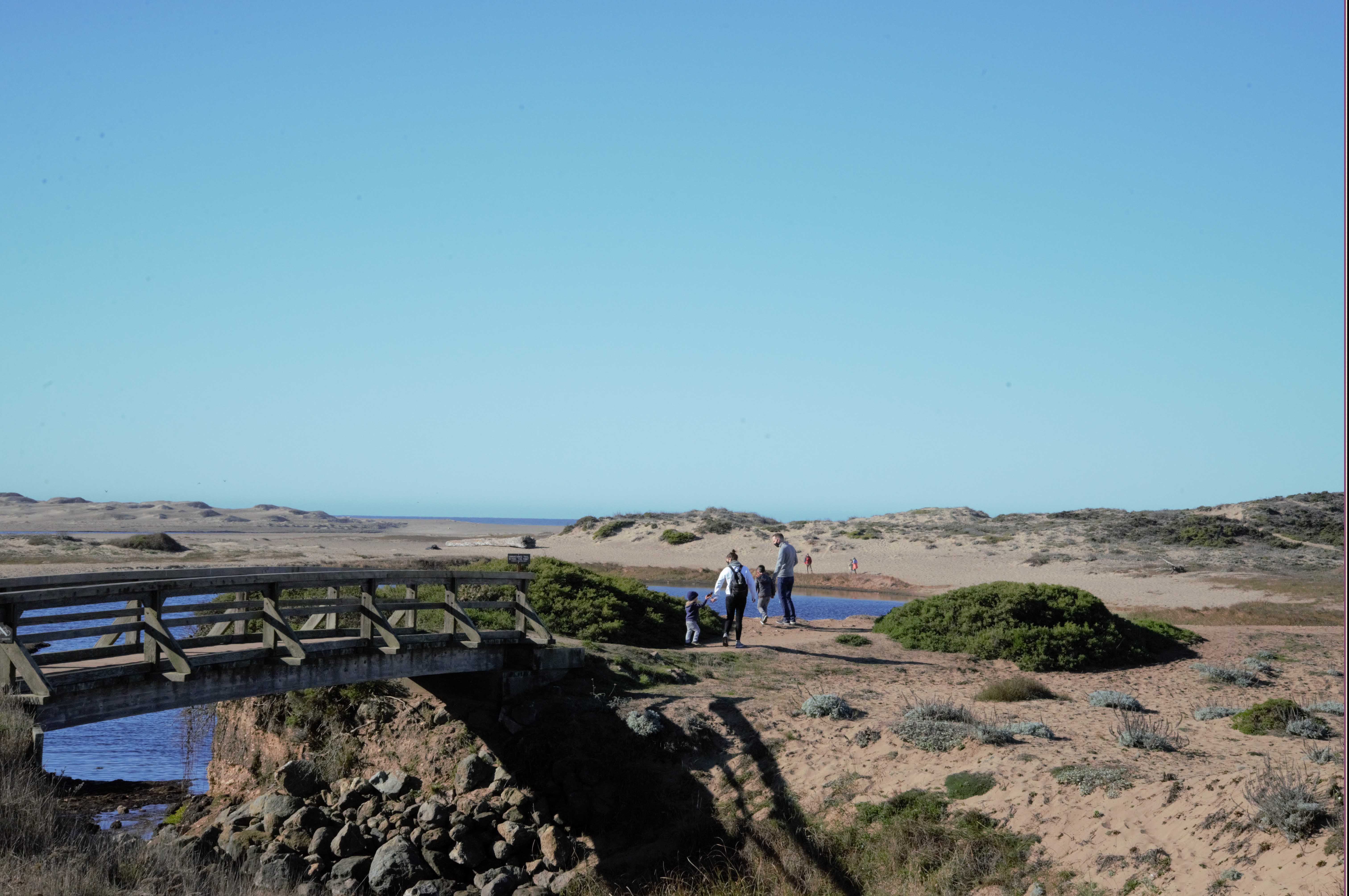
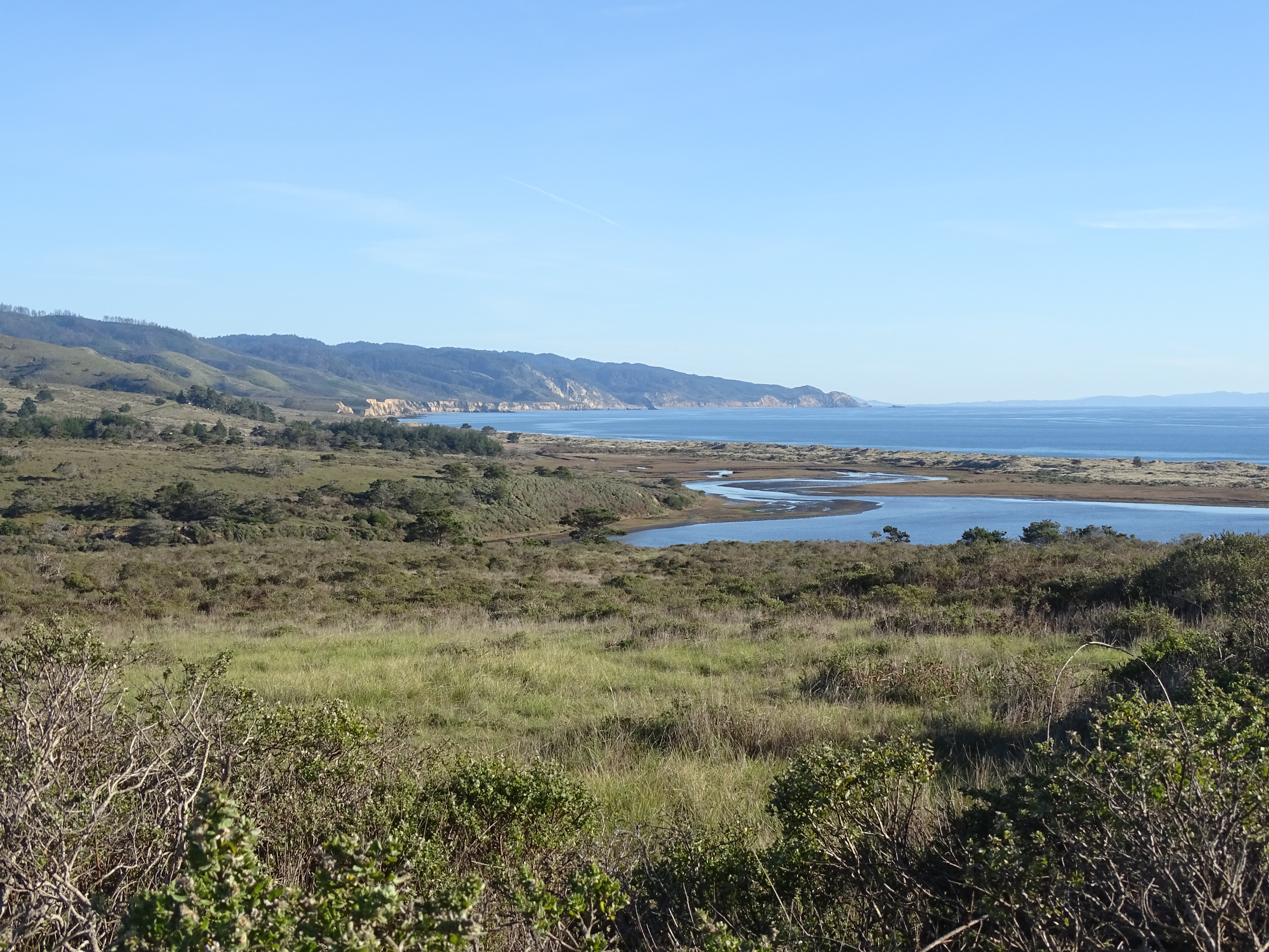
Abbotts Lagoon is a popular destination for birders and families. Photo: NPS / S. Frisbie
Distance: 1.8 mi. (2.9 km) roundtrip
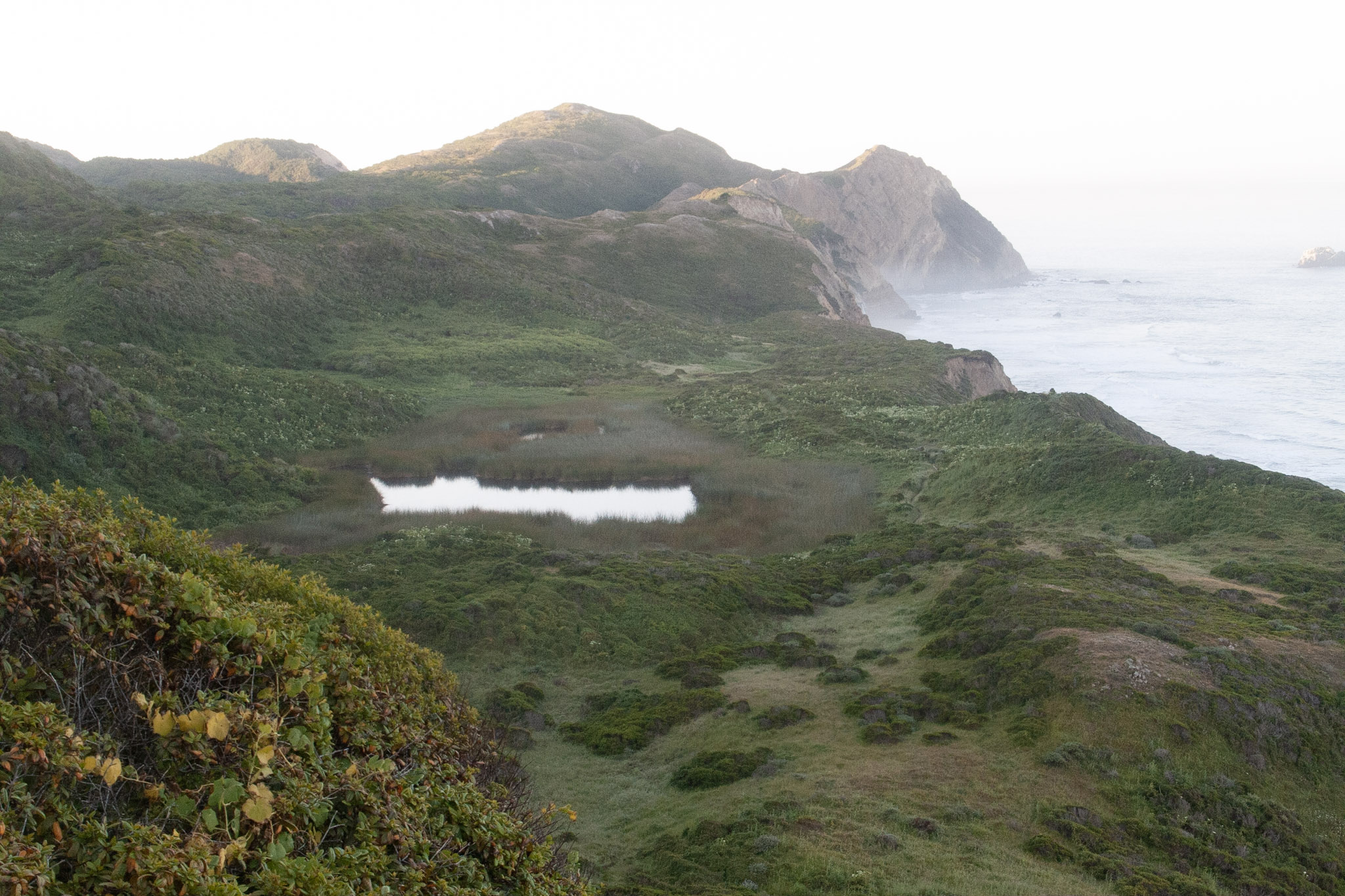
Abbotts Lagoon is known for fantastic birding opportunities (particularly in the fall and winter), and beautiful wildflowers in the spring. Abbotts Lagoon is actually a series of three coastal lagoons. The upper (easternmost) lagoon is the smallest and contains the freshest water; the lower (westernmost) lagoon is the largest and saltiest.
The beginning of this trail is an easy stroll past pastures and through coastal scrub before skirting along the southern edge of the middle lagoon. After 0.9 miles (1.5 km), you will arrive at a footbridge that crosses a short stream that connects the middle and lower lagoons. From this point, turn around if you are short on time, or feel free to continue for an extra 0.5 miles (800 meters) along the north edge of the lower lagoon and amid the sand dunes to arrive at the Point Reyes Beach (aka the Great Beach). Visit our Hike the Abbotts Lagoon Trail to the Ocean page for more information. Return via the same trail.
This route description alone is not a substitute for a trail map. Print out the park's North District trail map (3,409 KB PDF) before your visit, or pick one up at a visitor center on your way.
Always check current conditions before heading out into the park and familiarize yourself with park regulations . Please practice Leave No Trace principles.
Visit the park's Hiking at Point Reyes National Seashore page for hiking tips and information about trail etiquette and safety.
Visit the park's Trail Advisories and Closures page for current information about closed trails, trails blocked by trees, or other temporary hazards or advisories.
Pets Pets are prohibited on the Abbotts Lagoon Trail. Visit the park's Pets page to learn where pets are welcome at Point Reyes National Seashore.
Accessibility A gentle, soil-cemented trail leads 0.25 miles (400 meters) to an overlook of the lagoon. Beyond this point the trail is packed dirt, typically two or three feet in width. Rain and heavy foot traffic have created ruts in some places. After the footbridge the trail turns to sand, and is likely impassable without a beach-specific wheelchair. Restrooms at the trailhead are accessible and there are two designated parking spaces.
Hike the Abbotts Lagoon Trail to the Ocean the Park Service's write-up
60-90 Minutes · no dogs
Start Abbotts Lagoon Trailhead, Point Reyes National Seashore
Abbotts Lagoon is a popular destination for birders and families. Photo: NPS / S. Frisbie
Distance: 2.8 mi. (4.5 km) roundtrip
Abbotts Lagoon is known for fantastic birding opportunities (particularly in the fall and winter), and beautiful wildflowers in the spring. Abbotts Lagoon is actually a series of three coastal lagoons. The upper (easternmost) lagoon is the smallest and contains the freshest water; the lower (westernmost) lagoon is the largest and saltiest.
The beginning of this trail is an easy stroll past pastures and through coastal scrub before skirting along the southern edge of the middle lagoon. After 0.9 miles (1.5 km), you will arrive at a footbridge that crosses a short stream that connects the middle and lower lagoons. From this point, continue for an extra 0.5 miles (800 meters) along the north edge of the lower lagoon and amid the sand dunes to arrive at the Point Reyes Beach (aka the Great Beach). Return via the same trail.
Be advised that beyond the footbridge, the trail enters the Phillip Burton Wilderness and the trail is considered to be unmaintained. Take note of your surroundings before exploring the beach or the lagoon area so you can ensure you'll be able to find the trail again for your return trip. Please be respectful of fragile coastal dune vegetation.
From Memorial Day to Labor Day, hiking south of Abbotts Lagoon on the Great Beach is prohibited on weekends and holidays to protect nesting western snowy plovers .
Sneaker waves and strong coastal surf are just a few of the hazards of which visitors should be aware while visiting Point Reyes beaches. Beaches may be closed at various times of the year to protect park wildlife and visitors alike. Please visit Point Reyes National Seashore's Current Conditions page to learn about any current beach closures.
This route description alone is not a substitute for a trail map. Print out the park's North District trail map (3,409 KB PDF) before your visit, or pick one up at a visitor center on your way.
Always check current conditions before heading out into the park and familiarize yourself with park regulations . Please practice Leave No Trace principles.
Visit the park's Hiking at Point Reyes National Seashore page for hiking tips and information about trail etiquette and safety.
Visit the park's Trail Advisories and Closures page for current information about closed trails, trails blocked by trees, or other temporary hazards or advisories.
Pets Pets are prohibited on the Abbotts Lagoon Trail. Visit the park's Pets page to learn where pets are welcome at Point Reyes National Seashore.
Accessibility A gentle, soil-cemented trail leads 0.25 miles (400 meters) to an overlook of the lagoon. Beyond this point the trail is packed dirt, typically two or three feet in width. Rain and heavy foot traffic have created ruts in some places. After the footbridge the trail turns to sand, and is likely impassable without a beach-specific wheelchair. Restrooms at the trailhead are accessible and there are two designated parking spaces.
0.1 mi one way · 20 ft of descent · 388 ft–406 ft · earth surface · hiking, horse
Hike to Bass Lake the Park Service's write-up
2-4 Hours · no dogs
Start Bass Lake within the Phillip Burton Wilderness, Point Reyes National Seashore
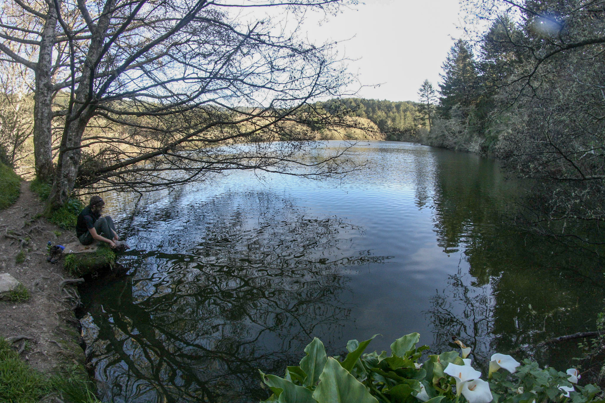
Bass Lake serves as a great destination in itself, or a pit stop on the way to Wildcat Beach! Photo: NPS / A. Kopshever
The Palomarin Trailhead Parking Lot will be closed from Monday, September 9, 2024, through Friday, September 13, 2024, for resurfacing. The parking lot and trailhead will be fully closed with no overnight parking allowed to accommodate staging equipment and materials. Large trucks will be present on Mesa and Palomarin Roads, so visitors to Bass Lake should plan alternative parking arrangements.
-->
Distance: 6 miles (9.6 km) roundtrip, moderate
Bass Lake is a great destination for a moderate day hike, or a beautiful pit stop on the way to Wildcat Beach .
Begin at the Palomarin Trailhead and head northwest on the Coast Trail. Much of the first mile (1.6 km) of this hike offers spectacular ocean views from the tops of bluffs high above the surf. The Coast Trail then heads inland and drops in elevation to a valley floor before switchbacking out the other side. After climbing over a pass, one hikes past the Lake Ranch Trail junction and past a number of small ponds before reaching Bass Lake after 2.8 miles (4.5 km) of hiking. At 2.9 miles (4.6 km), an unmaintained spur trail leads to the southwest along the northwest side of Bass Lake.
Bass Lake is a popular, but unofficial, swimming spot; accessing the lakeside can be challenging and poison oak is common. There are no lifeguards—swim at your own risk .
This hike is mostly within the Phillip Burton Wilderness . There are no toilets at Bass Lake; be sure to use the vault toilets at the Palomarin Trailhead before starting your hike. Please practice Leave No Trace principles.
This route description alone is not a substitute for a trail map. Print out the Point Reyes National Seashore's South District trail map (3,422 KB PDF) before your visit, or pick one up at a visitor center on your way. Always check current conditions before heading out into the park and familiarize yourself with park regulations .
Visit the park's Hiking at Point Reyes National Seashore page for hiking tips and information about trail etiquette and safety.
Visit the park's Trail Advisories and Closures page for current information about closed trails, trails blocked by trees, or other temporary hazards or advisories.
Pets Pets are prohibited on the Coast Trail and at Bass Lake. Visit the park's Pets page to learn where pets are welcome at Point Reyes National Seashore.
Accessibility The initial stretch of the Coast Trail from Palomarin Trailhead is fairly flat and wide, about 5 to 6 feet (1.5 to 1.8 m) across. The trail surface is packed dirt with exposed roots and rocks. As the trail progresses, it becomes narrower and rutted in places. Relatively short sections of moderate to steep grade exist, primarily after the first mile (1.6 km).
4.1 mi one way · about 300 ft of climbing · 93 ft–379 ft · earth, gravel surface · bike, hiking, horse
TrailheadsBear Valley Trailhead 108 ft Drive there · Rift Zone Trailhead 107 ft Drive there · Woodpecker Nature Trailhead 109 ft Drive there
Hike the Muddy Hollow Trail the Park Service's write-up
1-3 Hours · no dogs
Start Muddy Hollow Trailhead or Limantour Beach Trailhead, Point Reyes National Seashore
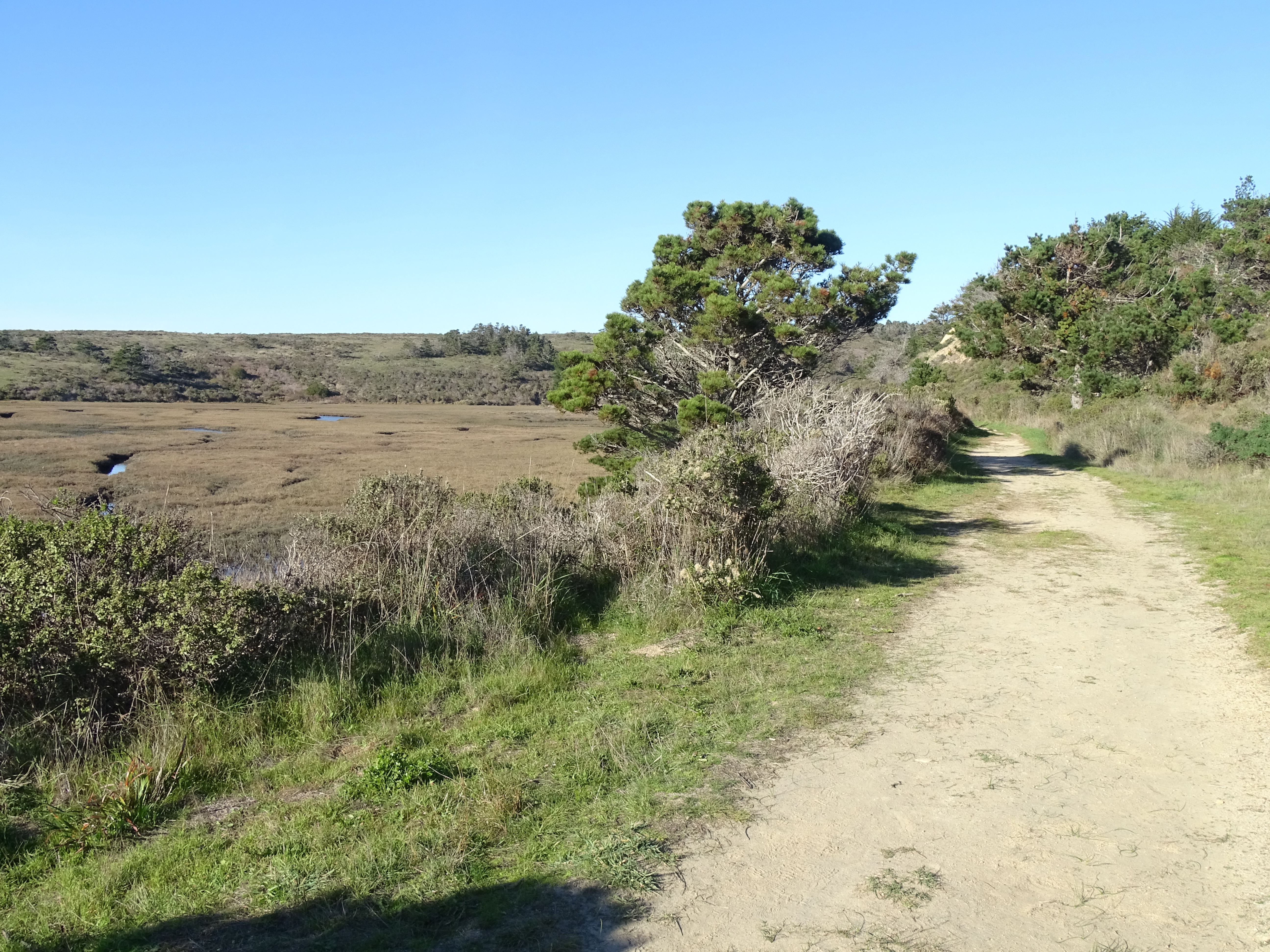
The Muddy Hollow Trail offers a mellow hike through a variety of environments, including wetlands. Photo: NPS Photo
Distance: 4 mi (6.4 km) roundtrip
This out-and-back trail offers an easy hike with opportunities to see diverse bird life, wildflowers, and possibly tule elk ! One can either start at the Muddy Hollow Trailhead at the trail's north end and hike to and from Limantour Beach , or start at trail's southern terminous at the Limantour Beach Trailhead and hike north and up the Muddy Hollow drainage.
Beginning at the Muddy Hollow Trailhead, follow the path downstream through lush riparian habitat of red alder and willow. After 1.4 miles (2.2 km), one arrives at a pond, which is a good location for birding. The next 0.4 miles (0.7 km) of trail skirts along the southern edge of an arm of Estero de Limantour before eventually arrive at the picnic area just south of Limantour Beach parking lot. Vault toilets are available at this location. From here, you can continue for ~0.2 miles (~350 meters) to the edge of Drakes Bay at Limantour Beach. Retrace your route back when you are ready.
Alternatively, some prefer to start their hike by parking at the Limantour Beach lot and following the Muddy Hollow Trail north from the Limantour Beach Trailhead. This offers the possibility of relax at the beach upon one's return. To find the southern end of the Muddy Hollow Trail from the large gravel parking lot at Limantour Beach, follow the path from the southern end of the parking lot past the vault toilets, keeping to the right. Just before the picnic area, the trail heads off to the west (to the right) through a small copse of pines.
In the spring and early summer months, tall grasses and new plant growth encroach along sections of the Muddy Hollow Trail. Pants and long sleeves are advised.
This route description alone is not a substitute for a trail map. Print out the park's North District trail map (3,409 KB PDF) before your visit, or pick one up at a visitor center on your way.
Always check current conditions before heading out into the park and familiarize yourself with park regulations . Please practice Leave No Trace principles.
Visit the park's Hiking at Point Reyes National Seashore page for hiking tips and information about trail etiquette and safety.
Visit the park's Trail Advisories and Closures page for current information about closed trails, trails blocked by trees, or other temporary hazards or advisories.
Pets Pets are prohibited on the Muddy Hollow Trail. However, pets on a six-foot-or-shorter leash are permitted on Limantour Beach east of the main Limantour Beach Access Trail. Visit the park's Pets page to learn more about where pets are welcome at Point Reyes National Seashore.
Accessibility The trail has a flat or mild grade for its duration. The trail surface is packed dirt, and is approximately 3 to 8 feet wide, depending on the section. There are several narrow footbridges on the path. The vault toilets at Limantour Beach do not meet the criteria for accessibility.
Hike the Rift Zone Trail the Park Service's write-up
1-4 Hours · no dogs
Start Bear Valley Trailhead or Five Brooks Trailhead, Point Reyes National Seashore
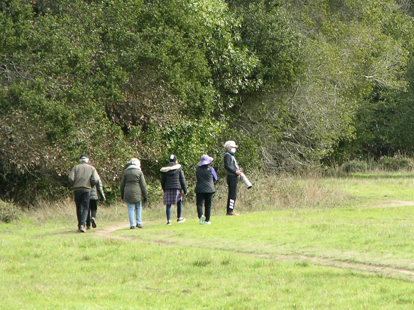
Hikers enjoying the Rift Zone Trail. Photo: NPS Photo
Distance: 2 to 8.6 miles (3 to 13.8 km) roundtrip
Explore the floor of a valley that follows the San Andreas Fault , passing through meadows and woods. Evidence of former earthquakes are rather subtle, coming in the form of diverted streams, shutter ridges, and sag ponds that most visitors overlook. One will only find a fresh scar on the surface of the ground if there has been a large earthquake recently; the last one was on April 18, 1906.
Start at either the Bear Valley Trailhead at the trail's north end, or the Five Brooks Trailhead at its south. The description below proceeds from north to south.
From the southwestern corner of the Bear Valley Trailhead, the Rift Zone Trail heads east through a meadow for 0.3 miles (0.5 km) before crossing a bridge over the tree-lined Bear Valley Creek. Those paying attention may notice that the creek is deflected by a low ridge just upstream from this location—one of the first indications one will encounter of the valley's seismic history. After crossing the bridge, the trail climbs up and over a partially wooded shutter ridge and then crosses through another meadow, which, until relatively recently, served as a cattle pasture.
After another 0.5 miles (0.8 km) [0.8 miles (1.3 km) from Bear Valley], the trail crosses the access road for the Vedanta Society Retreat. The trail beyond this road is only open to the general public from 8 am until 2 hours before sunset. Please be sure to close the gates after you pass through. South of the road, the trail passes through private property for the next couple miles (few kilometers); please treat both the private land and public park lands with respect and practice Leave No Trace principles. Take only pictures and leave only footprints.
From the access road, the trail turns south and passes through two active (and sometimes muddy) cattle pastures. The trail may be difficult to distinguish from the cattle paths, but, so long as the cows haven't pushed them over, there should be posts with small signs along the designated path to help you find your way. After 0.3 miles (0.5 km), the trail pass through a gate in the fence separating the pastures. Again, please be sure to close any gates you open. The trail then turns south-southwest for another 0.3 miles (0.5 km) before heading west through a gate near the southwest corner of the pasture. Follow the trail ~235 feet (~70 m) west between the fence line and the tree line. Pass through the smaller gate to the left (closest to the tree line) and keep to the left to stay on the Rift Zone Trail, which intersects in this immediate area with ranch roads and fences.
From this junction, the trail (an old ranch road) heads south a bit before bending south-southeast to travel between a fenced meadow on the west and trees to the east. After another 0.2 miles (0.3 km), the trail enters the woods. After another hundred yards/meters or so into the woods [1.8 miles (2.9 km) from Bear Valley], one will encounter a shallow sag pond. Young redwoods grow east of the trail to the south of the pond for a few hundred yards. Beyond the pond, the terrain becomes more hilly, but the trail should be easier to follow with only a couple junctions with other ranch roads that are rarely used (and are closed to the general public). Follow the Rift Zone Trail through woods and a few meadows until you reach the Five Brooks Horse Camp, located 4.0 miles (6.4 km) from Bear Valley Trailhead.
The southernmost 0.2 miles (0.3 kilometers) of the Rift Zone Trail are closed due a severe washout of the trail. Due to the presence of these hazardous conditions, use of the trail by anyone is not safe until these hazards are mitigated. Please do not use this section of trail until the trail has been repaired. There is a detour route available:
To get from the the Rift Zone Trail at the north end of the Horse Camp to Five Brooks Trailhead:
head south on the Rift Zone Trail through the Horse Camp for 460 feet (140 m) to the Stewart Trail-Horse Camp Connector Trail/Road;
turn right and follow the Stewart Trail-Horse Camp Connector Trail/Road for ~0.3 miles (0.5 km) past the horse camp's bath house and up the hill past the water tank to the Stewart Trail;
follow the Stewart Trail south ~0.4 miles (0.7 km) to the Five Brooks Trailhead.
To get from Five Brooks Trailhead to the Rift Zone Trail:
follow the Stewart Trail north ~0.4 miles (0.7 km) to its junction with the Stewart Trail-Horse Camp Connector Trail/Road;
turn right and follow the Stewart Trail-Horse Camp Connector Trail/Road for ~0.3 miles (0.5 km) down the hill past a water tank and the horse camp's bath house to the junction with the Rift Zone Trail;
turn left onto the Rift Zone Trail and head north through the horse camp for 460 feet (140 m) to a gap in the split rail fence.
This route description alone is not a substitute for a trail map. Print out the Point Reyes National Seashore's South District trail map (3,422 KB PDF) before your visit, or pick one up at the Bear Valley Visitor Center on your way.
While designated as part of Point Reyes National Seashore, the trails on the Vedanta Society Retreat property are managed by Marin County Parks .
This trail is shared with horse riders. It also traverses open rangeland, and grazing cattle may be present. Give them plenty of space when passing.
Always check current conditions before heading out into the park and familiarize yourself with park regulations . Please practice Leave No Trace principles.
Visit the park's Hiking at Point Reyes National Seashore page for hiking tips and information about trail etiquette and safety.
Visit the park's Trail Advisories and Closures page for current information about closed trails, trails blocked by trees, or other temporary hazards or advisories.
Pets Pets are prohibited on the Rift Zone Trail. Visit the park's Pets page to learn where pets are welcome at Point Reyes National Seashore.
Accessibility The northern 0.3 miles (0.5 kilometers) of the Rift Zone Trail from the Bear Valley Trailhead is fairly flat, but narrow, only a couple feet across. The trail surface is packed dirt. As the trail progresses, it becomes narrower and rutted in places, and frequently muddy. Short sections of moderate to steep grade exist.
Hike the Sky–Bear Valley Loop the Park Service's write-up
4-6 Hours · no dogs
Start Bear Valley Trailhead, Point Reyes National Seashore
Tall Douglas Fir trees lined the Sky Trail before the Woodward Fire. Photo: NPS/A. Kopshever
Distance : 10.8 miles (17.4 km) total
This varied hike takes you through dense forest, meadows, coastal scrub, and coastal grasslands, starting with an uphill climb on the east side of Inverness Ridge to a ridgetop with ocean views. Follow the forested ridgeline to the coastline, and return on a mostly flat trail through Bear Valley. This area was burned in 2020, when lightning strikes in the Woodward Valley started what became the Woodward Fire .
Start at the Bear Valley Trailhead and follow the relatively flat Bear Valley Trail south. A short distance beyond a sign indicating you are entering the Phillip Burton Wilderness , you will get to choose between two routes that will lead you to the Sky Trail along the crest of Inverness Ridge.
Turn right on to the Mount Wittenberg Trail 0.2 miles (0.3 km) from the trailhead if you want a more strenuous ascent of about 1,130 feet (~340 m) over a distance of 1.8 miles (2.9 km). While the Woodward Fire burned along most of the length of the Mount Wittenberg Trail, it primarily burned in the understory and left most of the canopy of the Douglas fir forest intact. As a result, there are very few far-reaching views from this trail until you reach the ridge crest. Remain on the Mount Wittenberg Trail at the Z Ranch Trail junction, which is located at the highest point along this route with an elevation of 1270 feet (385 m).* From the crest of Inverness Ridge along the western 0.4 mile-long (0.6-kilometer-long) leg of the Mount Wittenberg Trail, you may be rewarded (weather dependent) with views looking west across the peninsula to the Pacific Ocean. The Mount Wittenberg Trail intersects with the Sky Trail 0.4 miles (0.6 km) beyond the Z Ranch Trail junction and 2.4 miles (3.8 km) from the Bear Valley Trailhead.
*From Mount Wittenberg–Z Ranch Trail junction, the 0.3-mile-long (0.5-kilometer-long) Mount Wittenberg Summit Trail leads, as its name suggests, to the summit of Mount Wittenberg (elevation 1407 feet (426 m). The once unobstructed views from near the summit have, since 2000, become obstructed by dense Douglas fir thickets that sprouted shortly after the 1995 Vision Fire . While the 2020 Woodward Fire burned through much of the forest around Mount Wittenberg, the view-obstructing Douglas fir thickets were largely left unscathed. So, without being rewarded with views for their effort, many hikers pass on ascending the Mount Wittenberg Summit Trail.
Turn right on to the Meadow Trail 0.8 miles (1.3 km) from the trailhead if you want a slightly easier climb over Inverness Ridge. Similar to the Mount Wittenberg Trail, the Woodward Fire mostly impacted the understory of the forest along the Meadow Trail. While the trail does pass through a fairly large meadow (after which the trail was named), views from the meadow are of forested hillsides less than a mile distant. The Meadow Trail ascends about 840 feet (~255 m) over a distance of 1.6 miles (2.6 km) before intersecting with the Sky Trail 2.4 miles (3.8 km) from the Bear Valley Trailhead. The elevation at this intersection is ~1080 feet (~327 m).
Both the Mount Wittenberg Trail and the Meadow Trail intersect the Sky Trail at the same large trail junction. Turn left (south) on to the Sky Trail and follow it for 3.9 miles (6.2 km) to its junction with the Coast Trail. Once hemmed in by a ~six-foot-tall (~two-meter-tall) hedge of huckleberry bushes, the Woodward Fire cleared out most of the shrubs and a lot of the lower branches of the trees in this area so that this section of trail feels a bit more open than it did before 2020. And, as a result of the fire, there are many more far-reaching views from the Sky Trail.
Turning south on to the Coast Trail leads in 0.5 miles (0.8 km ) to the Coast Trail-Bear Valley Trail junction. Turn left on to the Bear Valley Trail and follow it 4 miles (6.4 km) east and north back to the Bear Valley Trailhead parking lot. The Bear Valley Trail has a gentle grade as it first follows Coast Creek to Divide Meadow and then gradually descends along Bear Valley Creek for the final 1.6 miles (2.6 km) of this hike. The trail passes through a beautiful forest of buckeyes, oaks, and Douglas firs, aside from the large meadow at Divide Meadow.
Restrooms and water are available at the Bear Valley Trailhead parking lot. Otherwise, there are no other facilities along this route until you reach Divide Meadow, at which there are vault toilets, but no potable water.
This route description alone is not a substitute for a trail map. Print out the Point Reyes National Seashore's South District trail map (3,422 KB PDF) before your visit, or pick one up at the Bear Valley Visitor Center on your way.
Always check current conditions before heading out into the park and familiarize yourself with park regulations . Please practice Leave No Trace principles.
Visit the park's Hiking at Point Reyes National Seashore page for hiking tips and information about trail etiquette and safety.
Visit the park's Trail Advisories and Closures page for current information about closed trails, trails blocked by trees, or other temporary hazards or advisories.
Pets Pets are prohibited on all of the trails that are described on this page. Visit the park's Pets page to learn where pets are welcome at Point Reyes National Seashore.
Accessibility The Bear Valley Trail is wide, mostly flat, and has a substrate of dirt and gravel. The other trails described on this page vary in width from two to six feet (0.6 to 1.8 meters) and have surfaces of mostly compacted dirt that may be rutted and have exposed roots and rocks in places.The total elevation change from Bear Valley to the crest of Inverness Ridge is about 1200 feet (360 meters) over a distance of 1.6 to 1.8 miles (2.6 to 2.9 km), depending on which route one follows. The vault toilet building at Divide Meadow on the Bear Valley trail does not meet accessibility standards.
Hike to Mount Wittenberg from Bear Valley the Park Service's write-up
2-3 Hours · no dogs
Start Bear Valley Trailhead, Point Reyes National Seashore
The Mount Wittenberg trail climbs steeply under the shade of Douglas fir and tan oak. Photo: NPS / A. Kopshever
Distance: 4.8 to 6.5 miles (7.7 to 10.4 km) roundtrip, strenuous
The hikes described on this page feature steep 400 meter (1300 feet) climbs to Mount Wittenberg, the highest point on the Point Reyes Peninsula at 1407 feet (426 meters) in elevation, with a few limited views of the ocean and Olema Valley near the ridge crest. These routes pass through a dense mixed Douglas fir and oak forest and a few open meadows. These routes are also mostly within the Phillip Burton Wilderness . Please practice Leave No Trace principles.
Start at the Bear Valley Trailhead and follow the relatively flat Bear Valley Trail south through a meadow for 0.2 miles (0.3 km), passing into the Phillip Burton Wilderness. Turn right on to the Mount Wittenberg Trail and ascend through the forest, passing through a few meadows, for a distance of 1.8 miles (2.9 km) to the Mount Wittenberg-Z Ranch trail junction, which is located in a meadow along the ridge crest.
From this junction, the 0.3-mile-long (0.5-kilometer-long) Mount Wittenberg Summit Trail leads, as its name suggests, to the summit of Mount Wittenberg. The once unobstructed views from near the summit have, since 2000, become obstructed by dense Douglas fir thickets that sprouted shortly after the 1995 Vision Fire . While the 2020 Woodward Fire burned through much of the forest around Mount Wittenberg, the view-obstructing Douglas fir thickets were largely left unscathed.
Return back to the Mount Wittenberg-Z Ranch trail junction where there are a few options to return to the trailhead:
Retrace your route back to the Bear Valley trailhead for a total of 4.8 miles (7.7 km) roundtrip.
Return via the Meadow Trail for a 5.4-mile-long (8.6-km-long) loop. From the Mount Wittenberg-Z Ranch trail junction, continue west along the Mount Wittenberg Trail for 0.4 miles (0.6 km) to its junction with the Meadow and Sky trails. Along this section of trail, one may be rewarded (weather dependent) with views looking west across the peninsula to the Pacific Ocean. From the Meadow-Sky trail junction, descend the Meadow Trail through forest and a couple meadows for 1.6 miles (2.6 miles) to the Bear Valley Trail. Turn left and follow Bear Valley Creek downstream for 0.8 miles (1.3 km) to return to the Bear Valley Trailhead.
Return via the Horse Trail for a 6.5-mile-long (10.4-km-long) loop. From the Mount Wittenberg-Z Ranch trail junction, turn north and follow the Z Ranch Trail through a thicket of Douglas fir for 0.7 miles (1.2 km) to the Horse Trail. Turn right and follow the Horse Trail downhill for 2.4 miles (3.8 miles) to its junction with the Morgan Trail. Along this section, there are a few gaps in the forest canopy that provide views to the north of Inverness Ridge and Bolinas Ridge and just a little bit of Tomales Bay. Turn right and follow the Morgan Trail around the west side of the Morgan Horse Ranch to return to the Bear Valley Trailhead.
This route description alone is not a substitute for a trail map. Print out the Point Reyes National Seashore's South District trail map (3,422 KB PDF) before your visit, or pick one up at the Bear Valley Visitor Center on your way.
Always check current conditions before heading out into the park and familiarize yourself with park regulations . Please practice Leave No Trace principles.
Visit the park's Hiking at Point Reyes National Seashore page for hiking tips and information about trail etiquette and safety.
Visit the park's Trail Advisories and Closures page for current information about closed trails, trails blocked by trees, or other temporary hazards or advisories.
Pets Pets are prohibited on all of the trails that lead to Mount Wittenberg. Visit the park's Pets page to learn where pets are welcome at Point Reyes National Seashore.
Accessibility The Mount Wittenberg, Meadow, Z Ranch, and Horse Trails vary in width from three to six feet (0.9 to 1.8 meters). The total elevation change from Bear Valley to the summit of Mount Wittenberg is about 1300 feet (400 meters) over a distance of 2.4 to 4.1 miles (3.8 to 6.6 km), depending on which route one follows. The trail surface is mostly compacted dirt with exposed roots and rocks.
Walk the Woodpecker Nature Trail the Park Service's write-up
25-40 Minutes · no dogs
Start Woodpecker Nature Trailhead at Bear Valley, Point Reyes National Seashore
Pick up a trail guide at the Woodpecker Trailhead. Photo: NPS Photo
Distance: 0.9 mi. (1.5 km) roundtrip
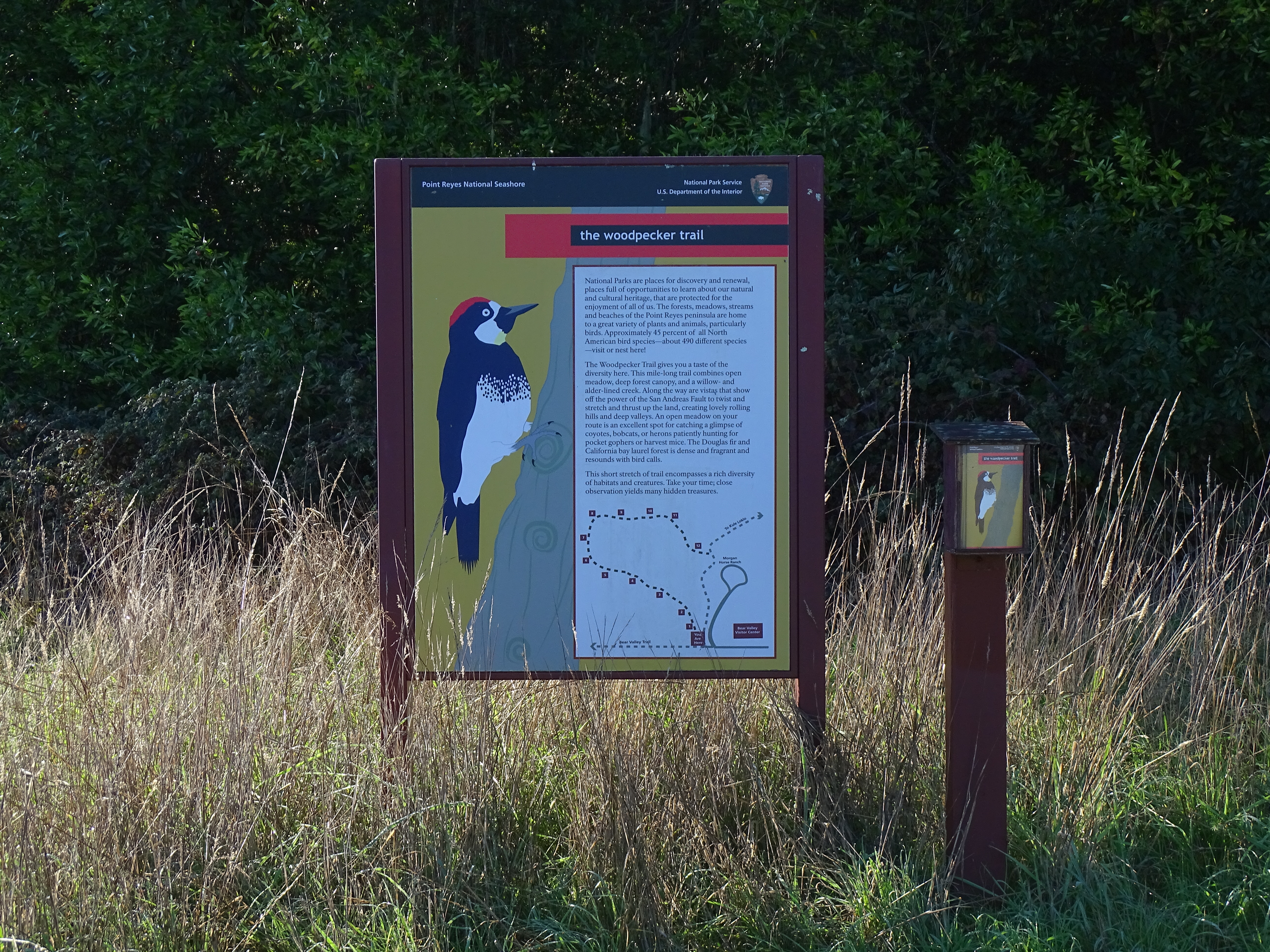
The Woodpecker Nature Trail is a loop trail that explores the beautiful local forest and meadow ecosystems of Bear Valley. It will give you a taste of the rich biodiversity of this area. It combines open meadow, deep forest canopy, and a willow- and alder-lined creek. Along the way are vistas that show off the power of the San Andreas Fault to twist and stretch and thrust up the land creating lovely rolling hills and deep valleys. An open meadow on the route is an excellent spot for catching a glimpse of coyotes, bobcats, or herons patiently hunting for pocket gophers, deer mice, and meadow voles. The Douglas fir and California bay laurel forest is dense and fragrant and resounds with bird calls. An interpretive trail guide describing some of the plants and animals you may see can be obtained at the trailhead or at the Bear Valley Visitor Center .
The Woodpecker Trail begins at the Bear Valley Trailhead , at the south end of the Bear Valley Parking Lot. It exits the wooded section of the loop near the Morgan Horse Ranch .
Download the Bear Valley Area Map . (427 KB PDF)
Download the Woodpecker Trail Guide. (6,943 KB PDF)
Always check current conditions before heading out into the park and familiarize yourself with park regulations . Please practice Leave No Trace principles.
Visit the park's Hiking at Point Reyes National Seashore page for hiking tips and information about trail etiquette and safety.
Visit the park's Trail Advisories and Closures page for current information about closed trails, trails blocked by trees, or other temporary hazards or advisories.
Pets Pets are prohibited on the Woodpecker Trail. Visit the park's Pets page to learn where pets are welcome at Point Reyes National Seashore.
Accessibility The Woodpecker Nature Trail is a relatively narrow (less than two feet wide [0.6 meters wide]) with a dirt substrate. There is a change of about 100 feet (30 meters) in elevation along the route of the trail, including some stairs. Within the forested part of the hike, tree roots pose as another obstacle.
11 mi one way · about 650 ft of climbing · 1,800 ft of descent · 365 ft–1,681 ft · gravel surface · bike, hiking, horse
TrailheadsBolinas Ridge (North) Trailhead 366 ft Drive there · Bolinas Ridge (South) Trailhead 1,518 ft Drive there
Hike the Bolinas Ridge Trail the Park Service's write-up
1-11 Hours · dogs allowed
Start Bolinas Ridge Trailhead along Sir Francis Drake Boulevard
The Bolinas Ridge Trail offers many views of Olema Valley. Photo: NPS / J. Dupont
Distance: up to 22 miles (35 km) roundtrip
Difficulty: Easy to difficult, largely depending on how far one hikes
Admire the expansive views of the Olema Valley from a ridge crest on this multi-use trail where you may walk your leashed dog. (Dogs must be on a six-foot or shorter leash at all times. Visit Point Reyes National Seashore's Pets page for additional regulations and safety tips.) The Bolinas Ridge Trail is a current ranch/fire road that is shared with bike and horse riders. Most of the northern part of the trail passes through active cattle pastures. Grazing cattle may be present; give them plenty of space when passing. This is an out-and-back trail (although connecting trails offer the opportunity of loop hikes), so it provides visitors with the flexibility to choose how long they want to make their adventure. The Bolinas Ridge trail spans 11 miles (17.6 km) from its northern trailhead along Sir Francis Drake Boulevard to its southern terminus on the Fairfax-Bolinas Road. Turn around and retrace your steps whenever you are ready. The trail description below proceeds from north to south.
The Bolinas Ridge Trail's northernmost 2.4 miles (3.8 km) pass through grasslands, gradually increasing in elevation. Due to the absence of trees, this section offers some of the best views along the trail of Olema Valley to the west, Tomales Bay to the northwest, and Black Mountain to the north.
The Bolinas Ridge Trail intersects with the Jewell Trail 1.4 miles (2.2 km) from the northern trailhead. The Jewell Trail leads east and downhill to Lagunitas Creek and the Cross Marin Trail . If you don't mind walking 0.7 miles (1.2 km) along Sir Francis Drake Boulevard, follow Jewell Trail to Cross Marin Trail to Sir Francis Drake Boulevard and back along the road to the trailhead for a 4.3-mile-long (6.9-km-long) loop hike.
The Bolinas Ridge Trail continues south from the Jewell Trail junction with grasslands initially on both sides of the trail. The trail begins to run along the edge of a Douglas fir and coast redwood forest 2.4 miles (3.8 km) from the northern trailhead. The trail skirts along the edge of the woods, staying mostly out from under the tree canopy for the next 3.3 miles (5.3 km).
The Shafter Grade Road/Trail descends to the east 5.1 miles (8.2 km) from Bolinas Ridge Trail's northern trailhead. The Shafter Grade connects with the Cross Marin Trail at the southeast boundary of Samuel P. Taylor State Park and provides options for loop hikes in excess of 10.3 miles (16.5 km).
The Bolinas Ridge Trail more completely enters the forest 5.7 miles (9.1 km) south of its northern trailhead. South of here, far-reaching views are few and far between.
The Randall Trail descends west to Highway 1 (aka Shoreline Highway) 0.5 miles (0.8 km) later. Continuing south through the forest for another 1.6 miles (2.6 km) brings the hiker to the McCurdy Trail, which similarly descends west to Highway 1. Starting from either the Randall or McCurdy Trailheads, combining the appropriate sections of the Randall, Bolinas Ridge, McCurdy, and Olema Valley Trails results in an 8.1-mile-long (13-km-long) loop hike.
The Bolinas Ridge Trail remains in the forest for another 1.7 miles (2.7 km) as it winds to the south before encountering a drier 1-mile-long (1.6-km-long) section of the ridge dominated by fragrant chaparral. From a few sections of this part of the trail, one can look south to Bolinas Lagoon, Stinson Beach, Bolinas Bay, and the Pacific Ocean. Hikers will reenter the redwood forest and find shade along the southernmost 0.5 miles (0.8 km) of the Bolinas Ridge Trail and at the small parking area along the Fairfax-Bolinas Road.
This route description alone is not a substitute for a trail map. Print out Point Reyes National Seashore's South District trail map (3,422 KB PDF) before your visit, or pick up the trail map at the Bear Valley Visitor Center on your way. (While designated as part of Golden Gate National Recreation Area, Bolinas Ridge Trail and most of the trails referenced on this page are managed by Point Reyes National Seashore.)
Always check current conditions before heading out into the park and familiarize yourself with park regulations . Please practice Leave No Trace principles.
Visit the park's Hiking at Point Reyes National Seashore page for hiking tips and information about trail etiquette and safety.
Visit the park's Trail Advisories and Closures page for current information about closed trails, trails blocked by trees, or other temporary hazards or advisories.
Accessibility The parking for the Bolinas Ridge Trailhead on Sir Francis Drake Boulevard consists of two roadside pullouts that are mostly unpaved. There is a narrow V-shaped chute/gate that prevents cattle from escaping at the trailhead which might be difficult to pass through for some users. Cyclists must lift their bikes over this feature. The trail surface is mostly compacted soil. While the footing is typically even, rain and heavy traffic can make the trail muddy and rutted in various sections. The trail/road is eight to ten feet wide in most places, and traverses through open grasslands, shrubs, and forests. Steep grades exist at various locations.
0.9 mi one way · about 90 ft of climbing · 129 ft–217 ft · earth surface · hiking
TrailheadChimney Rock Trailhead 132 ft Drive there
Hike the Chimney Rock Trail the Park Service's write-up
40-90 Minutes · no dogs
Start Chimney Rock Trailhead, Point Reyes Headlands
Chimney Rock trail transforms to lush and green in the spring time. Photo: NPS Photo / S. Frisbie
Distance: 1.8 mi. (2.9 km) roundtrip
Chimney Rock Trail offers spectacular views of Drakes Bay, the Pacific Ocean , and, in spring, wildflowers along this open coastal walk. From January through May, look for gray whales as they migrate past the point.
The trail begins at the Chimney Rock Trailhead . A narrow dirt path leads to a viewpoint at the southeast end of the Point Reyes Headlands. For your safety, please stay on the official trail and stay away from the bluff tops. Every now and then, with little to no warning, coastal erosion results in cliff faces collapsing. The narrowest section of the Chimney Rock peninsula located ~0.4 miles (600 meters) along the trail and the southwest corner of the peninsula just beyond are both very prone to coastal erosion. Fissures along the bluff tops and freshly exposed vertical faces of rock are evidence of the instability of this area. Immediately beyond the narrow section, the trail climbs a short distance along a rutted section of soft rock before leveling off. After the climb, there are a number of small social trails to the right. These are not park maintained trails. Stay on the official trail, as some of the bluff tops in this area have been undercut, are unstable, and may fall into the Pacific at anytime. The trail continues down the middle of the peninsula, with views of the water in almost every direction. Listen for elephant seals barking on the beaches below. The trail ends at the southeast end of the peninsula where visitors may enjoy the view while sitting on park benches. On clear days, vistas extend to San Francisco and Montara Mountain above Half Moon Bay.
This route description alone is not a substitute for a trail map. Print out the park's Chimney Rock Area Map (125 KB PDF) before your visit, or pick up a park map or hiking map at a visitor center on your way.
Always check current conditions before heading out into the park and familiarize yourself with park regulations . Please practice Leave No Trace principles.
Visit the park's Hiking at Point Reyes National Seashore page for hiking tips and information about trail etiquette and safety.
Visit the park's Trail Advisories and Closures page for current information about closed trails, trails blocked by trees, or other temporary hazards or advisories.
Pets Pets are prohibited on the Chimney Rock Trail. Visit the park's Pets page to learn where pets are welcome at Point Reyes National Seashore.
Accessibility A narrow dirt trail leads from the parking lot along a relatively flat section for about 0.4 miles (640 meters). The trail widens and ascends about 75 feet (23 meters) along a rutted section of trail over a distance of about 720 feet (220 meters). The trail then levels and narrows again and gradually descends to the end of the trail where there are benches.
Hike the Laguna-Coast Loop the Park Service's write-up
2-3 Hours · no dogs
Start Laguna Trailhead or Coast Trailhead along Laguna Road, Point Reyes National Seashore
The Laguna-Coast Loop is beautiful for a day hike, or an overnight trip to Coast Camp! Photo: NPS / A. Kopshever
Distance: 5 miles (8 km) roundtrip, moderate
This hike through coastal scrub, coastal grasslands, and along a stream offers some breath-taking ocean views. This loop may be hiked either clockwise or counter-clockwise (when viewed from above or on a map), although many frequent hikers of this trail prefer the clockwise route. The route description below follows the clockwise route.
The Laguna-Coast Loop hike begins at the Laguna Trailhead and quickly enters the Phillip Burton Wilderness . The route steadily ascends the 0.8-mile-long (1.3-kilometer-long) southern leg of the Laguna Trail to a 400-foot-high (120-meter-high) ridge crest from which Drakes Bay is visible. The route then descends via the 1-mile-long (1.6-kilometer-long) southern leg of the Fire Lane Trail to the Coast Trail just north of the Coast Campground . After 1.8 miles (2.9 km), turn left on the Coast Trail for 0.1 miles (160 m) to reach the Coast Campground. Here, you can access the Santa Maria Beach, refill your water bottle at one of the campgrounds water faucets, or use the vault toilet.
Retrace your steps for 0.1 miles (160 m) to the Coast Trail-Fire Lane Trail junction. Instead of turning back up the Fire Lane Trail, continue on the Coast Trail for 2.8 miles (4.5 km). An additional place to descend to the beach is located 1.1 miles (1.9 km) west of the Coast Campground. This multi-use trail* meanders along the tops of coastal bluffs before turning north and inland to parallel a steam before ending at the Coast Trailhead near Limantour Lodge. Turn right and walk a short distance along Laguna Road to return to your vehicle. Use caution when walking along the road.
* Bicycles are permitted on the Coast Trail from the Coast Trailhead to Coast Campground. Bicycles are prohibited on other trails in this immediate area. Visit the park's Bicycle Riding page to learn more about where bicylces may be ridden at Point Reyes National Seashore.
This loop can also be done in the opposite direction, beginning at the Coast Trailhead and ending at the Laguna Trailhead.
This route description alone is not a substitute for a trail map. Print out the park's South District trail map (3,422 KB PDF) before your visit, or pick one up at a visitor center on your way.
Always check current conditions before heading out into the park and familiarize yourself with park regulations . Please practice Leave No Trace principles.
Visit the park's Hiking at Point Reyes National Seashore page for hiking tips and information about trail etiquette and safety.
Visit the park's Trail Advisories and Closures page for current information about closed trails, trails blocked by trees, or other temporary hazards or advisories.
Pets Pets are prohibited on the Laguna, Fire Lane, and Coast Trails, as well as other trails in this area. Visit the park's Pets page to learn more about where pets are welcome at Point Reyes National Seashore.
Accessibility The Laguna and Fire Lane Trails are fairly narrow and moderately steep and can be deeply rutted in some places. The Coast Trail from the Coast Trailhead doubles as an eight-foot-wide (2.4-meter-wide) service/fire road that is composed of compacted dirt and gravel (and potholes and washboarding). Otherwise, the Coast Trail's northern 2.8 miles (4.5 km) is relative flat; the steepest section is at the Coast Trail's junction with the Laguna Road where the trail drops relatively steeply from the built-up road to the valley floor.
Hike the Sky–Woodward Valley–Fire Lane Loop the Park Service's write-up
4-6 Hours · no dogs
Start Sky Trailhead along Limantour Road, Point Reyes National Seashore
By January 2022, green vegetation had returned to much of the area burned in the 2020 Woodward Fire. Photo: NPS Photo
The Sky Trailhead Parking Lot and the Sky Trail from the trailhead to Sky Campground will be closed from Wednesday, September 18, 2024, through Wednesday, October 2, 2024, for resurfacing and trailwork. The parking lot and trailhead will be fully closed with no overnight parking allowed to accommodate staging equipment and materials. While work is performed on Sky Trail, equestrians and bicyclists must use alternate routes and hikers should also seek different paths. Visitors should also expect to see large trucks on Limatour Road and staging at the pullout across from the Sky Trailhead Parking Lot. Although the trailhead will be closed to parking for the duration of the project, the Sky Trail will be open to hikers on weekends.
-->
Distance : 9.5 miles (15.3 km), strenuous
Descend from forested Inverness Ridge through coastal scrub to the ocean. However, it's a steep return through the forest back to the trailhead.
This hike is mostly within the Phillip Burton Wilderness . Much of this area was burned in the 1995 Vision Fire and, again, by the 2020 Woodward Fire , which was ignited by lightning strikes in August of 2020.
Start at the Sky Trailhead , which is located along Limantour Road. Follow the northern section of the Sky Trail, which has some limited views of the ocean, through the woods for 2.6 miles (4.2 km) to the Woodward Valley Trail. Along the way, you'll pass by the junctions for Fire Lane Trail, Horse Trail, Mount Wittenberg Trail, and Meadow Trail, as well as Sky Campground . Vault toilets and potable water are available along the Sky Trail at the campground, which is 1.3 miles from the trailhead.
Turn right (west) on to the Woodward Valley Trail, which was one of the lushest, greenest trails in the park before the Woodward Fire. The Woodward Valley Trail descends about 800 feet (~240 meters) over a distance of 2.0 miles (3.2 km) before intersecting with the Coast Trail. Open ocean views are plentiful along the last 0.5 miles (0.8 km) of the Woodward Valley Trail as you pass through coastal grasslands intermixed with some coastal scrub.
Turn right on to the Coast Trail and follow it 0.8 miles (1.3 km) north to Coast Campground . Vault toilets and potable water are available at Coast Campground, and, just north of site 8, a trail leads down to Santa Maria Beach.
To continue with your hike, follow the Coast Trail north from the campground for 0.1 mile (180 meters) to its junction with Fire Lane Trail. Turn right (north) on to the Fire Lane Trail and begin your ascent through coastal scrub to return to the ridge crest. Be sure to turn around every now and then to see if any views of Drakes Bay have become available as you climb.
After 1 mile (1.6 km), bear right to stay on the Fire Lane Trail at its junction with the more heavily traveled Laguna Trail. This northern leg of the Fire Lane Trail will ascend about 600 feet (180 meters) over a distance of 2.3 miles (3.7 km) as it passes from coastal scrub habitat into increasingly denser forest. At its junction with the Sky Trail, turn left and return in 0.8 miles (1.3 km) to the Sky Trailhead.
This route description alone is not a substitute for a trail map. Print out the Point Reyes National Seashore's South District trail map (3,422 KB PDF) before your visit, or pick one up at the Bear Valley Visitor Center on your way.
Always check current conditions before heading out into the park and familiarize yourself with park regulations . Please practice Leave No Trace principles.
Visit the park's Hiking at Point Reyes National Seashore page for hiking tips and information about trail etiquette and safety.
Visit the park's Trail Advisories and Closures page for current information about closed trails, trails blocked by trees, or other temporary hazards or advisories.
Pets Pets are prohibited on the Sky, Woodward Valley, Coast, and Fire Lane trails. Visit the park's Pets page to learn where pets are welcome at Point Reyes National Seashore.
Accessibility The Sky Trail is an old ranch road and its northern 1.4 miles (2.2 km) is maintained as a service road for NPS vehicles to drive to Sky Campground. So, this section of the route tends to be at least 8 feet (2.4 meters) wide with a substrate of dirt and gravel. The Sky Trail from its trailhead to Sky Campground is open to bicycles, strollers, and other wheeled devices. But, since this section has a change in elevation of about 350 feet (106 meters), it may be challenging for someone in a wheelchair without assistance. The other sections of trail along this hike also follow the routes of old ranch roads, but these sections are not maintained as roadways and have largely become single-track trails that may be only a two feet (60 cm) wide in places. The Woodward Valley Trail and the Fire Lane Trail have changes in elevation of roughly 900 feet (270 meters) each and are oftentimes quite steep. Wheeled devices, such as bicycles and strollers, are prohibited on these other trails. Wheelchairs are permitted on these other trails, but none of these trails meet the criteria for being accessible. The vault toilets at Sky and Coast Campgrounds do not meet accessibility standards.
Hike to the Site of the Y Ranch the Park Service's write-up
4-6 Hours · no dogs
Start Y Ranch site within the Phillip Burton Wilderness, Point Reyes National Seashore
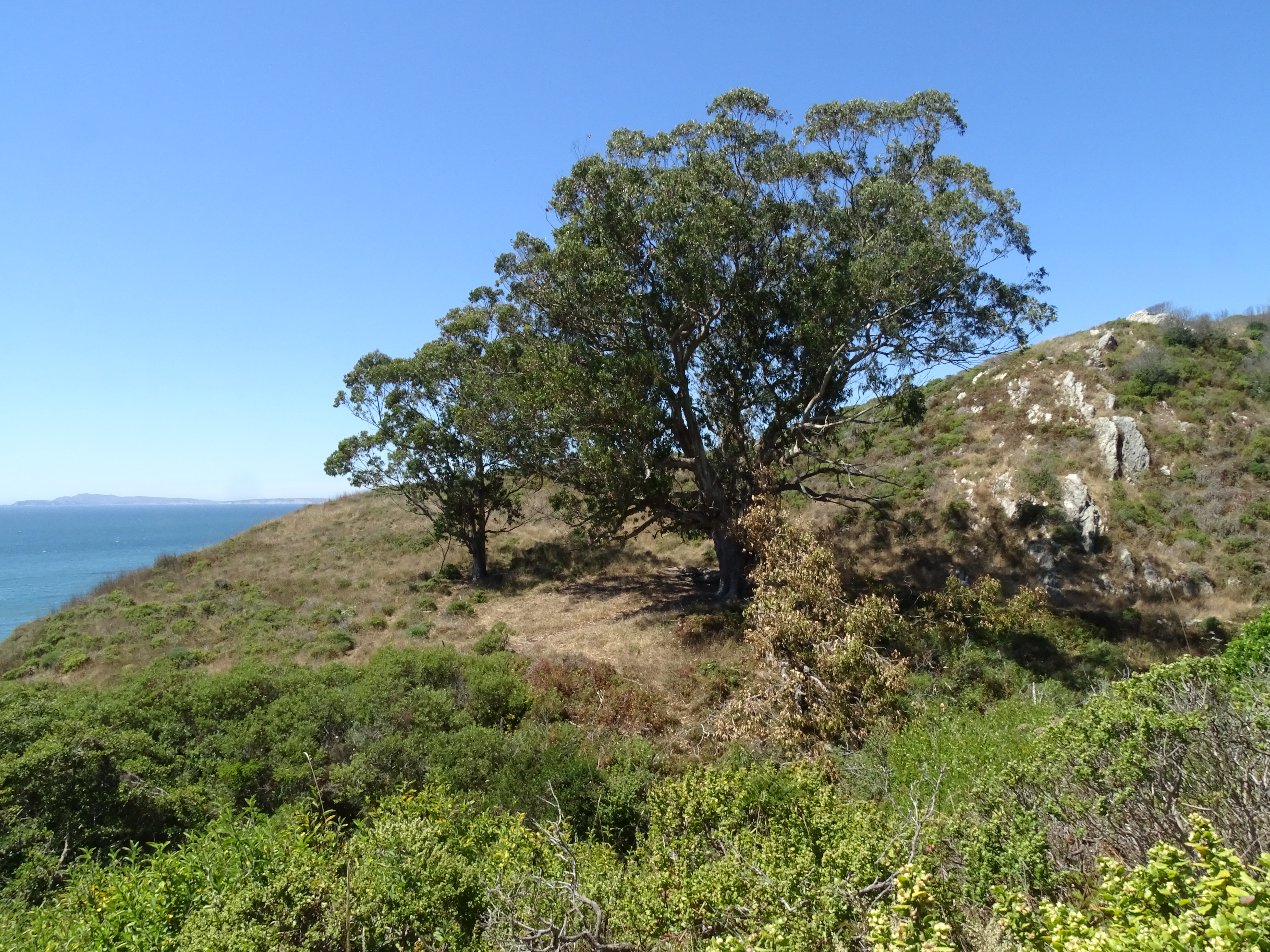
Eucalyptus at the Y Ranch site above Kelham Beach along the Coast Trail. Photo: NPS Photo
Distance: 10 miles (16 km) roundtrip, moderate
The Kelham Beach Trail is indefinitely closed due to storm damage.
The Y Ranch, also known later as Pig Ranch, was one of the smaller of the Charles Webb Howard dairies in the larger Bear Valley Ranch. It sat on a clifftop overlooking Drakes Bay, adjacent to a creek that drains into the ocean at what is now called Kelham Beach. The site of Y Ranch is now located deep within the Phillip Burton Wilderness in the central part of the national seashore. Today, the only things marking the site of Y Ranch are a huge eucalyptus tree, adjacent to one of its progeny. A large limb of the mother tree broke off and lies parallel to the Coast Trail, offering a pleasant place to sit—so long as its not too windy.
Kelham Beach is a 0.9-mile-long (1.5-kilometer-long) beach deep within the Phillip Burton Wilderness in the central part of the national seashore. The only safe location to access Kelham Beach is via Kelham Beach Trail, which is 5-miles (8-kilometers) from the nearest trailhead.
-->
The closest place to park is the Bear Valley Trailhead . Follow the Bear Valley Trail south for 1.6 miles (2.6 km) through a Douglas fir forest along Bear Valley Creek to Divide Meadow. Vault toilets are located at Divide Meadow—there are no other facilities beyond Divide Meadow, so please be sure to use the toilets before proceeding further.
Beyond Divide Meadow, the Bear Valley Trail re-enters the forest and begins to parallel Coast Creek as it flows downhill toward the coast. After another 1.5 miles (2.4 km), the Bear Valley Trail intersects with the Glen Trail and the Baldy Trail. If you are riding a bicycle , you will need to dismount and lock your bicycle to the bike rack at this junction. Beyond this junction, the Bear Valley Trail enters the Phillip Burton Wilderness and bicycles (and other wheeled devices, like strollers) are prohibited in Wilderness.
Continue on the Bear Valley Trail for 0.9 miles (1.5 km) to its junction with the Coast Trail, which is 4.1 miles (6.5 km) from the Bear Valley Trailhead. Bear right onto the Coast Trail and follow it northwest for 0.9 miles (1.5 km) to a large eucalyptus at the site of the Y ranch.
The coastal bluff area where the trail leading down to Kelham Beach was located suffered a major collapse in 2024. There is no longer any safe access to Kelham Beach.
Retrace your steps to return to the Bear Valley Trailhead.
tide chart and local weather forecasts before setting out on your trip; venturing on to Kelham Beach during hazardous surf conditions or a high tide can result in becoming trapped against the coastal bluffs. Visit the park's Beach Safety page for more information.
-->
Some of this area was burned in 2020, when lightning strikes in the Woodward Valley started what became the 2020 Woodward Fire .
This route description alone is not a substitute for a trail map. Print out the Point Reyes National Seashore's South District trail map (3,422 KB PDF) before your visit, or pick one up at the Bear Valley Visitor Center on your way.
Always check current conditions before heading out into the park and familiarize yourself with park regulations . Please practice Leave No Trace principles.
Visit the park's Hiking at Point Reyes National Seashore page for hiking tips and information about trail etiquette and safety.
Visit the park's Trail Advisories and Closures page for current information about closed trails, trails blocked by trees, or other temporary hazards or advisories.
Please take note! As of 2024, there is no longer a park-sanctioned/maintained "Kelham Beach Trail" and there are no safe routes to access Kelham Beach. In January 2023, coastal erosion eliminated the lowest 12 feet or so of steps at the bottom of the Kelham Beach Trail. In April 2024, a much larger landslide occurred, taking out even more of the Kelham Beach Trail. The route is unstable and moving. The decommissioned "Kelham Beach Trail" is no longer maintained and poses many hazards to off-trail hikers—crumbling and eroding cliffs and lots of poison oak . Visitors who use this unmaintained trail damage plants and wildlife habitat, and may endanger themselves and rescuers. Visitors have been hurt scrambling down the crumbly bluff to get to the beach or were unable to get back up, requiring the efforts of search and rescue teams to extract the injured or stranded party. The National Park Service strongly advises visitors against using this unmaintained route.
Pets Pets are prohibited at the site of the Y Ranch and along all of the trails that lead to the site. Visit the park's Pets page to learn more about where pets are welcome at Point Reyes National Seashore. Pets are prohibited at Kelham Beach and along all of the trails that lead to Kelham Beach. Visit the park's Pets page to learn more about where pets are welcome at Point Reyes National Seashore. -->
Accessibility The Bear Valley trail has a flat or mild grade (less than 5% slope) for most of its duration, although there are a couple sections with grades of more than 5%. The trail surface is packed dirt and gravel, and is approximately 8 feet (2.4 meters) wide, depending on the section. The trail serves as a service road for NPS vehicles. The steeper sections and a few somewhat rocky sections are passable for those in wheelchairs with assistance. While the trail does not technically meet accessibility standards, it can accommodate some wheelchairs. Strollers and bicycles are also permitted on the Bear Valley Trail from the trailhead to the Glen Trail Junction. The vault toilets at Divide Meadow do not meet accessibility standards. After the first 3 miles (5 km) the trail narrows, and the surface becomes more inconsistent and uneven.
Start Wildcat Beach within the Phillip Burton Wilderness, Point Reyes National Seashore
If you start this hike from the Palomarin Hike, you can pass by Ocean Lake. Photo: NPS / A. Kopshever
The Palomarin Trailhead Parking Lot will be closed from Monday, September 9, 2024, through Friday, September 13, 2024, for resurfacing. The parking lot and trailhead will be fully closed with no overnight parking allowed to accommodate staging equipment and materials. Large trucks will be present on Mesa and Palomarin Roads, so visitors to Wildcat Beach should plan alternative parking arrangements.
-->
Distance:
11 miles (17.6 km) roundtrip from the Palomarin Trailhead
12.6 miles (20.3 km) roundtrip from the Bear Valley Trailhead
13.4 miles (21.6 km) roundtrip from the Five Brooks Trailhead
Wildcat Beach is a 2.9-mile-long (4.7-kilometer-long) beach deep within the Phillip Burton Wilderness in the southern part of the national seashore. To get to Wildcat Beach, you can start from a number of different trailhead, although the Palomarin, Bear Valley, or Five Brooks trailheads are the closest. The following directions from any of these closest trailheads will bring you to Wildcat Camp, where there are vault toilets, potable water, and the only safe location at which to get onto Wildcat Beach. A well-worn trail leads along the south side of Wildcat Camp to the beach.
These route descriptions alone are not a substitute for a trail map. Print out the park's South District trail map (3,422 KB PDF) before your visit, or pick one up at a visitor center on your way.
Always check current conditions before heading out into the park and familiarize yourself with park regulations . Please practice Leave No Trace principles.
Visit the park's Hiking at Point Reyes National Seashore page for hiking tips and information about trail etiquette and safety.
Visit the park's Trail Advisories and Closures page for current information about closed trails, trails blocked by trees, or other temporary hazards or advisories.
Hiking Directions To Wildcat Beach
From Palomarin Trailhead
Due to a washout along Palomarin Road, Mesa Road and Palomarin Road are closed to motor traffic north of the Commonweal entrance until further notice. Hikers wishing to go to Wildcat Beach, Wildcat Campground, or Alamere Falls can begin their hike at Five Brooks Trailhead, instead.
-->
Follow the Coast Trail northwest as it meanders along an ocean cliff top for approximately one mile (1.6 km). The Coast Trail then heads inland and drops into a small valley before ascending switchbacks up the other side. Climb over a pass, and hike past a number of small ponds before reaching Bass Lake after 2.8 miles (4.5 km) of hiking. In another 0.6 miles (1 km) arrive at a view of Pelican Lake. Continuing on 0.8 miles (1.3 km) leads to the junction with the Ocean Lake Loop Trail. Stay right to remain on the Coast Trail as it heads a bit further inland through coastal scrub and forest, or turn left on to the Ocean Lake Loop Trail, which drops initially to pass by Ocean Lake, but then climbs steeply to reach the top of some coastal bluffs with views looking up and down the shoreline. Both routes reconnect after 1.1 miles (1.7 km). After this point you'll be back on the Coast Trail for a final 0.2 miles (0.3 km) to Wildcat Campground.
From Bear Valley Trailhead
Follow the relatively flat Bear Valley Trail south for 3.1 miles (5 km) to the Glen Trail. Turn left onto the Glen Trail and begin climbing up the side of a ridge. After 0.6 miles (1 km), keep right to stay on the Glen Trail. After another 0.4 miles (0.6 km) keep left to stay on the Glen Trail. Hike for 0.5 miles (0.8 km) to the intersection with the Stewart Trail. Turn right and follow the Stewart Trail 1.2 miles (1.9 km) downhill to get to Wildcat Campground.
From Five Brooks Trailhead
Follow the Stewart Trail northwest for 0.3 miles (0.5 km) to the junction with the Olema Valley Trail. Keep right to stay on the Stewart Trail as it begins a long climb up the side of Inverness Ridge. After 0.8 miles (1.3 km), the Greenpicker Trail branches off to the right at a switchback. Hikers may wish to shorten their hike by 0.7 miles (1.2 km) by following the Greenpicker Trail to the top of the ridge, but be forewarned that the Greenpicker Trail is steeper than the Stewart Trail. Alternatively, continue on the Stewart Trail as it switchbacks 2.6 miles (4.2 km) up the side of the ridge to Fir Top, the highest location (1324 ft/404 m) along the southern end of Inverness Ridge. Due to the dense Douglas fir forests, there are no far-reaching views. Hikers on the Greenpicker Trail can return to the Stewart Trail at this location. Continue straight on the Stewart Trail as it descends 2.7 miles (4.3 km) from the top of the ridge to Wildcat Camp.
Pets Pets are prohibited on all trails that lead to Wildcat Beach. Visit the park's Pets page to learn where pets are welcome at Point Reyes National Seashore.
Accessibility Each of the three main routes varies in length, difficulty, and type of terrain. The route from Five Brooks via the Stewart Trail is the widest, as it's a multi-use service road—it's a gravel and packed dirt path the entire way to Wildcat Camp. This route, however, gains and loses over 1,300 feet (400 meters) of elevation. The routes from Bear Valley and Palomarin follow old ranch roads which have significantly narrowed and/or degraded and have exposed roots and rocks and have become rutted in numerous locations.
Walk the Cross Marin Trail the Park Service's write-up
1-5 Hours · dogs allowed
Start Cross Marin Trailhead, Golden Gate National Recreation Area
The Cross Marin Trail offers an easy creek-side hike or ride along an old railroad grade. Photo: NPS / A. Kopshever
Distance: up to 10.6 miles (17 km) roundtrip
Difficulty: Easy
The Cross Marin Trail follows the historic North Pacific Coast Railroad right-of-way as it parallels Lagunitas Creek, resulting in a trail that has relatively little change in elevation. Pets are permitted on the Cross Marin Trail and must be on a six-foot or shorter leash at all times. Visit Point Reyes National Seashore's Pets page for additional regulations and safety tips. The Cross Marin Trail is shared with bike and horse riders.
This is an out-and-back trail (although connecting trails offer the opportunity of loop hikes), so it provides visitors with the flexibility to choose how long they want to make their adventure. The Cross Marin Trail spans 5.3 miles (17.6 km) from its northern trailhead along Sir Francis Drake Boulevard to its southern terminus at the Leo T. Cronin Fish Viewing Area along the southeast border of Samuel P. Taylor State Park . Turn around and retrace your steps whenever you are ready. The trail description below proceeds from north to south.
The northernmost 1.5 mile (2.4 km) of the Cross Marin Trail passes through streamside woodlands, including a few small copses of redwoods, and meadows. After intersecting with the Jewell Trail (which heads steeply uphill to Bolinas Ridge Trail to the west), the Cross Marin Trail enters the redwood forest protected within Samuel P. Taylor State Park.
Another 0.8 miles (1.3 km) will bring the trail user to the site of Samuel P. Taylor's paper mill, where there are a few wayside exhibits. State park employee housing is located in this area. Please respect the residents' privacy by staying on official trails and away from the residences. Camp Taylor, the state park's campground, is located 0.8 miles (1.3 km) further along the Cross Marin Trail.
Continue another 0.2 miles (0.3 km) to reach the Redwood Grove group picnic area, which is located across the creek via an automobile bridge from the Azalea Day Use lot. The Azalea Day Use lot is located just inside the entrance from Sir Francis Drake Boulevard to Camp Taylor and provides an additional location to start a hike on the Cross Marin Trail. (Samuel P. Taylor does have an entrance fee for parking at the Azalea Day Use lot.)
The Cross Marin Trail's surface changes from paved to gravel at the south end of the Redwood Grove group picnic area. The Cross Marin Trail crosses Lagunitas Creek and Sir Francis Drake Boulevard 0.6 miles (1 km) later, just before the Irving group picnic area. Follow the gravel trail for an additional 1.4 miles (2.2 km) to reach the Cross Marin Trail's southern terminus at the the Leo T. Cronin Fish Viewing Area. From here, one could head up the Shafter Grade to connect with the Bolinas Ridge Trail, providing options for loop hikes in excess of 10.3 miles (16.5 km).
The Ox Trail, the accessible South Creek Trail, the Pioneer Tree Trail, and the Barnabe Road/Trail also intersect at various locations along the Cross Marin Trail within the state park. Visit Samuel P. Taylor State Park's website for more information on these routes.
This route description alone is not a substitute for a trail map. Print out the park's South District trail map (3,422 KB PDF) and Samuel P. Taylor State Park's map (found under the "Brochures" tab on the state park's website ) before your visit, or pick up the trail map at a visitor center on your way. (While designated as part of Golden Gate National Recreation Area, the northern 1.5 miles (2.4 km) of the Cross Marin Trail are managed by Point Reyes National Seashore.)
This route description alone is not a substitute for a trail map. Print out Point Reyes National Seashore's South District trail map (3,422 KB PDF) before your visit, or pick up the trail map at the Bear Valley Visitor Center on your way. (While designated as part of Golden Gate National Recreation Area, the northern 1.5 miles (2.4 km) of the Cross Marin Trail are managed by Point Reyes National Seashore.)
Always check current conditions before heading out into the park and familiarize yourself with park regulations . Please practice Leave No Trace principles.
Visit the park's Hiking at Point Reyes National Seashore page for hiking tips and information about trail etiquette and safety.
Visit the park's Trail Advisories and Closures page for current information about closed trails, trails blocked by trees, or other temporary hazards or advisories.
Accessibility The northern 3.2 miles (5.1 km) of the Cross Marin Trail is an eight-foot-wide (2.4-meter-wide) paved path along an old railroad grade, so there is very relatively little change in elevation. Unfortunately, over the years since it was last paved, the surface has degraded a bit and depressions have developed in a number of locations. The southern 2.1 miles (3.4 km) similarly follows the old railroad grade with relatively little change in elevation and is approximately eight feet wide (2.4 meters wide), but is a gravel path.
Walk the Kule Loklo Trail the Park Service's write-up
20-60 Minutes · no dogs
Start Kule Loklo Trail, Bear Valley, Point Reyes National Seashore
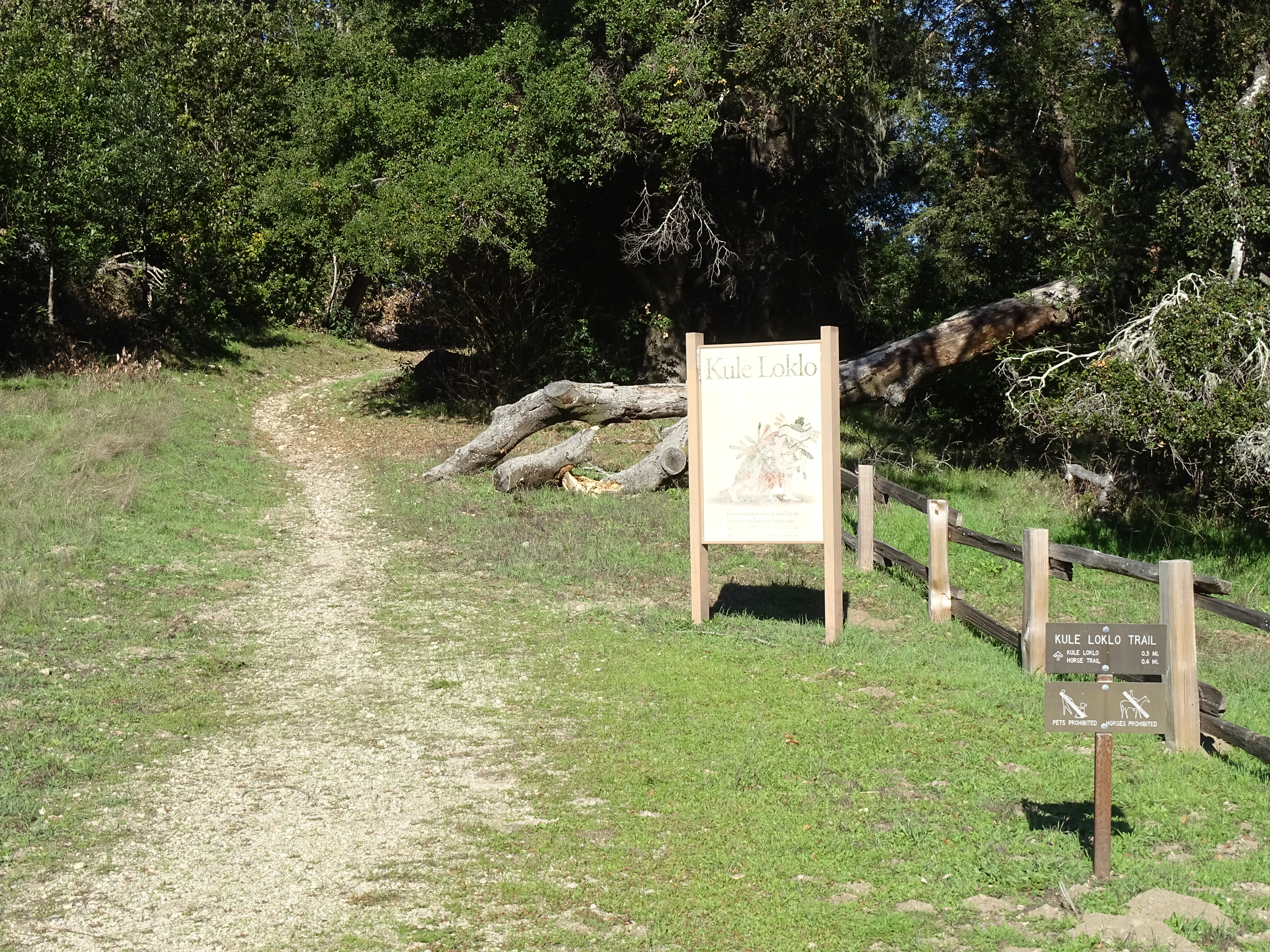
Look for the Kule Loklo Trailhead sign at the north end of the Bear Valley Parking Lot. Photo: NPS Photo
Kule Loklo and the trails leading to Kule Loklo are closed until further notice due to hazard trees.
-->
Distance: 0.8 mi. (1.3 km) roundtrip
A short path leads from the Bear Valley Visitor Center up a small hill to a replica of a Coast Miwok Indian village . Interpretive signs briefly describe Coast Miwok culture and history and the structures in the village.
From Kule Loklo, return on the same trail, or continue around the horse pasture via the Morgan Trail to return past the Morgan Horse Ranch .
The Kule Loklo Trailhead is located at the north end of the Bear Valley Parking Lot, about 110 yards (100 meters) from the the Bear Valley Visitor Center.
Download the Bear Valley Area Map . (427 KB PDF)
Always check current conditions before heading out into the park and familiarize yourself with park regulations . Please practice Leave No Trace principles.
Visit the park's Hiking at Point Reyes National Seashore page for hiking tips and information about trail etiquette and safety.
Visit the park's Trail Advisories and Closures page for current information about closed trails, trails blocked by trees, or other temporary hazards or advisories.
Pets Pets are prohibited at Kule Loklo and on the trails that lead to Kule Loklo. Visit the park's Pets page to learn where pets are welcome at Point Reyes National Seashore.
Accessibility The first part of the 0.4 mile (650 meter) dirt trail to Kule Loklo is quite steep, but then the trail levels off with relatively minimal cross slope. However, the dirt trail does pass over some exposed tree roots, which may be difficult for some to get over. Many gopher holes fill the grassy field at Kule Loklo, making it challenging for some to navigate between the exhibit's structures in a wheelchair or on crutches. There are no accessible restrooms. Inquire at Bear Valley Visitor Center for more information on accessing Kule Loklo.
1.3 mi one way · about 40 ft of climbing · 150 ft of descent · 81 ft–224 ft · earth surface · bike, hiking, horse
Hike the Estero Trail to Drakes Head or Sunset Beach the Park Service's write-up
1-7 Hours · no dogs
Start Estero Trailhead, Point Reyes National Seashore
This trail leads to stunning views of the rich blue estero waters. Photo: NPS / S.Frisbie
Distances:
To the footbridge: 2.4 miles (3.8 km) roundtrip
To Sunset Beach Trail Junction: 5 miles (8 km)
To Sunset Beach: 7.8 miles (12.6 km) roundtrip
To Drakes Head: 8.8 miles (14.2 km) roundtrip
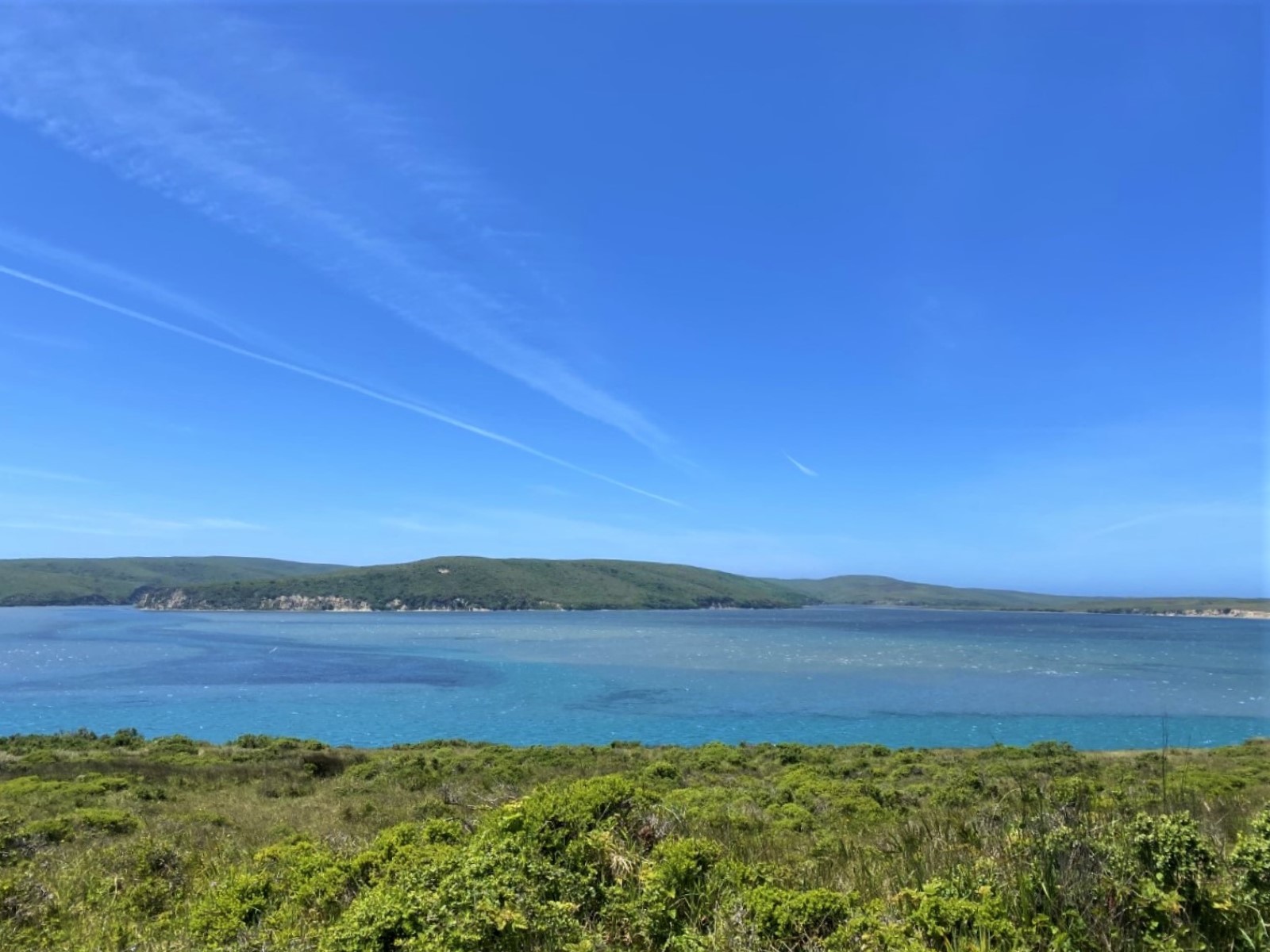
This trail through grassland and cattle pastures offers outstanding views of Drakes Estero and Estero de Limantour, and the opportunity to see the diverse wildlife that call these ecosystems home.
From the Estero Trailhead at its northwestern end, the Estero Trail heads south through brush-spotted grasslands for 0.6 miles (1 km). The trail then skirts along the northern edge of an abandoned Christmas tree farm before turning south to pass among the Monterey pines. Keep your eyes and ears open for owls. After another 0.6 miles (1 km), the trail arrives at Home Bay, the head of which was dammed by ranchers to create a stock pond. More recently, the dam was breached and the trail now traverses along the crest of the earthen dam. A footbridge with benches was constructed at the location of the breach. The bridge is a great location to look for birds —egrets and herons roost and nest in the pines and shorebirds and waterfowl abound in the estero (which is Spanish for estuary). One may also observe bat rays and leopard sharks in the water below the bridge. The bridge is also a good turn-around point for those wanting a shorter hike.
From Home Bay, the trail leads up and over a couple of small ridges through pastureland. Please be respectful of grazing stock and be sure to leave gates as you find them: if they are closed, please close them after passing through. Between the ridges are valleys in which stock ponds were constructed by ranchers. These ponds attract a variety of waterfowl.
The Sunset Beach Trail branches off to the right 1.4 miles (2.3 km) south of the bridge. Some hikers turn around here for a 5-mile (8 km) round-trip hike.
Follow Sunset Beach Trail for an additional 1.4 miles (2.3 km) to get to Sunset Beach—which is arguably more of a marshy wetland, rather than a beach.
Alternatively, turn left to stay on the Estero Trail as it heads up a ridge away from Drakes Estero. The last couple sections of the route seems more like a cattle trail than a hiking trail, but persevere and look for markers to differentiate between the cattle paths and the hiking trail. After 0.6 miles (1 km), turn right on to the Drakes Head Trail at the junction of a number of fencelines adjacent to a small corral and abandoned, circular, concrete water trough. There will be abundant views of Estero de Limantour to the east as one heads south 1.3 miles (2 km) south to Drakes Head. The view looking down into the estero on a clear day is truly spectacular, with the possibility of seeing bat rays and leopard sharks swimming just below the water's surface.
If you want to continue east along the Estero Trail, you will get to explore sections of the Phillip Burton Wilderness where you may be the only hiker. The Estero Trail will sequentially intersect with White Gate Trail and Glenbrook Trail, and ultimately terminate after a total of 9.7 miles (15.5 km) along the Muddy Hollow Trail 1.5 miles (2.4 km) north of Limantour Beach .
This route description alone is not a substitute for a trail map. Print out the park's North District trail map (3,409 KB PDF) before your visit, or pick one up at a visitor center on your way.
Always check current conditions before heading out into the park and familiarize yourself with park regulations . Please practice Leave No Trace principles.
Visit the park's Hiking at Point Reyes National Seashore page for hiking tips and information about trail etiquette and safety.
Visit the park's Trail Advisories and Closures page for current information about closed trails, trails blocked by trees, or other temporary hazards or advisories.
Pets Pets are prohibited on the Estero Trail and Sunset Beach Trail. Visit the park's Pets page to learn where pets are welcome at Point Reyes National Seashore.
Accessibility This trail traverses rolling terrain over short grass and packed dirt surfaces. With the exception of some ruts and animal holes, the trail surface is largely flat and even for the first mile (1.6 km). The trailhead parking lot is dirt/gravel and the vault toilets do not meet accessibility standards.
0.5 mi one way · 60 ft of descent · 66 ft–108 ft · asphalt surface · hiking
Picnic areas
Along the wayBear Valley Picnic Area
TrailheadEarthquake Nature Trailhead 109 ft Drive there
Walk the Earthquake Trail the Park Service's write-up
15-40 Minutes · no dogs
Start Earthquake Trailhead at Bear Valley
The NPS constructed a fence to illustrate the displacement that occurred during the 1906 Earthquake. Photo: NPS Photo
Distance: 0.6 mi. (1 km) loop
Welcome to the San Andreas Fault Zone. Here, where the North American and Pacific plates scrape against one another, we witness forces of change. This world-famous fault holds secrets of geologic processes under its long bays and valleys. Looking closely, you may find clues about Earth's restlessness that shapes the land, its inhabitants, and all our lives.
Discover the geology of the San Andreas Fault through interpretive signs on this paved loop through meadows and along a stream lined with alders and willows. A fence that was constructed half way around the trail illustrates the 16 feet (3 meters) of displacement that occurred during the infamous 1906 earthquake . (5,501 KB PDF)
The Earthquake Trailhead is at the northeast corner of the Trailhead and Picnic Area parking area at Bear Valley in Point Reyes National Seashore. Look for trailhead signs to the north (e.g., left if standing in the parking lot) of the picnic area's restroom building.
Download the Bear Valley Area Map . (427 KB PDF)
Always check current conditions before heading out into the park and familiarize yourself with park regulations . Please practice Leave No Trace principles.
Visit the park's Hiking at Point Reyes National Seashore page for hiking tips and information about trail etiquette and safety.
Visit the park's Trail Advisories and Closures page for current information about closed trails, trails blocked by trees, or other temporary hazards or advisories.
Pets Pets are prohibited on the Earthquake Trail. Visit the park's Pets page to learn where pets are welcome at Point Reyes National Seashore.
Accessibility The trail's asphalt pathway was designed to be accessible, and has gentle slopes suitable for wheelchair users. Unfortunately, over the years since it was last paved, depressions have developed in a number of locations, which precludes the pathway from currently meeting criteria for being fully accessible. Some wheelchair users may need assistance to navigate through these degraded sections of the trail. An accessible restroom and two designated parking spaces in a dirt/gravel parking lot are located at the trailhead.
0.2 mi one way · 82 ft–89 ft · gravel surface · hiking
Views
Along the wayElephant Seal Overlook
Walk the Elephant Seal Overlook Trail the Park Service's write-up
15-60 Minutes · no dogs
Start Chimney Rock Parking Lot, Point Reyes National Seashore
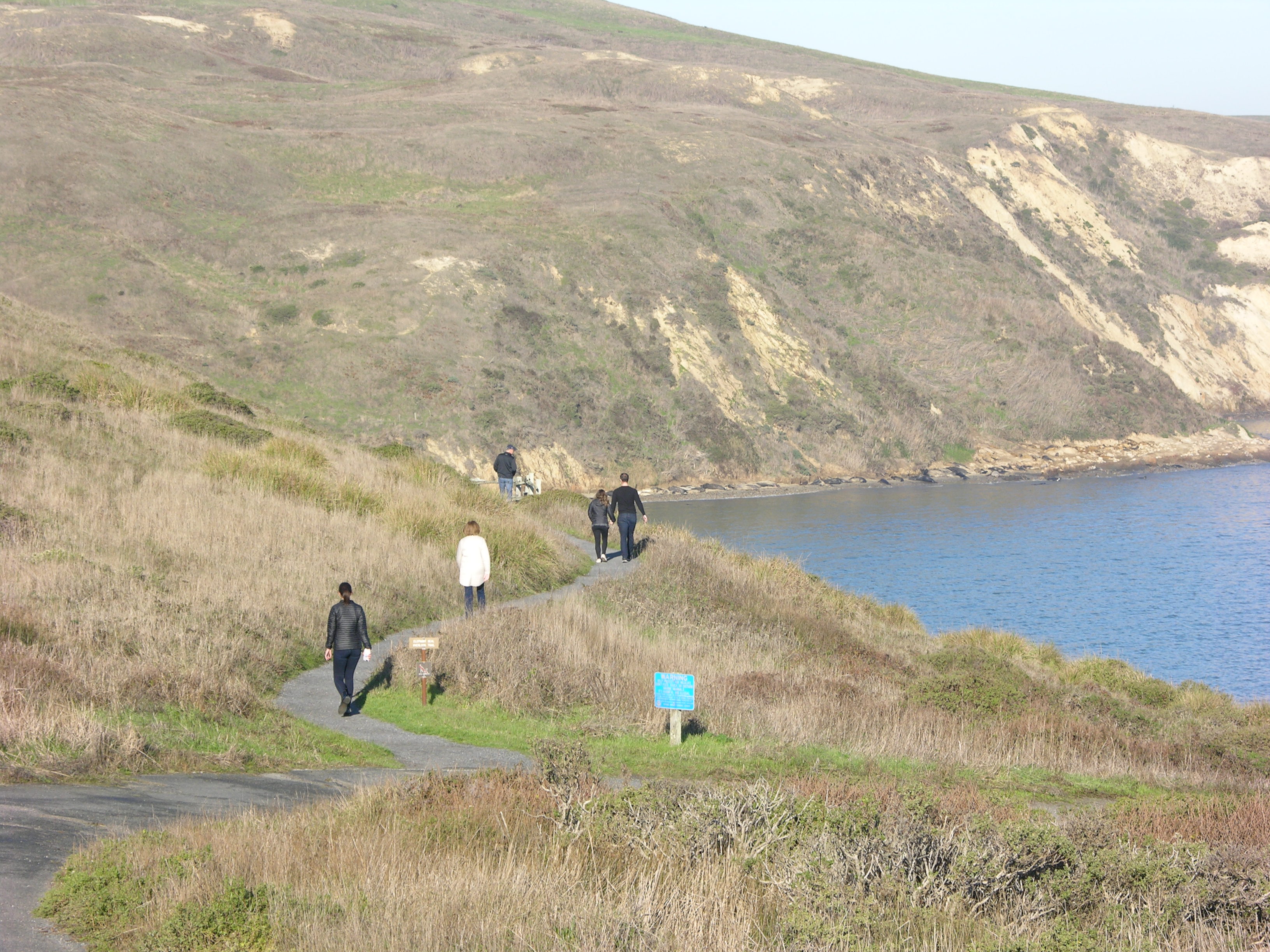
Elephant seals are visible in the distance from where the trail branches off from the driveway. Photo: NPS Photo
Distance to the Elephant Seal Overlook: 0.5 mi. (800 m) roundtrip
From the Chimney Rock parking lot/trailhead , follow the driveway downhill (on foot; the driveway is closed to visitors' vehicles) and to the left. After 400 feet (120 meters), turn off of the paved driveway onto the relatively level gravel path. The path travels along the bluff top with views of Drakes Bay and Drakes Beach before terminating at the Elephant Seal Overlook . Visit our Elephant Seals and Viewing Elephant Seals for more information.
This route description alone is not a substitute for a trail map. Print out the park's Chimney Rock Area Map (125 KB PDF) before your visit, or pick up a park map or hiking map at a visitor center on your way.
Always check current conditions before heading out into the park and familiarize yourself with park regulations . Please practice Leave No Trace principles.
Visit the park's Hiking at Point Reyes National Seashore page for hiking tips and information about trail etiquette and safety.
Visit the park's Trail Advisories and Closures page for current information about closed trails, trails blocked by trees, or other temporary hazards or advisories.
Pets Pets are prohibited on the Elephant Seal Overlook Trail. Visit the park's Pets page to learn where pets are welcome at Point Reyes National Seashore.
Accessibility To reach the Elephant Seal Overlook, park in the Chimney Rock Trailhead parking lot and follow the path/driveway from the parking lot northeast toward the bay as it descends about 50 feet (15 meters) over a distance of about 500 feet (150 meters). (This driveway is closed to privately-owned vehicles.) The driveway is composed of asphalt, which has degraded and has become potholed in places. The actual Elephant Seal Overlook Trail is mostly flat and about 4 feet wide (1.2 meters wide) with a crushed rock surface.
1.0 mi one way · 300 ft of descent · 66 ft–377 ft · earth surface · hiking, horse
Hike the Sky–Woodward Valley–Fire Lane Loop the Park Service's write-up
4-6 Hours · no dogs
Start Sky Trailhead along Limantour Road, Point Reyes National Seashore
By January 2022, green vegetation had returned to much of the area burned in the 2020 Woodward Fire. Photo: NPS Photo
The Sky Trailhead Parking Lot and the Sky Trail from the trailhead to Sky Campground will be closed from Wednesday, September 18, 2024, through Wednesday, October 2, 2024, for resurfacing and trailwork. The parking lot and trailhead will be fully closed with no overnight parking allowed to accommodate staging equipment and materials. While work is performed on Sky Trail, equestrians and bicyclists must use alternate routes and hikers should also seek different paths. Visitors should also expect to see large trucks on Limatour Road and staging at the pullout across from the Sky Trailhead Parking Lot. Although the trailhead will be closed to parking for the duration of the project, the Sky Trail will be open to hikers on weekends.
-->
Distance : 9.5 miles (15.3 km), strenuous
Descend from forested Inverness Ridge through coastal scrub to the ocean. However, it's a steep return through the forest back to the trailhead.
This hike is mostly within the Phillip Burton Wilderness . Much of this area was burned in the 1995 Vision Fire and, again, by the 2020 Woodward Fire , which was ignited by lightning strikes in August of 2020.
Start at the Sky Trailhead , which is located along Limantour Road. Follow the northern section of the Sky Trail, which has some limited views of the ocean, through the woods for 2.6 miles (4.2 km) to the Woodward Valley Trail. Along the way, you'll pass by the junctions for Fire Lane Trail, Horse Trail, Mount Wittenberg Trail, and Meadow Trail, as well as Sky Campground . Vault toilets and potable water are available along the Sky Trail at the campground, which is 1.3 miles from the trailhead.
Turn right (west) on to the Woodward Valley Trail, which was one of the lushest, greenest trails in the park before the Woodward Fire. The Woodward Valley Trail descends about 800 feet (~240 meters) over a distance of 2.0 miles (3.2 km) before intersecting with the Coast Trail. Open ocean views are plentiful along the last 0.5 miles (0.8 km) of the Woodward Valley Trail as you pass through coastal grasslands intermixed with some coastal scrub.
Turn right on to the Coast Trail and follow it 0.8 miles (1.3 km) north to Coast Campground . Vault toilets and potable water are available at Coast Campground, and, just north of site 8, a trail leads down to Santa Maria Beach.
To continue with your hike, follow the Coast Trail north from the campground for 0.1 mile (180 meters) to its junction with Fire Lane Trail. Turn right (north) on to the Fire Lane Trail and begin your ascent through coastal scrub to return to the ridge crest. Be sure to turn around every now and then to see if any views of Drakes Bay have become available as you climb.
After 1 mile (1.6 km), bear right to stay on the Fire Lane Trail at its junction with the more heavily traveled Laguna Trail. This northern leg of the Fire Lane Trail will ascend about 600 feet (180 meters) over a distance of 2.3 miles (3.7 km) as it passes from coastal scrub habitat into increasingly denser forest. At its junction with the Sky Trail, turn left and return in 0.8 miles (1.3 km) to the Sky Trailhead.
This route description alone is not a substitute for a trail map. Print out the Point Reyes National Seashore's South District trail map (3,422 KB PDF) before your visit, or pick one up at the Bear Valley Visitor Center on your way.
Always check current conditions before heading out into the park and familiarize yourself with park regulations . Please practice Leave No Trace principles.
Visit the park's Hiking at Point Reyes National Seashore page for hiking tips and information about trail etiquette and safety.
Visit the park's Trail Advisories and Closures page for current information about closed trails, trails blocked by trees, or other temporary hazards or advisories.
Pets Pets are prohibited on the Sky, Woodward Valley, Coast, and Fire Lane trails. Visit the park's Pets page to learn where pets are welcome at Point Reyes National Seashore.
Accessibility The Sky Trail is an old ranch road and its northern 1.4 miles (2.2 km) is maintained as a service road for NPS vehicles to drive to Sky Campground. So, this section of the route tends to be at least 8 feet (2.4 meters) wide with a substrate of dirt and gravel. The Sky Trail from its trailhead to Sky Campground is open to bicycles, strollers, and other wheeled devices. But, since this section has a change in elevation of about 350 feet (106 meters), it may be challenging for someone in a wheelchair without assistance. The other sections of trail along this hike also follow the routes of old ranch roads, but these sections are not maintained as roadways and have largely become single-track trails that may be only a two feet (60 cm) wide in places. The Woodward Valley Trail and the Fire Lane Trail have changes in elevation of roughly 900 feet (270 meters) each and are oftentimes quite steep. Wheeled devices, such as bicycles and strollers, are prohibited on these other trails. Wheelchairs are permitted on these other trails, but none of these trails meet the criteria for being accessible. The vault toilets at Sky and Coast Campgrounds do not meet accessibility standards.
0.7 mi one way · about 90 ft of climbing · 207 ft–294 ft · earth surface · hiking, horse
Hike the Estero–Glenbrook–Muddy Hollow Road Loop the Park Service's write-up
3-4 Hours · no dogs
Start Muddy Hollow Trailhead, Point Reyes National Seashore
The Estero-Glenbrook-Muddy Hollow Road Loop offers many views of Estero de Limantour and Drakes Bay. Photo: NPS Photo
Distance: 7.4 miles (12 km) roundtrip, moderate
This loop hike passes through young woodlands, coastal scrub, and grassland within the Phillip Burton Wilderness . It offers views of Estero de Limantour and the possibility of seeing tule elk and other wildlife that call this area home. It is also a great hike for spring wildflowers . This area was burned by the 1995 Vision Fire , and Bishop pine trees have since started encroaching on what had previously been open grassland and coastal scrub.
From the Muddy Hollow Trailhead , this loop offers a similar experience and views regardless of whether one follows it clockwise or counter-clockwise. However, just west of the trailhead, the Muddy Hollow Road Trail intersects with Muddy Hollow Creek. No bridge exists at this crossing, so hikers may get their feet wet while attempting to cross this ~8-foot-wide (2.4-meter-wide) creek, especially when the water level is high in the winter and spring. You may want to check out this crossing before starting your hike to determine which direction you will go. If you attempt to cross the creek at the start of the hike and you do get your feet wet, you may not enjoy the hike as much as you hike for the next 7.4 miles (12 km) with wet footwear. If you decide to cross the creek at the end of your hike, you won't have too much further to walk before you can change out of your wet footwear at your vehicle.
If you choose to hike the route clockwise, head south on the Muddy Hollow Trail for 0.3 miles (0.5 km) through a riparian (e.g., streamside) zone to the junction with Estero Trail. The Estero Trail heads west out of the valley floor through some coastal scrub and young Bishop pine woodlands up and over a 370-foot-high (112-meter-high) ridge before descending into another valley and crossing the Glenbrook Creek after 2.2 miles (3.5 km). There may be standing water on the trail in the Glenbrook Creek area during winter and spring.
Just beyond the Glenbrook Creek is the site of the New Albion Ranch, which is significant as the first dairy on Point Reyes, perhaps in Marin County. All that remains of the ranch, however, are eucalyptus trees that were planted to protect the ranch from the wind.
Continue south 0.4 miles (0.6 km) toward the estero (which is Spanish for estuary) and Drakes Bay before making a sharp bend to the north. The trail runs fairly straight along a low ridge crest before intersecting with the Glenbrook Trail in 1.1 miles (1.7 km). The forested ridge in the distance to the north is the northern end of Inverness Ridge, which reaches heights of 1282 feet (388 meters) at Mount Vision and 1336 feet (405 meters) at Point Reyes Hill. The route described on this page will ultimately follow along the western base of this ridge, but won't ascend to its crest.
At the Glenbrook Trail junction, you could turn left to stay on the Estero Trail and return via the White Gate and Muddy Hollow Road trails—doing so would add an extra 2 miles (3 km) to your hike. Or continue straight along the ridge crest as the Glenbrook Trail leads 0.6 miles (1 km) north to the Muddy Hollow Road Trail. Turn right and follow the Muddy Hollow Road Trail as it meanders 2.3 miles (3.7 km) along the base of Inverness Ridge back to the trailhead.
The Bucklin and Bayview Trails connect with the Muddy Hollow Road Trail and offer routes to ascend to the crest of Inverness Ridge, which would add another ~4 to ~6 miles (6.4 to 9.6 km) to your hike.
This route description alone is not a substitute for a trail map. Print out the park's North District trail map (3,409 KB PDF) before your visit, or pick one up at a visitor center on your way.
Always check current conditions before heading out into the park and familiarize yourself with park regulations . Please practice Leave No Trace principles.
Visit the park's Hiking at Point Reyes National Seashore page for hiking tips and information about trail etiquette and safety.
Visit the park's Trail Advisories and Closures page for current information about closed trails, trails blocked by trees, or other temporary hazards or advisories.
Pets Pets are prohibited on all of the trails described on this page. Visit the park's Pets page to learn where pets are welcome at Point Reyes National Seashore.
Accessibility This trail traverses rolling terrain over packed dirt surfaces, which may be wet and rutted in places. The trailhead parking lot is dirt/gravel. Just west of the Muddy Hollow Trailhead, the Muddy Hollow Road Trail intersects with Muddy Hollow Creek. No bridge exists at this crossing, so hikers may get their feet wet while attempting to cross this ~8-foot-wide (2.4-meter-wide) creek.
2.4 mi one way · about 1,000 ft of climbing · 83 ft–1,105 ft · earth surface · hiking, horse
Hike the Meadow–Horse Trails Loop the Park Service's write-up
2-4 Hours · no dogs
Start Bear Valley Trailhead, Point Reyes National Seashore
Gaps in the forest canopy provide views from the Horse Trail of Inverness Ridge and Bolinas Ridge. Photo: NPS Photo
Distance : 6.5 miles (10.4 km) total
This hike takes you through dense forest and a few meadows, starting with an uphill climb on the east side of Inverness Ridge to a ridgetop with ocean views. Most of this hike's distance is within the Phillip Burton Wilderness . This area was burned in 2020, when lightning strikes in the Woodward Valley started what became the Woodward Fire .
Start at the Bear Valley Trailhead and follow the relatively flat Bear Valley Trail south for 0.8 miles (1.3 km). Turn right on to the Meadow Trail to begin your ascent to the crest of Inverness Ridge. While the Woodward Fire burned along most of the length of the Meadow Trail, it primarily burned in the understory and left most of the canopy of the Douglas fir forest intact. The trail does pass through a fairly large meadow (after which the trail was named), but views from the meadow are of forested hillsides less than a mile distant. As a result, there are very few far-reaching views from this trail until you reach the ridge crest. The Meadow Trail ascends about 840 feet (~255 m) over a distance of 1.6 miles (2.6 km) before intersecting with the Sky Trail 2.4 miles (3.8 km) from the Bear Valley Trailhead. The elevation at this intersection is ~1080 feet (~327 m).
Turn right onto the Sky Trail and, after 55 yards (50 meters), bear right onto the Mount Wittenberg Trail. Head north and east 0.4 miles (0.7 km) to the Mount Wittenberg–Z Ranch trail junction along the ridge crest at an elevation of 1270 feet (385 m). Along this section of the Mount Wittenberg Trail, you may be rewarded (weather dependent) with views looking west across the peninsula to the Pacific Ocean.
From the Mount Wittenberg–Z Ranch Trail junction, the 0.3-mile-long (0.5-kilometer-long) Mount Wittenberg Summit Trail leads, as its name suggests, to the summit of Mount Wittenberg (elevation 1407 feet (426 m). The once unobstructed views from near the summit have, since 2000, become obstructed by dense Douglas fir thickets that sprouted shortly after the 1995 Vision Fire . While the 2020 Woodward Fire burned through much of the forest around Mount Wittenberg, the view-obstructing Douglas fir thickets were largely left unscathed. So, without being rewarded with views for their effort, many hikers pass on ascending the Mount Wittenberg Summit Trail.
From the Mount Wittenberg–Z Ranch trail junction, head north and follow the Z Ranch Trail through a thicket of Douglas fir for 0.7 miles (1.2 km) to the Horse Trail. Turn right and follow the Horse Trail east and downhill for 2.4 miles (3.8 miles) to its junction with the Morgan Trail. Along this section, there are a few gaps in the forest canopy that provide views to the north of Inverness Ridge and Bolinas Ridge and just a little bit of Tomales Bay. Turn right and follow the Morgan Trail around the west side of the Morgan Horse Ranch to return to the Bear Valley Trailhead.
Restrooms and water are available at the Bear Valley Trailhead parking lot. Otherwise, there are no other facilities along this route, unless, instead of following the Mount Wittenberg Trail north from its junction with the Sky Trail, you follow the Sky Trail north for 0.5 miles (0.8 meters) to Sky Campground. Potable water and vault toilets are available at Sky Campground, along with a trailside picnic table. (If you use the picnic tables at the designated campsites, be prepared to vacate the site if campers with reservations for the site arrive.) From Sky Campground, you could return to the Mount Wittenberg–Sky Trail junction, or continue north for 0.5 miles (0.8 km) along the Sky Trail to its junction with the Horse Trail. Turn right to follow the Horse Trail for 0.4 miles (0.6 km) to its junction with the Z Ranch Trail and then bear left to stay on the Horse Trail.
This route description alone is not a substitute for a trail map. Print out the Point Reyes National Seashore's South District trail map (3,422 KB PDF) before your visit, or pick one up at the Bear Valley Visitor Center on your way.
Always check current conditions before heading out into the park and familiarize yourself with park regulations . Please practice Leave No Trace principles.
Visit the park's Hiking at Point Reyes National Seashore page for hiking tips and information about trail etiquette and safety.
Visit the park's Trail Advisories and Closures page for current information about closed trails, trails blocked by trees, or other temporary hazards or advisories.
Pets Pets are prohibited on all of the trails that are described on this page. Visit the park's Pets page to learn where pets are welcome at Point Reyes National Seashore.
Accessibility The Bear Valley Trail is wide, mostly flat, and has a substrate of dirt and gravel. The other trails described on this page vary in width from two to six feet (0.6 to 1.8 meters) and have surfaces of mostly compacted dirt that may be rutted and have exposed roots and rocks in places.The total elevation change from Bear Valley to the crest of Inverness Ridge is about 1200 feet (360 meters) over a distance of 2.8 to 3.7 miles (4.5 to 5.9 km). Restrooms at the Bear Valley Trailhead are accessible and open from 6 am to midnight. The vault toilet building at Sky Campground does not meet accessibility standards.
2.8 mi one way · about 700 ft of climbing · 715 ft–1,333 ft · asphalt, earth, gravel surface · bike, hiking, horse
TrailheadsBayview Trailhead 787 ft Drive there · Point Reyes Hill Trailhead 1,237 ft Drive there
Hike the Meadow–Horse Trails Loop the Park Service's write-up
2-4 Hours · no dogs
Start Bear Valley Trailhead, Point Reyes National Seashore
Gaps in the forest canopy provide views from the Horse Trail of Inverness Ridge and Bolinas Ridge. Photo: NPS Photo
Distance : 6.5 miles (10.4 km) total
This hike takes you through dense forest and a few meadows, starting with an uphill climb on the east side of Inverness Ridge to a ridgetop with ocean views. Most of this hike's distance is within the Phillip Burton Wilderness . This area was burned in 2020, when lightning strikes in the Woodward Valley started what became the Woodward Fire .
Start at the Bear Valley Trailhead and follow the relatively flat Bear Valley Trail south for 0.8 miles (1.3 km). Turn right on to the Meadow Trail to begin your ascent to the crest of Inverness Ridge. While the Woodward Fire burned along most of the length of the Meadow Trail, it primarily burned in the understory and left most of the canopy of the Douglas fir forest intact. The trail does pass through a fairly large meadow (after which the trail was named), but views from the meadow are of forested hillsides less than a mile distant. As a result, there are very few far-reaching views from this trail until you reach the ridge crest. The Meadow Trail ascends about 840 feet (~255 m) over a distance of 1.6 miles (2.6 km) before intersecting with the Sky Trail 2.4 miles (3.8 km) from the Bear Valley Trailhead. The elevation at this intersection is ~1080 feet (~327 m).
Turn right onto the Sky Trail and, after 55 yards (50 meters), bear right onto the Mount Wittenberg Trail. Head north and east 0.4 miles (0.7 km) to the Mount Wittenberg–Z Ranch trail junction along the ridge crest at an elevation of 1270 feet (385 m). Along this section of the Mount Wittenberg Trail, you may be rewarded (weather dependent) with views looking west across the peninsula to the Pacific Ocean.
From the Mount Wittenberg–Z Ranch Trail junction, the 0.3-mile-long (0.5-kilometer-long) Mount Wittenberg Summit Trail leads, as its name suggests, to the summit of Mount Wittenberg (elevation 1407 feet (426 m). The once unobstructed views from near the summit have, since 2000, become obstructed by dense Douglas fir thickets that sprouted shortly after the 1995 Vision Fire . While the 2020 Woodward Fire burned through much of the forest around Mount Wittenberg, the view-obstructing Douglas fir thickets were largely left unscathed. So, without being rewarded with views for their effort, many hikers pass on ascending the Mount Wittenberg Summit Trail.
From the Mount Wittenberg–Z Ranch trail junction, head north and follow the Z Ranch Trail through a thicket of Douglas fir for 0.7 miles (1.2 km) to the Horse Trail. Turn right and follow the Horse Trail east and downhill for 2.4 miles (3.8 miles) to its junction with the Morgan Trail. Along this section, there are a few gaps in the forest canopy that provide views to the north of Inverness Ridge and Bolinas Ridge and just a little bit of Tomales Bay. Turn right and follow the Morgan Trail around the west side of the Morgan Horse Ranch to return to the Bear Valley Trailhead.
Restrooms and water are available at the Bear Valley Trailhead parking lot. Otherwise, there are no other facilities along this route, unless, instead of following the Mount Wittenberg Trail north from its junction with the Sky Trail, you follow the Sky Trail north for 0.5 miles (0.8 meters) to Sky Campground. Potable water and vault toilets are available at Sky Campground, along with a trailside picnic table. (If you use the picnic tables at the designated campsites, be prepared to vacate the site if campers with reservations for the site arrive.) From Sky Campground, you could return to the Mount Wittenberg–Sky Trail junction, or continue north for 0.5 miles (0.8 km) along the Sky Trail to its junction with the Horse Trail. Turn right to follow the Horse Trail for 0.4 miles (0.6 km) to its junction with the Z Ranch Trail and then bear left to stay on the Horse Trail.
This route description alone is not a substitute for a trail map. Print out the Point Reyes National Seashore's South District trail map (3,422 KB PDF) before your visit, or pick one up at the Bear Valley Visitor Center on your way.
Always check current conditions before heading out into the park and familiarize yourself with park regulations . Please practice Leave No Trace principles.
Visit the park's Hiking at Point Reyes National Seashore page for hiking tips and information about trail etiquette and safety.
Visit the park's Trail Advisories and Closures page for current information about closed trails, trails blocked by trees, or other temporary hazards or advisories.
Pets Pets are prohibited on all of the trails that are described on this page. Visit the park's Pets page to learn where pets are welcome at Point Reyes National Seashore.
Accessibility The Bear Valley Trail is wide, mostly flat, and has a substrate of dirt and gravel. The other trails described on this page vary in width from two to six feet (0.6 to 1.8 meters) and have surfaces of mostly compacted dirt that may be rutted and have exposed roots and rocks in places.The total elevation change from Bear Valley to the crest of Inverness Ridge is about 1200 feet (360 meters) over a distance of 2.8 to 3.7 miles (4.5 to 5.9 km). Restrooms at the Bear Valley Trailhead are accessible and open from 6 am to midnight. The vault toilet building at Sky Campground does not meet accessibility standards.
Hike the Sky–Bear Valley Loop the Park Service's write-up
4-6 Hours · no dogs
Start Bear Valley Trailhead, Point Reyes National Seashore
Tall Douglas Fir trees lined the Sky Trail before the Woodward Fire. Photo: NPS/A. Kopshever
Distance : 10.8 miles (17.4 km) total
This varied hike takes you through dense forest, meadows, coastal scrub, and coastal grasslands, starting with an uphill climb on the east side of Inverness Ridge to a ridgetop with ocean views. Follow the forested ridgeline to the coastline, and return on a mostly flat trail through Bear Valley. This area was burned in 2020, when lightning strikes in the Woodward Valley started what became the Woodward Fire .
Start at the Bear Valley Trailhead and follow the relatively flat Bear Valley Trail south. A short distance beyond a sign indicating you are entering the Phillip Burton Wilderness , you will get to choose between two routes that will lead you to the Sky Trail along the crest of Inverness Ridge.
Turn right on to the Mount Wittenberg Trail 0.2 miles (0.3 km) from the trailhead if you want a more strenuous ascent of about 1,130 feet (~340 m) over a distance of 1.8 miles (2.9 km). While the Woodward Fire burned along most of the length of the Mount Wittenberg Trail, it primarily burned in the understory and left most of the canopy of the Douglas fir forest intact. As a result, there are very few far-reaching views from this trail until you reach the ridge crest. Remain on the Mount Wittenberg Trail at the Z Ranch Trail junction, which is located at the highest point along this route with an elevation of 1270 feet (385 m).* From the crest of Inverness Ridge along the western 0.4 mile-long (0.6-kilometer-long) leg of the Mount Wittenberg Trail, you may be rewarded (weather dependent) with views looking west across the peninsula to the Pacific Ocean. The Mount Wittenberg Trail intersects with the Sky Trail 0.4 miles (0.6 km) beyond the Z Ranch Trail junction and 2.4 miles (3.8 km) from the Bear Valley Trailhead.
*From Mount Wittenberg–Z Ranch Trail junction, the 0.3-mile-long (0.5-kilometer-long) Mount Wittenberg Summit Trail leads, as its name suggests, to the summit of Mount Wittenberg (elevation 1407 feet (426 m). The once unobstructed views from near the summit have, since 2000, become obstructed by dense Douglas fir thickets that sprouted shortly after the 1995 Vision Fire . While the 2020 Woodward Fire burned through much of the forest around Mount Wittenberg, the view-obstructing Douglas fir thickets were largely left unscathed. So, without being rewarded with views for their effort, many hikers pass on ascending the Mount Wittenberg Summit Trail.
Turn right on to the Meadow Trail 0.8 miles (1.3 km) from the trailhead if you want a slightly easier climb over Inverness Ridge. Similar to the Mount Wittenberg Trail, the Woodward Fire mostly impacted the understory of the forest along the Meadow Trail. While the trail does pass through a fairly large meadow (after which the trail was named), views from the meadow are of forested hillsides less than a mile distant. The Meadow Trail ascends about 840 feet (~255 m) over a distance of 1.6 miles (2.6 km) before intersecting with the Sky Trail 2.4 miles (3.8 km) from the Bear Valley Trailhead. The elevation at this intersection is ~1080 feet (~327 m).
Both the Mount Wittenberg Trail and the Meadow Trail intersect the Sky Trail at the same large trail junction. Turn left (south) on to the Sky Trail and follow it for 3.9 miles (6.2 km) to its junction with the Coast Trail. Once hemmed in by a ~six-foot-tall (~two-meter-tall) hedge of huckleberry bushes, the Woodward Fire cleared out most of the shrubs and a lot of the lower branches of the trees in this area so that this section of trail feels a bit more open than it did before 2020. And, as a result of the fire, there are many more far-reaching views from the Sky Trail.
Turning south on to the Coast Trail leads in 0.5 miles (0.8 km ) to the Coast Trail-Bear Valley Trail junction. Turn left on to the Bear Valley Trail and follow it 4 miles (6.4 km) east and north back to the Bear Valley Trailhead parking lot. The Bear Valley Trail has a gentle grade as it first follows Coast Creek to Divide Meadow and then gradually descends along Bear Valley Creek for the final 1.6 miles (2.6 km) of this hike. The trail passes through a beautiful forest of buckeyes, oaks, and Douglas firs, aside from the large meadow at Divide Meadow.
Restrooms and water are available at the Bear Valley Trailhead parking lot. Otherwise, there are no other facilities along this route until you reach Divide Meadow, at which there are vault toilets, but no potable water.
This route description alone is not a substitute for a trail map. Print out the Point Reyes National Seashore's South District trail map (3,422 KB PDF) before your visit, or pick one up at the Bear Valley Visitor Center on your way.
Always check current conditions before heading out into the park and familiarize yourself with park regulations . Please practice Leave No Trace principles.
Visit the park's Hiking at Point Reyes National Seashore page for hiking tips and information about trail etiquette and safety.
Visit the park's Trail Advisories and Closures page for current information about closed trails, trails blocked by trees, or other temporary hazards or advisories.
Pets Pets are prohibited on all of the trails that are described on this page. Visit the park's Pets page to learn where pets are welcome at Point Reyes National Seashore.
Accessibility The Bear Valley Trail is wide, mostly flat, and has a substrate of dirt and gravel. The other trails described on this page vary in width from two to six feet (0.6 to 1.8 meters) and have surfaces of mostly compacted dirt that may be rutted and have exposed roots and rocks in places.The total elevation change from Bear Valley to the crest of Inverness Ridge is about 1200 feet (360 meters) over a distance of 1.6 to 1.8 miles (2.6 to 2.9 km), depending on which route one follows. The vault toilet building at Divide Meadow on the Bear Valley trail does not meet accessibility standards.
Hike the Sky–Woodward Valley–Fire Lane Loop the Park Service's write-up
4-6 Hours · no dogs
Start Sky Trailhead along Limantour Road, Point Reyes National Seashore
By January 2022, green vegetation had returned to much of the area burned in the 2020 Woodward Fire. Photo: NPS Photo
The Sky Trailhead Parking Lot and the Sky Trail from the trailhead to Sky Campground will be closed from Wednesday, September 18, 2024, through Wednesday, October 2, 2024, for resurfacing and trailwork. The parking lot and trailhead will be fully closed with no overnight parking allowed to accommodate staging equipment and materials. While work is performed on Sky Trail, equestrians and bicyclists must use alternate routes and hikers should also seek different paths. Visitors should also expect to see large trucks on Limatour Road and staging at the pullout across from the Sky Trailhead Parking Lot. Although the trailhead will be closed to parking for the duration of the project, the Sky Trail will be open to hikers on weekends.
-->
Distance : 9.5 miles (15.3 km), strenuous
Descend from forested Inverness Ridge through coastal scrub to the ocean. However, it's a steep return through the forest back to the trailhead.
This hike is mostly within the Phillip Burton Wilderness . Much of this area was burned in the 1995 Vision Fire and, again, by the 2020 Woodward Fire , which was ignited by lightning strikes in August of 2020.
Start at the Sky Trailhead , which is located along Limantour Road. Follow the northern section of the Sky Trail, which has some limited views of the ocean, through the woods for 2.6 miles (4.2 km) to the Woodward Valley Trail. Along the way, you'll pass by the junctions for Fire Lane Trail, Horse Trail, Mount Wittenberg Trail, and Meadow Trail, as well as Sky Campground . Vault toilets and potable water are available along the Sky Trail at the campground, which is 1.3 miles from the trailhead.
Turn right (west) on to the Woodward Valley Trail, which was one of the lushest, greenest trails in the park before the Woodward Fire. The Woodward Valley Trail descends about 800 feet (~240 meters) over a distance of 2.0 miles (3.2 km) before intersecting with the Coast Trail. Open ocean views are plentiful along the last 0.5 miles (0.8 km) of the Woodward Valley Trail as you pass through coastal grasslands intermixed with some coastal scrub.
Turn right on to the Coast Trail and follow it 0.8 miles (1.3 km) north to Coast Campground . Vault toilets and potable water are available at Coast Campground, and, just north of site 8, a trail leads down to Santa Maria Beach.
To continue with your hike, follow the Coast Trail north from the campground for 0.1 mile (180 meters) to its junction with Fire Lane Trail. Turn right (north) on to the Fire Lane Trail and begin your ascent through coastal scrub to return to the ridge crest. Be sure to turn around every now and then to see if any views of Drakes Bay have become available as you climb.
After 1 mile (1.6 km), bear right to stay on the Fire Lane Trail at its junction with the more heavily traveled Laguna Trail. This northern leg of the Fire Lane Trail will ascend about 600 feet (180 meters) over a distance of 2.3 miles (3.7 km) as it passes from coastal scrub habitat into increasingly denser forest. At its junction with the Sky Trail, turn left and return in 0.8 miles (1.3 km) to the Sky Trailhead.
This route description alone is not a substitute for a trail map. Print out the Point Reyes National Seashore's South District trail map (3,422 KB PDF) before your visit, or pick one up at the Bear Valley Visitor Center on your way.
Always check current conditions before heading out into the park and familiarize yourself with park regulations . Please practice Leave No Trace principles.
Visit the park's Hiking at Point Reyes National Seashore page for hiking tips and information about trail etiquette and safety.
Visit the park's Trail Advisories and Closures page for current information about closed trails, trails blocked by trees, or other temporary hazards or advisories.
Pets Pets are prohibited on the Sky, Woodward Valley, Coast, and Fire Lane trails. Visit the park's Pets page to learn where pets are welcome at Point Reyes National Seashore.
Accessibility The Sky Trail is an old ranch road and its northern 1.4 miles (2.2 km) is maintained as a service road for NPS vehicles to drive to Sky Campground. So, this section of the route tends to be at least 8 feet (2.4 meters) wide with a substrate of dirt and gravel. The Sky Trail from its trailhead to Sky Campground is open to bicycles, strollers, and other wheeled devices. But, since this section has a change in elevation of about 350 feet (106 meters), it may be challenging for someone in a wheelchair without assistance. The other sections of trail along this hike also follow the routes of old ranch roads, but these sections are not maintained as roadways and have largely become single-track trails that may be only a two feet (60 cm) wide in places. The Woodward Valley Trail and the Fire Lane Trail have changes in elevation of roughly 900 feet (270 meters) each and are oftentimes quite steep. Wheeled devices, such as bicycles and strollers, are prohibited on these other trails. Wheelchairs are permitted on these other trails, but none of these trails meet the criteria for being accessible. The vault toilets at Sky and Coast Campgrounds do not meet accessibility standards.
Hike the Kehoe Beach Trail the Park Service's write-up
25-75 Minutes · dogs allowed
Start Kehoe Beach Trailhead along Pierce Point Road in Point Reyes National Seashore
The Kehoe Beach Trail is relatively easy...until you have to climb over a sand dune. Photo: NPS / A. Kopshever
Distance: 1.2 mi. (1.9 km) roundtrip
Follow this relatively flat and easy trail along the northern edge of Kehoe Marsh and out to Kehoe Beach . Look for elusive birds, brush rabbits, bobcats, and mountain lions , which are occasionally sighted in this area. The final stretch of the trail climbs up and over a sand dune, which isn't as easy as the rest of the trail.
This is the only trail within Point Reyes National Seashore where dogs are permitted. Keep dogs on-leash at all times. (See our Pets page for more information.)
Never turn your back to the ocean. Due to the frequently large surf , this is not a beach at which it is safe to play close to the water's edge, much less to go for a swim.
This route description alone is not a substitute for a trail map. Print out the park's North District trail map (3,409 KB PDF) before your visit, or pick one up at a visitor center on your way.
Always check current conditions before heading out into the park and familiarize yourself with park regulations . Please practice Leave No Trace principles.
Visit the park's Hiking at Point Reyes National Seashore page for hiking tips and information about trail etiquette and safety.
Visit the park's Trail Advisories and Closures page for current information about closed trails, trails blocked by trees, or other temporary hazards or advisories.
Accessibility A relatively flat narrow dirt trail leads toward an ocean beach. After 0.5 miles (800 meters), the trail widens but becomes sandy and climbs up and over a smallish sand dune before arriving at the sandy beach.
0.5 mi one way · about 30 ft of climbing · 94 ft–128 ft · earth surface · bike, hiking
TrailheadKule Loklo Nature Trailhead 92 ft Drive there
Walk the Kule Loklo Trail the Park Service's write-up
20-60 Minutes · no dogs
Start Kule Loklo Trail, Bear Valley, Point Reyes National Seashore
Look for the Kule Loklo Trailhead sign at the north end of the Bear Valley Parking Lot. Photo: NPS Photo
Kule Loklo and the trails leading to Kule Loklo are closed until further notice due to hazard trees.
-->
Distance: 0.8 mi. (1.3 km) roundtrip
A short path leads from the Bear Valley Visitor Center up a small hill to a replica of a Coast Miwok Indian village . Interpretive signs briefly describe Coast Miwok culture and history and the structures in the village.
From Kule Loklo, return on the same trail, or continue around the horse pasture via the Morgan Trail to return past the Morgan Horse Ranch .
The Kule Loklo Trailhead is located at the north end of the Bear Valley Parking Lot, about 110 yards (100 meters) from the the Bear Valley Visitor Center.
Download the Bear Valley Area Map . (427 KB PDF)
Always check current conditions before heading out into the park and familiarize yourself with park regulations . Please practice Leave No Trace principles.
Visit the park's Hiking at Point Reyes National Seashore page for hiking tips and information about trail etiquette and safety.
Visit the park's Trail Advisories and Closures page for current information about closed trails, trails blocked by trees, or other temporary hazards or advisories.
Pets Pets are prohibited at Kule Loklo and on the trails that lead to Kule Loklo. Visit the park's Pets page to learn where pets are welcome at Point Reyes National Seashore.
Accessibility The first part of the 0.4 mile (650 meter) dirt trail to Kule Loklo is quite steep, but then the trail levels off with relatively minimal cross slope. However, the dirt trail does pass over some exposed tree roots, which may be difficult for some to get over. Many gopher holes fill the grassy field at Kule Loklo, making it challenging for some to navigate between the exhibit's structures in a wheelchair or on crutches. There are no accessible restrooms. Inquire at Bear Valley Visitor Center for more information on accessing Kule Loklo.
Hike the Laguna-Coast Loop the Park Service's write-up
2-3 Hours · no dogs
Start Laguna Trailhead or Coast Trailhead along Laguna Road, Point Reyes National Seashore
The Laguna-Coast Loop is beautiful for a day hike, or an overnight trip to Coast Camp! Photo: NPS / A. Kopshever
Distance: 5 miles (8 km) roundtrip, moderate
This hike through coastal scrub, coastal grasslands, and along a stream offers some breath-taking ocean views. This loop may be hiked either clockwise or counter-clockwise (when viewed from above or on a map), although many frequent hikers of this trail prefer the clockwise route. The route description below follows the clockwise route.
The Laguna-Coast Loop hike begins at the Laguna Trailhead and quickly enters the Phillip Burton Wilderness . The route steadily ascends the 0.8-mile-long (1.3-kilometer-long) southern leg of the Laguna Trail to a 400-foot-high (120-meter-high) ridge crest from which Drakes Bay is visible. The route then descends via the 1-mile-long (1.6-kilometer-long) southern leg of the Fire Lane Trail to the Coast Trail just north of the Coast Campground . After 1.8 miles (2.9 km), turn left on the Coast Trail for 0.1 miles (160 m) to reach the Coast Campground. Here, you can access the Santa Maria Beach, refill your water bottle at one of the campgrounds water faucets, or use the vault toilet.
Retrace your steps for 0.1 miles (160 m) to the Coast Trail-Fire Lane Trail junction. Instead of turning back up the Fire Lane Trail, continue on the Coast Trail for 2.8 miles (4.5 km). An additional place to descend to the beach is located 1.1 miles (1.9 km) west of the Coast Campground. This multi-use trail* meanders along the tops of coastal bluffs before turning north and inland to parallel a steam before ending at the Coast Trailhead near Limantour Lodge. Turn right and walk a short distance along Laguna Road to return to your vehicle. Use caution when walking along the road.
* Bicycles are permitted on the Coast Trail from the Coast Trailhead to Coast Campground. Bicycles are prohibited on other trails in this immediate area. Visit the park's Bicycle Riding page to learn more about where bicylces may be ridden at Point Reyes National Seashore.
This loop can also be done in the opposite direction, beginning at the Coast Trailhead and ending at the Laguna Trailhead.
This route description alone is not a substitute for a trail map. Print out the park's South District trail map (3,422 KB PDF) before your visit, or pick one up at a visitor center on your way.
Always check current conditions before heading out into the park and familiarize yourself with park regulations . Please practice Leave No Trace principles.
Visit the park's Hiking at Point Reyes National Seashore page for hiking tips and information about trail etiquette and safety.
Visit the park's Trail Advisories and Closures page for current information about closed trails, trails blocked by trees, or other temporary hazards or advisories.
Pets Pets are prohibited on the Laguna, Fire Lane, and Coast Trails, as well as other trails in this area. Visit the park's Pets page to learn more about where pets are welcome at Point Reyes National Seashore.
Accessibility The Laguna and Fire Lane Trails are fairly narrow and moderately steep and can be deeply rutted in some places. The Coast Trail from the Coast Trailhead doubles as an eight-foot-wide (2.4-meter-wide) service/fire road that is composed of compacted dirt and gravel (and potholes and washboarding). Otherwise, the Coast Trail's northern 2.8 miles (4.5 km) is relative flat; the steepest section is at the Coast Trail's junction with the Laguna Road where the trail drops relatively steeply from the built-up road to the valley floor.
TrailheadLimantour Beach Trailhead 18 ft Drive there
Hike the Muddy Hollow Trail the Park Service's write-up
1-3 Hours · no dogs
Start Muddy Hollow Trailhead or Limantour Beach Trailhead, Point Reyes National Seashore
The Muddy Hollow Trail offers a mellow hike through a variety of environments, including wetlands. Photo: NPS Photo
Distance: 4 mi (6.4 km) roundtrip
This out-and-back trail offers an easy hike with opportunities to see diverse bird life, wildflowers, and possibly tule elk ! One can either start at the Muddy Hollow Trailhead at the trail's north end and hike to and from Limantour Beach , or start at trail's southern terminous at the Limantour Beach Trailhead and hike north and up the Muddy Hollow drainage.
Beginning at the Muddy Hollow Trailhead, follow the path downstream through lush riparian habitat of red alder and willow. After 1.4 miles (2.2 km), one arrives at a pond, which is a good location for birding. The next 0.4 miles (0.7 km) of trail skirts along the southern edge of an arm of Estero de Limantour before eventually arrive at the picnic area just south of Limantour Beach parking lot. Vault toilets are available at this location. From here, you can continue for ~0.2 miles (~350 meters) to the edge of Drakes Bay at Limantour Beach. Retrace your route back when you are ready.
Alternatively, some prefer to start their hike by parking at the Limantour Beach lot and following the Muddy Hollow Trail north from the Limantour Beach Trailhead. This offers the possibility of relax at the beach upon one's return. To find the southern end of the Muddy Hollow Trail from the large gravel parking lot at Limantour Beach, follow the path from the southern end of the parking lot past the vault toilets, keeping to the right. Just before the picnic area, the trail heads off to the west (to the right) through a small copse of pines.
In the spring and early summer months, tall grasses and new plant growth encroach along sections of the Muddy Hollow Trail. Pants and long sleeves are advised.
This route description alone is not a substitute for a trail map. Print out the park's North District trail map (3,409 KB PDF) before your visit, or pick one up at a visitor center on your way.
Always check current conditions before heading out into the park and familiarize yourself with park regulations . Please practice Leave No Trace principles.
Visit the park's Hiking at Point Reyes National Seashore page for hiking tips and information about trail etiquette and safety.
Visit the park's Trail Advisories and Closures page for current information about closed trails, trails blocked by trees, or other temporary hazards or advisories.
Pets Pets are prohibited on the Muddy Hollow Trail. However, pets on a six-foot-or-shorter leash are permitted on Limantour Beach east of the main Limantour Beach Access Trail. Visit the park's Pets page to learn more about where pets are welcome at Point Reyes National Seashore.
Accessibility The trail has a flat or mild grade for its duration. The trail surface is packed dirt, and is approximately 3 to 8 feet wide, depending on the section. There are several narrow footbridges on the path. The vault toilets at Limantour Beach do not meet the criteria for accessibility.
1.2 mi one way · about 30 ft of climbing · 400 ft of descent · 9 ft–397 ft · gravel surface · bike, hiking, horse
CampgroundsBeaches
Along the wayMarshall BeachMarshall Beach Boat-in Campsites
TrailheadMarshall Beach Trailhead 365 ft Drive there
Hike the Marshall Beach Trail the Park Service's write-up
50-90 Minutes · no dogs
Start Marshall Beach Trailhead, Point Reyes National Seashore
A hiker finishes their hike at the Marshall Beach Trailhead. Photo: NPS / A. Kopshever
Distance: 2.4 mi. (3.8 km) roundtrip
Marshall Beach is a 400-foot-long (366-meter-long) beach on the west side of Tomales Bay in the northern part of the national seashore. Most visitors to this beach arrive via water (i.e., by kayak ), but visitors may also hike (or ride their bicycles or horses ) to Marshall Beach via the 1.2-mile-long (1.9-kilometer-long) Marshall Beach Trail. The Marshall Beach Trailhead is reached by vehicle via L Ranch Road, which is a 2.6-mile-long (4.2-kilometer-long) gravel road.
The Marshall Beach Trail follows the route of an old ranch road, which is now used once a day or so by NPS staff in park vehicles to service the vault toilets at the beach. The first half of the Marshall Beach Trail is mostly level, passing through pasture land along a fence line. After 0.4 miles (0.7 km), the trail passes through a gate in the fence and continues along the fence's eastern side for another 0.2 km (0.3 km) before bending away to the northwest, leaving the pastures behind for coastal scrub. The trail begins to descend gradually at first, but then loses ~300 feet (90 meters) in elevation over the last 0.4 miles (0.7) as the trail hooks to the southeast. The trail enters a grove of pine trees for the final 650 feet (200 meters) before reaching the beach. Vault toilets are located to the right as one approaches the beach. Return via the same trail.
This route description alone is not a substitute for a trail map. Print out the park's North District trail map (3,409 KB PDF) before your visit, or pick one up at a visitor center on your way.
Always check current conditions before heading out into the park and familiarize yourself with park regulations . Please practice Leave No Trace principles.
Visit the park's Hiking at Point Reyes National Seashore page for hiking tips and information about trail etiquette and safety.
Visit the park's Trail Advisories and Closures page for current information about closed trails, trails blocked by trees, or other temporary hazards or advisories.
Pets Pets are prohibited on the Marshall Beach Trail. Visit the park's Pets page to learn where pets are welcome at Point Reyes National Seashore.
Accessibility The Marshall Beach Trail follows the route of an old ranch road, which is now used once a day or so by NPS staff in park vehicles to service the vault toilets at the beach. So, the trail is fairly wide for its entire length. The first 0.6 miles (1 kilometer) of the trail is relatively flat, but the last 0.6 miles (1 kilometer), gets progressively steeper and more rutted.
0.4 mi one way · 200 ft of descent · 31 ft–228 ft · earth surface · hiking, horse
Beaches
Along the wayMcClures Beach
TrailheadMcClures Beach Trailhead 239 ft Drive there
Hike the McClures Beach Trail the Park Service's write-up
20-60 Minutes · no dogs
Start McClures Beach Trailhead, Tomales Point in Point Reyes National Seashore
During the summer, the McClures Beach Trail is lined with flowering yellow bush lupine. Photo: NPS / A. Kopshever
Distance: 0.8 miles (1.3 km) roundtrip
A rugged, moderately steep trail descends down a ravine to an ocean beach. McClures Beach is contained within a beautiful cove backed by rocky cliffs, but watch out for tidal fluctuations and sneaker waves . Never turn your back to the ocean. Due to the frequently large surf, this is not a beach at which it is safe to play close to the water's edge, much less to go for a swim.
The marine invertebrates growing and/or scrambling around on the intertidal rocks at either end of the beach may entice visitors to check them out. But, due to the frequently large surf, McClures Beach is not considered a safe location for tidepooling . If you do decide to risk tidepooling at McClures Beach, please follow Leave No Trace 's Tips for Tide Pooling and consult a tide chart and local weather forecasts before setting out on your trip. Visit the park's Beach Safety page for more information.
This hike is mostly within the Phillip Burton Wilderness . Please practice Leave No Trace principles.
Allow 35 minutes driving time from Bear Valley to the McClures Beach Trailhead , located at the end of the Pierce Point Road, west of and below Pierce Point Ranch .
This route description alone is not a substitute for a trail map. Print out the park's Tomales Point Map (1,116 KB PDF) and North District trail map (3,409 KB PDF) before your visit, or pick one up at a visitor center on your way.
Always check current conditions before heading out into the park and familiarize yourself with park regulations .
Visit the park's Hiking at Point Reyes National Seashore page for hiking tips and information about trail etiquette and safety.
Visit the park's Trail Advisories and Closures page for current information about closed trails, trails blocked by trees, or other temporary hazards or advisories.
Visit the park's Tomales Point, Pierce Point Ranch, and the Tule Elk Reserve for more information about other points of interest and activities in the immediate vicinity.
Pets Pets are prohibited on the McClures Beach Trail (or anywhere else within the Tule Elk Reserve). Visit the park's Pets page to learn where pets are welcome at Point Reyes National Seashore.
Accessibility A moderately steep, narrow dirt trail leads downhill from the paved parking lot at the McClures Beach Trailhead . The lowest section of the trail immediately above the beach may have a steep drop-off or be washed out due to high tides undercutting the trail.
1.6 mi one way · about 900 ft of climbing · 193 ft–1,113 ft · earth surface · hiking, horse
Hike the Meadow–Horse Trails Loop the Park Service's write-up
2-4 Hours · no dogs
Start Bear Valley Trailhead, Point Reyes National Seashore
Gaps in the forest canopy provide views from the Horse Trail of Inverness Ridge and Bolinas Ridge. Photo: NPS Photo
Distance : 6.5 miles (10.4 km) total
This hike takes you through dense forest and a few meadows, starting with an uphill climb on the east side of Inverness Ridge to a ridgetop with ocean views. Most of this hike's distance is within the Phillip Burton Wilderness . This area was burned in 2020, when lightning strikes in the Woodward Valley started what became the Woodward Fire .
Start at the Bear Valley Trailhead and follow the relatively flat Bear Valley Trail south for 0.8 miles (1.3 km). Turn right on to the Meadow Trail to begin your ascent to the crest of Inverness Ridge. While the Woodward Fire burned along most of the length of the Meadow Trail, it primarily burned in the understory and left most of the canopy of the Douglas fir forest intact. The trail does pass through a fairly large meadow (after which the trail was named), but views from the meadow are of forested hillsides less than a mile distant. As a result, there are very few far-reaching views from this trail until you reach the ridge crest. The Meadow Trail ascends about 840 feet (~255 m) over a distance of 1.6 miles (2.6 km) before intersecting with the Sky Trail 2.4 miles (3.8 km) from the Bear Valley Trailhead. The elevation at this intersection is ~1080 feet (~327 m).
Turn right onto the Sky Trail and, after 55 yards (50 meters), bear right onto the Mount Wittenberg Trail. Head north and east 0.4 miles (0.7 km) to the Mount Wittenberg–Z Ranch trail junction along the ridge crest at an elevation of 1270 feet (385 m). Along this section of the Mount Wittenberg Trail, you may be rewarded (weather dependent) with views looking west across the peninsula to the Pacific Ocean.
From the Mount Wittenberg–Z Ranch Trail junction, the 0.3-mile-long (0.5-kilometer-long) Mount Wittenberg Summit Trail leads, as its name suggests, to the summit of Mount Wittenberg (elevation 1407 feet (426 m). The once unobstructed views from near the summit have, since 2000, become obstructed by dense Douglas fir thickets that sprouted shortly after the 1995 Vision Fire . While the 2020 Woodward Fire burned through much of the forest around Mount Wittenberg, the view-obstructing Douglas fir thickets were largely left unscathed. So, without being rewarded with views for their effort, many hikers pass on ascending the Mount Wittenberg Summit Trail.
From the Mount Wittenberg–Z Ranch trail junction, head north and follow the Z Ranch Trail through a thicket of Douglas fir for 0.7 miles (1.2 km) to the Horse Trail. Turn right and follow the Horse Trail east and downhill for 2.4 miles (3.8 miles) to its junction with the Morgan Trail. Along this section, there are a few gaps in the forest canopy that provide views to the north of Inverness Ridge and Bolinas Ridge and just a little bit of Tomales Bay. Turn right and follow the Morgan Trail around the west side of the Morgan Horse Ranch to return to the Bear Valley Trailhead.
Restrooms and water are available at the Bear Valley Trailhead parking lot. Otherwise, there are no other facilities along this route, unless, instead of following the Mount Wittenberg Trail north from its junction with the Sky Trail, you follow the Sky Trail north for 0.5 miles (0.8 meters) to Sky Campground. Potable water and vault toilets are available at Sky Campground, along with a trailside picnic table. (If you use the picnic tables at the designated campsites, be prepared to vacate the site if campers with reservations for the site arrive.) From Sky Campground, you could return to the Mount Wittenberg–Sky Trail junction, or continue north for 0.5 miles (0.8 km) along the Sky Trail to its junction with the Horse Trail. Turn right to follow the Horse Trail for 0.4 miles (0.6 km) to its junction with the Z Ranch Trail and then bear left to stay on the Horse Trail.
This route description alone is not a substitute for a trail map. Print out the Point Reyes National Seashore's South District trail map (3,422 KB PDF) before your visit, or pick one up at the Bear Valley Visitor Center on your way.
Always check current conditions before heading out into the park and familiarize yourself with park regulations . Please practice Leave No Trace principles.
Visit the park's Hiking at Point Reyes National Seashore page for hiking tips and information about trail etiquette and safety.
Visit the park's Trail Advisories and Closures page for current information about closed trails, trails blocked by trees, or other temporary hazards or advisories.
Pets Pets are prohibited on all of the trails that are described on this page. Visit the park's Pets page to learn where pets are welcome at Point Reyes National Seashore.
Accessibility The Bear Valley Trail is wide, mostly flat, and has a substrate of dirt and gravel. The other trails described on this page vary in width from two to six feet (0.6 to 1.8 meters) and have surfaces of mostly compacted dirt that may be rutted and have exposed roots and rocks in places.The total elevation change from Bear Valley to the crest of Inverness Ridge is about 1200 feet (360 meters) over a distance of 2.8 to 3.7 miles (4.5 to 5.9 km). Restrooms at the Bear Valley Trailhead are accessible and open from 6 am to midnight. The vault toilet building at Sky Campground does not meet accessibility standards.
Start Bear Valley Trailhead, Point Reyes National Seashore
This relaxing stroll is a great option for those who are short on time or who are hiking with kids. Photo: NPS / A. Kopshever
Distance: 3.2 miles roundtrip (5.1 km), easy
Start from the Bear Valley Trailhead and stroll through a forest of towering Douglas fir trees alongside Bear Valley Creek. The trail is fairly well shaded and several benches along the way offer resting spots. The trail gradually ascends 240 feet (73 meters) over 1.6 miles (2.6 km), crossing the creek a few times, before the forest gives way to Divide Meadow.
Two vault toilets are available at Divide Meadow, but no water is available. If you would like to take a break or enjoy a picnic in this beautiful area, please be mindful not to trample the sensitive meadow vegetation. Please Leave No Trace .
From Divide Meadow, you can retrace your steps back to the trailhead or continue deeper into the Phillip Burton Wilderness via the Bear Valley Trail or Old Pine Trail, which descends from Inverness Ridge just south of the vault toilets.
Along the northern three miles of the Bear Valley Trail, you can see evidence of the backfires that were set to combat the Woodward Fire , which was started by lightning strikes in August of 2020.
The Bear Valley Trail to Divide Meadow is a multi-use trail and is shared with bicyclists and horse riders. Please yield to horses, and be respectful of all users.
This route description alone is not a substitute for a trail map. Print out the Point Reyes National Seashore's South District trail map (3,422 KB PDF) before your visit, or pick one up at the Bear Valley Visitor Center on your way.
Always check the current conditions before heading out into the park, for up to date information on closures and hazards. Visit our park regulations web page for more information on specific regulations.
Visit the park's Hiking at Point Reyes National Seashore page for hiking tips and information about trail etiquette and safety.
Visit the park's Trail Advisories and Closures page for current information about closed trails, trails blocked by trees, or other temporary hazards or advisories.
Pets Pets are prohibited on all of the trails that depart from Bear Valley. Visit the park's Pets page to learn where pets are welcome at Point Reyes National Seashore.
Accessibility The trail has a flat or mild grade (less than 5% slope) for most of its duration, although there are a couple sections with grades of more than 5%. The trail surface is packed dirt and gravel, and is approximately 8 feet (2.4 meters) wide, depending on the section. The trail serves as a service road for NPS vehicles. The steeper sections and a few somewhat rocky sections are passable for those in wheelchairs with assistance. While the trail does not technically meet accessibility standards, it can accommodate some wheelchairs. Strollers and bicycles are also permitted on the Bear Valley Trail from the trailhead to the Glen Trail Junction. The vault toilets at Divide Meadow are not accessible.
Walk the Woodpecker Nature Trail the Park Service's write-up
25-40 Minutes · no dogs
Start Woodpecker Nature Trailhead at Bear Valley, Point Reyes National Seashore
Pick up a trail guide at the Woodpecker Trailhead. Photo: NPS Photo
Distance: 0.9 mi. (1.5 km) roundtrip
The Woodpecker Nature Trail is a loop trail that explores the beautiful local forest and meadow ecosystems of Bear Valley. It will give you a taste of the rich biodiversity of this area. It combines open meadow, deep forest canopy, and a willow- and alder-lined creek. Along the way are vistas that show off the power of the San Andreas Fault to twist and stretch and thrust up the land creating lovely rolling hills and deep valleys. An open meadow on the route is an excellent spot for catching a glimpse of coyotes, bobcats, or herons patiently hunting for pocket gophers, deer mice, and meadow voles. The Douglas fir and California bay laurel forest is dense and fragrant and resounds with bird calls. An interpretive trail guide describing some of the plants and animals you may see can be obtained at the trailhead or at the Bear Valley Visitor Center .
The Woodpecker Trail begins at the Bear Valley Trailhead , at the south end of the Bear Valley Parking Lot. It exits the wooded section of the loop near the Morgan Horse Ranch .
Download the Bear Valley Area Map . (427 KB PDF)
Download the Woodpecker Trail Guide. (6,943 KB PDF)
Always check current conditions before heading out into the park and familiarize yourself with park regulations . Please practice Leave No Trace principles.
Visit the park's Hiking at Point Reyes National Seashore page for hiking tips and information about trail etiquette and safety.
Visit the park's Trail Advisories and Closures page for current information about closed trails, trails blocked by trees, or other temporary hazards or advisories.
Pets Pets are prohibited on the Woodpecker Trail. Visit the park's Pets page to learn where pets are welcome at Point Reyes National Seashore.
Accessibility The Woodpecker Nature Trail is a relatively narrow (less than two feet wide [0.6 meters wide]) with a dirt substrate. There is a change of about 100 feet (30 meters) in elevation along the route of the trail, including some stairs. Within the forested part of the hike, tree roots pose as another obstacle.
1.8 mi one way · 1,100 ft of descent · 132 ft–1,272 ft · earth surface · hiking
Hike to Mount Wittenberg from Bear Valley the Park Service's write-up
2-3 Hours · no dogs
Start Bear Valley Trailhead, Point Reyes National Seashore
The Mount Wittenberg trail climbs steeply under the shade of Douglas fir and tan oak. Photo: NPS / A. Kopshever
Distance: 4.8 to 6.5 miles (7.7 to 10.4 km) roundtrip, strenuous
The hikes described on this page feature steep 400 meter (1300 feet) climbs to Mount Wittenberg, the highest point on the Point Reyes Peninsula at 1407 feet (426 meters) in elevation, with a few limited views of the ocean and Olema Valley near the ridge crest. These routes pass through a dense mixed Douglas fir and oak forest and a few open meadows. These routes are also mostly within the Phillip Burton Wilderness . Please practice Leave No Trace principles.
Start at the Bear Valley Trailhead and follow the relatively flat Bear Valley Trail south through a meadow for 0.2 miles (0.3 km), passing into the Phillip Burton Wilderness. Turn right on to the Mount Wittenberg Trail and ascend through the forest, passing through a few meadows, for a distance of 1.8 miles (2.9 km) to the Mount Wittenberg-Z Ranch trail junction, which is located in a meadow along the ridge crest.
From this junction, the 0.3-mile-long (0.5-kilometer-long) Mount Wittenberg Summit Trail leads, as its name suggests, to the summit of Mount Wittenberg. The once unobstructed views from near the summit have, since 2000, become obstructed by dense Douglas fir thickets that sprouted shortly after the 1995 Vision Fire . While the 2020 Woodward Fire burned through much of the forest around Mount Wittenberg, the view-obstructing Douglas fir thickets were largely left unscathed.
Return back to the Mount Wittenberg-Z Ranch trail junction where there are a few options to return to the trailhead:
Retrace your route back to the Bear Valley trailhead for a total of 4.8 miles (7.7 km) roundtrip.
Return via the Meadow Trail for a 5.4-mile-long (8.6-km-long) loop. From the Mount Wittenberg-Z Ranch trail junction, continue west along the Mount Wittenberg Trail for 0.4 miles (0.6 km) to its junction with the Meadow and Sky trails. Along this section of trail, one may be rewarded (weather dependent) with views looking west across the peninsula to the Pacific Ocean. From the Meadow-Sky trail junction, descend the Meadow Trail through forest and a couple meadows for 1.6 miles (2.6 miles) to the Bear Valley Trail. Turn left and follow Bear Valley Creek downstream for 0.8 miles (1.3 km) to return to the Bear Valley Trailhead.
Return via the Horse Trail for a 6.5-mile-long (10.4-km-long) loop. From the Mount Wittenberg-Z Ranch trail junction, turn north and follow the Z Ranch Trail through a thicket of Douglas fir for 0.7 miles (1.2 km) to the Horse Trail. Turn right and follow the Horse Trail downhill for 2.4 miles (3.8 miles) to its junction with the Morgan Trail. Along this section, there are a few gaps in the forest canopy that provide views to the north of Inverness Ridge and Bolinas Ridge and just a little bit of Tomales Bay. Turn right and follow the Morgan Trail around the west side of the Morgan Horse Ranch to return to the Bear Valley Trailhead.
This route description alone is not a substitute for a trail map. Print out the Point Reyes National Seashore's South District trail map (3,422 KB PDF) before your visit, or pick one up at the Bear Valley Visitor Center on your way.
Always check current conditions before heading out into the park and familiarize yourself with park regulations . Please practice Leave No Trace principles.
Visit the park's Hiking at Point Reyes National Seashore page for hiking tips and information about trail etiquette and safety.
Visit the park's Trail Advisories and Closures page for current information about closed trails, trails blocked by trees, or other temporary hazards or advisories.
Pets Pets are prohibited on all of the trails that lead to Mount Wittenberg. Visit the park's Pets page to learn where pets are welcome at Point Reyes National Seashore.
Accessibility The Mount Wittenberg, Meadow, Z Ranch, and Horse Trails vary in width from three to six feet (0.9 to 1.8 meters). The total elevation change from Bear Valley to the summit of Mount Wittenberg is about 1300 feet (400 meters) over a distance of 2.4 to 4.1 miles (3.8 to 6.6 km), depending on which route one follows. The trail surface is mostly compacted dirt with exposed roots and rocks.
Hike to Mount Wittenberg from the Sky Trailhead the Park Service's write-up
2-3 Hours · no dogs
Start Sky Trailhead along Limantour Road, Point Reyes National Seashore
The western leg of the Mount Wittenberg Trail offers views of the Point Reyes peninsula & the ocean. Photo: NPS Photo
The Sky Trailhead Parking Lot and the Sky Trail from the trailhead to Sky Campground will be closed from Wednesday, September 18, 2024, through Wednesday, October 2, 2024, for resurfacing and trailwork. The parking lot and trailhead will be fully closed with no overnight parking allowed to accommodate staging equipment and materials. While work is performed on Sky Trail, equestrians and bicyclists must use alternate routes and hikers should also seek different paths. Visitors should also expect to see large trucks on Limatour Road and staging at the pullout across from the Sky Trailhead Parking Lot. Although the trailhead will be closed to parking for the duration of the project, the Sky Trail will be open to hikers on weekends.
-->
Distance: 4.5 miles (7.2 km) roundtrip
This hike provides the easiest route to Mount Wittenberg, the highest point on the Point Reyes Peninsula at 1407 feet (426 meters) in elevation. There is only 750 feet (225 meters) in elevation gain from the Sky Trailhead , as opposed to 1300 feet (400 meters) from the Bear Valley Trailhead via the Mount Wittenberg Trail . This hike is mostly within the Phillip Burton Wilderness . Please practice Leave No Trace principles.
Start at the Sky Trailhead, which is located along Limantour Road. Follow the northern section of the Sky Trail, which has some limited views of the ocean, through the woods for 0.8 (1.3 km) to the Horse Trail. Turn left and follow the Horse Trail for 0.4 miles (0.6 km) to the Z Ranch Trail and turn right. After 0.7 miles (1.1 km), the Z Ranch Trail brings you to the Z Ranch-Mount Wittenberg trail junction.
From this junction, the 0.3-mile-long (0.5-kilometer-long) Mount Wittenberg Summit Trail leads, as its name suggests, to the summit of Mount Wittenberg. The once unobstructed views from near the summit have, since 2000, become obstructed by dense Douglas fir thickets that sprouted shortly after the 1995 Vision Fire . While the 2020 Woodward Fire burned through much of the forest around Mount Wittenberg, the view-obstructing Douglas fir thickets were largely left unscathed.
However, as one continues from the Z Ranch-Mount Wittenberg trail junction along the 0.4.-mile-long (0.6-km-long) western leg of the Mount Wittenberg Trail to the junction of Sky and Meadow Trails, there are locations from which one may look west across the peninsula to the Pacific Ocean (weather dependent). From the Sky-Meadow trail junction, turn north on to the Sky Trail, which, in 0.5 miles (0.8 km) leads past Sky Campground , before returning to the trailhead 1.3 mile (2.1 km) later.
Mount Wittenberg took its name from Peter and Newton Wittenberg, who are believed to be the first occupants of the Z Ranch in the early 1860s. The Z Ranch was located at the present-day Sky Campground. The Z Ranch was the highest elevation ranch on the peninsula. All that remains of the ranch operation are eucalyptus and cypress trees that were planted as wind breaks and the remains of a concrete pathway that leads to the old ranch spring.
This route description alone is not a substitute for a trail map. Print out the Point Reyes National Seashore's South District trail map (3,422 KB PDF) before your visit, or pick one up at the Bear Valley Visitor Center on your way.
Always check current conditions before heading out into the park and familiarize yourself with park regulations . Please practice Leave No Trace principles.
Visit the park's Hiking at Point Reyes National Seashore page for hiking tips and information about trail etiquette and safety.
Visit the park's Trail Advisories and Closures page for current information about closed trails, trails blocked by trees, or other temporary hazards or advisories.
Pets Pets are prohibited on the Sky, Mount Wittenberg, Z Ranch, and Horse trails. Visit the park's Pets page to learn where pets are welcome at Point Reyes National Seashore.
Accessibility The Sky Trail is an old ranch road and its northern 1.4 miles (2.2 km) is maintained as a service road for NPS vehicles to drive to Sky Campground. So, this section of the route tends to be at least 8 feet (2.4 meters) wide with a substrate of dirt and gravel. The Sky Trail from its trailhead to Sky Campground is open to bicycles, strollers, and other wheeled devices. But, since this is also one of the steeper sections of the route, with a change in elevation of about 350 feet (106 meters), it may be challenging for someone in a wheelchair without assistance. The other sections of trail along this hike also follow the routes of old ranch roads, but these sections are not maintained as roadways and have largely become single-track trails that may be only a two feet (60 cm) wide in places. Wheeled devices, such as bicycles and strollers, are prohibited on these other trails. Wheelchairs are permitted on these other trails, but none of these trails meet the criteria for being accessible.
0.9 mi one way · about 200 ft of climbing · 104 ft–279 ft · earth surface · hiking, horse
Hike the Estero–Glenbrook–Muddy Hollow Road Loop the Park Service's write-up
3-4 Hours · no dogs
Start Muddy Hollow Trailhead, Point Reyes National Seashore
The Estero-Glenbrook-Muddy Hollow Road Loop offers many views of Estero de Limantour and Drakes Bay. Photo: NPS Photo
Distance: 7.4 miles (12 km) roundtrip, moderate
This loop hike passes through young woodlands, coastal scrub, and grassland within the Phillip Burton Wilderness . It offers views of Estero de Limantour and the possibility of seeing tule elk and other wildlife that call this area home. It is also a great hike for spring wildflowers . This area was burned by the 1995 Vision Fire , and Bishop pine trees have since started encroaching on what had previously been open grassland and coastal scrub.
From the Muddy Hollow Trailhead , this loop offers a similar experience and views regardless of whether one follows it clockwise or counter-clockwise. However, just west of the trailhead, the Muddy Hollow Road Trail intersects with Muddy Hollow Creek. No bridge exists at this crossing, so hikers may get their feet wet while attempting to cross this ~8-foot-wide (2.4-meter-wide) creek, especially when the water level is high in the winter and spring. You may want to check out this crossing before starting your hike to determine which direction you will go. If you attempt to cross the creek at the start of the hike and you do get your feet wet, you may not enjoy the hike as much as you hike for the next 7.4 miles (12 km) with wet footwear. If you decide to cross the creek at the end of your hike, you won't have too much further to walk before you can change out of your wet footwear at your vehicle.
If you choose to hike the route clockwise, head south on the Muddy Hollow Trail for 0.3 miles (0.5 km) through a riparian (e.g., streamside) zone to the junction with Estero Trail. The Estero Trail heads west out of the valley floor through some coastal scrub and young Bishop pine woodlands up and over a 370-foot-high (112-meter-high) ridge before descending into another valley and crossing the Glenbrook Creek after 2.2 miles (3.5 km). There may be standing water on the trail in the Glenbrook Creek area during winter and spring.
Just beyond the Glenbrook Creek is the site of the New Albion Ranch, which is significant as the first dairy on Point Reyes, perhaps in Marin County. All that remains of the ranch, however, are eucalyptus trees that were planted to protect the ranch from the wind.
Continue south 0.4 miles (0.6 km) toward the estero (which is Spanish for estuary) and Drakes Bay before making a sharp bend to the north. The trail runs fairly straight along a low ridge crest before intersecting with the Glenbrook Trail in 1.1 miles (1.7 km). The forested ridge in the distance to the north is the northern end of Inverness Ridge, which reaches heights of 1282 feet (388 meters) at Mount Vision and 1336 feet (405 meters) at Point Reyes Hill. The route described on this page will ultimately follow along the western base of this ridge, but won't ascend to its crest.
At the Glenbrook Trail junction, you could turn left to stay on the Estero Trail and return via the White Gate and Muddy Hollow Road trails—doing so would add an extra 2 miles (3 km) to your hike. Or continue straight along the ridge crest as the Glenbrook Trail leads 0.6 miles (1 km) north to the Muddy Hollow Road Trail. Turn right and follow the Muddy Hollow Road Trail as it meanders 2.3 miles (3.7 km) along the base of Inverness Ridge back to the trailhead.
The Bucklin and Bayview Trails connect with the Muddy Hollow Road Trail and offer routes to ascend to the crest of Inverness Ridge, which would add another ~4 to ~6 miles (6.4 to 9.6 km) to your hike.
This route description alone is not a substitute for a trail map. Print out the park's North District trail map (3,409 KB PDF) before your visit, or pick one up at a visitor center on your way.
Always check current conditions before heading out into the park and familiarize yourself with park regulations . Please practice Leave No Trace principles.
Visit the park's Hiking at Point Reyes National Seashore page for hiking tips and information about trail etiquette and safety.
Visit the park's Trail Advisories and Closures page for current information about closed trails, trails blocked by trees, or other temporary hazards or advisories.
Pets Pets are prohibited on all of the trails described on this page. Visit the park's Pets page to learn where pets are welcome at Point Reyes National Seashore.
Accessibility This trail traverses rolling terrain over packed dirt surfaces, which may be wet and rutted in places. The trailhead parking lot is dirt/gravel. Just west of the Muddy Hollow Trailhead, the Muddy Hollow Road Trail intersects with Muddy Hollow Creek. No bridge exists at this crossing, so hikers may get their feet wet while attempting to cross this ~8-foot-wide (2.4-meter-wide) creek.
1.9 mi one way · about 90 ft of climbing · 13 ft–87 ft · earth, gravel surface · hiking, horse
HistoryPicnic areas
Along the wayDrakes Bay National Historic Landmark plaqueLimantour Beach Picnic Area
TrailheadsLimantour Beach Trailhead 18 ft Drive there · Muddy Hollow (North) Trailhead 89 ft Drive there · Muddy Hollow (South) Trailhead 23 ft Drive there
Hike the Estero–Glenbrook–Muddy Hollow Road Loop the Park Service's write-up
3-4 Hours · no dogs
Start Muddy Hollow Trailhead, Point Reyes National Seashore
The Estero-Glenbrook-Muddy Hollow Road Loop offers many views of Estero de Limantour and Drakes Bay. Photo: NPS Photo
Distance: 7.4 miles (12 km) roundtrip, moderate
This loop hike passes through young woodlands, coastal scrub, and grassland within the Phillip Burton Wilderness . It offers views of Estero de Limantour and the possibility of seeing tule elk and other wildlife that call this area home. It is also a great hike for spring wildflowers . This area was burned by the 1995 Vision Fire , and Bishop pine trees have since started encroaching on what had previously been open grassland and coastal scrub.
From the Muddy Hollow Trailhead , this loop offers a similar experience and views regardless of whether one follows it clockwise or counter-clockwise. However, just west of the trailhead, the Muddy Hollow Road Trail intersects with Muddy Hollow Creek. No bridge exists at this crossing, so hikers may get their feet wet while attempting to cross this ~8-foot-wide (2.4-meter-wide) creek, especially when the water level is high in the winter and spring. You may want to check out this crossing before starting your hike to determine which direction you will go. If you attempt to cross the creek at the start of the hike and you do get your feet wet, you may not enjoy the hike as much as you hike for the next 7.4 miles (12 km) with wet footwear. If you decide to cross the creek at the end of your hike, you won't have too much further to walk before you can change out of your wet footwear at your vehicle.
If you choose to hike the route clockwise, head south on the Muddy Hollow Trail for 0.3 miles (0.5 km) through a riparian (e.g., streamside) zone to the junction with Estero Trail. The Estero Trail heads west out of the valley floor through some coastal scrub and young Bishop pine woodlands up and over a 370-foot-high (112-meter-high) ridge before descending into another valley and crossing the Glenbrook Creek after 2.2 miles (3.5 km). There may be standing water on the trail in the Glenbrook Creek area during winter and spring.
Just beyond the Glenbrook Creek is the site of the New Albion Ranch, which is significant as the first dairy on Point Reyes, perhaps in Marin County. All that remains of the ranch, however, are eucalyptus trees that were planted to protect the ranch from the wind.
Continue south 0.4 miles (0.6 km) toward the estero (which is Spanish for estuary) and Drakes Bay before making a sharp bend to the north. The trail runs fairly straight along a low ridge crest before intersecting with the Glenbrook Trail in 1.1 miles (1.7 km). The forested ridge in the distance to the north is the northern end of Inverness Ridge, which reaches heights of 1282 feet (388 meters) at Mount Vision and 1336 feet (405 meters) at Point Reyes Hill. The route described on this page will ultimately follow along the western base of this ridge, but won't ascend to its crest.
At the Glenbrook Trail junction, you could turn left to stay on the Estero Trail and return via the White Gate and Muddy Hollow Road trails—doing so would add an extra 2 miles (3 km) to your hike. Or continue straight along the ridge crest as the Glenbrook Trail leads 0.6 miles (1 km) north to the Muddy Hollow Road Trail. Turn right and follow the Muddy Hollow Road Trail as it meanders 2.3 miles (3.7 km) along the base of Inverness Ridge back to the trailhead.
The Bucklin and Bayview Trails connect with the Muddy Hollow Road Trail and offer routes to ascend to the crest of Inverness Ridge, which would add another ~4 to ~6 miles (6.4 to 9.6 km) to your hike.
This route description alone is not a substitute for a trail map. Print out the park's North District trail map (3,409 KB PDF) before your visit, or pick one up at a visitor center on your way.
Always check current conditions before heading out into the park and familiarize yourself with park regulations . Please practice Leave No Trace principles.
Visit the park's Hiking at Point Reyes National Seashore page for hiking tips and information about trail etiquette and safety.
Visit the park's Trail Advisories and Closures page for current information about closed trails, trails blocked by trees, or other temporary hazards or advisories.
Pets Pets are prohibited on all of the trails described on this page. Visit the park's Pets page to learn where pets are welcome at Point Reyes National Seashore.
Accessibility This trail traverses rolling terrain over packed dirt surfaces, which may be wet and rutted in places. The trailhead parking lot is dirt/gravel. Just west of the Muddy Hollow Trailhead, the Muddy Hollow Road Trail intersects with Muddy Hollow Creek. No bridge exists at this crossing, so hikers may get their feet wet while attempting to cross this ~8-foot-wide (2.4-meter-wide) creek.
Hike the Muddy Hollow Trail the Park Service's write-up
1-3 Hours · no dogs
Start Muddy Hollow Trailhead or Limantour Beach Trailhead, Point Reyes National Seashore
The Muddy Hollow Trail offers a mellow hike through a variety of environments, including wetlands. Photo: NPS Photo
Distance: 4 mi (6.4 km) roundtrip
This out-and-back trail offers an easy hike with opportunities to see diverse bird life, wildflowers, and possibly tule elk ! One can either start at the Muddy Hollow Trailhead at the trail's north end and hike to and from Limantour Beach , or start at trail's southern terminous at the Limantour Beach Trailhead and hike north and up the Muddy Hollow drainage.
Beginning at the Muddy Hollow Trailhead, follow the path downstream through lush riparian habitat of red alder and willow. After 1.4 miles (2.2 km), one arrives at a pond, which is a good location for birding. The next 0.4 miles (0.7 km) of trail skirts along the southern edge of an arm of Estero de Limantour before eventually arrive at the picnic area just south of Limantour Beach parking lot. Vault toilets are available at this location. From here, you can continue for ~0.2 miles (~350 meters) to the edge of Drakes Bay at Limantour Beach. Retrace your route back when you are ready.
Alternatively, some prefer to start their hike by parking at the Limantour Beach lot and following the Muddy Hollow Trail north from the Limantour Beach Trailhead. This offers the possibility of relax at the beach upon one's return. To find the southern end of the Muddy Hollow Trail from the large gravel parking lot at Limantour Beach, follow the path from the southern end of the parking lot past the vault toilets, keeping to the right. Just before the picnic area, the trail heads off to the west (to the right) through a small copse of pines.
In the spring and early summer months, tall grasses and new plant growth encroach along sections of the Muddy Hollow Trail. Pants and long sleeves are advised.
This route description alone is not a substitute for a trail map. Print out the park's North District trail map (3,409 KB PDF) before your visit, or pick one up at a visitor center on your way.
Always check current conditions before heading out into the park and familiarize yourself with park regulations . Please practice Leave No Trace principles.
Visit the park's Hiking at Point Reyes National Seashore page for hiking tips and information about trail etiquette and safety.
Visit the park's Trail Advisories and Closures page for current information about closed trails, trails blocked by trees, or other temporary hazards or advisories.
Pets Pets are prohibited on the Muddy Hollow Trail. However, pets on a six-foot-or-shorter leash are permitted on Limantour Beach east of the main Limantour Beach Access Trail. Visit the park's Pets page to learn more about where pets are welcome at Point Reyes National Seashore.
Accessibility The trail has a flat or mild grade for its duration. The trail surface is packed dirt, and is approximately 3 to 8 feet wide, depending on the section. There are several narrow footbridges on the path. The vault toilets at Limantour Beach do not meet the criteria for accessibility.
1.3 mi one way · about 300 ft of climbing · 415 ft–617 ft · earth surface · bike, hiking, horse
Hike the Bolinas Ridge Trail the Park Service's write-up
1-11 Hours · dogs allowed
Start Bolinas Ridge Trailhead along Sir Francis Drake Boulevard
The Bolinas Ridge Trail offers many views of Olema Valley. Photo: NPS / J. Dupont
Distance: up to 22 miles (35 km) roundtrip
Difficulty: Easy to difficult, largely depending on how far one hikes
Admire the expansive views of the Olema Valley from a ridge crest on this multi-use trail where you may walk your leashed dog. (Dogs must be on a six-foot or shorter leash at all times. Visit Point Reyes National Seashore's Pets page for additional regulations and safety tips.) The Bolinas Ridge Trail is a current ranch/fire road that is shared with bike and horse riders. Most of the northern part of the trail passes through active cattle pastures. Grazing cattle may be present; give them plenty of space when passing. This is an out-and-back trail (although connecting trails offer the opportunity of loop hikes), so it provides visitors with the flexibility to choose how long they want to make their adventure. The Bolinas Ridge trail spans 11 miles (17.6 km) from its northern trailhead along Sir Francis Drake Boulevard to its southern terminus on the Fairfax-Bolinas Road. Turn around and retrace your steps whenever you are ready. The trail description below proceeds from north to south.
The Bolinas Ridge Trail's northernmost 2.4 miles (3.8 km) pass through grasslands, gradually increasing in elevation. Due to the absence of trees, this section offers some of the best views along the trail of Olema Valley to the west, Tomales Bay to the northwest, and Black Mountain to the north.
The Bolinas Ridge Trail intersects with the Jewell Trail 1.4 miles (2.2 km) from the northern trailhead. The Jewell Trail leads east and downhill to Lagunitas Creek and the Cross Marin Trail . If you don't mind walking 0.7 miles (1.2 km) along Sir Francis Drake Boulevard, follow Jewell Trail to Cross Marin Trail to Sir Francis Drake Boulevard and back along the road to the trailhead for a 4.3-mile-long (6.9-km-long) loop hike.
The Bolinas Ridge Trail continues south from the Jewell Trail junction with grasslands initially on both sides of the trail. The trail begins to run along the edge of a Douglas fir and coast redwood forest 2.4 miles (3.8 km) from the northern trailhead. The trail skirts along the edge of the woods, staying mostly out from under the tree canopy for the next 3.3 miles (5.3 km).
The Shafter Grade Road/Trail descends to the east 5.1 miles (8.2 km) from Bolinas Ridge Trail's northern trailhead. The Shafter Grade connects with the Cross Marin Trail at the southeast boundary of Samuel P. Taylor State Park and provides options for loop hikes in excess of 10.3 miles (16.5 km).
The Bolinas Ridge Trail more completely enters the forest 5.7 miles (9.1 km) south of its northern trailhead. South of here, far-reaching views are few and far between.
The Randall Trail descends west to Highway 1 (aka Shoreline Highway) 0.5 miles (0.8 km) later. Continuing south through the forest for another 1.6 miles (2.6 km) brings the hiker to the McCurdy Trail, which similarly descends west to Highway 1. Starting from either the Randall or McCurdy Trailheads, combining the appropriate sections of the Randall, Bolinas Ridge, McCurdy, and Olema Valley Trails results in an 8.1-mile-long (13-km-long) loop hike.
The Bolinas Ridge Trail remains in the forest for another 1.7 miles (2.7 km) as it winds to the south before encountering a drier 1-mile-long (1.6-km-long) section of the ridge dominated by fragrant chaparral. From a few sections of this part of the trail, one can look south to Bolinas Lagoon, Stinson Beach, Bolinas Bay, and the Pacific Ocean. Hikers will reenter the redwood forest and find shade along the southernmost 0.5 miles (0.8 km) of the Bolinas Ridge Trail and at the small parking area along the Fairfax-Bolinas Road.
This route description alone is not a substitute for a trail map. Print out Point Reyes National Seashore's South District trail map (3,422 KB PDF) before your visit, or pick up the trail map at the Bear Valley Visitor Center on your way. (While designated as part of Golden Gate National Recreation Area, Bolinas Ridge Trail and most of the trails referenced on this page are managed by Point Reyes National Seashore.)
Always check current conditions before heading out into the park and familiarize yourself with park regulations . Please practice Leave No Trace principles.
Visit the park's Hiking at Point Reyes National Seashore page for hiking tips and information about trail etiquette and safety.
Visit the park's Trail Advisories and Closures page for current information about closed trails, trails blocked by trees, or other temporary hazards or advisories.
Accessibility The parking for the Bolinas Ridge Trailhead on Sir Francis Drake Boulevard consists of two roadside pullouts that are mostly unpaved. There is a narrow V-shaped chute/gate that prevents cattle from escaping at the trailhead which might be difficult to pass through for some users. Cyclists must lift their bikes over this feature. The trail surface is mostly compacted soil. While the footing is typically even, rain and heavy traffic can make the trail muddy and rutted in various sections. The trail/road is eight to ten feet wide in most places, and traverses through open grasslands, shrubs, and forests. Steep grades exist at various locations.
Hike the Rift Zone Trail the Park Service's write-up
1-4 Hours · no dogs
Start Bear Valley Trailhead or Five Brooks Trailhead, Point Reyes National Seashore
Hikers enjoying the Rift Zone Trail. Photo: NPS Photo
Distance: 2 to 8.6 miles (3 to 13.8 km) roundtrip
Explore the floor of a valley that follows the San Andreas Fault , passing through meadows and woods. Evidence of former earthquakes are rather subtle, coming in the form of diverted streams, shutter ridges, and sag ponds that most visitors overlook. One will only find a fresh scar on the surface of the ground if there has been a large earthquake recently; the last one was on April 18, 1906.
Start at either the Bear Valley Trailhead at the trail's north end, or the Five Brooks Trailhead at its south. The description below proceeds from north to south.
From the southwestern corner of the Bear Valley Trailhead, the Rift Zone Trail heads east through a meadow for 0.3 miles (0.5 km) before crossing a bridge over the tree-lined Bear Valley Creek. Those paying attention may notice that the creek is deflected by a low ridge just upstream from this location—one of the first indications one will encounter of the valley's seismic history. After crossing the bridge, the trail climbs up and over a partially wooded shutter ridge and then crosses through another meadow, which, until relatively recently, served as a cattle pasture.
After another 0.5 miles (0.8 km) [0.8 miles (1.3 km) from Bear Valley], the trail crosses the access road for the Vedanta Society Retreat. The trail beyond this road is only open to the general public from 8 am until 2 hours before sunset. Please be sure to close the gates after you pass through. South of the road, the trail passes through private property for the next couple miles (few kilometers); please treat both the private land and public park lands with respect and practice Leave No Trace principles. Take only pictures and leave only footprints.
From the access road, the trail turns south and passes through two active (and sometimes muddy) cattle pastures. The trail may be difficult to distinguish from the cattle paths, but, so long as the cows haven't pushed them over, there should be posts with small signs along the designated path to help you find your way. After 0.3 miles (0.5 km), the trail pass through a gate in the fence separating the pastures. Again, please be sure to close any gates you open. The trail then turns south-southwest for another 0.3 miles (0.5 km) before heading west through a gate near the southwest corner of the pasture. Follow the trail ~235 feet (~70 m) west between the fence line and the tree line. Pass through the smaller gate to the left (closest to the tree line) and keep to the left to stay on the Rift Zone Trail, which intersects in this immediate area with ranch roads and fences.
From this junction, the trail (an old ranch road) heads south a bit before bending south-southeast to travel between a fenced meadow on the west and trees to the east. After another 0.2 miles (0.3 km), the trail enters the woods. After another hundred yards/meters or so into the woods [1.8 miles (2.9 km) from Bear Valley], one will encounter a shallow sag pond. Young redwoods grow east of the trail to the south of the pond for a few hundred yards. Beyond the pond, the terrain becomes more hilly, but the trail should be easier to follow with only a couple junctions with other ranch roads that are rarely used (and are closed to the general public). Follow the Rift Zone Trail through woods and a few meadows until you reach the Five Brooks Horse Camp, located 4.0 miles (6.4 km) from Bear Valley Trailhead.
The southernmost 0.2 miles (0.3 kilometers) of the Rift Zone Trail are closed due a severe washout of the trail. Due to the presence of these hazardous conditions, use of the trail by anyone is not safe until these hazards are mitigated. Please do not use this section of trail until the trail has been repaired. There is a detour route available:
To get from the the Rift Zone Trail at the north end of the Horse Camp to Five Brooks Trailhead:
head south on the Rift Zone Trail through the Horse Camp for 460 feet (140 m) to the Stewart Trail-Horse Camp Connector Trail/Road;
turn right and follow the Stewart Trail-Horse Camp Connector Trail/Road for ~0.3 miles (0.5 km) past the horse camp's bath house and up the hill past the water tank to the Stewart Trail;
follow the Stewart Trail south ~0.4 miles (0.7 km) to the Five Brooks Trailhead.
To get from Five Brooks Trailhead to the Rift Zone Trail:
follow the Stewart Trail north ~0.4 miles (0.7 km) to its junction with the Stewart Trail-Horse Camp Connector Trail/Road;
turn right and follow the Stewart Trail-Horse Camp Connector Trail/Road for ~0.3 miles (0.5 km) down the hill past a water tank and the horse camp's bath house to the junction with the Rift Zone Trail;
turn left onto the Rift Zone Trail and head north through the horse camp for 460 feet (140 m) to a gap in the split rail fence.
This route description alone is not a substitute for a trail map. Print out the Point Reyes National Seashore's South District trail map (3,422 KB PDF) before your visit, or pick one up at the Bear Valley Visitor Center on your way.
While designated as part of Point Reyes National Seashore, the trails on the Vedanta Society Retreat property are managed by Marin County Parks .
This trail is shared with horse riders. It also traverses open rangeland, and grazing cattle may be present. Give them plenty of space when passing.
Always check current conditions before heading out into the park and familiarize yourself with park regulations . Please practice Leave No Trace principles.
Visit the park's Hiking at Point Reyes National Seashore page for hiking tips and information about trail etiquette and safety.
Visit the park's Trail Advisories and Closures page for current information about closed trails, trails blocked by trees, or other temporary hazards or advisories.
Pets Pets are prohibited on the Rift Zone Trail. Visit the park's Pets page to learn where pets are welcome at Point Reyes National Seashore.
Accessibility The northern 0.3 miles (0.5 kilometers) of the Rift Zone Trail from the Bear Valley Trailhead is fairly flat, but narrow, only a couple feet across. The trail surface is packed dirt. As the trail progresses, it becomes narrower and rutted in places, and frequently muddy. Short sections of moderate to steep grade exist.
Hike the Rift Zone Trail to the Vedanta Society Retreat Access Road the Park Service's write-up
40-60 Minutes · no dogs
Start Bear Valley Trailhead, Point Reyes National Seashore
Hikers enjoying the Rift Zone Trail. Photo: NPS Photo
Distance: 2 miles (3.2 km) roundtrip
Explore a section of the floor of a valley that follows the San Andreas Fault , passing through meadows and over a stream. Evidence of former earthquakes is rather subtle—coming in the form of diverted streams and shutter ridges—that most visitors overlook. One will only find a fresh scar on the surface of the ground if there has been a large earthquake recently; the last one was on April 18, 1906.
Start the Bear Valley Trailhead .
From the southwestern corner of the Bear Valley Trailhead, the Rift Zone Trail heads east through a meadow for 0.3 miles (0.5 km) before crossing a bridge over the tree-lined Bear Valley Creek. Those paying attention may notice that the creek is deflected by a low ridge just upstream from this location—one of the first indications one will encounter of the valley's seismic history. After crossing the bridge, the trail climbs up and over a partially wooded shutter ridge and then crosses through another meadow, which, until relatively recently, served as a cattle pasture.
After another 0.5 miles (0.8 km) [0.8 miles (1.3 km) from Bear Valley], the trail crosses the access road for the Vedanta Society Retreat. Many hikers turn around here. Many hikers turn around at the road, but the Rift Zone Trail continues south for another 3.3 miles (5.3 km). Visit our Hike the Rift Zone Trail page for information about hiking further along the trail.
The trail beyond this access road is only open to the general public from 8 am until 2 hours before sunset. If you continue, please be sure to close any gates you pass through. South of the road, the trail passes through private property for the next couple miles (few kilometers); please treat both the private land and public park lands with respect and practice Leave No Trace principles. Take only pictures and leave only footprints.
This route description alone is not a substitute for a trail map. Print out the park's Bear Valley Area Map (427 KB PDF) and South District trail map (3,422 KB PDF) before your visit, or pick up the trail map at a visitor center on your way.
Always check current conditions before heading out into the park and familiarize yourself with park regulations . Please practice Leave No Trace principles.
Visit the park's Hiking at Point Reyes National Seashore page for hiking tips and information about trail etiquette and safety.
Visit the park's Trail Advisories and Closures page for current information about closed trails, trails blocked by trees, or other temporary hazards or advisories.
Pets Pets are prohibited on the Rift Zone Trail. Visit the park's Pets page to learn where pets are welcome at Point Reyes National Seashore.
Accessibility The northern 0.3 miles (0.5 kilometers) of the Rift Zone Trail from the Bear Valley Trailhead is fairly flat, but narrow, only a couple feet across. The trail surface is packed dirt. As the trail progresses, it becomes narrower and rutted in places, and frequently muddy. Short sections of moderate to steep grade exist.
Hike the Sky–Bear Valley Loop the Park Service's write-up
4-6 Hours · no dogs
Start Bear Valley Trailhead, Point Reyes National Seashore
Tall Douglas Fir trees lined the Sky Trail before the Woodward Fire. Photo: NPS/A. Kopshever
Distance : 10.8 miles (17.4 km) total
This varied hike takes you through dense forest, meadows, coastal scrub, and coastal grasslands, starting with an uphill climb on the east side of Inverness Ridge to a ridgetop with ocean views. Follow the forested ridgeline to the coastline, and return on a mostly flat trail through Bear Valley. This area was burned in 2020, when lightning strikes in the Woodward Valley started what became the Woodward Fire .
Start at the Bear Valley Trailhead and follow the relatively flat Bear Valley Trail south. A short distance beyond a sign indicating you are entering the Phillip Burton Wilderness , you will get to choose between two routes that will lead you to the Sky Trail along the crest of Inverness Ridge.
Turn right on to the Mount Wittenberg Trail 0.2 miles (0.3 km) from the trailhead if you want a more strenuous ascent of about 1,130 feet (~340 m) over a distance of 1.8 miles (2.9 km). While the Woodward Fire burned along most of the length of the Mount Wittenberg Trail, it primarily burned in the understory and left most of the canopy of the Douglas fir forest intact. As a result, there are very few far-reaching views from this trail until you reach the ridge crest. Remain on the Mount Wittenberg Trail at the Z Ranch Trail junction, which is located at the highest point along this route with an elevation of 1270 feet (385 m).* From the crest of Inverness Ridge along the western 0.4 mile-long (0.6-kilometer-long) leg of the Mount Wittenberg Trail, you may be rewarded (weather dependent) with views looking west across the peninsula to the Pacific Ocean. The Mount Wittenberg Trail intersects with the Sky Trail 0.4 miles (0.6 km) beyond the Z Ranch Trail junction and 2.4 miles (3.8 km) from the Bear Valley Trailhead.
*From Mount Wittenberg–Z Ranch Trail junction, the 0.3-mile-long (0.5-kilometer-long) Mount Wittenberg Summit Trail leads, as its name suggests, to the summit of Mount Wittenberg (elevation 1407 feet (426 m). The once unobstructed views from near the summit have, since 2000, become obstructed by dense Douglas fir thickets that sprouted shortly after the 1995 Vision Fire . While the 2020 Woodward Fire burned through much of the forest around Mount Wittenberg, the view-obstructing Douglas fir thickets were largely left unscathed. So, without being rewarded with views for their effort, many hikers pass on ascending the Mount Wittenberg Summit Trail.
Turn right on to the Meadow Trail 0.8 miles (1.3 km) from the trailhead if you want a slightly easier climb over Inverness Ridge. Similar to the Mount Wittenberg Trail, the Woodward Fire mostly impacted the understory of the forest along the Meadow Trail. While the trail does pass through a fairly large meadow (after which the trail was named), views from the meadow are of forested hillsides less than a mile distant. The Meadow Trail ascends about 840 feet (~255 m) over a distance of 1.6 miles (2.6 km) before intersecting with the Sky Trail 2.4 miles (3.8 km) from the Bear Valley Trailhead. The elevation at this intersection is ~1080 feet (~327 m).
Both the Mount Wittenberg Trail and the Meadow Trail intersect the Sky Trail at the same large trail junction. Turn left (south) on to the Sky Trail and follow it for 3.9 miles (6.2 km) to its junction with the Coast Trail. Once hemmed in by a ~six-foot-tall (~two-meter-tall) hedge of huckleberry bushes, the Woodward Fire cleared out most of the shrubs and a lot of the lower branches of the trees in this area so that this section of trail feels a bit more open than it did before 2020. And, as a result of the fire, there are many more far-reaching views from the Sky Trail.
Turning south on to the Coast Trail leads in 0.5 miles (0.8 km ) to the Coast Trail-Bear Valley Trail junction. Turn left on to the Bear Valley Trail and follow it 4 miles (6.4 km) east and north back to the Bear Valley Trailhead parking lot. The Bear Valley Trail has a gentle grade as it first follows Coast Creek to Divide Meadow and then gradually descends along Bear Valley Creek for the final 1.6 miles (2.6 km) of this hike. The trail passes through a beautiful forest of buckeyes, oaks, and Douglas firs, aside from the large meadow at Divide Meadow.
Restrooms and water are available at the Bear Valley Trailhead parking lot. Otherwise, there are no other facilities along this route until you reach Divide Meadow, at which there are vault toilets, but no potable water.
This route description alone is not a substitute for a trail map. Print out the Point Reyes National Seashore's South District trail map (3,422 KB PDF) before your visit, or pick one up at the Bear Valley Visitor Center on your way.
Always check current conditions before heading out into the park and familiarize yourself with park regulations . Please practice Leave No Trace principles.
Visit the park's Hiking at Point Reyes National Seashore page for hiking tips and information about trail etiquette and safety.
Visit the park's Trail Advisories and Closures page for current information about closed trails, trails blocked by trees, or other temporary hazards or advisories.
Pets Pets are prohibited on all of the trails that are described on this page. Visit the park's Pets page to learn where pets are welcome at Point Reyes National Seashore.
Accessibility The Bear Valley Trail is wide, mostly flat, and has a substrate of dirt and gravel. The other trails described on this page vary in width from two to six feet (0.6 to 1.8 meters) and have surfaces of mostly compacted dirt that may be rutted and have exposed roots and rocks in places.The total elevation change from Bear Valley to the crest of Inverness Ridge is about 1200 feet (360 meters) over a distance of 1.6 to 1.8 miles (2.6 to 2.9 km), depending on which route one follows. The vault toilet building at Divide Meadow on the Bear Valley trail does not meet accessibility standards.
Hike the Sky–Woodward Valley–Fire Lane Loop the Park Service's write-up
4-6 Hours · no dogs
Start Sky Trailhead along Limantour Road, Point Reyes National Seashore
By January 2022, green vegetation had returned to much of the area burned in the 2020 Woodward Fire. Photo: NPS Photo
The Sky Trailhead Parking Lot and the Sky Trail from the trailhead to Sky Campground will be closed from Wednesday, September 18, 2024, through Wednesday, October 2, 2024, for resurfacing and trailwork. The parking lot and trailhead will be fully closed with no overnight parking allowed to accommodate staging equipment and materials. While work is performed on Sky Trail, equestrians and bicyclists must use alternate routes and hikers should also seek different paths. Visitors should also expect to see large trucks on Limatour Road and staging at the pullout across from the Sky Trailhead Parking Lot. Although the trailhead will be closed to parking for the duration of the project, the Sky Trail will be open to hikers on weekends.
-->
Distance : 9.5 miles (15.3 km), strenuous
Descend from forested Inverness Ridge through coastal scrub to the ocean. However, it's a steep return through the forest back to the trailhead.
This hike is mostly within the Phillip Burton Wilderness . Much of this area was burned in the 1995 Vision Fire and, again, by the 2020 Woodward Fire , which was ignited by lightning strikes in August of 2020.
Start at the Sky Trailhead , which is located along Limantour Road. Follow the northern section of the Sky Trail, which has some limited views of the ocean, through the woods for 2.6 miles (4.2 km) to the Woodward Valley Trail. Along the way, you'll pass by the junctions for Fire Lane Trail, Horse Trail, Mount Wittenberg Trail, and Meadow Trail, as well as Sky Campground . Vault toilets and potable water are available along the Sky Trail at the campground, which is 1.3 miles from the trailhead.
Turn right (west) on to the Woodward Valley Trail, which was one of the lushest, greenest trails in the park before the Woodward Fire. The Woodward Valley Trail descends about 800 feet (~240 meters) over a distance of 2.0 miles (3.2 km) before intersecting with the Coast Trail. Open ocean views are plentiful along the last 0.5 miles (0.8 km) of the Woodward Valley Trail as you pass through coastal grasslands intermixed with some coastal scrub.
Turn right on to the Coast Trail and follow it 0.8 miles (1.3 km) north to Coast Campground . Vault toilets and potable water are available at Coast Campground, and, just north of site 8, a trail leads down to Santa Maria Beach.
To continue with your hike, follow the Coast Trail north from the campground for 0.1 mile (180 meters) to its junction with Fire Lane Trail. Turn right (north) on to the Fire Lane Trail and begin your ascent through coastal scrub to return to the ridge crest. Be sure to turn around every now and then to see if any views of Drakes Bay have become available as you climb.
After 1 mile (1.6 km), bear right to stay on the Fire Lane Trail at its junction with the more heavily traveled Laguna Trail. This northern leg of the Fire Lane Trail will ascend about 600 feet (180 meters) over a distance of 2.3 miles (3.7 km) as it passes from coastal scrub habitat into increasingly denser forest. At its junction with the Sky Trail, turn left and return in 0.8 miles (1.3 km) to the Sky Trailhead.
This route description alone is not a substitute for a trail map. Print out the Point Reyes National Seashore's South District trail map (3,422 KB PDF) before your visit, or pick one up at the Bear Valley Visitor Center on your way.
Always check current conditions before heading out into the park and familiarize yourself with park regulations . Please practice Leave No Trace principles.
Visit the park's Hiking at Point Reyes National Seashore page for hiking tips and information about trail etiquette and safety.
Visit the park's Trail Advisories and Closures page for current information about closed trails, trails blocked by trees, or other temporary hazards or advisories.
Pets Pets are prohibited on the Sky, Woodward Valley, Coast, and Fire Lane trails. Visit the park's Pets page to learn where pets are welcome at Point Reyes National Seashore.
Accessibility The Sky Trail is an old ranch road and its northern 1.4 miles (2.2 km) is maintained as a service road for NPS vehicles to drive to Sky Campground. So, this section of the route tends to be at least 8 feet (2.4 meters) wide with a substrate of dirt and gravel. The Sky Trail from its trailhead to Sky Campground is open to bicycles, strollers, and other wheeled devices. But, since this section has a change in elevation of about 350 feet (106 meters), it may be challenging for someone in a wheelchair without assistance. The other sections of trail along this hike also follow the routes of old ranch roads, but these sections are not maintained as roadways and have largely become single-track trails that may be only a two feet (60 cm) wide in places. The Woodward Valley Trail and the Fire Lane Trail have changes in elevation of roughly 900 feet (270 meters) each and are oftentimes quite steep. Wheeled devices, such as bicycles and strollers, are prohibited on these other trails. Wheelchairs are permitted on these other trails, but none of these trails meet the criteria for being accessible. The vault toilets at Sky and Coast Campgrounds do not meet accessibility standards.
Hike to Mount Wittenberg from the Sky Trailhead the Park Service's write-up
2-3 Hours · no dogs
Start Sky Trailhead along Limantour Road, Point Reyes National Seashore
The western leg of the Mount Wittenberg Trail offers views of the Point Reyes peninsula & the ocean. Photo: NPS Photo
The Sky Trailhead Parking Lot and the Sky Trail from the trailhead to Sky Campground will be closed from Wednesday, September 18, 2024, through Wednesday, October 2, 2024, for resurfacing and trailwork. The parking lot and trailhead will be fully closed with no overnight parking allowed to accommodate staging equipment and materials. While work is performed on Sky Trail, equestrians and bicyclists must use alternate routes and hikers should also seek different paths. Visitors should also expect to see large trucks on Limatour Road and staging at the pullout across from the Sky Trailhead Parking Lot. Although the trailhead will be closed to parking for the duration of the project, the Sky Trail will be open to hikers on weekends.
-->
Distance: 4.5 miles (7.2 km) roundtrip
This hike provides the easiest route to Mount Wittenberg, the highest point on the Point Reyes Peninsula at 1407 feet (426 meters) in elevation. There is only 750 feet (225 meters) in elevation gain from the Sky Trailhead , as opposed to 1300 feet (400 meters) from the Bear Valley Trailhead via the Mount Wittenberg Trail . This hike is mostly within the Phillip Burton Wilderness . Please practice Leave No Trace principles.
Start at the Sky Trailhead, which is located along Limantour Road. Follow the northern section of the Sky Trail, which has some limited views of the ocean, through the woods for 0.8 (1.3 km) to the Horse Trail. Turn left and follow the Horse Trail for 0.4 miles (0.6 km) to the Z Ranch Trail and turn right. After 0.7 miles (1.1 km), the Z Ranch Trail brings you to the Z Ranch-Mount Wittenberg trail junction.
From this junction, the 0.3-mile-long (0.5-kilometer-long) Mount Wittenberg Summit Trail leads, as its name suggests, to the summit of Mount Wittenberg. The once unobstructed views from near the summit have, since 2000, become obstructed by dense Douglas fir thickets that sprouted shortly after the 1995 Vision Fire . While the 2020 Woodward Fire burned through much of the forest around Mount Wittenberg, the view-obstructing Douglas fir thickets were largely left unscathed.
However, as one continues from the Z Ranch-Mount Wittenberg trail junction along the 0.4.-mile-long (0.6-km-long) western leg of the Mount Wittenberg Trail to the junction of Sky and Meadow Trails, there are locations from which one may look west across the peninsula to the Pacific Ocean (weather dependent). From the Sky-Meadow trail junction, turn north on to the Sky Trail, which, in 0.5 miles (0.8 km) leads past Sky Campground , before returning to the trailhead 1.3 mile (2.1 km) later.
Mount Wittenberg took its name from Peter and Newton Wittenberg, who are believed to be the first occupants of the Z Ranch in the early 1860s. The Z Ranch was located at the present-day Sky Campground. The Z Ranch was the highest elevation ranch on the peninsula. All that remains of the ranch operation are eucalyptus and cypress trees that were planted as wind breaks and the remains of a concrete pathway that leads to the old ranch spring.
This route description alone is not a substitute for a trail map. Print out the Point Reyes National Seashore's South District trail map (3,422 KB PDF) before your visit, or pick one up at the Bear Valley Visitor Center on your way.
Always check current conditions before heading out into the park and familiarize yourself with park regulations . Please practice Leave No Trace principles.
Visit the park's Hiking at Point Reyes National Seashore page for hiking tips and information about trail etiquette and safety.
Visit the park's Trail Advisories and Closures page for current information about closed trails, trails blocked by trees, or other temporary hazards or advisories.
Pets Pets are prohibited on the Sky, Mount Wittenberg, Z Ranch, and Horse trails. Visit the park's Pets page to learn where pets are welcome at Point Reyes National Seashore.
Accessibility The Sky Trail is an old ranch road and its northern 1.4 miles (2.2 km) is maintained as a service road for NPS vehicles to drive to Sky Campground. So, this section of the route tends to be at least 8 feet (2.4 meters) wide with a substrate of dirt and gravel. The Sky Trail from its trailhead to Sky Campground is open to bicycles, strollers, and other wheeled devices. But, since this is also one of the steeper sections of the route, with a change in elevation of about 350 feet (106 meters), it may be challenging for someone in a wheelchair without assistance. The other sections of trail along this hike also follow the routes of old ranch roads, but these sections are not maintained as roadways and have largely become single-track trails that may be only a two feet (60 cm) wide in places. Wheeled devices, such as bicycles and strollers, are prohibited on these other trails. Wheelchairs are permitted on these other trails, but none of these trails meet the criteria for being accessible.
1.4 mi one way · about 30 ft of climbing · 150 ft of descent · 17 ft–172 ft · earth surface · bike, hiking, horse
Hike the Estero Trail to Drakes Head or Sunset Beach the Park Service's write-up
1-7 Hours · no dogs
Start Estero Trailhead, Point Reyes National Seashore
This trail leads to stunning views of the rich blue estero waters. Photo: NPS / S.Frisbie
Distances:
To the footbridge: 2.4 miles (3.8 km) roundtrip
To Sunset Beach Trail Junction: 5 miles (8 km)
To Sunset Beach: 7.8 miles (12.6 km) roundtrip
To Drakes Head: 8.8 miles (14.2 km) roundtrip
This trail through grassland and cattle pastures offers outstanding views of Drakes Estero and Estero de Limantour, and the opportunity to see the diverse wildlife that call these ecosystems home.
From the Estero Trailhead at its northwestern end, the Estero Trail heads south through brush-spotted grasslands for 0.6 miles (1 km). The trail then skirts along the northern edge of an abandoned Christmas tree farm before turning south to pass among the Monterey pines. Keep your eyes and ears open for owls. After another 0.6 miles (1 km), the trail arrives at Home Bay, the head of which was dammed by ranchers to create a stock pond. More recently, the dam was breached and the trail now traverses along the crest of the earthen dam. A footbridge with benches was constructed at the location of the breach. The bridge is a great location to look for birds —egrets and herons roost and nest in the pines and shorebirds and waterfowl abound in the estero (which is Spanish for estuary). One may also observe bat rays and leopard sharks in the water below the bridge. The bridge is also a good turn-around point for those wanting a shorter hike.
From Home Bay, the trail leads up and over a couple of small ridges through pastureland. Please be respectful of grazing stock and be sure to leave gates as you find them: if they are closed, please close them after passing through. Between the ridges are valleys in which stock ponds were constructed by ranchers. These ponds attract a variety of waterfowl.
The Sunset Beach Trail branches off to the right 1.4 miles (2.3 km) south of the bridge. Some hikers turn around here for a 5-mile (8 km) round-trip hike.
Follow Sunset Beach Trail for an additional 1.4 miles (2.3 km) to get to Sunset Beach—which is arguably more of a marshy wetland, rather than a beach.
Alternatively, turn left to stay on the Estero Trail as it heads up a ridge away from Drakes Estero. The last couple sections of the route seems more like a cattle trail than a hiking trail, but persevere and look for markers to differentiate between the cattle paths and the hiking trail. After 0.6 miles (1 km), turn right on to the Drakes Head Trail at the junction of a number of fencelines adjacent to a small corral and abandoned, circular, concrete water trough. There will be abundant views of Estero de Limantour to the east as one heads south 1.3 miles (2 km) south to Drakes Head. The view looking down into the estero on a clear day is truly spectacular, with the possibility of seeing bat rays and leopard sharks swimming just below the water's surface.
If you want to continue east along the Estero Trail, you will get to explore sections of the Phillip Burton Wilderness where you may be the only hiker. The Estero Trail will sequentially intersect with White Gate Trail and Glenbrook Trail, and ultimately terminate after a total of 9.7 miles (15.5 km) along the Muddy Hollow Trail 1.5 miles (2.4 km) north of Limantour Beach .
This route description alone is not a substitute for a trail map. Print out the park's North District trail map (3,409 KB PDF) before your visit, or pick one up at a visitor center on your way.
Always check current conditions before heading out into the park and familiarize yourself with park regulations . Please practice Leave No Trace principles.
Visit the park's Hiking at Point Reyes National Seashore page for hiking tips and information about trail etiquette and safety.
Visit the park's Trail Advisories and Closures page for current information about closed trails, trails blocked by trees, or other temporary hazards or advisories.
Pets Pets are prohibited on the Estero Trail and Sunset Beach Trail. Visit the park's Pets page to learn where pets are welcome at Point Reyes National Seashore.
Accessibility This trail traverses rolling terrain over short grass and packed dirt surfaces. With the exception of some ruts and animal holes, the trail surface is largely flat and even for the first mile (1.6 km). The trailhead parking lot is dirt/gravel and the vault toilets do not meet accessibility standards.
Hike the Marshall Beach Trail the Park Service's write-up
50-90 Minutes · no dogs
Start Marshall Beach Trailhead, Point Reyes National Seashore
A hiker finishes their hike at the Marshall Beach Trailhead. Photo: NPS / A. Kopshever
Distance: 2.4 mi. (3.8 km) roundtrip
Marshall Beach is a 400-foot-long (366-meter-long) beach on the west side of Tomales Bay in the northern part of the national seashore. Most visitors to this beach arrive via water (i.e., by kayak ), but visitors may also hike (or ride their bicycles or horses ) to Marshall Beach via the 1.2-mile-long (1.9-kilometer-long) Marshall Beach Trail. The Marshall Beach Trailhead is reached by vehicle via L Ranch Road, which is a 2.6-mile-long (4.2-kilometer-long) gravel road.
The Marshall Beach Trail follows the route of an old ranch road, which is now used once a day or so by NPS staff in park vehicles to service the vault toilets at the beach. The first half of the Marshall Beach Trail is mostly level, passing through pasture land along a fence line. After 0.4 miles (0.7 km), the trail passes through a gate in the fence and continues along the fence's eastern side for another 0.2 km (0.3 km) before bending away to the northwest, leaving the pastures behind for coastal scrub. The trail begins to descend gradually at first, but then loses ~300 feet (90 meters) in elevation over the last 0.4 miles (0.7) as the trail hooks to the southeast. The trail enters a grove of pine trees for the final 650 feet (200 meters) before reaching the beach. Vault toilets are located to the right as one approaches the beach. Return via the same trail.
This route description alone is not a substitute for a trail map. Print out the park's North District trail map (3,409 KB PDF) before your visit, or pick one up at a visitor center on your way.
Always check current conditions before heading out into the park and familiarize yourself with park regulations . Please practice Leave No Trace principles.
Visit the park's Hiking at Point Reyes National Seashore page for hiking tips and information about trail etiquette and safety.
Visit the park's Trail Advisories and Closures page for current information about closed trails, trails blocked by trees, or other temporary hazards or advisories.
Pets Pets are prohibited on the Marshall Beach Trail. Visit the park's Pets page to learn where pets are welcome at Point Reyes National Seashore.
Accessibility The Marshall Beach Trail follows the route of an old ranch road, which is now used once a day or so by NPS staff in park vehicles to service the vault toilets at the beach. So, the trail is fairly wide for its entire length. The first 0.6 miles (1 kilometer) of the trail is relatively flat, but the last 0.6 miles (1 kilometer), gets progressively steeper and more rutted.
Hike the Tomales Point Trail the Park Service's write-up
1-5 Hours · no dogs
Start Tomales Point Trailhead, Point Reyes National Seashore
Coastal fog and spring wildflowers add to the beauty of a hike on Tomales Point trail. Photo: NPS / A. Kopshever
Distances:
To Windy Gap: 2 miles (3.2 km) roundtrip
To Lower Pierce Ranch site: 6 miles (9.6 km) roundtrip
To Tomales Point: 9.5 miles (15 km) roundtrip
This hike starts from the Tomales Point Trailhead by passing along the west side of Pierce Ranch before veering west through coastal scrub to the top of tall coastal bluffs. This trail rambles along the crest of an open ridge as it follows an old ranch road northwest. It offers spectacular views of Tomales Bay, Bodega Bay, and the Pacific Ocean. It is also a prime wildlife viewing trail, as it traverses through an area where most hikers see tule elk . The Tomales Point Trail is an out-and-back trail, so it provides visitors with the flexibility to choose how long they want to make their adventure.
The first mile of the trail is fairly level and broad, with views looking west over the Pacific Ocean. This is an opportune section of the trail to be on for sunset (so long as fog doesn't obscure the view). One can catch the sun setting "into" the ocean and still have enough twilight to walk back to one's vehicle before dark.
After 1 mile (1.6 kilometers) with very little change in elevation, the trail drops a bit into a saddle, called Windy Gap, at the head of White Gulch. This is a good location from which to view tule elk gathered at a perennial spring in the gulch below. Looking beyond White Gulch, one has a view of Hog Island in Tomales Bay. This is a good destination at which to turn around for visitors wanting to do a shorter hike.
Continuing north on the trail, one begins to ascend along the ridge crest to the highest location along the trail, located approximately 2.25 miles (3.6 km) from the trailhead. If you don't want to sweat much on the return hike, turn around here. Beyond this "peak", the trail descends rather steeply over the next 0.75 miles (1.2 km). But, if you are willing to proceed, you will soon arrive at a stock pond at the site of the Lower Pierce Ranch where elk, herons, and ducks can usually be seen. If you have yet to see elk, you'll likely see some here. Turn around here if you desire a 6-mile (~10 km) round-trip hike.
Beyond the Lower Pierce Ranch site, it is 1.7 miles to the tip of Tomales Point, but the trail is unmaintained, sandy, and is often overgrown. Long pants and long sleeves are advised. Fog and wind can limit visibility and make this hike more challenging; along some stretches it can be difficult to recognize which path to follow among the bush lupine. But the myriad paths tend to reconnect and ultimately merge into one path along the last half mile (0.8 km) of the "trail."
An important note to all visitors: Please stay on the main trail and away from the cliff tops. Bluffs along the California coast are inherently unstable. As an example, in January 2017, part of the bluff at the northern end of Tomales Point collapsed with no warning. As a result, a section of the Tomales Point Trail is no more. If you plan on hiking to Tomales Point, please be mindful of these hazards. Be aware of your surroundings and stay back from the edge. Many of the cliffs around Point Reyes are unstable and prone to slides or collapse, especially in wet weather. It is very dangerous to climb or walk along the edge of cliffs.
This route description alone is not a substitute for a trail map. Print out the park's Tomales Point Map (1,116 KB PDF) and North District trail map (3,409 KB PDF) before your visit, or pick one up at a visitor center on your way.
Always check current conditions before heading out into the park and familiarize yourself with park regulations .
The Tomales Point Trail is mostly within the Phillip Burton Wilderness . Please practice Leave No Trace principles.
Visit the park's Hiking at Point Reyes National Seashore page for hiking tips and information about trail etiquette and safety.
Visit the park's Trail Advisories and Closures page for current information about closed trails, trails blocked by trees, or other temporary hazards or advisories.
Visit the park's Tomales Point, Pierce Ranch, and Tule Elk for more information about other points of interest and activities in the immediate vicinity.
Pets Pets are prohibited on the Tomales Point Trail and everywhere else on Tomales Point beyond Pierce Point Road and the parking lots. Visit the park's Pets page to learn where pets are welcome at Point Reyes National Seashore.
Accessibility The Tomales Point Trail does not meet criteria for being accessible. However, the first mile (1.6 miles) of the Tomales Point Trail is fairly level and wide with mostly hard-packed soil. Beyond Windy Gap, the trail ascends for 1.25 miles (2 km) along a rutted section of an old ranch road before steeply descending from 0.75 (1.2 km) as the trail narrows to about two to three feet (>1 meter) wide in places. The trail surface is primarily hard-packed soil for the first 3 miles (5 km), but then becomes sandy for the final 1.7 miles (2.7 km).
4.7 mi one way · about 550 ft of climbing · 66 ft–540 ft · earth surface · hiking, horse
HistoryPicnic areas
Along the wayHistoric Pierce RanchPierce Ranch Picnic Area
TrailheadTomales Point Trailhead 306 ft Drive there
Hike the Tomales Point Trail the Park Service's write-up
1-5 Hours · no dogs
Start Tomales Point Trailhead, Point Reyes National Seashore
Coastal fog and spring wildflowers add to the beauty of a hike on Tomales Point trail. Photo: NPS / A. Kopshever
Distances:
To Windy Gap: 2 miles (3.2 km) roundtrip
To Lower Pierce Ranch site: 6 miles (9.6 km) roundtrip
To Tomales Point: 9.5 miles (15 km) roundtrip
This hike starts from the Tomales Point Trailhead by passing along the west side of Pierce Ranch before veering west through coastal scrub to the top of tall coastal bluffs. This trail rambles along the crest of an open ridge as it follows an old ranch road northwest. It offers spectacular views of Tomales Bay, Bodega Bay, and the Pacific Ocean. It is also a prime wildlife viewing trail, as it traverses through an area where most hikers see tule elk . The Tomales Point Trail is an out-and-back trail, so it provides visitors with the flexibility to choose how long they want to make their adventure.
The first mile of the trail is fairly level and broad, with views looking west over the Pacific Ocean. This is an opportune section of the trail to be on for sunset (so long as fog doesn't obscure the view). One can catch the sun setting "into" the ocean and still have enough twilight to walk back to one's vehicle before dark.
After 1 mile (1.6 kilometers) with very little change in elevation, the trail drops a bit into a saddle, called Windy Gap, at the head of White Gulch. This is a good location from which to view tule elk gathered at a perennial spring in the gulch below. Looking beyond White Gulch, one has a view of Hog Island in Tomales Bay. This is a good destination at which to turn around for visitors wanting to do a shorter hike.
Continuing north on the trail, one begins to ascend along the ridge crest to the highest location along the trail, located approximately 2.25 miles (3.6 km) from the trailhead. If you don't want to sweat much on the return hike, turn around here. Beyond this "peak", the trail descends rather steeply over the next 0.75 miles (1.2 km). But, if you are willing to proceed, you will soon arrive at a stock pond at the site of the Lower Pierce Ranch where elk, herons, and ducks can usually be seen. If you have yet to see elk, you'll likely see some here. Turn around here if you desire a 6-mile (~10 km) round-trip hike.
Beyond the Lower Pierce Ranch site, it is 1.7 miles to the tip of Tomales Point, but the trail is unmaintained, sandy, and is often overgrown. Long pants and long sleeves are advised. Fog and wind can limit visibility and make this hike more challenging; along some stretches it can be difficult to recognize which path to follow among the bush lupine. But the myriad paths tend to reconnect and ultimately merge into one path along the last half mile (0.8 km) of the "trail."
An important note to all visitors: Please stay on the main trail and away from the cliff tops. Bluffs along the California coast are inherently unstable. As an example, in January 2017, part of the bluff at the northern end of Tomales Point collapsed with no warning. As a result, a section of the Tomales Point Trail is no more. If you plan on hiking to Tomales Point, please be mindful of these hazards. Be aware of your surroundings and stay back from the edge. Many of the cliffs around Point Reyes are unstable and prone to slides or collapse, especially in wet weather. It is very dangerous to climb or walk along the edge of cliffs.
This route description alone is not a substitute for a trail map. Print out the park's Tomales Point Map (1,116 KB PDF) and North District trail map (3,409 KB PDF) before your visit, or pick one up at a visitor center on your way.
Always check current conditions before heading out into the park and familiarize yourself with park regulations .
The Tomales Point Trail is mostly within the Phillip Burton Wilderness . Please practice Leave No Trace principles.
Visit the park's Hiking at Point Reyes National Seashore page for hiking tips and information about trail etiquette and safety.
Visit the park's Trail Advisories and Closures page for current information about closed trails, trails blocked by trees, or other temporary hazards or advisories.
Visit the park's Tomales Point, Pierce Ranch, and Tule Elk for more information about other points of interest and activities in the immediate vicinity.
Pets Pets are prohibited on the Tomales Point Trail and everywhere else on Tomales Point beyond Pierce Point Road and the parking lots. Visit the park's Pets page to learn where pets are welcome at Point Reyes National Seashore.
Accessibility The Tomales Point Trail does not meet criteria for being accessible. However, the first mile (1.6 miles) of the Tomales Point Trail is fairly level and wide with mostly hard-packed soil. Beyond Windy Gap, the trail ascends for 1.25 miles (2 km) along a rutted section of an old ranch road before steeply descending from 0.75 (1.2 km) as the trail narrows to about two to three feet (>1 meter) wide in places. The trail surface is primarily hard-packed soil for the first 3 miles (5 km), but then becomes sandy for the final 1.7 miles (2.7 km).
Hike the Tomales Point Trail to Windy Gap the Park Service's write-up
40-90 Minutes · no dogs
Start Tomales Point Trailhead, Point Reyes National Seashore
Coastal fog and spring wildflowers add to the beauty of a hike on Tomales Point trail. Photo: NPS / A. Kopshever
Distance to Windy Gap: 2 miles (3.2 km) roundtrip
This hike starts from the Tomales Point Trailhead by passing along the west side of Pierce Ranch before veering west through coastal scrub to the top of tall coastal bluffs. The trail follows an old ranch road northwest with spectacular views of the Tomales Point Headlands and the Pacific Ocean.
This is an opportune section of the trail to be on for sunset (so long as fog doesn't obscure the view). One can catch the sun setting "into" the ocean and still have enough twilight to walk back to one's vehicle before dark.
It is also a prime wildlife viewing trail, as it traverses through an area where most hikers see tule elk . After 1 mile (1.6 kilometers) with very little change in elevation, the trail drops a bit into a saddle, called Windy Gap, at the head of White Gulch. This is a good location from which to view tule elk gathered at a perennial spring in the gulch below. Looking beyond White Gulch, one has a view of Hog Island in Tomales Bay.
This is a good destination and turn-around location for visitors wanting a shorter hike. Visit our Hike the Tomales Point Trail page for information about the trail north of Windy Gap.
This route description alone is not a substitute for a trail map. Print out the park's Tomales Point Map (1,116 KB PDF) and North District trail map (3,409 KB PDF) before your visit, or pick one up at a visitor center on your way.
Always check current conditions before heading out into the park and familiarize yourself with park regulations .
The Tomales Point Trail is mostly within the Phillip Burton Wilderness . Please practice Leave No Trace principles.
Visit the park's Hiking at Point Reyes National Seashore page for hiking tips and information about trail etiquette and safety.
Visit the park's Trail Advisories and Closures page for current information about closed trails, trails blocked by trees, or other temporary hazards or advisories.
Visit the park's Tomales Point, Pierce Ranch, and Tule Elk page for more information about other points of interest and activities in the immediate vicinity.
Pets Pets are prohibited on the Tomales Point Trail and everywhere else on Tomales Point beyond Pierce Point Road and the parking lots. Visit the park's Pets page to learn where pets are welcome at Point Reyes National Seashore.
Accessibility The Tomales Point Trail does not meet criteria for being accessible. However, the first mile (1.6 miles) of the Tomales Point Trail is fairly level and wide with mostly hard-packed soil.
0.6 mi one way · about 150 ft of climbing · 110 ft–260 ft · earth surface · hiking
TrailheadsBear Valley Trailhead 108 ft Drive there · Rift Zone Trailhead 107 ft Drive there · Woodpecker Nature Trailhead 109 ft Drive there
Walk the Woodpecker Nature Trail the Park Service's write-up
25-40 Minutes · no dogs
Start Woodpecker Nature Trailhead at Bear Valley, Point Reyes National Seashore
Pick up a trail guide at the Woodpecker Trailhead. Photo: NPS Photo
Distance: 0.9 mi. (1.5 km) roundtrip
The Woodpecker Nature Trail is a loop trail that explores the beautiful local forest and meadow ecosystems of Bear Valley. It will give you a taste of the rich biodiversity of this area. It combines open meadow, deep forest canopy, and a willow- and alder-lined creek. Along the way are vistas that show off the power of the San Andreas Fault to twist and stretch and thrust up the land creating lovely rolling hills and deep valleys. An open meadow on the route is an excellent spot for catching a glimpse of coyotes, bobcats, or herons patiently hunting for pocket gophers, deer mice, and meadow voles. The Douglas fir and California bay laurel forest is dense and fragrant and resounds with bird calls. An interpretive trail guide describing some of the plants and animals you may see can be obtained at the trailhead or at the Bear Valley Visitor Center .
The Woodpecker Trail begins at the Bear Valley Trailhead , at the south end of the Bear Valley Parking Lot. It exits the wooded section of the loop near the Morgan Horse Ranch .
Download the Bear Valley Area Map . (427 KB PDF)
Download the Woodpecker Trail Guide. (6,943 KB PDF)
Always check current conditions before heading out into the park and familiarize yourself with park regulations . Please practice Leave No Trace principles.
Visit the park's Hiking at Point Reyes National Seashore page for hiking tips and information about trail etiquette and safety.
Visit the park's Trail Advisories and Closures page for current information about closed trails, trails blocked by trees, or other temporary hazards or advisories.
Pets Pets are prohibited on the Woodpecker Trail. Visit the park's Pets page to learn where pets are welcome at Point Reyes National Seashore.
Accessibility The Woodpecker Nature Trail is a relatively narrow (less than two feet wide [0.6 meters wide]) with a dirt substrate. There is a change of about 100 feet (30 meters) in elevation along the route of the trail, including some stairs. Within the forested part of the hike, tree roots pose as another obstacle.
2.0 mi one way · about 800 ft of climbing · 172 ft–948 ft · earth surface · hiking, horse
Hike the Sky–Woodward Valley–Fire Lane Loop the Park Service's write-up
4-6 Hours · no dogs
Start Sky Trailhead along Limantour Road, Point Reyes National Seashore
By January 2022, green vegetation had returned to much of the area burned in the 2020 Woodward Fire. Photo: NPS Photo
The Sky Trailhead Parking Lot and the Sky Trail from the trailhead to Sky Campground will be closed from Wednesday, September 18, 2024, through Wednesday, October 2, 2024, for resurfacing and trailwork. The parking lot and trailhead will be fully closed with no overnight parking allowed to accommodate staging equipment and materials. While work is performed on Sky Trail, equestrians and bicyclists must use alternate routes and hikers should also seek different paths. Visitors should also expect to see large trucks on Limatour Road and staging at the pullout across from the Sky Trailhead Parking Lot. Although the trailhead will be closed to parking for the duration of the project, the Sky Trail will be open to hikers on weekends.
-->
Distance : 9.5 miles (15.3 km), strenuous
Descend from forested Inverness Ridge through coastal scrub to the ocean. However, it's a steep return through the forest back to the trailhead.
This hike is mostly within the Phillip Burton Wilderness . Much of this area was burned in the 1995 Vision Fire and, again, by the 2020 Woodward Fire , which was ignited by lightning strikes in August of 2020.
Start at the Sky Trailhead , which is located along Limantour Road. Follow the northern section of the Sky Trail, which has some limited views of the ocean, through the woods for 2.6 miles (4.2 km) to the Woodward Valley Trail. Along the way, you'll pass by the junctions for Fire Lane Trail, Horse Trail, Mount Wittenberg Trail, and Meadow Trail, as well as Sky Campground . Vault toilets and potable water are available along the Sky Trail at the campground, which is 1.3 miles from the trailhead.
Turn right (west) on to the Woodward Valley Trail, which was one of the lushest, greenest trails in the park before the Woodward Fire. The Woodward Valley Trail descends about 800 feet (~240 meters) over a distance of 2.0 miles (3.2 km) before intersecting with the Coast Trail. Open ocean views are plentiful along the last 0.5 miles (0.8 km) of the Woodward Valley Trail as you pass through coastal grasslands intermixed with some coastal scrub.
Turn right on to the Coast Trail and follow it 0.8 miles (1.3 km) north to Coast Campground . Vault toilets and potable water are available at Coast Campground, and, just north of site 8, a trail leads down to Santa Maria Beach.
To continue with your hike, follow the Coast Trail north from the campground for 0.1 mile (180 meters) to its junction with Fire Lane Trail. Turn right (north) on to the Fire Lane Trail and begin your ascent through coastal scrub to return to the ridge crest. Be sure to turn around every now and then to see if any views of Drakes Bay have become available as you climb.
After 1 mile (1.6 km), bear right to stay on the Fire Lane Trail at its junction with the more heavily traveled Laguna Trail. This northern leg of the Fire Lane Trail will ascend about 600 feet (180 meters) over a distance of 2.3 miles (3.7 km) as it passes from coastal scrub habitat into increasingly denser forest. At its junction with the Sky Trail, turn left and return in 0.8 miles (1.3 km) to the Sky Trailhead.
This route description alone is not a substitute for a trail map. Print out the Point Reyes National Seashore's South District trail map (3,422 KB PDF) before your visit, or pick one up at the Bear Valley Visitor Center on your way.
Always check current conditions before heading out into the park and familiarize yourself with park regulations . Please practice Leave No Trace principles.
Visit the park's Hiking at Point Reyes National Seashore page for hiking tips and information about trail etiquette and safety.
Visit the park's Trail Advisories and Closures page for current information about closed trails, trails blocked by trees, or other temporary hazards or advisories.
Pets Pets are prohibited on the Sky, Woodward Valley, Coast, and Fire Lane trails. Visit the park's Pets page to learn where pets are welcome at Point Reyes National Seashore.
Accessibility The Sky Trail is an old ranch road and its northern 1.4 miles (2.2 km) is maintained as a service road for NPS vehicles to drive to Sky Campground. So, this section of the route tends to be at least 8 feet (2.4 meters) wide with a substrate of dirt and gravel. The Sky Trail from its trailhead to Sky Campground is open to bicycles, strollers, and other wheeled devices. But, since this section has a change in elevation of about 350 feet (106 meters), it may be challenging for someone in a wheelchair without assistance. The other sections of trail along this hike also follow the routes of old ranch roads, but these sections are not maintained as roadways and have largely become single-track trails that may be only a two feet (60 cm) wide in places. The Woodward Valley Trail and the Fire Lane Trail have changes in elevation of roughly 900 feet (270 meters) each and are oftentimes quite steep. Wheeled devices, such as bicycles and strollers, are prohibited on these other trails. Wheelchairs are permitted on these other trails, but none of these trails meet the criteria for being accessible. The vault toilets at Sky and Coast Campgrounds do not meet accessibility standards.
Hike the Woodward Valley Loop the Park Service's write-up
6-7 Hours · no dogs
Start Bear Valley Trailhead, Point Reyes National Seashore
By January 2022, green vegetation had returned to much of the area burned in the 2020 Woodward Fire. Photo: NPS Photo
Distance : ~13 miles (21 km), strenuous
Travel from forest to tidepools on this ambitious walk through the central part of the Phillip Burton Wilderness . This trail includes beautiful forest and spectacular coastal hiking with sweeping ocean views. Much of this area through which this route passes was burned in the Woodward Fire , which was started by lightning strikes in August of 2020.
Start at the Bear Valley Trailhead and follow the relatively flat Bear Valley Trail south. A short distance beyond a sign indicating you are entering the Phillip Burton Wilderness, you will get to choose between two routes that will lead you to the Sky Trail along the crest of Inverness Ridge.
Turn right on to the Mount Wittenberg Trail 0.2 miles (0.3 km) from the trailhead if you want a more strenuous ascent of about 1,130 feet (~340 m) over a distance of 1.8 miles (2.9 km). While the Woodward Fire burned along most of the length of the Mount Wittenberg Trail, it primarily burned in the understory and left most of the canopy of the Douglas fir forest intact. As a result, there are very few far-reaching views from this trail until you reach the ridge crest. Remain on the Mount Wittenberg Trail at the Z Ranch Trail junction, which is located at the highest point along this route with an elevation of 1270 feet (385 m).* From the crest of Inverness Ridge along the western 0.4 mile-long (0.6-kilometer-long) leg of the Mount Wittenberg Trail, you may be rewarded (weather dependent) with views looking west across the peninsula to the Pacific Ocean. The Mount Wittenberg Trail intersects with the Sky Trail 0.4 miles (0.6 km) beyond the Z Ranch Trail junction and 2.4 miles (3.8 km) from the Bear Valley Trailhead.
*From Mount Wittenberg-Z Ranch Trail junction, the 0.3-mile-long (0.5-kilometer-long) Mount Wittenberg Summit Trail leads, as its name suggests, to the summit of Mount Wittenberg (elevation 1407 feet (426 m). The once unobstructed views from near the summit have, since 2000, become obstructed by dense Douglas fir thickets that sprouted shortly after the 1995 Vision Fire . While the 2020 Woodward Fire burned through much of the forest around Mount Wittenberg, the view-obstructing Douglas fir thickets were largely left unscathed. So, without being rewarded with views for their effort, many hikers pass on ascending the Mount Wittenberg Summit Trail.
Turn right on to the Meadow Trail 0.8 miles (1.3 km) from the trailhead if you want a slightly easier climb over Inverness Ridge. Similar to the Mount Wittenberg Trail, the Woodward Fire mostly impacted the understory of the forest along the Meadow Trail. While the trail does pass through a fairly large meadow (after which the trail was named), views from the meadow are of forested hillsides less than a mile distant. The Meadow Trail ascends about 840 feet (~255 m) over a distance of 1.6 miles (2.6 km) before intersecting with the Sky Trail 2.4 miles (3.8 km) from the Bear Valley Trailhead. The elevation at this intersection is ~1080 feet (~327 m).
Both the Mount Wittenberg Trail and the Meadow Trail intersect the Sky Trail at the same large trail junction. Turn left (south) on to the Sky Trail and follow it for 0.8 miles (1.3 km) to its junction with the Woodward Valley Trail. Once hemmed in by a ~six-foot-tall (~two-meter-tall) hedge of huckleberry bushes, the Woodward Fire cleared out most of the shrubs and a lot of the lower branches of the trees in this area so that this section of trail feels a bit more open than it did before 2020.
Turn right (west) on to the Woodward Valley Trail, which was one of the lushest, greenest trails in the park before the Woodward Fire. The Woodward Valley Trail descends about 800 feet (~240 meters) over a distance of 2.0 miles (3.2 km) before intersecting with the Coast Trail, where you will turn left/south. Open ocean views are plentiful along the last 0.5 miles (0.8 km) of the Woodward Valley Trail and along the length of the Coast Trail as you pass through coastal grasslands intermixed with some coastal scrub.
The Sculptured Beach Trail branches off after 0.5 miles (0.8 km), leading down to Sculptured Beach , where there are tidepools exposed at low tides. A second location to descend to a beach occurs 2.5 miles (4 km) later when you reach the Kelham Beach Trail junction. The Sculptured Beach and Kelham Beach Trails are indefinitely closed due to storm damage.
Continuing south on the Coast Trail for another 0.9 miles (1.5 km ) brings you to the Coast-Bear Valley Trail junction. Turn left on to the Bear Valley Trail and follow it 4 miles (6.4 km) east and north back to the Bear Valley Trailhead parking lot. The Bear Valley Trail has a gentle grade as it first follows Coast Creek to Divide Meadow and then gradually descends along Bear Valley Creek for the final 1.6 miles (2.6 km) of this hike. Aside from the large meadow at Divide Meadow, the trail passes through a beautiful forest of buckeyes, oaks, and Douglas firs.
Restrooms and water are available at the Bear Valley Trailhead parking lot. Otherwise, there are no other facilities along this route until you reach Divide Meadow, at which there are vault toilets, but no potable water.
This route description alone is not a substitute for a trail map. Print out the Point Reyes National Seashore's South District trail map (3,422 KB PDF) before your visit, or pick one up at the Bear Valley Visitor Center on your way.
Always check current conditions before heading out into the park and familiarize yourself with park regulations . Please practice Leave No Trace principles.
Visit the park's Hiking at Point Reyes National Seashore page for hiking tips and information about trail etiquette and safety.
Visit the park's Trail Advisories and Closures page for current information about closed trails, trails blocked by trees, or other temporary hazards or advisories.
Pets Pets are prohibited on all of the trails that are described on this page. Visit the park's Pets page to learn where pets are welcome at Point Reyes National Seashore.
Accessibility The Bear Valley Trail is wide, mostly flat, and has a substrate of dirt and gravel. The other trails described on this page vary in width from two to six feet (0.6 to 1.8 meters) and have surfaces of mostly compacted dirt that may be rutted and have exposed roots and rocks in places.The total elevation change from Bear Valley to the crest of Inverness Ridge is about 1200 feet (360 meters) over a distance of 1.6 to 1.8 miles (2.6 to 2.9 km), depending on which route one follows. The vault toilet building at Divide Meadow on the Bear Valley trail does not meet accessibility standards.
Write-ups that name no single mapped trail, in the Service's words.
Hike the Estero Trail to Home Bay · 45-90 Minutes · no dogs This trail through grassland and an abandoned Christmas tree farm to the head of Home Bay offers the opportunity to see the birds, bat rays, and leopard sharks that call these habitats home. Allow 25 minutes driving time from Bear Valley to the Estero Trailhead.
Hike to Alamere Falls · 6-8 Hours · no dogs Alamere Falls is an incredible sight, as water cascades over a 40 foot cliff onto a beautiful sandy beach below. Getting there is no easy trek—a 13 mile minimum roundtrip hike is required, parking fills up early and you must time your visit to the falls with low tide. The best thing you can do to guarantee a safe, fun visit to the falls is to be prepared! Allow 10 minutes drive time from Bear Valley to the Five Brooks Trailhead and 35 minutes to the Palomarin Trailhead.
Hike to Miller Point · 4-6 Hours · no dogs Meander along a creek through Douglas fir forest to arrive at a beautiful stretch of coastline deep within the Phillip Burton Wilderness. This trail begins at the Bear Valley Trailhead, at the south end of the Bear Valley Parking Lot.
Hike to Sculptured Beach · 3-5 Hours · no dogs An easy to moderate walk on the beach or through coastal scrub and grassland offers some breath-taking ocean views and leads to a rocky shoreline where one can look for intertidal organisms when the tide is very low. Allow 15 to 20 minutes driving time from Bear Valley to the closest trailheads to Sculptured Beach.
Hike to Secret Beach and Skylight Cave · 3-4 Hours · no dogs Skylight Cave is a sea cave with a collapsed ceiling at the north end of Secret Beach, which is located within the Phillip Burton Wilderness along the eastern shore of Drakes Bay. Even though Skylight Cave is only 2.5 miles (3.8 km) from the closest parking lot at Limantour Beach, it is usually only safe to visit at tides that measure -1 (negative one) foot or lower. The best thing you can do to guarantee a safe, fun visit to Secret Beach and Skylight Cave is to be prepared!
About these trails
The lines are the National Park Service's public trails layer, the trailheads and the waterfalls, views, peaks and historic places along them the Service's public points of interest, read 2026-10-14 and simplified for the map. The write-ups are the Service's own "things to do", unedited. Heights come from USGS 3DEP through Terrain Tiles on AWS (Mapzen/Tilezen), read along each line and rounded; a short trail on steep ground can be off by a few tens of feet. Closures change: check the park's own site before you go.