
Historic Railroad Trail
Tunnels
Along the way HRR Tunnel 1 HRR Tunnel 2 HRR Tunnel 3 HRR Tunnel 4 HRR Tunnel 5
Trailheads Historic Railroad and River Mountain Loop Trailhead 1,567 ft Drive there · HRRT Trailhead (Hoover Dam side) 1,418 ft Drive there
Hike the Historic Railroad Trail 3.7 mi one way · the Park Service's write-up
1-4 Hours · dogs allowed · entrance fee applies · Winter, Spring, Fall · season Remember heat kills, be summer-smart and opt to hike when temperatures are cooler. If you do choose to hike during the summer, rangers recommend starting early in the morning or later in the evening when the weather is slightly cooler. Remember to pack enough water for your entire trip.
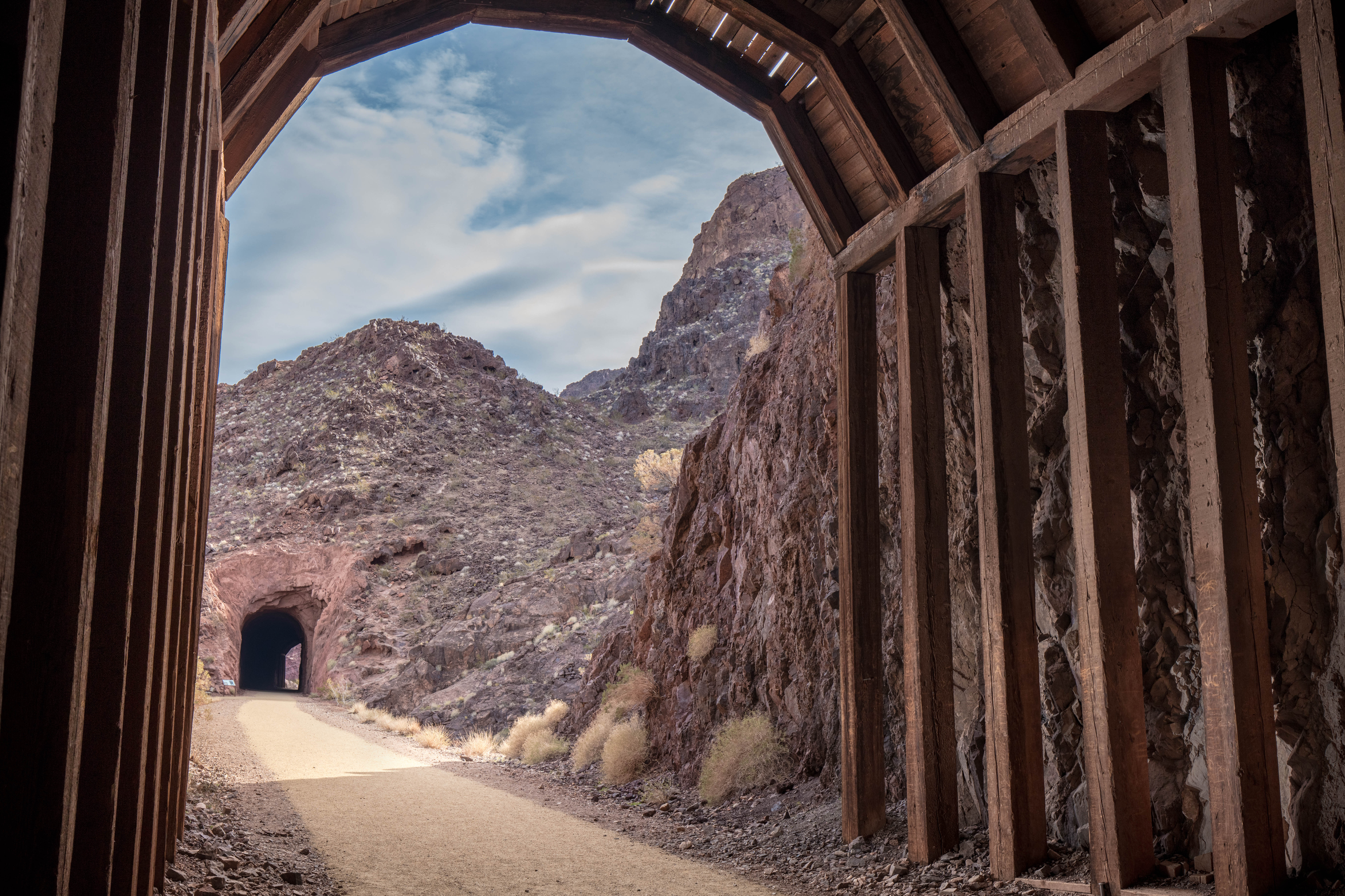
In 1931, the federal government partnered with Six Companies, Inc., a group of six major western construction firms, to build nearly 30 miles of railroad connecting the Hoover Dam and Boulder City. The route was essential in the dam's construction as it allowed workers to move materials and resources from nearby cement mixing and gravel sorting plants and the quarry pits to build the dam.
The railroad tracks were dismantled in 1962. The current multi-use trail was established in 1992 and connection to the Hoover Dam in 2007. Today the trail, perfect for hikers and bikers, features incredible vistas of Lake Mead and Boulder Basin and five tunnels – each approximately 25 feet wide.
The trail is made of level hardpacked fine gravel. Due to high temperatures (100-115 degrees Fahrenheit/38-46 degrees Celsius) in summer and no shade for the first 1.5 miles, this trail is not recommended in summer.
Trail Information
Trailhead: DIRECTIONS
Parking: Parking lot located below the Lake Mead Visitor Center on Lakeshore Rd.
Distance: 3.7-mile one way / 7.5 miles round trip
Elevation Gain: 11 ft. elevation change
Difficulty: Easy
THIS TRAIL IS MAINTAINED
Services: Accessible pit toilets at the trailhead, self-service bike repair station, trash/litter receptacles.
Accessibility There is no shade for the first 1.5 miles. The surface is level and made of hardpacked fine gravel that is easy for bikes and wheelchairs to navigate. There are shipping containers in two of the tunnels with short ramps at each end. They protect people from small rocks that infrequently fall from the ceiling.