
National Recreation Area · Arizona, Nevada
Trails in Lake Mead National Recreation Area
19 named trails · 121 miles · 15 trailheads · 11 with the Park Service's own write-up. The lines, trailheads and points are the Park Service's; the write-ups are the Service's own words; the climbing is read from USGS elevation along each line.
19 trails, A to Z.
Arizona Hot Spring-White Rock Canyon
Arizona Hot Spring, Liberty Bell Arch
Trailhead AZ Hot Springs and Liberty Bell Arch Trailhead 1,550 ft Drive there
Black Canyon National Water Trail
Bluffs
Trailhead Las Vegas Bluffs Trailhead 1,298 ft Drive there
Hike the Bluffs Trail the Park Service's write-up
1-4 Hours · dogs allowed · entrance fee applies
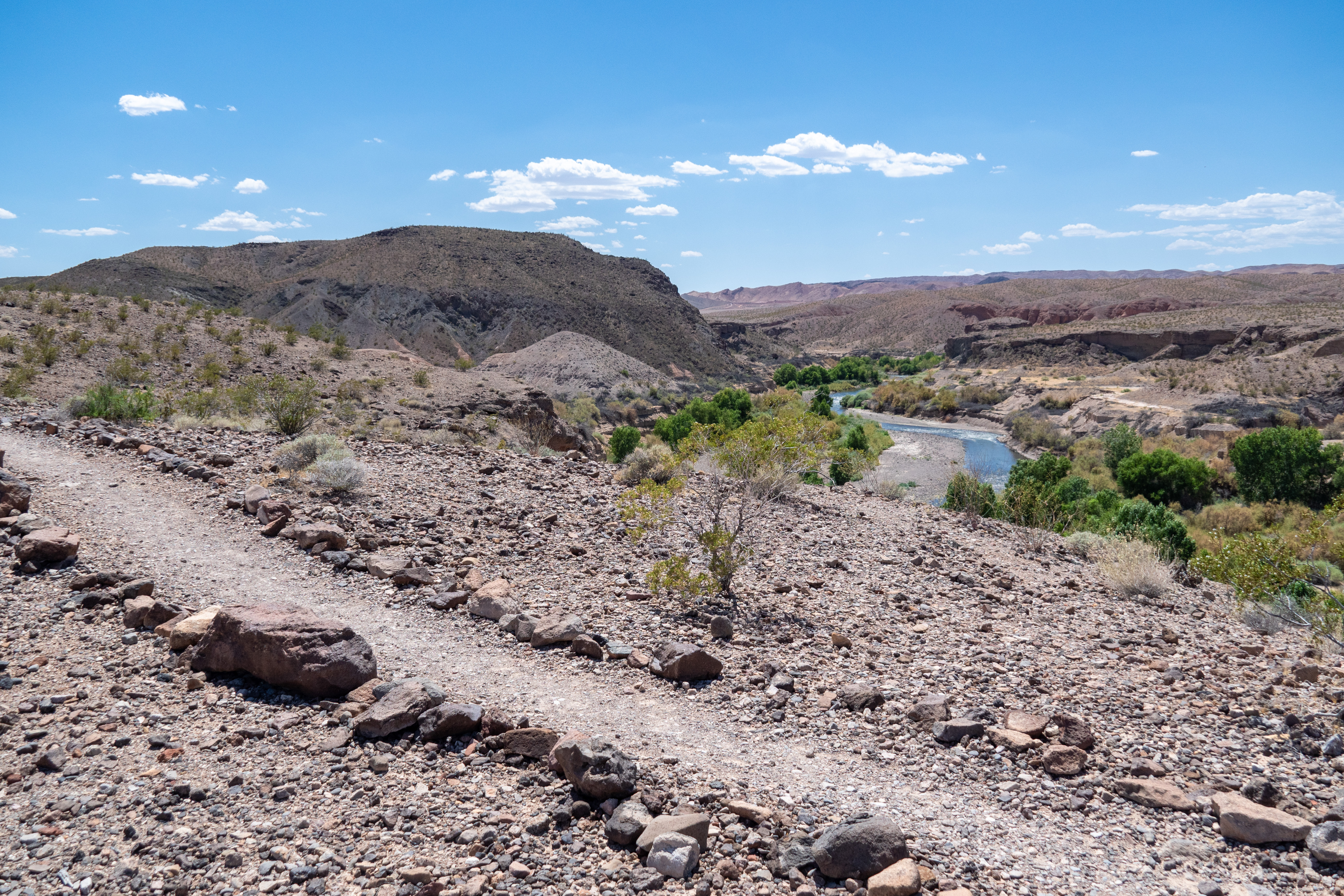
A bird-watcher's dream, the Bluffs trail sets out from camp site #72 in the Las Vegas Bay Campground. The route is rated as moderate, is about 3.9 miles round-trip, and overlooks the Las Vegas Bay and Las Vegas Wash, where one can see a stark contrast in vegetation between wet and dry areas. Additionally, the summit provides outstanding views of Lava Butte to the northwest and the Muddy Mountain range to the east.
The Bluffs trail is geologically intriguing due to the presence of granite, mica, and forces of erosion. The outdoor amphitheater at the beginning of the trail is a great spot to watch a striking desert sunset.
Remember heat kills, be summer-smart and opt to hike when temperatures are cooler.
Trail Information
Trailhead: DIRECTIONS
Parking: Parking is available at the restroom at Las Vegas Bay Campground.
Distance: 3.9 miles round trip
Elevation Gain: 145 ft. change
Difficulty: Moderate
THIS TRAIL IS NOT MAINTAINED.
Services: Accessible restrooms available at Las Vegas Bay Campground, trash/litter receptacles.
Accessibility Beginning near campsite #72, this trail is 3.9 miles (6.2 km) on a natural earth surface with uneven rock and gravel. There is about 145 feet of elevation change throughout the trail and some steeper sections to traverse through a wash.
Callville Summit
Picnic areas
Along the way Callville Bay Picnic Area
Trailheads Callville Summit Trailhead 1,259 ft Drive there · Callville Summit Trailhead 1,248 ft Drive there
Hike the Callville Summit Trail the Park Service's write-up
1-4 Hours · dogs allowed · entrance fee applies
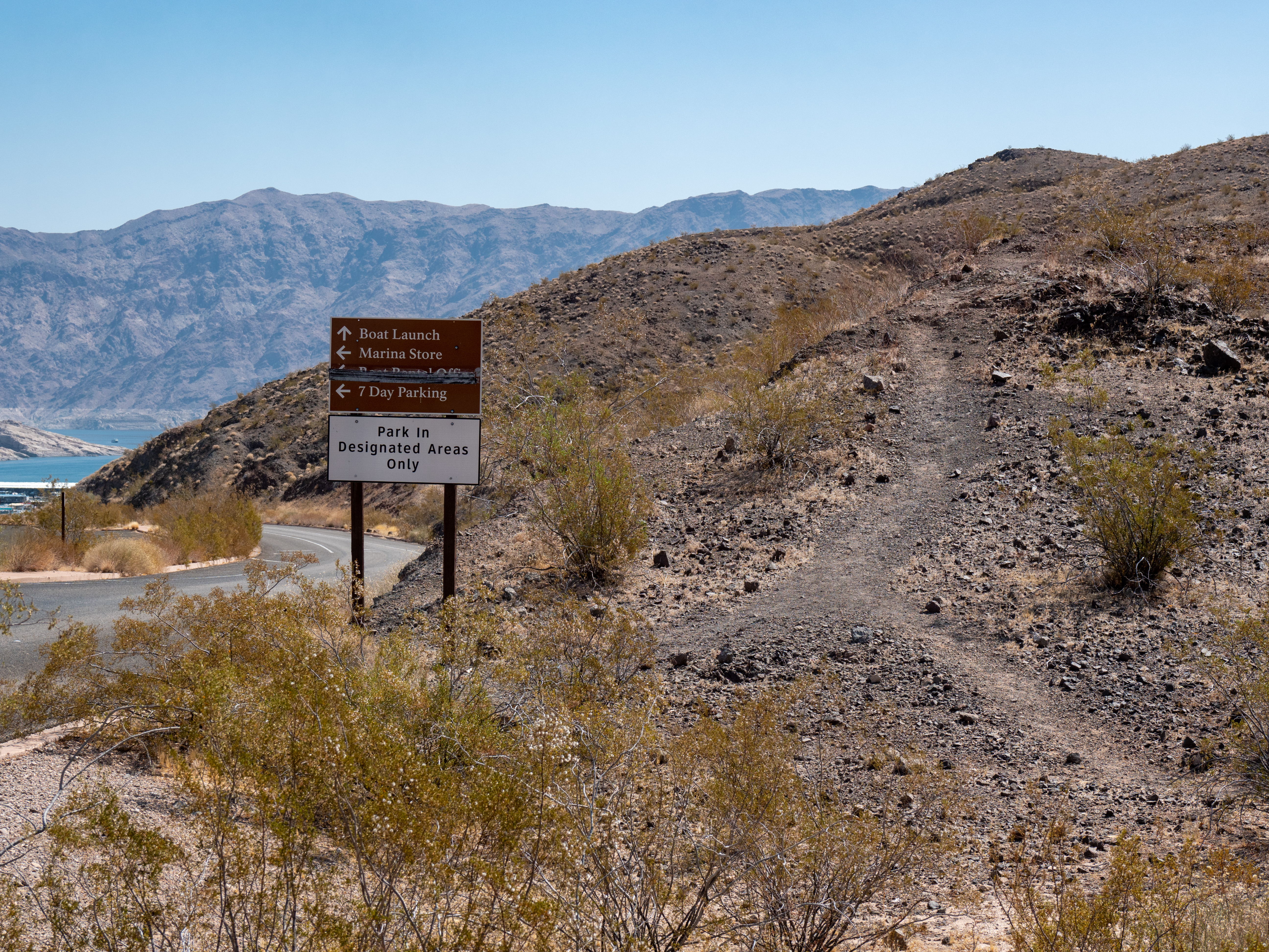
The trailhead leaves from the dump station parking lot across from the Callville Bay campground. There is also a more direct route to the expansive view using a strenuous and steeper trail that leaves from trash collection area of the campground. From the summit, take in views looking over Callville Bay and Lake Mead. Other social trails lead down to the water and can be seen leading to even further hikes and enjoyment.
Remember heat kills, be summer-smart and opt to hike when temperatures are cooler.
Trail Information
Trailhead: DIRECTIONS
Parking: Parking is at trailhead leaves from the dump station parking lot across from the Callville Bay campground.
Distance: 2 .9 miles roundtrip
Elevation Gain: 349 ft. elevation change
Difficulty: Moderate
THIS TRAIL IS NOT MAINTAINED
Services: Accessible pit toilets nearby, trash/litter receptacles.
Accessibility This trail is made up of uneven rocks and gravel as it climbs up to the summit. There is about 150 feet of elevation change throughout the trail up to a high viewpoint overlooking the Boulder Basin of Lake Mead. A hiking pole is recommended.
Goldstrike Canyon
Trailhead Goldstrike Canyon Trailhead 1,662 ft Drive there
Hike the Goldstrike Canyon Trail the Park Service's write-up
4-8 Hours · dogs allowed · entrance fee applies · Winter, Spring, Fall
To help keep visitors and first responder staff safe from dangerously high temperatures during the hottest time of year, Lake Mead National Recreation Area institutes an annual seasonal closure of certain strenuous trails from May 15 to September 30.
Temporary closures will take place outside of these dates when temperatures are forecasted to reach 95 Fahrenheit or higher at Willow Beach (AZ), or if flash floods are possible.
The hot springs remain open and accessible by water on Lake Mohave.
-----
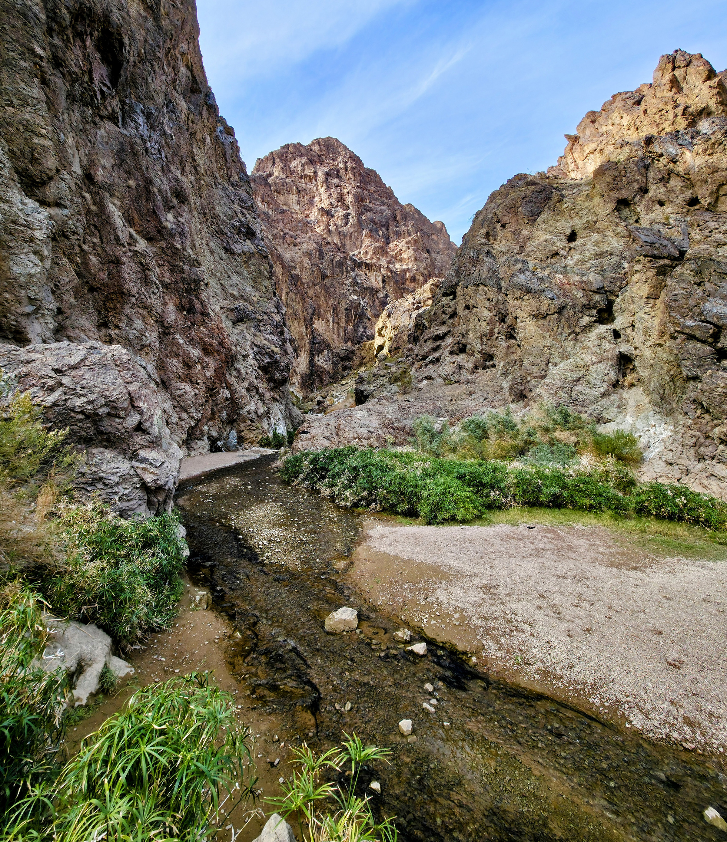
The Gold Strike Canyon trail is a challenging hike that takes you through a beautiful canyon to natural hot springs with stunning views of the Colorado River and Hoover Dam. The trail has around 1,000 feet of elevation change and includes seven dry falls of varying heights, making it a Class 2 canyoneering route. To get through, you'll need to scramble using both hands and feet to navigate the steep sections. Because of how technical this route is, this is not a trail to take a pet on.
Scroll to the bottom of this page for images of one of the pouroffs and some of the ropes you may see that were left by others that should not be trusted as safe.
Trail Information
Parking: Free parking off Goldstrike road. Near Boulder City, shortly before the Mike O’Callaghan-Pat Tillman Memorial Bridge.
Distance: 5.3 miles/8.5km round trip
Elevation Change: 1,200 ft/366m
Difficulty: Very Strenuous, Grade 2 Canyoneering Route
THIS ROUTE IS NOT MAINTAINED, INCLUDING THE ROPES. Ropes are not provided by the park. These were installed by hikers and left behind. Use at your own risk.
Services: Only toilets at the parking lot. Please bring Wag-bags to carry out all of your human waste and dispose of it properly.
Good to Know:
Always lock your car and take valuables with you.
Do not leave pets in cars while you are away! This route is not recommended for pets.
Because of flash flood dangers, do not hike in wash or canyon areas if thunderstorms are threatening.
It is illegal to remove plants, wildlife, geologic features (rocks), and archeological artifacts as they are protected under federal law.
Warning!
The water is not tested and may contain high levels of fecal matter. Do Not Drink! Carry plenty of water for each person to complete the roundtrip hike (at least 2 + liters per person).
The hike starts from the parking lot, following a dirt road past a gate before entering the canyon, which alternates between narrow and wide sections as different washes come together. The dry falls require strength, balance, and coordination to climb down—and then back up. You might see ropes at some of the more difficult spots, but these are not maintained by the National Park Service and should not be relied upon. Before sliding down a dry fall, ask yourself: Can I climb back up without a rope? Every year, hikers underestimate the difficulty of this trail, leading to injuries and death.
Thousands of people visit this trail each year. Please do your part to keep it beautiful by following Leave No Trace principles, including packing out all trash and human waste. There are toilets at the trailhead, but none at the hot springs. If nature calls while you’re hiking, bring a wag bag to pack out waste—just like you would for your dog.
Health Warning:
The hot springs flow naturally, and altering their flow by blocking water with sandbags or other objects can increase health risks. Past testing has found high levels of bacteria, including fecal coliform, E. coli, and enterococci, when the water is pooled. Additionally, the springs can contain amoebas, such as Naegleria , which in rare cases can cause serious illness if they enter the body. The park does not regularly test the water, and the springs are not designated swim areas, so visitors should use their own judgment before soaking. Never drink the water . Failure to follow these recommendations has resulted in significant health impacts or death.
Stay safe, be prepared, and enjoy this unique adventure responsibly!
Disclaimer: The ropes along the route are not managed, maintained, or inspected by the National Park Service. Visitors who choose to rappel do so at their own risk. The National Park Service assumes no responsibility for injuries, accidents, or damages resulting from these activities. Please use caution and sound judgment.
Accessibility This trail is an unmaintained route through a normally dry desert wash. The wash is made of soft sand, gravel, rocks, and boulders its entire length and wading through water and over slippery rocks. There are steep grades, rope descents, and rock ledges that must be climbed down.
Historic Railroad Trail
Tunnels
Along the way HRR Tunnel 1 HRR Tunnel 2 HRR Tunnel 3 HRR Tunnel 4 HRR Tunnel 5
Trailheads Historic Railroad and River Mountain Loop Trailhead 1,567 ft Drive there · HRRT Trailhead (Hoover Dam side) 1,418 ft Drive there
Hike the Historic Railroad Trail the Park Service's write-up
1-4 Hours · dogs allowed · entrance fee applies · Winter, Spring, Fall
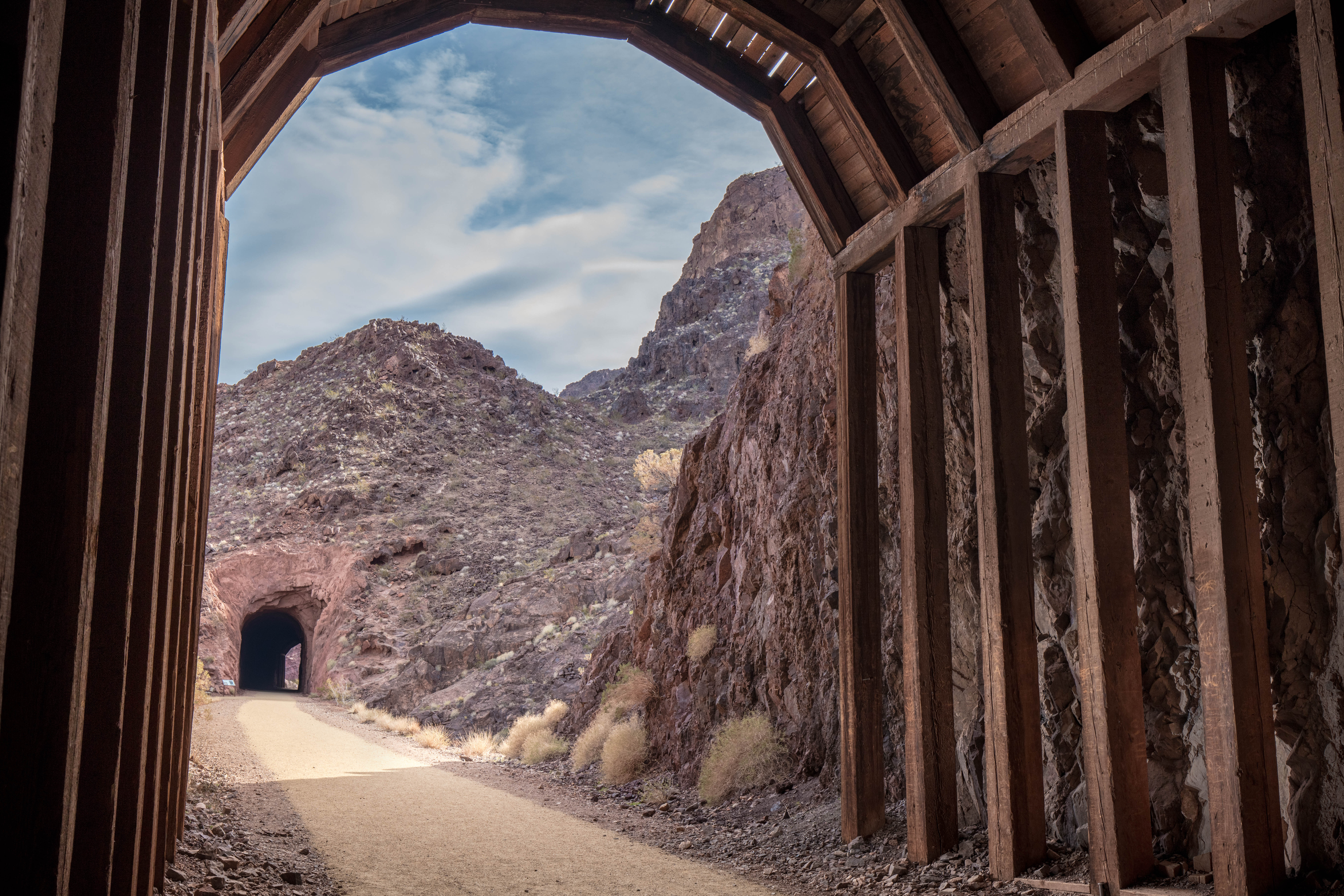
In 1931, the federal government partnered with Six Companies, Inc., a group of six major western construction firms, to build nearly 30 miles of railroad connecting the Hoover Dam and Boulder City. The route was essential in the dam's construction as it allowed workers to move materials and resources from nearby cement mixing and gravel sorting plants and the quarry pits to build the dam.
The railroad tracks were dismantled in 1962. The current multi-use trail was established in 1992 and connection to the Hoover Dam in 2007. Today the trail, perfect for hikers and bikers, features incredible vistas of Lake Mead and Boulder Basin and five tunnels – each approximately 25 feet wide.
The trail is made of level hardpacked fine gravel. Due to high temperatures (100-115 degrees Fahrenheit/38-46 degrees Celsius) in summer and no shade for the first 1.5 miles, this trail is not recommended in summer.
Trail Information
Trailhead: DIRECTIONS
Parking: Parking lot located below the Lake Mead Visitor Center on Lakeshore Rd.
Distance: 3.7-mile one way / 7.5 miles round trip
Elevation Gain: 11 ft. elevation change
Difficulty: Easy
THIS TRAIL IS MAINTAINED
Services: Accessible pit toilets at the trailhead, self-service bike repair station, trash/litter receptacles.
Accessibility There is no shade for the first 1.5 miles. The surface is level and made of hardpacked fine gravel that is easy for bikes and wheelchairs to navigate. There are shipping containers in two of the tunnels with short ramps at each end. They protect people from small rocks that infrequently fall from the ceiling.
Historic Railroad Trail Alternate Route
Lake View
Picnic areas
Along the way Katherine Landing Picnic Area
Trailhead Lake View Trailhead 658 ft Drive there
Hike the Lake View Trail the Park Service's write-up
1-4 Hours · dogs allowed · entrance fee applies · Winter, Spring, Fall
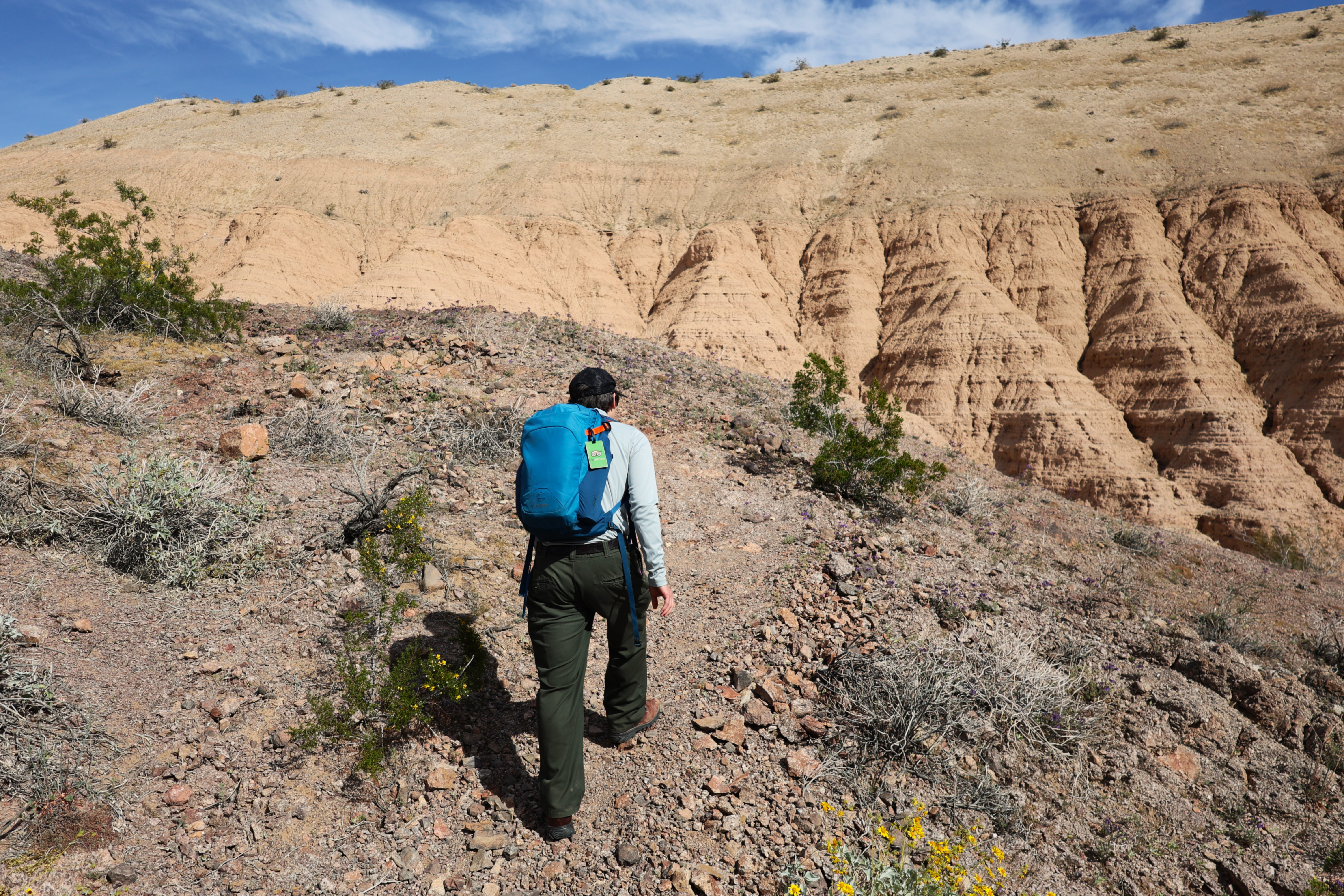
This sandy hike meanders through the Mohave Desert terrain with opportunities to view the mountainous landscapes that surround lovely Lake Mohave. The trailhead is located at the Katherine Landing location of Lake Mead National Recreation Area on the West end of parking lot B next to is a moderate 4.7 roundtrip hike. When you reach South Telephone Cove beach, you have come to the end.
This trail is excellent for exploration of the desert flora and fauna including creosote, brittle bush, roadrunners, Gamble's quail and if you are lucky, you may have the unique experience of seeing a desert tortoise.
Remember heat kills, be summer-smart and opt to hike when temperatures are cooler.
Trail Information
Trailhead: DIRECTIONS
Parking: This trail's parking area is next to the Katherine Landing day-use picnic area.
Distance: 4.7 miles roundtrip
Elevation Gain: 115 ft. elevation change
Difficulty: Moderate
THIS TRAIL IS NOT MAINTAINED
Services: Accessible pit toilets at the trailhead; trash/litter receptacles. Potable water spigots are available at picnic area by the trailhead.
Accessibility This trail is an unmaintained route. It is 4.7 miles (7.6 km) roundtrip on some uneven rocks, gravel, and loose sand. There is about 115 feet of elevation change with steep inclines/declines throughout the trail.
Las Vegas Wetlands
Trailhead Las Vegas Wetlands Trailhead 1,345 ft Drive there
Liberty Bell Arch
ViewsArches
Along the way Liberty Bell Arch Liberty Bell Arch Trail Overlook
Hike the Liberty Bell Arch Trail the Park Service's write-up
4-8 Hours · dogs allowed · entrance fee applies · Winter, Spring, Fall
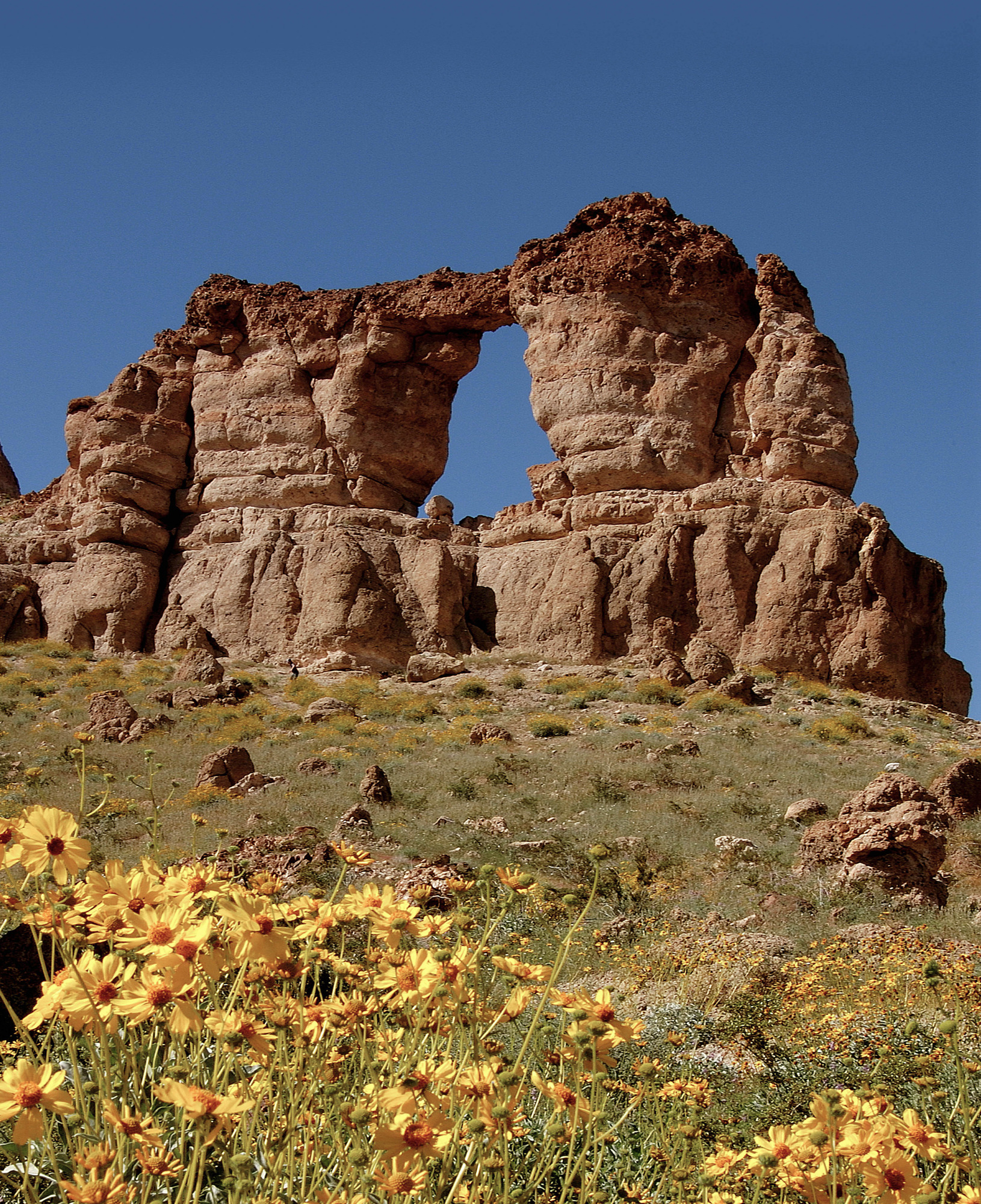
To help keep visitors and first responder staff safe from dangerously high temperatures during the hottest time of year, Lake Mead National Recreation Area institutes an annual seasonal closure of certain strenuous trails from May 15 to September 30.
Temporary closures will take place outside of these dates when temperatures are forecasted to reach 95 Fahrenheit or higher at Willow Beach (AZ), or if flash floods are possible.
-------
The Liberty Bell Arch trail starts from the White Rock Canyon parking area and heads west under the highway bridge towards the Colorado River. While there is no river access on this trail, hikers are rewarded throughout their adventure with geological highlights, remnants of a historic magnesium mine going back to the days of WWII, and a fantastic panoramic view overlooking the Colorado River from 1000 ft. up.
Trail Information
Trailhead: DIRECTIONS
Parking: Shared trailhead. Parking located just off U.S. Highway 93 before mile post 4, south of Hoover Dam.
Distance: 5.5 miles roundtrip
Elevation Gain: 750 ft. elevation change
Difficulty: Strenuous
THIS TRAIL IS NOT MAINTAINED
Services: Scenic view/photo spot, trash/litter receptacles.
Accessibility This trail is an unmaintained route through a normally dry desert wash. The wash is made of soft sand, gravel, rocks, and boulders its entire length. There are steep grades as well as rock ledges a few feet high that must be climbed over.
Mohave National Water Trail
Northshore Summit
Trailhead Northshore Summit Trailhead 2,370 ft Drive there
Hike the Northshore Summit Trail the Park Service's write-up
1-4 Hours · dogs allowed · entrance fee applies
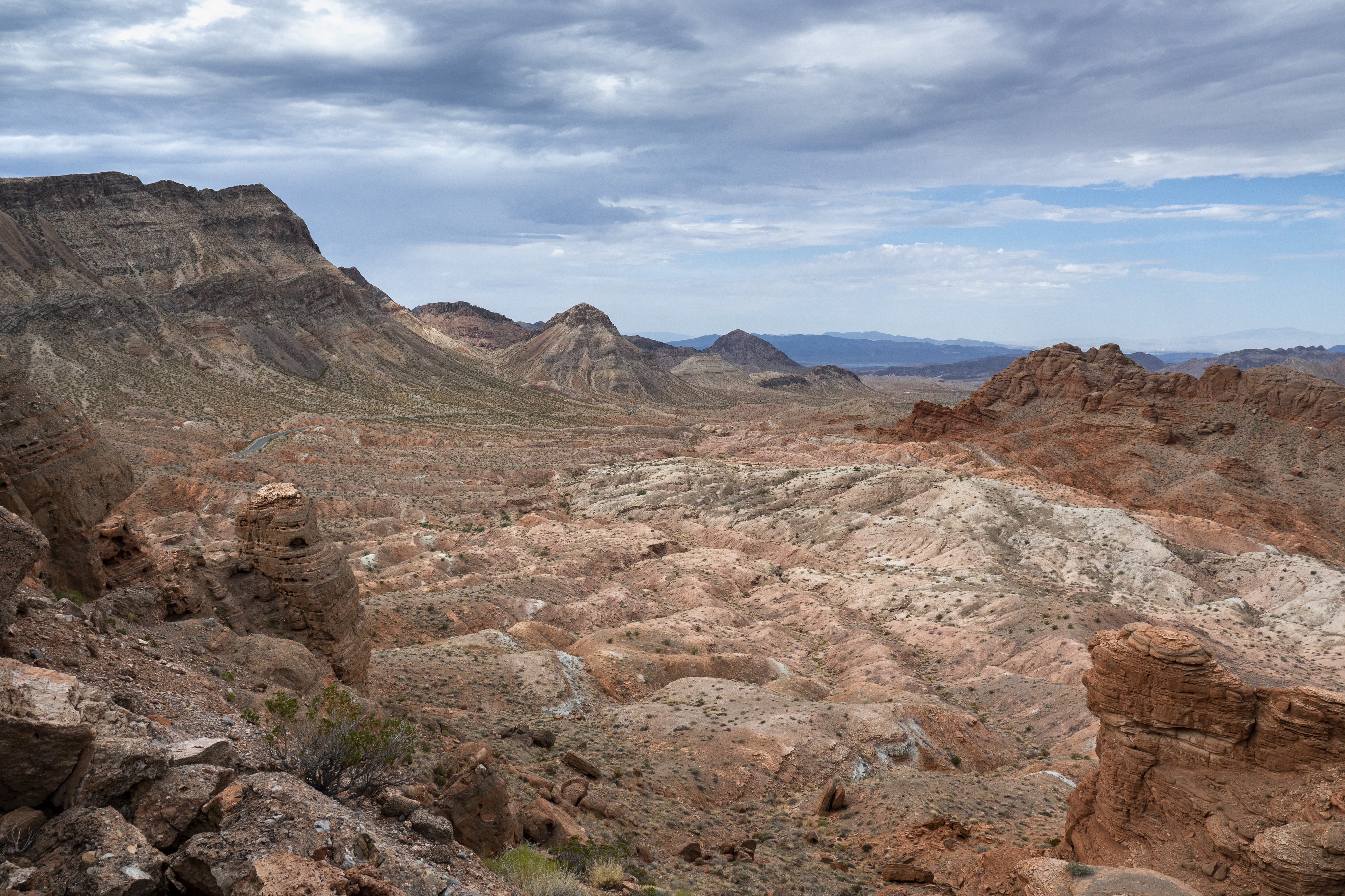
A perfect place to take in the desert in all its vastness and striking colors. After a short but steep climb, visitors are rewarded with views of the Muddy Mountains, Bowl of Fire, and the Bitter Spring Valley.
Trail Information
Trailhead: DIRECTIONS
Parking: Parking area past mile post 20 on Northshore Rd.
Distance: 1-mile round trip
Elevation Gain: 200 ft. elevation change
Difficulty: Moderate
THIS TRAIL IS NOT MAINTAINED
Services: Accessible pit toilets at the trailhead; trash/litter receptacles.
Accessibility This trail is an unmaintained route. It is 1.0 miles (1.6 km) on a natural earth surface with some uneven rocks and gravel. With about 200 feet of elevation change, this trail climbs up to a hilltop to a panoramic view of the surrounding area.
Owl Canyon
Picnic areas
Along the way Three Island Overlook Picnic Area
Trailhead White Owl Canyon Trailhead 1,244 ft Drive there
Hike the Owl Canyon Trail the Park Service's write-up
1-4 Hours · dogs allowed · entrance fee applies
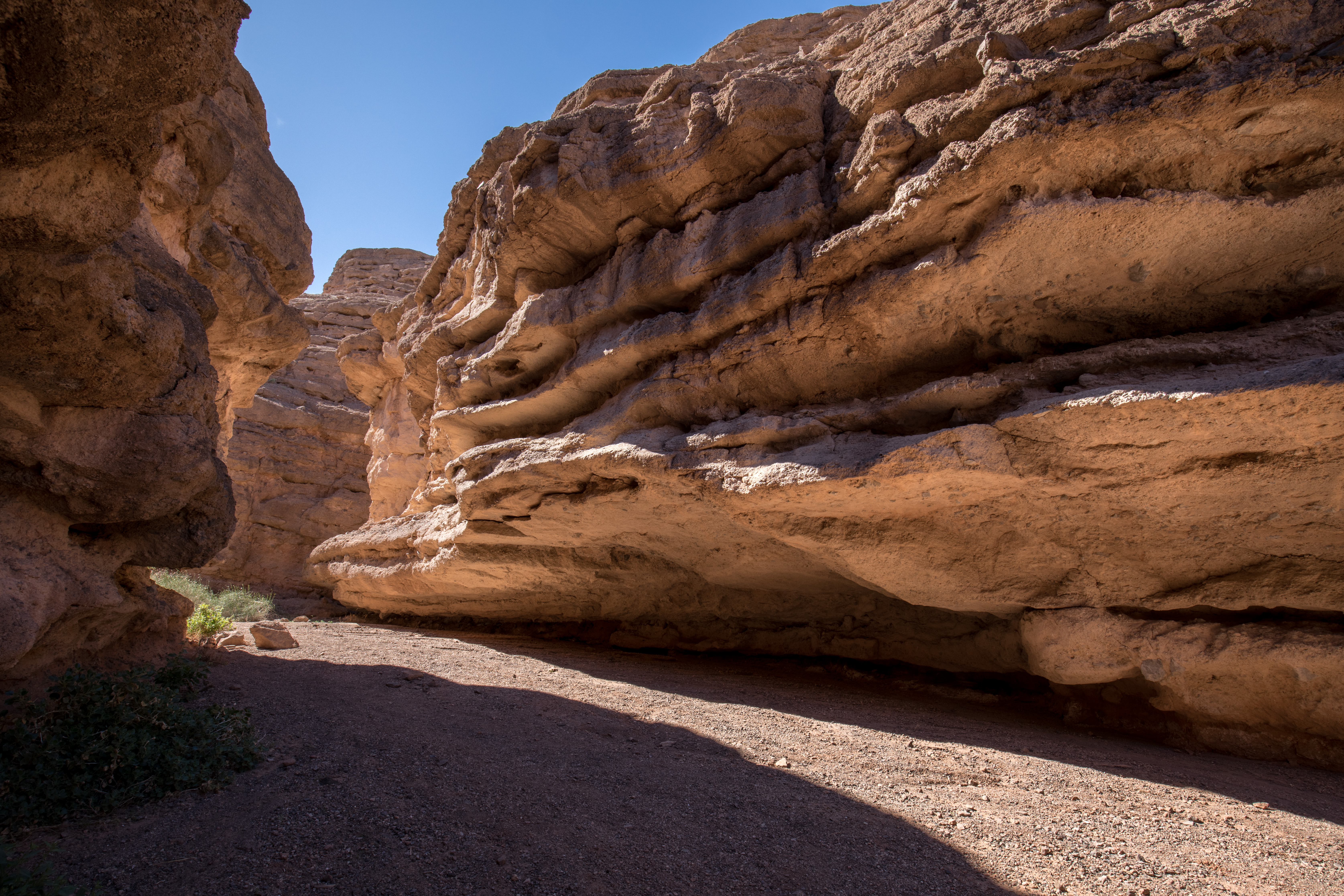
Once entirely submerged beneath Lake Mead, Owl Canyon was exposed as water levels dropped. From the trailhead down into the wash the trail is steep and made up of loose rocks and dirt that can cause hikers to slide or slip and fall. As you follow the wash, the trail narrows and deepens into a slot canyon with 100-foot vertical walls in the most confined section. You will be walking on sand and loose rocks in the canyon. The hues and colors of sculptural rock walls change through the day with the play of light and shadows, making this spot a favorite for photographers. Owls have also been seen in the area, making it an excellent destination for birdwatchers.
Trail Information
Trailhead: DIRECTIONS
Parking: Parking lot located off the first road on the left at 33 Hole Canyon Road.
Distance: 2.2 miles roundtrip
Elevation Gain: 300 ft. elevation change
Difficulty: Moderate
THIS TRAIL IS NOT MAINTAINED.
AVOID DURING MONSOON RAINSTORMS DUE TO FLASH FLOOD RISK.
Services: Picnic Shelter, accessible pit toilets at the trailhead, trash/litter receptacles, scenic view/photo spot
Accessibility The first 50 yards of the trail is very steep and made of unstable rocks and sand. It presents a risk of slipping and falling for any hiker. A hiking pole is recommended. The rest of the trail into Owl Canyon is made up of loose uneven rocks and sand.
Redstone
Picnic areas
Along the way Redstone Picnic Area
Trailhead Redstone Trailhead 2,252 ft Drive there
Hike the Redstone Trail the Park Service's write-up
1-4 Hours · dogs allowed · entrance fee applies
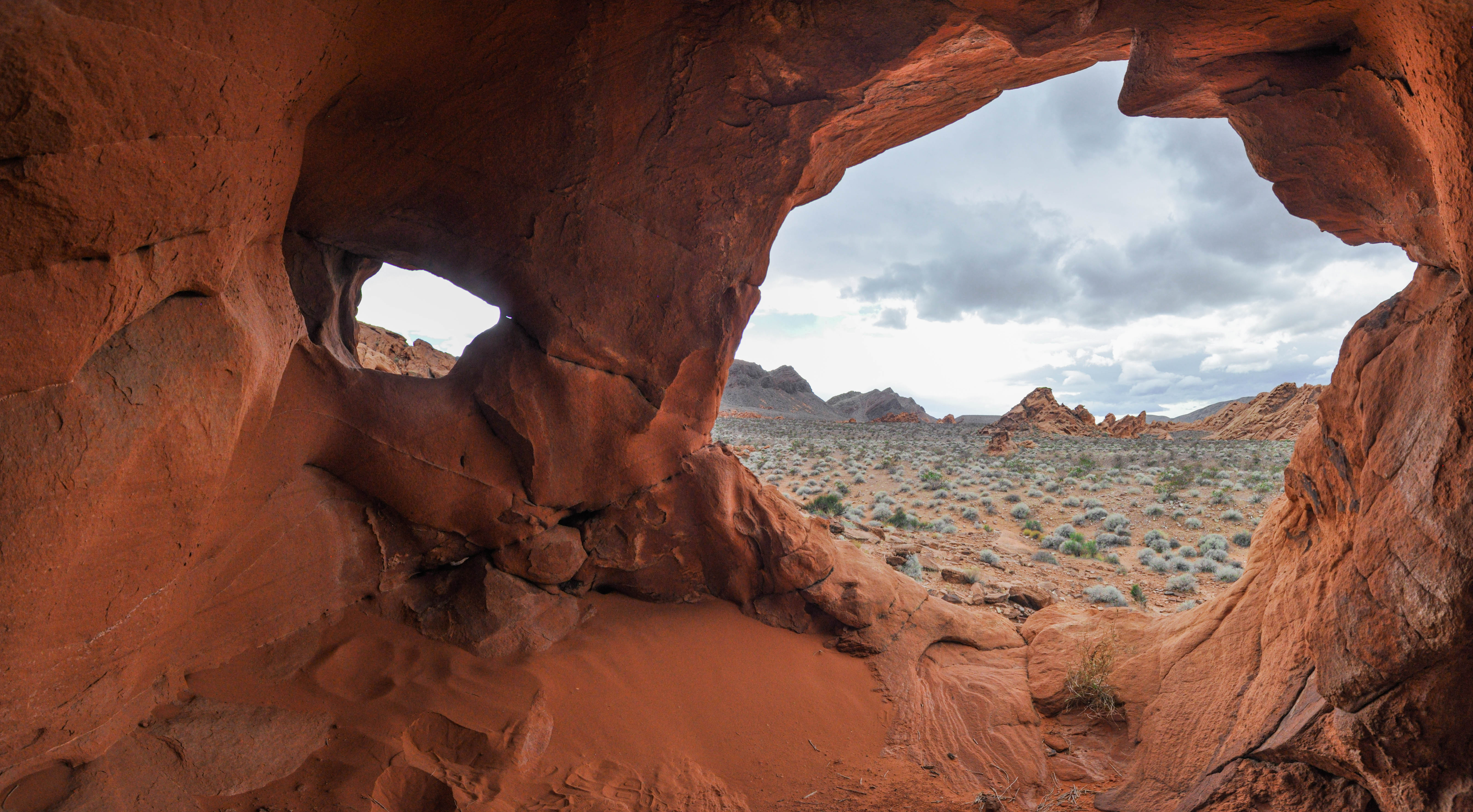
The fiery eroded formations on this trail were once part of a vast desert landscape. The dunes responsible for these formations existed one hundred forty million years ago. Over time, geological forces turned the loose dunes into hard sandstone.
Keep an eye out for wildlife as well, and of course, please respect the environment by staying on trail!
Trail Information
Trailhead: DIRECTIONS
Parking: Parking lot located at trailhead
Distance: 1.1-mile roundtrip
Elevation Gain: 80 ft. elevation change
Difficulty: Easy
THIS TRAIL IS NOT MAINTAINED
Services: Accessible pit toilets at the trailhead, covered picnic tables, trash/litter receptacles.
Accessibility The trailhead begins next to the paved sidewalk around the picnic tables and restrooms. This trail is an unmaintained route. The majority of the trail is on loose sand and gravel with about 80 feet of elevation change.
River Mountains Loop
Trailhead Historic Railroad and River Mountain Loop Trailhead 1,567 ft Drive there
Hike the River Mountains Loop Trail the Park Service's write-up
4-8 Hours · dogs allowed · entrance fee applies
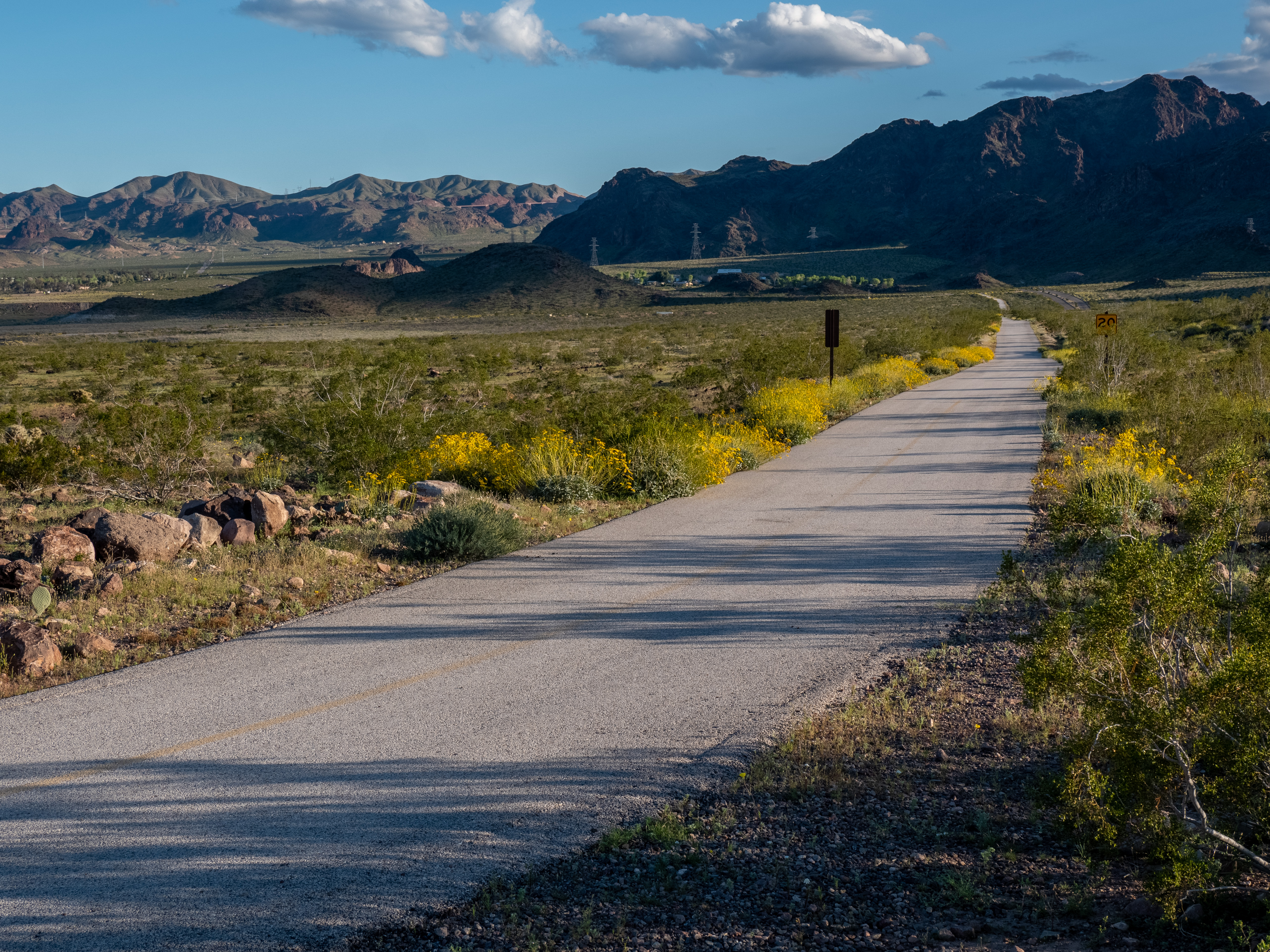
The River Mountains Loop Trail results from a multi-agency public-private partnership bringing together resources from government agencies, private landowners, and local businesses. This non-motorized, paved trail provides visitors with an extensive trail loop offering scenic views, plentiful wildlife, and the vast beauty only the Mojave Desert can offer.
The trail surrounds the River Mountains connecting Lake Mead National Recreation Area, Hoover Dam, Henderson, Boulder City, and the rest of the Las Vegas Valley.
Trail Information
Trailhead: DIRECTIONS
Parking: With multiple access points, there are several parking options along the length of the trail.
Distance: 16.2 miles one-way within Lake Mead National Recreation Area boundaries (The entire looped trail system, which includes portions that cut outside the Lake Mead NRA boundaries, is 34-miles).
Elevation Gain: 750 ft. elevation change
Difficulty: Easy
THIS TRAIL IS MAINTAINED
Services: Accessible pit toilets at the trailheads/along the trail, self-service bike repair stations, and trash/litter receptacles.
Accessibility This trail is 34 miles of a firm paved surface that is easy for bikes and wheelchairs to navigate. Several miles of the trail are level, but there is about 750 feet of elevation change throughout the trail.
River Mountains Loop Connector
Trailhead River Mountain Loop (Lake Mead Parkway) Trailhead 1,622 ft Drive there
St. Thomas
Trailhead St. Thomas Trailhead 1,233 ft Drive there
Hike the St. Thomas Trail the Park Service's write-up
1-4 Hours · dogs allowed · entrance fee applies
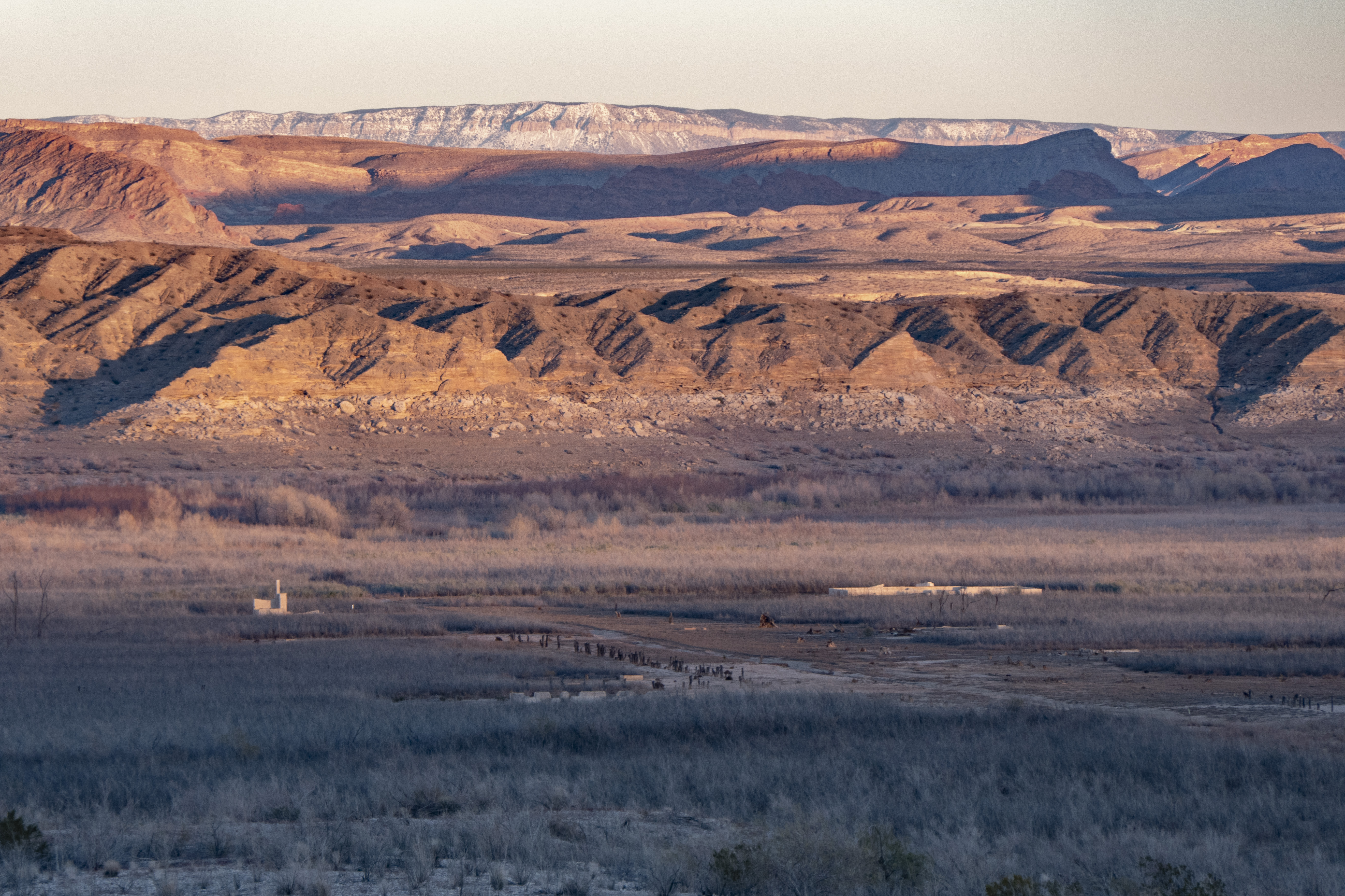
St. Thomas was settled by Mormon pioneers in the 1850-1860’s and later grew into a thriving town home to entrepreneurs who found ways to build prosperous lives in the challenging conditions of the desert. The town was abandoned in the 1930s to make way for the rising waters of Lake Mead. The remains of St. Thomas have since resurfaced and visitors can roam the ruins of the once bustling township.
Visitors can roam the ghost remains of an authentic Western town. The historic site comes alive through the interpretive signs that detail the trials and tribulations of the desert dwellers that once called this place home.
Artifacts of this town may be found in many forms, from small glass fragments to large building foundations. While it may seem like you're helping clean up the trail or moving fragile artifacts out of the way, it is against the law to disturb archeological sites. This includes moving and removing artifacts, climbing on structures, or defacing structures with graffiti or etchings.
Trail Information
Trailhead: DIRECTIONS
Parking: At end of Old St. Thomas Access Road, just past mile post 46 on Northshore Rd.
Distance: 2.5 miles round trip
Elevation Gain: 85 ft. elevation change
Difficulty: Moderate
THIS TRAIL IS NOT MAINTAINED
Services: No services available
Accessibility This trail begins on a slope downhill on loose rocks. The rest of the trail made up of uneven rocks and sand through the foundations of St. Thomas. A hiking pole is recommended.
More hikes the Park Service describes
Write-ups that name no single mapped trail, in the Service's words.
- Hike the Arizona Hot Springs Trail · 4-8 Hours · dogs allowed · Winter, Spring, Fall
Arizona Hot Spring trail is strenuous and can be combined to make a loop going down a 20-foot ladder to the White Rock Canyon trail. With a 750-foot elevation change and some steep scrambling, this hike is considered very strenuous. - Hike the Lone Palm Trail · 4-8 Hours · dogs allowed · Winter, Spring, Fall
This strenuous hike leads through a scenic canyon to natural hot springs and offers views of the Colorado River at the end of the trail. - Hike the Wetlands Trail · 1-4 Hours · dogs allowed
The Wetlands Trail follows a dry dirt trail down to the flowing Las Vegas Wash, where water from the Las Vegas Valley dispenses into Lake Mead and shapes the landscape through erosion. - Hike the White Rock Canyon Trail · 4-8 Hours · dogs allowed · Winter, Spring, Fall
Follow this meandering canyon down as it compresses and loosens until it finally opens to reveal the mighty Colorado River.
About these trails
The lines are the National Park Service's public trails layer, the trailheads and the waterfalls, views, peaks and historic places along them the Service's public points of interest, read 2026-10-14 and simplified for the map. The write-ups are the Service's own "things to do", unedited. Heights come from USGS 3DEP through Terrain Tiles on AWS (Mapzen/Tilezen), read along each line and rounded; a short trail on steep ground can be off by a few tens of feet. Closures change: check the park's own site before you go.