
Fairyland Loop Trail
Trailheads Fairyland Loop Trailhead 7,777 ft Drive there · Tower Bridge Trailhead 7,993 ft Drive there
Fairyland Loop the Park Service's write-up
4-5 Hours · no dogs
Start Fairyland Loop Trailhead
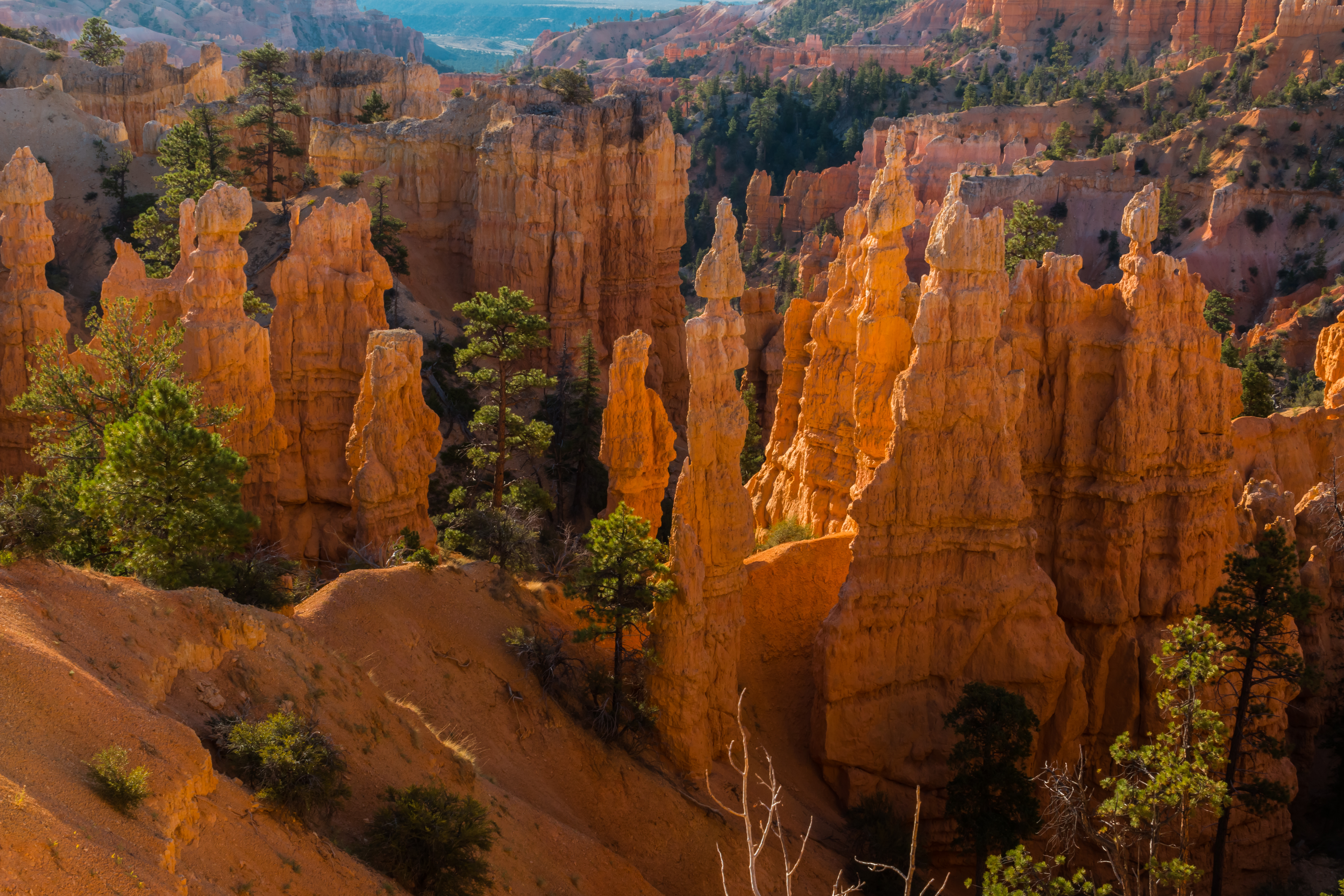
The Fairyland Loop is a quiet 8 mile hike that combines hiking along the plateau rim near Boat Mesa with a hike in the canyon with long views of the Bryce Amphitheater surrounded by unique hoodoos. You can start this hike at Fairyland Point or on the rim trail north of Sunrise Point at the Tower Bridge trailhead. We recommend hiking in a counter-clockwise direction. There is no shuttle pick-up at Fairyland Point, so you will need to hike to your starting point to complete the loop.
Trailhead: Fairyland Point or north of Sunrise Point at the Tower Bridge trailhead .
Parking: At Fairyland Point (oversized vehicles permitted) or at Sunrise Point (oversized vehicles are not permitted in this parking area when the shuttle is in operation. ) Check when parking lots are busiest .
Distance: 8.0 mile (12.9 km)
Approximate Time: 4-5 hours
Elevation Gain: 1900 feet (579 meters)
Difficulty: Strenuous (rapid elevation gain, longer length)
Services: Accessible restrooms available at the General Store near Sunrise Point (seasonally). Water-fill stations available at the General Store (seasonally). No services at Fairyland Point.
Shuttle Service: Yes at Sunrise Point, None at Fairyland Point. Private options may be available.
Pets are not allowed on this trail. Service animals are allowed in national parks. What is a service animal?
This trail may be inaccessible during mid-winter due to snow depths ranging from 2-15 ft. (.7-5 m)
Accessibility This is a backcountry trail with natural terrain and is not considered an accessible trail. Surface Type: Firm Native Sediment Total Ascent: 1900 feet (579 meters) Length: 7.8 mi (12.6 km) roundtrip Typical Grade: 9.0% Maximum Grade: 25.0% Typical Cross Slope: 5% Maximum Cross Slope: 39% Typical Width : 49 inches (124 cm) Minimum Width: 16 inches (41 cm) Service animals are allowed in national parks. What is a service animal?
Tower Bridge 3 mi round trip · the Park Service's write-up
2-3 Hours · no dogs
Start Tower Bridge Trailhead
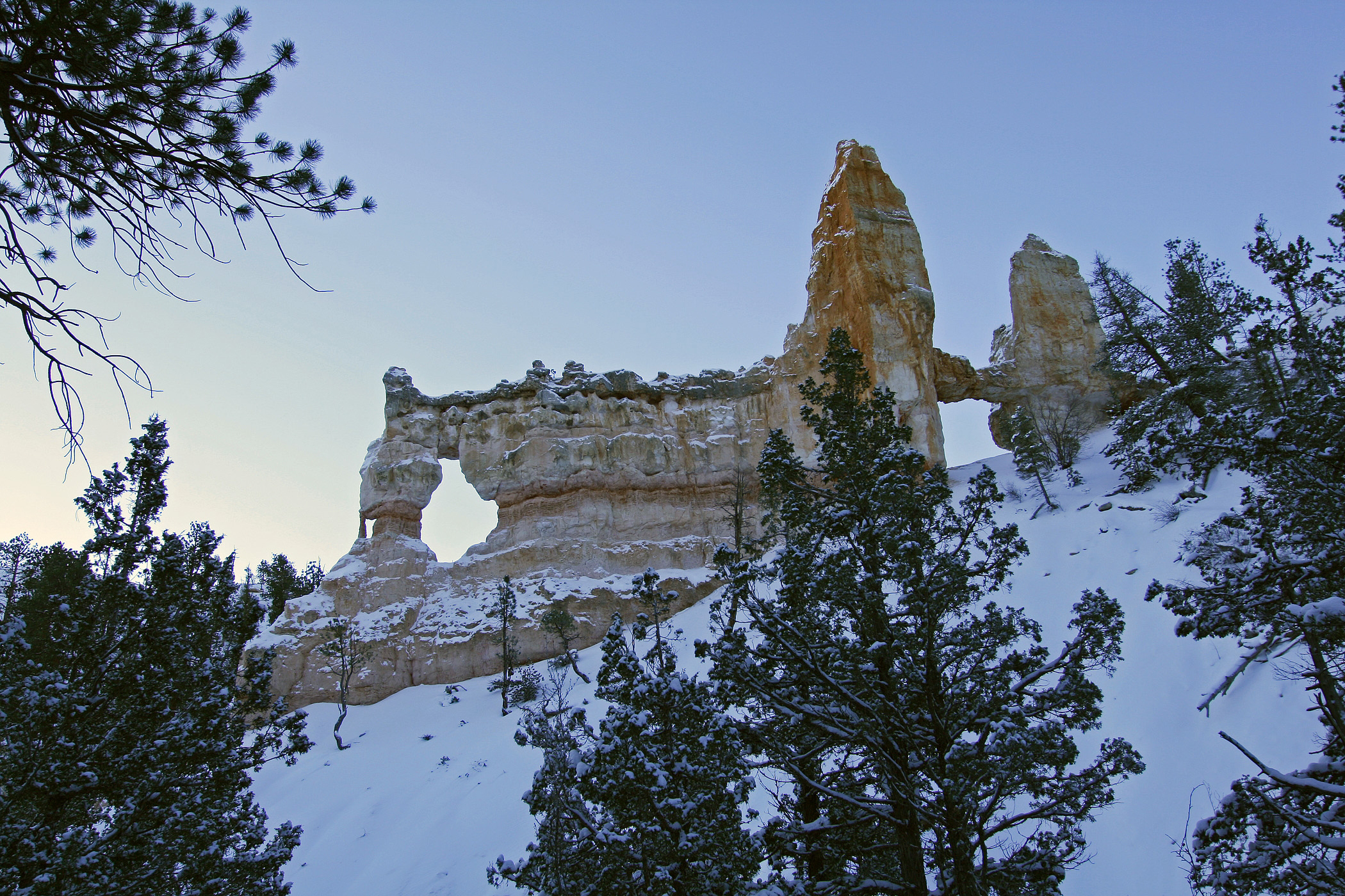
The Tower Bridge hike consists of the southern portion of the Fairyland Loop trail. This is an out-and-back trail that descends to a shady 1/4-mile spur trail leading to the Tower Bridge hoodoo. From there, hikers can return the way they came or continue to hike the entirety of the Fairyland Loop Trail.
Trailhead: North of Sunrise Point
Parking: Available at Sunrise Point (check when parking lots are busiest ). Oversized vehicles are not permitted in this parking area when the shuttle is in operation.
Distance: 3.0 miles (4.8 km) roundtrip
Approximate Time: 2-3 hours
Elevation Gain: 760 feet (232 meters)
Difficulty: Moderate (less than 1000 feet elevation gain, moderate length)
Services: Accessible restrooms and water-fill station available at the General Store near Sunrise Point (seasonally).
Shuttle Service: Yes.
Pets are not allowed on this trail. Service animals are allowed in national parks. What is a service animal?
Accessibility This is a backcountry trail with natural terrain and is not considered an accessible trail. Surface Type: Firm Native Sediment Total Ascent: 760 feet (232 meters) Length: 3.0 mi (4.8km) roundtrip Service animals are allowed in national parks. What is a service animal?