Agua Canyon Connecting Trail
Views
Along the way Ponderosa Canyon Overlook
Trailhead Agua Canyon Connecting Trail Trailhead 8,906 ft Drive there

National Park · Utah
32 named trails · 21 miles · 14 trailheads · 11 with the Park Service's own write-up. The lines, trailheads and points are the Park Service's; the write-ups are the Service's own words; the climbing is read from USGS elevation along each line.
32 trails, A to Z.
Views
Along the way Ponderosa Canyon Overlook
Trailhead Agua Canyon Connecting Trail Trailhead 8,906 ft Drive there
Views
Along the way Bryce Point
Trailhead Rim Trail Bryce Point Trailhead 8,311 ft Drive there
Trailheads Fairyland Loop Trailhead 7,777 ft Drive there · Tower Bridge Trailhead 7,993 ft Drive there
4-5 Hours · no dogs
Start Fairyland Loop Trailhead
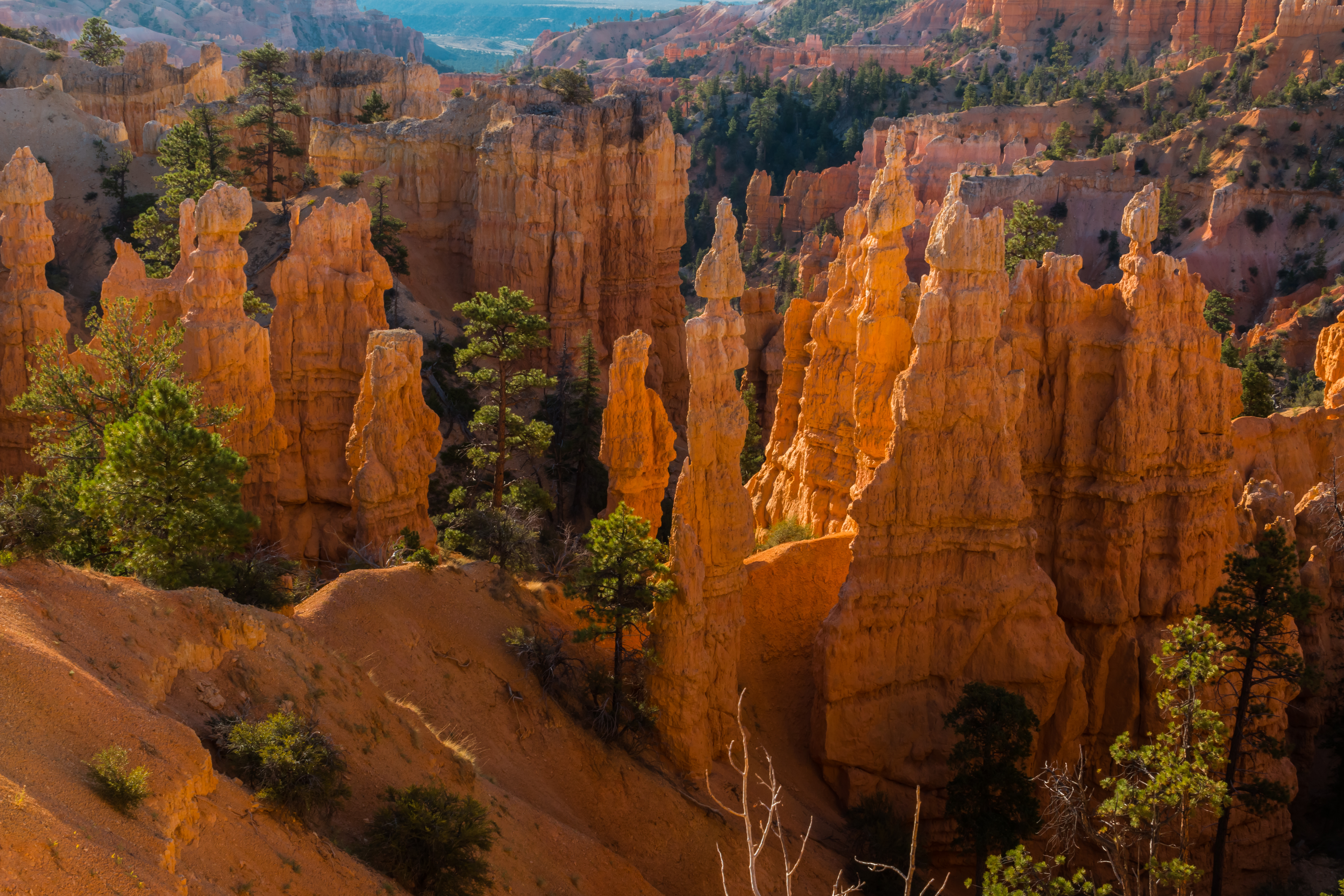
The Fairyland Loop is a quiet 8 mile hike that combines hiking along the plateau rim near Boat Mesa with a hike in the canyon with long views of the Bryce Amphitheater surrounded by unique hoodoos. You can start this hike at Fairyland Point or on the rim trail north of Sunrise Point at the Tower Bridge trailhead. We recommend hiking in a counter-clockwise direction. There is no shuttle pick-up at Fairyland Point, so you will need to hike to your starting point to complete the loop.
Trailhead: Fairyland Point or north of Sunrise Point at the Tower Bridge trailhead .
Parking: At Fairyland Point (oversized vehicles permitted) or at Sunrise Point (oversized vehicles are not permitted in this parking area when the shuttle is in operation. ) Check when parking lots are busiest .
Distance: 8.0 mile (12.9 km)
Approximate Time: 4-5 hours
Elevation Gain: 1900 feet (579 meters)
Difficulty: Strenuous (rapid elevation gain, longer length)
Services: Accessible restrooms available at the General Store near Sunrise Point (seasonally). Water-fill stations available at the General Store (seasonally). No services at Fairyland Point.
Shuttle Service: Yes at Sunrise Point, None at Fairyland Point. Private options may be available.
Pets are not allowed on this trail. Service animals are allowed in national parks. What is a service animal?
This trail may be inaccessible during mid-winter due to snow depths ranging from 2-15 ft. (.7-5 m)
Accessibility This is a backcountry trail with natural terrain and is not considered an accessible trail. Surface Type: Firm Native Sediment Total Ascent: 1900 feet (579 meters) Length: 7.8 mi (12.6 km) roundtrip Typical Grade: 9.0% Maximum Grade: 25.0% Typical Cross Slope: 5% Maximum Cross Slope: 39% Typical Width : 49 inches (124 cm) Minimum Width: 16 inches (41 cm) Service animals are allowed in national parks. What is a service animal?
2-3 Hours · no dogs
Start Tower Bridge Trailhead
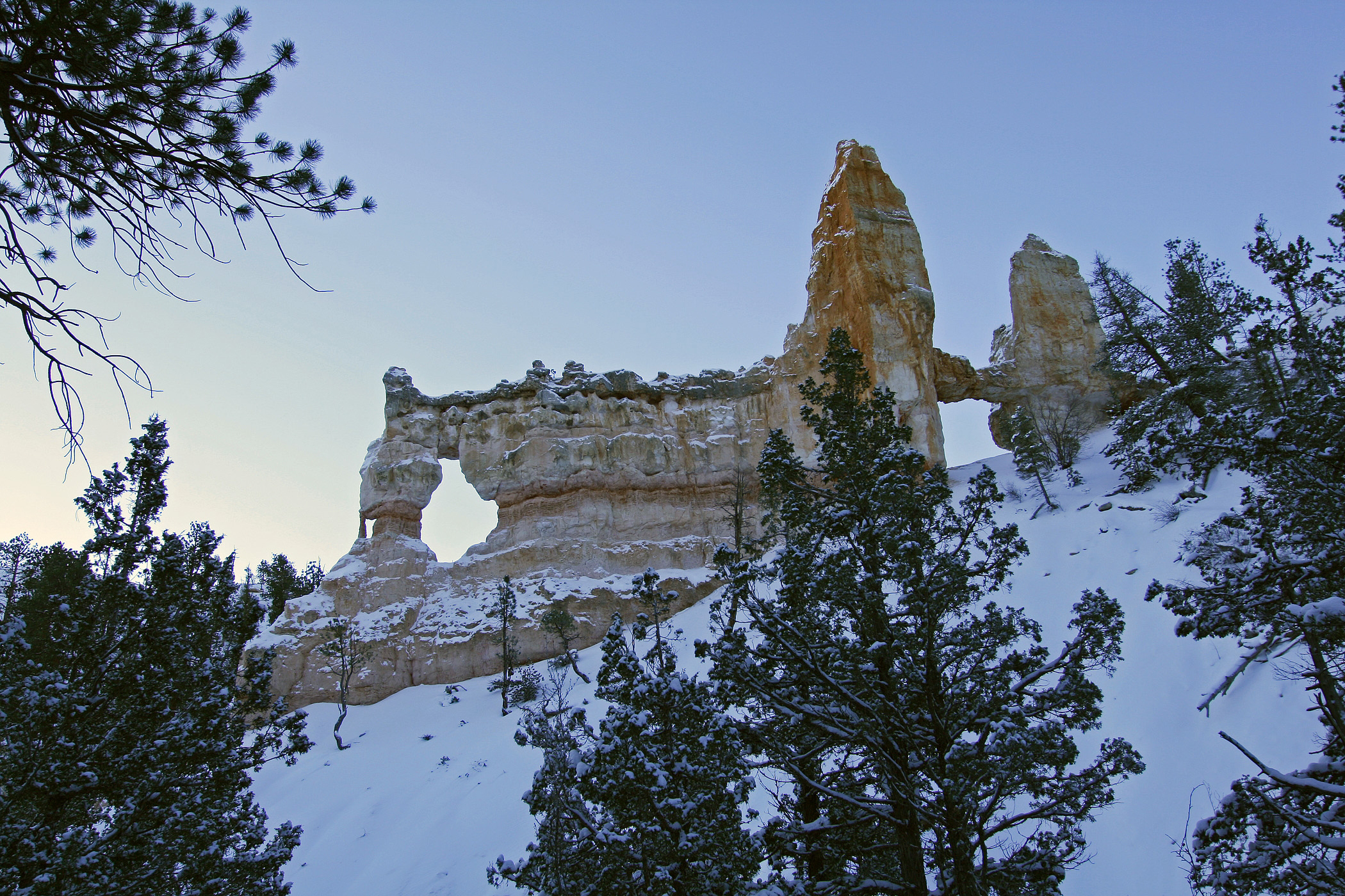
The Tower Bridge hike consists of the southern portion of the Fairyland Loop trail. This is an out-and-back trail that descends to a shady 1/4-mile spur trail leading to the Tower Bridge hoodoo. From there, hikers can return the way they came or continue to hike the entirety of the Fairyland Loop Trail.
Trailhead: North of Sunrise Point
Parking: Available at Sunrise Point (check when parking lots are busiest ). Oversized vehicles are not permitted in this parking area when the shuttle is in operation.
Distance: 3.0 miles (4.8 km) roundtrip
Approximate Time: 2-3 hours
Elevation Gain: 760 feet (232 meters)
Difficulty: Moderate (less than 1000 feet elevation gain, moderate length)
Services: Accessible restrooms and water-fill station available at the General Store near Sunrise Point (seasonally).
Shuttle Service: Yes.
Pets are not allowed on this trail. Service animals are allowed in national parks. What is a service animal?
Accessibility This is a backcountry trail with natural terrain and is not considered an accessible trail. Surface Type: Firm Native Sediment Total Ascent: 760 feet (232 meters) Length: 3.0 mi (4.8km) roundtrip Service animals are allowed in national parks. What is a service animal?
Views
Along the way Farview Point Overlook
2-3 Hours · no dogs
Start Queen's Garden Trailhead
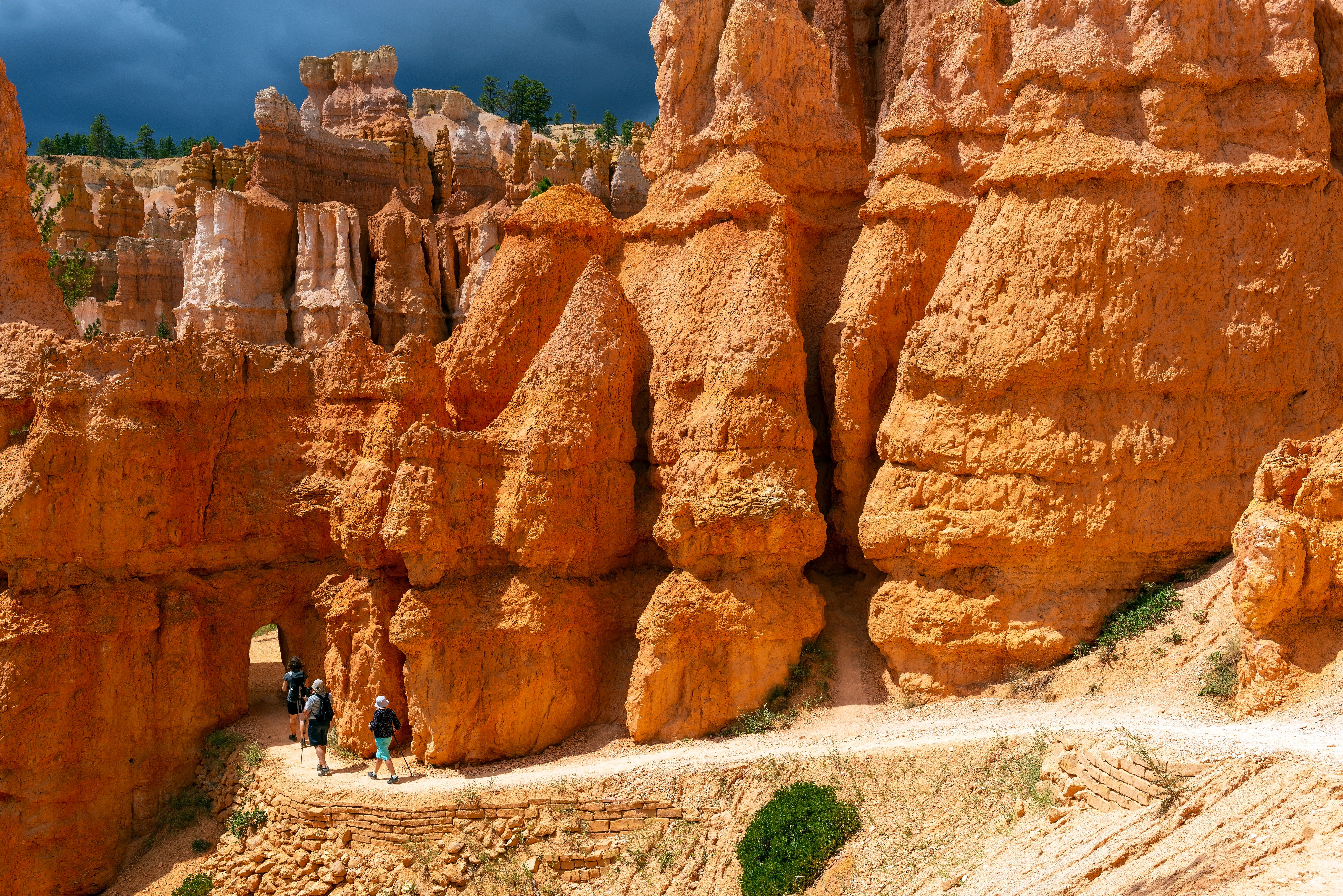
Our most popular hike in the park and the one we most recommend to first-time visitors. The Queen's/Navajo Combination Loop combines the open views and unique hoodoos of the Queen's Garden Trail with the iconic switchbacks and towering canyon walls of the Navajo Loop Trail. Descend Queen's Garden at Sunrise Point, ascend the Navajo Loop to Sunset Point, and then complete the loop back to Sunrise Point via the Rim Trail, enjoying views into the Bryce Canyon Amphitheater below.
Trailhead: Sunrise or Sunset Point
Parking: Available at both Sunrise and Sunset Points (check when parking lots are busiest ). Oversized vehicles are not permitted in these parking areas when the shuttle is in operation.
Distance: 2.9 miles (4.6 km)
Approximate Time: 2-3 hours
Elevation Gain: 625 feet (191 meters)
Difficulty: Moderate (less than 1000 feet elevation gain, moderate length)
Services: Accessible restrooms available at Sunset Point (year-round) and available at the General Store near Sunrise Point (seasonally). Water-fill stations available at Sunset Point (seasonally), the Sunset Point restroom (year-round), and the General Store (seasonally).
Shuttle Service: Yes.
Use the Two Bridges side of the Navajo Loop in winter when Wall Street is closed. We recommend hiking this loop in a clockwise direction.
Pets are not allowed on this trail . Service animals are allowed in national parks. What is a service animal?
Accessibility Due to the park's natural terrain, this is not considered an accessible trail. Surface Type: Firm Native Sediment Total Ascent: 625 feet (191 meters) Length: 2.9 mi (4.6 km) roundtrip Typical Grade: Queen's Garden - 11.0% / Navajo - 14.0% Maximum Grade: Queen's Garden - 25.0% / Navajo - 30.0% Typical Cross Slope: Queen's Garden - 5.0% / Navajo - 7.0% Maximum Cross Slope: Queen's Garden - 17.0% / Navajo - 24.0% Typical Width : Queen's Garden - 81 inches (206 cm) / Navajo - 77 inches (196 cm) Minimum Width: Queen's Garden - 33 inches (84 cm) / Navajo - 25 inches (64 cm) Service animals are allowed in national parks. What is a service animal?
Views
Along the way Inspiration Point
Views
Along the way Sunset Point
Trailhead Navajo Loop Trailhead / Trail End 7,986 ft Drive there
Trailhead Mossy Cave Trailhead 6,831 ft Drive there
30-60 Minutes · no dogs
Start Mossy Cave
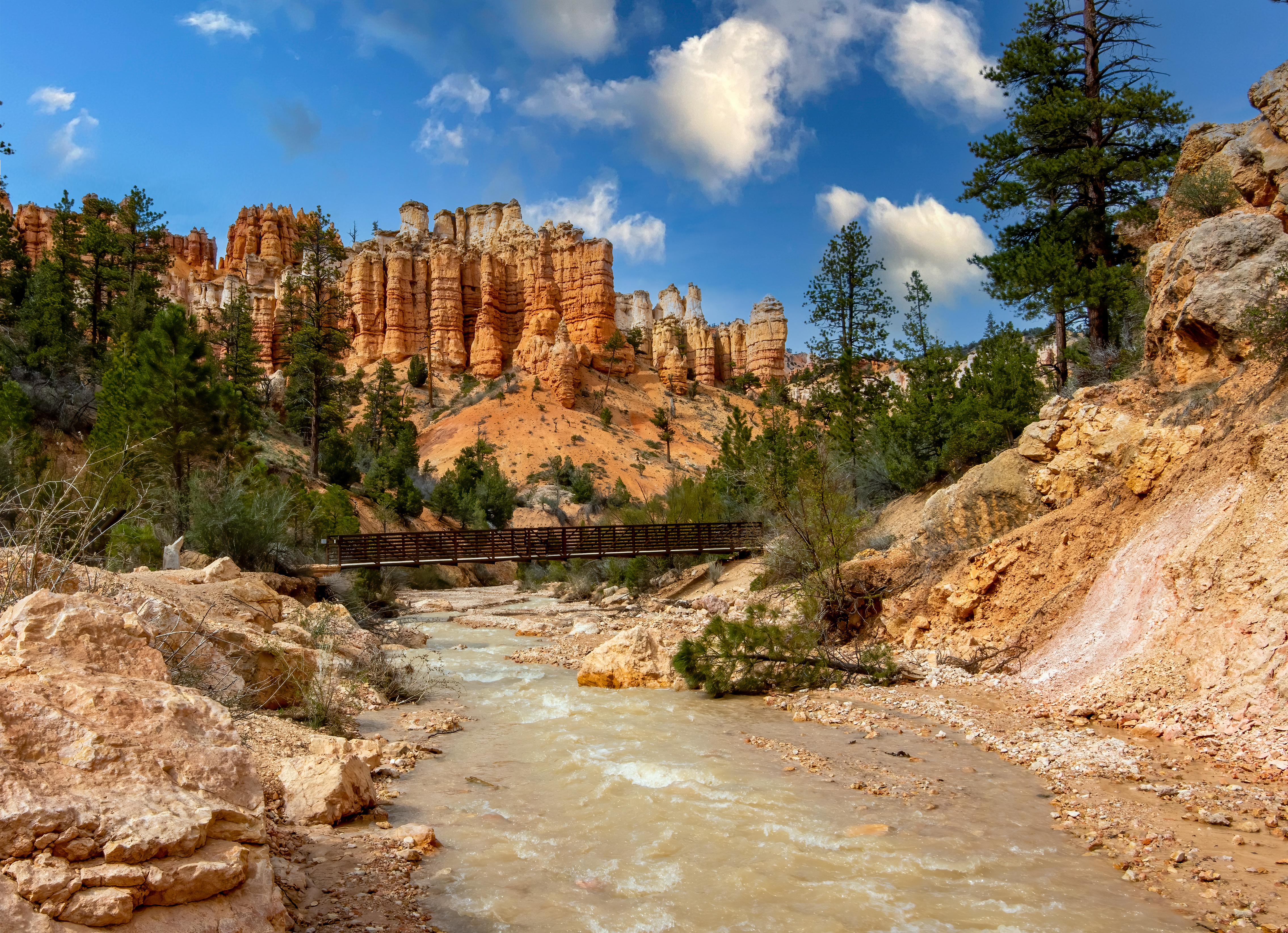
Mossy Cave trail is one of the lowest elevation hikes in the park as well as one of the only hikes that begins with a climb and ends with a descent. It is also the northernmost hike in the park, located just off of SR 12 as it winds its way through the park boundary.
Trailhead: Northern end of the park, 4 miles east on Hwy 12
Parking: At trailhead (check when parking lots are busiest ). Oversized vehicles permitted.
Distance: 0.8 miles (1.3 km)
Approximate Time: 1 hour
Elevation Gain: 150 feet (46 meters)
Difficulty: Easy (elevation gain of 200 feet or less, shorter length)
Services: Accessible restrooms available at the trailhead.
Shuttle Service: None. Private options may be available.
Pets are not allowed on this trail. Service animals are allowed in national parks. What is a service animal?
Delicate rocks and sensitive plants exist throughout this area. Please stay on the main trail and respect all posted signs.
While visitors are permitted within the water , we ask that they enter and exit at bridge crossings to reduce social trails elsewhere.
Mossy Cave is a fee area, like the rest of the park. Keep your park pass or proof of admission with your vehicle for rangers to inspect.
Accessibility Due to the park's natural terrain, this is not considered an accessible trail. Surface Type: Firm Native Sediment Total Ascent: 150 ft (46 meters) Length: 0.8 mi (1.3km) roundtrip Typical Grade: 5.0% Maximum Grade: 23.0% Typical Cross Slope: 6.0% Maximum Cross Slope: 20.0% Typical Width : 63 inches (160 cm) Minimum Width: 32 inches (81 cm) Service animals are allowed in national parks. What is a service animal?
Backcountry campsVisitor centers
Along the way North Campground North Campground North Campground North Campground North Campground North Campground North Campground Visitor Center
60-120 Minutes · no dogs · reservation required
Start Bryce Canyon Visitor Center
Be sure to always check the Calendar or stop by the Visitor Center to find the programs that will be available during your visit.
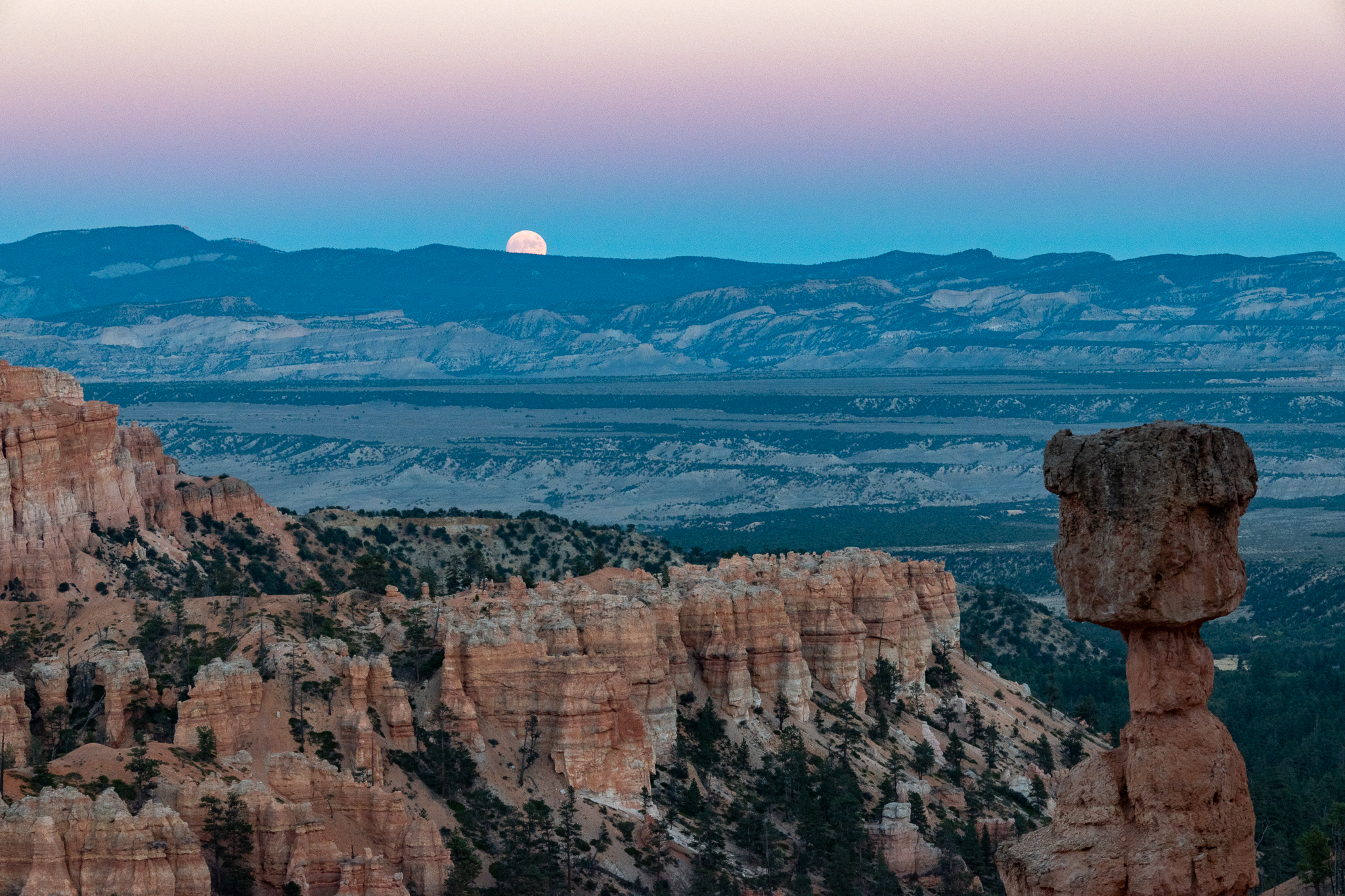
Typically offered year-round at sunset as weather permits. Those planning to join a ranger-led full moon hike at Bryce Canyon National Park can make reservations online via Recreation.gov . Tickets for each month’s hike are released in two phases, 14 and 5 days in advance.
This is a "ranger's choice" hike and can range from an easy hike along the rim of the plateau to a more strenuous hike that descends down into the canyon along steep and rocky trails. More information will be given on the day of the event. Hikes are typically 1 to 2 miles.
For more information on full moon hikes, including schedules and how to participate, please visit our Full Moon Hikes page.
Due to the nature of this special activity all participants must agree to the following rules:
Children 7 and younger are not permitted.
Hiking boots or hiking shoes (lug soles) in good condition are required for your safety and the safety of Park Staff and other Participant(s).
White light flashlights, headlamps are not allowed to be used during the hike (you may bring them for later use). Red light flashlights and headlamps are permitted as necessary. Flash photography may be permitted under key restrictions.
Bring drinking water and a jacket - night time temperatures can be cold.
Due to steep and rocky trails this activity is not wheelchair accessible.
Accessibility Due to steep and rocky trails this activity is not wheelchair accessible.
Views
Along the way Sunset Point
Trailhead Navajo Loop Trailhead / Trail End 7,986 ft Drive there
4-5 Hours · no dogs
Start Queen's Garden Trailhead
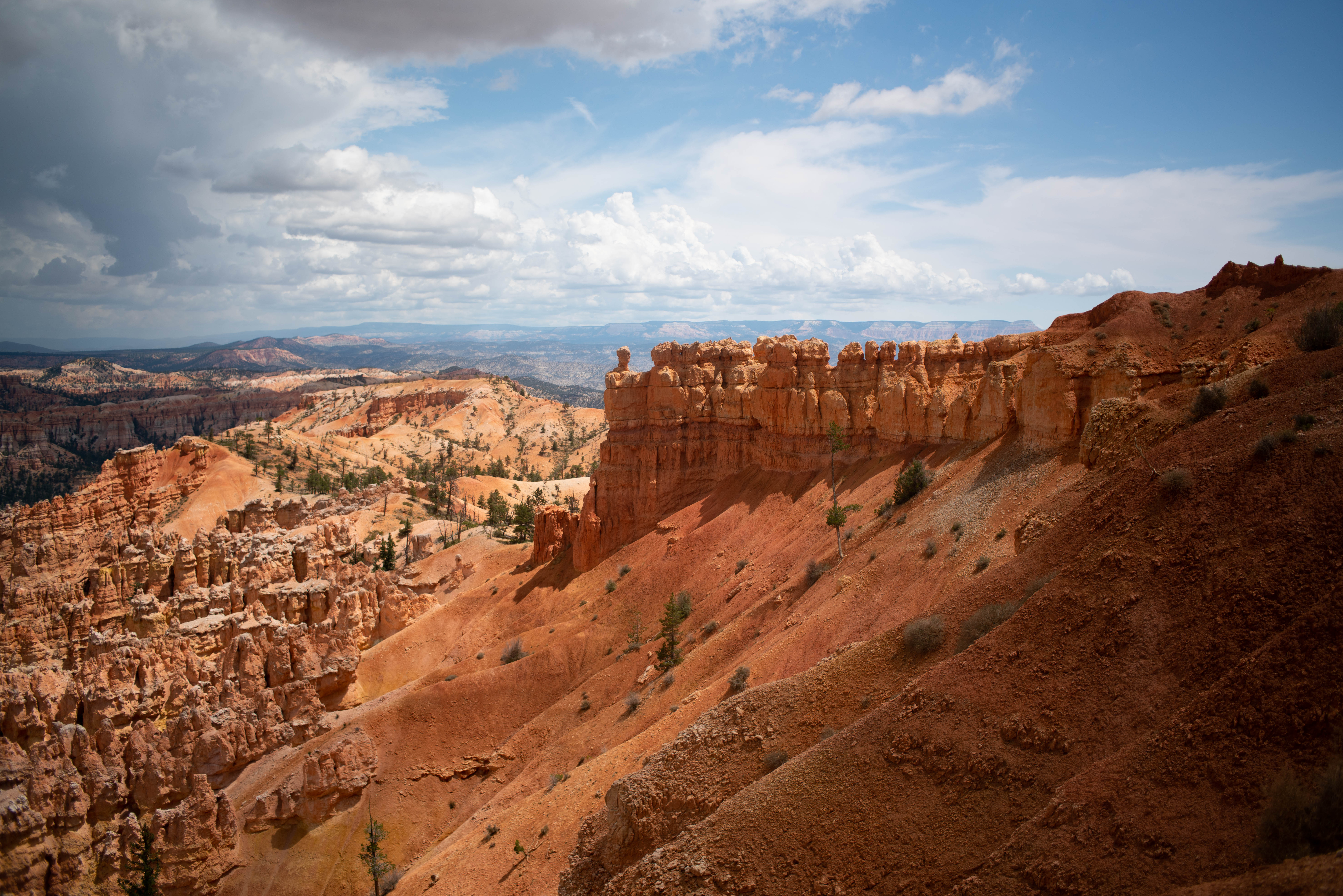
The Figure-8 Combination combines three amphitheater hikes, Queen's Garden, Navajo Loop, and the Peekaboo Loop, into one ultimate hike! We recommend a clockwise direction descending Queen's Garden, connecting to the Peekaboo Loop (we recommend hiking it in a clockwise direction), and ascending either side of the Navajo Loop (Two Bridges in winter). From there you can complete the trail by hiking back to Sunrise Point along the Rim Trail.
Trailhead: Sunrise Point or Sunset Point
Parking: Available at both Sunrise and Sunset Points (check when parking lots are busiest ). Oversized vehicles are not permitted in these parking areas when the shuttle is in operation .
Distance: 6.4 miles (10.3 km)
Approximate Time: 4-5 hours
Elevation Gain: 1575 feet (480 meters)
Difficulty: Strenuous (rapid elevation gain, longer length)
Services: Accessible restrooms available at Sunset Point (year-round) and available at the General Store near Sunrise Point (seasonally). Water-fill stations available at Sunset Point (seasonally), the Sunset Point restroom (year-round), and the General Store (seasonally). Pit toilets on the west side of Peekaboo Loop (summer only)
Shuttle Service: Yes.
This trail may be inaccessible during mid-winter due to snow depths ranging from 2-15 ft. (.7-5 m)
Pets are not allowed on this trail. Service animals are allowed in national parks. What is a service animal?
Hikers will encounter horses and mules on the Peekaboo Loop and should give the right-of-way to these riders.
You can hike these trails individually as the Peekaboo Loop , Queen's Garden , and the Navajo Loop .
Accessibility Due to the park's natural terrain, this is not considered an accessible trail. Surface Type: Firm Native Sediment Total Ascent: 1575 feet (480 meters) Length: 6.4 mi (10.3 km) roundtrip Typical Grade: 11.0% (Queen's);14.0% (Navajo); 6.0% (Peekaboo) Maximum Grade: 25.0% (Queen's) ; 30.0% (Navajo); 27.0% (Peekaboo) Typical Cross Slope: 5.0% (Queen's) ; 7.0% (Navajo); 4.0% (Peekaboo) Maximum Cross Slope: 17.0% (Queen's); 24.0% (Navajo) ; 21.0% (Peekaboo) Typical Width : 81 inches (206 cm); 77 inches (196 cm) (Navajo); 76 inches (193 cm) (Peekaboo) Minimum Width: 33 inches (84 cm) ; 25 inches (64 cm) (Navajo); 48 inches (122 cm) (Peekaboo) Service animals are allowed in national parks. What is a service animal?
1-2 Hours · no dogs
Start Navajo Loop Trailhead
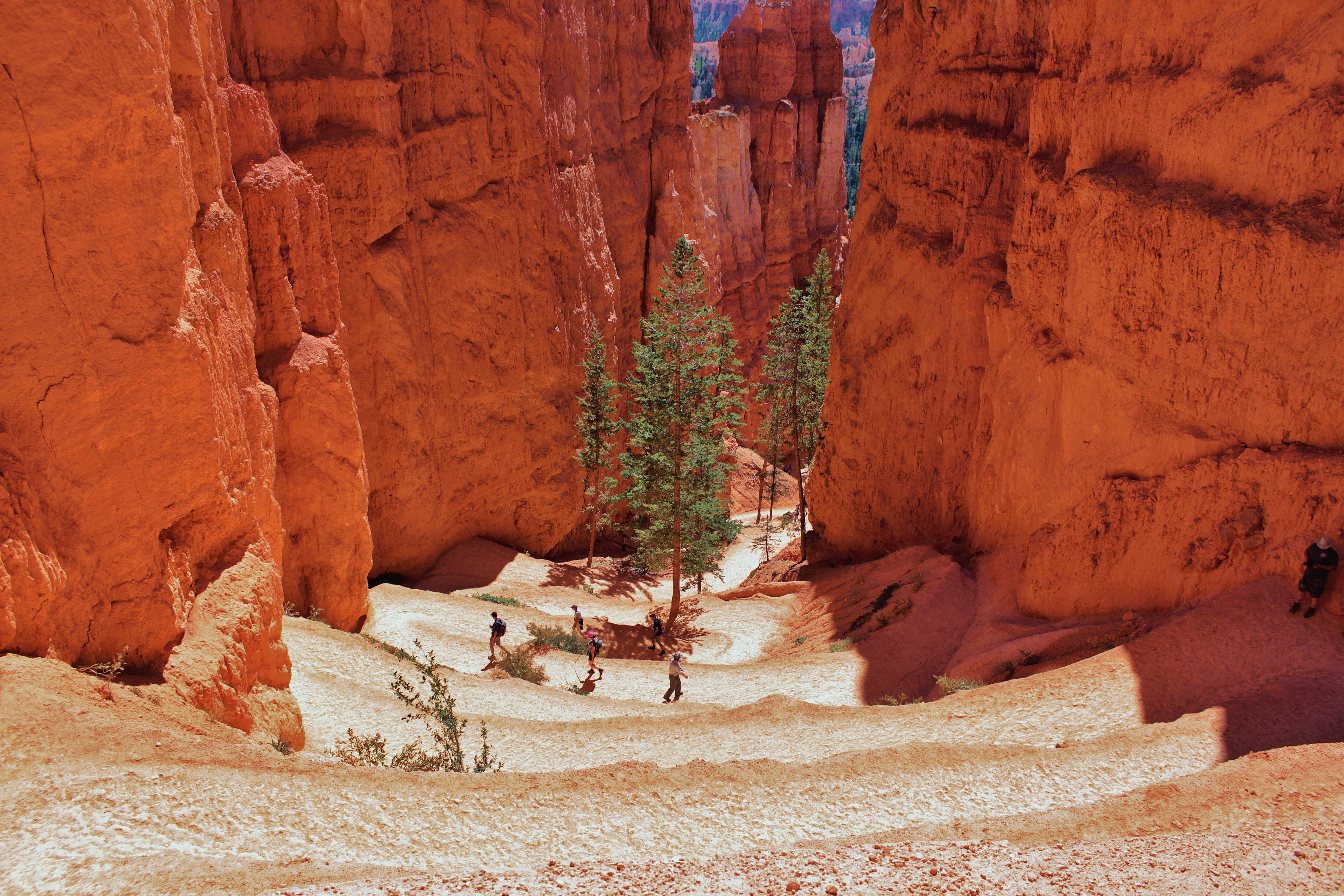
The iconic Navajo Loop Trail begins and ends at Sunset Point. Its switchbacks wind between narrow walls of colorful limestone with views of towering Douglas-fir trees and the park's most famous hoodoo: Thor's hammer. The loop has two sides: Two Bridges and Wall Street. The Two Bridges side is open year-round, however, the Wall Street side is closed during the winter months. During this time Two-Bridges can be hiked as an out-and-back trail or combined with other trails.
Trailhead: Sunset Point
Parking: At trailhead (check when parking lots are busiest ). Oversized vehicles are not permitted in these parking areas when the shuttle is in operation.
Distance: 1.3 mile (2.1 km)
Approximate Time: 1-2 hour
Elevation Gain: 515 feet (157 meters)
Difficulty: Moderate (less than 1000 feet elevation gain, moderate length)
Services: Accessible restrooms available at Sunset Point (year-round). Water-fill stations available at Sunset Point (seasonally) and the Sunset Point restroom (year-round).
Shuttle Service: Yes.
Only a loop in summer. During this time, we recommend hiking in a counter-clockwise direction. During winter months, Two Bridges can be hiked as an out-and-back trail or combined with other trails.
Pets are not allowed on this trail . Service animals are allowed in national parks. What is a service animal?
This trail is commonly combined with Queen's Garden to create a 2.9 mile round trip trail where you can descend Queen's Garden at Sunrise Point and ascend Navajo Loop to Sunset Point. Complete the loop using the Sunset to Sunrise section of the Rim Trail.
Accessibility Due to the park's natural terrain, this is not considered an accessible trail. Surface Type: Firm Native Sediment Total Ascent: 515 feet (157 meters) Length: 1.3 mi (2.1km) roundtrip Typical Grade: 14.0% Maximum Grade: 30.0% Typical Cross Slope: 7.0% Maximum Cross Slope: 24.0% Typical Width : 77 inches (196 cm) Minimum Width: 25 inches (64 cm) Service animals are allowed in national parks. What is a service animal?
3-4 Hours · no dogs
Start Bryce Point
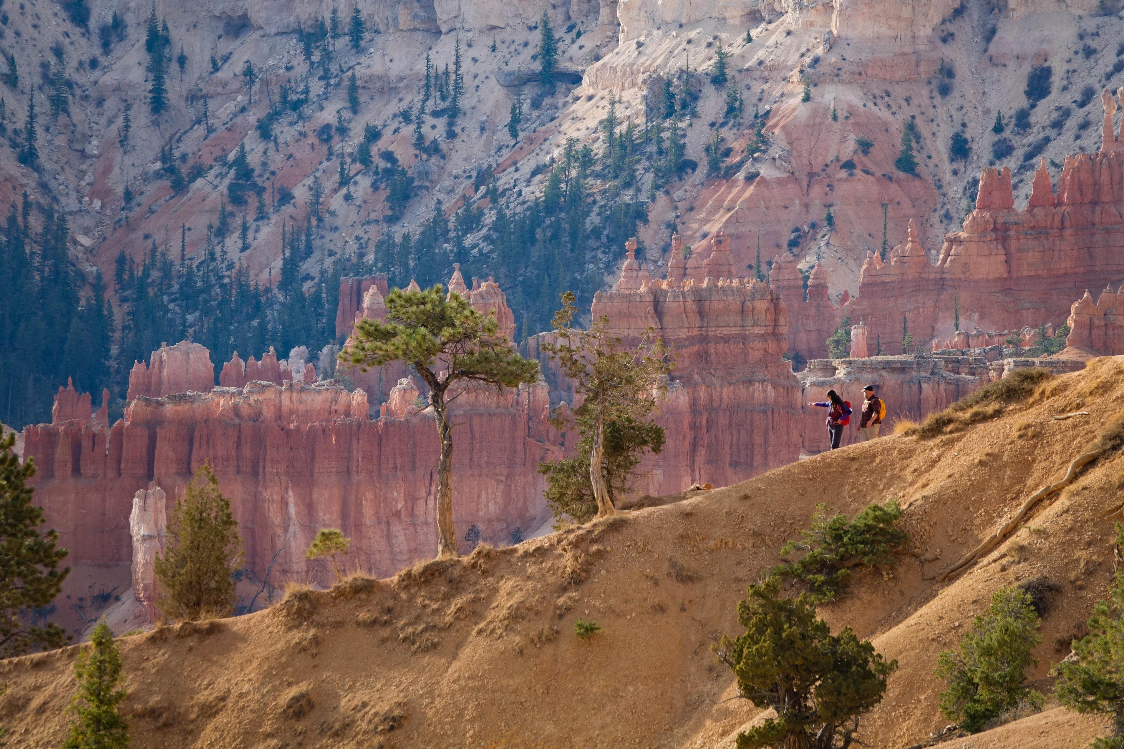
The Bryce Amphitheater Traverse is a one-way hike combining the Peekaboo Loop with the Queen's Garden trail. Hikers descend from Bryce Point, turning left (clockwise) on Peekaboo Loop and then connecting to the Queen's Garden trail to ascend to Sunrise Point.
Trailhead: Bryce Point
Parking: At trailhead (check when parking lots are busiest ). Oversized vehicles are not permitted in this parking area when the shuttle is in operation.
Distance: 4.7 miles (7.6 km)
Approximate Time: 3-4 hours
Elevation Gain: 1145 feet (349 meters)
Difficulty: Strenuous (rapid elevation gain, longer length)
Services: Pit toilets on the west side of Peekaboo Loop (summer only)
Shuttle Service: Yes.
This trail may be inaccessible during mid-winter due to snow depths ranging from 2-15 ft. (.7-5 m)
Pets are not allowed on this trail. Service animals are allowed in national parks. What is a service animal?
Hikers will encounter horses and mules on the Peekaboo Loop and should give the right-of-way to these riders.
Accessibility Due to the park's natural terrain, this is not considered an accessible trail. Surface Type: Firm Native Sediment Total Ascent: 1145 feet (349 meters) Length: 4.7 mi (7.6 km) Typical Grade: 11.0% (Queen's); 6.0% (Peekaboo) Maximum Grade: 25.0% (Queen's) ; 27.0% (Peekaboo) Typical Cross Slope: 5.0% (Queen's) ; 4.0% (Peekaboo) Maximum Cross Slope: 17.0% (Queen's); 21.0% (Peekaboo) Typical Width : 81 inches (206 cm) (Queen's); 76 inches (193 cm) (Peekaboo) Minimum Width: 33 inches (84 cm) (Queen's) ; 48 inches (122 cm) (Peekaboo) Service animals are allowed in national parks. What is a service animal?
4-5 Hours · no dogs
Start Queen's Garden Trailhead
The Figure-8 Combination combines three amphitheater hikes, Queen's Garden, Navajo Loop, and the Peekaboo Loop, into one ultimate hike! We recommend a clockwise direction descending Queen's Garden, connecting to the Peekaboo Loop (we recommend hiking it in a clockwise direction), and ascending either side of the Navajo Loop (Two Bridges in winter). From there you can complete the trail by hiking back to Sunrise Point along the Rim Trail.
Trailhead: Sunrise Point or Sunset Point
Parking: Available at both Sunrise and Sunset Points (check when parking lots are busiest ). Oversized vehicles are not permitted in these parking areas when the shuttle is in operation .
Distance: 6.4 miles (10.3 km)
Approximate Time: 4-5 hours
Elevation Gain: 1575 feet (480 meters)
Difficulty: Strenuous (rapid elevation gain, longer length)
Services: Accessible restrooms available at Sunset Point (year-round) and available at the General Store near Sunrise Point (seasonally). Water-fill stations available at Sunset Point (seasonally), the Sunset Point restroom (year-round), and the General Store (seasonally). Pit toilets on the west side of Peekaboo Loop (summer only)
Shuttle Service: Yes.
This trail may be inaccessible during mid-winter due to snow depths ranging from 2-15 ft. (.7-5 m)
Pets are not allowed on this trail. Service animals are allowed in national parks. What is a service animal?
Hikers will encounter horses and mules on the Peekaboo Loop and should give the right-of-way to these riders.
You can hike these trails individually as the Peekaboo Loop , Queen's Garden , and the Navajo Loop .
Accessibility Due to the park's natural terrain, this is not considered an accessible trail. Surface Type: Firm Native Sediment Total Ascent: 1575 feet (480 meters) Length: 6.4 mi (10.3 km) roundtrip Typical Grade: 11.0% (Queen's);14.0% (Navajo); 6.0% (Peekaboo) Maximum Grade: 25.0% (Queen's) ; 30.0% (Navajo); 27.0% (Peekaboo) Typical Cross Slope: 5.0% (Queen's) ; 7.0% (Navajo); 4.0% (Peekaboo) Maximum Cross Slope: 17.0% (Queen's); 24.0% (Navajo) ; 21.0% (Peekaboo) Typical Width : 81 inches (206 cm); 77 inches (196 cm) (Navajo); 76 inches (193 cm) (Peekaboo) Minimum Width: 33 inches (84 cm) ; 25 inches (64 cm) (Navajo); 48 inches (122 cm) (Peekaboo) Service animals are allowed in national parks. What is a service animal?
3-4 Hours · no dogs
Start Navajo Loop Trailhead
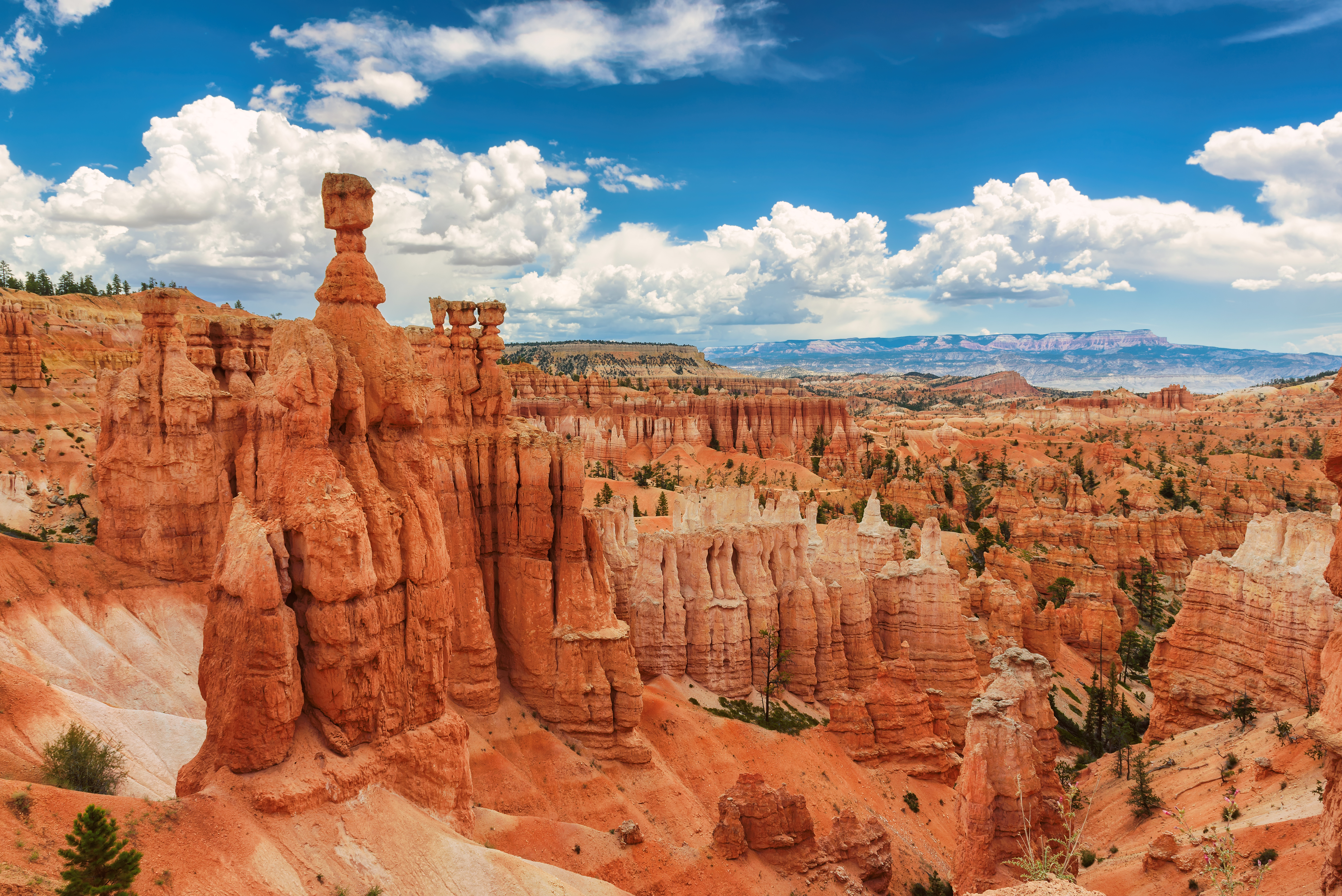
Combine two of our most iconic trails, the Navajo and Peekaboo Loop trails, into a a mini Figure-8 combination loop. Start the hike at Sunset Point, descend down either side of the Navajo Loop (Two Bridges in winter), connect to the Peekaboo Loop (we recommend hiking it in a clockwise direction), and ascend Navajo back to Sunset Point.
Trailhead: Sunset Point
Parking: At trailhead (check when parking lots are busiest ). Oversized vehicles are not permitted in this parking area when the shuttle is in operation.
Distance: 4.9 miles (7.9 km)
Approximate Time: 3-4 hours
Elevation Gain: 1475 feet (450 meters)
Difficulty: Strenuous (rapid elevation gain, longer length)
Services: Accessible restrooms available at Sunset Point (year-round). Pit toilets on the west side of Peekaboo Loop (summer only). Water-fill stations available at Sunset Point (seasonally) and the Sunset Point restroom (year-round).
Shuttle Service: Yes.
In winter, use the Two Bridges side of the Navajo Loop.
Pets are not allowed on this trail. Service animals are allowed in national parks. What is a service animal?
Hikers will encounter horses and mules on the Peekaboo Loop and should give the right-of-way to these riders.
You can hike these two trails individually as the Peekaboo Loop and the Navajo Loop .
Accessibility Due to the park's natural terrain, this is not considered an accessible trail. Surface Type: Firm Native Sediment Total Ascent: 1475 feet (450 meters) Length: 4.9 mi (7.9 km) roundtrip Typical Grade: 14.0% (Navajo); 6.0% (Peekaboo) Maximum Grade: 30.0% (Navajo); 27.0% (Peekaboo) Typical Cross Slope: 7.0% (Navajo); 4.0% (Peekaboo) Maximum Cross Slope: 24.0% (Navajo) ; 21.0% (Peekaboo) Typical Width : 77 inches (196 cm) (Navajo); 76 inches (193 cm) (Peekaboo) Minimum Width: 25 inches (64 cm) (Navajo); 48 inches (122 cm) (Peekaboo) Service animals are allowed in national parks. What is a service animal?
3-4 Hours · no dogs
Start Bryce Point
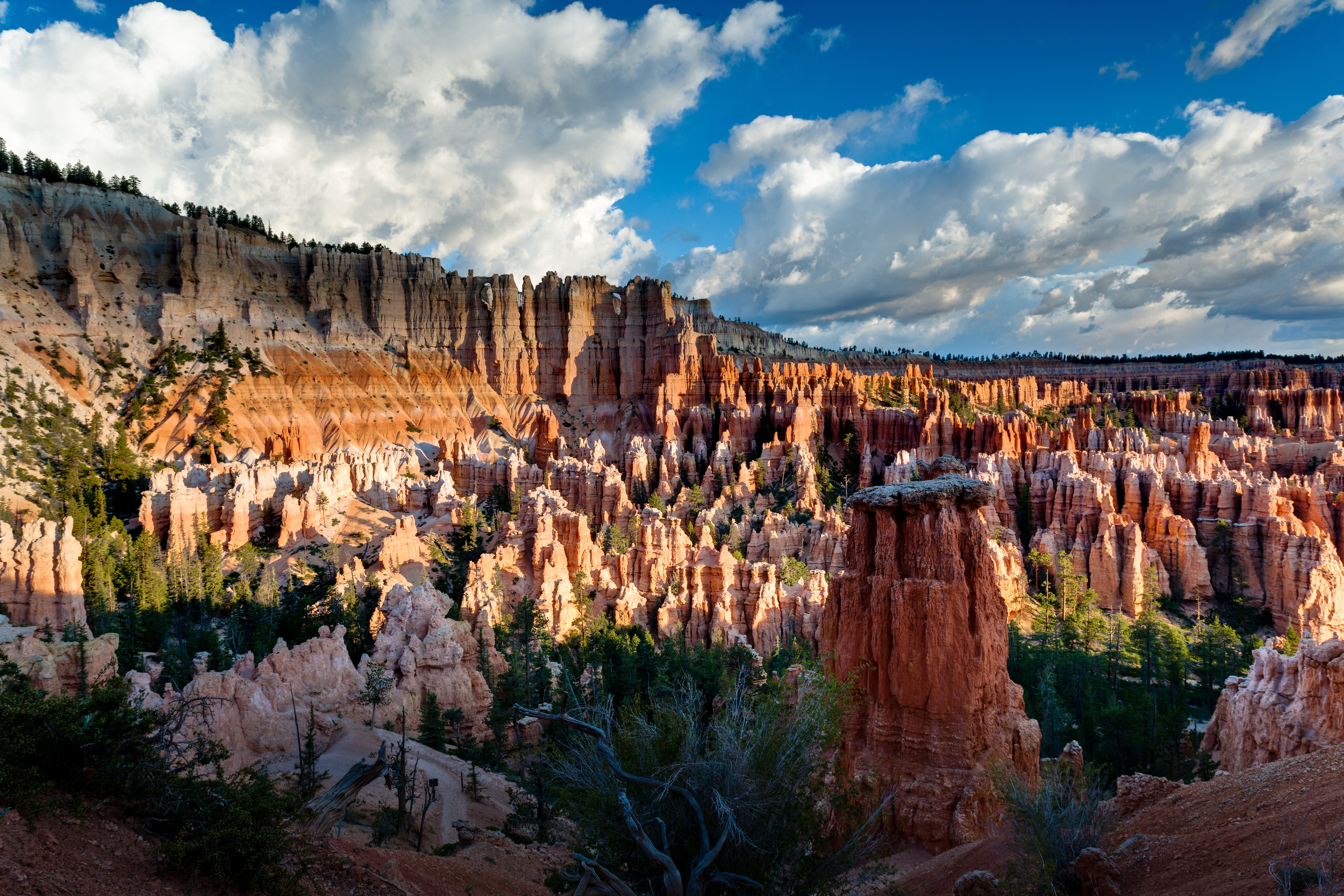
The Peekaboo Loop descends 670 feet (204 meters) from Bryce Point to this hoodoo-filled loop trail before ascending back up to Bryce Point. In summer months, hikers will encounter horses/mules on this trail. We recommend hiking this trail in a clockwise direction.
Trailhead: Bryce Point
Parking: At trailhead (check when parking lots are busiest ). Oversized vehicles are not permitted in this parking area when the shuttle is in operation.
Distance: 5.5 miles (8.9 km)
Approximate Time: 3-4 hours
Elevation Gain: 1560 feet (474 meters)
Difficulty: Strenuous (rapid elevation gain, longer length)
Services: Pit toilets on the west side of Peekaboo Loop (summer only)
Shuttle Service: Yes.
This trail may be inaccessible during mid-winter due to snow depths ranging from 2-15 ft. (.7-5 m)
Pets are not allowed on this trail. Service animals are allowed in national parks. What is a service animal?
Hikers may encounter horses and mules on this trail and should give the right-of-way to these riders.
Accessibility Due to the park's natural terrain, this is not considered an accessible trail. Surface Type: Firm Native Sediment Total Ascent: 1560 feet (474 meters) Length: 5.5 mi (8.9km) roundtrip Typical Grade: 6.0% Maximum Grade: 27.0% Typical Cross Slope: 4.0% Maximum Cross Slope: 21.0% Typical Width : 76 inches (193 cm) Minimum Width: 48 inches (122 cm) Service animals are allowed in national parks. What is a service animal?
ViewsShelters
Along the way Rainbow Overlook Shelter Rainbow Point
Trailhead Bristlecone Loop Trailhead 9,103 ft Drive there
Trailhead Riggs Spring LoopTrailhead 9,101 ft Drive there
30-60 Minutes · no dogs · Spring, Summer, Fall
Start Bristlecone Loop Trailhead
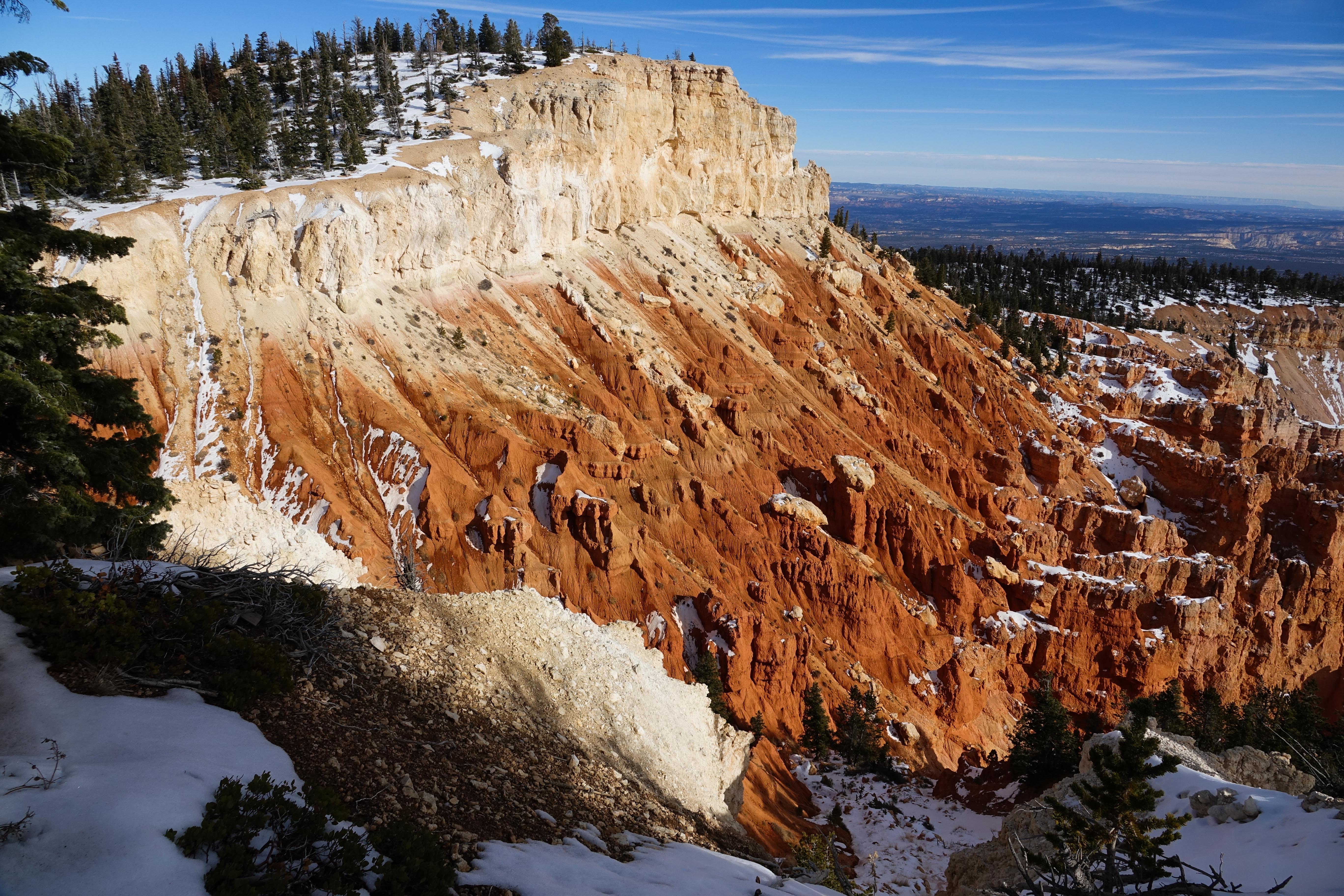
The Bristlecone Loop, accessible from Rainbow Point at the southern end of the park, meanders through the forest atop this highest portion of the park, reaching elevations over 9,100 feet (2778 m). Here you will pass by bristlecone pines up to 1,800-years-old and experience vistas reaching into the Four Corners area.
Trailhead: Rainbow Point or Yovimpa Point
Parking: At trailhead (check when parking lots are busiest ). Oversized vehicles permitted.
Distance: 1.0 mile (1.6 km)
Approximate Time: 1 hour
Elevation Gain: 200 feet (61 meters)
Difficulty: Easy (elevation gain of 200 feet or less, shorter length)
Services: Accessible restrooms available (seasonally).
Shuttle Service: None. Private options may be available.
This trail may be inaccessible during mid-winter due to snow depths ranging from 2-15 ft. (.7-5 m)
Pets are not allowed on this trail . Service animals are allowed in national parks. What is a service animal?
This forest is dominated by Blue Spruce, Douglas Fir, and White Fir, making this good habitat for grouse, woodpeckers, owls, and a variety of squirrels and chipmunks. Here you are also sure to see Ravens and Steller's Jays.
Accessibility Due to the park's natural terrain, this is not considered an accessible trail. Surface Type: Firm Native Sediment Total Ascent: 200 feet (61 meters) Length: 1.0 mi (0.8km) roundtrip Typical Grade: 7.0% Maximum Grade: 20.0% Typical Cross Slope: 5.0% Maximum Cross Slope: 24% Typical Width: 51 inches Minimum Width: 51 inches Service animals are allowed in national parks. What is a service animal?
4-5 Hours · no dogs · reservation required
Start Riggs Spring Loop Trailhead
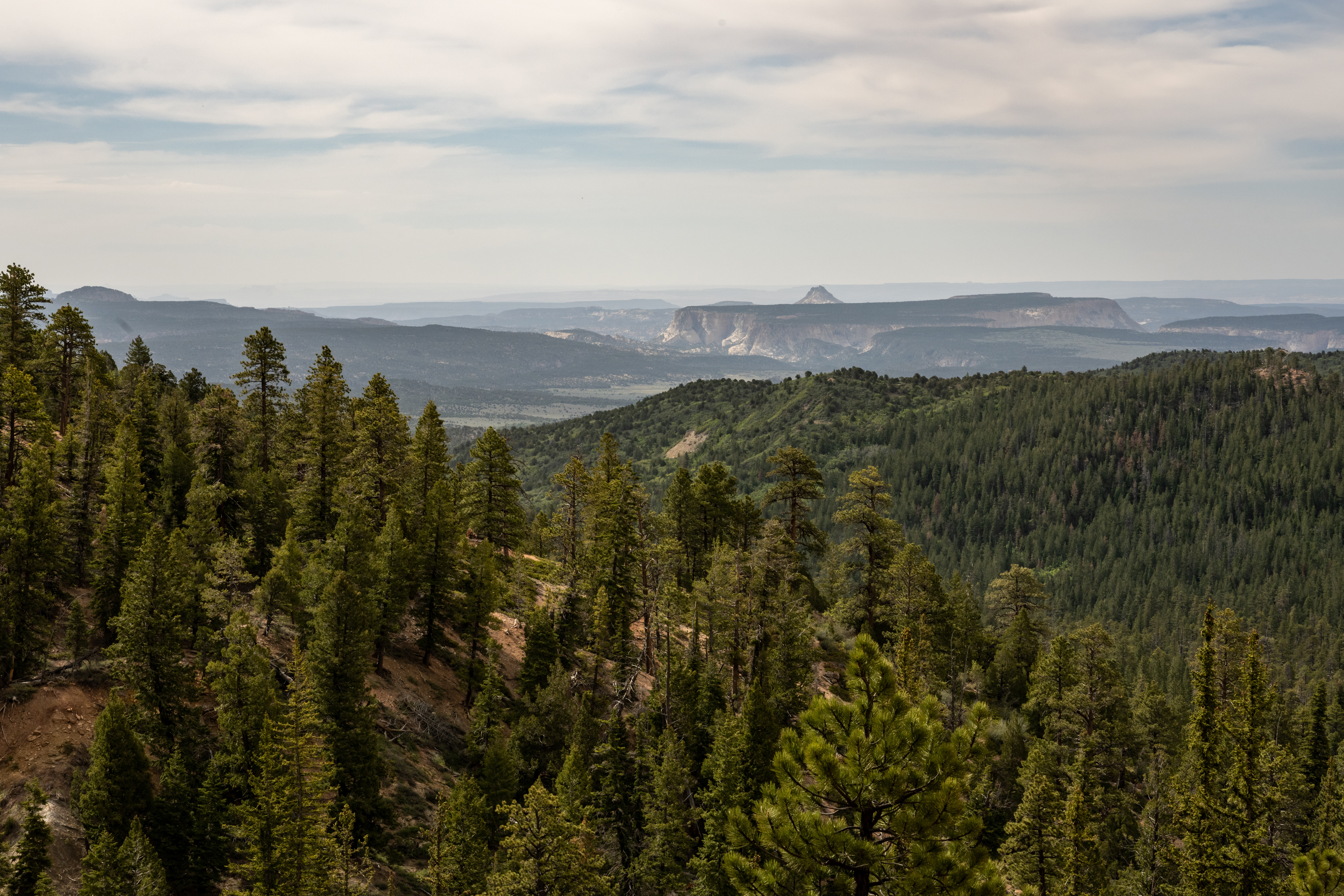
The Riggs Spring Loop is a backcountry trail that begins and ends at Yovimpa Point. This trail travels through spruce, fir, and bristlecone forests offering beautiful views of distant cliffs. The western section of the trail is steeper and more heavily forested. Permits are not required to hike this trail, but all overnight stays require a permit .
Trailhead: Yovimpa Point
Parking: At trailhead; oversized vehicles permitted
Distance: 8.6 miles (13.9 km)
Approximate Time: 5 hours
Elevation Gain: 2200 feet (671 meters)
Difficulty: Strenuous
Services: Accessible restrooms available at Yovimpa Point (year-round). No water-fill stations.
Shuttle Service: None. Private options may be available.
This trail may be inaccessible during mid-winter due to snow depths ranging from 2-15 ft. (.7-5 m)
Pets are not allowed on this trail. Service animals are allowed in national parks. What is a service animal?
Backcountry camping is permitted only in designated backcountry campsites and all overnight backcountry stays require a permit.
Typically this loop is hiked in a counter-clockwise direction with a single overnight. Some backcountry hikers will combine this loop with additional nights along the Under-the-Rim Trail . For more information and reservation information visit our Backcountry Information page .
Accessibility This is a backcountry trail with natural terrain and is not considered an accessible trail. Surface Type: Firm Native Sediment Total Ascent: 2200 feet (671 meters) Length: 8.6 mi (13.9 km) roundtrip
Views
Along the way Sunrise Point Sunset Point
Trailheads Navajo Loop Trailhead / Trail End 7,986 ft Drive there · Peekaboo Loop, Hat Shop, Under-the-Rim Trailhead 8,310 ft Drive there · Queen's Garden Trailhead 7,993 ft Drive there · Rim Trail Bryce Point Trailhead 8,311 ft Drive there · Tower Bridge Trailhead 7,993 ft Drive there
no dogs · entrance fee applies
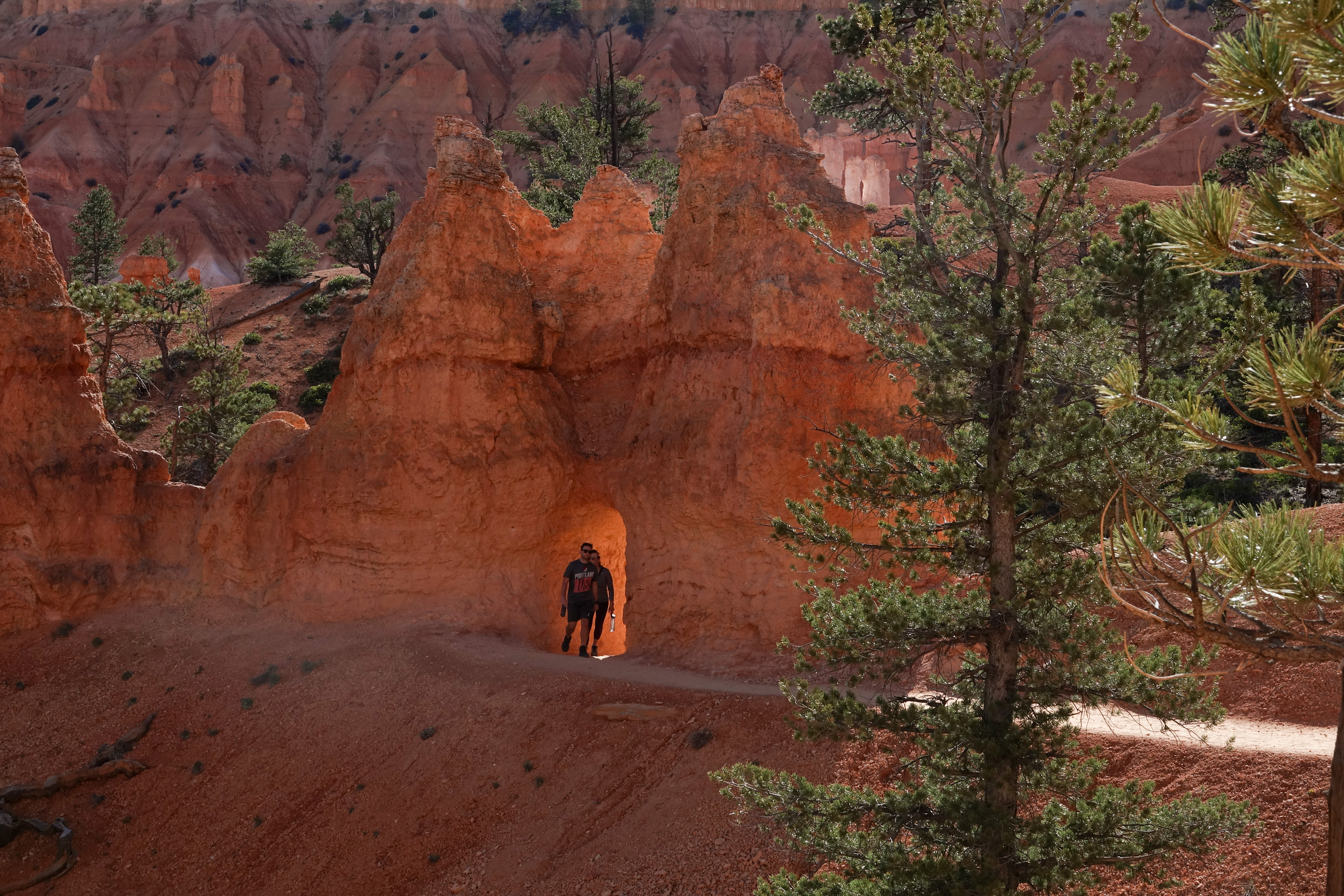
Visit our Hiking Page for more details on the hikes below.
This is a High Elevation Park
With most of the park at 8,000 feet (2,438 m) or above, elevation is a very real factor to consider when choosing your hike. At this elevation, there's about 70% of the oxygen available at sea-level, and you'll certainly feel it if you begin to hike. When you're choosing a hike, do yourself a huge favor and don't choose something at the edge of your abilities. Take it easy, and rest assured that even short hikes have as much beauty to offer as the longest ones. Elevation-related injuries, such as heart issues, are among the park's most common medical emergencies.
UV radiation is also a lot stronger at this elevation. Make sure you cover up, wear sunscreen, or take other precautions to protect your skin and eyes.
Lastly, storms can form quickly here. If thunder roars, go indoors! Lightning--especially during the summer monsoon season--is a deadly threat. Take shelter in your vehicle, a building, a shuttle bus, or if you're on a trail find a low lying depression. Both trees and hoodoos can conduct lightning down to you.
Water and Footwear
With less oxygen available in each breath, you're going to be breathing harder, which means that you're going to dehydrate more quickly. We recommend a liter of water for every 1-2 hours you plan to hike. There is no water available once you're on a trail (backcountry hikes pass seasonal springs and drainages, but even these are rarely reliable), so make sure you pack all that you need.
Our number one cause of injuries in the park? Bad footwear. Trails have a lot of small, loose rock on their otherwise flat surfaces making slipping and twisting an ankle all too easy. Footwear with a good tread and ankle support is highly recommended. In winter, ice creates even more hazardous conditions. We strongly recommend the use of footwear traction devices when ice is present.
Easy Hikes
Mossy Cave: 0.8 mi (1.3 km)
Sunset to Sunrise (along Rim Trail): 1.0 mi (1.6 km)
Bristlecone Loop: 1.0 mi (1.6 km)
Moderate Hikes
Queen's Garden: 1.8 mi (2.9 km)
Navajo Loop: 1.3 mi (2.2 km)
Queen's/Navajo Combo Loop: 2.9 mi (4.6 km)
Tower Bridge: 3.0 mi (4.8 km)
Swamp Canyon Loop: 4.0 mi (6.4 km)
Strenuous Hikes
Hat Shop: 4.0 mi (6.4 km)
Fairyland Loop: 8.0 mi (12.9 km)
Peekaboo Loop: 5.5 mi (8.8 km)
Navajo/Peekaboo Combo: 4.9 mi (7.8 km)
Figure-8 Combo: 6.4 mi (10.2 km)
Bryce Amphitheater Traverse: 4.7 mi (7.5 km)
Pets Pets are permitted on all paved surfaces in the park: campgrounds, parking lots, paved roads, paved viewpoint areas, on the paved trail between Sunset Point and Sunrise Point, and on the paved Shared Use Path between the park entrance and Inspiration Point. Pets are not permitted on unpaved trails or viewpoints, in public buildings or on public transportation vehicles. These regulations also apply to pets that are carried. Pets must be on a leash at all times ; the leash must be no longer than 6 feet. Pet owners may not leave pet(s) unattended or tied to an object. Pets may not be left in vehicles while their owners hike. Be aware that idling and generator use is not permitted in park parking lots. Pets may not make unreasonable noise. Pet owners are required to pick-up after their pets (excrement and other solid waste).
Accessibility The only truly accessible trail here listed is the 0.5 mile (0.8 km) Sunset to Sunrise section of the Rim Trail. Other trails will vary. More details can be found on each individual hike page.
4-5 Hours · no dogs
Start Fairyland Loop Trailhead
The Fairyland Loop is a quiet 8 mile hike that combines hiking along the plateau rim near Boat Mesa with a hike in the canyon with long views of the Bryce Amphitheater surrounded by unique hoodoos. You can start this hike at Fairyland Point or on the rim trail north of Sunrise Point at the Tower Bridge trailhead. We recommend hiking in a counter-clockwise direction. There is no shuttle pick-up at Fairyland Point, so you will need to hike to your starting point to complete the loop.
Trailhead: Fairyland Point or north of Sunrise Point at the Tower Bridge trailhead .
Parking: At Fairyland Point (oversized vehicles permitted) or at Sunrise Point (oversized vehicles are not permitted in this parking area when the shuttle is in operation. ) Check when parking lots are busiest .
Distance: 8.0 mile (12.9 km)
Approximate Time: 4-5 hours
Elevation Gain: 1900 feet (579 meters)
Difficulty: Strenuous (rapid elevation gain, longer length)
Services: Accessible restrooms available at the General Store near Sunrise Point (seasonally). Water-fill stations available at the General Store (seasonally). No services at Fairyland Point.
Shuttle Service: Yes at Sunrise Point, None at Fairyland Point. Private options may be available.
Pets are not allowed on this trail. Service animals are allowed in national parks. What is a service animal?
This trail may be inaccessible during mid-winter due to snow depths ranging from 2-15 ft. (.7-5 m)
Accessibility This is a backcountry trail with natural terrain and is not considered an accessible trail. Surface Type: Firm Native Sediment Total Ascent: 1900 feet (579 meters) Length: 7.8 mi (12.6 km) roundtrip Typical Grade: 9.0% Maximum Grade: 25.0% Typical Cross Slope: 5% Maximum Cross Slope: 39% Typical Width : 49 inches (124 cm) Minimum Width: 16 inches (41 cm) Service animals are allowed in national parks. What is a service animal?
3-4 Hours · no dogs
Start Hat Shop Trailhead
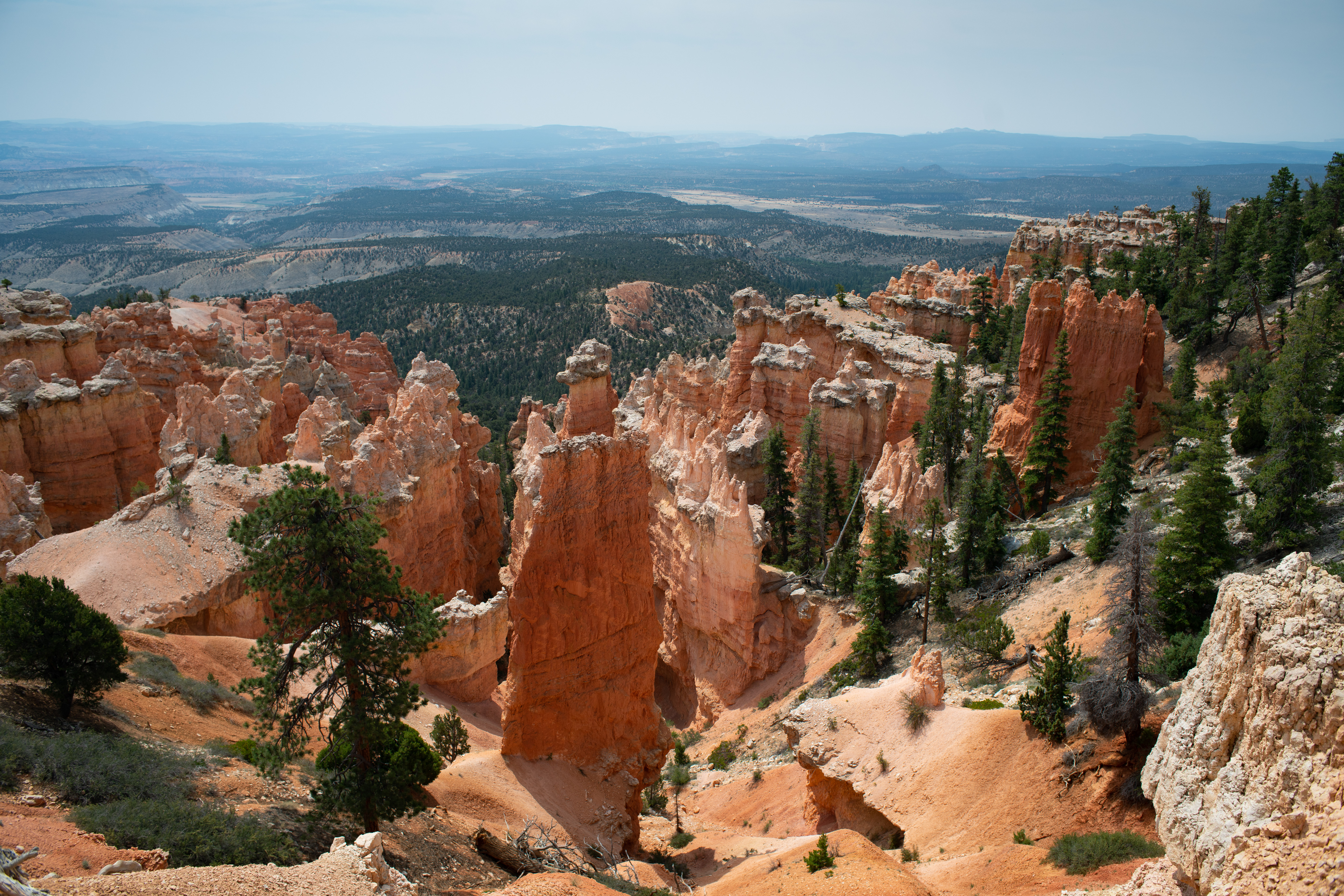
The Hat Shop trail descends from Bryce Point into the backcountry using the Under-the-Rim trail, offering views of the colorful cliffs of the Grand Staircase. This strenuous out-and-back hike leads down 1,380 feet (421 meters) over two-miles to a cluster of balanced-rock hoodoos before hikers turn around to return to Bryce Point. These narrow, orange pinnacles wear "hats" of large gray boulders, giving them a distinct appearance compared to hoodoos seen in the Bryce Amphitheater to the north.
Trailhead: Bryce Point
Parking: At Bryce Point; oversized vehicles are not permitted in this parking area when the shuttle is in operation.
Distance: 4.0 miles (6.4 km)
Approximate Time: 3-4 hours
Elevation Gain: 1,380 feet (421 meters)
Difficulty: Strenuous (rapid elevation gain, longer length)
Services: None.
Shuttle Service: Yes.
During winter, the Hat Shop trail is not advised unless you are very well prepared for ice, deep snow, and other winter conditions.
Pets are not allowed on this trail. Service animals are allowed in national parks. What is a service animal?
Accessibility Due to the park's natural terrain, this is not considered an accessible trail. Surface Type: Firm Native Sediment Total Ascent: 1380 feet (421 meters) Length: 4.0 mi (6.4km) roundtrip Typical Grade: 13.0% Maximum Grade: 29.0% Typical Cross Slope: 5% Maximum Cross Slope: 20% Typical Width : 37 inches (94 cm) Minimum Width: 36 inches (cm) Service animals are allowed in national parks. What is a service animal?
1-2 Hours · no dogs
Start Queen's Garden Trail
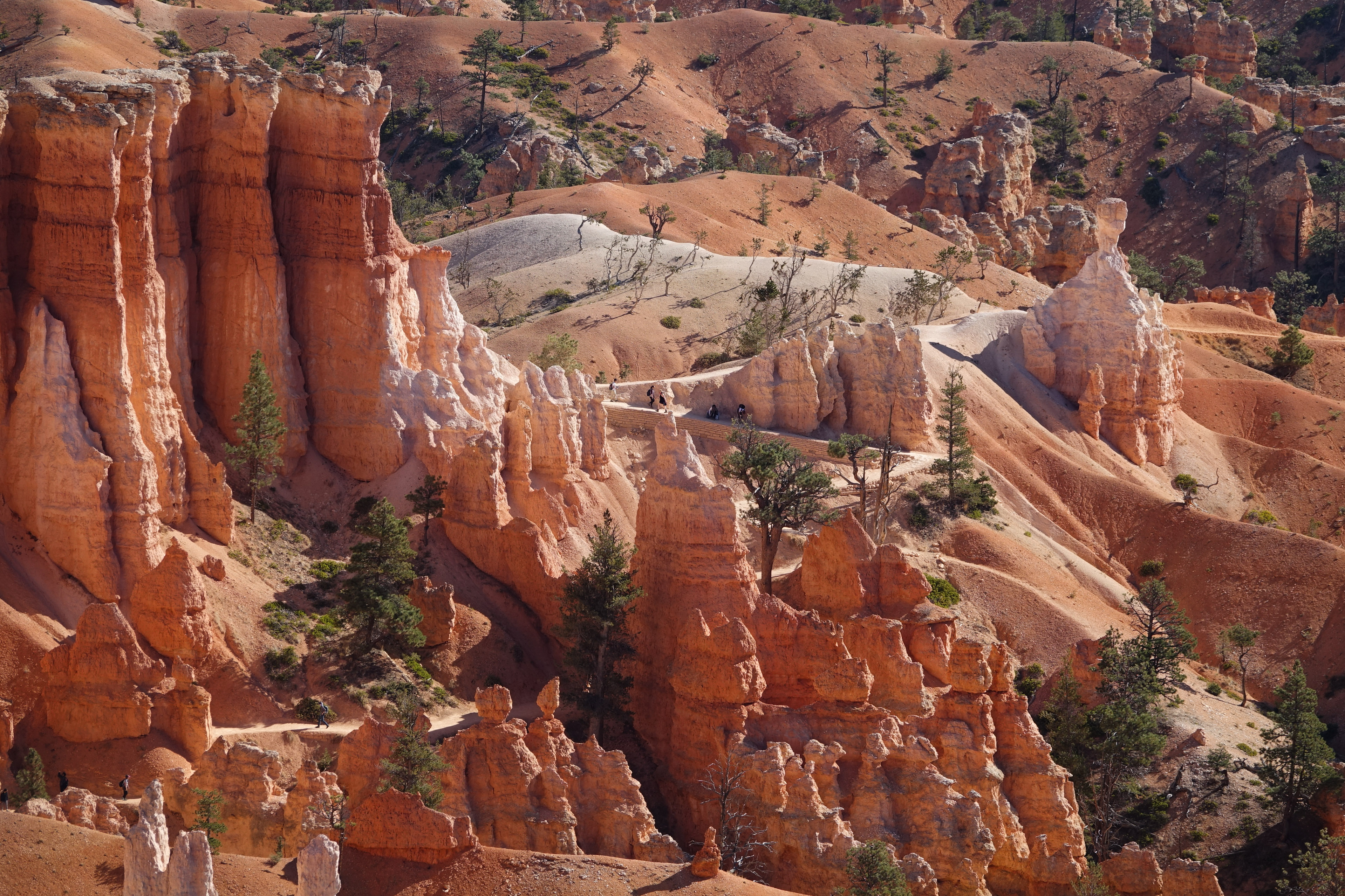
The Queen's Garden Trail is the least difficult of the trails descending from the rim into the Bryce Canyon Amphitheater. Hike this out-and-back trail to the Queen Victoria hoodoo at the end of a short spur trail and experience the splendor of hiking amongst the hoodoos.
Trailhead: Sunrise Point
Parking: Available at Sunrise Point (check when parking lots are busiest ). Oversized vehicles are not permitted in this parking area when the shuttle is in operation.
Distance: 1.8 miles (2.9 km) roundtrip
Approximate Time: 1-2 hours
Elevation Gain: 450 feet (137 meters)
Difficulty: Moderate (less than 1000 feet elevation gain, moderate length)
Services: Accessible restrooms and a water-fill station are available at the General Store near Sunrise Point (seasonally).
Shuttle Service: Yes.
Pets are not allowed on this trail. Service animals are allowed in national parks. What is a service animal?
This trail is commonly combined with the Navajo Loop to create a 2.9 mile round trip trail where you can descend Queen's Garden at Sunrise Point and ascend Navajo Loop to Sunset Point. Complete the loop using the Sunset to Sunrise section of the Rim Trail.
Accessibility Due to the park's natural terrain, this is not considered an accessible trail. Surface Type: Firm Native Sediment Total Ascent: 450 feet (137 meters) Length: 1.8 mi (2.9km) roundtrip Typical Grade: 11.0% Maximum Grade: 25.0% Typical Cross Slope: 5.0% Maximum Cross Slope: 17.0% Typical Width : 81 inches (206 cm) Minimum Width: 33 inches (84 cm) Service animals are allowed in national parks. What is a service animal?
20-60 Minutes · dogs allowed
Start Sunset Point
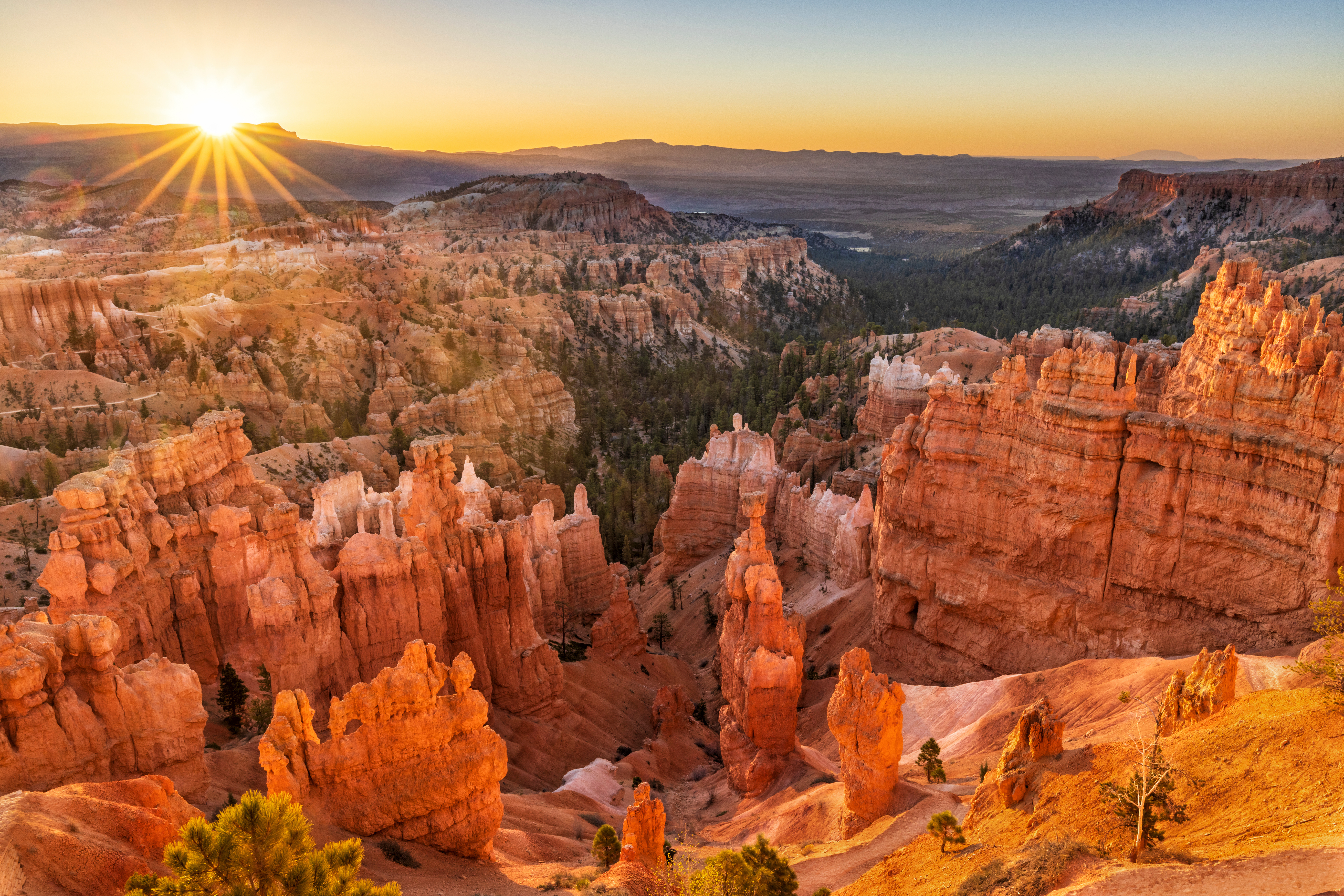
The Rim Trail hike meanders along the rim of the iconic Bryce Canyon Amphitheater, giving you views of the hoodoos below. This portion of the Rim Trail, from Sunset Point to Sunrise Point, is the only paved section of this trail and is the easiest walk in the park.
Trailhead: Sunset Point or Sunrise Point
Parking: Available at both Sunrise and Sunset Points (check when parking lots are busiest ). Oversized vehicles are not permitted in these parking areas when the shuttle is in operation.
Distance: 1.0 mile (1.6 km) (half-mile one-way)
Approximate Time: 1 hour
Elevation Gain: 40 feet (12 meters)
Difficulty: Easy (elevation gain of 200 feet or less, shorter length)
Shuttle Service: Yes.
Services: Accessible restrooms available at Sunset Point (year-round) and at the General Store near Sunrise Point (seasonally). Water-fill stations available at Sunset Point (seasonally), the Sunset Point restroom (year-round), and the General Store (seasonally).
Pets are allowed on paved surfaces .
Accessibility This portion of the Rim Trail is paved and accessible. Surface Type: Concrete Total Ascent: 40 feet (12 meters) Length: 1.0 mi (0.8km) roundtrip Typical Grade: 3.3% Maximum Grade: 16.5% Typical Cross Slope: 2.8% Maximum Cross Slope: 12.2% Typical Width : 97 inches (246.2 cm) Minimum Width: 72 inches (182.9 cm) Service animals are allowed in national parks. What is a service animal?
1-7 Hours · dogs allowed
Start Bryce Point
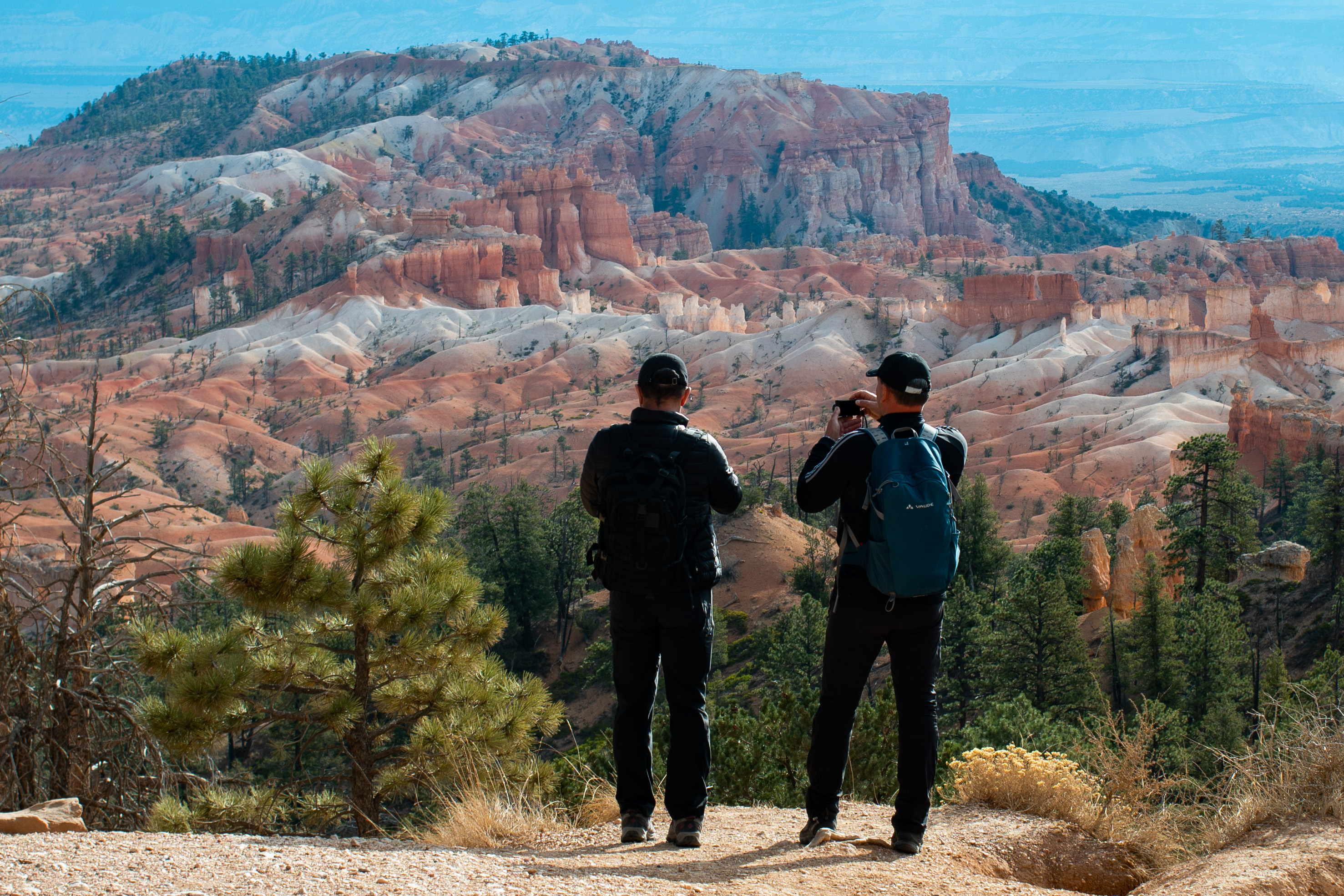
The Rim Trail stretches from its beginning in the south at Bryce Point 5.5 miles (8.9 km) north to Fairyland Point. As it follows the edge of the Bryce Amphitheater area of the park, it connects to Inspiration Point, Sunset Point, and Sunrise Point providing a relatively easy hike (depending on how much of it you do) that offers spectacular views of the park's most popular area.
Trailhead: Bryce , Inspiration , Sunset , Sunrise , or Fairyland Point .
Parking: Available at each trailhead above (check when parking lots are busiest ). With the exception of Fairyland Point, oversized vehicles are not permitted in these parking areas when the shuttle is in operation.
Distance: 1.0 mile to 11.0 miles (1.6 km to 17.7 km) depending on how far you choose to walk.
Bryce to Inspiration: 1.5 miles (2.4 km)
Inspiration to Sunset: 0.7 miles (1.1 km)
Sunset to Sunrise: 0.5 miles (0.8 km)
Sunrise to Fairyland 2.8 miles (4.5 km)
Approximate Time: 1 hour to 7.5 hours
Elevation Gain: 719 feet (219 meters)
Difficulty: Easy to Moderate
Services: Accessible restrooms available at Sunset Point (year-round) and available at the General Store near Sunrise Point (seasonally). Water-fill stations available at Sunset Point (seasonally), the Sunset Point restroom (year-round), and the General Store (seasonally).
Shuttle Service: Yes. Available at Bryce, Inspiration, Sunset, and Sunrise Points. Fairyland does not have shuttle service.
In winter, the 1.5 mile (2.4 km) section of the Rim Trail from Bryce Point to Inspiration Point is regularly closed.
Pets are only allowed on the paved section of the Rim Trail between Sunrise and Sunset Points . Service animals are allowed in national parks. What is a service animal?
The easiest hike in the park is the section of the Rim Trail that connects Sunset and Sunrise Points . It is 0.5 miles (0.8 km) long and walkers can begin from either Sunrise or Sunset Point. Elevation gain is 34 feet (10 meters). We recommend hiking from one point and back for a very easy 1 mile (1.6 km) walk. This section of trail is accessible and pet friendly on paved surfaces .
Accessibility Due to the park's natural terrain, only portions of the Rim Trail are considered accessible. Surface Type: Firm Native Sediment (Concrete for the portion of the trail between Sunrise and Sunset Points) Total Ascent: 200 feet (61 meters) Length: 1.0 mi (0.8km) roundtrip Typical Grade: 7.0% Maximum Grade: 20.0% Typical Width : 51 inches (129.5 cm) Minimum Width: 51 inches (129.5 cm) Service animals are allowed in national parks. What is a service animal?
1-6 Hours · dogs allowed · entrance fee applies
Start Sunset Point
The Rim Trail stretches from its beginning in the south at Bryce Point 5.5 miles (8.9 km) north to Fairyland Point. As it follows the edge of the Bryce Amphitheater area of the park, it connects to Inspiration Point, Sunset Point, and Sunrise Point providing a relatively easy hike (depending on how much of it you do) that offers spectacular views of the park's most popular area.
Recommended: Sunset to Sunrise
The easiest hike in the park is the section of the Rim Trail that connects Sunset and Sunrise Points. It is 0.5 miles (0.8 km) long and walkers can begin from either Sunrise or Sunset Point. Elevation gain is 34 feet (10 meters). We recommend hiking from one point and back for a very easy 1 mile (1.6 km) walk.
Winter Closures
In winter the 1.5 mile (2.4 km) section of the Rim Trail from Bryce Point to Inspiration Point is regularly closed.
Section Lengths
Difficulty: Varies (Easy to Moderate)
Total Distance: 5.5 miles (8.9 km)
Ascent/Descent (South to North): 1,330 feet (405 m) / 1,825 feet (556 m)
Average time: 3-4 hours
Bryce to Inspiration: 1.5 miles (2.4 km)
Inspiration to Sunset: 0.7 miles (1.1 km)
Sunset to Sunrise: 0.5 miles (0.8 km)
Sunrise to Fairyland 2.8 miles (4.5 km)
Riding the Shuttle
During shuttle season, hikers may use stops at Bryce, Inspiration, Sunset, and Sunrise Points to complete one-way hikes. Fairyland Point has no shuttle service.
Accessibility Because of the park's natural terrain, only the 0.5 mile (0.8 km) section of the Rim Trail between Sunset and Sunrise Points is wheelchair accessible.
3-4 Hours · no dogs
Start Swamp Canyon Overlook
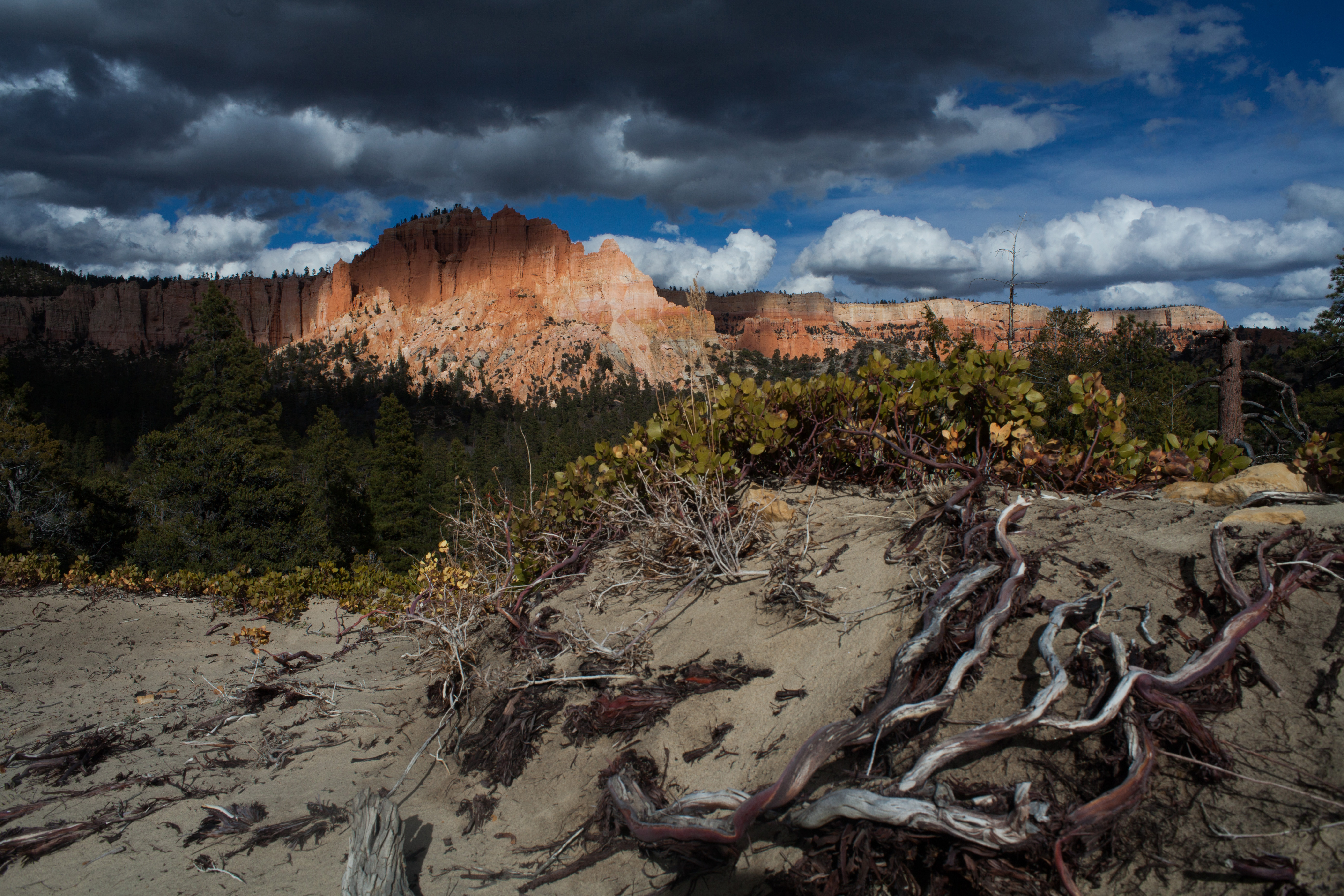
Swamp Canyon appears relatively small and sheltered from the overlook, allowing the viewer to develop a more intimate connection with the landscape than some of the grander viewpoints in the park. The Swamp Canyon Loop, which starts at the viewpoint, is more rugged than the Bryce Amphitheater trails, taking hikers into a more forested backcountry hike. There is less signage on this hike and hikers are encouraged to carry a map.
Trailhead: Swamp Canyon Viewpoint (Mile 6 on the Southern Scenic Drive)
Parking: At Swamp Canyon Viewpoint (check when parking lots are busiest ). Oversized vehicles permitted.
Distance: 4.0 mile (6.4 km)
Approximate Time: 3-4 hours
Elevation Gain: 800 feet (244 meters)
Difficulty: Moderate (less than 1000 feet elevation gain, moderate length)
Services: None.
Shuttle Service: None. Private options may be available.
This trail may be inaccessible during mid-winter due to snow depths ranging from 2-15 ft. (.7-5 m)
Pets are not allowed on this trail. Service animals are allowed in national parks. What is a service animal?
Accessibility This is a backcountry trail with natural terrain and is not considered an accessible trail. Surface Type: Firm Native Sediment Total Ascent: 800 feet (244 meters) Length: 4.0 mi (6.4km) roundtrip Service animals are allowed in national parks. What is a service animal?
Views
Along the way Swamp Canyon
Trailhead Swamp Canyon Trailhead 8,060 ft Drive there
Trailhead Tower Bridge Trailhead 7,993 ft Drive there
2-3 Hours · no dogs
Start Tower Bridge Trailhead
The Tower Bridge hike consists of the southern portion of the Fairyland Loop trail. This is an out-and-back trail that descends to a shady 1/4-mile spur trail leading to the Tower Bridge hoodoo. From there, hikers can return the way they came or continue to hike the entirety of the Fairyland Loop Trail.
Trailhead: North of Sunrise Point
Parking: Available at Sunrise Point (check when parking lots are busiest ). Oversized vehicles are not permitted in this parking area when the shuttle is in operation.
Distance: 3.0 miles (4.8 km) roundtrip
Approximate Time: 2-3 hours
Elevation Gain: 760 feet (232 meters)
Difficulty: Moderate (less than 1000 feet elevation gain, moderate length)
Services: Accessible restrooms and water-fill station available at the General Store near Sunrise Point (seasonally).
Shuttle Service: Yes.
Pets are not allowed on this trail. Service animals are allowed in national parks. What is a service animal?
Accessibility This is a backcountry trail with natural terrain and is not considered an accessible trail. Surface Type: Firm Native Sediment Total Ascent: 760 feet (232 meters) Length: 3.0 mi (4.8km) roundtrip Service animals are allowed in national parks. What is a service animal?
Trailhead Tropic Trail Trailhead / Trail End 6,904 ft Drive there
Trailhead Whiteman Connecting Trail Trailhead 8,696 ft Drive there
Views
Along the way Yovimpa Point
Trailheads Riggs Spring LoopTrailhead 9,101 ft Drive there · Yovimpa Point Trailhead 9,111 ft Drive there
4-5 Hours · no dogs · reservation required
Start Riggs Spring Loop Trailhead
The Riggs Spring Loop is a backcountry trail that begins and ends at Yovimpa Point. This trail travels through spruce, fir, and bristlecone forests offering beautiful views of distant cliffs. The western section of the trail is steeper and more heavily forested. Permits are not required to hike this trail, but all overnight stays require a permit .
Trailhead: Yovimpa Point
Parking: At trailhead; oversized vehicles permitted
Distance: 8.6 miles (13.9 km)
Approximate Time: 5 hours
Elevation Gain: 2200 feet (671 meters)
Difficulty: Strenuous
Services: Accessible restrooms available at Yovimpa Point (year-round). No water-fill stations.
Shuttle Service: None. Private options may be available.
This trail may be inaccessible during mid-winter due to snow depths ranging from 2-15 ft. (.7-5 m)
Pets are not allowed on this trail. Service animals are allowed in national parks. What is a service animal?
Backcountry camping is permitted only in designated backcountry campsites and all overnight backcountry stays require a permit.
Typically this loop is hiked in a counter-clockwise direction with a single overnight. Some backcountry hikers will combine this loop with additional nights along the Under-the-Rim Trail . For more information and reservation information visit our Backcountry Information page .
Accessibility This is a backcountry trail with natural terrain and is not considered an accessible trail. Surface Type: Firm Native Sediment Total Ascent: 2200 feet (671 meters) Length: 8.6 mi (13.9 km) roundtrip
Write-ups that name no single mapped trail, in the Service's words.
The lines are the National Park Service's public trails layer, the trailheads and the waterfalls, views, peaks and historic places along them the Service's public points of interest, read 2026-10-14 and simplified for the map. The write-ups are the Service's own "things to do", unedited. Heights come from USGS 3DEP through Terrain Tiles on AWS (Mapzen/Tilezen), read along each line and rounded; a short trail on steep ground can be off by a few tens of feet. Closures change: check the park's own site before you go.