
Timber Creek Trail
Views
Along the way Kolob Canyons Viewpoint
Trailhead Timber Creek Overlook 6,209 ft Drive there
Timber Creek Overlook the Park Service's write-up
30-60 Minutes · no dogs
Start Timber Creek Overlook Trailhead
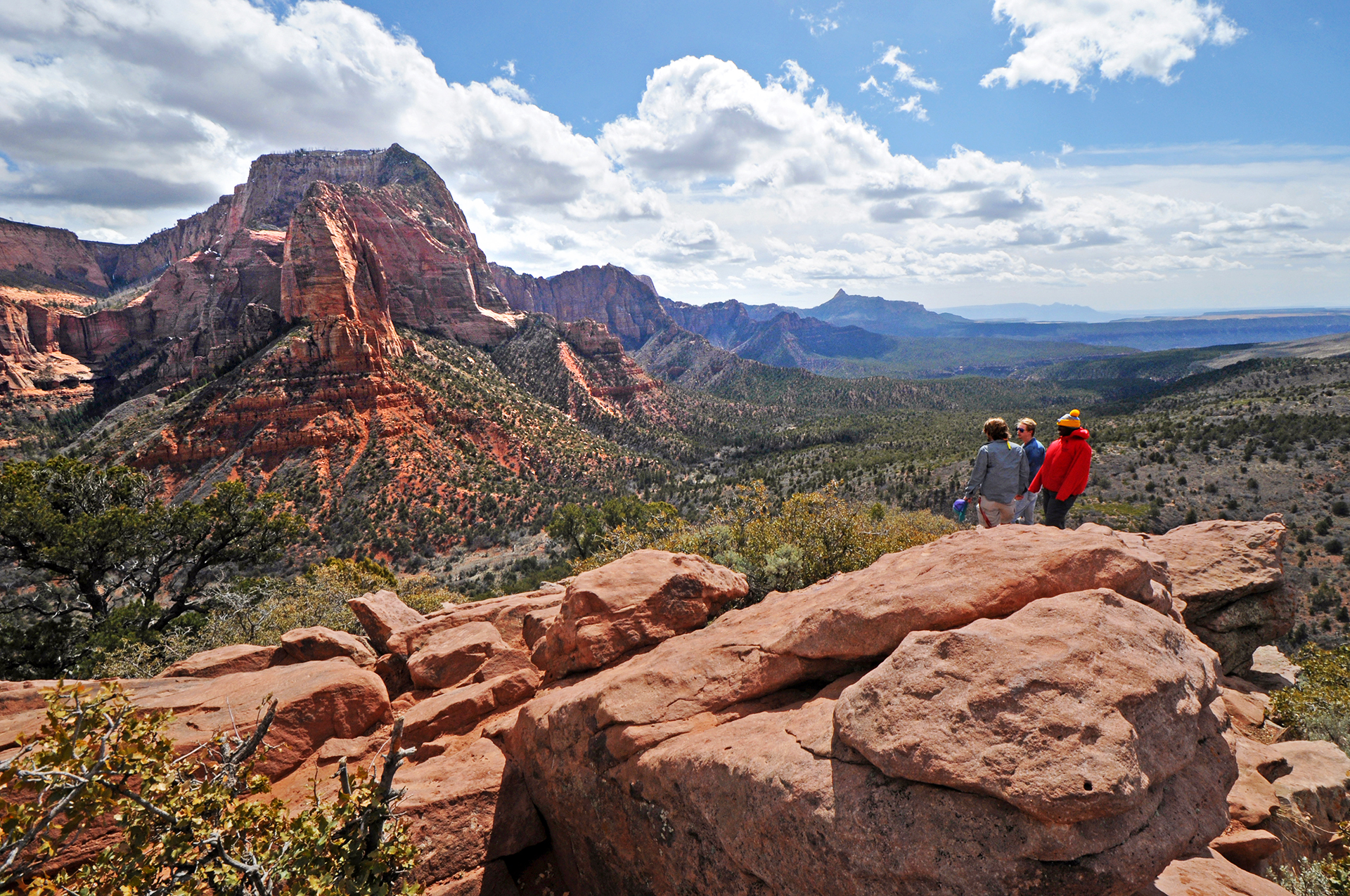
The Timber Creek Overlook Trail is a short, relatively easy trail that follows a rocky ridge with minimal elevation gain, making it perfect for a quick walk to a stunning viewpoint. A small picnic area is located a short distance from the trailhead. Unlike other trails in the area, large groups (of 12 or more people) are allowed to hike on this trail.
Once you reach the overlook, you will be rewarded with views of Shuntavi Butte, Timber Creek, Kolob Terrace, and the Pine Valley Mountains. Looking south on the far horizon, visitors may see Mount Trumbull, 100 miles away at the north rim of the Grand Canyon.
During the spring and early summer months, the Timber Creek Overlook Trail is covered in a beautiful display of desert wildflowers.
Pets Pets are not allowed on any trails in Kolob Canyons.
Accessibility Length (one way) | 0.6 mi (1 km) Elevation | Gain: 117.3 ft (35.8 m) | Loss: 103.2 ft (31.5 m) Grade | Typical: 6.8% | Maximum: 38% | 31 % of the trail is at an 8.3% or higher grade. Cross Slope | Typical: 4% | Maximum: 27.2% Tread Width | Typical: 54 in (137.8 cm) | Minimum: 6 in (15.2 cm) Surface | 98.8% of the trail is firm soil, and 1.2% is hard rock. Obstructions | Steps up to 18 in (45.7 cm) tall, with 0 in of remaining tread | Boulders making 12-in-long (30.5 cm) area where tread is 6 in (15.2 cm) wide. 30 in (76.2 cm) of remaining tread. | The dirt trail is often muddy when wet. Last assessed on March 31, 2025. Obstructions less than 7 in (17.8 cm) tall, or outside the tread area of 12 in (30.5 cm) wide by 96 in (243.8 cm) high, were not reported.