Access to Grotto Trail
Trailhead West Rim 4,273 ft Drive there

National Park · Utah
44 named trails · 72 miles · 29 trailheads · 15 with the Park Service's own write-up. The lines, trailheads and points are the Park Service's; the write-ups are the Service's own words; the climbing is read from USGS elevation along each line.
44 trails, A to Z.
Trailhead West Rim 4,273 ft Drive there
1-2 Hours · no dogs · entrance fee applies · reservation required
Start Kayenta & West Rim Trailhead
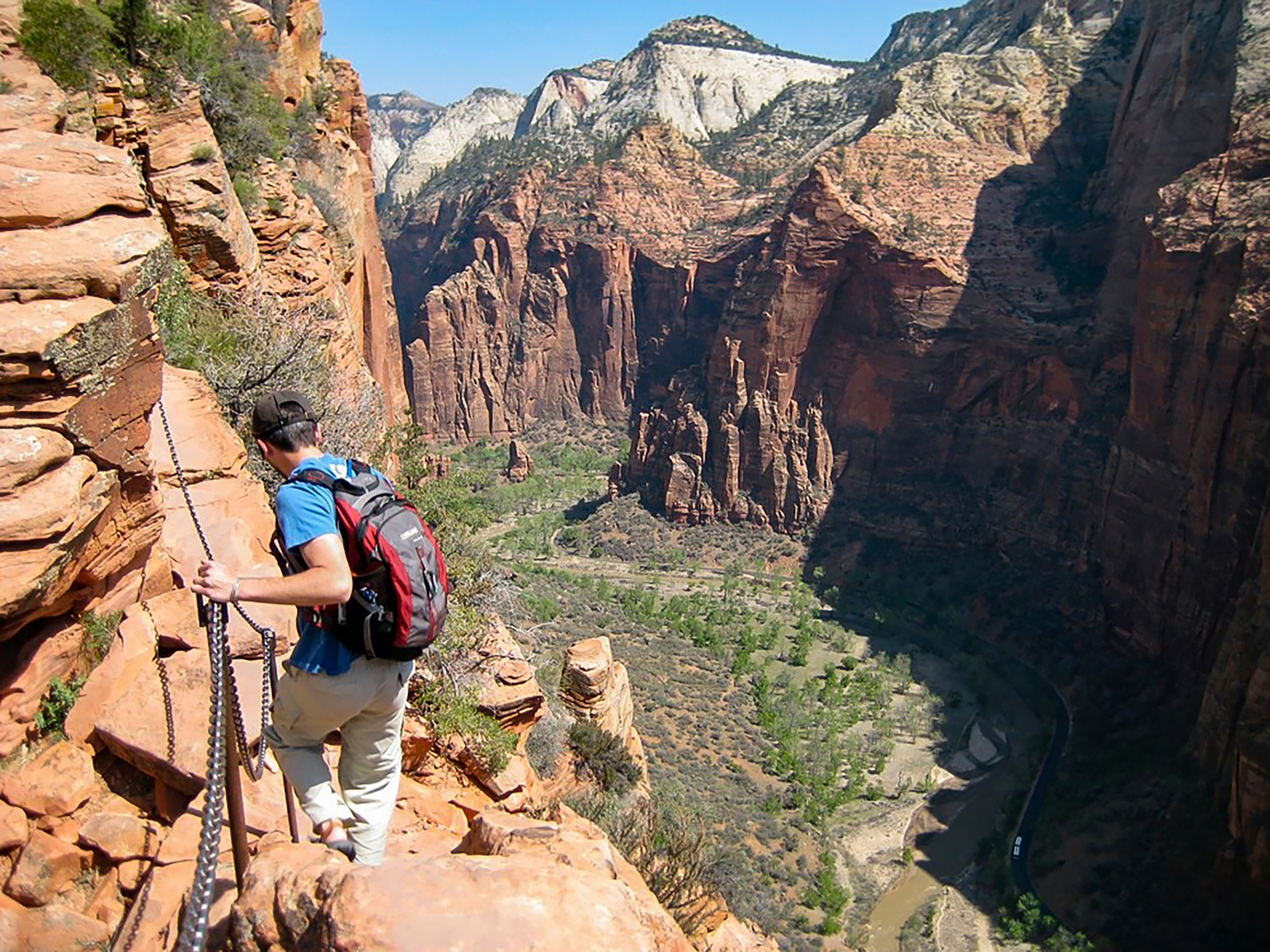
On and after April 1, 2022 hikers continuing to Angels Landing from Scout Lookout are required to have a permit , obtained on recreation.gov.
The strenuous, challenging trail follows a steep, narrow ridge with uneven steps cut into the rock and chains anchored intermittently along the route. You must navigate a trail only a few feet wide in some areas, with exposed edges and sheer drop-offs of as much as 1,000 feet on each side. Please watch your footing and exercise extreme caution at all times. Be ready to yield to other hikers, as the trail is only wide enough for one person in many places. At the end of the hike, the trail widens slightly and there are areas to rest, snack, and soak in the spectacular views of Zion Canyon.
Restrooms are available at Scout Lookout and The Grotto. Water filling stations are also available at The Grotto.
Accessibility Trail is unpaved, rocky, and less than 3 ft (1 m) wide in many sections. Chains act as handrails for multiple sections, with long drop-offs. Hiking traffic moves in both directions in limited space.
Backcountry camps
Along the way Watchman Campground, Site: 18
Trailhead Archeology 3,924 ft Drive there
Backcountry camps
Along the way Lava Point, Site: 2
Trailhead Barney's 7,667 ft Drive there
Bridges
Along the way Bridge
Trailhead Emerald Pools 4,282 ft Drive there
15-45 Minutes · no dogs
Start Weeping Rock Trailhead
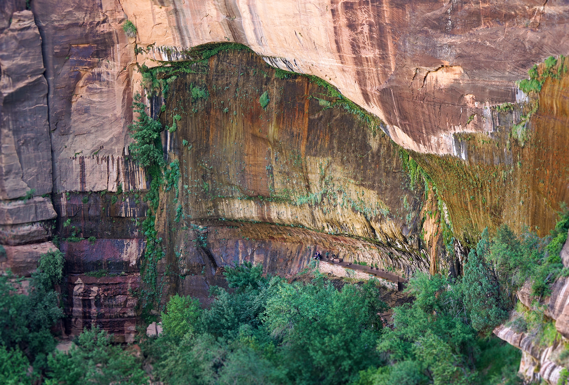
Short but steep! From the parking area, you'll cross the bridge and head to the left onto a paved trail to Weeping Rock. Along the way, look for small trailside exhibits and watch for minor drop-offs. The trail ends at a set of steps leading you to a rock alcove with dripping springs.
Pit toilets are available at the parking area.
Pets Pets are not allowed on any trail other than the Pa'rus Trail.
Accessibility Short but steep paved trail that gains 98ft (30m) of elevation in 0.4mi (0.6km). Minor drop-offs. Trail includes several stairs.
Backcountry campsCampgrounds
Along the way Lava Point, Site: 1 Lava Point, Site: 2 Lava Point, Site: 3 Lava Point, Site: 4 Lava Point, Site: 5 Lava Point, Site: 6 Lava Point Campground
Trailhead Lava Point 7,904 ft Drive there
Views
Along the way Canyon Overlook Trail
Trailhead Canyon Overlook 5,103 ft Drive there
1-2 Hours · no dogs
Start Canyon Overlook Trailhead
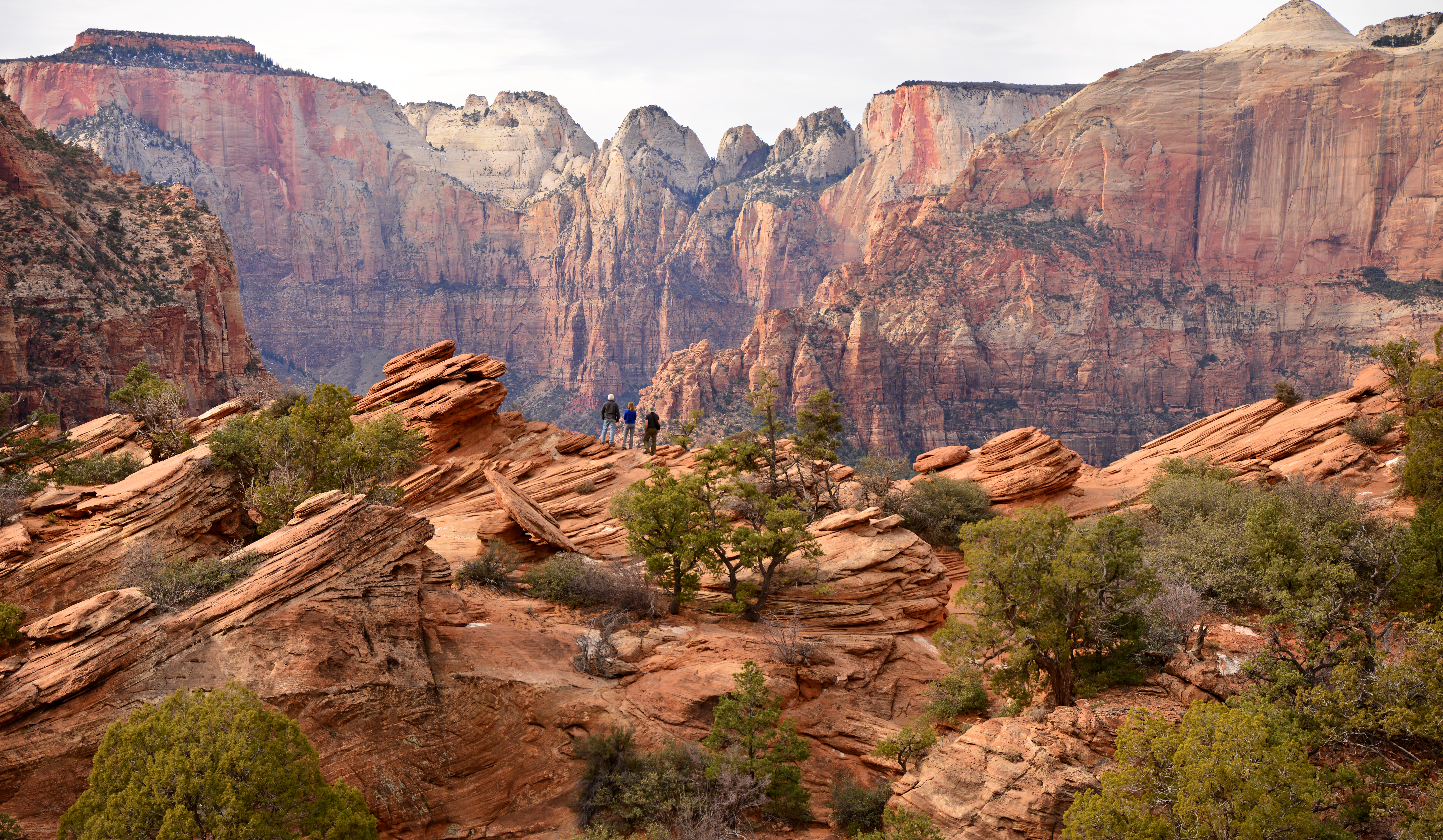
Canyon Overlook Trail is a moderate, 1 mi (1.6 km) trail on the East Side of Zion. The path begins with a series of sandstone steps with a metal handrail leading visitors over rocky terrain above a dark slot canyon. Near the end of the trail, the view opens up to an expanse of red and cream-colored slickrock. The end of the trail is marked by a fenced cliff edge facing the main Zion Canyon, with excellent views of the Towers of the Virgin. Keep an eye out for bighorn sheep along the trail.
Parking is extremely limited, be prepared to try mulitple times. Pit toilets are available in the parking area.
Accessibility Lengt h (one way) | 0.5 mi (0.8 km) Elevation | Gain: 154.2 ft (47.0 m) | Loss: 48.5 ft (14.78 m) Grade | Typical: 7.6% | Maximum: 50.4% | 23.9% of the trail is at a 10% or higher grade. Cross Slope | Typical: 4.9% | Maximum: 36.4% Tread Width | Typical: 48 in (122.4 cm) | Minimum: 12 in (30.5 cm) Surface | 73.8% of the trail is hard rock, 18.0% is firm soil, and 8.2% is soft sand Obstructions | 118.9 ft (36.2 m) of o verhanging rocks with an a verage vertical clearance of 7ft (2.1 m), minimum vertical clearance of 4 ft (1.2 m), and 30 in (76.2 cm) of remaining tread. | Staircases with steps up to 18 in (45.7 cm) tall and 0 in of remaining tread | Boulders up to 12 in (30.5 cm) tall and 0 in of remaining tread Last assessed February 20, 2025. Obstructions less than 4 in (10.2 cm) or outside of the tread area 36 in (91.4 cm) wide by 96 in (243.8 cm) high were not reported.
Views
Along the way Hop Valley Trailhead
Trailhead Hop Valley 6,376 ft Drive there
Trailhead Court of the Patriarchs 4,281 ft Drive there
Trailhead East Mesa 6,511 ft Drive there
Exhibits
Along the way Big Tooth Maple Box Elder Gambel Oak Golden Columbine Hackberry Hjllside Of Shrubs Lichens Life On The Vertical Palmer Penstemon Plant Galls Sand Sagebrush Shrub Live Oak and 3 more
Trailheads East Rim 5,736 ft Drive there · Weeping Rock 4,367 ft Drive there
Bridges
Along the way Bridge
Trailhead West Rim 4,273 ft Drive there
ViewsBackcountry camps
Along the way Hop Valley B Hop Valley Trailhead
Trailhead Hop Valley 6,376 ft Drive there
Bridges
Along the way Bridge
2-3 Hours · no dogs
Start Kayenta & West Rim Trailhead
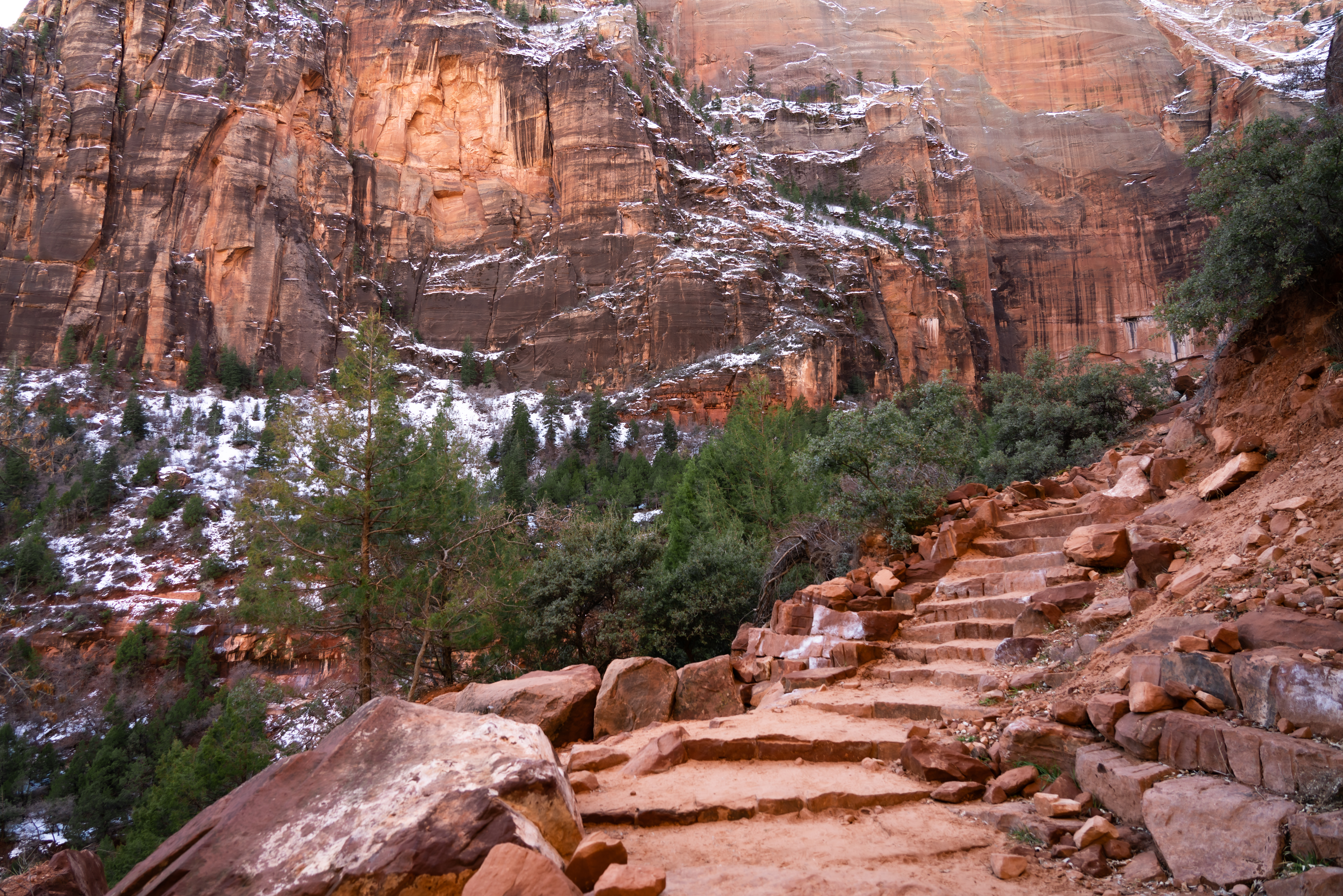
The moderate Kayenta Trail follows the Virgin River before ascending to the Lower and Upper Emerald Pool Trails. Provides panoramic views of Zion Canyon along the way. Long drop-offs are present along this trail. You can either return on the same trail, or make a loop using one of the Emerald Pools trails.
Water and restrooms are available at The Grotto .
Accessibility Length (one way) | 0.9 mi (1.4 km) Elevation | Gain: 204.1ft (62.2 m) | Loss: 101.9 ft (31.0 m) Grade | Typical: 6.7% | Maximum: 35.3% | 21.5% of the trail is at an 8.3% or higher grade. Cross Slope | Typical: 4.5% | Maximum: 20.2% Tread Width | Typical: 50 in (126.1 cm) | Minimum: 15 in (38.1 cm) Surface | 65% of the trail is firm soil, and 35% is hard concrete or rock. Obstructions | Overhanging rocks with a minimum vertical clearance of 5.3 ft (1.6 m), with 15 in (38.1 cm) of remaining tread | Staircases with steps up to 21 in (53.3 cm) tall, and 0 in of remaining tread Last assessed on March 3, 2025. Obstructions less than 12 in (30.5 cm), or outside the tread area of 12 in (30.5 cm) wide by 96 in (243.8 cm) high, were not reported.
1-2 Hours · no dogs
Start Emerald Pools Trailhead
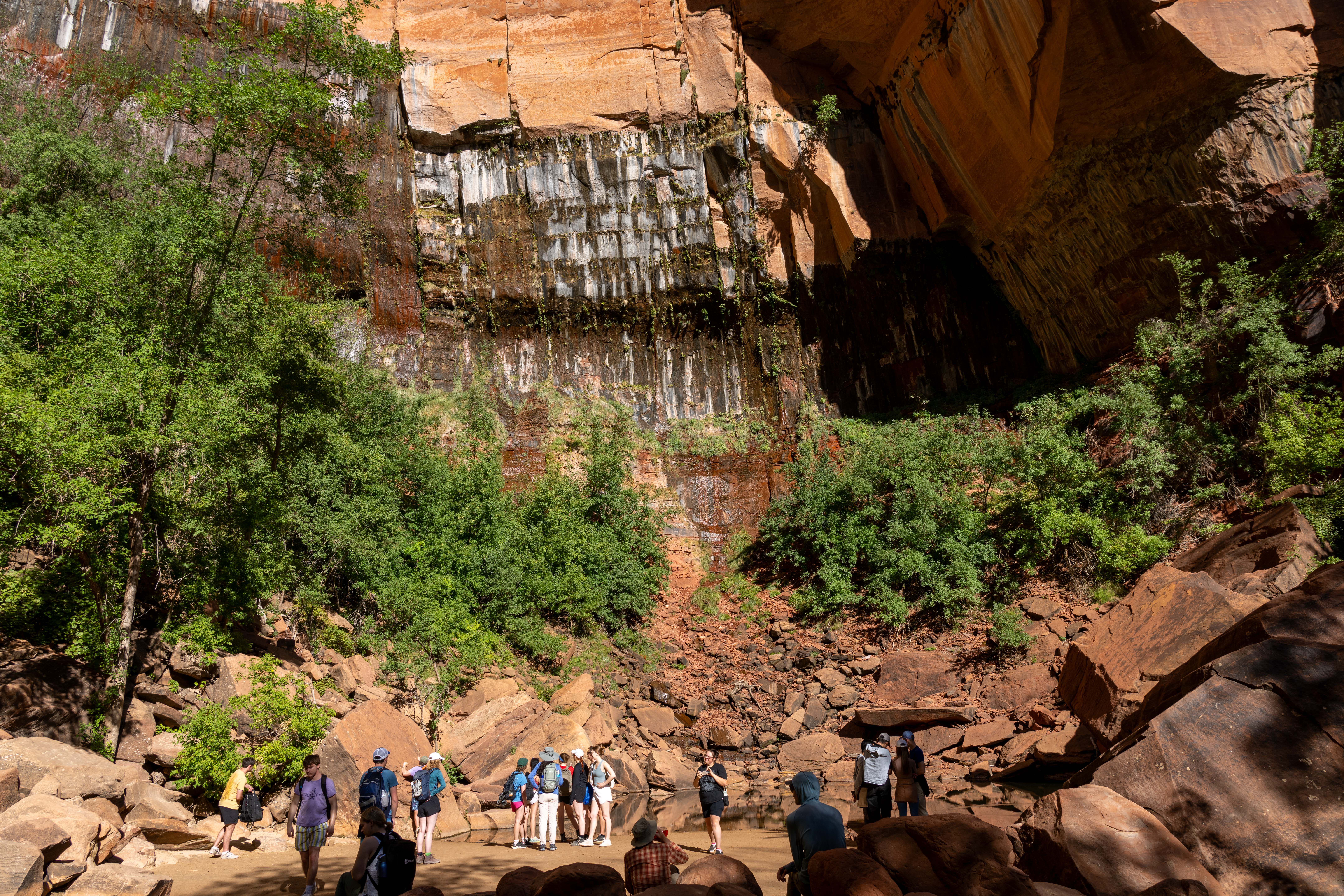
Upper Emerald Pools Trail is a moderate trail that can be accessed via the Kayenta Trail, Lower Emerald Pools Trail, or Middle Emerald Pools Trail. Climb up stone steps to a sandy path that leads through pinyon-juniper woodlands to the base of towering canyon walls which boast majestic, seasonal waterfalls. Enjoy views of canyon landmarks such as Lady Mountain and The Great White Throne along the way. The trail ends at the sandy shore of Upper Emerald Pool. The pool is fragile and an essential water source for wildlife. Do not go into the water.
Connects to the other Emerald Pools trails and the Kayenta Trail.
Restrooms and water filling stations are available at Zion Lodge and The Grotto.
Accessibility Length (one way) | 0.3 mi (0.4 km) Elevation | Gain: 75.8 ft (23.11 m) | Loss: 28.9 ft (8.81 m) Grade | Typical: 7.5% | Maximum: 37% | 25.6% of the trail is at a 10% or higher grade. Cross Slope | Typical: 5.2% | Maximum: 20.6% Tread Width | Typical: 59 in (149.0 cm) | Minimum: 12 in (30.5 cm) Surface | 45.1% of trail is hard rock, 35.8% is soft sand, and 19.1% is firm soil. Obstructions | Overhanging rock 11.3 ft (3.4 m) long with 30 in (76.2 cm) of remaining tread outside of rock zone. | Staircases with steps up to 30 in (76.2 cm) tall. Last assessed on March 20, 2025. Obstructions less than 12 in (30.5 cm) tall, or outside the tread area of 12 in (30.5 cm) wide by 96 in (243.8 cm) high, were not reported.
7-9 Hours · no dogs
Start Lee Pass Trailhead
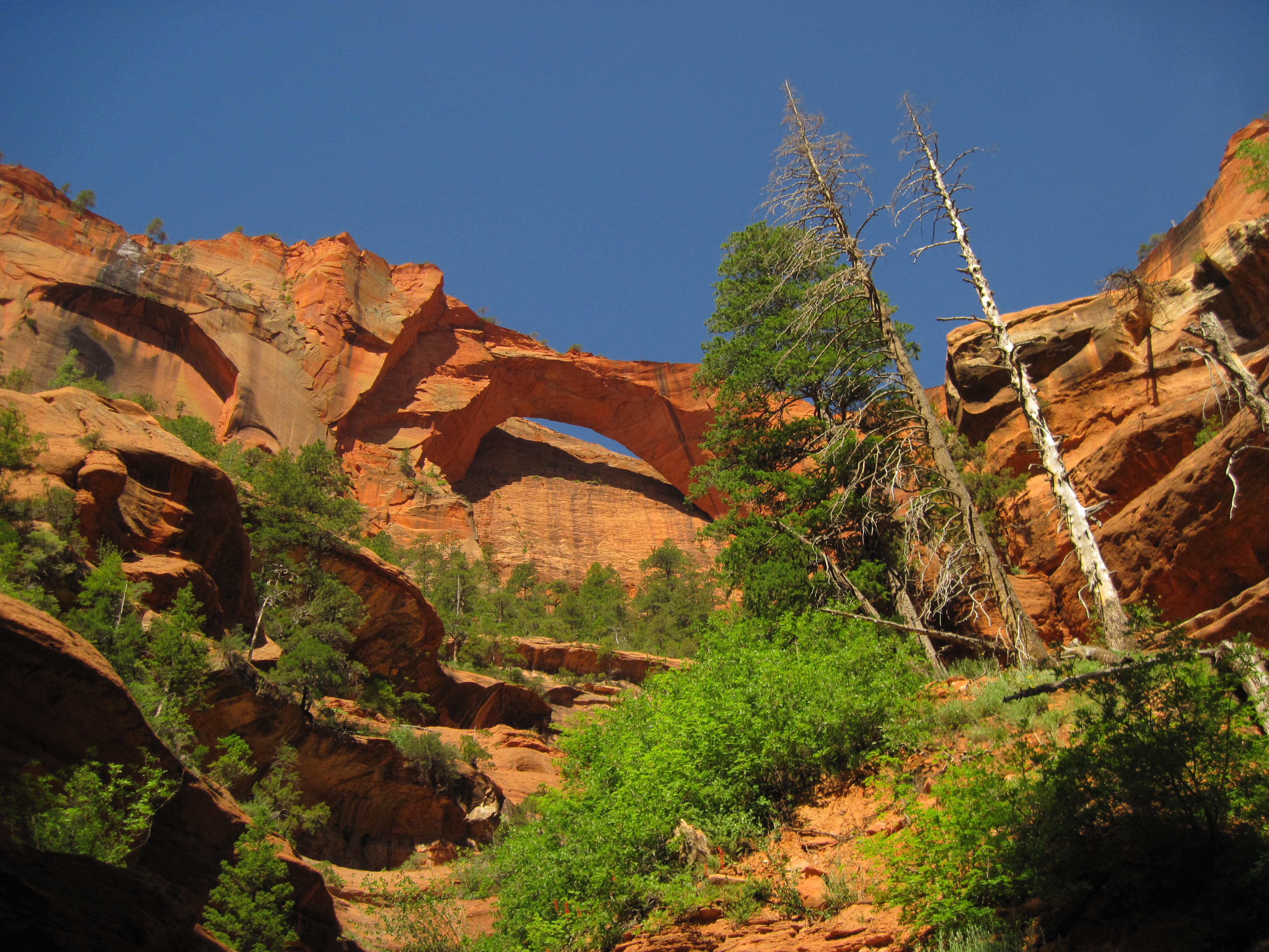
The La Verkin Creek Trail to Kolob Arch allows hikers outstanding opportunities for solitude in a primitive area of Zion Wilderness. The trail begins at Lee Pass with stunning views of the Kolob Canyons as it crosses Timber Creek and continues to descend toward La Verkin Creek. After seven miles, a spur trail leads hikers to a viewpoint where they can see Kolob Arch. With a span of 287 feet and a thickness of 75 feet, Kolob Arch is one of the world's largest natural arches.
Pets Pets are not permitted on any trails within Kolob Canyons.
Accessibility Strenuous trail with 1037ft / 316m of elevation change over 14mi / 22.5km. Rocky, sandy, uneven terrain with water crossings.
Bridges
Along the way Bridge
1-2 Hours · no dogs
Start Emerald Pools Trailhead
Upper Emerald Pools Trail is a moderate trail that can be accessed via the Kayenta Trail, Lower Emerald Pools Trail, or Middle Emerald Pools Trail. Climb up stone steps to a sandy path that leads through pinyon-juniper woodlands to the base of towering canyon walls which boast majestic, seasonal waterfalls. Enjoy views of canyon landmarks such as Lady Mountain and The Great White Throne along the way. The trail ends at the sandy shore of Upper Emerald Pool. The pool is fragile and an essential water source for wildlife. Do not go into the water.
Connects to the other Emerald Pools trails and the Kayenta Trail.
Restrooms and water filling stations are available at Zion Lodge and The Grotto.
Accessibility Length (one way) | 0.3 mi (0.4 km) Elevation | Gain: 75.8 ft (23.11 m) | Loss: 28.9 ft (8.81 m) Grade | Typical: 7.5% | Maximum: 37% | 25.6% of the trail is at a 10% or higher grade. Cross Slope | Typical: 5.2% | Maximum: 20.6% Tread Width | Typical: 59 in (149.0 cm) | Minimum: 12 in (30.5 cm) Surface | 45.1% of trail is hard rock, 35.8% is soft sand, and 19.1% is firm soil. Obstructions | Overhanging rock 11.3 ft (3.4 m) long with 30 in (76.2 cm) of remaining tread outside of rock zone. | Staircases with steps up to 30 in (76.2 cm) tall. Last assessed on March 20, 2025. Obstructions less than 12 in (30.5 cm) tall, or outside the tread area of 12 in (30.5 cm) wide by 96 in (243.8 cm) high, were not reported.
1-2 Hours · no dogs
Start Emerald Pools Trailhead
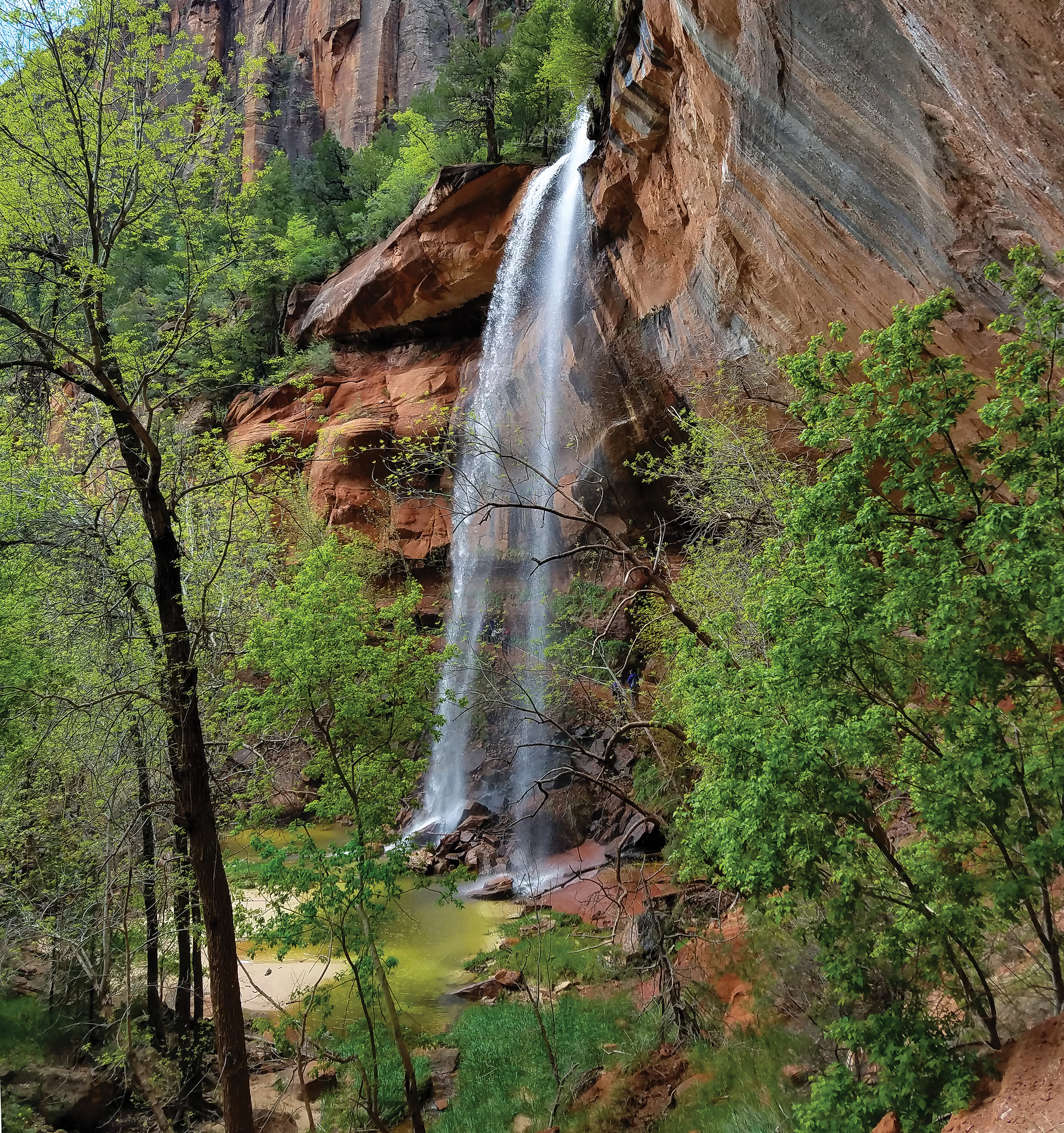
Lower Emerald Pool trail is a rough, paved trail that leads through pinyon-juniper woodland to the Lower Emerald Pool and ephemeral waterfalls.The pools are fragile and an essential water source for wildlife. Do not go into the water.
Connects to the other Emerald Pools trails and the Kayenta Trail.
Avoid cliff edges. Swimming is not permitted. Restrooms and water filling stations are available at the Zion Lodge.
Accessibility Length (one way) | 0.6 mi (1.0 km) Elevation | Gain: 131.1 ft (40.0 m) | Loss: 96.4 ft (29.38 m) Grade | Typical: 7.1% | Maximum: 25.3% | 34.4% of the trail is at a 8.3% or higher grade. Cross Slope | Typical: 3.6% | Maximum: 17.1% | 18.9% of trail has a cross slope of 6% or higher. Tread Width | Typical: 62 in (157.8 cm) | Minimum: 30 in (76.2 cm). 25 ft (7.6 m) of the trail is this width. Surface | 96.2% of the trail is hard concrete, and 3.8% is firm soil. Obstructions | Bridge with minimum tread width of 45 in (114.3 cm). | Gaps in concrete up to 2 in (5.1 cm) long. Last assessed on March 20, 2025. Obstructions less than 12 in (30.5 cm) tall, or outside the tread area of 12 in (30.5 cm) wide by 96 in (243.8 cm) high, were not reported.
1-2 Hours · no dogs
Start Emerald Pools Trailhead
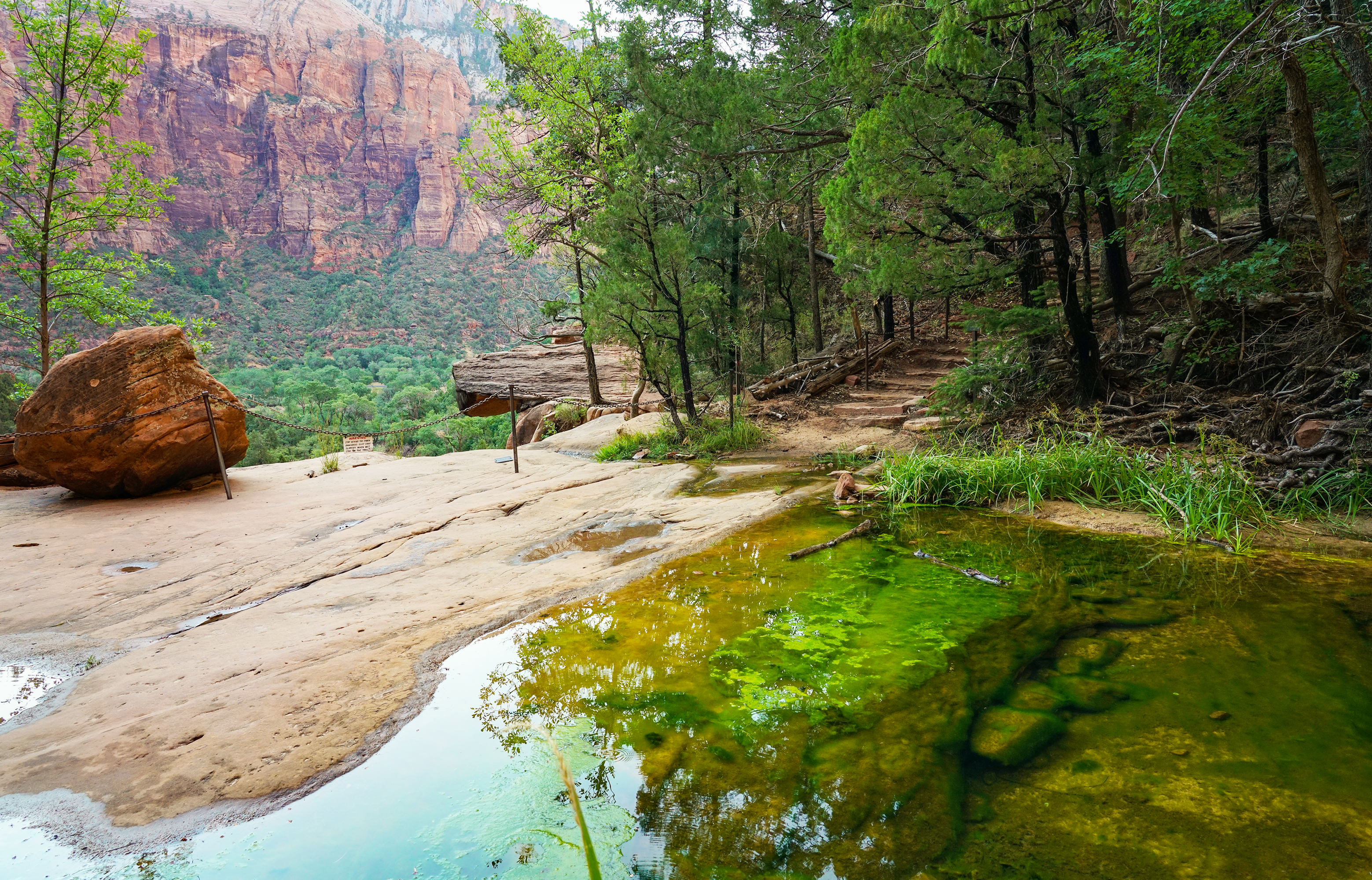
Middle Emerald Pools Trail is a moderate hike along an unpaved sandstone ledge above the Lower Emerald Pool Trail. The initial ascent is quite steep, bringing you to expansive views of main Zion Canyon below. Further along the trail, tucked into the red sandstone of the mountain, enjoy the shade and flora of pinyon-juniper woodlands. The trail then descends to emerald-colored pools of water above the small ephemeral waterfalls of Lower Emerald Pool Trail. The pools are fragile and an essential water source for wildlife. Do not go into the water.
Connects to the other Emerald Pools trails and the Kayenta Trail.
Avoid cliff edges. Swimming is not permitted. Restrooms and water filling stations are available at the Zion Lodge.
Accessibility Length (one way) | 0.9 mi (1.4 km) Elevation | Gain: 332.8 ft (101.4 m) | Loss: 152.2 ft (46.4 m) Grade | Typical: 10.3% | Maximum: 38.1% | 44.8% of the trail is at a 10% or higher grade. Cross Slope | Typical: 4.4% | Maximum: 20.1% Tread Width | Typical: 57 in (144.2 cm) | Minimum: 20 in (50.8 cm) Surface | 79.7% of the trail is firm soil, 18.7% is hard rock or concrete, and 1.6% is soft sand. Obstructions | Bridge with minimum tread width of 45 in (114.3 cm) | Staircases with steps up to 10 in (25.4 cm) tall, and 0 in of remaining tread Last assessed on March 20, 2025. Obstructions less than 12 in (30.5 cm) tall, or outside the tread area of 12 in (30.5 cm) wide by 96 in (243.8 cm) high, were not reported.
1-2 Hours · no dogs
Start Emerald Pools Trailhead
Upper Emerald Pools Trail is a moderate trail that can be accessed via the Kayenta Trail, Lower Emerald Pools Trail, or Middle Emerald Pools Trail. Climb up stone steps to a sandy path that leads through pinyon-juniper woodlands to the base of towering canyon walls which boast majestic, seasonal waterfalls. Enjoy views of canyon landmarks such as Lady Mountain and The Great White Throne along the way. The trail ends at the sandy shore of Upper Emerald Pool. The pool is fragile and an essential water source for wildlife. Do not go into the water.
Connects to the other Emerald Pools trails and the Kayenta Trail.
Restrooms and water filling stations are available at Zion Lodge and The Grotto.
Accessibility Length (one way) | 0.3 mi (0.4 km) Elevation | Gain: 75.8 ft (23.11 m) | Loss: 28.9 ft (8.81 m) Grade | Typical: 7.5% | Maximum: 37% | 25.6% of the trail is at a 10% or higher grade. Cross Slope | Typical: 5.2% | Maximum: 20.6% Tread Width | Typical: 59 in (149.0 cm) | Minimum: 12 in (30.5 cm) Surface | 45.1% of trail is hard rock, 35.8% is soft sand, and 19.1% is firm soil. Obstructions | Overhanging rock 11.3 ft (3.4 m) long with 30 in (76.2 cm) of remaining tread outside of rock zone. | Staircases with steps up to 30 in (76.2 cm) tall. Last assessed on March 20, 2025. Obstructions less than 12 in (30.5 cm) tall, or outside the tread area of 12 in (30.5 cm) wide by 96 in (243.8 cm) high, were not reported.
Views
Along the way Taylor Creek Trailhead
Trailhead Taylor Creek 5,477 ft Drive there
Bridges
Along the way Bridge
Views
Along the way Northgate Peaks Viewpoint
Bridges
Along the way Bridge
30-120 Minutes · dogs allowed
Start Pa'rus Trailhead
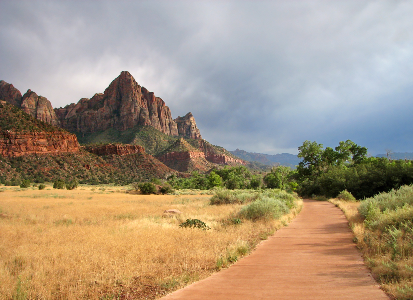
"Pa’rus" is Paiute for “bubbling water.” The Pa’rus Trail follows the Virgin River and has some of the best views of the Watchman. The paved trail connects the Zion Canyon Visitor Center and Canyon Junction. It is accessible for wheelchairs, pets on leashes, and bicycles. Trailside exhibits cover a variety of subjects, including plant and animal life along the river, geology, and human history.
The Pa'rus makes a good location for watching the sunset, stargazing, and astrophotography.
Access this trail from the Museum (Shuttle Stop #2) by using a short connector trail that is not designed for wheelchairs and not approved for bikes or pets.
Restrooms and water filling stations are available at the Visitor Center.
Accessibility Length (one way) | 1.6 mi (2.5 km) Elevation | Gain: 151.7 ft (46.3 m) | Loss: 62.7 ft (19.12 m) Grade | Typical: 2.6% | Maximum: 11.4% | 1.2% of the trail is at an 8.3% or higher grade. Cross Slope | Typical: 2.1% | Maximum: 8.8% Tread Width | Typical: 120 in (304.7 cm) | Minimum: 96 in (243.8 cm) Surface | 93.6% of the trail is paved and 6.4% is hard wood decking. Obstructions | Bridges (5) 120 in (304.8 cm) wide and 416 - 1744 in (1056.6 - 4429.8 cm) long, with gaps in decking up to 3 in (2.5 cm) wide | Post in trail leaving 60 in (152.4 cm) of remaining tread | Tripping hazards 1 - 2 in (2.5 - 5 cm) tall, with 0 in of remaining tread Last assessed on January 13, 2025. Obstructions less than 0.5 in tall, or outside the tread area of 120 in (304.8 cm) wide by 96 in (243.8 cm), high were not reported.
Bridges
Along the way Bridge
Trailheads Emerald Pools 4,282 ft Drive there · Grotto 4,298 ft Drive there
Bridges
Along the way Bridge
Trailhead Riverside Walk 4,434 ft Drive there
1-2 Hours · no dogs
Start Riverside Walk Trailhead
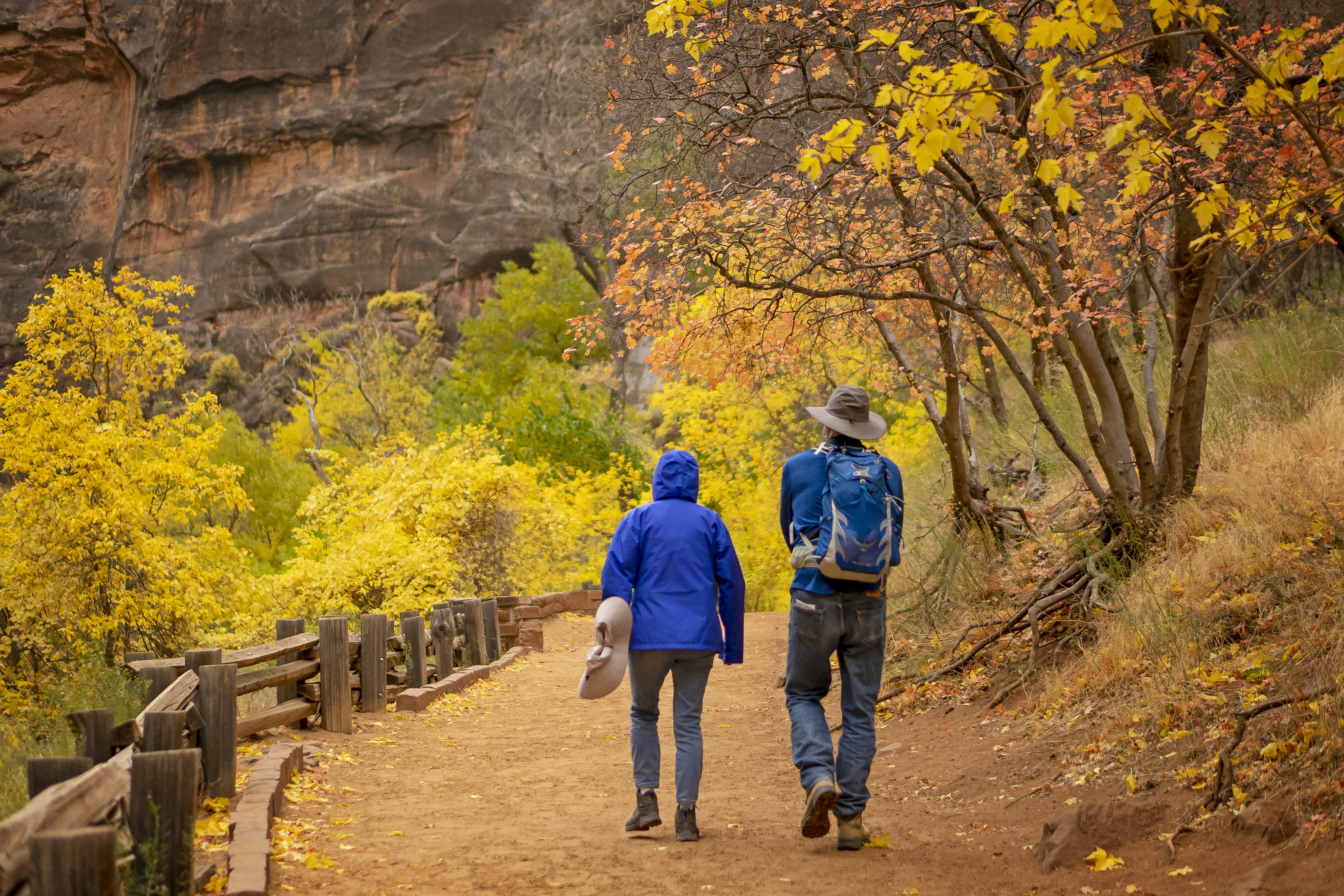
The Riverside Walk is a relatively flat and paved trail in the northern end of Zion Canyon. This easy trail follows the Virgin River as the sheer sandstone walls narrow in around you. The Riverside Walk is mostly flat through the first half-mile, although paving is irregular in some sections and minor drop-offs are present.
Look for exhibits along the trail to learn about canyon carving, erosion, and the ecological richness of this area.
This trail also leads to The Narrows. If you wish to stay dry, you can turn around at the end of the paved trail.
Water and restrooms are available at the Temple of Sinawava.
Accessibility Length (one way) | 1 mi (1.6 km) Elevation | Gain: 154.2 ft (47.0 m) | Loss: 48.5 ft (14.8 m) Grade | Typical: 4.6% | Maximum: 25.9% | 17.5% of the trail is at a 8.3% or higher grade. Cross Slope | Typical: 1.7% | Maximum: 7.6% | 18% of the trail has a cross slope of 3% or higher. Tread Width | Typical: 77 in (194.9 cm) | Minimum: 50 in (127 cm) Surface | 100% of the trail is concrete. Some sections may be slippery from sand. Obstructions | Overhanging rocks 7 ft (2.1 m) long, with a minimum vertical clearance of 4 ft (1.2 m), and 48 in (121.9 cm) of remaining tread Last assessed on February 24, 2025. Obstructions less than 4 in (10.2 cm) tall, or outside the tread area of 36 in (91.4 cm) wide by 96 in (243.8 cm), high were not reported.
1-8 Hours · no dogs
Start Riverside Walk Trailhead
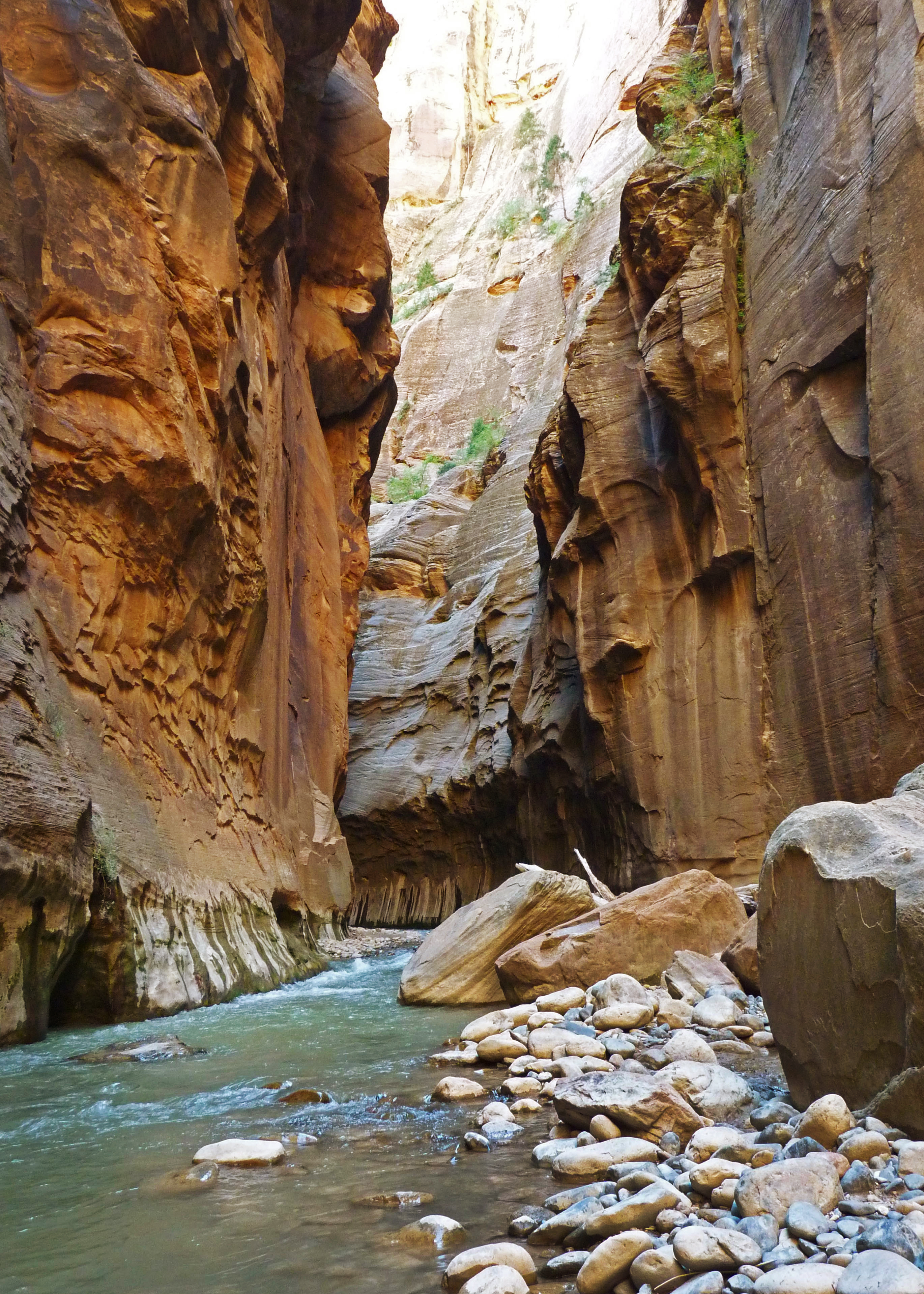
The Narrows is a strenuous hike that follows the Virgin River through a narrow slot canyon. After 1 mile (0.6 km) on the easy, paved Riverside Walk, head down a set of stairs and into the river. The rest of your hike will take place in the Virgin River, where the flow rate can change day by day and the streambed is rocky with unstable footing. Flash flooding and hypothermia are constant dangers. The hike requires wading, walking, and sometimes swimming in the river.
Good planning, proper equipment, and sound judgment are essential for a safe and successful hike. There is no formal destination, so remember to turn around before you feel tired so you can safely finish your hike the same way you came.
No permit is required for this day hike, but travel beyond Big Spring and up Orderville Canyon requires a Wilderness permit.
Water and restrooms are available at the Temple of Sinawava.
Accessibility The river is the trail. River rocks are slippery and uneven. Water depth is variable from ankle to chest height. The route is in shade for most of the day, even in summer.
1-4 Hours · no dogs
Start Emerald Pools Trailhead
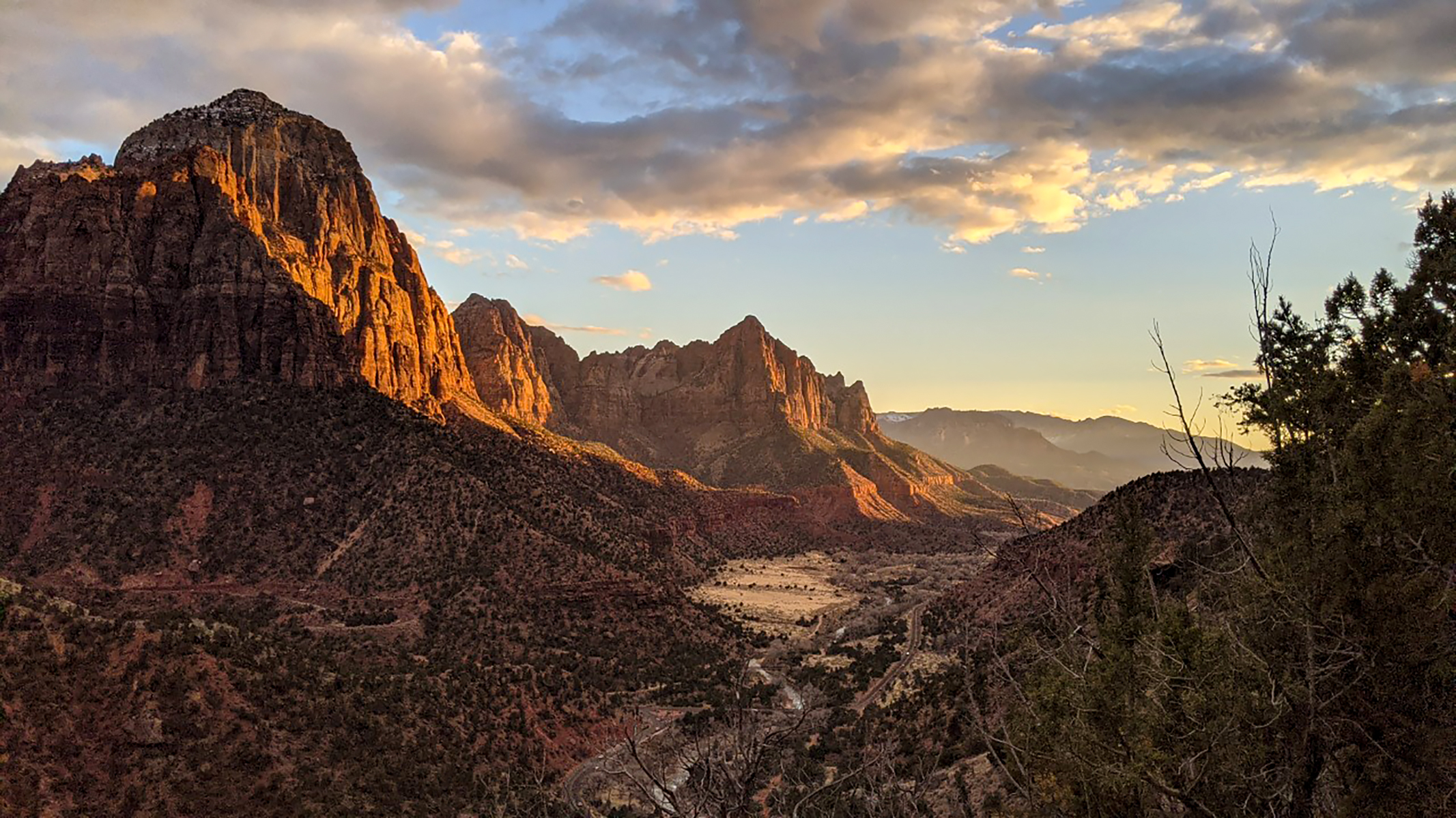
The Sand Bench Trail travels atop the remains of an ancient rockfall. This trail leads hikers along the Virgin River and then ascends a landslide that dammed the Virgin River 8,000 years ago and created a lake that extended to Angels Landing. This trail is a commercial horse trail from March to October, and it receives little shade in the hot, summer sun. Winter travel is possible, but watch for patches of ice.
Water and restrooms are available at The Zion Lodge .
Accessibility From Court of the Patriarchs to Zion Lodge Length (one way) | 1.5 (2.4 km) Elevation | Gain: 206.7 ft (63.0 m) | Loss: 235.2 ft (71.7 m) Grade | Typical: 5.5% | Maximum: 32.3% | 22.7% of the trail is at an 8.3% or higher grade. Cross Slope | Typical: 3.8% | Maximum: 23.1% Tread Width | Typical: 60 in (153.5 cm) | Minimum: 15 in (38.1 cm) Surface | 84.3% of the trail is firm soil, 10.3% is very soft sand, 3.9% is soft sand, and 1.5% is hard rock. Obstructions | Bridge 45 in (114.3 cm) wide | Steps up to 9 in (22.9 cm) tall Loop Trail from Court of the Patriarchs Length (round-trip) | 3.9 mi (6.3 km) Elevation | Gain: 1037.6 ft (316.2 m) | Loss: 748 ft (228.0 m) Grade | Typical: 8.7% | Maximum: 36% | 35.6% of the trail is at a 10% or higher grade. Cross Slope | Typical: 3.6% | Maximum: 22.8% Tread Width | Typical: 46 in (116.9 cm) | Minimum: 6 in (15.2 cm) Surface | 7.7% of the trail is hard rock, 19.3% is firm soil, 6.4% is soft soil, and 66.6% is very soft sand. Obstructions | Bridge 45 in (114.3 cm) wide | Creek crossing: Water level changes seasonally. Crossing through shallow water may be required. | Steps up to 21 in (53.3 cm) tall, with 0 in remaining tread Last assessed on March 19, 2025. Obstructions less than 7 in (17.8 cm) tall, or outside the tread area of 20 in (50.8 cm) wide by 96 in (243.8 cm) high, were not reported.
Backcountry camps
Along the way West Rim 9
Trailhead Stave Spring 6,443 ft Drive there
Backcountry camps
Along the way West Rim 1
Views
Along the way Kolob Canyons Viewpoint
Trailhead Timber Creek Overlook 6,209 ft Drive there
30-60 Minutes · no dogs
Start Timber Creek Overlook Trailhead
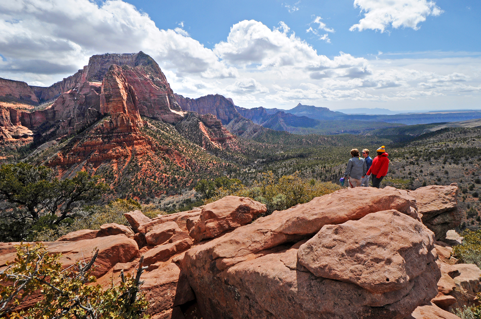
The Timber Creek Overlook Trail is a short, relatively easy trail that follows a rocky ridge with minimal elevation gain, making it perfect for a quick walk to a stunning viewpoint. A small picnic area is located a short distance from the trailhead. Unlike other trails in the area, large groups (of 12 or more people) are allowed to hike on this trail.
Once you reach the overlook, you will be rewarded with views of Shuntavi Butte, Timber Creek, Kolob Terrace, and the Pine Valley Mountains. Looking south on the far horizon, visitors may see Mount Trumbull, 100 miles away at the north rim of the Grand Canyon.
During the spring and early summer months, the Timber Creek Overlook Trail is covered in a beautiful display of desert wildflowers.
Pets Pets are not allowed on any trails in Kolob Canyons.
Accessibility Length (one way) | 0.6 mi (1 km) Elevation | Gain: 117.3 ft (35.8 m) | Loss: 103.2 ft (31.5 m) Grade | Typical: 6.8% | Maximum: 38% | 31 % of the trail is at an 8.3% or higher grade. Cross Slope | Typical: 4% | Maximum: 27.2% Tread Width | Typical: 54 in (137.8 cm) | Minimum: 6 in (15.2 cm) Surface | 98.8% of the trail is firm soil, and 1.2% is hard rock. Obstructions | Steps up to 18 in (45.7 cm) tall, with 0 in of remaining tread | Boulders making 12-in-long (30.5 cm) area where tread is 6 in (15.2 cm) wide. 30 in (76.2 cm) of remaining tread. | The dirt trail is often muddy when wet. Last assessed on March 31, 2025. Obstructions less than 7 in (17.8 cm) tall, or outside the tread area of 12 in (30.5 cm) wide by 96 in (243.8 cm) high, were not reported.
1-2 Hours · no dogs
Start Emerald Pools Trailhead
Upper Emerald Pools Trail is a moderate trail that can be accessed via the Kayenta Trail, Lower Emerald Pools Trail, or Middle Emerald Pools Trail. Climb up stone steps to a sandy path that leads through pinyon-juniper woodlands to the base of towering canyon walls which boast majestic, seasonal waterfalls. Enjoy views of canyon landmarks such as Lady Mountain and The Great White Throne along the way. The trail ends at the sandy shore of Upper Emerald Pool. The pool is fragile and an essential water source for wildlife. Do not go into the water.
Connects to the other Emerald Pools trails and the Kayenta Trail.
Restrooms and water filling stations are available at Zion Lodge and The Grotto.
Accessibility Length (one way) | 0.3 mi (0.4 km) Elevation | Gain: 75.8 ft (23.11 m) | Loss: 28.9 ft (8.81 m) Grade | Typical: 7.5% | Maximum: 37% | 25.6% of the trail is at a 10% or higher grade. Cross Slope | Typical: 5.2% | Maximum: 20.6% Tread Width | Typical: 59 in (149.0 cm) | Minimum: 12 in (30.5 cm) Surface | 45.1% of trail is hard rock, 35.8% is soft sand, and 19.1% is firm soil. Obstructions | Overhanging rock 11.3 ft (3.4 m) long with 30 in (76.2 cm) of remaining tread outside of rock zone. | Staircases with steps up to 30 in (76.2 cm) tall. Last assessed on March 20, 2025. Obstructions less than 12 in (30.5 cm) tall, or outside the tread area of 12 in (30.5 cm) wide by 96 in (243.8 cm) high, were not reported.
Backcountry campsVisitor centersBridges
Along the way Watchman Campground, Site: 10 Watchman Campground, Site: 11 Watchman Campground, Site: 12 Watchman Campground, Site: 13 Watchman Campground, Site: 14 Watchman Campground, Site: 15 Watchman Campground, Site: 16 Watchman Campground, Site: 16 Watchman Campground, Site: 16 Watchman Campground, Site: 16 Watchman Campground, Site: 2 Watchman Campground, Site: 3 and 14 more
Trailheads Archeology 3,924 ft Drive there · Watchman 3,906 ft Drive there
Backcountry camps
Along the way South Campground, Site: 68 South Campground, Site: 71 South Campground, Site: 72 South Campground, Site: 74 South Campground, Site: 77
Trailhead Watchman 3,906 ft Drive there
30-120 Minutes · dogs allowed
Start Pa'rus Trailhead
"Pa’rus" is Paiute for “bubbling water.” The Pa’rus Trail follows the Virgin River and has some of the best views of the Watchman. The paved trail connects the Zion Canyon Visitor Center and Canyon Junction. It is accessible for wheelchairs, pets on leashes, and bicycles. Trailside exhibits cover a variety of subjects, including plant and animal life along the river, geology, and human history.
The Pa'rus makes a good location for watching the sunset, stargazing, and astrophotography.
Access this trail from the Museum (Shuttle Stop #2) by using a short connector trail that is not designed for wheelchairs and not approved for bikes or pets.
Restrooms and water filling stations are available at the Visitor Center.
Accessibility Length (one way) | 1.6 mi (2.5 km) Elevation | Gain: 151.7 ft (46.3 m) | Loss: 62.7 ft (19.12 m) Grade | Typical: 2.6% | Maximum: 11.4% | 1.2% of the trail is at an 8.3% or higher grade. Cross Slope | Typical: 2.1% | Maximum: 8.8% Tread Width | Typical: 120 in (304.7 cm) | Minimum: 96 in (243.8 cm) Surface | 93.6% of the trail is paved and 6.4% is hard wood decking. Obstructions | Bridges (5) 120 in (304.8 cm) wide and 416 - 1744 in (1056.6 - 4429.8 cm) long, with gaps in decking up to 3 in (2.5 cm) wide | Post in trail leaving 60 in (152.4 cm) of remaining tread | Tripping hazards 1 - 2 in (2.5 - 5 cm) tall, with 0 in of remaining tread Last assessed on January 13, 2025. Obstructions less than 0.5 in tall, or outside the tread area of 120 in (304.8 cm) wide by 96 in (243.8 cm), high were not reported.
1-2 Hours · no dogs
Start Watchman Trailhead
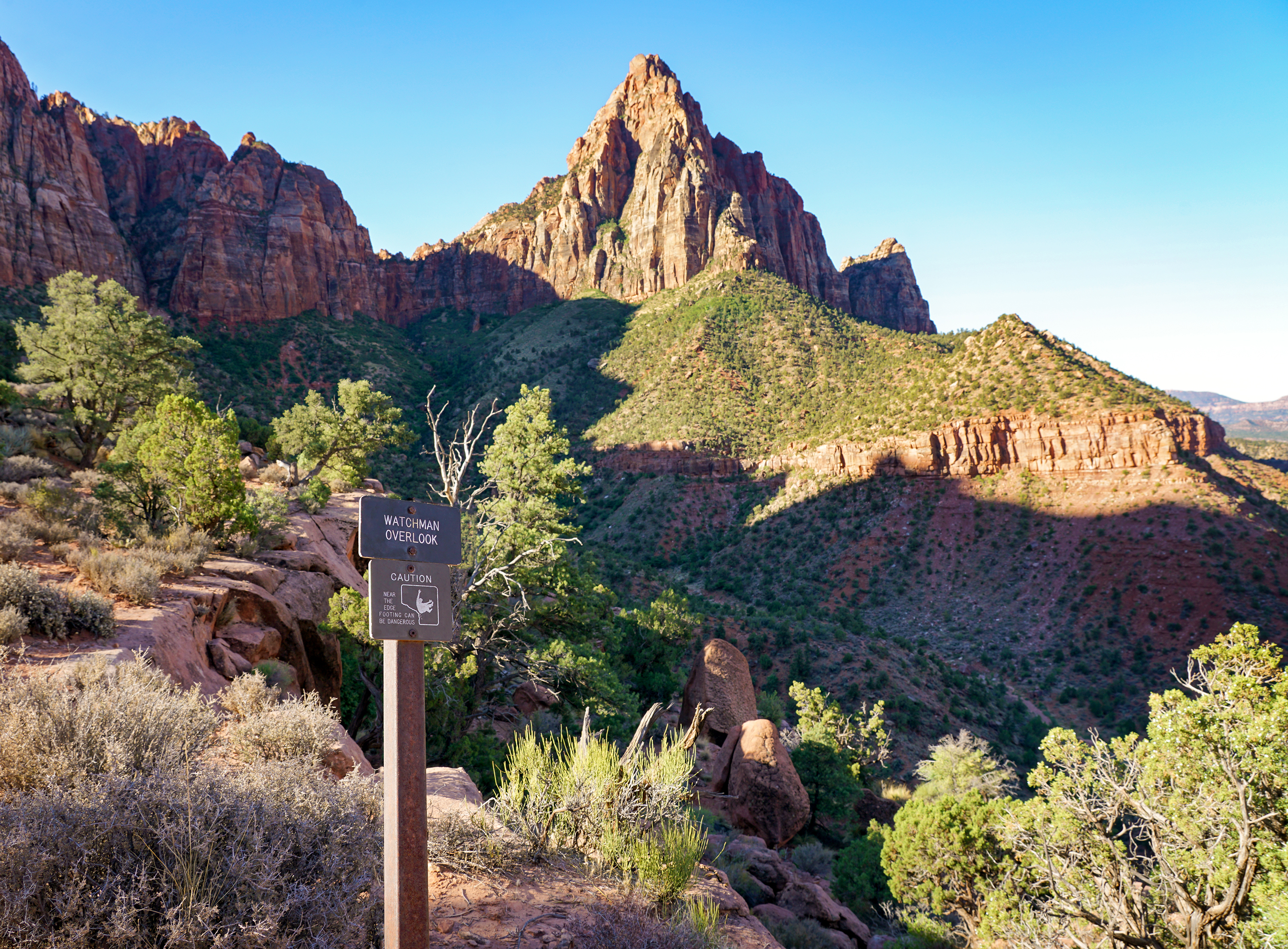
The Watchman Trail is a moderate out-and-back hike accessed from the Zion Canyon Visitor Center. To reach the trailhead, follow the sidewalk through the Visitor Center plaza and past the shuttle stop to the crosswalk. Stay along the river to begin the trail.
From the relatively flat beginning section of trail by the river, this unpaved trail climbs to a magnificent viewpoint of the Watchman, Temples and Towers, lower Zion Canyon, and the Town of Springdale. The terrain is sandy, rocky, and uneven, with several moderate drop-offs.
Restrooms and water filling stations are available at the Visitor Center.
Bikes are not permitted.
Accessibility Watchman Trail to Overlook Length (one way) | 1.4 mi (2.3 km) Elevation | Gain: 479.4 ft (146.1 m) | Loss: 78.1 ft (23.8 m) Grade | Typical: 7.4% | Maximum: 39.4% | 34 % of the trail is at an 8.3% or higher grade. Cross Slope | Typical: 4.8% | Maximum: 36.8% Tread Width | Typical: 77 in (195.6 cm) | Minimum: 12 in (30.5 cm) Surface | 2.2% of the trail is paved, 58.8% is hard rock, 37.4% is firm soil, and 1.6% is soft soil. Obstructions | Steps up to 24 in (61 cm) tall, with 0 in of remaining tread | Overhanging rocks 20 ft (6.1 m) long with a minimum vertical clearance of 7 ft (2.1 m). There are 20 in (50.8 cm) of remaining tread, Loop Trail from Overlook Length (one way, counterclockwise) | 0.4 mi (0.7 km) Elevation | Gain: 80.4 ft (24.52 m) | Loss: 64.6 ft (19.68 m) Grade | Typical: 6.6% | Maximum: 31.5% | 28.8% of the trail is at an 8.3% or higher grade. Cross Slope | Typical: 3.6% | Maximum: 18% Tread Width | Typical: 34 in (85.9 cm) | Minimum: 12 in (30.5 cm) Surface | 73% of the trail is firm soil, and 27% is hard rock. Obstructions | Steps up to 12 in (30.5 cm) tall, with 0 in remaining tread. Last assessed on 01-15-2025. Obstructions less than 4 in (10.2 cm) tall, or outside the tread area of 36 in (91.4 cm) wide by 96 in (243.8 cm) high, were not reported.
Exhibits
Along the way Big Tooth Maple Box Elder Gambel Oak Golden Columbine Hackberry Hanging Gardens Hjllside Of Shrubs Lichens Life On The Vertical Oregon Grape Palmer Penstemon Plant Galls and 8 more
Trailhead Weeping Rock 4,367 ft Drive there
15-45 Minutes · no dogs
Start Weeping Rock Trailhead
Short but steep! From the parking area, you'll cross the bridge and head to the left onto a paved trail to Weeping Rock. Along the way, look for small trailside exhibits and watch for minor drop-offs. The trail ends at a set of steps leading you to a rock alcove with dripping springs.
Pit toilets are available at the parking area.
Pets Pets are not allowed on any trail other than the Pa'rus Trail.
Accessibility Short but steep paved trail that gains 98ft (30m) of elevation in 0.4mi (0.6km). Minor drop-offs. Trail includes several stairs.
ViewsBackcountry campsBridges
Along the way West Rim 2 West Rim 3 West Rim 4 West Rim 5 West Rim 6 West Rim 7 Bridge West Rim Trailhead
Trailhead Lava Point 7,469 ft Drive there
3-4 Hours · no dogs
Start Kayenta & West Rim Trailhead

The strenuous West Rim Trail ascends ~1,000 ft (305 m) to Scout Lookout, high above the canyon floor. Hikers cross the Virgin River and then ascend a series of steep switchbacks along the canyon wall. The trail flattens out as it enters Refrigerator Canyon, offering relief from the heat and elevation gain of the previous segment, but resumes the climb shortly afterward at Walter’s Wiggles: a series of 21 switchbacks that leads hikers to Scout Lookout, a relatively flat, sandy area with some shade.
At Scout Lookout, there is a junction with the West Rim Trail and the route to Angels Landing. Many hikers choose to stop here to enjoy the views of Zion Canyon, or to look for the endangered California condors that call the cliffs home. Those looking to continue hiking to the end of Angels Landing will need a permit from recreation.gov .
Water and restrooms are available at The Grotto, and restrooms are available at Scout Lookout. There is no water available at Scout Lookout.
Accessibility Length (one way) | 1.9 mi (3 km) Elevation | Gain: 1187 ft (361.8 m) | Loss: 63 ft (19.2 m) Grade | Typical: 12.9% | Maximum: 43% | 67% of the trail is at an 8.3% or higher grade. Cross Slope | Typical: 3.7% | Maximum: 18.7% Tread Width | Typical: 63 in (159.2 cm) | Minimum: 21 in (53.3 cm) Surface | 81.1% of the trail is hard concrete, 17.3% is concrete covered in firm soil, and 1.7% is soft sand. Obstructions | Overhanging rocks 173.4 ft (52.9 m) long with a minimum vertical clearance of 7 ft (2.1 m). There is 45 in (114.3 cm) of remaining tread. | Steps up to 6 in (15.2 cm) tall, with 0 in remaining tread Last assessed on March 10, 2025. Obstructions less than 4 in (10.2 cm) tall, or outside the tread area of 15 in (38.1 cm) wide by 96 in (243.8 cm) high, were not reported.
Views
Along the way Wildcat Canyon Trailhead
Trailhead Wildcat Canyon 6,976 ft Drive there
Write-ups that name no single mapped trail, in the Service's words.
The lines are the National Park Service's public trails layer, the trailheads and the waterfalls, views, peaks and historic places along them the Service's public points of interest, read 2026-10-14 and simplified for the map. The write-ups are the Service's own "things to do", unedited. Heights come from USGS 3DEP through Terrain Tiles on AWS (Mapzen/Tilezen), read along each line and rounded; a short trail on steep ground can be off by a few tens of feet. Closures change: check the park's own site before you go.