
Mammoth Hot Springs Trail
Bunsen Peak Trail the Park Service's write-up
2-3 Hours · no dogs · Summer, Fall
Start Mammoth Hot Springs
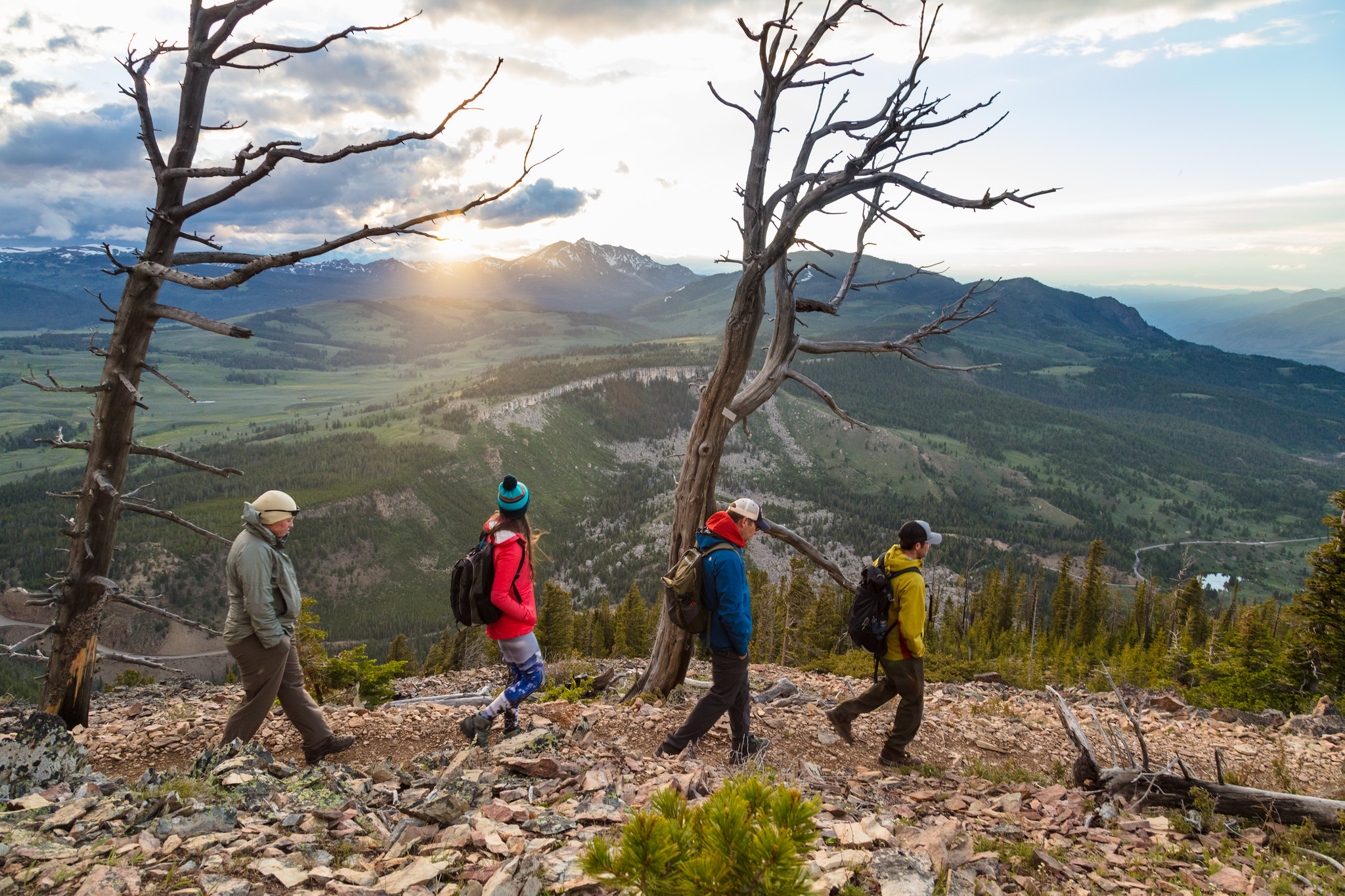
Climb 1,300 feet through forest and meadow to the summit of Bunsen Peak, named for German chemist Robert Bunsen who studied geysers and invented the Bunsen Burner. The summit offers panoramic views of the Blacktail Deer Plateau, Swan Lake Flat, Gallatin Mountain Range, and the Yellowstone River Valley. Return by the same route.
Safety notes: Grizzly bears frequent this area. You’ll also see communications equipment, which supplies Mammoth and nearby communities.
Trailhead: 5 miles (8 km) south of Mammoth on the Grand Loop Road. Park in the gravel lot just south of Golden Gate, across from the Glen Creek trailhead.
Mammoth Hot Springs Trails the Park Service's write-up
30-90 Minutes · no dogs · season Most of the boardwalks are not maintained during the winter.
Start Mammoth Hot Springs
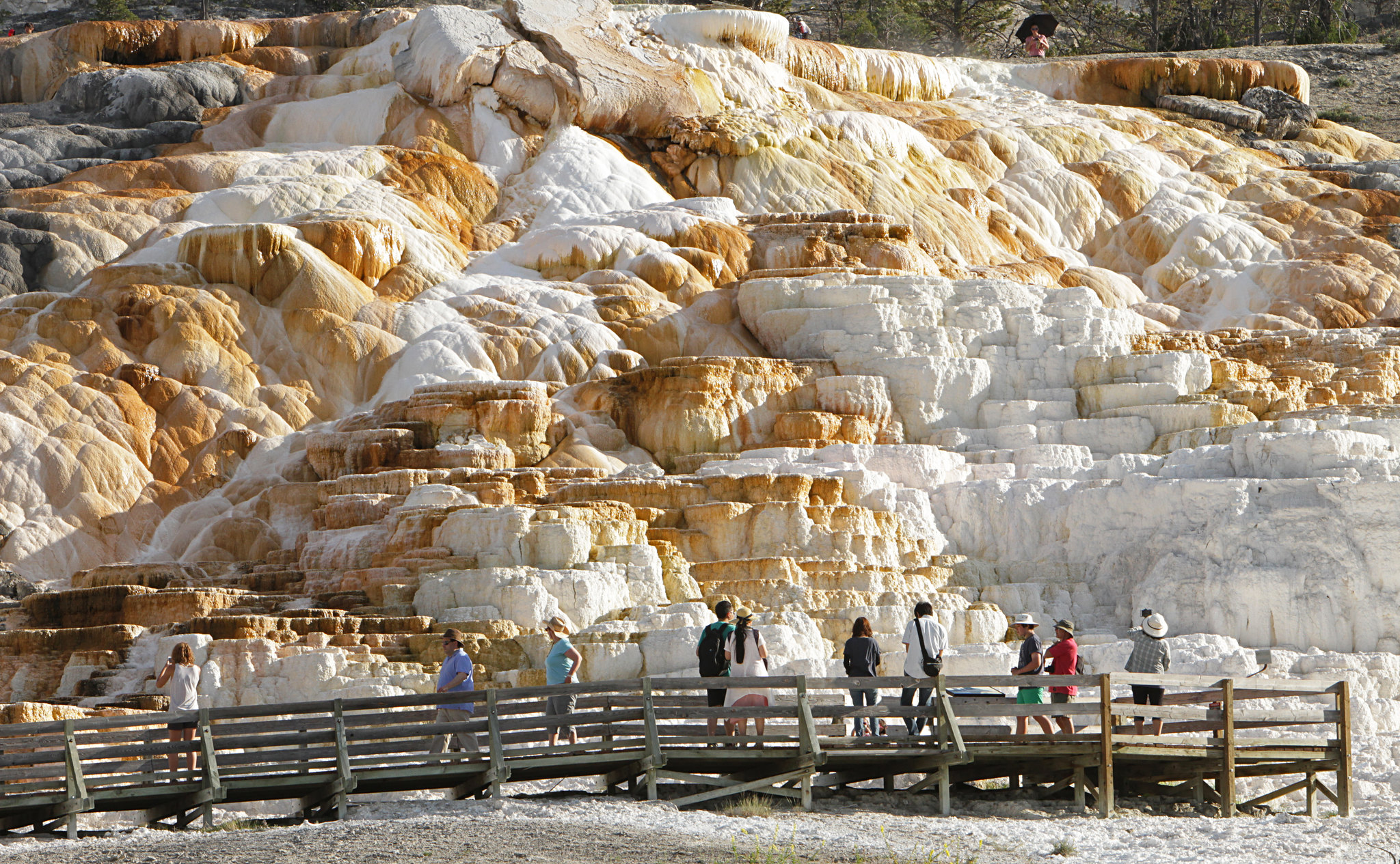
For hundreds of years, Shoshone and Bannock people collected minerals from Mammoth Hot Springs for white paint. These minerals contribute to the beautiful terrace structures, along with heat, a natural “plumbing” system, water, and limestone.
The volcanic heat source for Mammoth Hot Springs remains somewhat of a mystery. Scientists have proposed two sources, including the large magma chamber underlying the Yellowstone Caldera, or perhaps a smaller heat source closer to Mammoth.
At Mammoth, a network of fractures and fissures form the plumbing system that allows hot water from underground to reach the surface. The water comes from rain and snow falling on the surrounding mountains and seeping deep into the earth where it is heated. Small earthquakes may keep the plumbing open.
Limestone, deposited here millions of years ago when a vast sea covered this area, provides the final ingredient. Hot water with dissolved carbon dioxide makes a solution of weak carbonic acid. As the solution rises through rock, it dissolves calcium carbonate, the primary compound in limestone. At the surface, the calcium carbonate is deposited in the form of travertine, the rock that forms the terraces of Mammoth Hot Springs.
Notes: Thermal activity throughout this entire area. Stay on the boardwalk, designated trails, or roads at all times.
Accessibility This trail is along boardwalks, paved trails, or along roads. However, there are steep grades and stairs throughout the trail network. Both the top of Canary Springs and Palette Springs are accessible via wheelchair when snow is not on the ground. The trail from the Lower to Upper Terraces includes steep boardwalks and several hundred stairs. This strenuous trail is not recommended for people with heart, lung, or other health conditions.