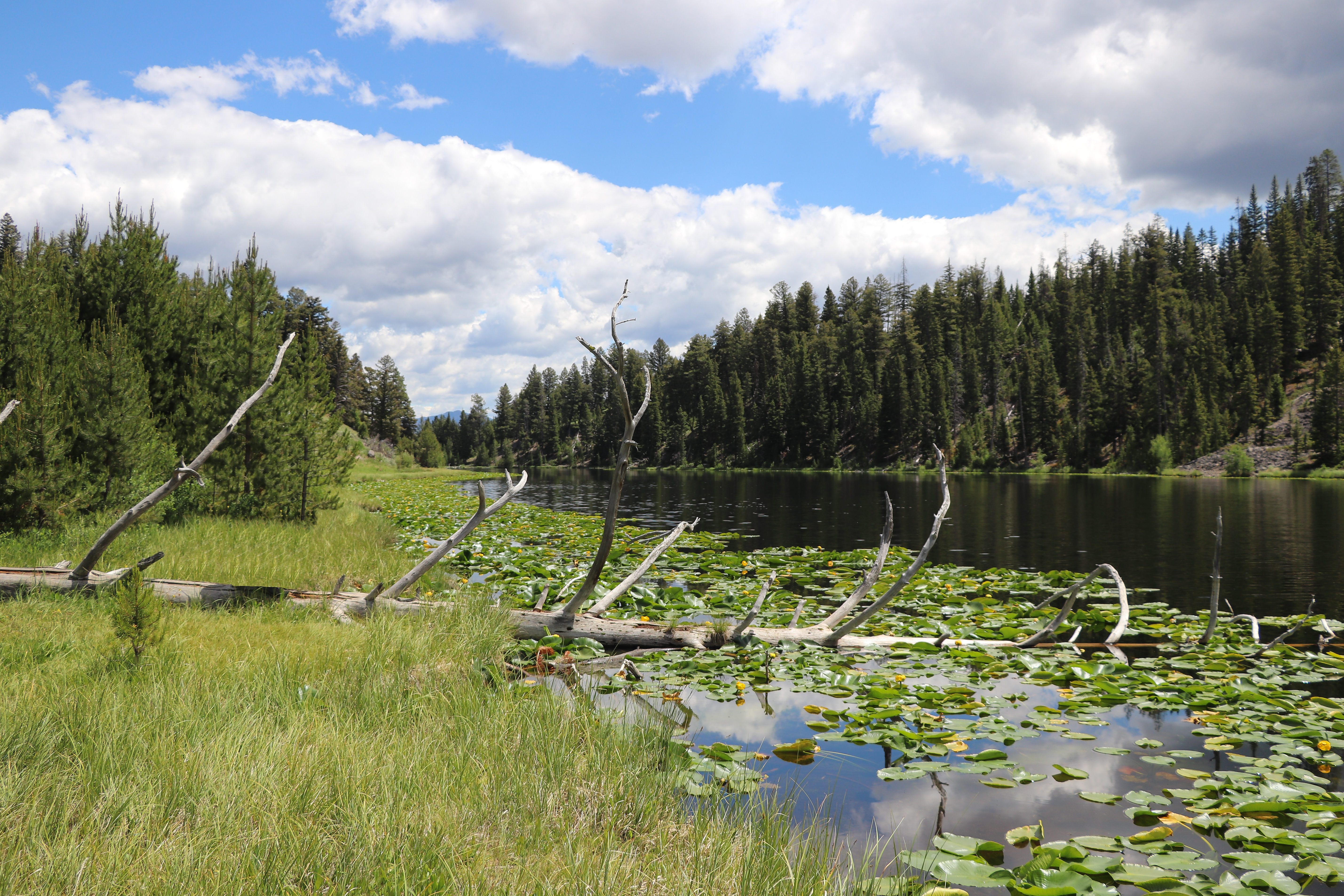
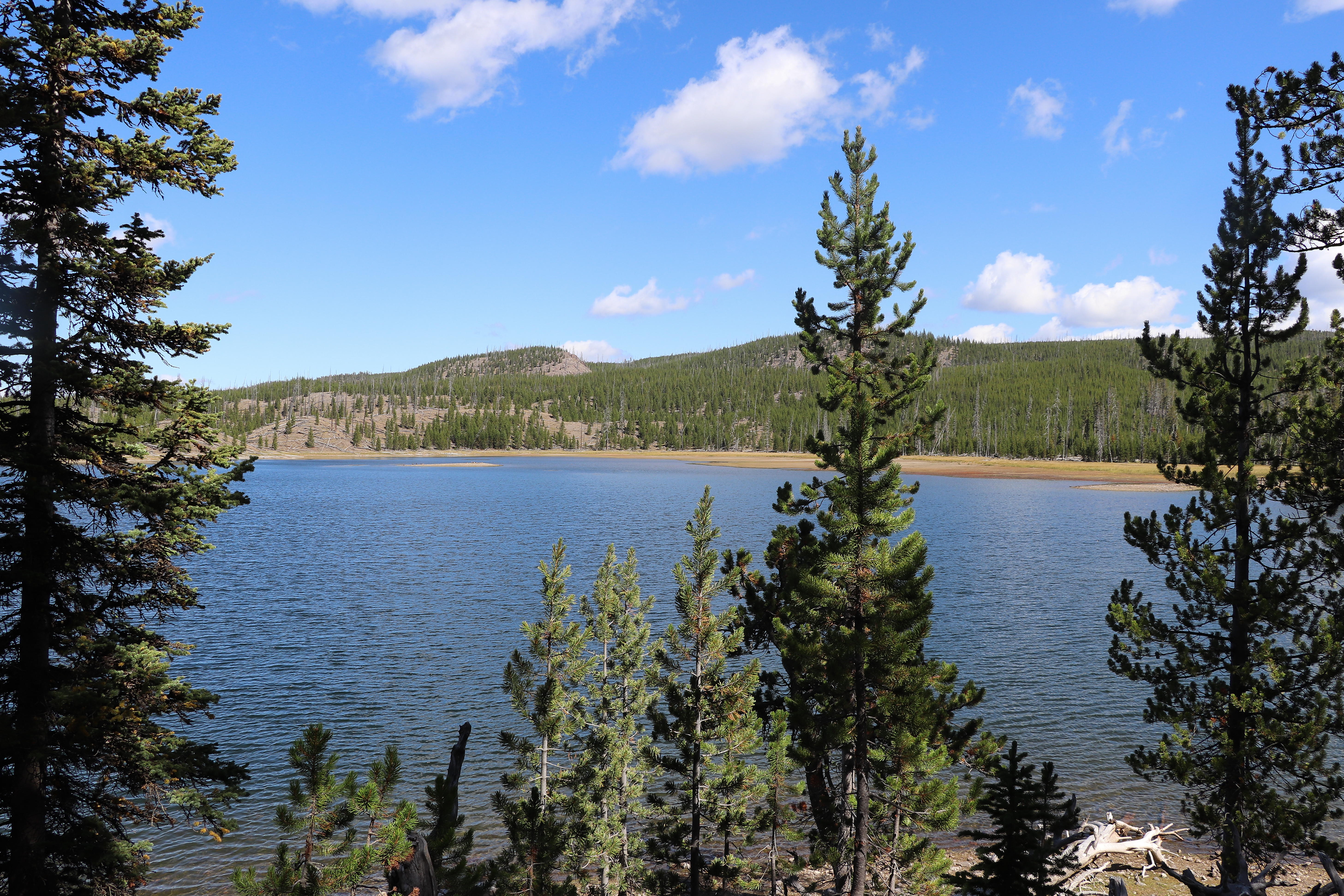
473 named trails · 1,064 miles · 131 trailheads · 48 with the Park Service's own write-up. The lines, trailheads and points are the Park Service's; the write-ups are the Service's own words; the climbing is read from USGS elevation along each line.
2.1 mi one way · about 2,100 ft of climbing · 8,491 ft–10,554 ft · earth surface · hiking
Picnic areas
Along the wayEleanor Lake Picnic Area
TrailheadAvalanche Peak Trailhead 8,483 ft Drive there
Avalanche Peak Trail the Park Service's write-up
3-4 Hours · no dogs · Summer, Fall
Start Yellowstone Lake
Photo: NPS / Diane Renkin
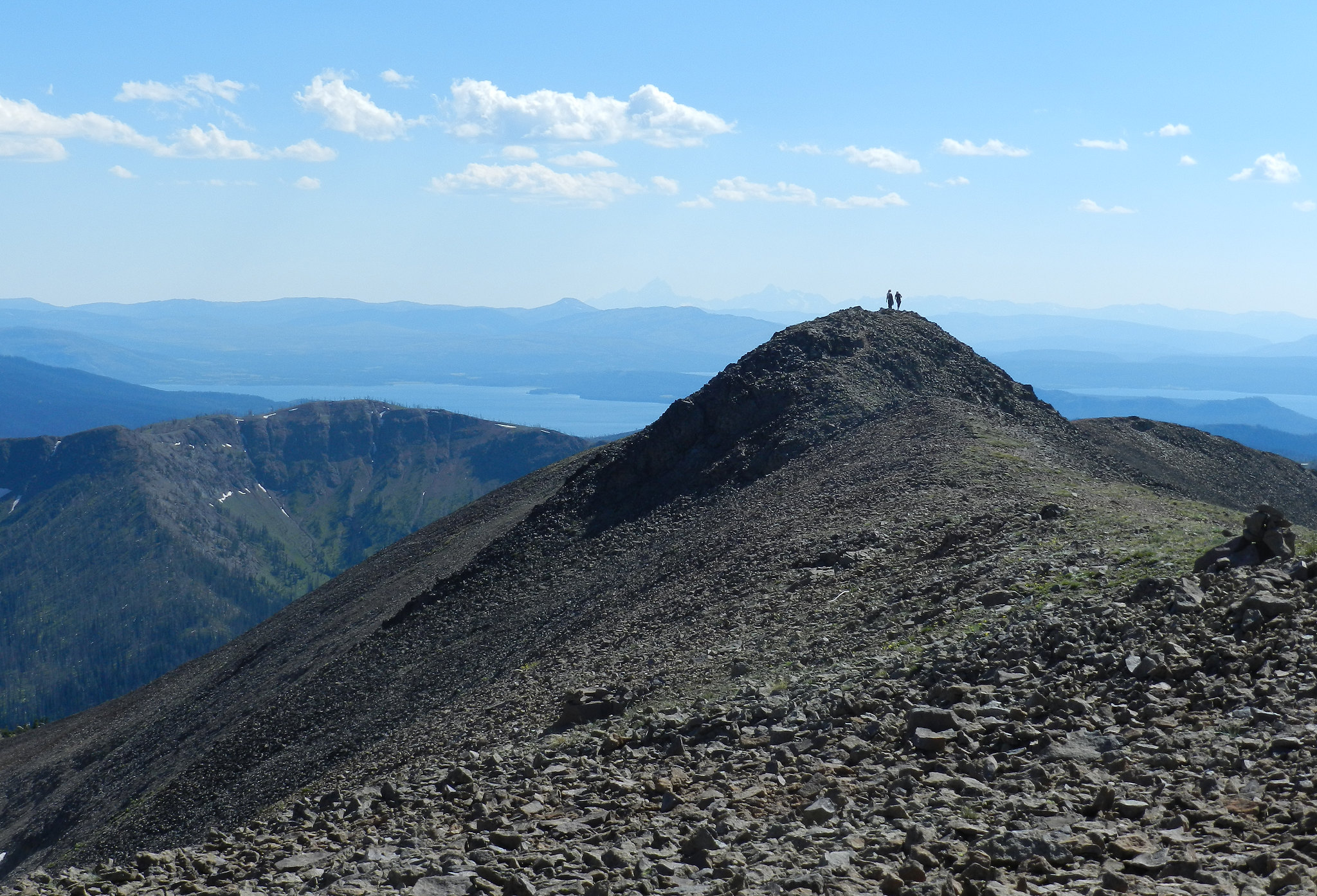
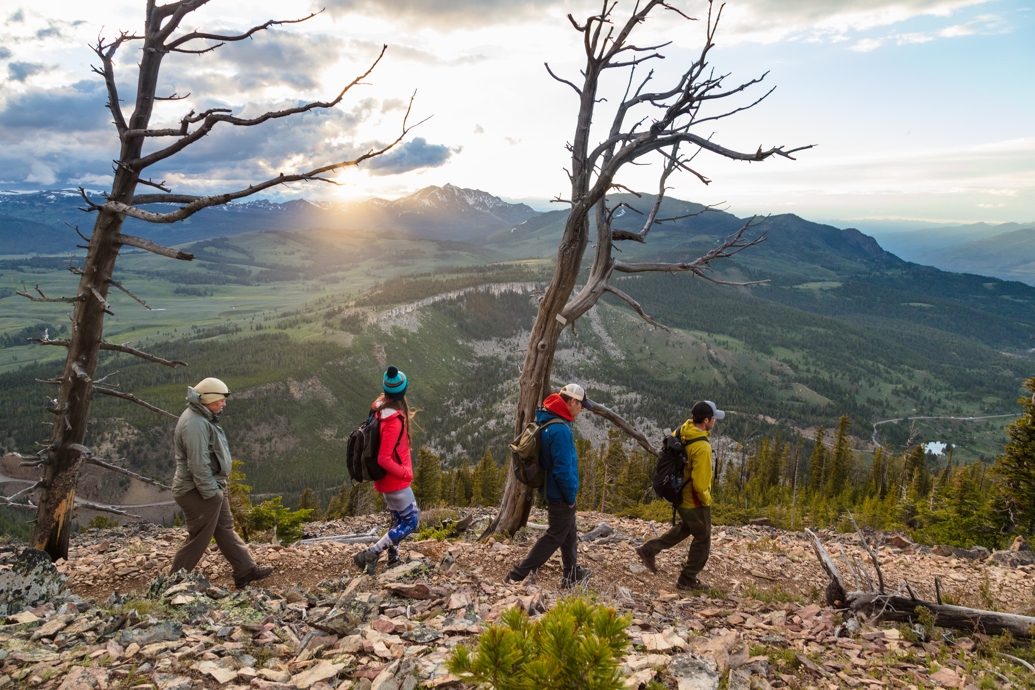
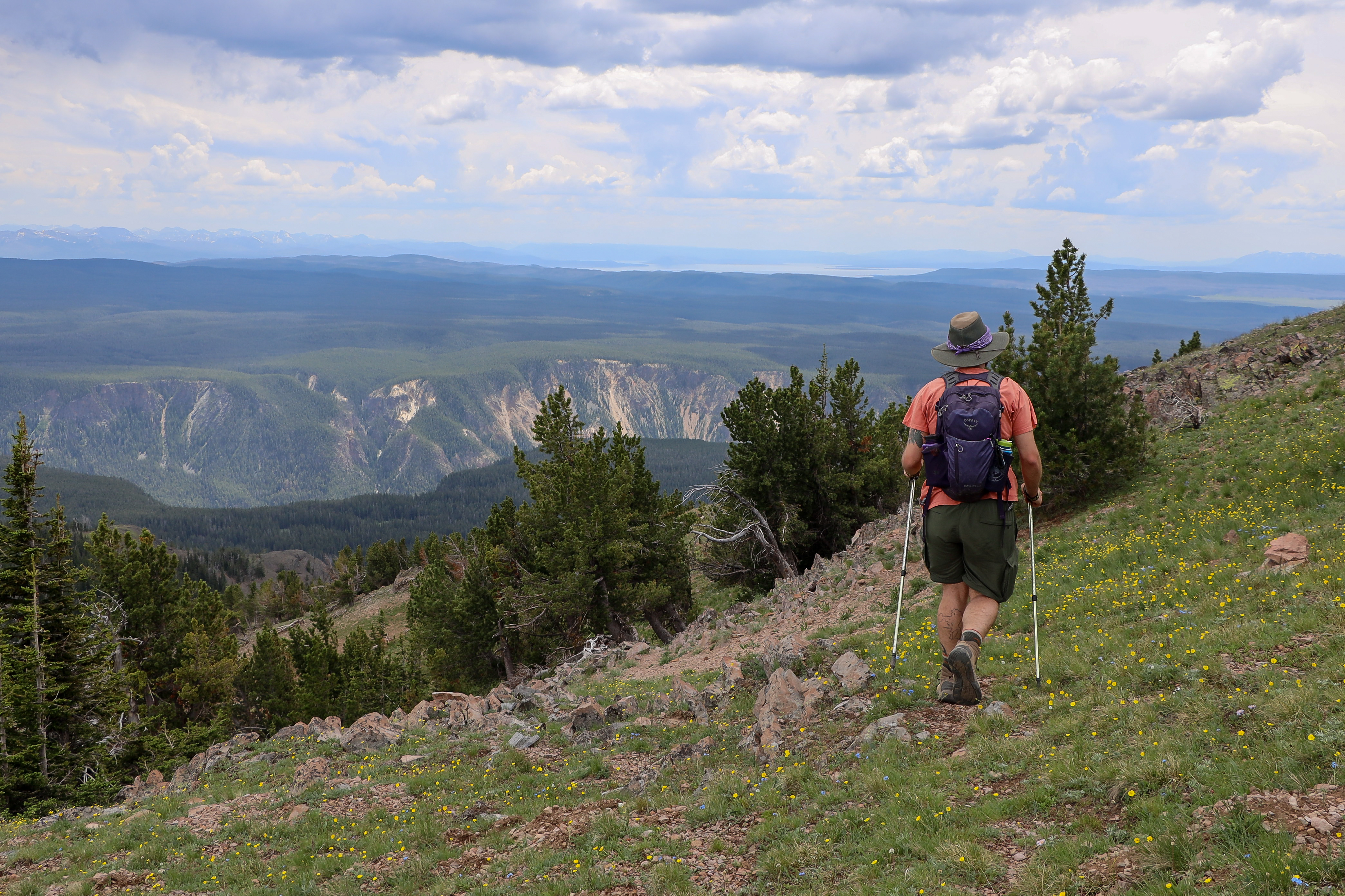
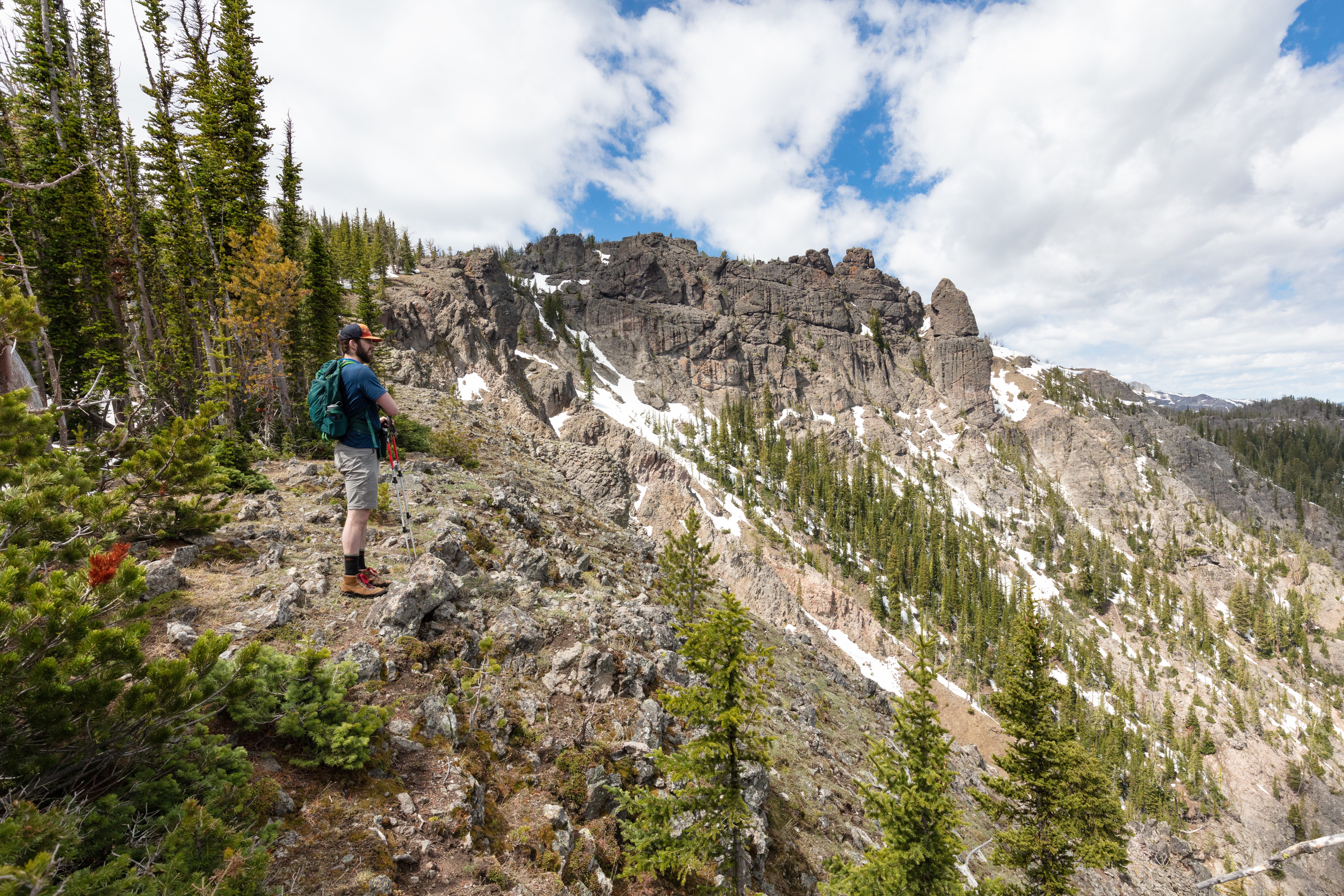
Across the road from the parking area and to the right of the creek, the trail enters the forest and begins its steep ascent—2,100 feet in 2.1 miles (3.3 km). In just over a mile, it arrives at the base of the large bowl of Avalanche Peak, then continues to the left and switches back over large talus slopes to an open level area below the summit. Follow the established trail up to the narrow ridgeline and cross it with extreme caution. Those who make this arduous hike will be rewarded with stunning views of some of the park’s tallest and most remote alpine peaks. Return by the same route.
Safety notes: This trail is often snow-covered until early July. This strenuous, high elevation trail is not recommended for people with heart and/or respiratory problems. Be aware of lightning above treeline. Even on warm summer days, bring rain gear, wool hats, and gloves. Burned trees may fall without warning. Grizzly bears frequent this area in the fall, seeking out whitebark pine nuts. Hiking this trail is not recommended in September and October.
Trailheads: Look for a pullout at Eleanor Lake, 19 miles (30.6 km) east of Fishing Bridge Junction (8 miles / 12.9 km west of East Entrance). The trailhead is across the road from the pullout.
Accessibility This trail is a path carved out of bare ground and rocky terrain that ascends the side of a mountain. Switchbacks are used for most elevation changes, but the grade can be steep in spots. There is at least 2,100 feet in elevation gain during the first-half of the hike, and the same elevation loss during the descent.
4.4 mi one way · about 300 ft of climbing · 750 ft of descent · 6,261 ft–6,763 ft · earth surface · hiking
TrailheadBeaver Ponds Trailhead 6,252 ft Drive there
Beaver Ponds Trail the Park Service's write-up
2-5 Hours · no dogs
Start Mammoth Hot Springs
Photo: NPS / Neal Herbert
The trail gains over 350 feet in elevation and rambles through sagebrush meadows and stands of trees. The beaver ponds are approximately half-way around the loop. You might see beavers or their sign, but you are more likely to see muskrats and water birds. Along the way, look for bears, elk, mule deer, pronghorn, and moose.
Safety notes: Grizzly and black bears frequent this area.
Trailheads: North of Liberty Cap, near the stone house or behind Mammoth Hot Springs Hotel at start of Old Gardiner Road.
Accessibility This trail is predominantly a narrow, bare-ground and rocky path. There are several wooden bridges over waterways, one of which is very narrow. Switchbacks are used for most elevation changes, but the grade can be steep in spots. There is at least 350 feet in elevation gain during this hike.
4.0 mi one way · about 200 ft of climbing · 1,100 ft of descent · 5,565 ft–6,741 ft · earth surface · hiking
TrailheadBlacktail Creek Trailhead 6,622 ft Drive there
Blacktail Deer Creek to Yellowstone River Trail the Park Service's write-up
4-5 Hours · no dogs · Spring, Summer, Fall
Start East of Mammoth Hot Springs
Photo: NPS / Jacob W. Frank
Follow Blacktail Deer Creek as it descends 1,100 feet (335 m) through rolling, grassy hills and Douglas-fir forest to a suspension bridge over the Yellowstone River. Return the same way.
Safety notes: Trail frequented by horseback-riders.
Trailhead: 7 miles (11.3 km) east of Mammoth on the Grand Loop Road.
0.8 mi one way · about 40 ft of climbing · 6,903 ft–6,942 ft · snow surface · hiking, ski
TrailheadSelf-Guided Trail Trailhead 6,922 ft Drive there
Forces of the Northern Range Self-guided Trail the Park Service's write-up
30-60 Minutes · no dogs · Spring, Summer, Fall
Start East of Mammoth Hot Springs
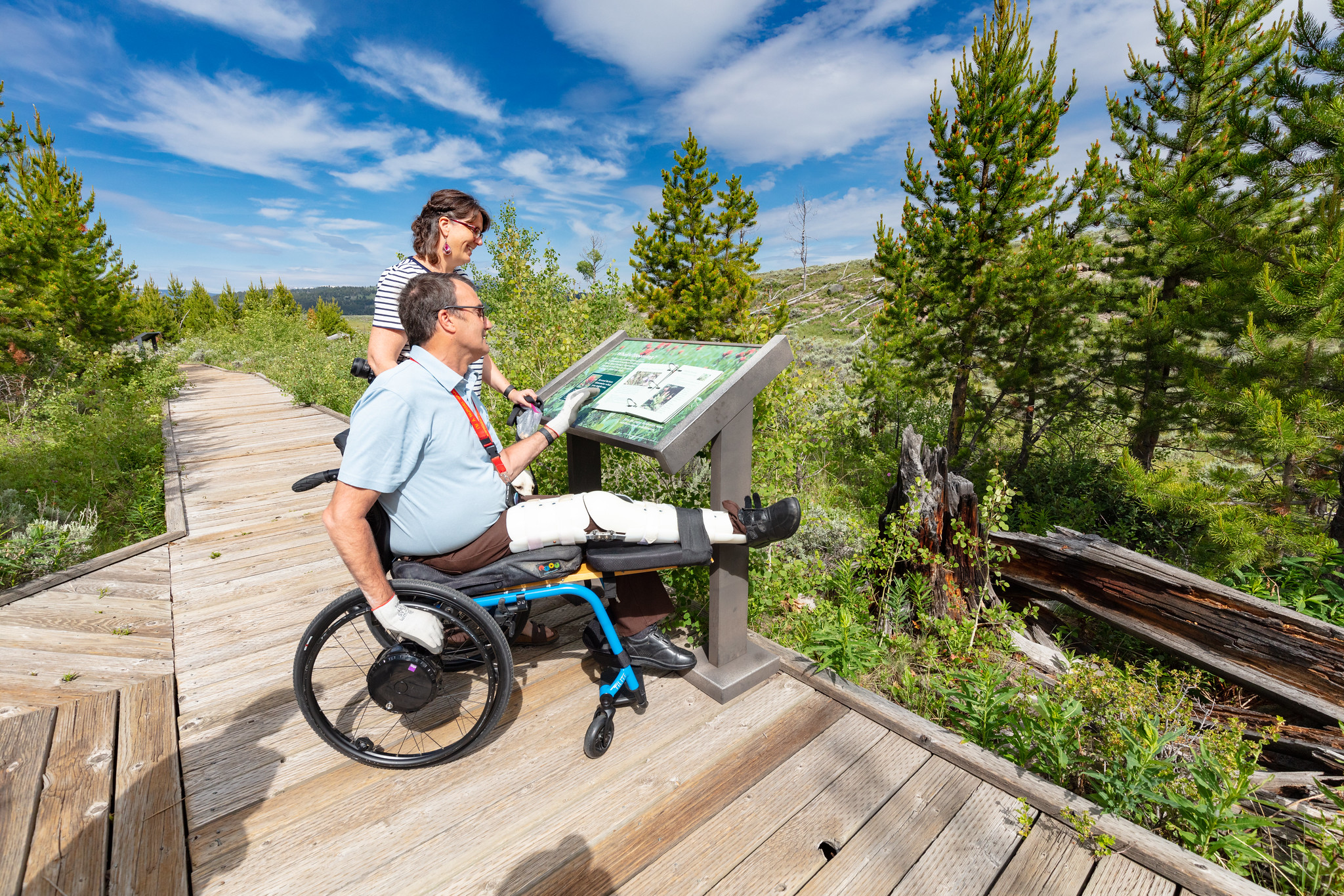
Visitors view a wayside exhibit on the Forces of the Northern Range Self-guided Trail
This .5 mile (.8 km) boardwalk has 11 stops with exhibits. No restroom.
Yellowstone’s northern range is a grassland north of the Yellowstone and Lamar Rivers. This area sustains one of the largest and most diverse communities of free-roaming large animals in the world.
Yellowstone National Park is a place where scientists can study nature in a nearly unchanged condition.
Safety notes: Do not approach or feed any animal. Stay 100 yards (91 m) from bears and wolves. Stay 25 yards (23 m) from all other animals.
Trailhead: The trail begins 8.3 miles (13.4 km) east of Mammoth on the Grand Loop Road.
Accessibility The entire boardwalk is accessible. There is no designated accessible parking. Some gaps between boards may exceed .5 inches. The boardwalk surface is somewhat uneven and bumpy. There are some tactile exhibits. The closest accessible toilet is at the Blacktail Creek pullout.
6.7 mi one way · about 1,500 ft of climbing · 7,206 ft–8,556 ft · earth surface · bike, hiking
Peaks
Along the wayBunsen Peak
TrailheadBunsen Peak Trailhead 7,274 ft Drive there
Bunsen Peak Trail the Park Service's write-up
2-3 Hours · no dogs · Summer, Fall
Start Mammoth Hot Springs
Photo: NPS / Jacob W. Frank
Climb 1,300 feet through forest and meadow to the summit of Bunsen Peak, named for German chemist Robert Bunsen who studied geysers and invented the Bunsen Burner. The summit offers panoramic views of the Blacktail Deer Plateau, Swan Lake Flat, Gallatin Mountain Range, and the Yellowstone River Valley. Return by the same route.
Safety notes: Grizzly bears frequent this area. You’ll also see communications equipment, which supplies Mammoth and nearby communities.
Trailhead: 5 miles (8 km) south of Mammoth on the Grand Loop Road. Park in the gravel lot just south of Golden Gate, across from the Glen Creek trailhead.
0.9 mi one way · about 60 ft of climbing · 200 ft of descent · 6,444 ft–6,589 ft · asphalt, earth surface · hiking
Backcountry campsCampgrounds
Along the wayTOWER FALL SITE #1TOWER FALL SITE #2TOWER FALL SITE #3TOWER FALL SITE #30TOWER FALL SITE #31TOWER FALL SITE #32TOWER FALL SITE #33TOWER FALL SITE #4TOWER FALL SITE #5TOWER FALL SITE #6TOWER FALL SITE #7TOWER FALL SITE #8and 2 more
TrailheadTower Creek Trailhead 6,534 ft Drive there
4.8 mi one way · about 900 ft of climbing · 6,522 ft–7,285 ft · earth surface · bike, hiking
Backcountry campsCampgrounds
Along the wayTOWER FALL SITE #18TOWER FALL SITE #19TOWER FALL SITE #20TOWER FALL SITE #21TOWER FALL SITE #22TOWER FALL SITE #23TOWER FALL SITE #24TOWER FALL SITE #25TOWER FALL SITE #26TOWER FALL SITE #27TOWER FALL SITE #28TOWER FALL SITE #29and 4 more
2.5 mi one way · about 1,300 ft of climbing · 8,757 ft–10,089 ft · earth surface · bike, hiking
TrailheadChittenden Road Trailhead 8,750 ft Drive there
Chittenden Road - Mount Washburn Trail the Park Service's write-up
3-5 Hours · no dogs · Summer, Fall
Start Canyon Village
Photo: NPS / Addy Falgoust
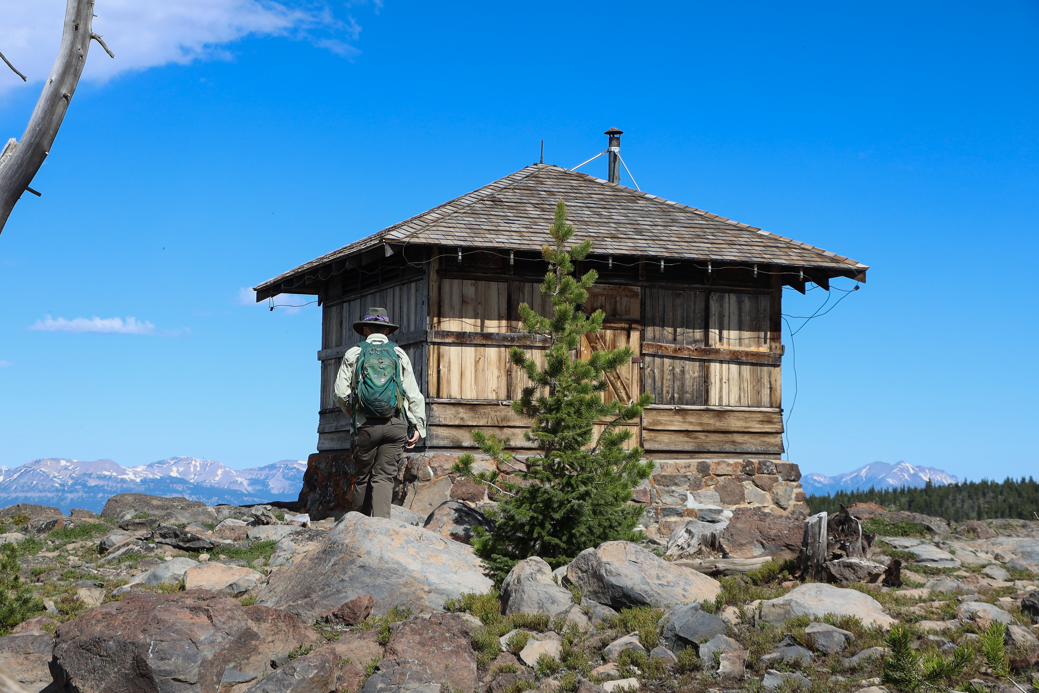
Starting at the Chittenden Road Trailhead this route provides the shortest route up to Mount Washburn. The road provides for a wide trail and a steady gradual incline. Look for bighorn sheep and wildflowers. Stay on the trail to avoid destroying fragile alpine vegetation. You may encounter bicyclists or service vehicles along this route. At the top, enjoy the view and interpretive exhibits from inside the shelter at the base of the fire lookout.
Safety notes: Be aware of lightning above the treeline. There is no access to water along this trail. Grizzly bears frequent the Mount Washburn area in the fall, seeking out whitebark pine nuts. To help protect yourself and any bears you may encounter , it's important to hike in groups of 3 or more people, make noise, and carry bear spray (and know how to use it). These hikes are not recommended for persons with heart and/or respiratory problems.
Trailheads: Trail starts at parking area on Chittenden Road, 10.3 miles (16.5 km) north of Canyon.
7.1 mi one way · about 550 ft of climbing · 7,795 ft–7,977 ft · earth surface · hiking
Backcountry camps
Along the way8S1
TrailheadDeLacy Creek Trailhead 7,954 ft Drive there
DeLacy Creek Trail the Park Service's write-up
3-5 Hours · no dogs · Summer, Fall
Start Craig Pass
Photo: NPS / Addy Falgoust
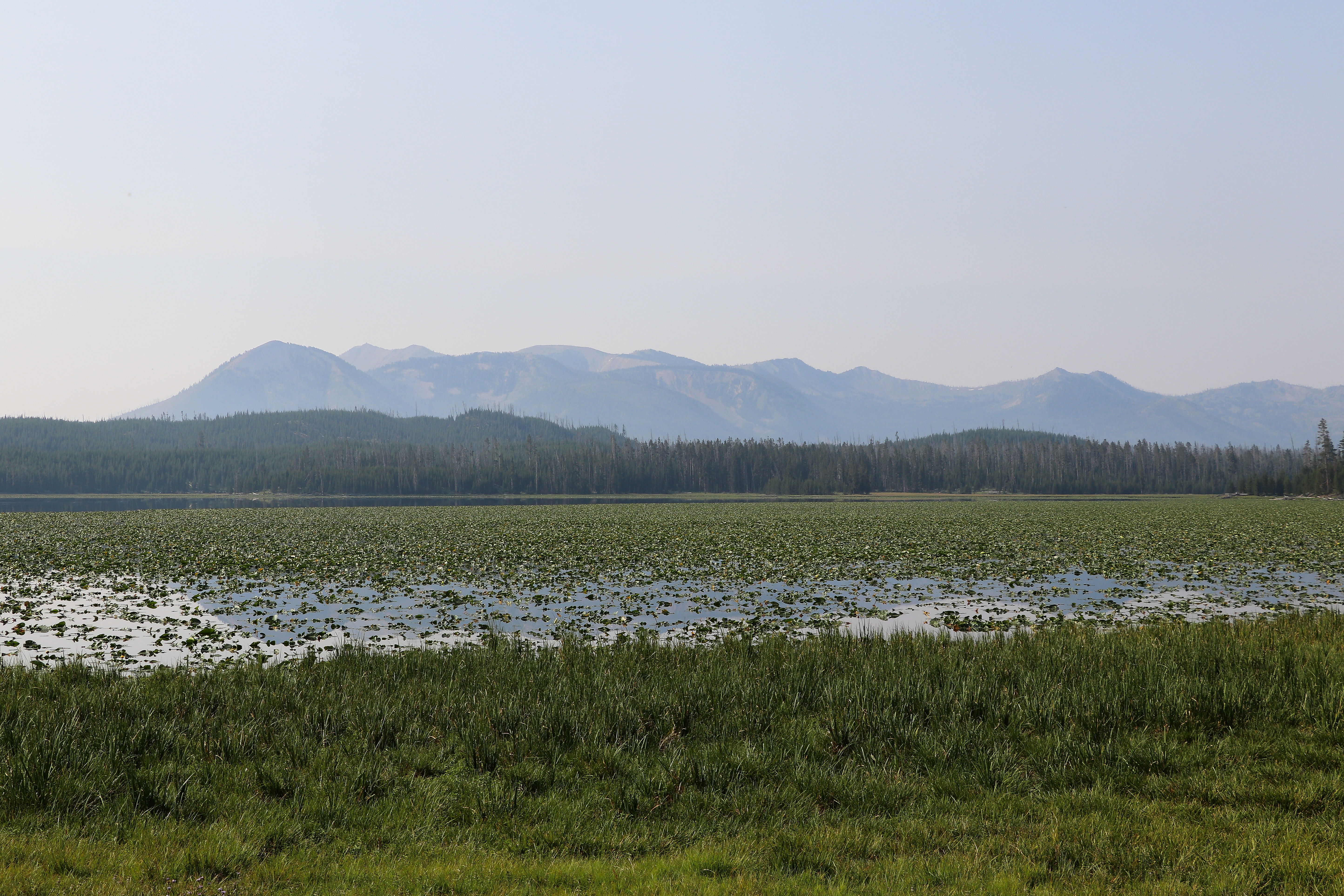
Hike along a forest’s edge and through open meadows to the shores of Yellowstone’s largest backcountry lake. Look for sandhill cranes in meadows, moose near shore, and water birds on and near the lake.
Safety notes: Beyond here the trail continues into Yellowstone’s vast backcountry. The dayhike stops here; return by the same route. Check the Backcountry Situation Report for further information.
Trailheads: 8.8 miles (14 km) west of West Thumb Junction at DeLacy Creek Parking Area.
4.6 mi one way · about 300 ft of climbing · 7,794 ft–8,008 ft · earth surface · hiking
TrailheadShoshone / Dogshead Trailhead 7,794 ft Drive there
Lewis River Channel/Dogshead Trail the Park Service's write-up
5-8 Hours · no dogs · Summer, Fall
Start Lewis Lake
Photo: NPS / Jacob W. Frank
This trail gives you a feel for Yellowstone’s backcountry. Hike through forest to the crystal-clear waters of the Lewis River Channel. Look for eagles and osprey fishing for trout in the shallow waters.
Safety notes: Always be aware of your surroundings. Return on the forested Dogshead Trail.
Trailheads: Approximately 5 miles (8 km) south of the Grant Village intersection, just north of Lewis Lake on the west side of the road.
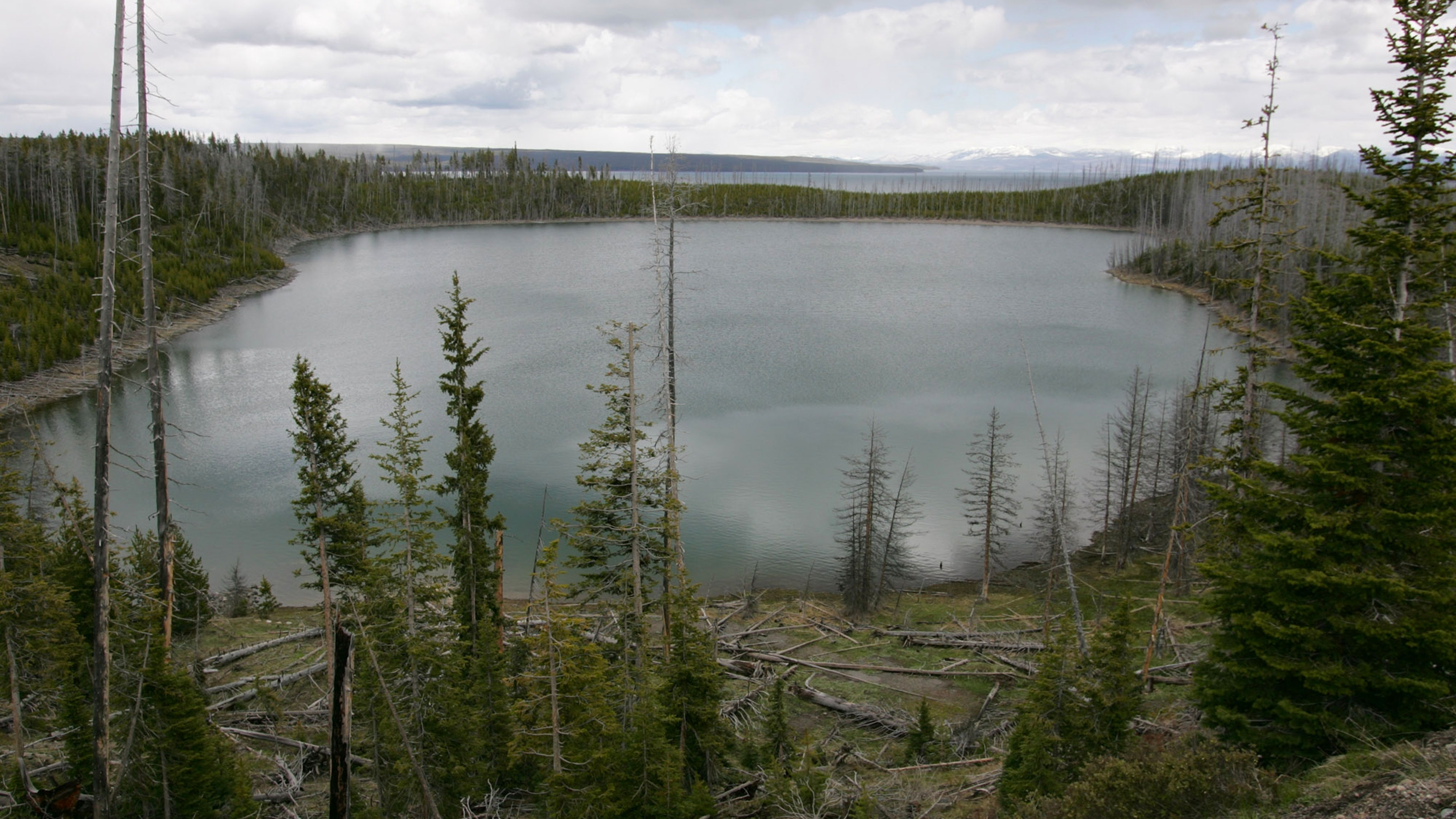
Climb a small hill for a view of Duck and Yellowstone lakes and the expanse of the 1988 fires that swept through this area. Trail descends to the shore of Duck Lake.
Safety notes: Always be aware of your surroundings.
Trailheads: West side of West Thumb Geyser Basin Parking Area.
2.9 mi one way · about 750 ft of climbing · 7,825 ft–8,617 ft · earth surface · hiking
TrailheadElephant Back Trailhead 7,826 ft Drive there
Elephant Back Mountain Trail the Park Service's write-up
2-3 Hours · no dogs · Summer, Fall
Start Lake Village
Photo: NPS / Addy Falgoust
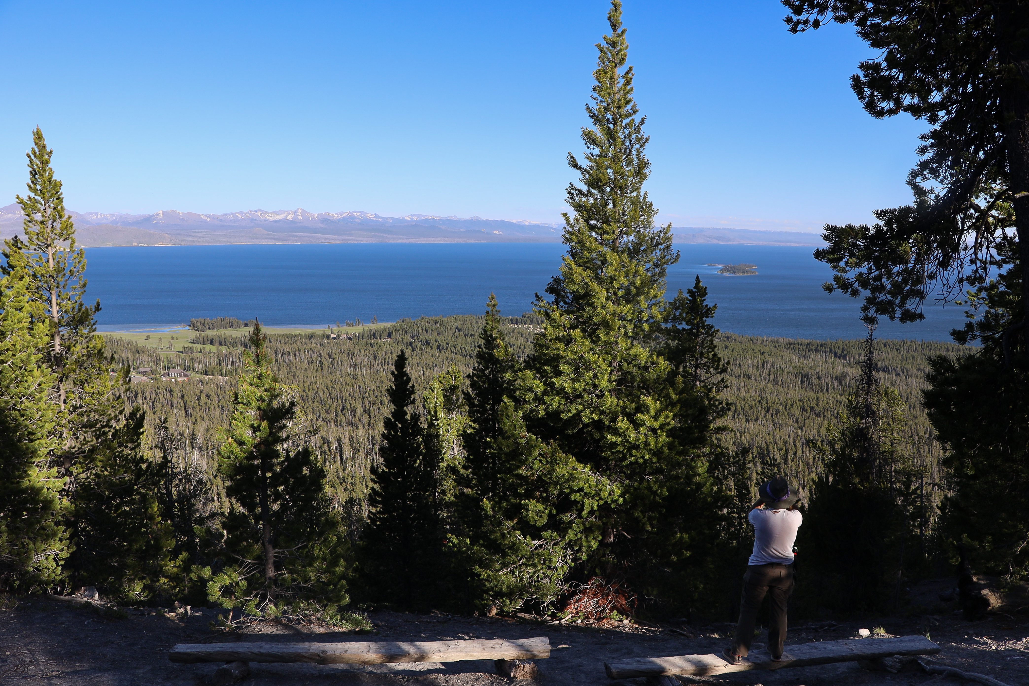
This trail climbs 800 feet (244 m) in 1-½ miles (2.4 km) through the dense lodgepole forest. After 0.8 of a mile, the trail splits into a loop. The left fork is the shortest route to the top, though both join again at the overlook. The overlook provides a sweeping panoramic view of Yellowstone Lake and surrounding area.
Safety notes: Always be aware of your surroundings and look for signs of grizzly bears.
Trailheads: Pullout 1 mile (1.5 km) south of Fishing Bridge Junction.
8.2 mi one way · about 250 ft of climbing · 7,182 ft–7,342 ft · earth surface · bike, hiking
TrailheadFairy Falls Trailhead 7,259 ft Drive there
Fairy Falls Ski Trail the Park Service's write-up
6-8 Hours · no dogs · reservation required · Winter
Start Old Faithful Area
Photo: NPS / Addy Falgoust
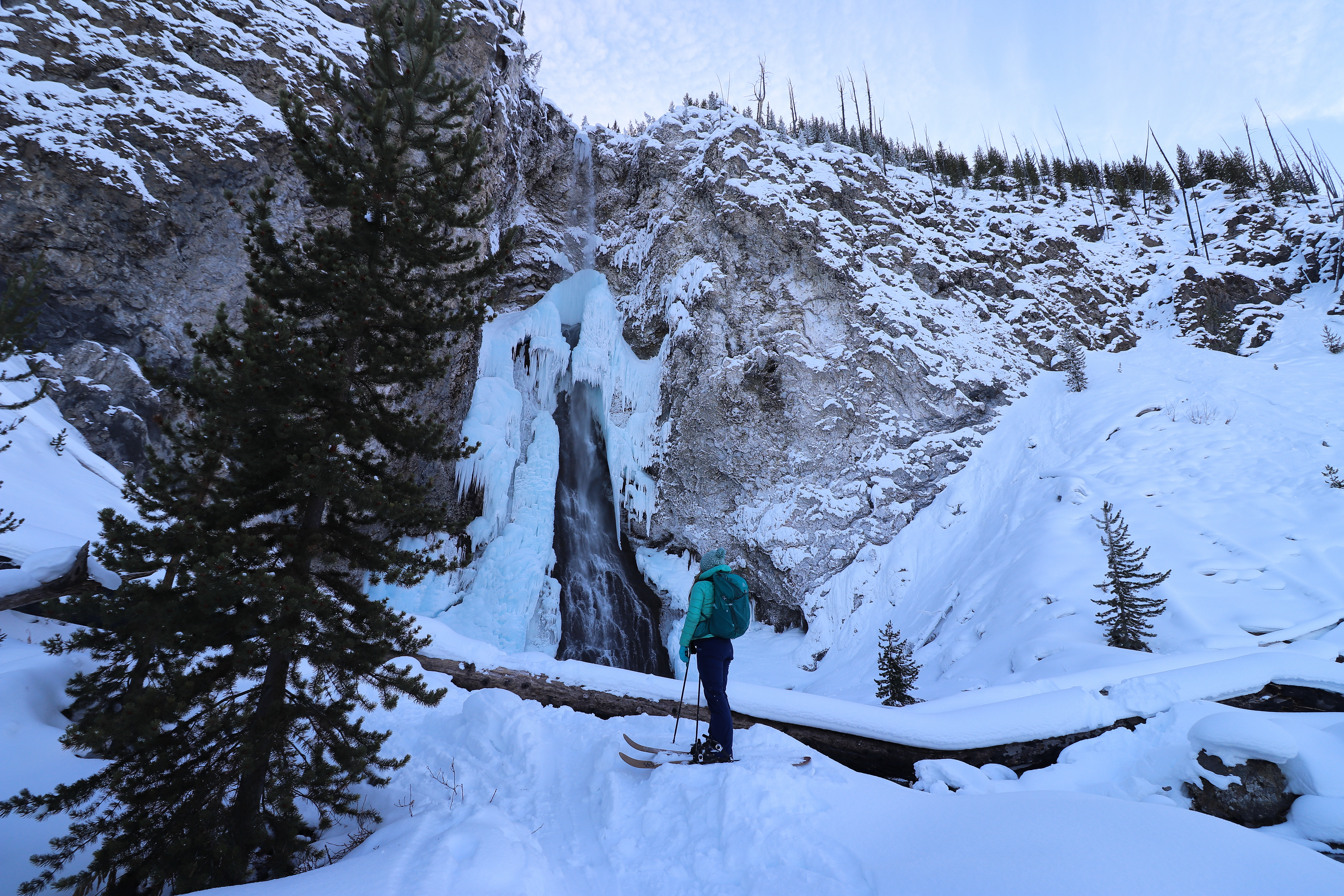
The Fairy Falls Ski Trail is a 10 mile (16 km) (with ski drop) skier-tracked, round-trip, easiest to more dificult ski that provides icy views of one of Yellowstone's most popular waterfalls. Ski 1.3 miles (2.1 km) on the Fountain Flats Drive, then turn left on the Fairy Falls Trail. Most of the Fairy Falls Trail is level, but there are hills and bends in the trail near the falls. Return via the same route, then take the Powerline Trail or the snow vehicle road to Old Faithful. To reach the more difficult Powerline Trail, ski about 0.25 miles (0.4 km) south (right) along the snow vehicle road to the Mallard Creek trailhead on the left. Follow the Mallard Creek Trail and turn right at the first junction onto the Powerline Trail, which has rolling hills. The Powerline Trail leads to the Upper Geyser Basin Trail and Morning Glory Pool. Where the trail crosses thermal areas, you may need to remove your skis due to lack of snow.
Notes: Bison and elk frequent this trail. Federal regulations require you to stay at least 100 yards (91 m) away from bears and wolves, and at least 25 yards (23 m) away from bison and all other wild animals. Stay on boardwalks and designated ski trails. The ground is unstable in hydrothermal areas.
Check out the ski trail details and accessibility information at the bottom of this page.
Pets Qualified service animals are welcome throughout the park and in all park facilities. However, they must be leashed and under your control at all times.
Accessibility This skier-tracked easy to more-difficult trail provides level terrain with some hills and bends in the trail near the falls. The trail elevation gain/loss is 160 feet. Service dogs allowed.
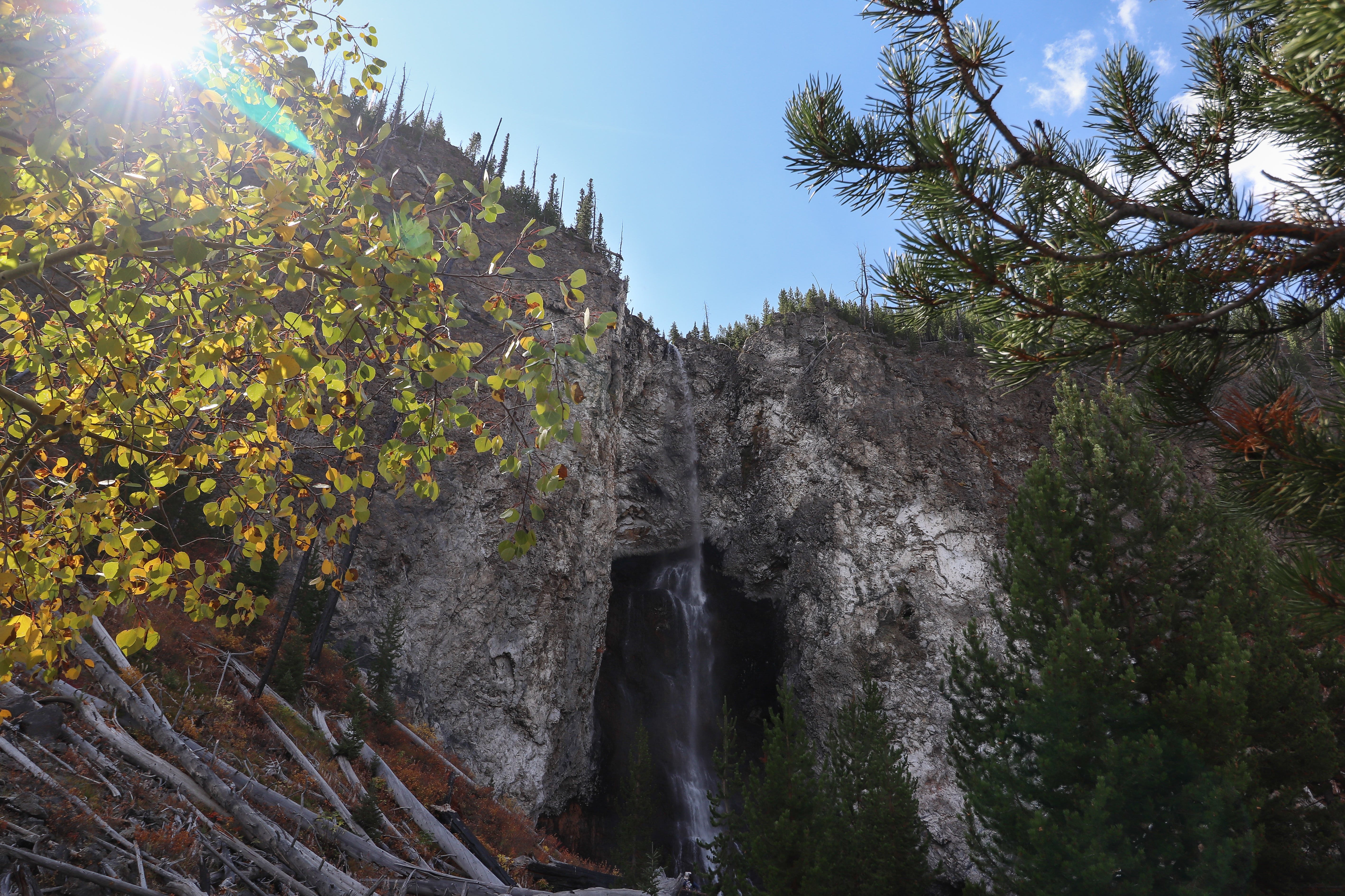
Fairy Falls, 200 feet (61 m) high, is one of Yellowstone's most spectacular waterfalls. From the trailhead, walk 1.6 miles (2.6 km) through a young lodgepole pine forest to the falls. You can continue 0.6 miles (0.97 km) to Spray and Imperial geysers, which adds 1.2 miles (1.9 km) to the hike. Return the same way.
Safety notes: Carry water and be aware of wildlife.
Trailheads: There are two trailheads and two different approaches to reach Fairy Falls. Either park at the end of Fountain Flat Drive or park 1 mile (1.6 km) south of Midway Geyser Basin at the Fairy Falls Parking Lot. Parking is very limited.
7.1 mi one way · about 350 ft of climbing · 1,300 ft of descent · 5,838 ft–6,456 ft · earth surface · hiking
Backcountry camps
Along the way2H72H9
TrailheadsHellroaring Trailhead 6,462 ft Drive there · Upper Hellroaring Trailhead 6,332 ft Drive there
Hellroaring Trail the Park Service's write-up
3-5 Hours · no dogs · Summer, Fall
Start Tower Junction
Photo: NPS / Jacob W. Frank
Trail begins with a steep descent to the Yellowstone River Suspension Bridge, then crosses a sagebrush plateau, and drops down to Hellroaring Creek. Both the Yellowstone River and Hellroaring Creek are popular fishing areas.
Safety notes: Beyond the bridge are trail junctions for other major backcountry trails. Pay attention; stay on the Hellroaring Trail. Hellroaring is a major backcountry trail. This day hike stops at the confluence of Hellroaring creek and the Yellowstone River. Limited shade along this trail. Bring water.
Trailheads: Short dirt road leads to a parking area at the trailhead 3.5 miles (5.6 km) west of Tower Junction.
4.2 mi one way · about 250 ft of climbing · 900 ft of descent · 5,759 ft–6,595 ft · earth surface · hiking
WaterfallsBackcountry campsPicnic areas
Along the way1A3Lava Creek Picnic AreaUndine Falls
TrailheadsLava Creek Trailhead 6,563 ft Drive there · Lava Creek Trailhead 5,967 ft Drive there · Lava Creek Trailhead 5,627 ft Drive there
Lava Creek Trail the Park Service's write-up
2-3 Hours · no dogs
Start Mammoth Hot Springs
Photo: NPS / Jacob W. Frank
Trail Alert! The bridge across the Gardner River was washed out in the 2022 flood event and fording is unsafe. The trail is only accessible from the trailhead across the road from the Lava Creek picnic area.
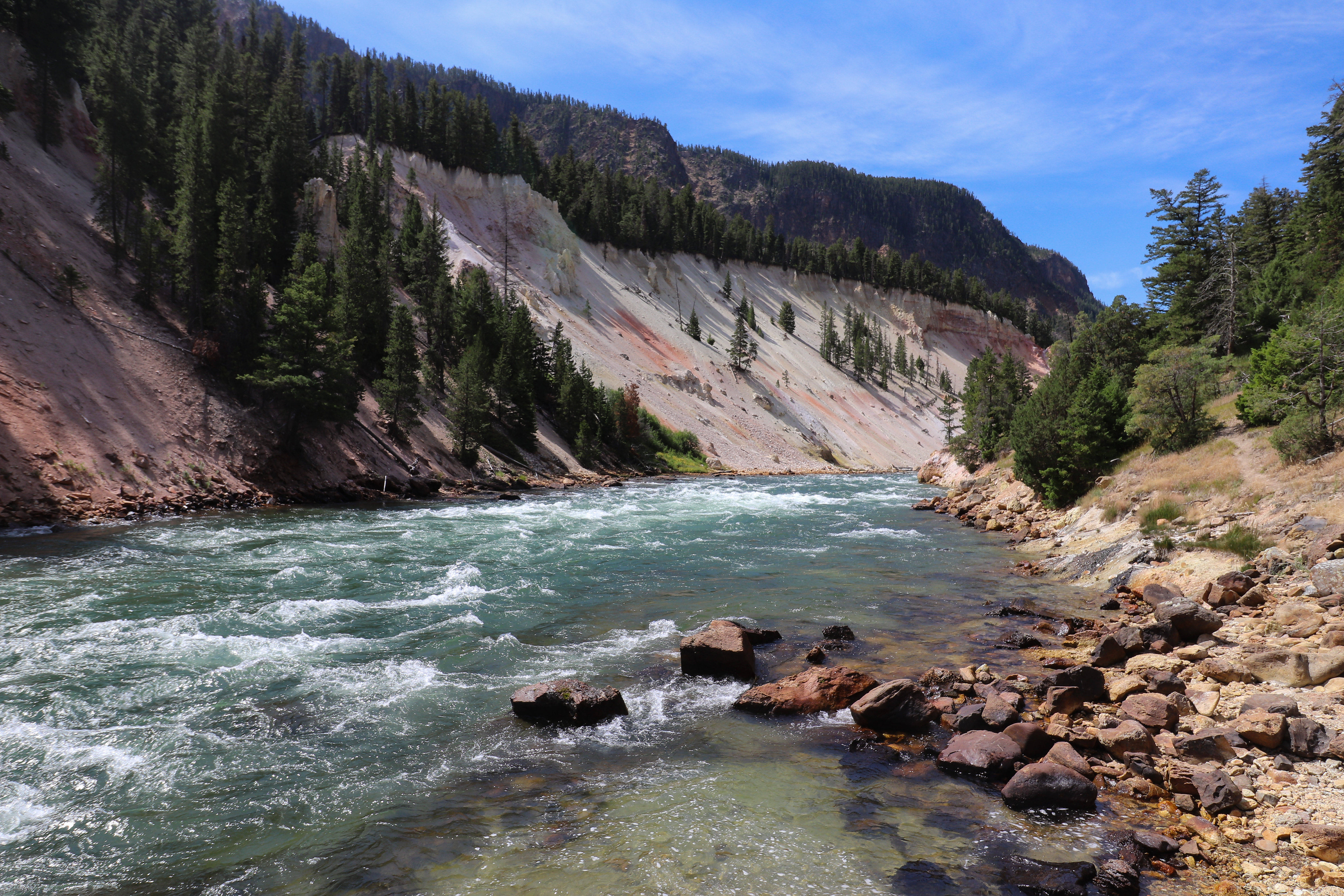
Follow Lava Creek and the Gardner River. Along the way, you can see Undine Falls (60 feet / 18 m) and the confluence of Lava Creek with Gardner River.
Safety notes: Return by the same route (another 4.2 miles), or have a vehicle shuttle arranged.
Trailheads: Across road from Lava Creek picnic area.
Accessibility The first 250 feet of the trail is accessible, with a level surface of hard-packed soil. Beyond, there is a steep grade down to the Gardner River. The southern trailhead is not accessible, due to topography.
6.1 mi one way · about 250 ft of climbing · 7,784 ft–7,846 ft · earth surface · hiking
TrailheadShoshone / Dogshead Trailhead 7,794 ft Drive there
Lewis River Channel/Dogshead Trail the Park Service's write-up
5-8 Hours · no dogs · Summer, Fall
Start Lewis Lake
Photo: NPS / Jacob W. Frank
This trail gives you a feel for Yellowstone’s backcountry. Hike through forest to the crystal-clear waters of the Lewis River Channel. Look for eagles and osprey fishing for trout in the shallow waters.
Safety notes: Always be aware of your surroundings. Return on the forested Dogshead Trail.
Trailheads: Approximately 5 miles (8 km) south of the Grant Village intersection, just north of Lewis Lake on the west side of the road.
Howard Eaton Trail (Old Faithful Area) the Park Service's write-up
3-5 Hours · no dogs · Winter, Summer, Fall
Start Upper Geyser Basin
Photo: NPS / Jacob W. Frank
The trail climbs a burned hill, continues through spruce-fir forest, then down to Lone Star Geyser.
Safety notes: Be aware of bear activity. Stay on maintained trails at all times, especially in the hydrothermal areas. Return the same way.
Trailheads: Park near the Old Faithful Ranger Station and walk 0.25 miles (0.4 km) to the trailhead by following the paved path across the Grand Loop Road, turning left at the first intersection, turning left again, and following the orange trailmarkers to the trailhead.
Lone Star Geyser Trail the Park Service's write-up
2-3 Hours · no dogs · Winter, Summer, Fall
Start Upper Geyser Basin
Photo: NPS / Jacob W. Frank
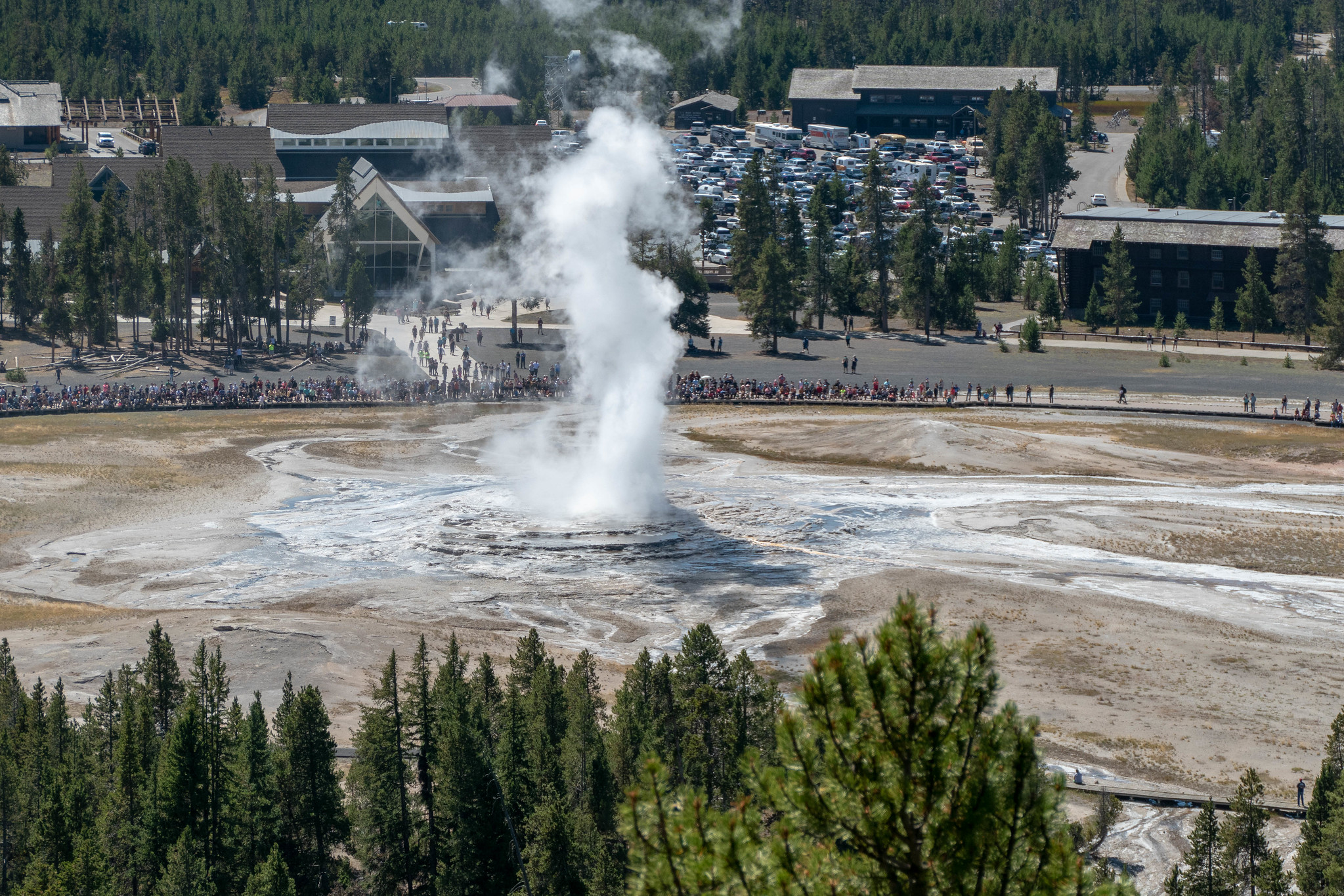
This pleasant, partially paved trail follows an old service road beside the Firehole River to the geyser. Lone Star Geyser erupts up to 45 feet (13.7 m) from a 12-foot (3.6 m) cone approximately every three hours.
Safety notes: Cyclists must dismount at the end of the asphalt and walk the last few hundred feet.
Trailheads: 3.5 miles (5.6 km) south of Old Faithful Overpass, just beyond Kepler Cascades Parking Lot.
Accessibility The Lone Star Geyser trail near Old Faithful is a trail/bike path that is accessible by wheelchair or other mobility devices.
This trail begins behind Roosevelt Lodge and climbs 300 feet (91 m) onto the bench. Here it joins the Roosevelt horse trail and continues west to Lost Lake. From Lost Lake the trail follows the contour around the hillside to the Petrified Tree parking area, crosses the parking lot and continues up the hill. It loops behind Tower Ranger Station, crosses the creek and returns to the lodge.
Safety notes: This area is home to many bears and bison, use caution when traveling. Trail frequented by horseback-riders. If you encounter horses, move to the downhill side of the trail and remain still until they have passed.
Trailheads: Starts behind Roosevelt Lodge or at the end of the Petrified Tree parking lot west of Tower Junction.
3.5 mi one way · about 800 ft of climbing · 7,357 ft–8,138 ft · earth surface · hiking
Backcountry camps
Along the wayOB2
TrailheadMallard Lake Trailhead 7,362 ft Drive there
Mallard Lake Trail the Park Service's write-up
3-6 Hours · no dogs · Winter, Summer, Fall
Start Upper Geyser Basin
Photo: NPS / Addy Falgoust
The trail crosses the Firehole River, passes Pipeline Hot Springs, and climbs rolling hills of partially-burned lodgepole pine and open, rocky areas to the lake.
Safety notes: Be aware of bear activity. Return the same way.
Trailheads: From the southeast side of the Old Faithful Lodge cabins, take the first right turn and continue 0.2 miles (0.3 km) across the Firehole River to the trailhead.
0.1 mi one way · about 20 ft of climbing · 6,796 ft–6,815 ft · earth surface · hiking
Bunsen Peak Trail the Park Service's write-up
2-3 Hours · no dogs · Summer, Fall
Start Mammoth Hot Springs
Photo: NPS / Jacob W. Frank
Climb 1,300 feet through forest and meadow to the summit of Bunsen Peak, named for German chemist Robert Bunsen who studied geysers and invented the Bunsen Burner. The summit offers panoramic views of the Blacktail Deer Plateau, Swan Lake Flat, Gallatin Mountain Range, and the Yellowstone River Valley. Return by the same route.
Safety notes: Grizzly bears frequent this area. You’ll also see communications equipment, which supplies Mammoth and nearby communities.
Trailhead: 5 miles (8 km) south of Mammoth on the Grand Loop Road. Park in the gravel lot just south of Golden Gate, across from the Glen Creek trailhead.
Mammoth Hot Springs Trails the Park Service's write-up
30-90 Minutes · no dogs
Start Mammoth Hot Springs
Photo: NPS / Jim Peaco
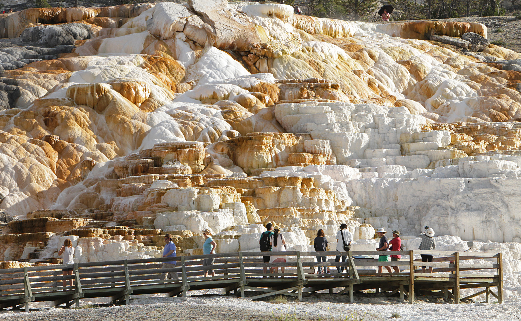
For hundreds of years, Shoshone and Bannock people collected minerals from Mammoth Hot Springs for white paint. These minerals contribute to the beautiful terrace structures, along with heat, a natural “plumbing” system, water, and limestone.
The volcanic heat source for Mammoth Hot Springs remains somewhat of a mystery. Scientists have proposed two sources, including the large magma chamber underlying the Yellowstone Caldera, or perhaps a smaller heat source closer to Mammoth.
At Mammoth, a network of fractures and fissures form the plumbing system that allows hot water from underground to reach the surface. The water comes from rain and snow falling on the surrounding mountains and seeping deep into the earth where it is heated. Small earthquakes may keep the plumbing open.
Limestone, deposited here millions of years ago when a vast sea covered this area, provides the final ingredient. Hot water with dissolved carbon dioxide makes a solution of weak carbonic acid. As the solution rises through rock, it dissolves calcium carbonate, the primary compound in limestone. At the surface, the calcium carbonate is deposited in the form of travertine, the rock that forms the terraces of Mammoth Hot Springs.
Notes: Thermal activity throughout this entire area. Stay on the boardwalk, designated trails, or roads at all times.
Accessibility This trail is along boardwalks, paved trails, or along roads. However, there are steep grades and stairs throughout the trail network. Both the top of Canary Springs and Palette Springs are accessible via wheelchair when snow is not on the ground. The trail from the Lower to Upper Terraces includes steep boardwalks and several hundred stairs. This strenuous trail is not recommended for people with heart, lung, or other health conditions.
5.4 mi one way · about 2,500 ft of climbing · 8,035 ft–10,137 ft · earth surface · hiking
Backcountry camps
Along the way4E1
Mount Washburn Spur Trail the Park Service's write-up
8-10 Hours · no dogs · Summer, Fall
Start Grand Canyon of the Yellowstone River
Photo: NPS / Addy Falgoust
This is a long day hike is started and ended at the same trailhead. However, along the trail are beautiful views of wildflowers, Mount Washburn, and even the Washburn Hot Springs. Alternatively, this trail can be started after ascending Mount Washburn from the Chittenden Road - Mount Washburn Trail or the Dunraven Pass - Mount Washburn Trail, though plans would need to be made for either being dropped off at the alternative trailheads or return to the same.
Safety notes: Be aware of lightning above the treeline. There is no access to water along this trail. Grizzly bears frequent the Mount Washburn area in the fall, seeking out whitebark pine nuts. To help protect yourself and any bears you may encounter , it's important to hike in groups of 3 or more people, make noise, and carry bear spray (and know how to use it). These hikes are not recommended for persons with heart and/or respiratory problems.
Trailheads: Glacial Boulder pullout on the road to Inspiration Point.
0.9 mi one way · about 150 ft of climbing · 7,757 ft–7,878 ft · asphalt, wood surface · hiking
TrailheadMud Volcano Trailhead 7,761 ft Drive there
Mud Volcano Trail the Park Service's write-up
1-2 Hours · no dogs
Start Mud Volcano
Photo: NPS / Addy Falgoust
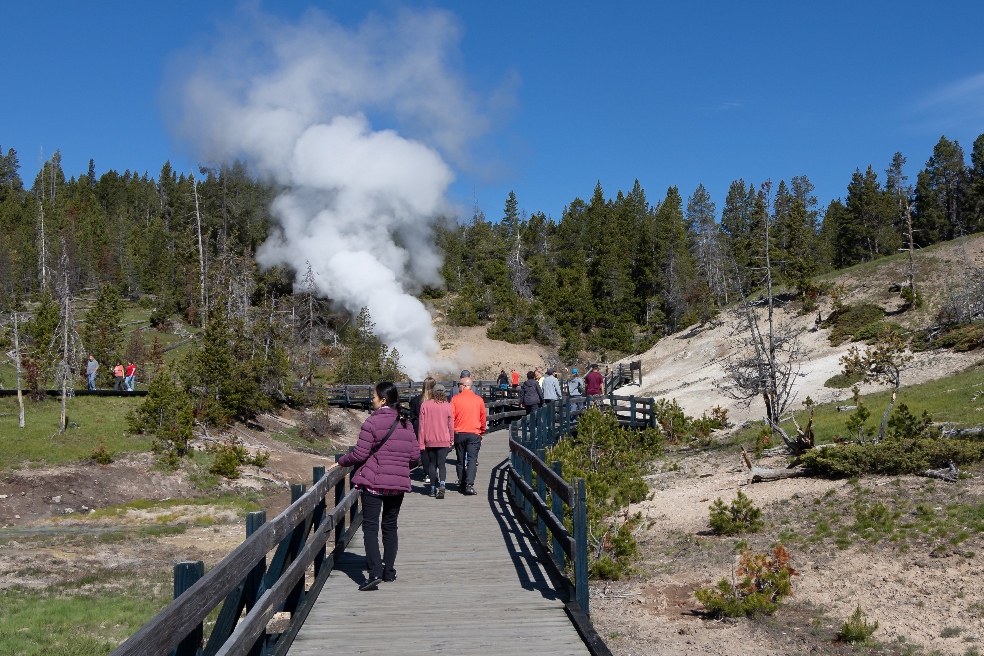
Yellowstone itself is a volcano, and one of its most spectacular eruptions occurred 640,000 years ago. During the eruption, the land collapsed and left a large depression in the earth—the Yellowstone Caldera. This caldera filled with lava flows over hundreds and thousands of years creating the volcanic plateau that comprises much of the central part of the park.
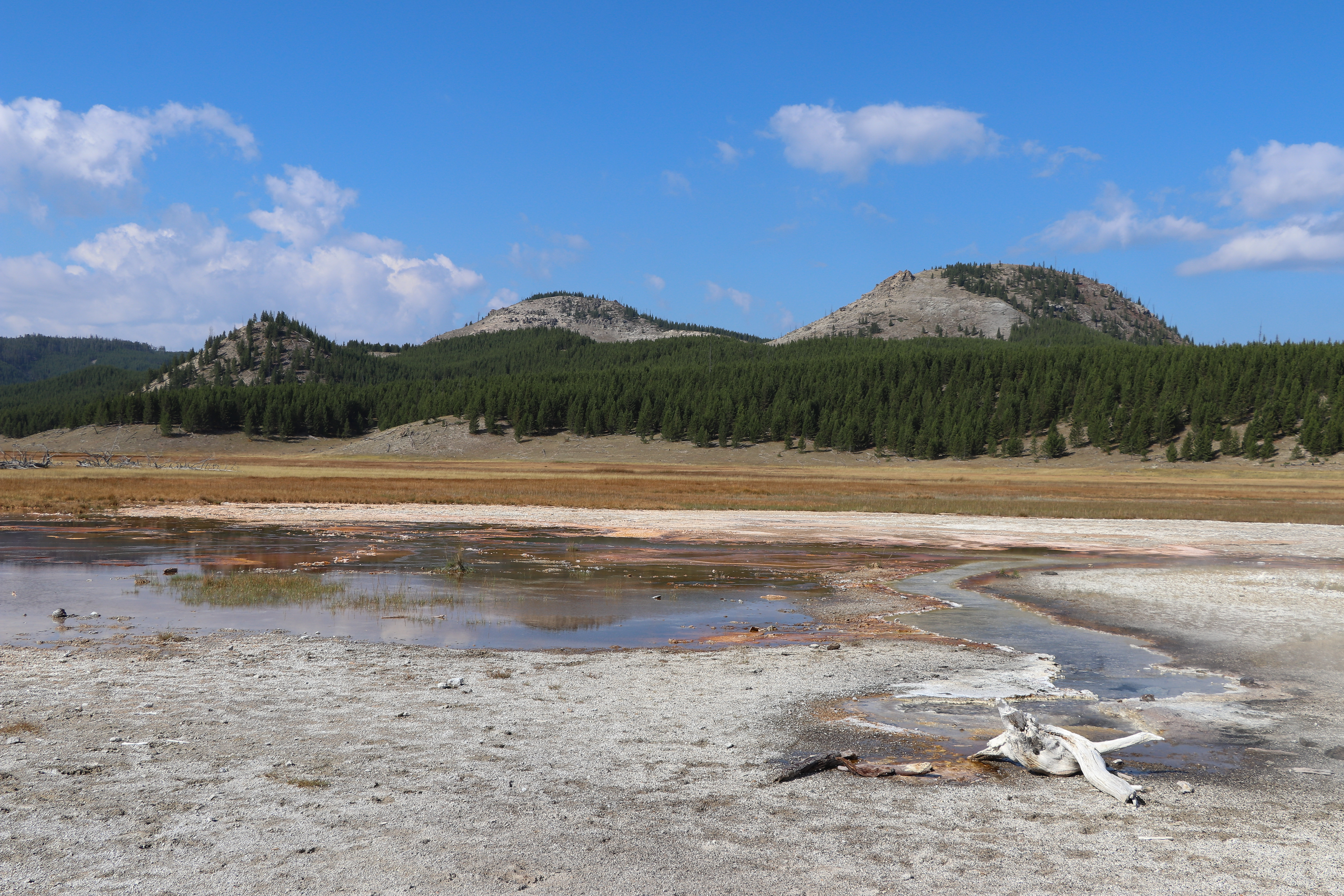
Here at Mud Volcano you are close to one of the resurgent domes. The hills you see east of here comprise Sour Creek Dome. Resurgent domes are areas of active ground deformation, where the land moves up or down with the fluctuation of the magma chamber below. Scientists monitor these domes closely for information about ongoing volcanic activity.
Not surprisingly, many of the park’s geysers, hot springs, mudpots, and fumaroles are also found near or within the caldera.
Accessibility The southern part of the trail is paved, but it does have a steep grade to the top of the hill. The northern end of the loop has stairs going partway up the hillside. The smaller loop around Mud Volcano and Dragon's Mouth Spring meets federal guidelines for wheelchair accessibility, though there are stairs leading up to a viewing platform at Dragon's Mouth Spring.
1.3 mi one way · about 10 ft of climbing · 500 ft of descent · 7,290 ft–7,802 ft · earth surface · hiking
Waterfalls
Along the wayMystic Falls
Mystic Falls Trail the Park Service's write-up
2-4 Hours · no dogs · Winter, Summer, Fall
Start Upper Geyser Basin
Photo: NPS / Addy Falgoust
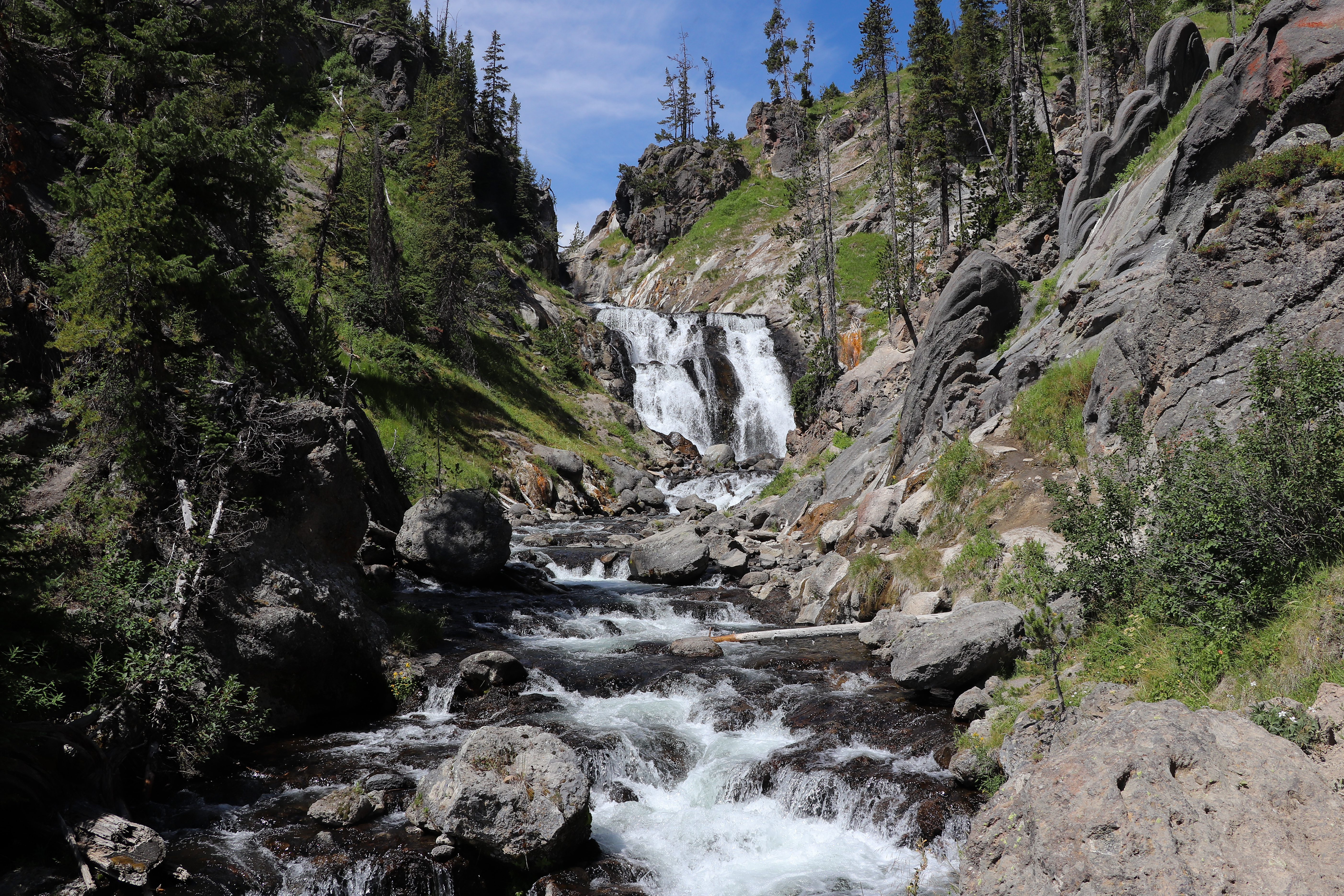
This trail follows a lovely creek through mixed conifer forest to the 70-foot Mystic Falls, over which the Little Firehole River drops from the Madison Plateau.
Safety notes: Stay on maintained trails and boardwalks at all times, especially in hydrothermal areas.
Trailheads: Walk 0.3 miles to the far side of the Biscuit Basin boardwalk to the trailhead or begin 0.25 miles (0.4 km) south of Biscuit Basin by parking in pullouts on either side of the road and walking 0.5 miles north along the Upper Geyser Basin–Biscuit Basin Trail to the trailhead.
1.4 mi one way · about 100 ft of climbing · 7,765 ft–7,877 ft · earth surface · bike, hiking
TrailheadNatural Bridge Trailhead 7,760 ft Drive there
Natural Bridge Trail the Park Service's write-up
1-2 Hours · no dogs · Summer, Fall
Start Bridge Bay Marina
Photo: NPS / Addy Falgoust
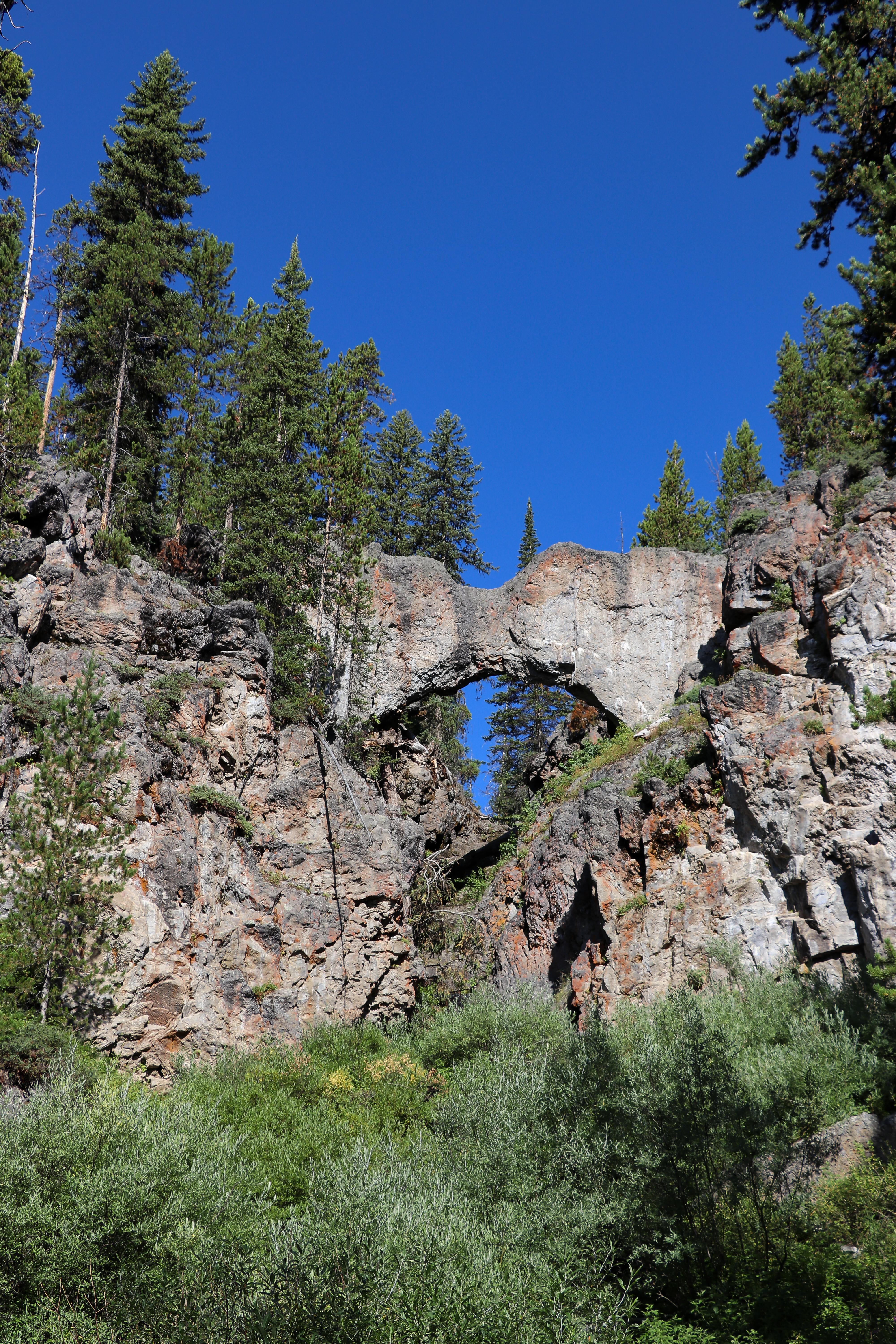
The natural bridge is a 51 foot (18 m) cliff of rhyolite rock cut through by Bridge Creek. The hiking trail meanders through the forest for .7 of a mile (1.2 km). It then joins a service road and continues to the right (west) for .4 of a mile (0.6 km) to the Natural Bridge. The short but steep switchback trail to the top of the bridge starts in front of the interpretive exhibit. To protect this fragile resource, the top of the bridge is closed to hiking and biking. Past the natural bridge, the trail crosses a creek then continues along the cliff before rejoining the road. Exercise caution along the creek bed for wet and slippery rocks.
Safety notes: Trail is generally closed in early summer while bears feed on spawning trout in Bridge Creek. Inquire at the Fishing Bridge Visitor Center for opening date and other closures. The bike trail to Natural Bridge begins just south of the marina off the Grand Loop Road.
Trailheads: Bridge Bay Marina parking lot near the campground entrance road.
Accessibility Natural Bridge Trail is a 2.5-mile, semi-paved accessible trail just south of Bridge Bay.
2.8 mi one way · about 150 ft of climbing · 7,484 ft–7,593 ft · asphalt, earth, wood surface · hiking
Visitor centers
Along the wayNorris Geyser Basin Museum
TrailheadNorris Geyser Basin Trailhead 7,465 ft Drive there
Norris Geyser Basin Trails the Park Service's write-up
30-90 Minutes · no dogs · Spring, Summer, Fall
Start Norris Geyser Basin
Photo: NPS / Matt Poyner
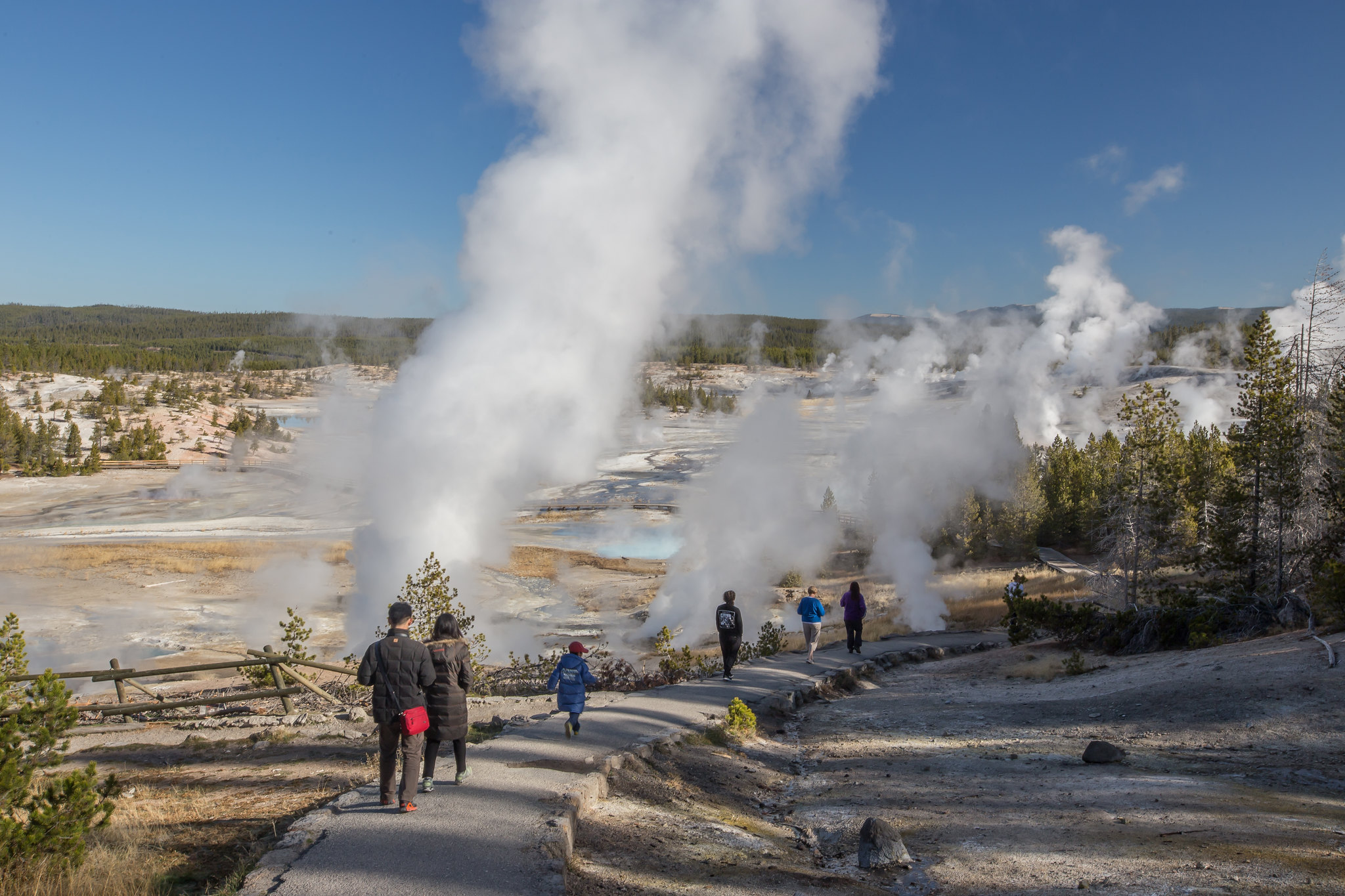
Norris is one of the hottest and most acidic of Yellowstone’s hydrothermal areas. It is part of one of the world’s largest active volcanoes. Many hot springs and fumaroles here have temperatures above the boiling point (200ºF / 93ºC).
Water fluctuation and seismic activity often change features. Norris is near the intersection of three major faults. One runs from the north; another runs from the west. These two faults intersect with a ring fracture from the Yellowstone Caldera eruption 640,000 years ago. These conditions helped to create this dynamic geyser basin.
Notes: Thermal activity throughout this entire area. Stay on the boardwalks and designated trails at all times.
Check out the hike details and accessibility information at the bottom of this page.
Accessibility The trails through the geyser basin are a combination of boardwalks, paved paths, and unpaved paths. The trail leading from the Norris Geyser Basin Museum & Information Station down into both basins is steep and uneven.
2.5 mi one way · about 1,400 ft of climbing · 8,006 ft–9,403 ft · earth surface · hiking
PeaksBackcountry camps
Along the way4E34P1Observation Peak
Observation Peak Trail the Park Service's write-up
5-6 Hours · no dogs · Summer, Fall
Start Canyon Village
Photo: NPS / Addy Falgoust
Hike to a high mountain peak for an outstanding view of the Yellowstone wilderness. Trail passes through open meadows to Cascade Lake where wildflowers abound and wildlife is often seen. Beyond the lake, the trail climbs 1,400 feet in 2.6 miles through whitebark pine forest.
Safety notes: The trail can be wet and snowy through July. Observation Peak trail is not recommended for persons with heart and/or respiratory problems. Past Cascade Lake, no water is available.
Trailheads: Cascade Lake trailhead 1-¼ miles (2 km) north of Canyon Junction on the Grand Loop Road.
1.1 mi one way · about 200 ft of climbing · 7,355 ft–7,587 ft · earth, wood surface · hiking
Observation Point Trail the Park Service's write-up
1-3 Hours · no dogs
Start Upper Geyser Basin
Photo: NPS / Diane Renkin
Switchbacks lead up the hill 0.5 miles (0.8 km) to a commanding view of the Upper Geyser Basin. Return the same way.
Safety notes: Carry water and pace yourself going up the hill.
Trailheads: From the Old Faithful Visitor Education Center, walk about 0.3 miles (0.5 km) counter-clockwise along the Old Faithful boardwalk, turn right at the Geyser Hill sign, and continue down the path. The trailhead is just after the bridge crossing the Firehole River.
3.8 mi one way · about 900 ft of climbing · 6,265 ft–7,199 ft · earth surface · bike, hiking
Osprey Falls Trail the Park Service's write-up
4-6 Hours · no dogs · Summer, Fall
Start Mammoth Hot Springs
Photo: NPS / Jacob W. Frank
Follow Old Bunsen Peak Road through grassland and burned forest 3 miles (4.9 km) to Osprey Falls Trail. Descend 700 feet (213 m) into Sheepeater Canyon, one of the deepest canyons in Yellowstone National Park. Osprey Falls, on the Gardner River, plunges 150 feet (46 m) over the edge of a lava flow. Return by the same route.
Safety notes: Grizzly bears frequent this area. Follow Old Bunsen Peak Road for 3 miles (4.9 km) to Osprey Falls Trail. Hiking and biking allowed on Old Bunsen Peak Road. No bikes allowed on Osprey Falls Trail.
Trailhead: 5 miles (8 km) south of Mammoth on the Grand Loop Road. Park in the gravel lot just south of Golden Gate, across from the Glen Creek trailhead.
0.5 mi one way · 7,746 ft–7,758 ft · earth surface · hiking
TrailheadPelican Creek Nature Trailhead 7,753 ft Drive there
Pelican Creek Nature Trail the Park Service's write-up
30-60 Minutes · no dogs · Summer, Fall
Start Yellowstone Lake
Photo: NPS / Jacob W. Frank
This short but diverse trail travels through the forest to the lakeshore before looping back to the trailhead. It is a scenic introduction to a variety of Yellowstone’s habitats and is a good place for birding.
Safety notes: Always be aware of your surroundings and look for signs of grizzly bears.
Trailheads: West end of Pelican Creek Bridge, 1 mile (1.6 km) east of Fishing Bridge Visitor Center.
12 mi one way · about 900 ft of climbing · 7,843 ft–8,496 ft · earth surface · hiking
Pelican Creek Nature Trail the Park Service's write-up
30-60 Minutes · no dogs · Summer, Fall
Start Yellowstone Lake
Photo: NPS / Jacob W. Frank
This short but diverse trail travels through the forest to the lakeshore before looping back to the trailhead. It is a scenic introduction to a variety of Yellowstone’s habitats and is a good place for birding.
Safety notes: Always be aware of your surroundings and look for signs of grizzly bears.
Trailheads: West end of Pelican Creek Bridge, 1 mile (1.6 km) east of Fishing Bridge Visitor Center.
6.9 mi one way · about 400 ft of climbing · 7,821 ft–7,970 ft · earth surface · hiking
TrailheadPelican Valley Trailhead 7,820 ft Drive there
Pelican Valley Trail the Park Service's write-up
3-4 Hours · no dogs · Summer, Fall
Start Fishing Bridge
Photo: NPS / Ashton Hooker
You are entering some of the best grizzly country in the lower 48 states. The trail heads north, crosses a few bridges through a meadow, then enters the forest. After it leaves the forest, it ascends a small hill to a nice overlook of the valley, with the creek below and the Absaroka Mountains to the east. From here, the trail turns slightly to the right (east) and passes through a small hydrothermal area. Stay on the trail through this fragile and hazardous area. Soon, the trail veers north (left), crosses a small creek, and climbs up a cut bank. This is a good place to enjoy the views of Pelican Creek. The trail continues one mile further to a washed-out bridge.
Safety notes: Many restrictions apply to this trail because it is in prime grizzly bear habitat: Closed until July 4th ( Bear Management Area closure ), day-use only from 9 am–7 pm, groups of four or more hikers recommended, and off-trail travel prohibited on the first 2.1 miles (3.4 km). Check the Backcountry Situation Report for current information.
Trailheads: Turn onto the gravel road 3 miles (4.8 km) east of Fishing Bridge Visitor Center; park at end of road.
Accessibility This is a fairly level, single-wide, bare ground trail that heads through a valley. There is no bridge crossing the creek.
7.2 mi one way · about 1,700 ft of climbing · 5,369 ft–6,870 ft · earth surface · hiking
TrailheadRescue Creek Trailhead 5,362 ft Drive there
Rescue Creek Trail the Park Service's write-up
4-6 Hours · no dogs
Start Mammoth Hot Springs
Photo: NPS / Jacob W. Frank
Trail Alert! The bridge across the Gardner River was washed out in the 2022 flood event and fording is unsafe. The trail is only accessible from the trailhead near Blacktail Pond.
Climb gradually through aspens and meadows, then descend through forests to sagebrush flats.
Safety notes: Return by the same route (another 8 miles).
Trailheads: 7 miles (11.3 km) east of Mammoth on the Grand Loop Road.
Accessibility Rescue Creek Trail is not accessible to persons using mobility devices, due to topography.
2.4 mi one way · about 20 ft of climbing · 90 ft of descent · 7,922 ft–7,988 ft · earth surface · hiking
TrailheadRiddle Lake Trailhead 7,989 ft Drive there
Riddle Lake Trail the Park Service's write-up
2-4 Hours · no dogs · Summer, Fall
Start Grant Village
Photo: NPS / Addy Falgoust
Crossing the Continental Divide, hike through small mountain meadows and forests to the shores of a picturesque little lake. Look for elk in the meadows and for birds near the lake.
Safety notes: Trail opens in mid-July ( Bear Management Area closure ) or later if trumpeter swans are nesting on the lake. Check the Backcountry Situation Report for current information.
Trailheads: Approximately 3 miles (5 km) south of the Grant Village intersection, just south of the Continental Divide sign.
2.0 mi one way · about 80 ft of climbing · 7,182 ft–7,241 ft · earth surface · bike, hiking
TrailheadFountain Flats Drive / Freight Road Trailhead 7,193 ft Drive there
Sentinel Meadows & Queen’s Laundry Trail the Park Service's write-up
2-4 Hours · no dogs · Winter, Summer, Fall
Start Midway Geyser Basin
Photo: NPS / Addy Falgoust
The trail follows the Firehole River a short distance, then veers toward the meadows. Look for the large sinter mounds of hot springs and the remains of the old, incomplete bathhouse at Queen’s Laundry. Begun in 1881, construction was abandoned as park administrations and priorities changed. Minerals from the hot springs preserved the structure, which was the first building constructed by the government for public use in any national park. Queen’s Laundry is a National Historic Site.
Safety notes: Hiking off-trail in the hydrothermal areas is not permitted.
Trailheads: Park at the end of Fountain Flats Drive and cross the bridge over the Firehole River.
7.6 mi one way · about 2,100 ft of climbing · 3,300 ft of descent · 6,277 ft–9,619 ft · earth, wood surface · hiking
TrailheadSepulcher Mtn Trailhead 6,277 ft Drive there
Sepulcher Mountain Trail the Park Service's write-up
6-8 Hours · no dogs · Summer, Fall
Start Mammoth Hot Springs
Photo: NPS / Jacob W. Frank
This hike climbs 3,400 feet through forest and meadows to the 9,652-foot (2,942-m) summit. Loop continues along the opposite side of the mountain through an open slope to the junction of Snow Pass. You may spot mountain goats, bighorn sheep, and moose along this trail.
Safety notes: Grizzly bears frequent this area. Requires a good map for navigation. Check the Backcountry Situation Report for further information.
Trailheads: North of Liberty Cap, near the stone house.
4.9 mi one way · about 1,800 ft of climbing · 6,709 ft–8,150 ft · earth surface · hiking
Backcountry camps
Along the way4C24C3
TrailheadGlacial Boulder Trailhead 7,896 ft Drive there
Seven Mile Hole Trail the Park Service's write-up
5-8 Hours · no dogs · Summer, Fall
Start Grand Canyon of the Yellowstone River
Photo: NPS / Addy Falgoust
For the first 1-½ miles, you will walk near the canyon rim and have views of Silver Cord Cascade across the canyon. In another ½-mile, you will join the Washburn Spur Trail; after an additional ¾-mile turn right onto the trail to Seven Mile Hole, which drops more than 1,000 feet in 2.3 miles.
Safety notes: Watch your footing and conserve your energy. Be especially careful where the trail passes both dormant and active hot springs. Stay on the trail. The only reliable water source on the trail is the Yellowstone river. Check the Backcountry Situation Report for further information.
Trailheads: Glacial Boulder pullout on the road to Inspiration Point.
0.1 mi one way · 7,821 ft–7,825 ft · earth surface · hiking
Seven Mile Hole Trail the Park Service's write-up
5-8 Hours · no dogs · Summer, Fall
Start Grand Canyon of the Yellowstone River
Photo: NPS / Addy Falgoust
For the first 1-½ miles, you will walk near the canyon rim and have views of Silver Cord Cascade across the canyon. In another ½-mile, you will join the Washburn Spur Trail; after an additional ¾-mile turn right onto the trail to Seven Mile Hole, which drops more than 1,000 feet in 2.3 miles.
Safety notes: Watch your footing and conserve your energy. Be especially careful where the trail passes both dormant and active hot springs. Stay on the trail. The only reliable water source on the trail is the Yellowstone river. Check the Backcountry Situation Report for further information.
Trailheads: Glacial Boulder pullout on the road to Inspiration Point.
10 mi one way · about 950 ft of climbing · 6,276 ft–6,738 ft · earth surface · hiking
Backcountry camps
Along the way2S6
TrailheadsSlough Creek Trailhead 6,274 ft Drive there · Upper Slough Trailhead 6,673 ft Drive there
Slough Creek Trail the Park Service's write-up
2-5 Hours · no dogs · Summer, Fall
Start Northeast
Photo: NPS / Addy Falgoust
This trail follows a historic wagon trail into the Absaroka-Beartooth Wilderness beyond Yellowstone. It begins with a steep climb then descends to the first meadow. Stop and relax here or continue to the second meadow. Be alert for bears and moose. Slough Creek is a popular fishing area.
Safety notes: Optional route: Continue down the trail another 2.6 miles (4.2 km) to the second meadow, making the total hike 8.6 miles (13.6 km). If you encounter horses or horse-drawn wagons, move to the downhill side of the trail and remain still until they have passed.
Trailheads: On the dirt road toward Slough Creek Campground; where the road bears left, park beside the vault toilet.
Specimen Ridge Day Hike Trail the Park Service's write-up
2-4 Hours · no dogs · Summer, Fall
Start Northeast
Photo: NPS / Jacob W. Frank
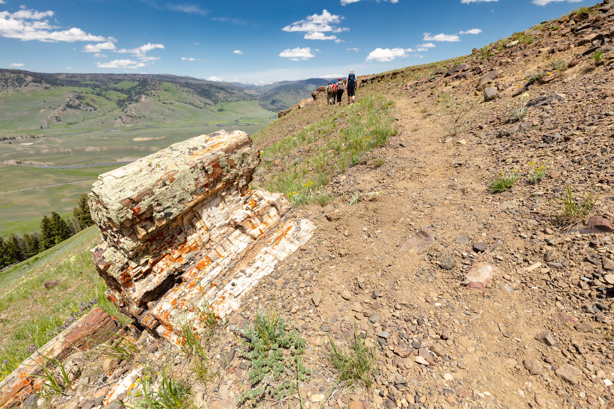
Follow the abandoned service road from the pullout for about 100 yards (91 m). Veer right onto the intersecting path and start climbing toward the ridge. Stay on the most obvious trail to the top of the open ridge. Follow the ridge line to the southwest in the direction of the cliff outcrop you saw from below. There are several wildlife trails that cut across below the top of the ridge, and traverse a forested area before ending at the trees. Be careful not to get off track on the wildlife trails. Take in the magnificent view across the valley. To the north, you can see the Slough Creek Valley and Absaroka Range. Descend the way you came up.
Safety notes: This strenuous, high elevation trail is not recommended for persons with heart and/or respiratory problems. This trail is not a part of the longer Specimen Ridge Trail. The Petrified Trees of Specimen Ridge is a separate, unmaintained and unmarked route. From the pullout, look southwest, away from the road. Toward the top of the ridge, at approximately the two o’clock position, you will see a cliff outcrop that contains the petrified trees. Keep this in mind as your ultimate destination.
Trailheads: Striped pullout 4.5 miles (7.2 km) east of Tower Junction on the Northeast Entrance Road. Marked by a sign reading “trailhead.”
17 mi one way · about 3,800 ft of climbing · 6,251 ft–9,609 ft · earth surface · hiking
TrailheadsSoda Butte Trailhead 6,647 ft Drive there · Specimen Ridge Trailhead 6,250 ft Drive there
Specimen Ridge Day Hike Trail the Park Service's write-up
2-4 Hours · no dogs · Summer, Fall
Start Northeast
Photo: NPS / Jacob W. Frank
Follow the abandoned service road from the pullout for about 100 yards (91 m). Veer right onto the intersecting path and start climbing toward the ridge. Stay on the most obvious trail to the top of the open ridge. Follow the ridge line to the southwest in the direction of the cliff outcrop you saw from below. There are several wildlife trails that cut across below the top of the ridge, and traverse a forested area before ending at the trees. Be careful not to get off track on the wildlife trails. Take in the magnificent view across the valley. To the north, you can see the Slough Creek Valley and Absaroka Range. Descend the way you came up.
Safety notes: This strenuous, high elevation trail is not recommended for persons with heart and/or respiratory problems. This trail is not a part of the longer Specimen Ridge Trail. The Petrified Trees of Specimen Ridge is a separate, unmaintained and unmarked route. From the pullout, look southwest, away from the road. Toward the top of the ridge, at approximately the two o’clock position, you will see a cliff outcrop that contains the petrified trees. Keep this in mind as your ultimate destination.
Trailheads: Striped pullout 4.5 miles (7.2 km) east of Tower Junction on the Northeast Entrance Road. Marked by a sign reading “trailhead.”
2.0 mi one way · about 60 ft of climbing · 7,746 ft–7,785 ft · native surface · hiking
TrailheadStorm Point Trailhead 7,785 ft Drive there
Storm Point Trail the Park Service's write-up
1-2 Hours · no dogs · Summer, Fall
Start Fishing Bridge
Photo: NPS / Addy Falgoust
This trail begins in the open meadows overlooking Indian Pond and Yellowstone Lake. It passes alongside the pond before turning right (west) into the forest. The trail continues through the trees and out to scenic, wind-swept Storm Point. The rocky area near the point is home to a large colony of yellow-bellied marmots. Following the shoreline to the west, the trail eventually loops back through the lodgepole forest and returns to Indian Pond.
Safety notes: Often closed in late spring and early summer due to bear activity. Inquire at the Fishing Bridge Visitor Center about trail closures before hiking.
Trailheads: Indian Pond pullout, 3 miles (5 km) east of Fishing Bridge Visitor Center.
3.5 mi one way · about 550 ft of climbing · 6,533 ft–6,952 ft · earth surface · hiking
Backcountry camps
Along the wayTOWER FALL SITE #1TOWER FALL SITE #2TOWER FALL SITE #3TOWER FALL SITE #32TOWER FALL SITE #4TOWER FALL SITE #5TOWER FALL SITE #6TOWER FALL SITE #7TOWER FALL SITE #8TOWER FALL SITE #9
TrailheadTower Creek Trailhead 6,534 ft Drive there
2.5 mi one way · about 350 ft of climbing · 6,186 ft–6,521 ft · asphalt, earth surface · hiking
TrailheadTower Falls Trailhead 6,451 ft Drive there
Yellowstone River Picnic Area Trail the Park Service's write-up
2-3 Hours · no dogs · Summer, Fall
Start Tower Junction
Photo: NPS / Jacob W. Frank
Trail climbs steeply to the east rim of the Narrows of the Yellowstone and then follows the rim. Look for peregrine falcons and osprey, which nest in the canyon, and bighorn sheep along the rim. View the Overhanging Cliff area, the towers of Tower Fall (the fall is not visible), basalt columns, and the historic Bannock Ford.
Safety notes: At the vista overlooking the Tower Falls area of the Yellowstone River, return the way you came or continue down the trail as it heads northeast; at the trail junction turn left and descend to the road. Walk west along the road for 0.7 mile (1.2 km) to the Yellowstone River Picnic Area.
Trailheads: Park at the Yellowstone River Picnic area, 1.25 miles (2 km) northeast of Tower Junction on the Northeast Entrance Road.
Accessibility The start of the trail ascends a rather steep hillside. The entire trail is single-wide, bare ground with frequent rocks and roots along the way. After ascending the hill, the trail follows a ridge with steep drop-offs.
2.5 mi one way · about 10 ft of climbing · 20 ft of descent · 7,323 ft–7,366 ft · asphalt, concrete, earth, wood surface · bike, hiking
Visitor centers
Along the wayOld Faithful Visitor Education Center
Observation Point Trail the Park Service's write-up
1-3 Hours · no dogs
Start Upper Geyser Basin
Photo: NPS / Diane Renkin
Switchbacks lead up the hill 0.5 miles (0.8 km) to a commanding view of the Upper Geyser Basin. Return the same way.
Safety notes: Carry water and pace yourself going up the hill.
Trailheads: From the Old Faithful Visitor Education Center, walk about 0.3 miles (0.5 km) counter-clockwise along the Old Faithful boardwalk, turn right at the Geyser Hill sign, and continue down the path. The trailhead is just after the bridge crossing the Firehole River.
0.9 mi one way · about 30 ft of climbing · 7,738 ft–7,791 ft · wood surface · hiking
TrailheadWest Thumb Geyser Basin Trailhead 7,791 ft Drive there
West Thumb Geyser Basin Trail the Park Service's write-up
30-60 Minutes · no dogs · Summer, Fall
Start West Thumb Geyser Basin
Photo: NPS / Diane Renkin
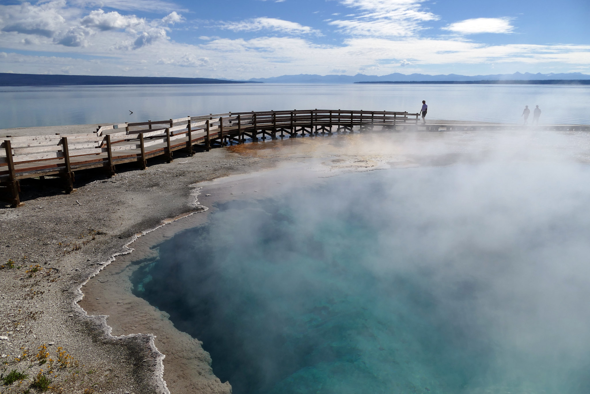
Stroll through a geyser basin of colorful hot springs and dormant lakeshore geysers situated on the scenic shores of Yellowstone Lake.
Safety notes: Be sure to stay on the boardwalks at all times.
Trailheads: West Thumb Geyser Basin Parking Area.
Accessibility West Thumb Geyser Basin overlooks Yellowstone Lake. The boardwalk trail has two loops. The outer loop is a ½-mile, and the inner loop is a ¼-mile in length. There is designated accessible parking.
0.3 mi one way · about 50 ft of climbing · 6,612 ft–6,660 ft · earth surface · hiking
TrailheadWraith Falls Trailhead 6,608 ft Drive there
Wraith Falls Trail the Park Service's write-up
30-60 Minutes · no dogs
Start Mammoth Hot Springs
Photo: NPS / Addy Falgoust
This short, easy trail passes through sagebrush meadows, marshland, and mixed conifer forest to the base of 79-foot (24 m) Wraith Falls on Lupine Creek.
Trailhead: The trail begins at a pullout ½-mile (0.8 km) east of Lava Creek Picnic Area on the Grand Loop Road.
Accessibility Wraith Falls trail is not accessible due to topography. The last 245’ of the trail is steep and rocky, with steps.
16 mi one way · about 2,100 ft of climbing · 5,257 ft–6,331 ft · earth surface · hiking
Backcountry camps
Along the way1Y11Y2
Blacktail Deer Creek to Yellowstone River Trail the Park Service's write-up
4-5 Hours · no dogs · Spring, Summer, Fall
Start East of Mammoth Hot Springs
Photo: NPS / Jacob W. Frank
Follow Blacktail Deer Creek as it descends 1,100 feet (335 m) through rolling, grassy hills and Douglas-fir forest to a suspension bridge over the Yellowstone River. Return the same way.
Safety notes: Trail frequented by horseback-riders.
Trailhead: 7 miles (11.3 km) east of Mammoth on the Grand Loop Road.
Grand Canyon of the Yellowstone the Park Service's write-up
1-2 Hours · no dogs
Start Canyon Village
Photo: NPS / Jacob W. Frank
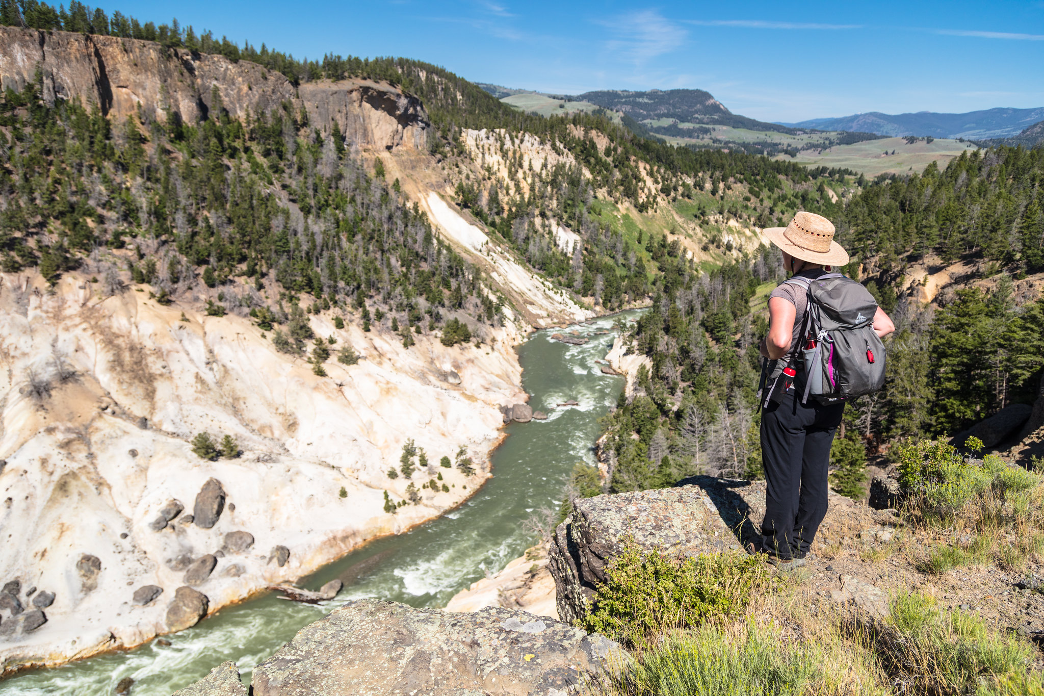
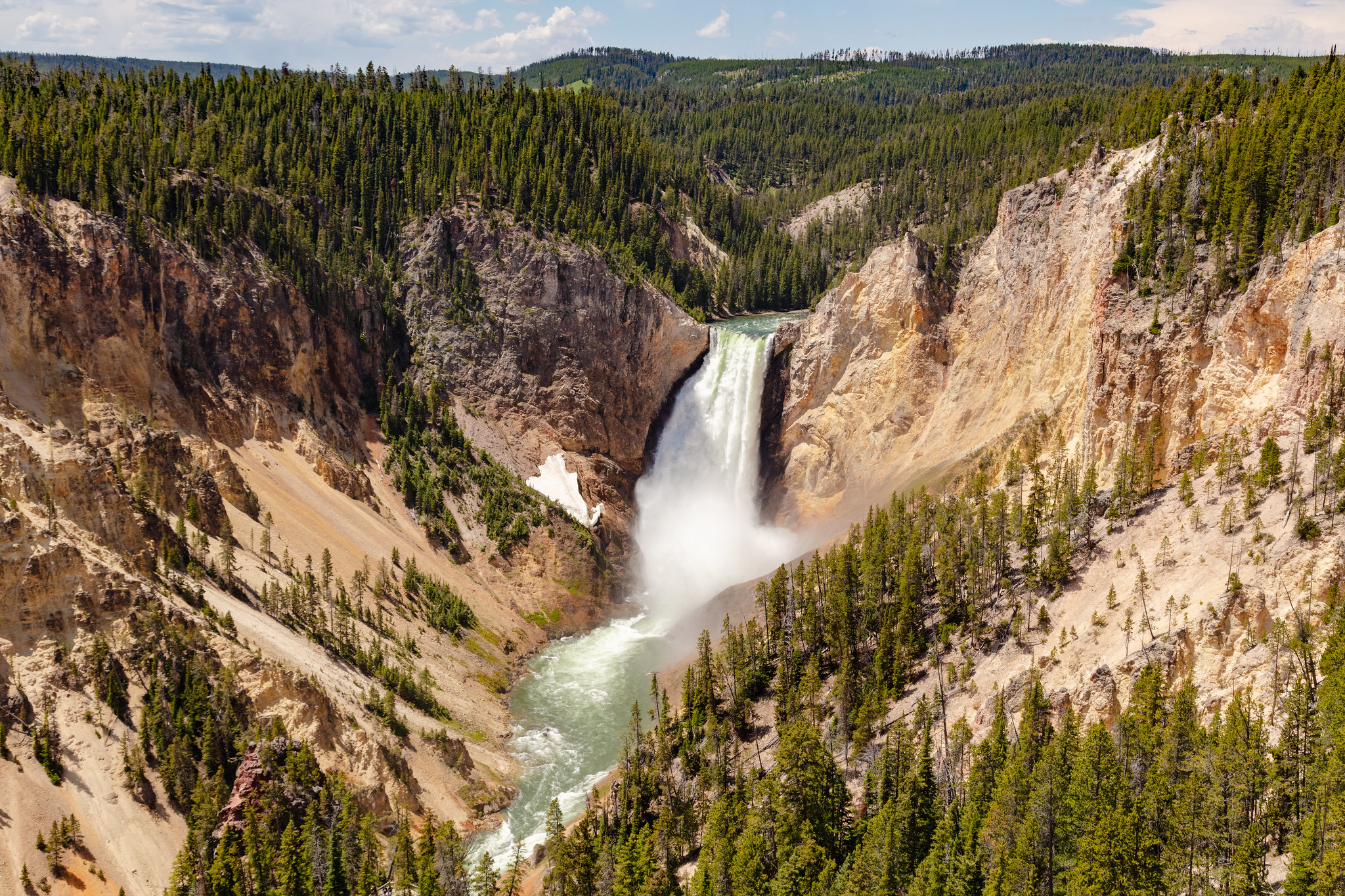
The Grand Canyon of the Yellowstone River expresses the park's complex geologic history in dramatic colors and shapes. Puffs of steam mark hydrothermal features in the canyon's walls. The Upper and Lower Falls of the Yellowstone River add to the grandeur of the unique natural treasure.
Experience the canyon from a variety of overlooks, at different times of day, and at different seasons. A number of trails and walkways wind along the rims and down partway into the canyon.
Check out the hike details and accessibility information at the bottom of this page.
Pets Pets are only allowed in the parking areas.
Accessibility Most of the trails along both rims have step grades or stairs. Because of the amount of vertical descent (and returning ascent), these trails are not recommended for visitors with heart, lungs, or other health conditions: Brink of the Lower Falls Trail Uncle Tom's Point Trail Red Rock Points Trail These locations meet wheelchair accessibility standards: Sidewalk along the Brink of the Lower Falls parking lot Sidewalk from Lookout Point parking lot to Grand View parking lot Sidewalk out to the second viewing area at Artist Point
Trail begins with a steep descent to the Yellowstone River Suspension Bridge, then crosses a sagebrush plateau, and drops down to Hellroaring Creek. Both the Yellowstone River and Hellroaring Creek are popular fishing areas.
Safety notes: Beyond the bridge are trail junctions for other major backcountry trails. Pay attention; stay on the Hellroaring Trail. Hellroaring is a major backcountry trail. This day hike stops at the confluence of Hellroaring creek and the Yellowstone River. Limited shade along this trail. Bring water.
Trailheads: Short dirt road leads to a parking area at the trailhead 3.5 miles (5.6 km) west of Tower Junction.
Yellowstone River Picnic Area Trail the Park Service's write-up
2-3 Hours · no dogs · Summer, Fall
Start Tower Junction
Photo: NPS / Jacob W. Frank
Trail climbs steeply to the east rim of the Narrows of the Yellowstone and then follows the rim. Look for peregrine falcons and osprey, which nest in the canyon, and bighorn sheep along the rim. View the Overhanging Cliff area, the towers of Tower Fall (the fall is not visible), basalt columns, and the historic Bannock Ford.
Safety notes: At the vista overlooking the Tower Falls area of the Yellowstone River, return the way you came or continue down the trail as it heads northeast; at the trail junction turn left and descend to the road. Walk west along the road for 0.7 mile (1.2 km) to the Yellowstone River Picnic Area.
Trailheads: Park at the Yellowstone River Picnic area, 1.25 miles (2 km) northeast of Tower Junction on the Northeast Entrance Road.
Accessibility The start of the trail ascends a rather steep hillside. The entire trail is single-wide, bare ground with frequent rocks and roots along the way. After ascending the hill, the trail follows a ridge with steep drop-offs.
347 more mapped segments without a name are on the map, not in the list.
More hikes the Park Service describes
Write-ups that name no single mapped trail, in the Service's words.
Brink of the Lower Falls Trail · no dogs · Summer, Fall Descend to the brink of the Lower Falls on this steep trail to catch a glimpse of one of Yellowstone's greatest wonders.
Dunraven Pass - Mount Washburn Trail · 3-6 Hours · no dogs · Summer, Fall Starting at the Dunravenn Pass Trailhead you ascend Mount Washburn on a trail with spectacular views. The Mount Washburn Trail and trailhead parking lot at Dunraven Pass will close for improvements August 6-27, 2019.
Explore the Fort Yellowstone Historic District · 45-60 Minutes · dogs allowed From 1886 to 1918, the US Army managed Yellowstone National Park. Starting in 1890, the US Army constructed Fort Yellowstone as a more permanent base of operations.
Fountain Paint Pot Trail · 30-45 Minutes · no dogs · Winter, Summer, Fall Explore the four major types of hydrothermal features along this short, popular, boardwalk trail.
Garnet Hill Trail · 4-5 Hours · no dogs Follow a stagecoach route on a meadow journey around Garnet Hill. The full route cannot be hiked due to a trail washout refer to Backcountry Conditions report.
Grand Prismatic Overlook Trail · 1-2 Hours · no dogs · Winter, Summer, Fall Hike up to an overlook of Grand Prismatic Spring.
Howard Eaton Trail (Canyon Area) · 5-6 Hours · no dogs · Summer, Fall Choose your destination on this trail that passes by four lakes, as you hike through forests, meadows, and marshes.
Ribbon Lake Trail · 3-4 Hours · no dogs · Summer, Fall Take a stroll out to Ribbon Lake, also passing by Lily Pad and Clear lakes.
Yellowstone Lake Overlook Trail · 1-3 Hours · no dogs · Summer, Fall Hike to a high mountain meadow for a commanding view of the West Thumb of Yellowstone Lake and the distant Absaroka Mountains.
About these trails
The lines are the National Park Service's public trails layer, the trailheads and the waterfalls, views, peaks and historic places along them the Service's public points of interest, read 2026-10-14 and simplified for the map. The write-ups are the Service's own "things to do", unedited. Heights come from USGS 3DEP through Terrain Tiles on AWS (Mapzen/Tilezen), read along each line and rounded; a short trail on steep ground can be off by a few tens of feet. Closures change: check the park's own site before you go.