
Fairy Falls Trail
Trailhead Fairy Falls Trailhead 7,259 ft Drive there
Fairy Falls Ski Trail the Park Service's write-up
6-8 Hours · no dogs · reservation required · Winter
Start Old Faithful Area
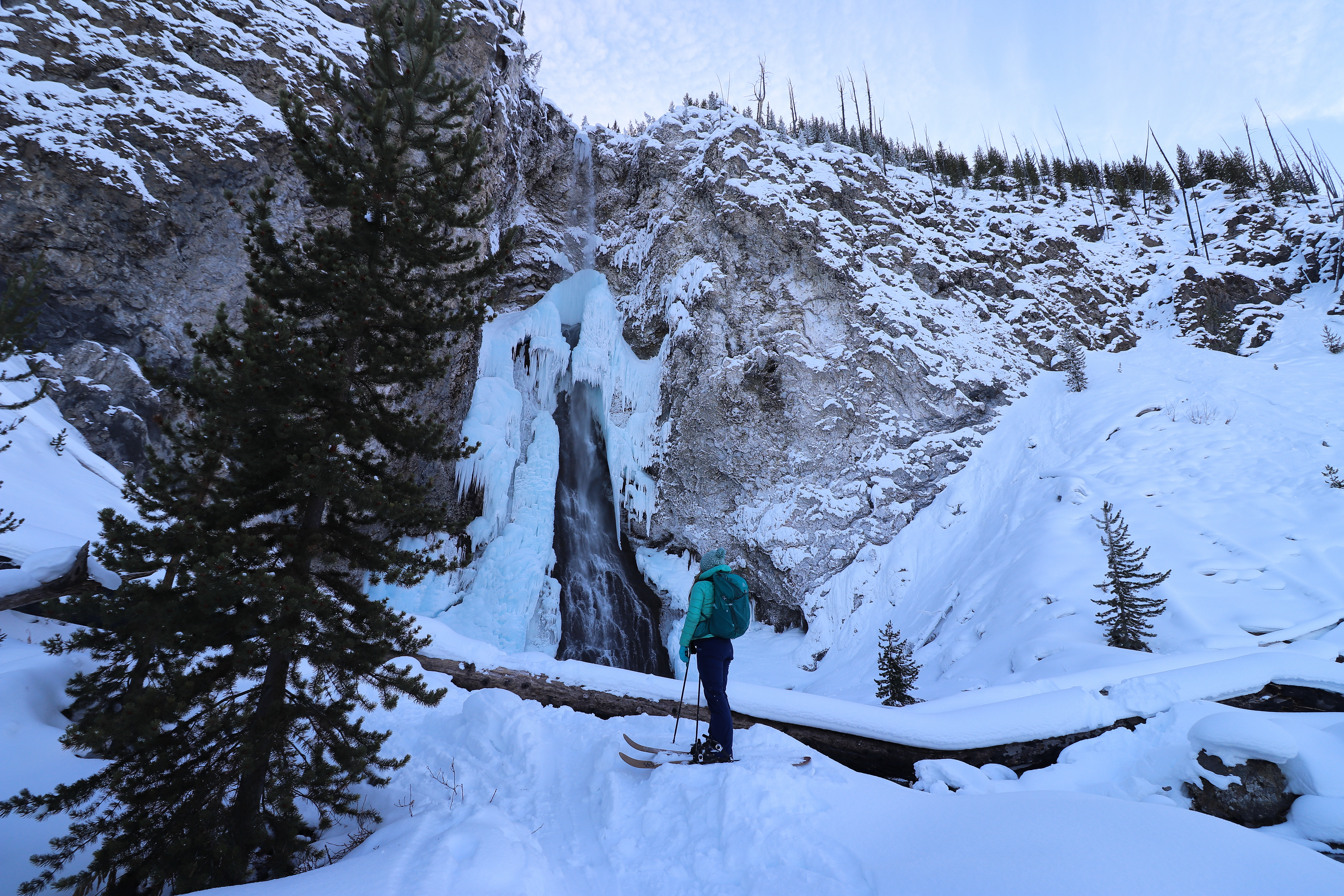
The Fairy Falls Ski Trail is a 10 mile (16 km) (with ski drop) skier-tracked, round-trip, easiest to more dificult ski that provides icy views of one of Yellowstone's most popular waterfalls. Ski 1.3 miles (2.1 km) on the Fountain Flats Drive, then turn left on the Fairy Falls Trail. Most of the Fairy Falls Trail is level, but there are hills and bends in the trail near the falls. Return via the same route, then take the Powerline Trail or the snow vehicle road to Old Faithful. To reach the more difficult Powerline Trail, ski about 0.25 miles (0.4 km) south (right) along the snow vehicle road to the Mallard Creek trailhead on the left. Follow the Mallard Creek Trail and turn right at the first junction onto the Powerline Trail, which has rolling hills. The Powerline Trail leads to the Upper Geyser Basin Trail and Morning Glory Pool. Where the trail crosses thermal areas, you may need to remove your skis due to lack of snow.
Notes: Bison and elk frequent this trail. Federal regulations require you to stay at least 100 yards (91 m) away from bears and wolves, and at least 25 yards (23 m) away from bison and all other wild animals. Stay on boardwalks and designated ski trails. The ground is unstable in hydrothermal areas.
Check out the ski trail details and accessibility information at the bottom of this page.
Pets Qualified service animals are welcome throughout the park and in all park facilities. However, they must be leashed and under your control at all times.
Accessibility This skier-tracked easy to more-difficult trail provides level terrain with some hills and bends in the trail near the falls. The trail elevation gain/loss is 160 feet. Service dogs allowed.
Fairy Falls Trail the Park Service's write-up
3-5 Hours · no dogs · Winter, Summer, Fall
Start Midway Geyser Basin
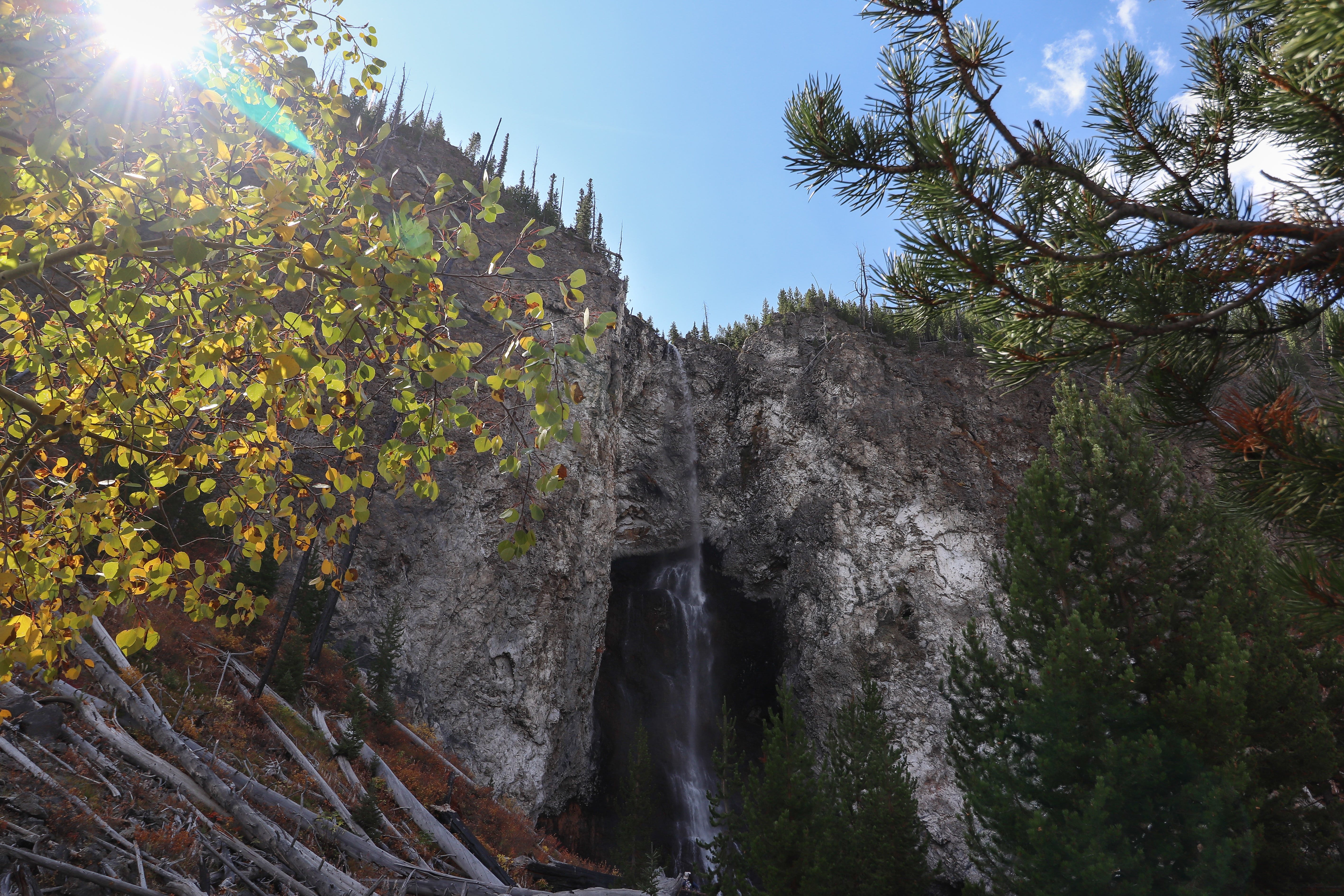
Fairy Falls, 200 feet (61 m) high, is one of Yellowstone's most spectacular waterfalls. From the trailhead, walk 1.6 miles (2.6 km) through a young lodgepole pine forest to the falls. You can continue 0.6 miles (0.97 km) to Spray and Imperial geysers, which adds 1.2 miles (1.9 km) to the hike. Return the same way.
Safety notes: Carry water and be aware of wildlife.
Trailheads: There are two trailheads and two different approaches to reach Fairy Falls. Either park at the end of Fountain Flat Drive or park 1 mile (1.6 km) south of Midway Geyser Basin at the Fairy Falls Parking Lot. Parking is very limited.