Valles Caldera National Preserve · New Mexico

VC08

5.9 mi of trail, end to end · Hike to Sulphur Springs: 1 mi round trip in the Service's write-up · about 500 ft of climbing · 850 ft of descent · 8,071 ft–8,901 ft · native surface · bike, hiking, horse · seasonal: Winter seasonal closure dependent on current conditions

8,500 ft 8,071 ft · 1.7 mi high 8,500 ft

Trailheads Alamo Canyon Trailhead 8,497 ft Drive there · Cerro Seco Trailhead 8,719 ft Drive there · Cerro Seco Trailhead 8,897 ft Drive there · San Antonio Mountain Trailhead 8,902 ft Drive there · VC10 Trailhead 8,393 ft Drive there

Hike to Sulphur Springs 1 mi round trip · the Park Service's write-up

30-60 Minutes · no dogs · entrance fee applies · Spring, Summer, Fall · season The last mile of Sulphur Creek Road/FR 105 gets very rough in the winter and is often impassable by vehicle.

Start Sulphur Creek Trailhead
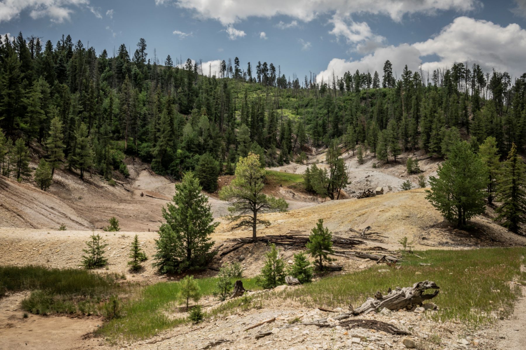
A hilly, geothermal landscape of bleached rock and soil largely devoid of vegetation.
Sulphur Springs Photo: NPS/Irene Owsley

A 0.5-mile (0.8 km) walk along the Sulphur Creek Trail leads hikers to Sulphur Springs, a site bubbling with geothermal features like acidic hot and cold springs, mudpots, and fumaroles. This area was once used for sulfur mining, geothermal energy exploration, and a hot springs health resort/spa.

For details about the geothermal features you'll encounter, check out the self-guided Sulphur Springs Geology Tour in the National Park Service smartphone app!

Elevation: 8,069 - 8,147 feet

Accessibility The gravel path that leads to Sulphur Springs is relatively flat. Service animals permitted.

This hike on nps.gov

Other trails from the same trailheads

All 27 trails in Valles Caldera National PreserveFind a trailOn the parks mapPark on nps.gov

About this trail's facts

The lines are the National Park Service's public trails layer, the trailheads and the waterfalls, views, peaks and historic places along them the Service's public points of interest, read 2026-10-16 and simplified for the map; the length is the line's, end to end. The write-ups are the Service's own "things to do" text, unedited. Heights come from USGS 3DEP through Terrain Tiles on AWS (Mapzen/Tilezen), read along each line and rounded; a short trail on steep ground can be off by a few tens of feet. Closures change: check the park's own site before you go.