Valles Caldera National Preserve · New Mexico

Cerro La Jara Trail

1.3 mi of trail, end to end · Hike the Cerro La Jara Loop: 1.5 mi loop in the Service's write-up · about 50 ft of climbing · 8,498 ft–8,547 ft · native surface · hiking · seasonal: Winter seasonal closure dependent on current conditions

8,517 ft 8,529 ft · 1.3 mi high 8,547 ft

Trailhead La Jara Trailhead 8,516 ft Drive there

Hike the Cerro La Jara Loop 1.5 mi loop · the Park Service's write-up

1-2 Hours · dogs allowed · entrance fee applies · season This is one of the few hiking trails that is accessible year-round at Valles Caldera National Preserve.

Start Cerro La Jara Loop
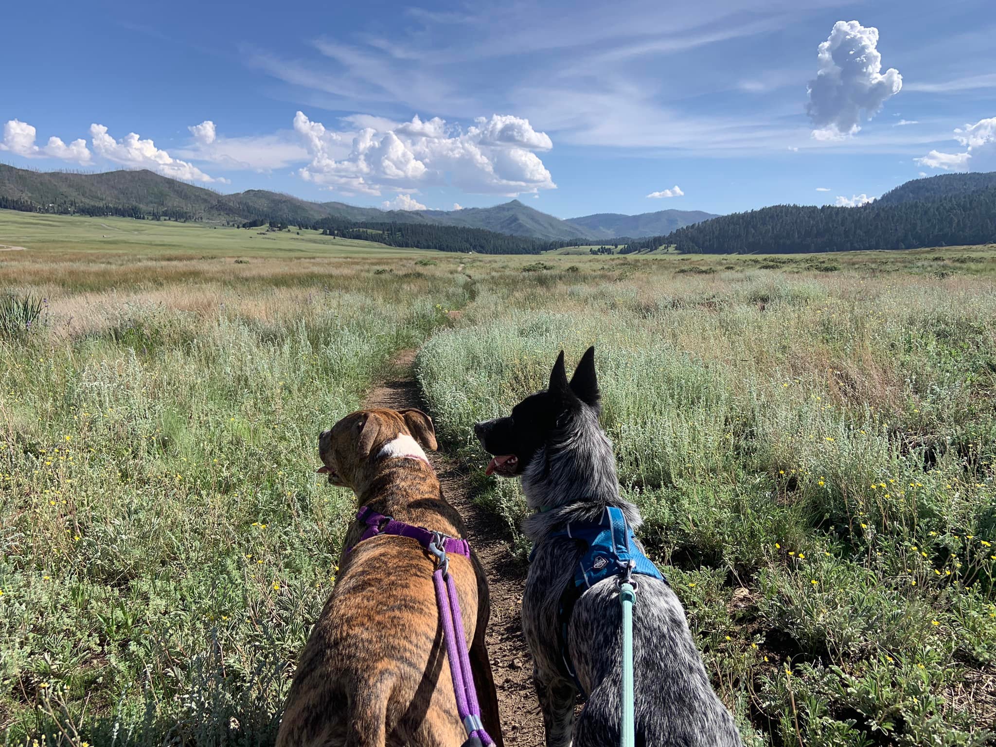
Two leashed dogs walk side-by-side in front of us on a narrow trail in a large grassland valley
Roxy and Zuma, two leashed dogs, walk side-by-side on the Cerro La Jara Loop. Photo: NPS/G. Farrell

This 1.5-mile (2.4 km) loop trail circles Cerro La Jara, the smallest volcanic dome in the park, which formed about 500,000 years ago when lava oozed up and onto the caldera floor. South Mountain, to the west, and Cerro del Medio, on the opposite side of Valle Grande, are also volcanic domes and can be seen from this trail.

The trail passes through a prairie dog colony; they'll be keeping an eye out for you and will make an alarm call as you approach and then scurry underground. Keep an eye out for them (and their large burrows) and their main predator, the coyote. Elk may be present late in the day at the base of South Mountain. There will be a good crop of wildflowers along the trail during the summer monsoon season.

Elevation: 8,497 - 8,545 feet

Accessibility This unpaved, natural surface trail is approximately 18 inches wide. Over 1.5 miles, the elevation range is between 8497 and 8545 feet.

This hike on nps.gov

Other trails from the La Jara Trailhead

All 27 trails in Valles Caldera National PreserveFind a trailOn the parks mapPark on nps.gov

About this trail's facts

The lines are the National Park Service's public trails layer, the trailheads and the waterfalls, views, peaks and historic places along them the Service's public points of interest, read 2026-10-16 and simplified for the map; the length is the line's, end to end. The write-ups are the Service's own "things to do" text, unedited. Heights come from USGS 3DEP through Terrain Tiles on AWS (Mapzen/Tilezen), read along each line and rounded; a short trail on steep ground can be off by a few tens of feet. Closures change: check the park's own site before you go.