
Muddy Hollow Trail
HistoryPicnic areas
Along the way Drakes Bay National Historic Landmark plaque Limantour Beach Picnic Area
Trailheads Limantour Beach Trailhead 18 ft Drive there · Muddy Hollow (North) Trailhead 89 ft Drive there · Muddy Hollow (South) Trailhead 23 ft Drive there
Hike the Estero–Glenbrook–Muddy Hollow Road Loop 7.4 mi round trip · the Park Service's write-up
3-4 Hours · no dogs · season <h2>Winter</h2> <p>The heaviest rainfall occurs in the winter months. Come prepared for rain and drizzle to possibly last for several days. In between winter rains, it is often sunny, calm, and cool.</p> <h2>Spring</h2> <p>Most spring days are windy and the Drakes Estero area frequently experiences stiff breezes. Expect cool temperatures in March. By late May and early June, temperatures can be quite pleasant, even warm.</p> <h2>Summer</h2> <p>Although there is very little rain during summer months, there is often dense fog throughout the day in July, August and September with temperatures often 20 degrees cooler than at Bear Valley.</p> <h2>Fall</h2> <p>The coastal areas of Point Reyes experience some of the clearest days in late September, October and early November. The occasional storm will start rolling through in late October, bringing clouds, wind, and rain. The strongest winds occur in November and December during occasional southerly gales.</p>
Start Muddy Hollow Trailhead, Point Reyes National Seashore
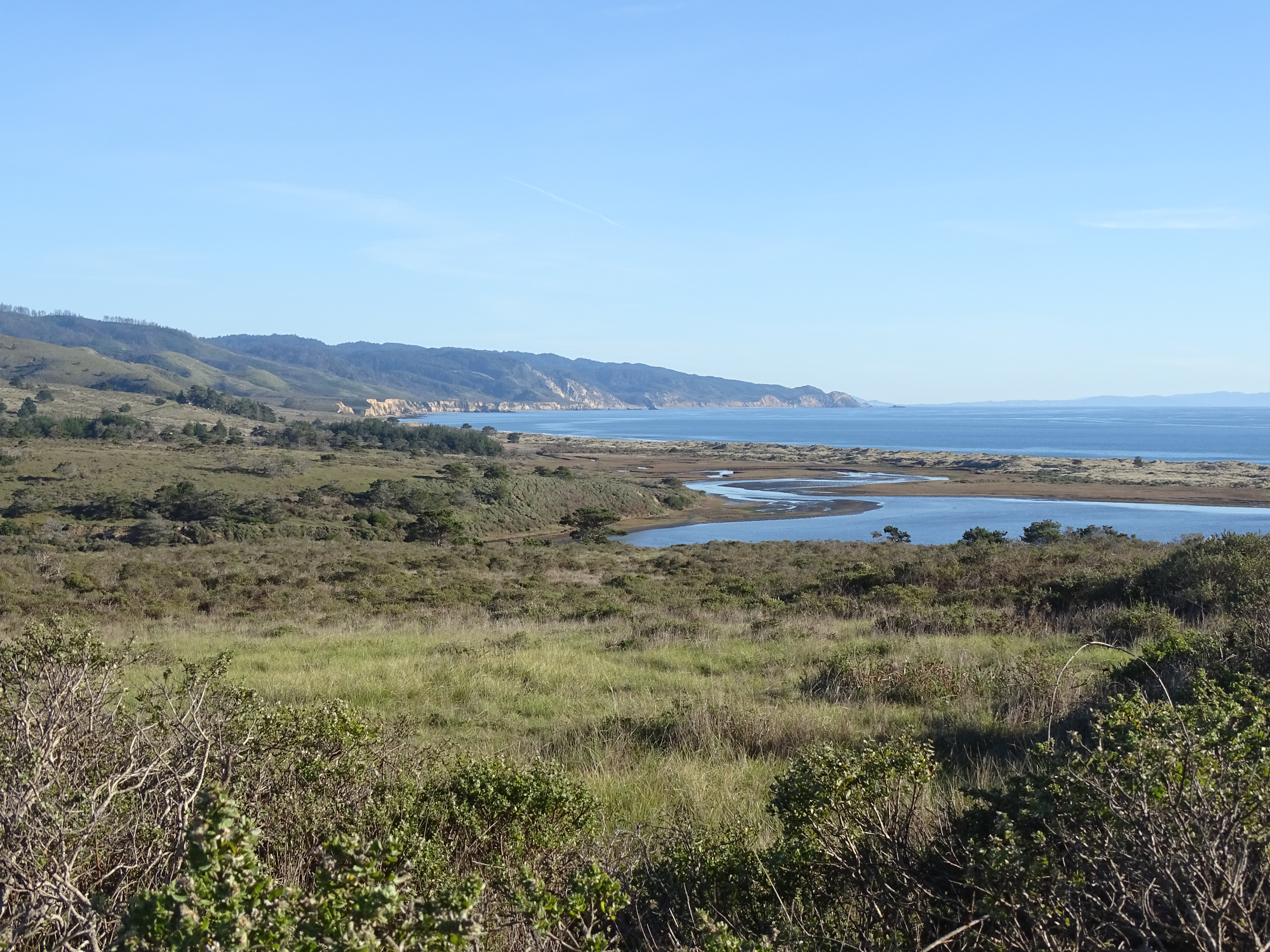
Distance: 7.4 miles (12 km) roundtrip, moderate
This loop hike passes through young woodlands, coastal scrub, and grassland within the Phillip Burton Wilderness . It offers views of Estero de Limantour and the possibility of seeing tule elk and other wildlife that call this area home. It is also a great hike for spring wildflowers . This area was burned by the 1995 Vision Fire , and Bishop pine trees have since started encroaching on what had previously been open grassland and coastal scrub.
From the Muddy Hollow Trailhead , this loop offers a similar experience and views regardless of whether one follows it clockwise or counter-clockwise. However, just west of the trailhead, the Muddy Hollow Road Trail intersects with Muddy Hollow Creek. No bridge exists at this crossing, so hikers may get their feet wet while attempting to cross this ~8-foot-wide (2.4-meter-wide) creek, especially when the water level is high in the winter and spring. You may want to check out this crossing before starting your hike to determine which direction you will go. If you attempt to cross the creek at the start of the hike and you do get your feet wet, you may not enjoy the hike as much as you hike for the next 7.4 miles (12 km) with wet footwear. If you decide to cross the creek at the end of your hike, you won't have too much further to walk before you can change out of your wet footwear at your vehicle.
If you choose to hike the route clockwise, head south on the Muddy Hollow Trail for 0.3 miles (0.5 km) through a riparian (e.g., streamside) zone to the junction with Estero Trail. The Estero Trail heads west out of the valley floor through some coastal scrub and young Bishop pine woodlands up and over a 370-foot-high (112-meter-high) ridge before descending into another valley and crossing the Glenbrook Creek after 2.2 miles (3.5 km). There may be standing water on the trail in the Glenbrook Creek area during winter and spring.
Just beyond the Glenbrook Creek is the site of the New Albion Ranch, which is significant as the first dairy on Point Reyes, perhaps in Marin County. All that remains of the ranch, however, are eucalyptus trees that were planted to protect the ranch from the wind.
Continue south 0.4 miles (0.6 km) toward the estero (which is Spanish for estuary) and Drakes Bay before making a sharp bend to the north. The trail runs fairly straight along a low ridge crest before intersecting with the Glenbrook Trail in 1.1 miles (1.7 km). The forested ridge in the distance to the north is the northern end of Inverness Ridge, which reaches heights of 1282 feet (388 meters) at Mount Vision and 1336 feet (405 meters) at Point Reyes Hill. The route described on this page will ultimately follow along the western base of this ridge, but won't ascend to its crest.
At the Glenbrook Trail junction, you could turn left to stay on the Estero Trail and return via the White Gate and Muddy Hollow Road trails—doing so would add an extra 2 miles (3 km) to your hike. Or continue straight along the ridge crest as the Glenbrook Trail leads 0.6 miles (1 km) north to the Muddy Hollow Road Trail. Turn right and follow the Muddy Hollow Road Trail as it meanders 2.3 miles (3.7 km) along the base of Inverness Ridge back to the trailhead.
The Bucklin and Bayview Trails connect with the Muddy Hollow Road Trail and offer routes to ascend to the crest of Inverness Ridge, which would add another ~4 to ~6 miles (6.4 to 9.6 km) to your hike.
This route description alone is not a substitute for a trail map. Print out the park's North District trail map (3,409 KB PDF) before your visit, or pick one up at a visitor center on your way.
Always check current conditions before heading out into the park and familiarize yourself with park regulations . Please practice Leave No Trace principles.
Visit the park's Hiking at Point Reyes National Seashore page for hiking tips and information about trail etiquette and safety.
Visit the park's Trail Advisories and Closures page for current information about closed trails, trails blocked by trees, or other temporary hazards or advisories.
Pets Pets are prohibited on all of the trails described on this page. Visit the park's Pets page to learn where pets are welcome at Point Reyes National Seashore.
Accessibility This trail traverses rolling terrain over packed dirt surfaces, which may be wet and rutted in places. The trailhead parking lot is dirt/gravel. Just west of the Muddy Hollow Trailhead, the Muddy Hollow Road Trail intersects with Muddy Hollow Creek. No bridge exists at this crossing, so hikers may get their feet wet while attempting to cross this ~8-foot-wide (2.4-meter-wide) creek.
Hike the Muddy Hollow Trail 4 mi round trip · the Park Service's write-up
1-3 Hours · no dogs · season <h2>Winter</h2> <p>The heaviest rainfall occurs in the winter months. Come prepared for rain and drizzle to possibly last for several days. In between winter rains, it is often sunny, calm, and cool.</p> <h2>Spring</h2> <p>Most spring days are windy and the Limantour Beach area frequently experiences fresh to strong breezes. Expect cool temperatures in March. By late May and early June, temperatures can be quite pleasant, even warm.</p> <h2>Summer</h2> <p>Although there is very little rain during summer months, there is often dense fog throughout the day in July, August and September with temperatures often 20 degrees cooler than at Bear Valley.</p> <h2>Fall</h2> <p>The coastal areas of Point Reyes experience some of the clearest days in late September, October and early November. The occasional storm will start rolling through in late October, bringing clouds, wind, and rain. The strongest winds occur in November and December during occasional southerly gales.</p>
Start Muddy Hollow Trailhead or Limantour Beach Trailhead, Point Reyes National Seashore
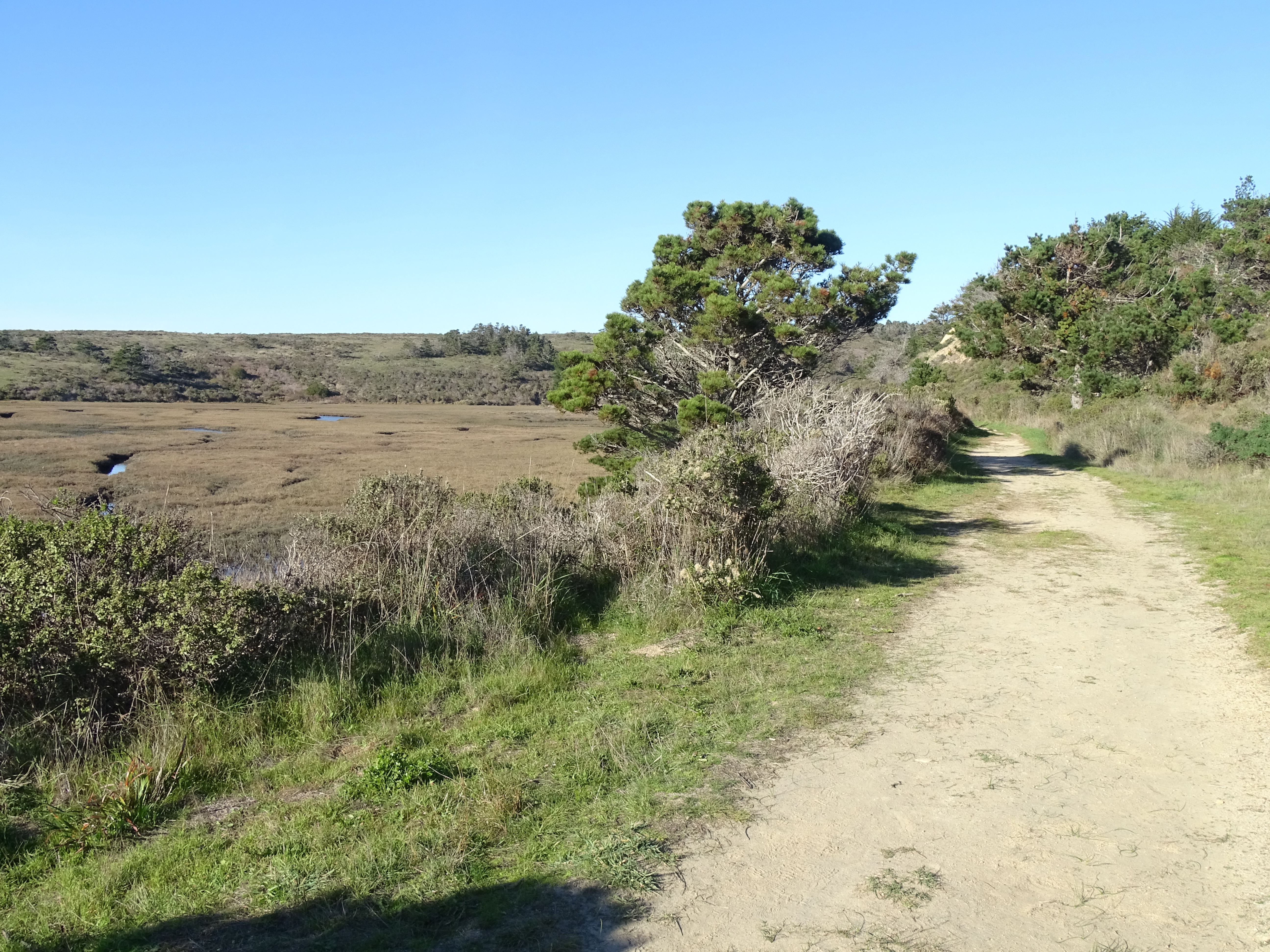
Distance: 4 mi (6.4 km) roundtrip
This out-and-back trail offers an easy hike with opportunities to see diverse bird life, wildflowers, and possibly tule elk ! One can either start at the Muddy Hollow Trailhead at the trail's north end and hike to and from Limantour Beach , or start at trail's southern terminous at the Limantour Beach Trailhead and hike north and up the Muddy Hollow drainage.
Beginning at the Muddy Hollow Trailhead, follow the path downstream through lush riparian habitat of red alder and willow. After 1.4 miles (2.2 km), one arrives at a pond, which is a good location for birding. The next 0.4 miles (0.7 km) of trail skirts along the southern edge of an arm of Estero de Limantour before eventually arrive at the picnic area just south of Limantour Beach parking lot. Vault toilets are available at this location. From here, you can continue for ~0.2 miles (~350 meters) to the edge of Drakes Bay at Limantour Beach. Retrace your route back when you are ready.
Alternatively, some prefer to start their hike by parking at the Limantour Beach lot and following the Muddy Hollow Trail north from the Limantour Beach Trailhead. This offers the possibility of relax at the beach upon one's return. To find the southern end of the Muddy Hollow Trail from the large gravel parking lot at Limantour Beach, follow the path from the southern end of the parking lot past the vault toilets, keeping to the right. Just before the picnic area, the trail heads off to the west (to the right) through a small copse of pines.
In the spring and early summer months, tall grasses and new plant growth encroach along sections of the Muddy Hollow Trail. Pants and long sleeves are advised.
This route description alone is not a substitute for a trail map. Print out the park's North District trail map (3,409 KB PDF) before your visit, or pick one up at a visitor center on your way.
Always check current conditions before heading out into the park and familiarize yourself with park regulations . Please practice Leave No Trace principles.
Visit the park's Hiking at Point Reyes National Seashore page for hiking tips and information about trail etiquette and safety.
Visit the park's Trail Advisories and Closures page for current information about closed trails, trails blocked by trees, or other temporary hazards or advisories.
Pets Pets are prohibited on the Muddy Hollow Trail. However, pets on a six-foot-or-shorter leash are permitted on Limantour Beach east of the main Limantour Beach Access Trail. Visit the park's Pets page to learn more about where pets are welcome at Point Reyes National Seashore.
Accessibility The trail has a flat or mild grade for its duration. The trail surface is packed dirt, and is approximately 3 to 8 feet wide, depending on the section. There are several narrow footbridges on the path. The vault toilets at Limantour Beach do not meet the criteria for accessibility.