
Mount Wittenberg Trail
Hike to Mount Wittenberg from Bear Valley 4.8–6.5 mi round trip · the Park Service's write-up
2-3 Hours · no dogs · season <h2>Winter</h2> <p>The heaviest rainfall occurs in the winter months. Come prepared for rain and drizzle to possibly last for several days. In between winter rains, it is often sunny, calm, and cool.</p> <h2>Spring</h2> <p>Most spring days are windy. Expect cool temperatures in March. By late May and early June, temperatures can be quite pleasant.</p> <h2>Summer</h2> <p>Although there is very little rain during summer months, there is often dense fog, which tends to burn off by mid-day. Afternoons are often sunny and warm to hot with a light breeze.</p> <h2>Fall</h2> <p>Point Reyes experience some of the clearest days in late September, October, and early November. The occasional storm will start rolling through in late October, bringing clouds, wind, and rain. The strongest winds occur in November and December during occasional southerly gales.</p>
Start Bear Valley Trailhead, Point Reyes National Seashore
Distance: 4.8 to 6.5 miles (7.7 to 10.4 km) roundtrip, strenuous
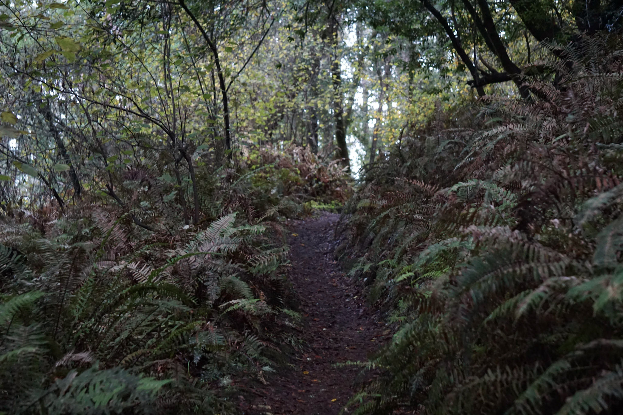
The hikes described on this page feature steep 400 meter (1300 feet) climbs to Mount Wittenberg, the highest point on the Point Reyes Peninsula at 1407 feet (426 meters) in elevation, with a few limited views of the ocean and Olema Valley near the ridge crest. These routes pass through a dense mixed Douglas fir and oak forest and a few open meadows. These routes are also mostly within the Phillip Burton Wilderness . Please practice Leave No Trace principles.
Start at the Bear Valley Trailhead and follow the relatively flat Bear Valley Trail south through a meadow for 0.2 miles (0.3 km), passing into the Phillip Burton Wilderness. Turn right on to the Mount Wittenberg Trail and ascend through the forest, passing through a few meadows, for a distance of 1.8 miles (2.9 km) to the Mount Wittenberg-Z Ranch trail junction, which is located in a meadow along the ridge crest.
From this junction, the 0.3-mile-long (0.5-kilometer-long) Mount Wittenberg Summit Trail leads, as its name suggests, to the summit of Mount Wittenberg. The once unobstructed views from near the summit have, since 2000, become obstructed by dense Douglas fir thickets that sprouted shortly after the 1995 Vision Fire . While the 2020 Woodward Fire burned through much of the forest around Mount Wittenberg, the view-obstructing Douglas fir thickets were largely left unscathed.
Return back to the Mount Wittenberg-Z Ranch trail junction where there are a few options to return to the trailhead:
Retrace your route back to the Bear Valley trailhead for a total of 4.8 miles (7.7 km) roundtrip.
Return via the Meadow Trail for a 5.4-mile-long (8.6-km-long) loop. From the Mount Wittenberg-Z Ranch trail junction, continue west along the Mount Wittenberg Trail for 0.4 miles (0.6 km) to its junction with the Meadow and Sky trails. Along this section of trail, one may be rewarded (weather dependent) with views looking west across the peninsula to the Pacific Ocean. From the Meadow-Sky trail junction, descend the Meadow Trail through forest and a couple meadows for 1.6 miles (2.6 miles) to the Bear Valley Trail. Turn left and follow Bear Valley Creek downstream for 0.8 miles (1.3 km) to return to the Bear Valley Trailhead.
Return via the Horse Trail for a 6.5-mile-long (10.4-km-long) loop. From the Mount Wittenberg-Z Ranch trail junction, turn north and follow the Z Ranch Trail through a thicket of Douglas fir for 0.7 miles (1.2 km) to the Horse Trail. Turn right and follow the Horse Trail downhill for 2.4 miles (3.8 miles) to its junction with the Morgan Trail. Along this section, there are a few gaps in the forest canopy that provide views to the north of Inverness Ridge and Bolinas Ridge and just a little bit of Tomales Bay. Turn right and follow the Morgan Trail around the west side of the Morgan Horse Ranch to return to the Bear Valley Trailhead.
This route description alone is not a substitute for a trail map. Print out the Point Reyes National Seashore's South District trail map (3,422 KB PDF) before your visit, or pick one up at the Bear Valley Visitor Center on your way.
Always check current conditions before heading out into the park and familiarize yourself with park regulations . Please practice Leave No Trace principles.
Visit the park's Hiking at Point Reyes National Seashore page for hiking tips and information about trail etiquette and safety.
Visit the park's Trail Advisories and Closures page for current information about closed trails, trails blocked by trees, or other temporary hazards or advisories.
Pets Pets are prohibited on all of the trails that lead to Mount Wittenberg. Visit the park's Pets page to learn where pets are welcome at Point Reyes National Seashore.
Accessibility The Mount Wittenberg, Meadow, Z Ranch, and Horse Trails vary in width from three to six feet (0.9 to 1.8 meters). The total elevation change from Bear Valley to the summit of Mount Wittenberg is about 1300 feet (400 meters) over a distance of 2.4 to 4.1 miles (3.8 to 6.6 km), depending on which route one follows. The trail surface is mostly compacted dirt with exposed roots and rocks.
Hike to Mount Wittenberg from the Sky Trailhead 4.5 mi round trip · the Park Service's write-up
2-3 Hours · no dogs · season <h2>Winter</h2> <p>The heaviest rainfall occurs in the winter months. Come prepared for rain and drizzle to possibly last for several days. In between winter rains, it is often sunny, calm, and cool.</p> <h2>Spring</h2> <p>Most spring days are windy. Expect cool temperatures in March. By late May and early June, temperatures can be quite pleasant.</p> <h2>Summer</h2> <p>Although there is very little rain during summer months, there is often dense fog, which tends to burn off by mid-day. Afternoons are often sunny and warm to hot with a light breeze.</p> <h2>Fall</h2> <p>Point Reyes experience some of the clearest days in late September, October, and early November. The occasional storm will start rolling through in late October, bringing clouds, wind, and rain. The strongest winds occur in November and December during occasional southerly gales.</p>
Start Sky Trailhead along Limantour Road, Point Reyes National Seashore
The Sky Trailhead Parking Lot and the Sky Trail from the trailhead to Sky Campground will be closed from Wednesday, September 18, 2024, through Wednesday, October 2, 2024, for resurfacing and trailwork. The parking lot and trailhead will be fully closed with no overnight parking allowed to accommodate staging equipment and materials. While work is performed on Sky Trail, equestrians and bicyclists must use alternate routes and hikers should also seek different paths. Visitors should also expect to see large trucks on Limatour Road and staging at the pullout across from the Sky Trailhead Parking Lot. Although the trailhead will be closed to parking for the duration of the project, the Sky Trail will be open to hikers on weekends.
-->
Distance: 4.5 miles (7.2 km) roundtrip
This hike provides the easiest route to Mount Wittenberg, the highest point on the Point Reyes Peninsula at 1407 feet (426 meters) in elevation. There is only 750 feet (225 meters) in elevation gain from the Sky Trailhead , as opposed to 1300 feet (400 meters) from the Bear Valley Trailhead via the Mount Wittenberg Trail . This hike is mostly within the Phillip Burton Wilderness . Please practice Leave No Trace principles.
Start at the Sky Trailhead, which is located along Limantour Road. Follow the northern section of the Sky Trail, which has some limited views of the ocean, through the woods for 0.8 (1.3 km) to the Horse Trail. Turn left and follow the Horse Trail for 0.4 miles (0.6 km) to the Z Ranch Trail and turn right. After 0.7 miles (1.1 km), the Z Ranch Trail brings you to the Z Ranch-Mount Wittenberg trail junction.
From this junction, the 0.3-mile-long (0.5-kilometer-long) Mount Wittenberg Summit Trail leads, as its name suggests, to the summit of Mount Wittenberg. The once unobstructed views from near the summit have, since 2000, become obstructed by dense Douglas fir thickets that sprouted shortly after the 1995 Vision Fire . While the 2020 Woodward Fire burned through much of the forest around Mount Wittenberg, the view-obstructing Douglas fir thickets were largely left unscathed.
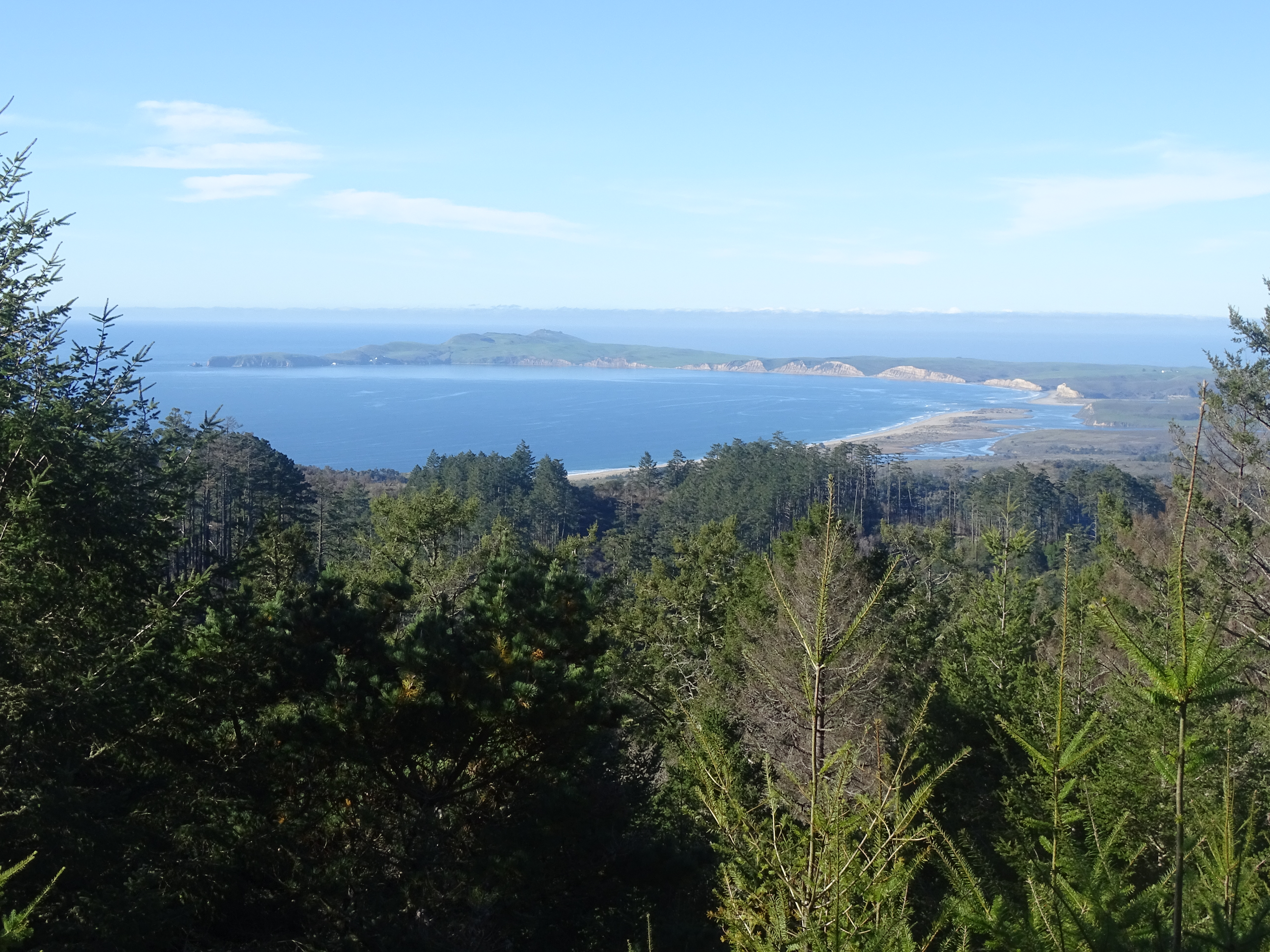
However, as one continues from the Z Ranch-Mount Wittenberg trail junction along the 0.4.-mile-long (0.6-km-long) western leg of the Mount Wittenberg Trail to the junction of Sky and Meadow Trails, there are locations from which one may look west across the peninsula to the Pacific Ocean (weather dependent). From the Sky-Meadow trail junction, turn north on to the Sky Trail, which, in 0.5 miles (0.8 km) leads past Sky Campground , before returning to the trailhead 1.3 mile (2.1 km) later.
Mount Wittenberg took its name from Peter and Newton Wittenberg, who are believed to be the first occupants of the Z Ranch in the early 1860s. The Z Ranch was located at the present-day Sky Campground. The Z Ranch was the highest elevation ranch on the peninsula. All that remains of the ranch operation are eucalyptus and cypress trees that were planted as wind breaks and the remains of a concrete pathway that leads to the old ranch spring.
This route description alone is not a substitute for a trail map. Print out the Point Reyes National Seashore's South District trail map (3,422 KB PDF) before your visit, or pick one up at the Bear Valley Visitor Center on your way.
Always check current conditions before heading out into the park and familiarize yourself with park regulations . Please practice Leave No Trace principles.
Visit the park's Hiking at Point Reyes National Seashore page for hiking tips and information about trail etiquette and safety.
Visit the park's Trail Advisories and Closures page for current information about closed trails, trails blocked by trees, or other temporary hazards or advisories.
Pets Pets are prohibited on the Sky, Mount Wittenberg, Z Ranch, and Horse trails. Visit the park's Pets page to learn where pets are welcome at Point Reyes National Seashore.
Accessibility The Sky Trail is an old ranch road and its northern 1.4 miles (2.2 km) is maintained as a service road for NPS vehicles to drive to Sky Campground. So, this section of the route tends to be at least 8 feet (2.4 meters) wide with a substrate of dirt and gravel. The Sky Trail from its trailhead to Sky Campground is open to bicycles, strollers, and other wheeled devices. But, since this is also one of the steeper sections of the route, with a change in elevation of about 350 feet (106 meters), it may be challenging for someone in a wheelchair without assistance. The other sections of trail along this hike also follow the routes of old ranch roads, but these sections are not maintained as roadways and have largely become single-track trails that may be only a two feet (60 cm) wide in places. Wheeled devices, such as bicycles and strollers, are prohibited on these other trails. Wheelchairs are permitted on these other trails, but none of these trails meet the criteria for being accessible.