
Coast Trail
Campgrounds
Along the way Coast Campground Wildcat Campground
Trailheads Coast Trailhead 119 ft Drive there · Palomarin Trailhead 264 ft Drive there
Hike the Laguna-Coast Loop 5 mi round trip · the Park Service's write-up
2-3 Hours · no dogs · season <h2>Winter</h2> <p>The heaviest rainfall occurs in the winter months. Come prepared for rain and drizzle to possibly last for several days. In between winter rains, it is often sunny, calm, and cool.</p> <h2>Spring</h2> <p>Most spring days are windy and this area frequently experiences fresh to strong breezes. Expect cool temperatures in March. By late May and early June, temperatures can be quite pleasant, even warm.</p> <h2>Summer</h2> <p>Although there is very little rain during summer months, there is often dense fog throughout the day in July, August and September with temperatures often 20 degrees cooler than at Bear Valley.</p> <h2>Fall</h2> <p>The coastal areas of Point Reyes experience some of the clearest days in late September, October and early November. The occasional storm will start rolling through in late October, bringing clouds, wind, and rain. The strongest winds occur in November and December during occasional southerly gales.</p>
Start Laguna Trailhead or Coast Trailhead along Laguna Road, Point Reyes National Seashore
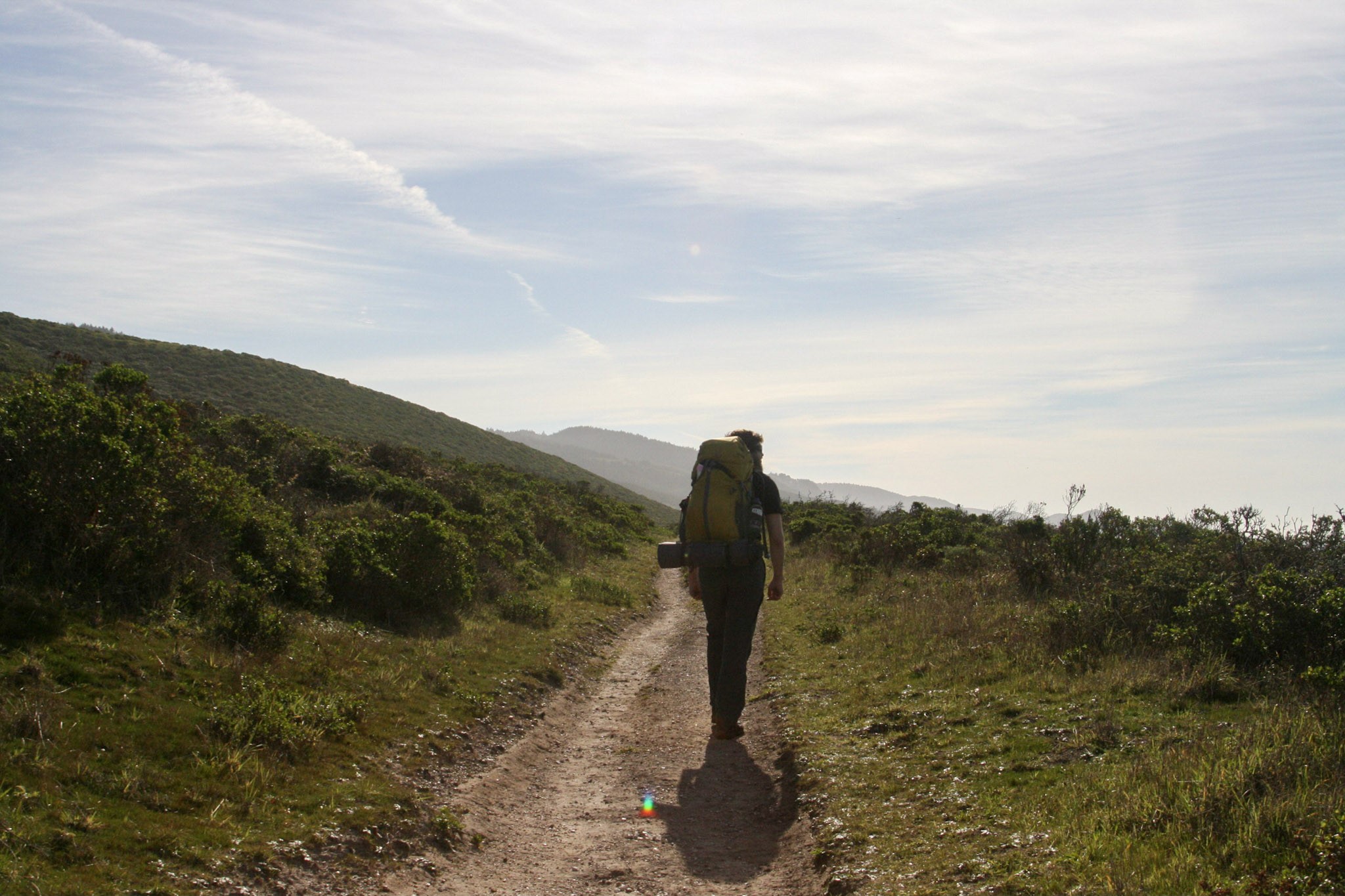
Distance: 5 miles (8 km) roundtrip, moderate
This hike through coastal scrub, coastal grasslands, and along a stream offers some breath-taking ocean views. This loop may be hiked either clockwise or counter-clockwise (when viewed from above or on a map), although many frequent hikers of this trail prefer the clockwise route. The route description below follows the clockwise route.
The Laguna-Coast Loop hike begins at the Laguna Trailhead and quickly enters the Phillip Burton Wilderness . The route steadily ascends the 0.8-mile-long (1.3-kilometer-long) southern leg of the Laguna Trail to a 400-foot-high (120-meter-high) ridge crest from which Drakes Bay is visible. The route then descends via the 1-mile-long (1.6-kilometer-long) southern leg of the Fire Lane Trail to the Coast Trail just north of the Coast Campground . After 1.8 miles (2.9 km), turn left on the Coast Trail for 0.1 miles (160 m) to reach the Coast Campground. Here, you can access the Santa Maria Beach, refill your water bottle at one of the campgrounds water faucets, or use the vault toilet.
Retrace your steps for 0.1 miles (160 m) to the Coast Trail-Fire Lane Trail junction. Instead of turning back up the Fire Lane Trail, continue on the Coast Trail for 2.8 miles (4.5 km). An additional place to descend to the beach is located 1.1 miles (1.9 km) west of the Coast Campground. This multi-use trail* meanders along the tops of coastal bluffs before turning north and inland to parallel a steam before ending at the Coast Trailhead near Limantour Lodge. Turn right and walk a short distance along Laguna Road to return to your vehicle. Use caution when walking along the road.
* Bicycles are permitted on the Coast Trail from the Coast Trailhead to Coast Campground. Bicycles are prohibited on other trails in this immediate area. Visit the park's Bicycle Riding page to learn more about where bicylces may be ridden at Point Reyes National Seashore.
This loop can also be done in the opposite direction, beginning at the Coast Trailhead and ending at the Laguna Trailhead.
This route description alone is not a substitute for a trail map. Print out the park's South District trail map (3,422 KB PDF) before your visit, or pick one up at a visitor center on your way.
Always check current conditions before heading out into the park and familiarize yourself with park regulations . Please practice Leave No Trace principles.
Visit the park's Hiking at Point Reyes National Seashore page for hiking tips and information about trail etiquette and safety.
Visit the park's Trail Advisories and Closures page for current information about closed trails, trails blocked by trees, or other temporary hazards or advisories.
Pets Pets are prohibited on the Laguna, Fire Lane, and Coast Trails, as well as other trails in this area. Visit the park's Pets page to learn more about where pets are welcome at Point Reyes National Seashore.
Accessibility The Laguna and Fire Lane Trails are fairly narrow and moderately steep and can be deeply rutted in some places. The Coast Trail from the Coast Trailhead doubles as an eight-foot-wide (2.4-meter-wide) service/fire road that is composed of compacted dirt and gravel (and potholes and washboarding). Otherwise, the Coast Trail's northern 2.8 miles (4.5 km) is relative flat; the steepest section is at the Coast Trail's junction with the Laguna Road where the trail drops relatively steeply from the built-up road to the valley floor.
Hike the Sky–Woodward Valley–Fire Lane Loop the Park Service's write-up
4-6 Hours · no dogs · season <h2>Winter</h2> <p>The heaviest rainfall occurs in the winter months. Come prepared for rain and drizzle to possibly last for several days. In between winter rains, it is often sunny, calm, and cool.</p> <h2>Spring</h2> <p>Most spring days are windy. Expect cool temperatures in March. By late May and early June, temperatures can be quite pleasant.</p> <h2>Summer</h2> <p>Although there is very little rain during summer months, there is often dense fog, which tends to burn off by mid-day. Afternoons are often sunny and warm to hot with a light breeze.</p> <h2>Fall</h2> <p>Point Reyes experience some of the clearest days in late September, October, and early November. The occasional storm will start rolling through in late October, bringing clouds, wind, and rain. The strongest winds occur in November and December during occasional southerly gales.</p>
Start Sky Trailhead along Limantour Road, Point Reyes National Seashore
The Sky Trailhead Parking Lot and the Sky Trail from the trailhead to Sky Campground will be closed from Wednesday, September 18, 2024, through Wednesday, October 2, 2024, for resurfacing and trailwork. The parking lot and trailhead will be fully closed with no overnight parking allowed to accommodate staging equipment and materials. While work is performed on Sky Trail, equestrians and bicyclists must use alternate routes and hikers should also seek different paths. Visitors should also expect to see large trucks on Limatour Road and staging at the pullout across from the Sky Trailhead Parking Lot. Although the trailhead will be closed to parking for the duration of the project, the Sky Trail will be open to hikers on weekends.
-->
Distance : 9.5 miles (15.3 km), strenuous
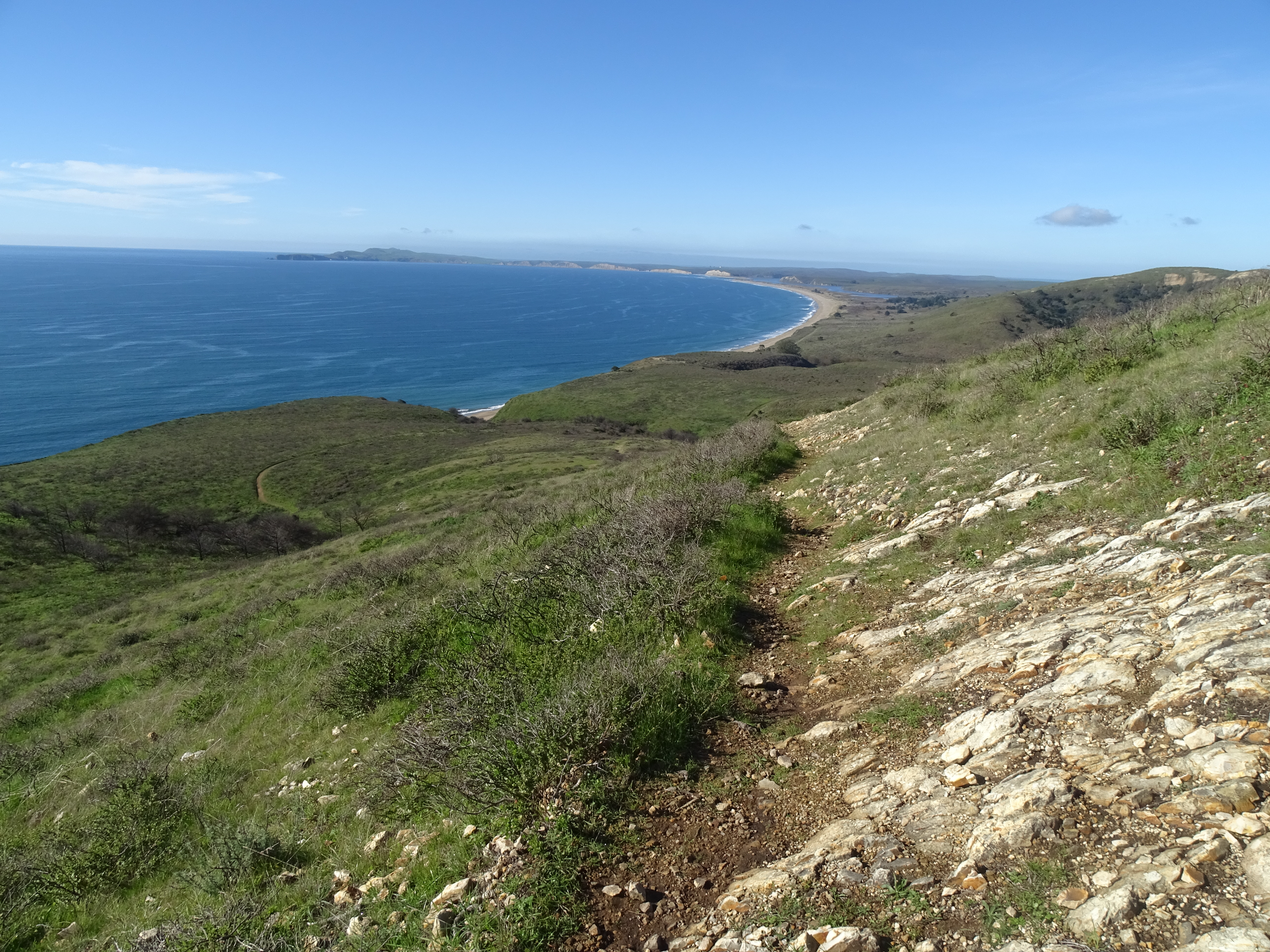
Descend from forested Inverness Ridge through coastal scrub to the ocean. However, it's a steep return through the forest back to the trailhead.
This hike is mostly within the Phillip Burton Wilderness . Much of this area was burned in the 1995 Vision Fire and, again, by the 2020 Woodward Fire , which was ignited by lightning strikes in August of 2020.
Start at the Sky Trailhead , which is located along Limantour Road. Follow the northern section of the Sky Trail, which has some limited views of the ocean, through the woods for 2.6 miles (4.2 km) to the Woodward Valley Trail. Along the way, you'll pass by the junctions for Fire Lane Trail, Horse Trail, Mount Wittenberg Trail, and Meadow Trail, as well as Sky Campground . Vault toilets and potable water are available along the Sky Trail at the campground, which is 1.3 miles from the trailhead.
Turn right (west) on to the Woodward Valley Trail, which was one of the lushest, greenest trails in the park before the Woodward Fire. The Woodward Valley Trail descends about 800 feet (~240 meters) over a distance of 2.0 miles (3.2 km) before intersecting with the Coast Trail. Open ocean views are plentiful along the last 0.5 miles (0.8 km) of the Woodward Valley Trail as you pass through coastal grasslands intermixed with some coastal scrub.
Turn right on to the Coast Trail and follow it 0.8 miles (1.3 km) north to Coast Campground . Vault toilets and potable water are available at Coast Campground, and, just north of site 8, a trail leads down to Santa Maria Beach.
To continue with your hike, follow the Coast Trail north from the campground for 0.1 mile (180 meters) to its junction with Fire Lane Trail. Turn right (north) on to the Fire Lane Trail and begin your ascent through coastal scrub to return to the ridge crest. Be sure to turn around every now and then to see if any views of Drakes Bay have become available as you climb.
After 1 mile (1.6 km), bear right to stay on the Fire Lane Trail at its junction with the more heavily traveled Laguna Trail. This northern leg of the Fire Lane Trail will ascend about 600 feet (180 meters) over a distance of 2.3 miles (3.7 km) as it passes from coastal scrub habitat into increasingly denser forest. At its junction with the Sky Trail, turn left and return in 0.8 miles (1.3 km) to the Sky Trailhead.
This route description alone is not a substitute for a trail map. Print out the Point Reyes National Seashore's South District trail map (3,422 KB PDF) before your visit, or pick one up at the Bear Valley Visitor Center on your way.
Always check current conditions before heading out into the park and familiarize yourself with park regulations . Please practice Leave No Trace principles.
Visit the park's Hiking at Point Reyes National Seashore page for hiking tips and information about trail etiquette and safety.
Visit the park's Trail Advisories and Closures page for current information about closed trails, trails blocked by trees, or other temporary hazards or advisories.
Pets Pets are prohibited on the Sky, Woodward Valley, Coast, and Fire Lane trails. Visit the park's Pets page to learn where pets are welcome at Point Reyes National Seashore.
Accessibility The Sky Trail is an old ranch road and its northern 1.4 miles (2.2 km) is maintained as a service road for NPS vehicles to drive to Sky Campground. So, this section of the route tends to be at least 8 feet (2.4 meters) wide with a substrate of dirt and gravel. The Sky Trail from its trailhead to Sky Campground is open to bicycles, strollers, and other wheeled devices. But, since this section has a change in elevation of about 350 feet (106 meters), it may be challenging for someone in a wheelchair without assistance. The other sections of trail along this hike also follow the routes of old ranch roads, but these sections are not maintained as roadways and have largely become single-track trails that may be only a two feet (60 cm) wide in places. The Woodward Valley Trail and the Fire Lane Trail have changes in elevation of roughly 900 feet (270 meters) each and are oftentimes quite steep. Wheeled devices, such as bicycles and strollers, are prohibited on these other trails. Wheelchairs are permitted on these other trails, but none of these trails meet the criteria for being accessible. The vault toilets at Sky and Coast Campgrounds do not meet accessibility standards.
Hike to the Site of the Y Ranch 10 mi round trip · the Park Service's write-up
4-6 Hours · no dogs · season <h2>Winter</h2> <p>The heaviest rainfall occurs in the winter months. Come prepared for rain and drizzle to possibly last for several days. In between winter rains, it is often sunny, calm, and cool.</p> <h2>Spring</h2> <p>Most spring days are windy and this area frequently experiences fresh to strong breezes. Expect cool temperatures in March. By late May and early June, temperatures can be quite pleasant, even warm.</p> <h2>Summer</h2> <p>Although there is very little rain during summer months, there is often dense fog throughout the day in July, August and September with temperatures often 20 degrees cooler than at Bear Valley.</p> <h2>Fall</h2> <p>The coastal areas of Point Reyes experience some of the clearest days in late September, October and early November. The occasional storm will start rolling through in late October, bringing clouds, wind, and rain. The strongest winds occur in November and December during occasional southerly gales.</p>
Start Y Ranch site within the Phillip Burton Wilderness, Point Reyes National Seashore
Distance: 10 miles (16 km) roundtrip, moderate
The Kelham Beach Trail is indefinitely closed due to storm damage.
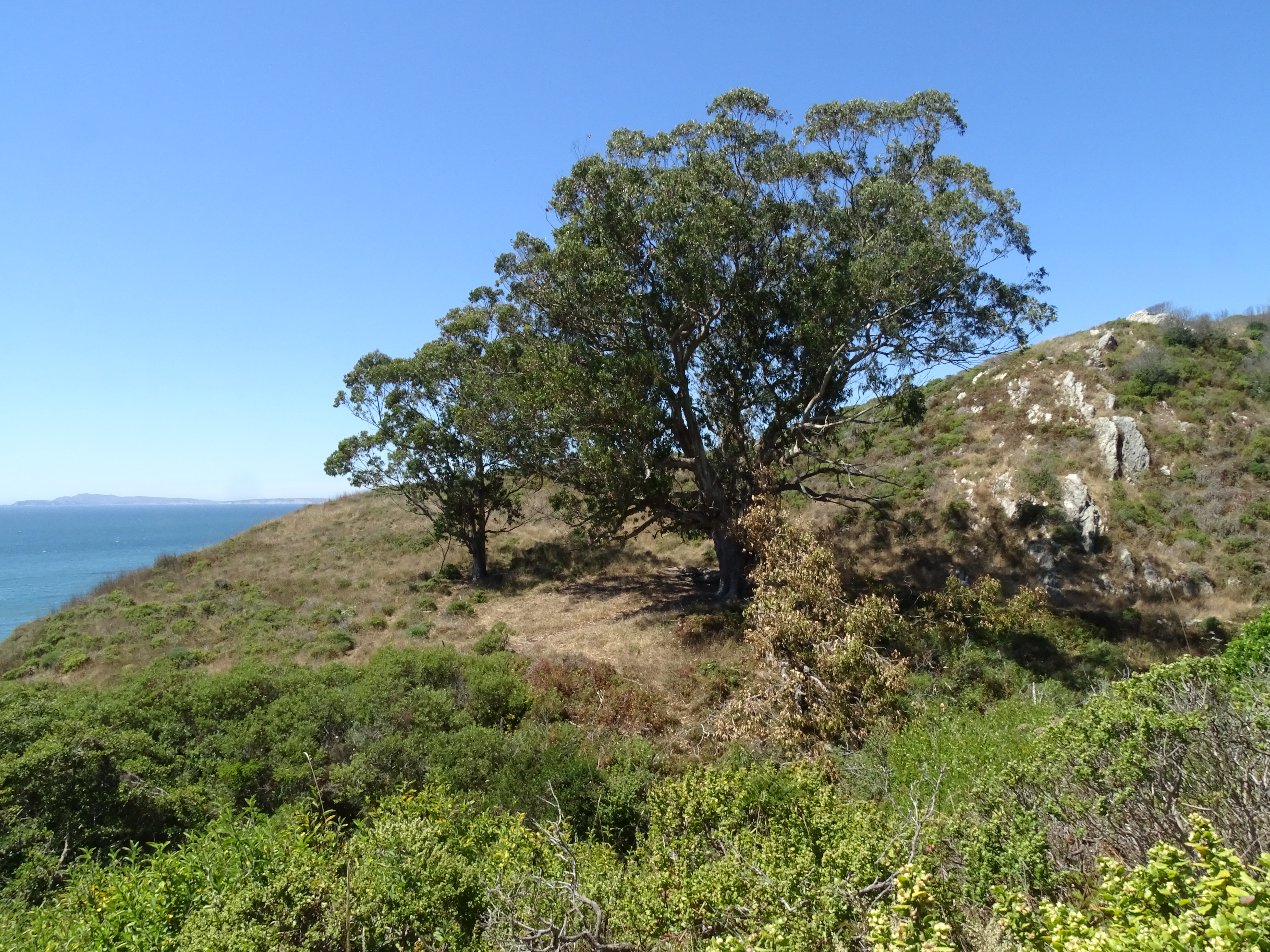
The Y Ranch, also known later as Pig Ranch, was one of the smaller of the Charles Webb Howard dairies in the larger Bear Valley Ranch. It sat on a clifftop overlooking Drakes Bay, adjacent to a creek that drains into the ocean at what is now called Kelham Beach. The site of Y Ranch is now located deep within the Phillip Burton Wilderness in the central part of the national seashore. Today, the only things marking the site of Y Ranch are a huge eucalyptus tree, adjacent to one of its progeny. A large limb of the mother tree broke off and lies parallel to the Coast Trail, offering a pleasant place to sit—so long as its not too windy.
Kelham Beach is a 0.9-mile-long (1.5-kilometer-long) beach deep within the Phillip Burton Wilderness in the central part of the national seashore. The only safe location to access Kelham Beach is via Kelham Beach Trail, which is 5-miles (8-kilometers) from the nearest trailhead.
-->
The closest place to park is the Bear Valley Trailhead . Follow the Bear Valley Trail south for 1.6 miles (2.6 km) through a Douglas fir forest along Bear Valley Creek to Divide Meadow. Vault toilets are located at Divide Meadow—there are no other facilities beyond Divide Meadow, so please be sure to use the toilets before proceeding further.
Beyond Divide Meadow, the Bear Valley Trail re-enters the forest and begins to parallel Coast Creek as it flows downhill toward the coast. After another 1.5 miles (2.4 km), the Bear Valley Trail intersects with the Glen Trail and the Baldy Trail. If you are riding a bicycle , you will need to dismount and lock your bicycle to the bike rack at this junction. Beyond this junction, the Bear Valley Trail enters the Phillip Burton Wilderness and bicycles (and other wheeled devices, like strollers) are prohibited in Wilderness.
Continue on the Bear Valley Trail for 0.9 miles (1.5 km) to its junction with the Coast Trail, which is 4.1 miles (6.5 km) from the Bear Valley Trailhead. Bear right onto the Coast Trail and follow it northwest for 0.9 miles (1.5 km) to a large eucalyptus at the site of the Y ranch.
The coastal bluff area where the trail leading down to Kelham Beach was located suffered a major collapse in 2024. There is no longer any safe access to Kelham Beach.
Retrace your steps to return to the Bear Valley Trailhead.
tide chart and local weather forecasts before setting out on your trip; venturing on to Kelham Beach during hazardous surf conditions or a high tide can result in becoming trapped against the coastal bluffs. Visit the park's Beach Safety page for more information.
-->
Some of this area was burned in 2020, when lightning strikes in the Woodward Valley started what became the 2020 Woodward Fire .
This route description alone is not a substitute for a trail map. Print out the Point Reyes National Seashore's South District trail map (3,422 KB PDF) before your visit, or pick one up at the Bear Valley Visitor Center on your way.
Always check current conditions before heading out into the park and familiarize yourself with park regulations . Please practice Leave No Trace principles.
Visit the park's Hiking at Point Reyes National Seashore page for hiking tips and information about trail etiquette and safety.
Visit the park's Trail Advisories and Closures page for current information about closed trails, trails blocked by trees, or other temporary hazards or advisories.
Please take note! As of 2024, there is no longer a park-sanctioned/maintained "Kelham Beach Trail" and there are no safe routes to access Kelham Beach. In January 2023, coastal erosion eliminated the lowest 12 feet or so of steps at the bottom of the Kelham Beach Trail. In April 2024, a much larger landslide occurred, taking out even more of the Kelham Beach Trail. The route is unstable and moving. The decommissioned "Kelham Beach Trail" is no longer maintained and poses many hazards to off-trail hikers—crumbling and eroding cliffs and lots of poison oak . Visitors who use this unmaintained trail damage plants and wildlife habitat, and may endanger themselves and rescuers. Visitors have been hurt scrambling down the crumbly bluff to get to the beach or were unable to get back up, requiring the efforts of search and rescue teams to extract the injured or stranded party. The National Park Service strongly advises visitors against using this unmaintained route.
Pets Pets are prohibited at the site of the Y Ranch and along all of the trails that lead to the site. Visit the park's Pets page to learn more about where pets are welcome at Point Reyes National Seashore. Pets are prohibited at Kelham Beach and along all of the trails that lead to Kelham Beach. Visit the park's Pets page to learn more about where pets are welcome at Point Reyes National Seashore. -->
Accessibility The Bear Valley trail has a flat or mild grade (less than 5% slope) for most of its duration, although there are a couple sections with grades of more than 5%. The trail surface is packed dirt and gravel, and is approximately 8 feet (2.4 meters) wide, depending on the section. The trail serves as a service road for NPS vehicles. The steeper sections and a few somewhat rocky sections are passable for those in wheelchairs with assistance. While the trail does not technically meet accessibility standards, it can accommodate some wheelchairs. Strollers and bicycles are also permitted on the Bear Valley Trail from the trailhead to the Glen Trail Junction. The vault toilets at Divide Meadow do not meet accessibility standards. After the first 3 miles (5 km) the trail narrows, and the surface becomes more inconsistent and uneven.
Hike to Wildcat Beach 11 mi round trip · the Park Service's write-up
4-7 Hours · no dogs · season <h2>Winter</h2> <p>The heaviest rainfall occurs in the winter months. Come prepared for rain and drizzle to possibly last for several days. More rain falls east of Inverness Ridge than on the west side. In between winter rains, it is often sunny, calm, and cool.</p> <h2>Spring</h2> <p>Most spring days are windy. Expect cool temperatures in March. By late May and early June, temperatures can be quite warm on the east side of Inverness Ridge.</p> <h2>Summer</h2> <p>Although there is very little rain during summer months, there is often dense fog. Patchy morning fog may burn off by mid-day. Afternoons are often sunny and warm with a light breeze inland. By contrast, the beaches and headlands are often 20 degrees cooler with heavy fogs common throughout the day in July, August and September.</p> <h2>Fall</h2> <p>The coastal areas of Point Reyes experience some of the clearest days in late September, October and early November. The occasional storm will start rolling through in late October, bringing clouds, wind, and rain. The strongest winds occur in November and December during occasional southerly gales.</p>
Start Wildcat Beach within the Phillip Burton Wilderness, Point Reyes National Seashore
The Palomarin Trailhead Parking Lot will be closed from Monday, September 9, 2024, through Friday, September 13, 2024, for resurfacing. The parking lot and trailhead will be fully closed with no overnight parking allowed to accommodate staging equipment and materials. Large trucks will be present on Mesa and Palomarin Roads, so visitors to Wildcat Beach should plan alternative parking arrangements.
-->
Distance:
11 miles (17.6 km) roundtrip from the Palomarin Trailhead
12.6 miles (20.3 km) roundtrip from the Bear Valley Trailhead
13.4 miles (21.6 km) roundtrip from the Five Brooks Trailhead
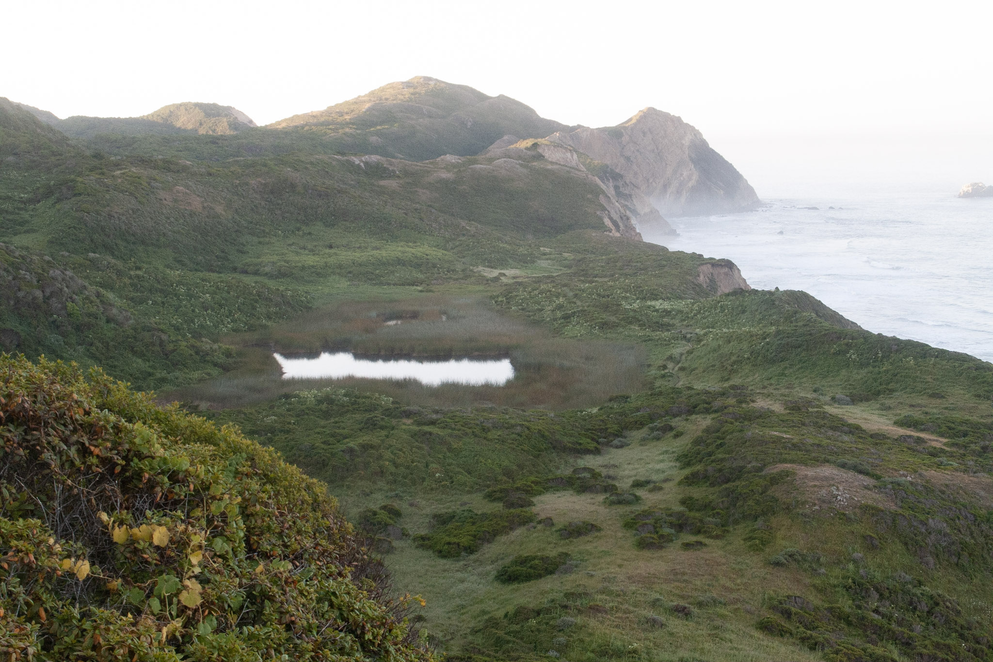
Wildcat Beach is a 2.9-mile-long (4.7-kilometer-long) beach deep within the Phillip Burton Wilderness in the southern part of the national seashore. To get to Wildcat Beach, you can start from a number of different trailhead, although the Palomarin, Bear Valley, or Five Brooks trailheads are the closest. The following directions from any of these closest trailheads will bring you to Wildcat Camp, where there are vault toilets, potable water, and the only safe location at which to get onto Wildcat Beach. A well-worn trail leads along the south side of Wildcat Camp to the beach.
These route descriptions alone are not a substitute for a trail map. Print out the park's South District trail map (3,422 KB PDF) before your visit, or pick one up at a visitor center on your way.
Always check current conditions before heading out into the park and familiarize yourself with park regulations . Please practice Leave No Trace principles.
Visit the park's Hiking at Point Reyes National Seashore page for hiking tips and information about trail etiquette and safety.
Visit the park's Trail Advisories and Closures page for current information about closed trails, trails blocked by trees, or other temporary hazards or advisories.
Hiking Directions To Wildcat Beach
From Palomarin Trailhead
Due to a washout along Palomarin Road, Mesa Road and Palomarin Road are closed to motor traffic north of the Commonweal entrance until further notice. Hikers wishing to go to Wildcat Beach, Wildcat Campground, or Alamere Falls can begin their hike at Five Brooks Trailhead, instead.
-->
Follow the Coast Trail northwest as it meanders along an ocean cliff top for approximately one mile (1.6 km). The Coast Trail then heads inland and drops into a small valley before ascending switchbacks up the other side. Climb over a pass, and hike past a number of small ponds before reaching Bass Lake after 2.8 miles (4.5 km) of hiking. In another 0.6 miles (1 km) arrive at a view of Pelican Lake. Continuing on 0.8 miles (1.3 km) leads to the junction with the Ocean Lake Loop Trail. Stay right to remain on the Coast Trail as it heads a bit further inland through coastal scrub and forest, or turn left on to the Ocean Lake Loop Trail, which drops initially to pass by Ocean Lake, but then climbs steeply to reach the top of some coastal bluffs with views looking up and down the shoreline. Both routes reconnect after 1.1 miles (1.7 km). After this point you'll be back on the Coast Trail for a final 0.2 miles (0.3 km) to Wildcat Campground.
From Bear Valley Trailhead
Follow the relatively flat Bear Valley Trail south for 3.1 miles (5 km) to the Glen Trail. Turn left onto the Glen Trail and begin climbing up the side of a ridge. After 0.6 miles (1 km), keep right to stay on the Glen Trail. After another 0.4 miles (0.6 km) keep left to stay on the Glen Trail. Hike for 0.5 miles (0.8 km) to the intersection with the Stewart Trail. Turn right and follow the Stewart Trail 1.2 miles (1.9 km) downhill to get to Wildcat Campground.
From Five Brooks Trailhead
Follow the Stewart Trail northwest for 0.3 miles (0.5 km) to the junction with the Olema Valley Trail. Keep right to stay on the Stewart Trail as it begins a long climb up the side of Inverness Ridge. After 0.8 miles (1.3 km), the Greenpicker Trail branches off to the right at a switchback. Hikers may wish to shorten their hike by 0.7 miles (1.2 km) by following the Greenpicker Trail to the top of the ridge, but be forewarned that the Greenpicker Trail is steeper than the Stewart Trail. Alternatively, continue on the Stewart Trail as it switchbacks 2.6 miles (4.2 km) up the side of the ridge to Fir Top, the highest location (1324 ft/404 m) along the southern end of Inverness Ridge. Due to the dense Douglas fir forests, there are no far-reaching views. Hikers on the Greenpicker Trail can return to the Stewart Trail at this location. Continue straight on the Stewart Trail as it descends 2.7 miles (4.3 km) from the top of the ridge to Wildcat Camp.
Pets Pets are prohibited on all trails that lead to Wildcat Beach. Visit the park's Pets page to learn where pets are welcome at Point Reyes National Seashore.
Accessibility Each of the three main routes varies in length, difficulty, and type of terrain. The route from Five Brooks via the Stewart Trail is the widest, as it's a multi-use service road—it's a gravel and packed dirt path the entire way to Wildcat Camp. This route, however, gains and loses over 1,300 feet (400 meters) of elevation. The routes from Bear Valley and Palomarin follow old ranch roads which have significantly narrowed and/or degraded and have exposed roots and rocks and have become rutted in numerous locations.
Walk the Cross Marin Trail 10.6 mi round trip · the Park Service's write-up
1-5 Hours · dogs allowed · season <h2>Winter</h2> <p>The heaviest rainfall occurs in the winter months. Come prepared for rain and drizzle to possibly last for several days. In between winter rains, it is often sunny, calm, and cool.</p> <h2>Spring</h2> <p>Most spring days are windy. Expect cool temperatures in March. By late May and early June, temperatures can be quite pleasant.</p> <h2>Summer</h2> <p>Although there is very little rain during summer months, there is often dense fog, which tends to burn off by mid-day. Afternoons are often sunny and warm to hot with a light breeze.</p> <h2>Fall</h2> <p>Point Reyes experiences some of the clearest days in late September, October, and early November. The occasional storm will start rolling through in late October, bringing clouds, wind, and rain. The strongest winds occur in November and December during occasional southerly gales.</p>
Start Cross Marin Trailhead, Golden Gate National Recreation Area
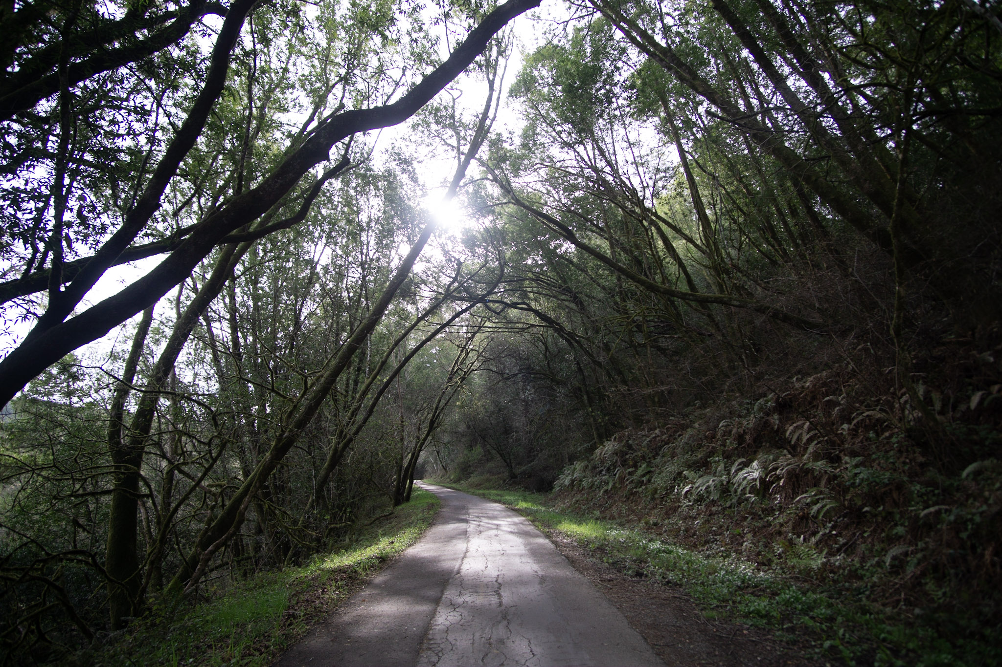
Distance: up to 10.6 miles (17 km) roundtrip
Difficulty: Easy
The Cross Marin Trail follows the historic North Pacific Coast Railroad right-of-way as it parallels Lagunitas Creek, resulting in a trail that has relatively little change in elevation. Pets are permitted on the Cross Marin Trail and must be on a six-foot or shorter leash at all times. Visit Point Reyes National Seashore's Pets page for additional regulations and safety tips. The Cross Marin Trail is shared with bike and horse riders.
This is an out-and-back trail (although connecting trails offer the opportunity of loop hikes), so it provides visitors with the flexibility to choose how long they want to make their adventure. The Cross Marin Trail spans 5.3 miles (17.6 km) from its northern trailhead along Sir Francis Drake Boulevard to its southern terminus at the Leo T. Cronin Fish Viewing Area along the southeast border of Samuel P. Taylor State Park . Turn around and retrace your steps whenever you are ready. The trail description below proceeds from north to south.
The northernmost 1.5 mile (2.4 km) of the Cross Marin Trail passes through streamside woodlands, including a few small copses of redwoods, and meadows. After intersecting with the Jewell Trail (which heads steeply uphill to Bolinas Ridge Trail to the west), the Cross Marin Trail enters the redwood forest protected within Samuel P. Taylor State Park.
Another 0.8 miles (1.3 km) will bring the trail user to the site of Samuel P. Taylor's paper mill, where there are a few wayside exhibits. State park employee housing is located in this area. Please respect the residents' privacy by staying on official trails and away from the residences. Camp Taylor, the state park's campground, is located 0.8 miles (1.3 km) further along the Cross Marin Trail.
Continue another 0.2 miles (0.3 km) to reach the Redwood Grove group picnic area, which is located across the creek via an automobile bridge from the Azalea Day Use lot. The Azalea Day Use lot is located just inside the entrance from Sir Francis Drake Boulevard to Camp Taylor and provides an additional location to start a hike on the Cross Marin Trail. (Samuel P. Taylor does have an entrance fee for parking at the Azalea Day Use lot.)
The Cross Marin Trail's surface changes from paved to gravel at the south end of the Redwood Grove group picnic area. The Cross Marin Trail crosses Lagunitas Creek and Sir Francis Drake Boulevard 0.6 miles (1 km) later, just before the Irving group picnic area. Follow the gravel trail for an additional 1.4 miles (2.2 km) to reach the Cross Marin Trail's southern terminus at the the Leo T. Cronin Fish Viewing Area. From here, one could head up the Shafter Grade to connect with the Bolinas Ridge Trail, providing options for loop hikes in excess of 10.3 miles (16.5 km).
The Ox Trail, the accessible South Creek Trail, the Pioneer Tree Trail, and the Barnabe Road/Trail also intersect at various locations along the Cross Marin Trail within the state park. Visit Samuel P. Taylor State Park's website for more information on these routes.
This route description alone is not a substitute for a trail map. Print out the park's South District trail map (3,422 KB PDF) and Samuel P. Taylor State Park's map (found under the "Brochures" tab on the state park's website ) before your visit, or pick up the trail map at a visitor center on your way. (While designated as part of Golden Gate National Recreation Area, the northern 1.5 miles (2.4 km) of the Cross Marin Trail are managed by Point Reyes National Seashore.)
This route description alone is not a substitute for a trail map. Print out Point Reyes National Seashore's South District trail map (3,422 KB PDF) before your visit, or pick up the trail map at the Bear Valley Visitor Center on your way. (While designated as part of Golden Gate National Recreation Area, the northern 1.5 miles (2.4 km) of the Cross Marin Trail are managed by Point Reyes National Seashore.)
Always check current conditions before heading out into the park and familiarize yourself with park regulations . Please practice Leave No Trace principles.
Visit the park's Hiking at Point Reyes National Seashore page for hiking tips and information about trail etiquette and safety.
Visit the park's Trail Advisories and Closures page for current information about closed trails, trails blocked by trees, or other temporary hazards or advisories.
Accessibility The northern 3.2 miles (5.1 km) of the Cross Marin Trail is an eight-foot-wide (2.4-meter-wide) paved path along an old railroad grade, so there is very relatively little change in elevation. Unfortunately, over the years since it was last paved, the surface has degraded a bit and depressions have developed in a number of locations. The southern 2.1 miles (3.4 km) similarly follows the old railroad grade with relatively little change in elevation and is approximately eight feet wide (2.4 meters wide), but is a gravel path.
Walk the Kule Loklo Trail the Park Service's write-up
20-60 Minutes · no dogs · season <h2>Winter</h2> <p>The heaviest rainfall occurs in the winter months. Come prepared for rain and drizzle to possibly last for several days. In between winter rains, it is often sunny, calm, and cool.</p> <h2>Spring</h2> <p>Most spring days are windy. Expect cool temperatures in March. By late May and early June, temperatures can be quite pleasant.</p> <h2>Summer</h2> <p>Although there is very little rain during summer months, there is often dense fog, which tends to burn off by mid-day. Afternoons are often sunny and warm to hot with a light breeze.</p> <h2>Fall</h2> <p>Point Reyes experience some of the clearest days in late September, October, and early November. The occasional storm will start rolling through in late October, bringing clouds, wind, and rain. The strongest winds occur in November and December during occasional southerly gales.</p>
Start Kule Loklo Trail, Bear Valley, Point Reyes National Seashore
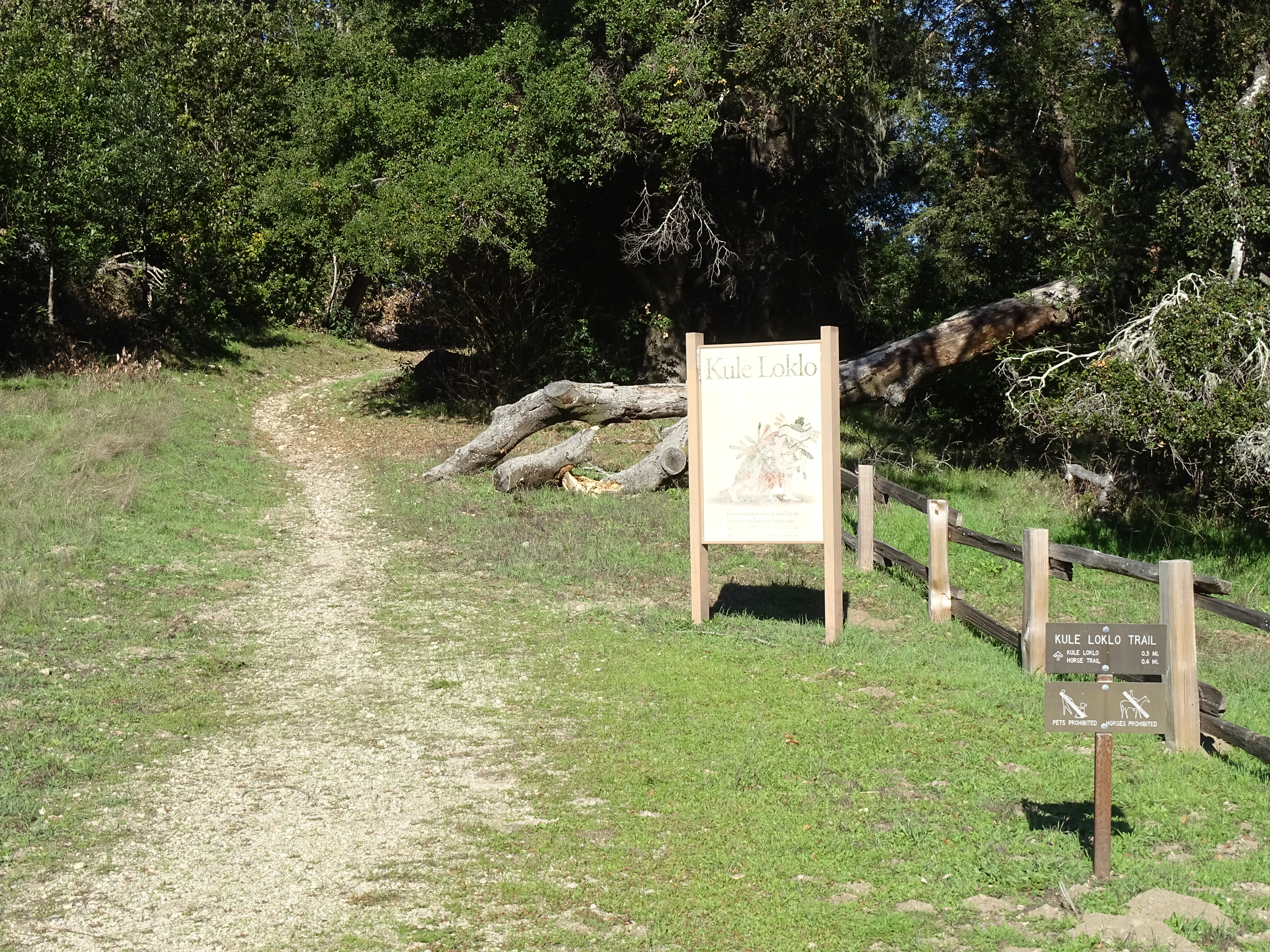
Kule Loklo and the trails leading to Kule Loklo are closed until further notice due to hazard trees.
-->
Distance: 0.8 mi. (1.3 km) roundtrip
A short path leads from the Bear Valley Visitor Center up a small hill to a replica of a Coast Miwok Indian village . Interpretive signs briefly describe Coast Miwok culture and history and the structures in the village.
From Kule Loklo, return on the same trail, or continue around the horse pasture via the Morgan Trail to return past the Morgan Horse Ranch .
The Kule Loklo Trailhead is located at the north end of the Bear Valley Parking Lot, about 110 yards (100 meters) from the the Bear Valley Visitor Center.
Download the Bear Valley Area Map . (427 KB PDF)
Always check current conditions before heading out into the park and familiarize yourself with park regulations . Please practice Leave No Trace principles.
Visit the park's Hiking at Point Reyes National Seashore page for hiking tips and information about trail etiquette and safety.
Visit the park's Trail Advisories and Closures page for current information about closed trails, trails blocked by trees, or other temporary hazards or advisories.
Pets Pets are prohibited at Kule Loklo and on the trails that lead to Kule Loklo. Visit the park's Pets page to learn where pets are welcome at Point Reyes National Seashore.
Accessibility The first part of the 0.4 mile (650 meter) dirt trail to Kule Loklo is quite steep, but then the trail levels off with relatively minimal cross slope. However, the dirt trail does pass over some exposed tree roots, which may be difficult for some to get over. Many gopher holes fill the grassy field at Kule Loklo, making it challenging for some to navigate between the exhibit's structures in a wheelchair or on crutches. There are no accessible restrooms. Inquire at Bear Valley Visitor Center for more information on accessing Kule Loklo.