
Bolinas Ridge Trail
Trailheads Bolinas Ridge (North) Trailhead 366 ft Drive there · Bolinas Ridge (South) Trailhead 1,518 ft Drive there
Hike the Bolinas Ridge Trail 22 mi round trip · the Park Service's write-up
1-11 Hours · dogs allowed · season <h2>Winter</h2> <p>The heaviest rainfall occurs in the winter months. Come prepared for rain and drizzle to possibly last for several days. In between winter rains, it is often sunny, calm, and cool.</p> <h2>Spring</h2> <p>Most spring days are windy. Expect cool temperatures in March. By late May and early June, temperatures can be quite pleasant.</p> <h2>Summer</h2> <p>Although there is very little rain during summer months, there is often dense fog, which tends to burn off by mid-day. Afternoons are often sunny and warm to hot with a light breeze.</p> <h2>Fall</h2> <p>Point Reyes experiences some of the clearest days in late September, October, and early November. The occasional storm will start rolling through in late October, bringing clouds, wind, and rain. The strongest winds occur in November and December during occasional southerly gales.</p>
Start Bolinas Ridge Trailhead along Sir Francis Drake Boulevard
Distance: up to 22 miles (35 km) roundtrip
Difficulty: Easy to difficult, largely depending on how far one hikes
Admire the expansive views of the Olema Valley from a ridge crest on this multi-use trail where you may walk your leashed dog. (Dogs must be on a six-foot or shorter leash at all times. Visit Point Reyes National Seashore's Pets page for additional regulations and safety tips.) The Bolinas Ridge Trail is a current ranch/fire road that is shared with bike and horse riders. Most of the northern part of the trail passes through active cattle pastures. Grazing cattle may be present; give them plenty of space when passing. This is an out-and-back trail (although connecting trails offer the opportunity of loop hikes), so it provides visitors with the flexibility to choose how long they want to make their adventure. The Bolinas Ridge trail spans 11 miles (17.6 km) from its northern trailhead along Sir Francis Drake Boulevard to its southern terminus on the Fairfax-Bolinas Road. Turn around and retrace your steps whenever you are ready. The trail description below proceeds from north to south.
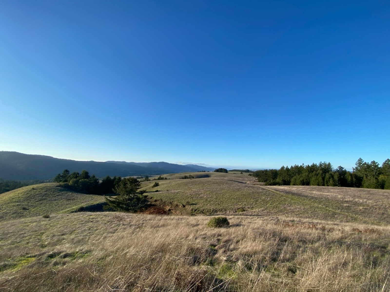
The Bolinas Ridge Trail's northernmost 2.4 miles (3.8 km) pass through grasslands, gradually increasing in elevation. Due to the absence of trees, this section offers some of the best views along the trail of Olema Valley to the west, Tomales Bay to the northwest, and Black Mountain to the north.
The Bolinas Ridge Trail intersects with the Jewell Trail 1.4 miles (2.2 km) from the northern trailhead. The Jewell Trail leads east and downhill to Lagunitas Creek and the Cross Marin Trail . If you don't mind walking 0.7 miles (1.2 km) along Sir Francis Drake Boulevard, follow Jewell Trail to Cross Marin Trail to Sir Francis Drake Boulevard and back along the road to the trailhead for a 4.3-mile-long (6.9-km-long) loop hike.
The Bolinas Ridge Trail continues south from the Jewell Trail junction with grasslands initially on both sides of the trail. The trail begins to run along the edge of a Douglas fir and coast redwood forest 2.4 miles (3.8 km) from the northern trailhead. The trail skirts along the edge of the woods, staying mostly out from under the tree canopy for the next 3.3 miles (5.3 km).
The Shafter Grade Road/Trail descends to the east 5.1 miles (8.2 km) from Bolinas Ridge Trail's northern trailhead. The Shafter Grade connects with the Cross Marin Trail at the southeast boundary of Samuel P. Taylor State Park and provides options for loop hikes in excess of 10.3 miles (16.5 km).
The Bolinas Ridge Trail more completely enters the forest 5.7 miles (9.1 km) south of its northern trailhead. South of here, far-reaching views are few and far between.
The Randall Trail descends west to Highway 1 (aka Shoreline Highway) 0.5 miles (0.8 km) later. Continuing south through the forest for another 1.6 miles (2.6 km) brings the hiker to the McCurdy Trail, which similarly descends west to Highway 1. Starting from either the Randall or McCurdy Trailheads, combining the appropriate sections of the Randall, Bolinas Ridge, McCurdy, and Olema Valley Trails results in an 8.1-mile-long (13-km-long) loop hike.
The Bolinas Ridge Trail remains in the forest for another 1.7 miles (2.7 km) as it winds to the south before encountering a drier 1-mile-long (1.6-km-long) section of the ridge dominated by fragrant chaparral. From a few sections of this part of the trail, one can look south to Bolinas Lagoon, Stinson Beach, Bolinas Bay, and the Pacific Ocean. Hikers will reenter the redwood forest and find shade along the southernmost 0.5 miles (0.8 km) of the Bolinas Ridge Trail and at the small parking area along the Fairfax-Bolinas Road.
This route description alone is not a substitute for a trail map. Print out Point Reyes National Seashore's South District trail map (3,422 KB PDF) before your visit, or pick up the trail map at the Bear Valley Visitor Center on your way. (While designated as part of Golden Gate National Recreation Area, Bolinas Ridge Trail and most of the trails referenced on this page are managed by Point Reyes National Seashore.)
Always check current conditions before heading out into the park and familiarize yourself with park regulations . Please practice Leave No Trace principles.
Visit the park's Hiking at Point Reyes National Seashore page for hiking tips and information about trail etiquette and safety.
Visit the park's Trail Advisories and Closures page for current information about closed trails, trails blocked by trees, or other temporary hazards or advisories.
Accessibility The parking for the Bolinas Ridge Trailhead on Sir Francis Drake Boulevard consists of two roadside pullouts that are mostly unpaved. There is a narrow V-shaped chute/gate that prevents cattle from escaping at the trailhead which might be difficult to pass through for some users. Cyclists must lift their bikes over this feature. The trail surface is mostly compacted soil. While the footing is typically even, rain and heavy traffic can make the trail muddy and rutted in various sections. The trail/road is eight to ten feet wide in most places, and traverses through open grasslands, shrubs, and forests. Steep grades exist at various locations.