
Sipapu Trail
Hike to Sipapu Bridge the Park Service's write-up
1-2 Hours · no dogs · season <p><strong>Spring and Fall:</strong> Suggested visiting time is spring and fall.</p> <p><strong>Summer:</strong> Summer temperatures often reach 100°F (38°C).</p> <p><strong>Winter:</strong> In the winter, the hike to Sipapu Bridge can be treacherous.<br /> The trail may be muddy, icy, and slick. This north-facing trail is in the shade for much of the day. Snow and ice will remain on the trail longer than elsewhere in the park. A long set of metal stairs and numerous ladders can become frost-covered and slippery. This trail should only be attempted by well-prepared, experienced hikers in the winter. If snow and/or ice are present, snow cleats, crampons, and/or hiking poles are highly recommended. Always <a href="https://www.nps.gov/nabr/planyourvisit/conditions.htm">check conditions</a> before hiking in winter<span style="font-size:11pt"><span style="line-height:107%"><span style="font-family:Calibri,sans-serif"><span style="font-size:14.0pt"><span style="line-height:107%"><span style="color:#00b0f0">.</span></span></span></span></span></span></p>
Start Sipapu Bridge Trailhead
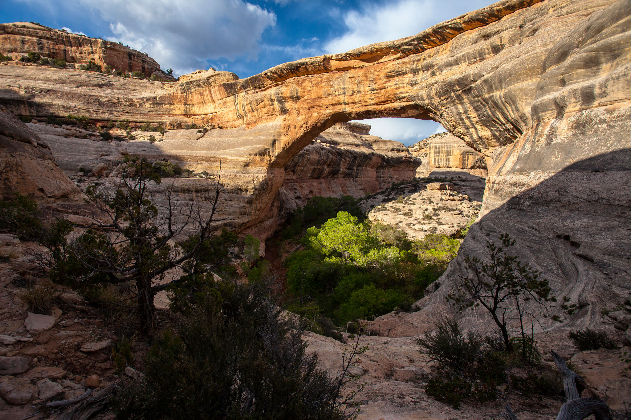
Sipapu Bridge is the largest natural bridge in the park and the second largest in the United States. Admire its 268-foot (82-meter) span up close with a hike to the bridge’s base. Sipapu’s size inspired its many names, including President. Sipapu Bridge’s current name is Hopi for “place of emergence,” or the opening through which Hopi ancestors entered this world.
Length Roundtrip: 1.4 miles (2 kilometers)
Elevation Change One-way (from Rim to Base): 436 feet (133 meters) loss, 11 feet (3 meters) gain
Getting There
Start at the Sipapu Bridge Trailhead parking area (different from the Sipapu Viewpoint parking area). Follow the trail to the bottom, 0.7 mile (1 kilometer) one-way.
Accessibility Service animals are allowed on this trail. There is one accessible parking spot in the parking lot. This is a primitive trail. This trail is not wheelchair accessible. Audio recordings of the posted signage are not available. There is uncertain footing in places. Stay away from the canyon edge - although it is not sheer, it can be steep. Most of the trail is in the shade for much of the day. The trail declines 436 feet (133 meters) to the base of the bridge. That elevation change is experienced using three wooden ladders, one long set of metal stairs, wood stairs, rock stairs, and switchbacks. The total trail length (roundtrip) is 1.4 miles (2 kilometers). This trail is strenuous. This trail may be difficult for individuals with mobility impairments. The nearest restroom is a pit toilet located at the Kachina Bridge parking area. There are flush toilets outside the visitor center. The nearest water is available at the visitor center.
Walk to the Sipapu Bridge Viewpoint the Park Service's write-up
10 Minutes · dogs allowed · season <p>All seasons – Suggested visiting time is spring and fall. Summer temperatures often reach 100°F (38°C), and the trail provides no shade. Winter snow and ice may make the viewpoint inaccessible. If snow and/or ice are present, snow cleats, crampons, and/or poles are recommended.</p>
Start Sipapu Bridge Viewpoint
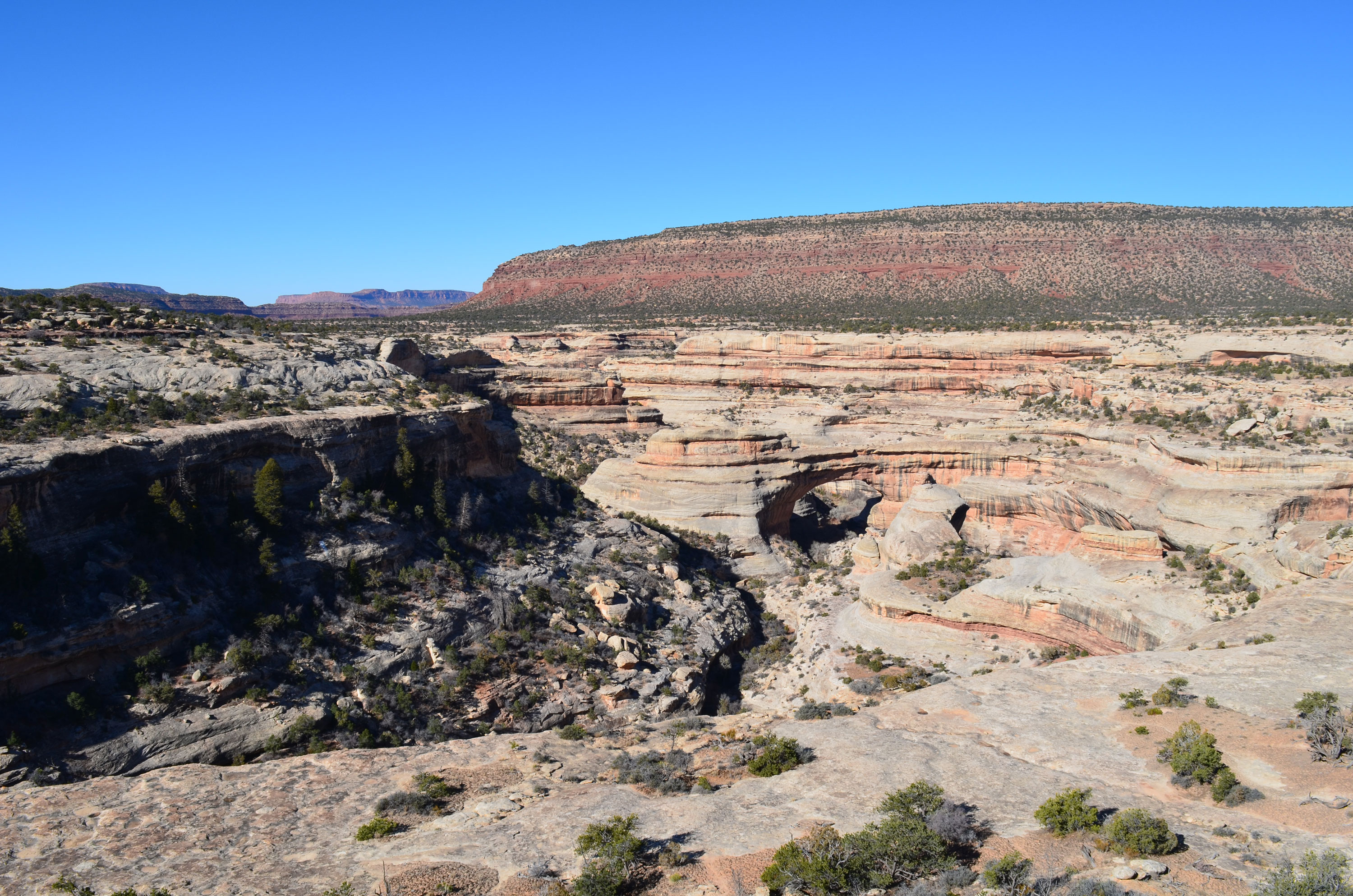
With a span of 268 feet, Sipapu Bridge is the largest natural bridge in the park and the second largest in the United States. From the viewpoint, you get sweeping views of the bridge and the canyon it spans.
Length Roundtrip: 581 feet (177 meters)
Elevation Change One-way (from Parking Lot to Viewpoint): 19 feet (5.89 meters) loss, 0 feet gain
Accessibility Service animals are allowed on this trail. There is one accessible parking space at the trailhead. The Sipapu Bridge Viewpoint trail is paved sidewalk. Total trail length (roundtrip) is 581 feet or about 194 yards (177 meters). The trail declines 19 feet (6 meters) to the overlook. Audio recordings of the posted signage are not available. There is a bench at the overlook. There is no shade. The nearest restrooms are flush toilets located outside the visitor center and a pit toilet located at the Kachina Bridge parking area. Restrooms and water are available at the visitor center.