Amphitheater Trail
Backcountry campsCampgrounds
Along the way Campsite Campsite Campsite Campsite Natural Bridges

National Monument · Utah
13 named trails · 11 miles · 3 with the Park Service's own write-up. The lines, trailheads and points are the Park Service's; the write-ups are the Service's own words; the climbing is read from USGS elevation along each line.
13 trails, A to Z.
Backcountry campsCampgrounds
Along the way Campsite Campsite Campsite Campsite Natural Bridges
Visitor centers
Along the way Natural Bridges
1-2 Hours · no dogs
Start Kachina Bridge Parking Area
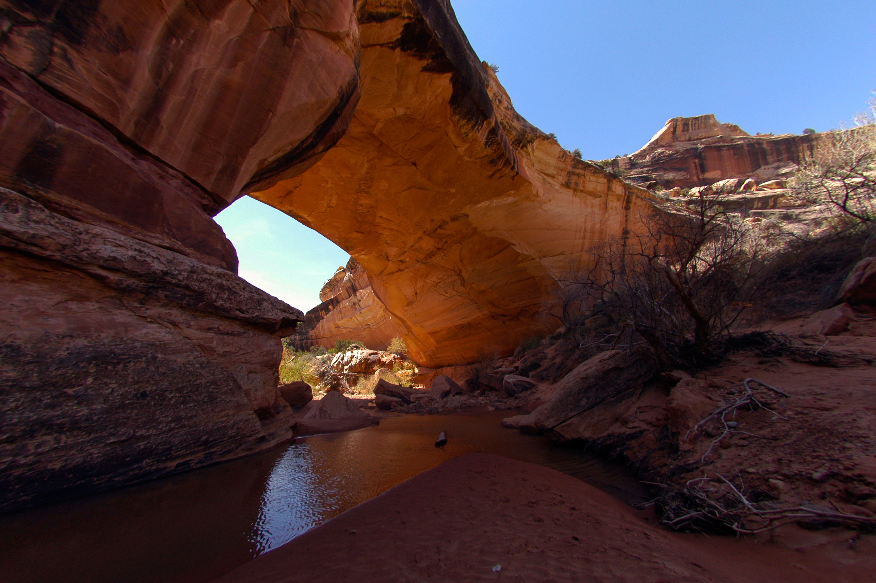
Kachina Bridge has the widest girth in the park at a whopping 44-foot width. The bridge is visible from a viewpoint , but hiking to the base of Kachina brings new perspectives. As you stand beneath this massive sandstone structure, it becomes clear why the Paiute referred to natural bridges as “under the horse’s belly.”
Length Roundtrip: 1.4 miles (2.25 kilometers)
Elevation Change One-way (from Rim to Base): 462 feet (140 meters) loss, 32 feet (9.7 meters) gain
Accessibility Service dogs are allowed on this trail. There is one accessible parking spot in the parking lot. This is a primitive trail. This trail is not wheelchair accessible. Audio recordings of the posted signage are not available. There is uncertain footing in places. Stay away from the canyon edge - although it is not sheer, it can be steep. Much of the trail is in the shade for much of the day. The trail declines 462 feet (140 meters) to the base of the bridge. That elevation change is experienced using one wooden ladder, wood stairs, rock stairs, and switchbacks. The total trail length (roundtrip) is 1.4 miles (2.25 kilometers). This trail is strenuous. This trail may be difficult for individuals with mobility impairments. The nearest restroom is a pit toilet located at the Kachina Bridge parking area. There are flush toilets outside the visitor center. The nearest water is available at the visitor center.
10 Minutes · dogs allowed
Start Kachina Bridge Parking Area
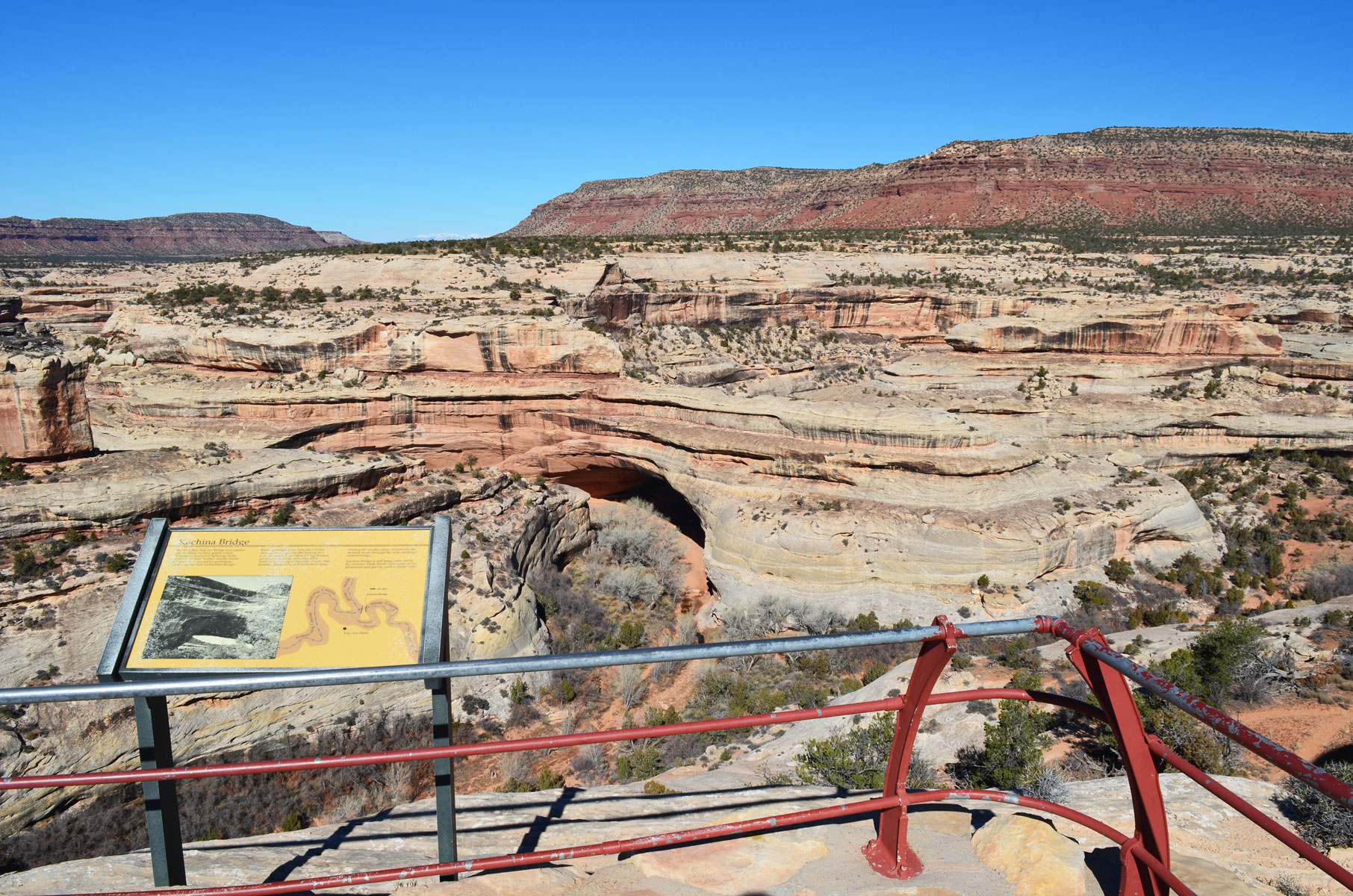
Kachina Bridge has the widest girth in the park at a whopping 44-foot width. From the viewpoint, you get a bird's eye view of this massive sandstone structure and the canyons below. Along the way, check out some of the park's plants and geological features.
Length Roundtrip: 0.26 miles (0.42 kilometers)
Elevation Change One-way (from Parking Lot to Viewpoint): 45 feet (14 meters) loss, 6 feet (2 meters) gain
Accessibility Service animals are allowed on this trail. There is one accessible parking space at the trailhead. The Kachina Bridge Viewpoint trail is paved sidewalk. Total trail length (round trip) is 0.26 miles (a quarter mile), or about 460 yards (0.42 kilometers). The trail elevation declines 45 feet (14 meters) to the overlook. This steep grade may make it difficult for visitors with mobility impairments. There is a bench 380 feet (116 meters) down the trail. There is no shade. Audio recordings of the posted signage are not available. There is a pit toilet located at the trailhead, next to the parking area. There are flush toilets located outside the visitor center. The nearest water is available at the visitor center.
20-60 Minutes · no dogs
Start Owachomo Bridge parking area
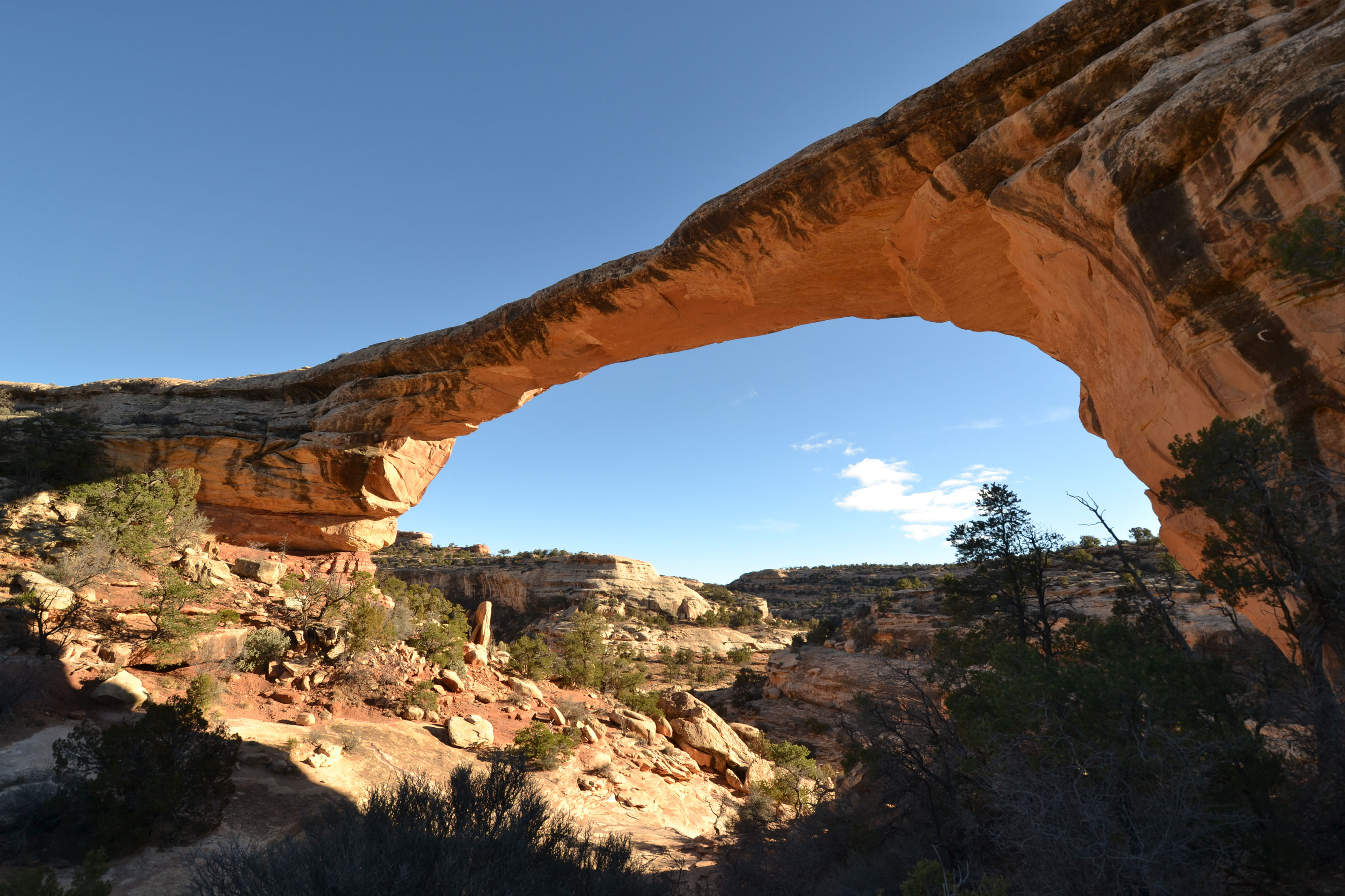
Once named “Little Bridge,” Owachomo Bridge is the smallest natural bridge in the park. Its thin structure suggests that Owachomo may also be the oldest. Hiking to Owachomo provides a rare peek into the monument’s history.
Length Roundtrip: 0.5 miles (0.84 kilometers)
Elevation Change One-way (from Rim to Base): 188 feet (57.3 meters) loss
Accessibility Service animals are allowed on this trail. This is a primitive trail. This trail is not wheelchair accessible. Audio recordings of the posted signage are not available. There is uncertain footing in places. Stay clear of the sides of the canyon; although they are not sheer, they can be steep. The trail declines 188 feet (57.3 meters) to the base of the bridge using wooden and rock stairs. Total trail length (round trip) is 0.5 miles (0.84 meters). This trail may be difficult for individuals with mobility impairments. The nearest restroom is a pit toilet located at the Kachina Bridge parking area. There are flush toilets outside the visitor center. The nearest water is available at the visitor center.
10 Minutes · dogs allowed
Start Owachomo Bridge Parking Area
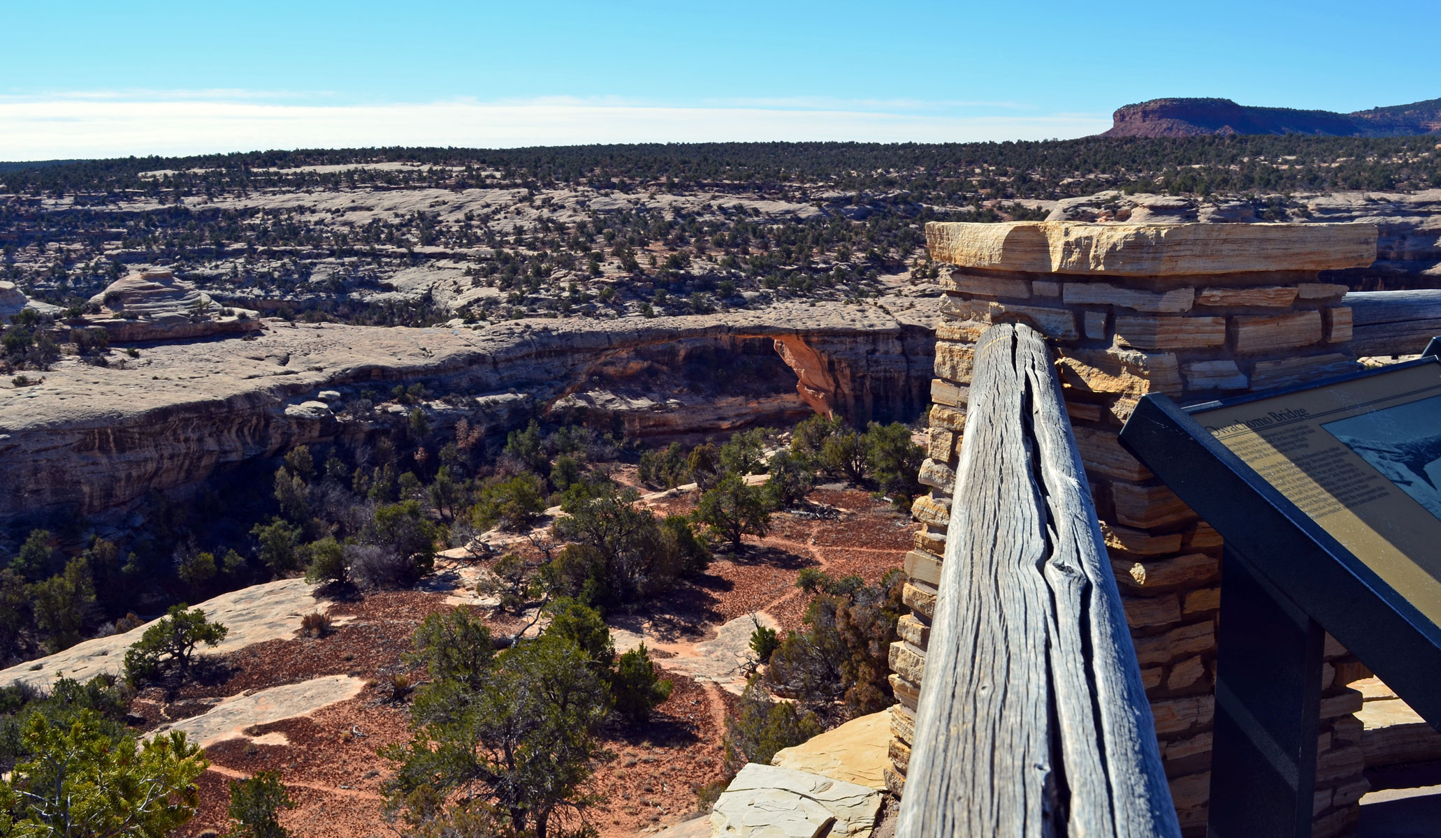
Owachomo Bridge is the smallest, and probably oldest, natural bridge in the park. From the viewpoint, you can see the bridge’s delicate span and surrounding landscape. You can also see the large rock mound on the left side that the bridge was named for - Owachomo is a Hopi word for “rock mound.”
Length Roundtrip: 519 feet (158.19 meters)
Elevation Change One-way (from Parking Lot to Viewpoint): 8.67 feet (2.64 meters) loss, 0 feet (0 meters) gain
Getting There
Start at the Owachomo Bridge parking area and follow the (mostly flat) paved trail 259.5 feet (79.10 meters) to the overlook. A bench is near the beginning of the trail.
For an easy hike, take the unpaved trail to the base of Owachomo Bridge.
Special Features
Below the viewpoint, notice the dark layer of biological soil crust carpeting the ground. This top layer of soil holds moisture, giving life to this arid environment. Do you see the interwoven trails in the soil crust? Deer follow these narrow trails to navigate the canyons and don’t damage much soil crust. In contrast, look at the dusty, tan soil lining the trail. When visitors step off trail, they crush the fragile soil crust, which takes decades to grow back. Please stay on trail at all times and help us protect the park!
Accessibility Service animals are allowed on this trail. The Owachomo Bridge Viewpoint trail is paved sidewalk. The trail elevation declines 8.67 feet (2.64 meters) to the overlook. Total trail length (round trip) is 519 feet or about 173 yards (158.19 meters). There is a bench near the beginning of the trail. There is no shade. Audio recordings of the posted signage are not available. The nearest restrooms are flush toilets located outside the visitor center and a pit toilet located at the Kachina Bridge parking area. The nearest water is available at the visitor center.
1-2 Hours · no dogs
Start Sipapu Bridge Trailhead
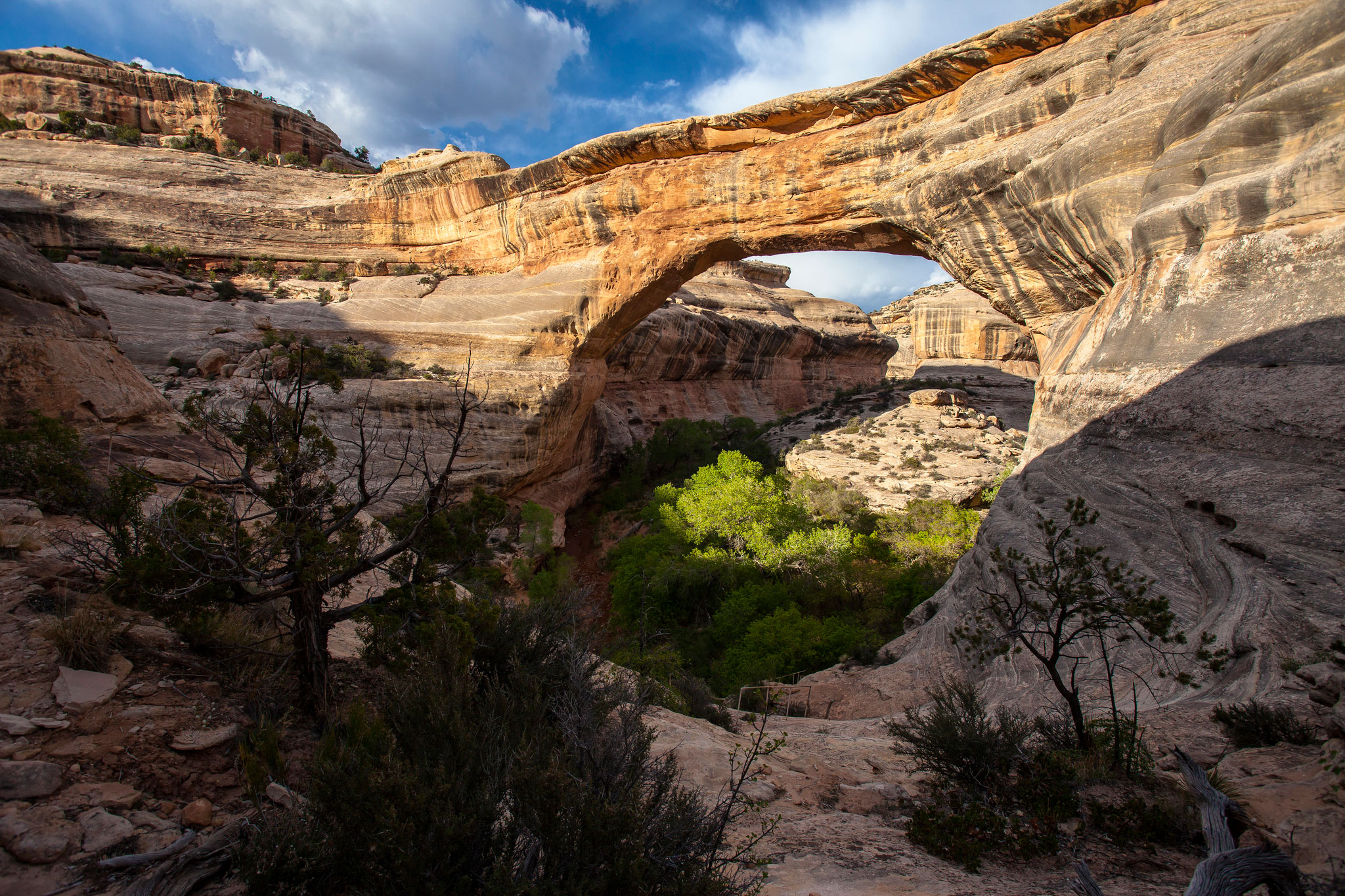
Sipapu Bridge is the largest natural bridge in the park and the second largest in the United States. Admire its 268-foot (82-meter) span up close with a hike to the bridge’s base. Sipapu’s size inspired its many names, including President. Sipapu Bridge’s current name is Hopi for “place of emergence,” or the opening through which Hopi ancestors entered this world.
Length Roundtrip: 1.4 miles (2 kilometers)
Elevation Change One-way (from Rim to Base): 436 feet (133 meters) loss, 11 feet (3 meters) gain
Getting There
Start at the Sipapu Bridge Trailhead parking area (different from the Sipapu Viewpoint parking area). Follow the trail to the bottom, 0.7 mile (1 kilometer) one-way.
Accessibility Service animals are allowed on this trail. There is one accessible parking spot in the parking lot. This is a primitive trail. This trail is not wheelchair accessible. Audio recordings of the posted signage are not available. There is uncertain footing in places. Stay away from the canyon edge - although it is not sheer, it can be steep. Most of the trail is in the shade for much of the day. The trail declines 436 feet (133 meters) to the base of the bridge. That elevation change is experienced using three wooden ladders, one long set of metal stairs, wood stairs, rock stairs, and switchbacks. The total trail length (roundtrip) is 1.4 miles (2 kilometers). This trail is strenuous. This trail may be difficult for individuals with mobility impairments. The nearest restroom is a pit toilet located at the Kachina Bridge parking area. There are flush toilets outside the visitor center. The nearest water is available at the visitor center.
10 Minutes · dogs allowed
Start Sipapu Bridge Viewpoint
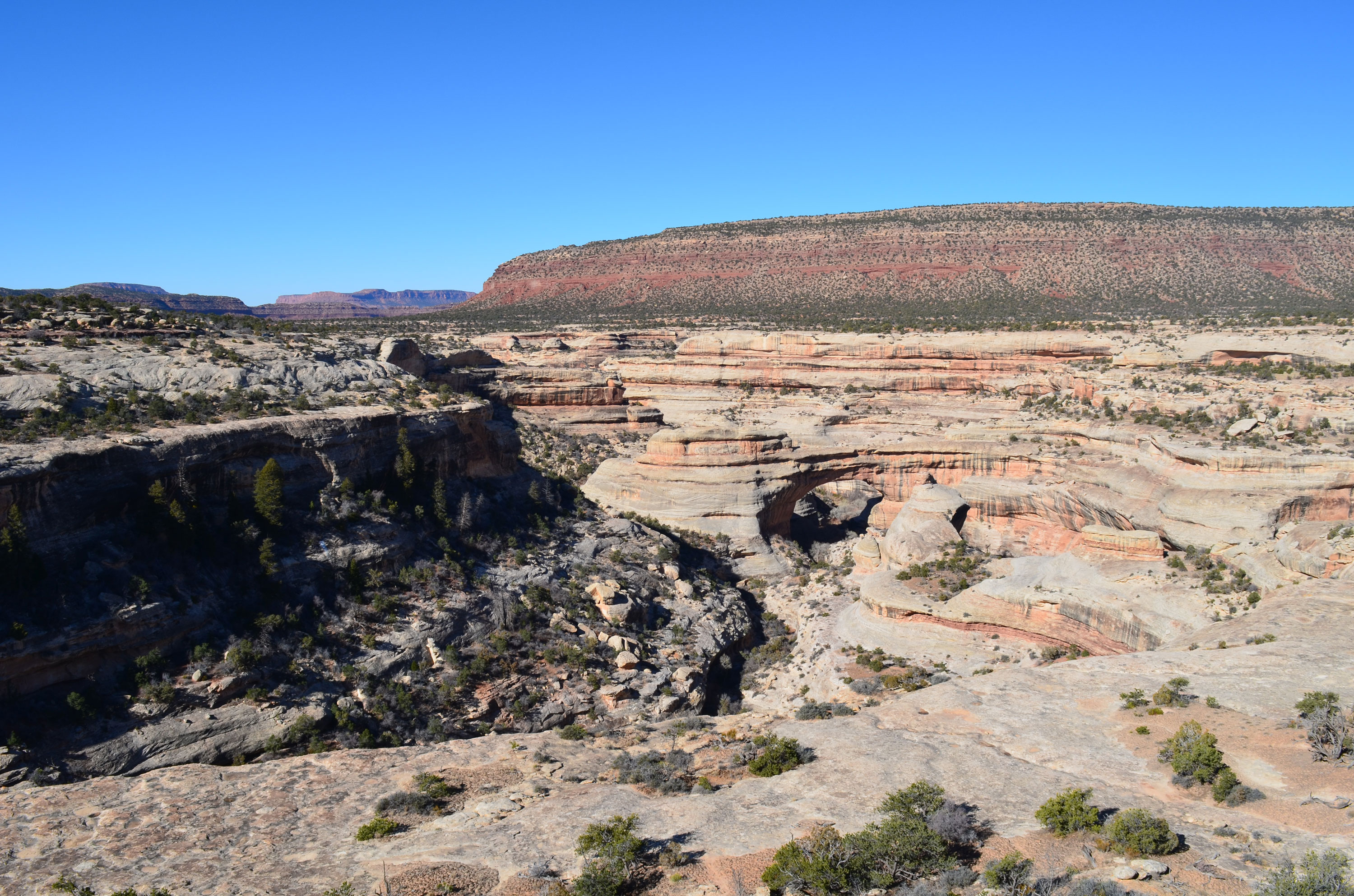
With a span of 268 feet, Sipapu Bridge is the largest natural bridge in the park and the second largest in the United States. From the viewpoint, you get sweeping views of the bridge and the canyon it spans.
Length Roundtrip: 581 feet (177 meters)
Elevation Change One-way (from Parking Lot to Viewpoint): 19 feet (5.89 meters) loss, 0 feet gain
Accessibility Service animals are allowed on this trail. There is one accessible parking space at the trailhead. The Sipapu Bridge Viewpoint trail is paved sidewalk. Total trail length (roundtrip) is 581 feet or about 194 yards (177 meters). The trail declines 19 feet (6 meters) to the overlook. Audio recordings of the posted signage are not available. There is a bench at the overlook. There is no shade. The nearest restrooms are flush toilets located outside the visitor center and a pit toilet located at the Kachina Bridge parking area. Restrooms and water are available at the visitor center.
Visitor centers
Along the way Natural Bridges
Write-ups that name no single mapped trail, in the Service's words.
The lines are the National Park Service's public trails layer, the trailheads and the waterfalls, views, peaks and historic places along them the Service's public points of interest, read 2026-10-14 and simplified for the map. The write-ups are the Service's own "things to do", unedited. Heights come from USGS 3DEP through Terrain Tiles on AWS (Mapzen/Tilezen), read along each line and rounded; a short trail on steep ground can be off by a few tens of feet. Closures change: check the park's own site before you go.