
Wonderland Trail
WaterfallsBackcountry campsCampgroundsPicnic areasVisitor centersTunnels
Along the way Devils Dream backcountry campsites Klapatche Park backcountry campsites Maple Creek backcountry campsites Nickel Creek backcountry campsites North Puyallup River backcountry campsites Paradise River backcountry campsites Pyramid Creek backcountry campsites South Mowich River backcountry campsites Mowich Lake Walk-in Campground Mowich Lake Box Canyon Tunnel Longmire Museum and 3 more
Trailheads Louise Lake Trailhead 4,672 ft Drive there · Pinnacle Peak Trailhead 4,886 ft Drive there · Trail of the Shadows Trailhead 2,740 ft Drive there · Wonderland Trail 4,943 ft Drive there · Wonderland Trail 4,888 ft Drive there · Wonderland Trail 4,999 ft Drive there · Wonderland Trailhead 4,146 ft Drive there · Wonderland Trailhead 3,027 ft Drive there · Wonderland Trailhead 3,828 ft Drive there · Wonderland Trailhead 4,291 ft Drive there · Wonderland Trailhead 2,833 ft Drive there · Wonderland Trailhead 4,863 ft Drive there · Wonderland Trailhead 3,028 ft Drive there · Wonderland Trailhead 3,180 ft Drive there · Wonderland Trailhead 2,749 ft Drive there · Wonderland Trailhead 4,857 ft Drive there
A Day In Longmire 0.7 mi round trip · the Park Service's write-up
2-8 Hours · no dogs · entrance fee applies
Start Longmire
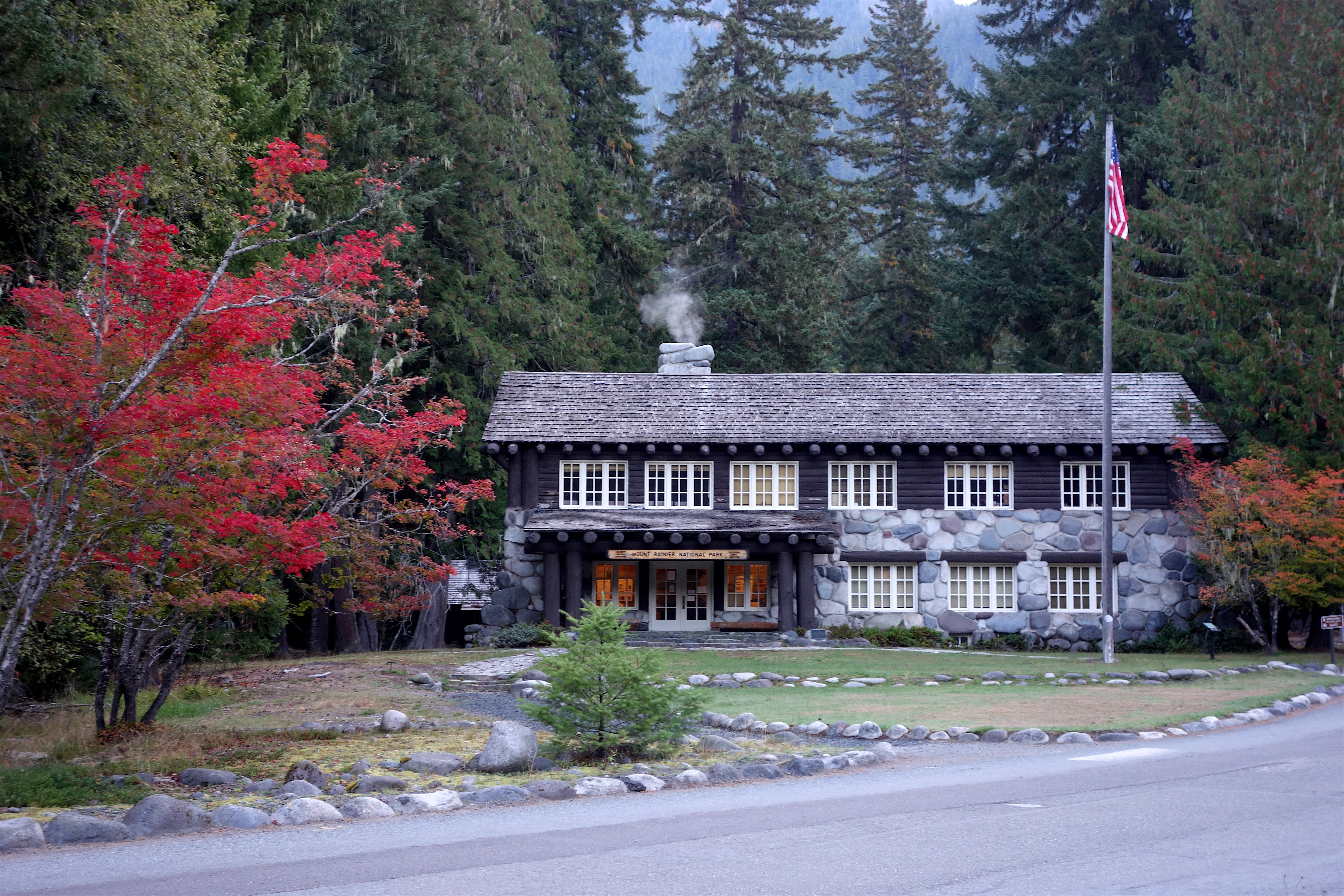
Longmire is an area steeped in history with so much to offer. There are countless opportunities to learn, explore, recreate, and enjoy Mount Rainier National Park here. Longmire has lots of historic buildings and scenic hiking trails. Stop at the historic Nisqually Bridge or the Trail of the Shadows to take in some history, or stretch your legs by hiking Rampart Ridge or Eagle Peak. This is a great place to visit year round. The National Park Inn is a nice place to take a break after a long drive, and the Longmire Museum provides information to visitors. Always check trail and road conditions with a park ranger or online before hiking. Many trails may be partially or totally covered in snow and can be dangerous. Roads may be closed due to snow conditions. Plan your day in Longmire by mixing and matching the options below.
Mountain Views
Year-round and weather dependent.
Trail of the Shadows (0.7 miles round-trip, 30 minutes) - Trail of the Shadows begins across the main park road from the Longmire Museum. A short spur trail will take you into the meadow and offer a view of the mountain. For your safety, do not drink the water from the springs!
Longmire Community Building Viewpoint (1 mile round-trip, 40 minutes) - Follow the side road towards all the buildings and through the employee housing area. The road will make two switchbacking turns before crossing the Nisqually River on a wooden suspension bridge. Cross the bridge and follow the road to the Community Building on the left. Enjoy the views of Mount Rainier! NOTE: The Nisqually Suspension Bridge has a weight limit of 3 tons (6,000 pounds or 2721 kilograms ). Vehicles over this weight limit CANNOT cross the bridge, including recreational vehicles (campers/trailers/motorhomes), maintenance trucks, box trucks, and medium trucks/SUVs pulling campers or trailers. Large trucks/SUVS can exceed the weight limit even without trailers. If your vehicle cannot cross the bridge, park in the main Longmire parking area near the National Park Inn and cross the bridge on foot.
Rampart Ridge (4.6 mile loop, 1339 feet elevation gain, 2.5 hours) - Beginning from the Trail of the Shadows, this is a steep loop trail traveling through forests with vistas from the top.
Waterfalls
Carter Falls Trail (2.2 miles round-trip, 500 feet elevation gain, 2 hours) - The trail begins at the paved pullout 100 yards below Cougar Rock Campground. To add 1.4 miles one-way to the hike, start in Longmire rather than Cougar Rock Campground. Look for the Wonderland Trail sign in Longmire to start your hike.
Christine Falls - Located 4.5 miles east of Longmire. Use the pullout just beyond the stone bridge. The trail descends 100 feet to a view of Christine Falls framed by the bridge. For your safety, please don’t stop your car or walk on the bridge— drivers distracted by the scenery may hit you!
Historic Buildings
Longmire Historic Walking Tour - Follow the self-guided walking tour pamphlet to explore the National Park Service rustic architecture in Longmire. The pamphlet can also be picked up at the Longmire Museum.
Longmire Museum - Completed in 1928 and is now primarily used as a visitor center. However, many of the original exhibits are still on display.
Administration Building - Built in 1928 and still stands as a treasured example of National Park Service Rustic architecture.
National Park Inn - Opened in 1906 and is still enjoyed by guests today. Feel free to explore the inside and enjoy a meal at the restaurant.
Old-Growth Forest
Twin Firs Trail (0.4 mile loop, 15 minutes) Located 2 miles west of Longmire (towards the Nisqually Entrance). This short loop is a quick and easy opportunity to enjoy a beautiful old-growth forest and gaze up at towering giant trees.
Trail of the Shadows ( 0.7 miles round-trip, 30 minutes) - Trail of the Shadows begins across the main park road from the Longmire Museum. The farthest side of the loop boasts some large old-growth trees. For your safety, do not drink the water from the springs!
Pets Pets are allowed only on the paved roads and paths in the developed area of Longmire. Pets are not allowed on any trails, including the Trail of the Shadows.
Accessibility The main developed area of Longmire has paved road and paths. In winter, paths can be snow covered and often icy. Buildings and restrooms are accessible year-round. Approximately half of the un-paved Trail of the Shadows (roughly 0.3 miles) is wheelchair accessible, though the trail can be covered in deep snow in winter. Other trails in the area can be steep and challenging.
Spring Recreation 0.7 mi round trip · the Park Service's write-up
no dogs · Spring
Start Longmire
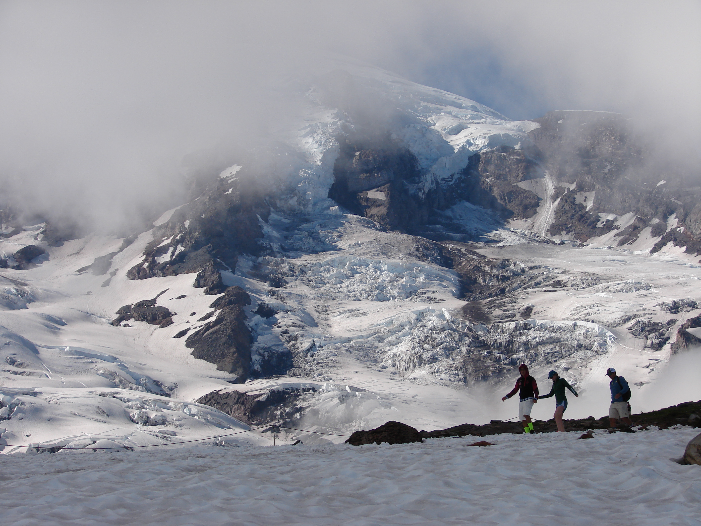
Enjoy Spring at Mount Rainier
With its tremendous amount of snowfall, Mount Rainier is a winter wonderland often into early summer, especially at higher elevations such as Paradise and Sunrise. Don’t let the amount of snow you encounter during your trip take you by surprise. Be prepared for snow well into June and early July.
For your spring visit bring along the appropriate clothes and footwear for recreating in snowy conditions. Don’t forget a warm hat, jacket, and gloves! Also, remember that snow can mean adverse road conditions. All vehicles are required to carry tire chains in the park until May 1. The road between Longmire and Paradise could close restricting access to Paradise if required by road conditions.
Plan for snow-covered trails throughout the park. Trails at lower elevations may be mostly snow-free between mid-May and early June. At higher elevations trails can be snow-covered into July or longer! Check trail conditions prior to setting out on a hike. To protect vegetation, hike only on trails or deep patches of snow.
Visitor centers, wilderness information centers, and ranger stations may still be closed for the winter. Check for hours of operation when planning your visit and be prepared to bring your own supplies, like food and water.
While there may be snow, there are plenty of opportunities to enjoy your spring visit. This time of year you’ll want to explore to Longmire and Paradise . Besides glaciers, rivers, and forests, this area is rich in history, offers plenty of hiking, and has breathtaking vistas. Plan to visit mid-week, and early or late in the day, to avoid crowds and traffic.
Whether you’re visiting for a few hours or the entire day, there is plenty to do at Longmire and Paradise. Take a hike, enjoy the views, hunt for elusive forest wildflowers in the lowlands, or enjoy the snowy landscape at Paradise.
Enter through the Nisqually Entrance via SR706 from Ashford, WA. Enjoy the drive through beautiful old-growth forests. You’ll reach Longmire in about 15 minutes of driving.
Longmire
Visit Longmire to walk in the footsteps of those who first founded the area and learn about the history of the park. Enjoy trails leading through meadows, old-growth forest, and for the more adventurous, amazing views.
Walk the Trail of Shadows . 0.7 miles round-trip. Average hiking time: 30 minutes. A self-guiding loop around Longmire Meadow explores the early history of the Longmire Springs Resort. The trail begins across the main park road from the Longmire Museum. For your safety, do not drink the water from the springs!
Drive the 30 minutes up to Paradise making some of the scenic stops along the way.
Christine Falls - Follow the short path down to the viewpoint of the waterfall.
Ricksecker Point - Enjoy magnificent views of Mount Rainier and the Tatoosh Range!
Narada Falls - A quick but steep trail will bring you down to the base of the waterfall. If snow is present it is not recommended to walk on this trail.
Paradise
Expect snow-covered trails well into June. This area receives several feet of snow during the winter and it will linger well into spring. Look for trail information and rangers near the visitor center.
A network of hiking trails provides access to outstanding views of Mount Rainier and its glaciers, and routes for skilled climbers attempting to reach the mountain’s summit. See the posted snow cover trail map at Paradise to avoid snow-covered trails. Photographers appreciate the high-country scenery at Inspiration Point and Reflection Lakes. Consider Nisqually Vista or Myrtle Falls for young hikers, or Alta Vista or Glacier Vista for the more ambitious. Take lots of water and sunscreen!
For snow-free hiking in June, consider the Longmire and Ohanapecosh areas.
Ohanapecosh
Once SR123 opens in late spring-early summer the Ohanapecosh area is a must see! Camp at the Ohanapecosh campground or hike one of the many trails in the area. Enjoy wandering through old-growth forests of giant western red cedar and hemlock, along the brilliant turquoise waters of the Ohanapecosh River, to thundering waterfalls and peaceful sanctuaries.
Spring Hiking Safety
Roads and facilities on the east side of the park are closed well into spring and early summer. Check the road status on the park website.
End-of-season snow conditions create hazards specific to this time of year. The following information will help you prepare for current conditions:
Winter storms can hit here any month of the year. Spring and early summer are notorious for unpredictable and rapidly changing weather. Know the current condition of the trail and obtain a current weather forecast. Be prepared for winter-like weather even in June. Unprepared hikers increase their risk of getting lost or being injured.
Notify a responsible person of your plans so they can contact rangers if you fail to return.
Before starting your hike, check the posted snow-cover map for current trail conditions.
Hypothermia and frostbite are cold weather hazards which can lead to serious injury or death. If you are spending time outside, dress sensibly, drink lots of fluids, and take warm-up breaks indoors.You will need a reliable map and compass skills in many areas of the park because snow-covered trails can be difficult to follow.
Avoid crossing steep, snow-covered slopes where a fall could be disastrous. Turn around instead. Comet Falls and Pinnacle Peak trails often have hazardous slopes. Take an ice axe if you know how to use it.
Falling through thin snow bridges is a hazard anywhere streams remain snow-covered. Stay alert for the muffled sound of running water.
Falling into snow moats around trees, and adjacent to logs and rocks, can cause injury. Avoid getting too close.
Avoid stepping on wet, slippery rocks, especially near rivers and waterfalls.
Avoid stepping onto snow cornices. They may collapse under your weight.
Beware of avalanches! Avalanches occur with frightening regularity. Check the maps for avalanche zones and ask a ranger for the forecast before you start. Backcountry travel is not recommended when avalanche conditions are high to extreme.
Carry the Ten Essentials and know how to use them: map of the area & compass; extra food & water; first aid kit; headlamp or flashlight; extra bulb & batteries; sunglasses & sunscreen; pocketknife; extra clothing & rain gear; emergency shelter, and; matches in a waterproof container––for emergency use only; fires are not allowed in Mount Rainier’s wilderness.
Learn more about Spring Hiking Safety .
Pets Service animals are permitted.
Accessibility The main developed areas have paved roads and paths. In spring, paths can be snow-covered and sometimes icy. Buildings and restrooms are accessible year-round. Service animals are permitted on trails and in buildings.