Alta Vista Trail
Trailhead Alta Vista Trailhead 5,381 ft Drive there

National Park · Washington
88 named trails · 176 miles · 49 trailheads · 14 with the Park Service's own write-up. The lines, trailheads and points are the Park Service's; the write-ups are the Service's own words; the climbing is read from USGS elevation along each line.
88 trails, A to Z.
Trailhead Alta Vista Trailhead 5,381 ft Drive there
Tunnels
Along the way Box Canyon Tunnel
Picnic areas
Along the way Chenuis Falls Picnic
Trailhead Chenuis Falls 2,152 ft Drive there
2-8 Hours · no dogs · entrance fee applies · Spring, Summer, Fall
Start Park-wide
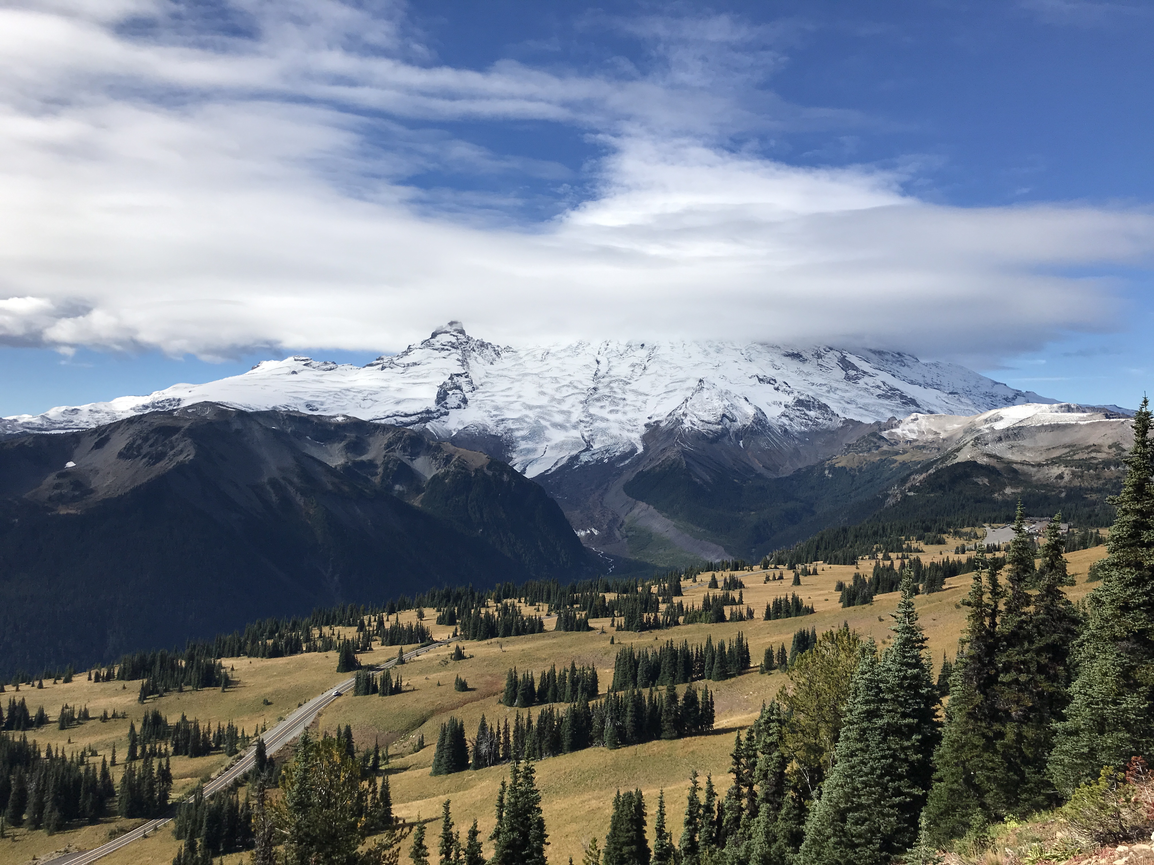
Mount Rainier National Park offers over 260 miles of maintained trails for your enjoyment. Trails lead through peaceful old-growth forest along river valleys up to subalpine wildflower meadows on the flanks of Mount Rainier. Most trails are snow-covered in winter, and snow can linger well into summer at higher elevations. Pets and bicycles are NOT permitted on any park trails. Always check current conditions before heading out on a trail. For your safety , never hike alone, carry (and know how to use) the Ten Essentials, and tell someone your plans. In the heavily used Paradise, Sunrise, and Tipsoo Lake meadows, hikers are required by law to stay on trails. All hikers are asked to avoid fragile wildflower meadows, lake shores, and stream banks throughout the park. Please choose a spot for a lunch stop carefully. Do not feed wildlife to help Keep Wildlife Wild . Feeding wildlife invites aggressive animal behavior and increases vehicle collisions which may injure people and commonly results in wildlife death. Feeding birds artificially concentrates nest predators, harming young songbirds.
The park recommends that day hikers limit their party size to no more than 12 people per group. Day hikers are advised to keep hiking plans flexible because some trailhead parking lots may be full. Overflow parking is not permitted in order to avoid impeding traffic and to provide a less crowded, higher quality experience for hikers. Alternative trailheads may have space available.
Suggested Day Hikes
Looking for easy and enjoyable trails that the whole family can experience together? Consider the following trails in the Longmire, Paradise, Ohanapecosh, and Sunrise areas of Mount Rainier National Park. The hikes described below range from short strolls to longer trails through the wilderness. For descriptions of longer day hikes, overnight or multi-day hikes, visit the Trails page on the park website.
Longmire Area Trails
Download the Longmire Area Trails Map .
Trail of the Shadows (0.7 mi/1.1 km loop trail) - Human and natural history come together in the forest and meadows of Longmire. View bubbling mineral springs and explore a replica of an early homestead cabin. Discover the plants and animals that call this area their home, including deer, birds, and beavers. Located across the road from the National Park Inn at Longmire.
Twin Firs Loop Trail (0.4 mi/0.6 km loop trail) - This short loop trail weaves through old-growth forest. Trailhead is located along the road two miles west of Longmire towards the Nisqually Entrance.
Rampart Ridge Trail (4.6 mi/7.4 km loop trail) - The trail climbs up forested slopes to Rampart Ridge, then follows the top of the ridge to connect to the Wonderland Trail. Make it a loop by following the Wonderland Trail back to Longmire. Viewpoints along the trail look over the Longmire area and provide glimpses of Mount Rainier and the surrounding valleys. Trail branches off of the Trail of the Shadows, located across the road from the National Park Inn at Longmire.
Carter Fall Trail (2.2 mi/3.5 km roundtrip) - This section of the Wonderland Trail referred to as "Carter Falls Trail" is a short hike from Cougar Rock Campground to Carter Falls. Continue past Carter Falls about 100 yards to view Madcap Falls. NOTE: The log footbridge over the Nisqually River can wash out in fall/winter. Check conditions before proceeding.
Paradise Area Trails
Download the Paradise Area Trails Map
Nisqually Vista Trail (1.2 mi/1.9 km loop trail) - Walk amidst the clouds and see how weather shapes the landscape, plants, and animals of these subalpine meadows. Enjoy excellent views of Mount Rainier and the Nisqually Glacier. Suitable for families with strollers. Trailhead located on the west end of the lower Paradise parking lot.
Bench & Snow Lakes Trail (2.5 mi/4 km roundtrip) - Enjoy two lakes along this one trail. In summer, this area is an excellent place to see bear grass and meadow flowers. The trail is a succession of gradual ups and downs crossing low ridges, reaching Bench Lake after 0.75 mile, then continuing another 0.5 mile to Snow Lake. Trailhead is along Stevens Canyon Road, 1.5 miles east of Reflection Lakes.
Skyline Trail to Myrtle Falls (1 mi/1.6 km roundtrip) - Follow a paved portion of the Skyline Trail through subalpine meadows to the Myrtle Falls viewpoint. View Mount Rainier and Tatoosh Range along the trail. Located on the north side of the upper Paradise parking lot.
Ohanapecosh Area Trails
Download the Ohanapecosh Area Trails Map
Hot Springs Nature Trail (0.5 mi/0.8 km loop trail) - The quiet green forests of Ohanapecosh offer a shady contrast to the windswept high country of the park. Walk under towering Douglas-firs and hemlocks to the bubbling waters of the Ohanapecosh Hot Springs. Located in the Ohanapecosh Campground, behind visitor center. NOTE: Due to the Ohanapecosh Construction Project , the Hot Springs Trailhead in the campground is CLOSED and the trail can only be accessed via the Eastside Trail/Silver Falls Trail starting from the Grove of the Patriarchs parking lot (5.9 mi/9.5 km roundtrip).
Silver Falls Trail (3 mi/4.8 km roundtrip) - The Ohanapecosh River falls majestically 75 feet in a silver spray over Silver Falls. Stay on the trail and behind safety barriers. Rocks are wet and slippery. Walk the trail as a loop by crossing the river on the bridge below the falls and return to the campground on the other side of the river. Trail begins from Loop B of the Ohanapecosh Campground. NOTE: Due to the Ohanapecosh Construction Project , the Silver Falls Trailhead in the campground is CLOSED and the trail can only be accessed via the Eastside Trail/Silver Falls Trail starting from the Grove of the Patriarchs parking lot (1 mi/1.6 km roundtrip).
Box Canyon Loop Trail (0.5 mi/0.8 km loop trail) - A short loop trail connected on either end by the road bridge and a wood foot bridge. From either bridge, gaze 180 feet (55 meters) below at water rushing through a narrow slot canyon carved by the Muddy Fork of the Cowlitz River. Located 12 miles west of Ohanapecosh along Stevens Canyon Road.
Sunrise Area Trails
Download the Sunrise Area Trails Map
Emmons Vista & Silver Forest Trail (0.4 mi to Emmons Vista Overlooks, 1.6 mi/2.5 km roundtrip) - Take a short walk from Sunrise to the two Emmons Vista Overlooks, which have excellent views of the White River Valley, the Emmons Glacier, and Mount Rainier. Continue along the Silver Forest Trail through the subalpine meadows for additional views. Trails starts from the south side of the Sunrise parking area.
Shadow Lakes Trail (3 mi/4.8 km roundtrip) - This trail offers views of the White River Valley and Mount Rainier on route to Shadow Lake. Return to Sunrise via the steeper trail to Frozen Lake and Sourdough Ridge or follow the old roadway back to Sunrise. Trail starts from the south side of the Sunrise parking area.
Sunrise Nature Trail (1.5 mi/2.4 km loop trail) - The main trail departing from Sunrise splits halfway up the slope, with both forks climbing up to Sourdough Ridge Trail . The two forks combined with the ridge trail form a triangle-shaped loop trail known as the the Sunrise Nature Trail. This route is a self-guided tour in the NPS app! Trail starts from the north side of the Sunrise parking area.
Dege Peak via Sourdough Ridge Trail (3.4 mi/5.5 km roundtrip) - Enjoy the beautiful subalpine meadows of the Sunrise area. A gentle climb to the ridge top offers breathtaking views of Mount Rainier, with Mount Baker, Glacier Peak, and Mount Adams in the distance. Stay on trail to protect fragile plants. Trail starts from the north side of the Sunrise parking area.
Naches Peak Loop Trail (3.5 mi/5.6 km roundtrip) - Explore the subalpine flower fields and breathtaking views of Mount Rainier. Late summer and fall brings an abundant supply of huckleberries. Half of the hike is on the Pacific Crest National Scenic Trail. Pets are not permitted on the west half of the loop trail which is inside Mount Rainier National Park. Located at Chinook Pass/Tipsoo Lake.
Glacier Basin Trail (7 mi/11.3 km) - In summer, the meadows of the basin are a rainbow of wild flowers. Watch for mountain goats on the surrounding slopes and mountain climbers ascending the Inter Glacier to Camp Schurman. After the first mile, a 0.5 mile spur trail leads along the Emmons Moraine to a view of the Emmons Glacier, the largest glacier in the lower 48 states. Stay on designated trails to protect fragile plants. Trail starts at the White River Campground.
Accessibility Trails throughout the park are typically dirt and broken by rock or log steps, and often include some elevation gain. Paradise area trails, including Nisqually Vista and Myrtle Falls, are the only paved trails. Many park roads close to vehicles during the winter.
WaterfallsPicnic areas
Along the way Chenuis Falls Picnic Chenuis Falls
Trailhead Chenuis Falls 2,152 ft Drive there
Picnic areas
Along the way Tipsoo Lake
Waterfalls
Along the way Christine Falls
Trailhead Comet Falls Trailhead 3,637 ft Drive there
Trailhead Cowlitz Divide Trail 2,349 ft Drive there
Backcountry camps
Along the way Lower Crystal Lake backcountry campsites Upper Crystal Lake backcountry campsites
Trailhead Crystal Lakes Trailhead 3,546 ft Drive there
Trailhead Nisqually Vista Trailhead 5,382 ft Drive there
Waterfalls
Along the way Denman Falls
Trailhead Eagle Peak Trailhead 2,805 ft Drive there
Waterfalls
Along the way Silver Falls
Trailheads Eastside Trailhead 3,198 ft Drive there · Grove of the Patriarchs Trailhead 2,202 ft Drive there · Naches Loop Trailhead 5,338 ft Drive there
1-2 Hours · no dogs · Summer, Fall
Start White River Campground
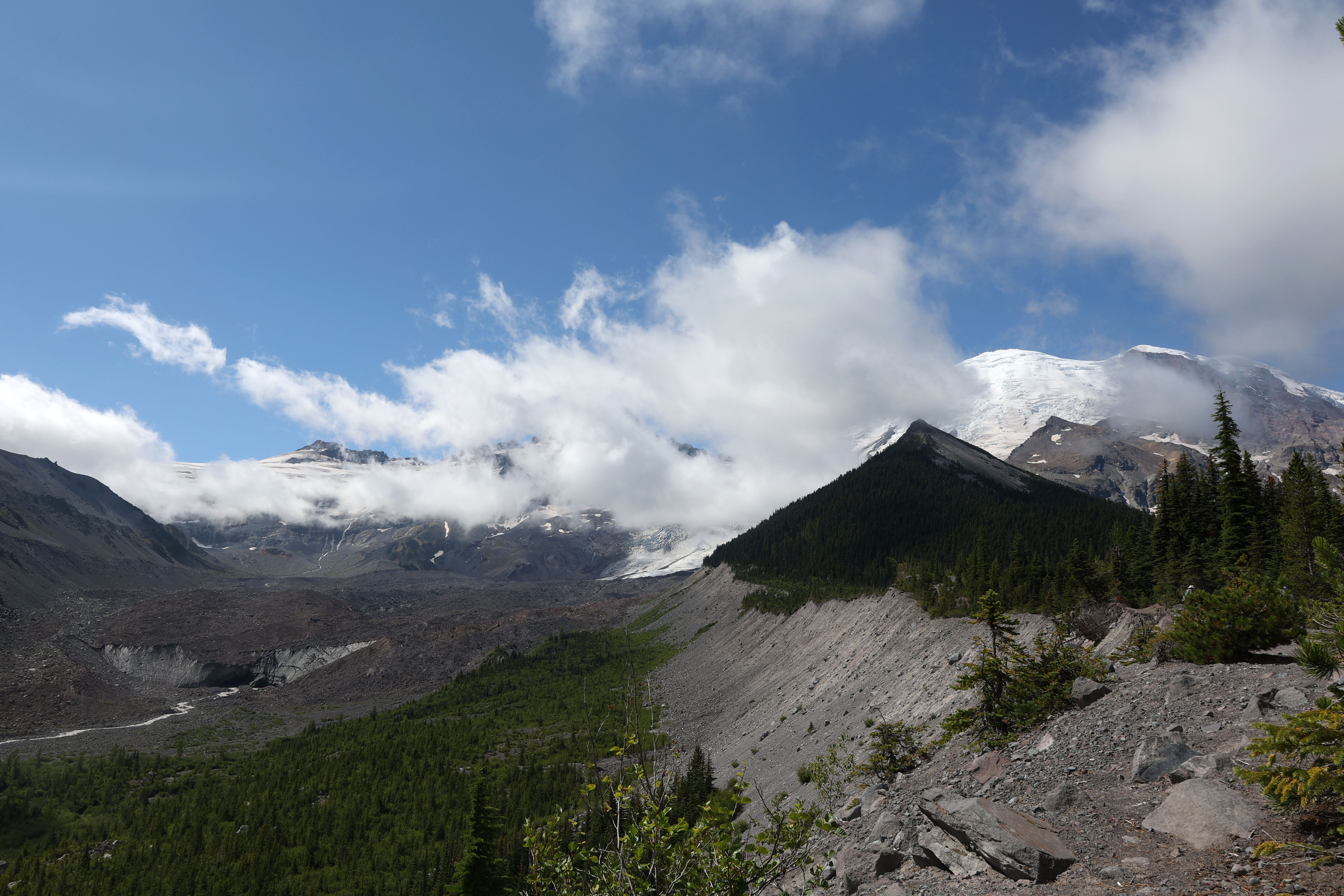
The Emmons Moraine Trail is a short hike that features a view of the Emmons Glacier and its terminus, along with a beautiful turquoise lake colored by glacial silt. Enjoy a walk through the forest along the Glacier Basin Trail until you reach a spur trail to the Emmons Moraine, a rocky ridge of rocks deposited by the glacier.
To get to the trailhead, drive through the White River Entrance Station and continue five miles to the White River Campground. Be sure to park in the hiker/climber parking area and not in a campsite. The trail to Emmons Moraine begins at the Glacier Basin trailhead, located in Loop D of the White River Campground .
The Glacier Basin trail was once an old mining road and follows the Inter Fork of the White River. One mile beyond the trailhead is a junction with the Emmons Moraine Trail to the left. This spur trail continues for a half mile to a viewpoint which overlooks the Emmons Glacier, the largest glacier in the contiguous United States.
From the turn off from the Glacier Basin Trail, the trail becomes rocky and uneven as it crosses boulders to get to the river crossing. There is a bridge but depending on conditions, the water crossing may be challenging. From here, the trail climbs up steep, loose dirt in a small set of switchbacks. Poles could be helpful here to maintain balance on ascent and descent.
Along the ridge, there are viewpoints of the lake. The lake is unnamed and was formed when a moraine blocked glacier melt from the retreating Emmons Glacier. From the lake viewpoints, return the way you came to the main trail. Unofficial spur trails from here can be narrow and hazardous with steep drop offs. Note that there is no official trail to reach the lake.
The maintained trail ends a half mile past the junction with Glacier Basin Trail. It is not recommended to continue beyond the “End of Maintained Trail” sign due to hazardous trail conditions. Enjoy the views from this spot of the glacier and return the way you came.
Trail Statistics
Distance: 3.0 miles round trip
Elevation gain: 600 feet
Hiking time, round trip: 1-2 hours
Wilderness Camps: None
Rules & Regulations
Pets are not allowed on trails
No campfires (backcountry stoves are okay)
No bicycles on trails
Pack out trash
Do not feed or disturb wildlife
Do not disturb any natural, cultural, or archeological features
Permits are required for all overnight wilderness use in the park, and for travel on glaciers above 10,000 feet
Accessibility The Glacier Basin trail starts out on a relatively flat, smooth, dirt path that gradually ascends through the forest. The spur trail to the Emmons Moraine is more rocky and narrow, with a bridge over the river and a short switchback climbs up loose dirt.
Trailhead 4th Crossing Trailhead 5,247 ft Drive there
Backcountry camps
Along the way Glacier Basin backcountry campsites
Trailhead Glacier Basin Trailhead 4,323 ft Drive there
HistoryBackcountry campsShelters
Along the way Lake George backcountry campsites Gobblers Knob Lookout Lake George Shelter
6-7 Hours · no dogs · Spring, Summer, Fall
Start Westside Road
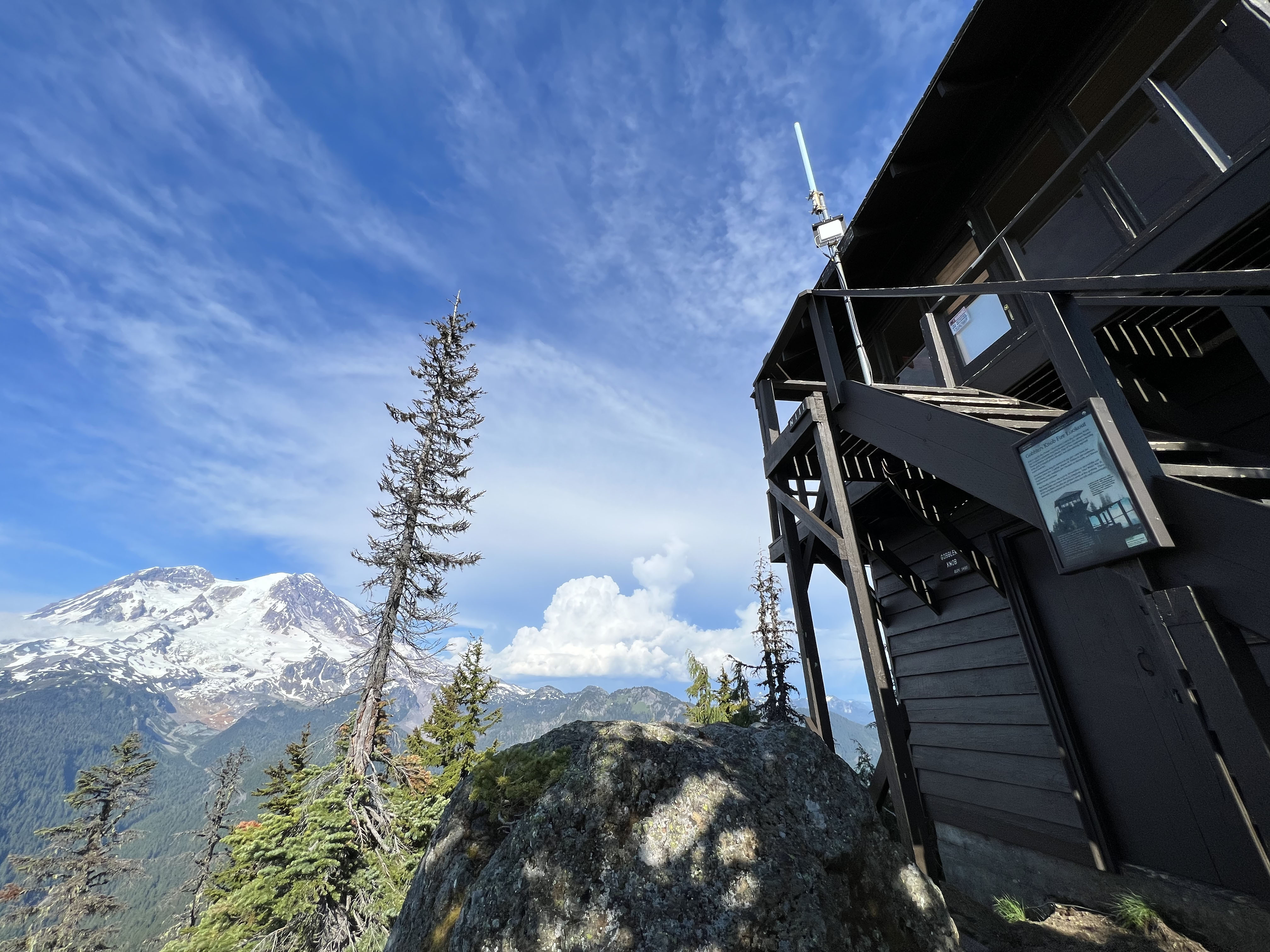
Gobblers Knob Fire Lookout , one of four historic fire lookouts in the park, sits on a rocky outcrop and offers panoramic views of Mount Rainier and the surrounding area.
To access the trailhead, take the Westside Road to the gate at Dry Creek (approximately 3 miles from the start of the road). Due to danger from rock fall, vehicles must park south of the barricade at Dry Creek. Hikers and bicyclists should travel through the area with caution and avoid lingering in the rock fall hazard zone. Visitors are also advised that Westside Road is an active geohazard zone .
Hike or bike up the closed portion of the road to Round Pass (3.8 miles). The Lake George/Gobblers Knob trailhead is on the left of the road by the wide parking area at Round Pass. A bike rack is next to the trailhead. Bikes are not allowed on any trails. The hike to Lake George is easy with a gradual incline over 0.8 miles. Lake George has a historic patrol cabin and backcountry campsites. Wilderness permits are required for all overnight stays in the backcountry. The hike to Gobblers Knob Lookout is an additional 1.0 mile from Lake George and much steeper.
Once you reach the lookout, enjoy views of Mount Rainier and the Tahoma Glacier from Gobblers Knob. On a clear day the peaks of Mount St. Helens, Mount Hood, Mount Adams, and the Olympic Mountains are visible. The fire lookout has been in use since the 1930s.
Trail Statistics
Distance: 11.2 miles roundtrip
Elevation gain: 2,585 feet
Hiking time: 6-7 hours
Difficulty Level: Strenuous
Wilderness Camp: Lake George
Rules & Regulations
Pets are not allowed on trails or on Westside Road past Dry Creek
No campfires (backcountry stoves are okay)
No bicycles on trails
Pack out trash
Do not feed or disturb wildlife
Do not disturb any natural, cultural, or archeological features
Permits are required for all overnight wilderness use in the park, and for travel on glaciers above 10,000 feet
Accessibility The hike along the closed portion of Westside Road up to Round Pass is a gradual incline, gaining 1,100 feet in 3.8 miles, along a wide, dirt road. From Round Pass, the hike to Lake George gains 390 feet in 0.8 miles, along a narrow, dirt trail with occasional rocks, roots, and boardwalk sections. The hike to Gobblers Knob Lookout from Lake George is similar terrain but much steeper, gaining approximately 1,095 feet in 1.0 mile.
CampgroundsVisitor centers
Along the way Ohanapecosh Campground Ohanapecosh Visitor Center
Backcountry camps
Along the way Forest Lake backcountry campsites
Trailhead Kautz Creek Trailhead 2,414 ft Drive there
Picnic areas
Along the way Kautz Creek Picnic Area
Trailhead Kautz Creek Trailhead 2,414 ft Drive there
Backcountry camps
Along the way Lake Eleanor backcountry campsites
Trailhead Laughingwater Creek Trailhead 2,169 ft Drive there
Trailhead Laughingwater Creek Trailhead 2,169 ft Drive there
Trailheads Lower Lakes Trail 4,967 ft Drive there · Lower Lakes Trailhead 5,375 ft Drive there
2-8 Hours · no dogs · entrance fee applies · Spring, Summer, Fall
Start Paradise
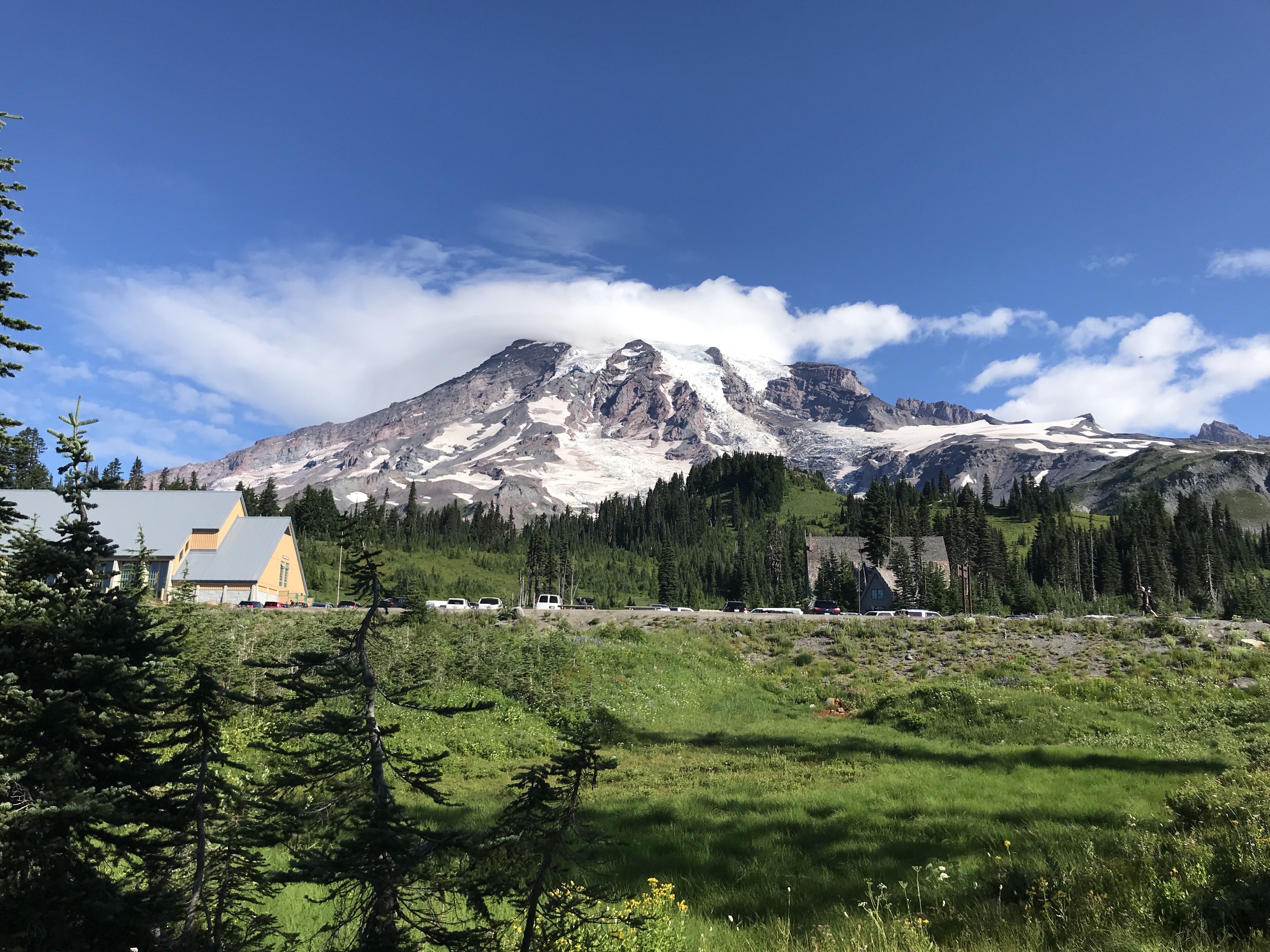
The Paradise area of Mount Rainier National Park has it all—history, hiking, wildflowers, and wildlife viewing opportunities, and more! Use this guide to help you decide what to do on your day in Paradise. Do you want a mountain view? How about a nice place to rest your feet and learn about the history of Mount Rainier?
Always check trail and road conditions with a park ranger or online before hiking. Many trails may be partially or totally covered in snow and can be dangerous. Roads may be closed due to snow conditions. Pets are not allowed on trails.
Don’t Be A Meadow Stomper
Don’t step off trail to get a closer look! Stepping off a designated trail can cause erosion and kill fragile plant life.
Do admire the wildflowers from a distance.
Don’t pick the wildflowers. We know, we know. They’re pretty and it can be hard to resist.
Do take some pictures! The flowers will last longer that way!
Don’t hike on social trails. These are trails that were created by hikers who strayed from designated trails. The trails once had bushes or wildflowers growing on them.
Do be careful when taking breaks. Make sure you don’t sit or put your bag on fragile plant life. Ensure all food is secure and wildlife can’t access it.
Don’t feed the wildlife. Keep Wildlife Wild!
Mountain Views
Year-round and weather dependent.
Mount Rainier can be seen from many locations at Paradise. You may need to move a short distance or wait for some clouds to move, but the parking lots, plazas, and trails all offer good views of the mountain when skies are clear . There is no one best spot to see the mountain. The following trails all offer many breathtaking views:
Nisqually Vista Trail (Easy) (1.2 miles round-trip, 200 feet elevation gain, 45 minutes) - The trailhead is located at the northwest end of the lower parking lot. Suitable for families with strollers.
Alta Vista via the Alta Vista and Skyline Trails (Moderate) (1.75 miles round-trip, 600 feet elevation gain, 1.25 hours) - Begin at the trailhead located at the entrance to the lower parking lot, or at the trailhead on the north side of the upper parking lot, next to the visitor center.
Waterfalls
Due to snow, trail access is safest in summer and fall.
Skyline Trail to Myrtle Falls and view of Sluiskin Falls (1 mile round-trip, 100 feet elevation gain, 35 minutes) - The trailhead is located on the north side of the upper parking lot, next to the visitor center. Suitable for wheelchairs with help, and strollers. View Sluiskin Falls northwest of Myrtle Falls from Skyline Trail just past Myrtle Falls.
Paradise to Ruby Falls and Narada Falls (2.2 miles round-trip, 800 feet elevation gain, 1.5 hours) - From the southeast corner of the upper parking lot, take the Lakes Trail. Follow signs for Narada Falls. Enjoy the cascading Ruby Falls before reaching the Narada Falls parking area and viewpoint. Return the same route.
Historic Buildings
Year-round.
Paradise Inn - Opened in 1917, this is one of the oldest inns in the national park system. The natural log architecture and handmade furniture makes this building a special visit. Former President Harry Truman played at the piano in 1945.
Historic Paradise Ranger Station - The ranger station was built in 1921. It is the small building at the top of the parking area. It is not open to the public and is now used for emergency service employees.
Guide House - The Guide House was built in 1920 and is now used as a Wilderness Information Center. In summer, learn about the history of this multifaceted building on the small wayside exhibit outside the southeast end of the building
Paradise Camp Lodge - The lodge was constructed in 1931 and demolished in the mid-1950s. The current Jackson Visitor Center stands on the original footprint of this building. Learn about the history of the building on the wayside exhibit and building markers on the south side of the visitor center.
Wildflowers
Mid July-Early September.
Myrtle Falls and Edith Creek Basin ( 2 miles round-trip, 200 feet elevation gain, 45 minutes) - Follow the Skyline Trail to Myrtle Falls and enjoy the views of the Paradise Valley along the way. Once at the falls, you can cross the bridge and walk up the Golden Gate Trail to enjoy wildflowers in summer and brightly colored foliage in autumn.
Nisqually Vista Trail (1.2 miles round-trip, 200 feet elevation gain, 45 minutes) - This trail will often have beautiful wildflowers in the area where the trail splits to form a loop. Hike the whole thing for great views of the Nisqually Glacier and Mount Rainier.
Lower Deadhorse Creek Trail (1.4 miles round-trip, 350 feet elevation gain, 1 hour) - Take the Avalanche Lily Trail until it intersects with the Deadhorse Creek Trail. Turn right and hike up the hill enjoying the views of the different wildflower meadows. Return the same way or follow the Skyline Trail to make a loop. This route is paved but it can be steep at times.
Scenic Drives
Roads are open seasonally.
Paradise Valley Road (5 minutes) - The Paradise Valley Road starts in the southeast corner of the upper parking lot. Take this road two miles to its intersection with Stevens Canyon Road. Turn left to go to Inspiration Point and Reflection Lakes and turn right to return to the Paradise Road.
Inspiration Point (10 minutes) - The Paradise Valley Road starts in the southeast corner of the upper parking lot. Take this road two miles to its intersection with Stevens Canyon Road. Turn left to go to Inspiration Point. Enjoy amazing views of Mount Rainier and the Tatoosh Mountains.
Ricksecker Point (10 minutes) - Follow the Paradise Road down towards Longmire. After five miles, follow signs for Ricksecker Point. Enjoy fantastic views of Mount Rainier and the Tatoosh Mountains.
Stevens Canyon Road (45 minutes) - The Paradise Valley Road starts in the southeast corner of the upper parking lot. Take this road two miles to its intersection with Stevens Canyon Road. Turn left and enjoy the 19 mile Stevens Canyon Road. Popular stops include Inspiration Point, Reflection Lakes, Box Canyon, and Backbone Ridge. Other pullouts are available.
Pets Pets are not allowed on any trails. Pets may be in the Paradise parking lot only.
Accessibility Many of the trails in the Paradise Area are paved, but sections can be steep or have steps. The Myrtle Falls Trail is suitable for wheelchairs with help, and strollers. The Nisqually Vista Trail is suitable for strollers. Edges of the trails may be abrupt and are often bordered by low ropes to discourage trampling meadow plants. Trails may have patches of snow or be snow-covered. Pets are not allowed on trails, but service animals are permitted. The Jackson Visitor Center is accessible to wheelchairs. The exhibits, theater, dining area, restrooms and general services are accessible. The Jackson Visitor Center exhibits can be explored with an audio description tour. Listening devices for the tour can be checked out at the front desk. The park film and exhibit videos in the vistor center are captioned. Assistive listening devices for the film can be checked out at the front desk. See accessibility page for more details.
1-2 Hours · no dogs · Summer, Fall
Start White River Campground
The Emmons Moraine Trail is a short hike that features a view of the Emmons Glacier and its terminus, along with a beautiful turquoise lake colored by glacial silt. Enjoy a walk through the forest along the Glacier Basin Trail until you reach a spur trail to the Emmons Moraine, a rocky ridge of rocks deposited by the glacier.
To get to the trailhead, drive through the White River Entrance Station and continue five miles to the White River Campground. Be sure to park in the hiker/climber parking area and not in a campsite. The trail to Emmons Moraine begins at the Glacier Basin trailhead, located in Loop D of the White River Campground .
The Glacier Basin trail was once an old mining road and follows the Inter Fork of the White River. One mile beyond the trailhead is a junction with the Emmons Moraine Trail to the left. This spur trail continues for a half mile to a viewpoint which overlooks the Emmons Glacier, the largest glacier in the contiguous United States.
From the turn off from the Glacier Basin Trail, the trail becomes rocky and uneven as it crosses boulders to get to the river crossing. There is a bridge but depending on conditions, the water crossing may be challenging. From here, the trail climbs up steep, loose dirt in a small set of switchbacks. Poles could be helpful here to maintain balance on ascent and descent.
Along the ridge, there are viewpoints of the lake. The lake is unnamed and was formed when a moraine blocked glacier melt from the retreating Emmons Glacier. From the lake viewpoints, return the way you came to the main trail. Unofficial spur trails from here can be narrow and hazardous with steep drop offs. Note that there is no official trail to reach the lake.
The maintained trail ends a half mile past the junction with Glacier Basin Trail. It is not recommended to continue beyond the “End of Maintained Trail” sign due to hazardous trail conditions. Enjoy the views from this spot of the glacier and return the way you came.
Trail Statistics
Distance: 3.0 miles round trip
Elevation gain: 600 feet
Hiking time, round trip: 1-2 hours
Wilderness Camps: None
Rules & Regulations
Pets are not allowed on trails
No campfires (backcountry stoves are okay)
No bicycles on trails
Pack out trash
Do not feed or disturb wildlife
Do not disturb any natural, cultural, or archeological features
Permits are required for all overnight wilderness use in the park, and for travel on glaciers above 10,000 feet
Accessibility The Glacier Basin trail starts out on a relatively flat, smooth, dirt path that gradually ascends through the forest. The spur trail to the Emmons Moraine is more rocky and narrow, with a bridge over the river and a short switchback climbs up loose dirt.
History
Along the way Mt Fremont Lookout
Picnic areas
Along the way Mowich Lake
Trailhead Wonderland Trail 4,999 ft Drive there
Trailhead Naches Loop Trailhead 5,338 ft Drive there
Waterfalls
Along the way Narada Falls
Trailhead Narada Falls trailhead 4,568 ft Drive there
Picnic areas
Along the way Sunrise
Trailhead Nisqually Vista Trailhead 5,382 ft Drive there
45-60 Minutes · no dogs
Start Nisqually Vista Trail
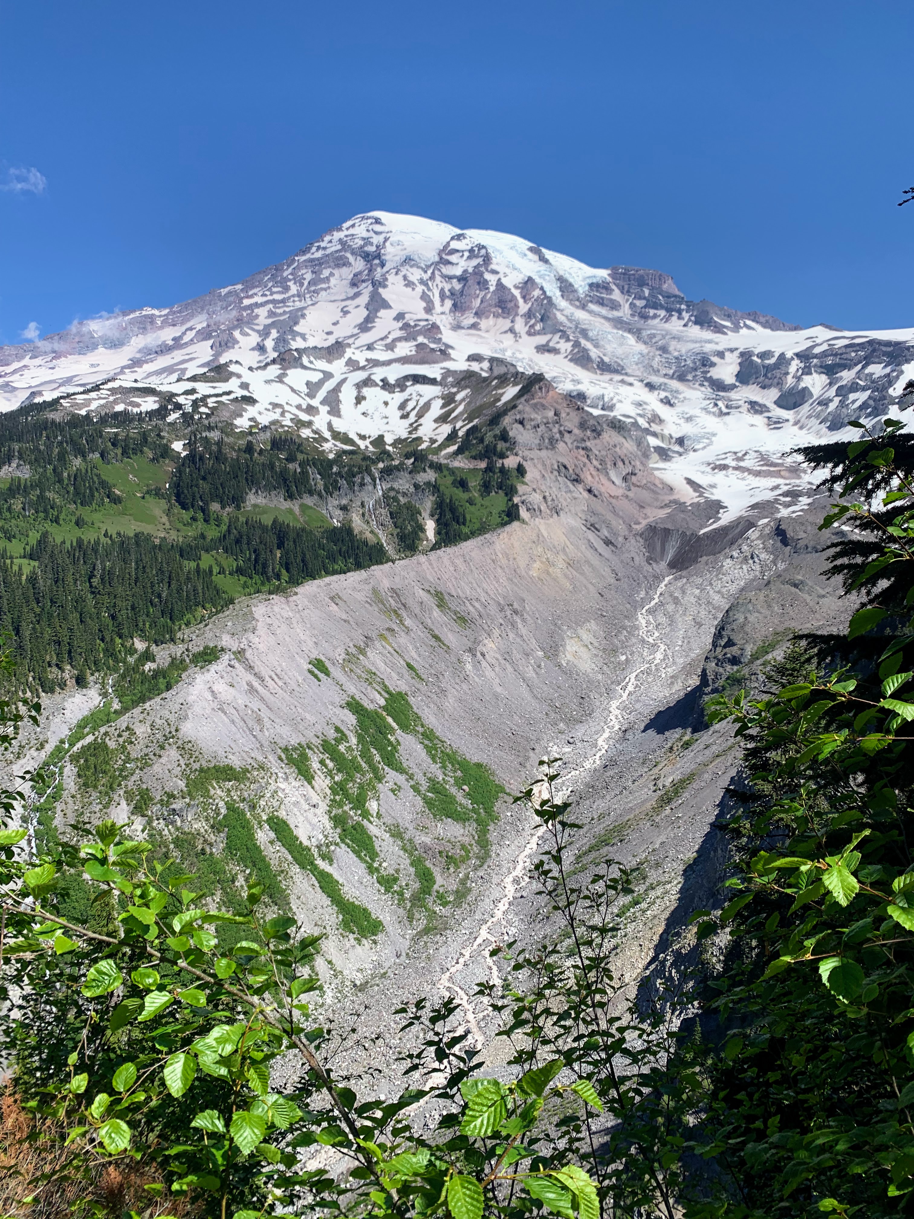
This easy hike in the Paradise area offers year-round views of the Nisqually Glacier as well as seasonal highlights, such as wildflowers and fall foliage. The trail is fully paved, 1.2 miles roundtrip and has 200 ft of elevation gain, following a lollipop shape. Find the stairs at the west end of the lower Paradise parking lot to start the trail. It is suitable for families with strollers, but be cautious of the stairs at the start of the trail.
As you start along the trail you will be treated to several views of Mount Rainier as you wind through a forest of evergreen trees and blueberry bushes. In about 0.25 miles you will encounter a fork in the trail. You can choose to go clockwise or counterclockwise from here, with the clockwise direction taking you to the viewpoints quicker. Four separate viewpoints offer different vantages of the Nisqually Valley, highlighting the end (terminus) of the Nisqually Glacier and the beginning of the Nisqually River.
The trail also features meadows that fill with wildflowers mid-summer and views of the Tatoosh mountain range to the south. The trail can even offer beautiful views on cloudy days, showcasing how weather shapes the landscapes, plants, and animals. The valley is typically visible on higher cloud days, but even foggy days can can offer things to see; most notably flowers, mushrooms, and berries! The many blueberry bushes along trail turn vibrant shades of red, yellow, and orange in the early fall and thriving mushrooms can be spotted on wet days.
Like all Paradise trails, Nisqually Vista is snow covered in the winters. It is, however, a marked snowshoe route, so the views can still be enjoyed with some extra equipment and layers.
Accessibility The Nisqually Vista Trail is completely paved with sections of moderate grade making up the 200ft of elevation gain. The trail is stroller friendly except for starting with a short stair section, making it inaccessible to wheelchairs. In winter and early spring, the trail is snow covered and often icy. Restrooms in the upper Paradise area open year-round and 24/7.
Backcountry camps
Along the way Berkeley Park backcountry campsites Fire Creek backcountry campsites
Backcountry camps
Along the way Deer Creek backcountry campsites Tamanos Creek backcountry campsites
Trailhead Owyhigh Lakes Trail 3,754 ft Drive there
Trailhead Palisades Lakes Trailhead 6,116 ft Drive there
Trailhead Paul Peak Trailhead 3,685 ft Drive there
Picnic areas
Along the way Sunrise
Trailhead Pinnacle Peak Trailhead 4,886 ft Drive there
Trailheads Carbon River Road Trailhead (hikers and bicycles only) 1,768 ft Drive there · Rainforest Loop Trailhead 1,766 ft Drive there
2-3 Hours · no dogs
Start Rampart Ridge Trail
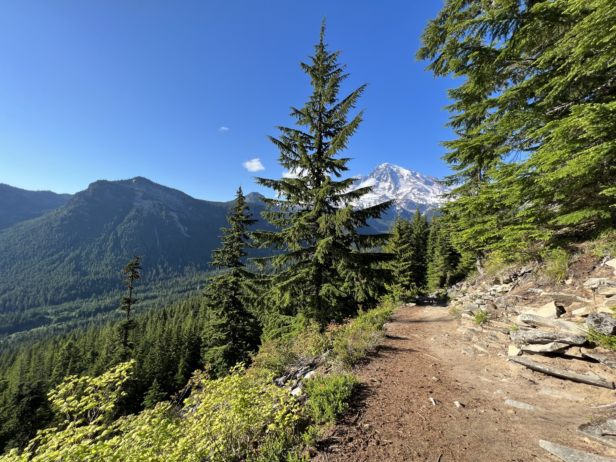
This moderate loop trail passes through forests with glimpses of the surrounding mountain vistas. Also known as "The Ramparts," this ridge is the remnant of an ancient lava flow which originated at the summit of Mount Rainier.
To connect with the trailhead to Rampart Ridge, begin at the west end of the Trail of the Shadows Trail located across the road from the National Park Inn. The loop can be hiked in either direction, but going clockwise keeps Mount Rainier in front more of the time and is thus recommended. The hike begins steeply as the trail leads through dense forest to the top of the ridge.
At 1.8 miles, there is a viewpoint looking up the Nisqually River Valley. As you hike along the relatively level ridge, listen for the tapping of the woodpeckers or the booming of the grouse. Keep an eye out for deer and other wildlife. Notice the various mosses and lichen clinging to the trees. On a clear day, hikers are also rewarded with excellent views of Mount Rainier and the Nisqually River Valley from two viewpoints atop the ridge At 2.9 miles, join the Wonderland Trail for the return to Longmire.
Trail Statistics
Distance, round trip: 4.6 miles
Elevation gain: 1339 feet
Hiking time, round trip: 2.5 hours
Wilderness Camps: None
Accessibility The west end of Trail of the Shadows is a relatively flat, wide path that includes a boardwalk. At the junction 0.2 miles in, the Rampart Ridge trail begins and continues up steep switchbacks to the top of the ridge. The trail is rocky and rooted throughout. As the loop continues down the Wonderland Trail to return to Longmire, there are sections of boardwalks and steep stairs. Some of the stairs are up to a foot tall.
Backcountry camps
Along the way Sunrise Camp backcountry campsites
HistoryBackcountry camps
Along the way Shriner Peak backcountry campsites Shriner Peak Lookout
Trailhead Shriner Peak Trailhead 2,431 ft Drive there
5-6 Hours · no dogs · Spring, Summer, Fall
Start Shriner Peak Trailhead
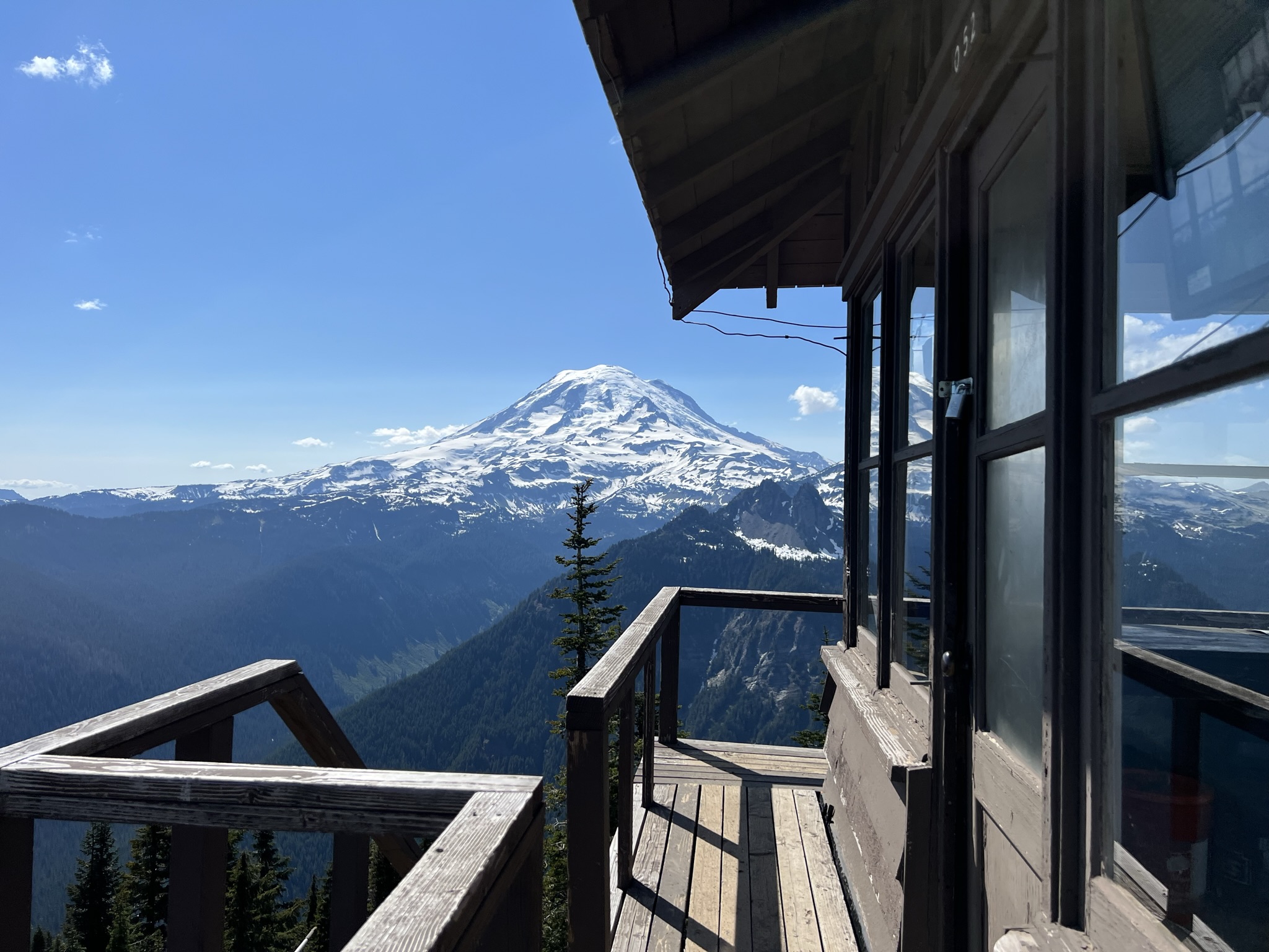
Panoramic views make Shriner Peak Trail worth the strenuous hike to the Shriner Peak Fire Lookout . The view from the top offers commanding views of Mount Rainier, Ohanapecosh Valley, and the Cascade Range. Along the trail, you’ll find brilliant fall foliage, colorful summer wildflowers, and wild strawberries in the fire-exposed meadows. At 2.5 miles in, there is a view of Mount Rainier's east side.
Although this trail begins in the forest, it soon climbs into an old burn area that is open and shadeless. The trail climbs steeply through open burn areas that offer little shade from the summer sun. Be sure to bring plenty of water and start your hike early in the day to avoid the hottest afternoon hours.
For 2.5 miles the trail continues its steep ascent to the top of the ridge. Still no shade, but a slight breeze sometimes makes the hike more bearable from here on. After a 0.5 mile walk along the ridge top, the route becomes a series of steep switchbacks for the final climb to the lookout.
The trail continues south of the fire lookout to Shriner Peak Camp, a wilderness camping area with two individual campsites (with a capacity of five people each) at an elevation of 5,355 feet. Wilderness permits are required for all overnight stays in the backcountry.
Trail Statistics
Distance: 8 miles roundtrip
Elevation gain: 3,434 feet
Hiking time: ~5 hours
Difficulty Level: Strenuous
Wilderness Camp: Shriner Peak
Rules & Regulations
Pets are not allowed on trails
No campfires (backcountry stoves are okay)
No bicycles on trails
Pack out trash
Do not feed or disturb wildlife
Do not disturb any natural, cultural, or archeological features
Permits are required for all overnight wilderness use in the park, and for travel on glaciers above 10,000 feet
Accessibility The Shriner Peak Trail is a steep, narrow dirt path with several switchbacks.
Waterfalls
Along the way Silver Falls
Trailheads Hot Springs Nature Trailhead 1,890 ft Drive there · Silver Falls Loop Trailhead 1,876 ft Drive there
2-8 Hours · no dogs · entrance fee applies · Summer, Fall
Start Ohanapecosh
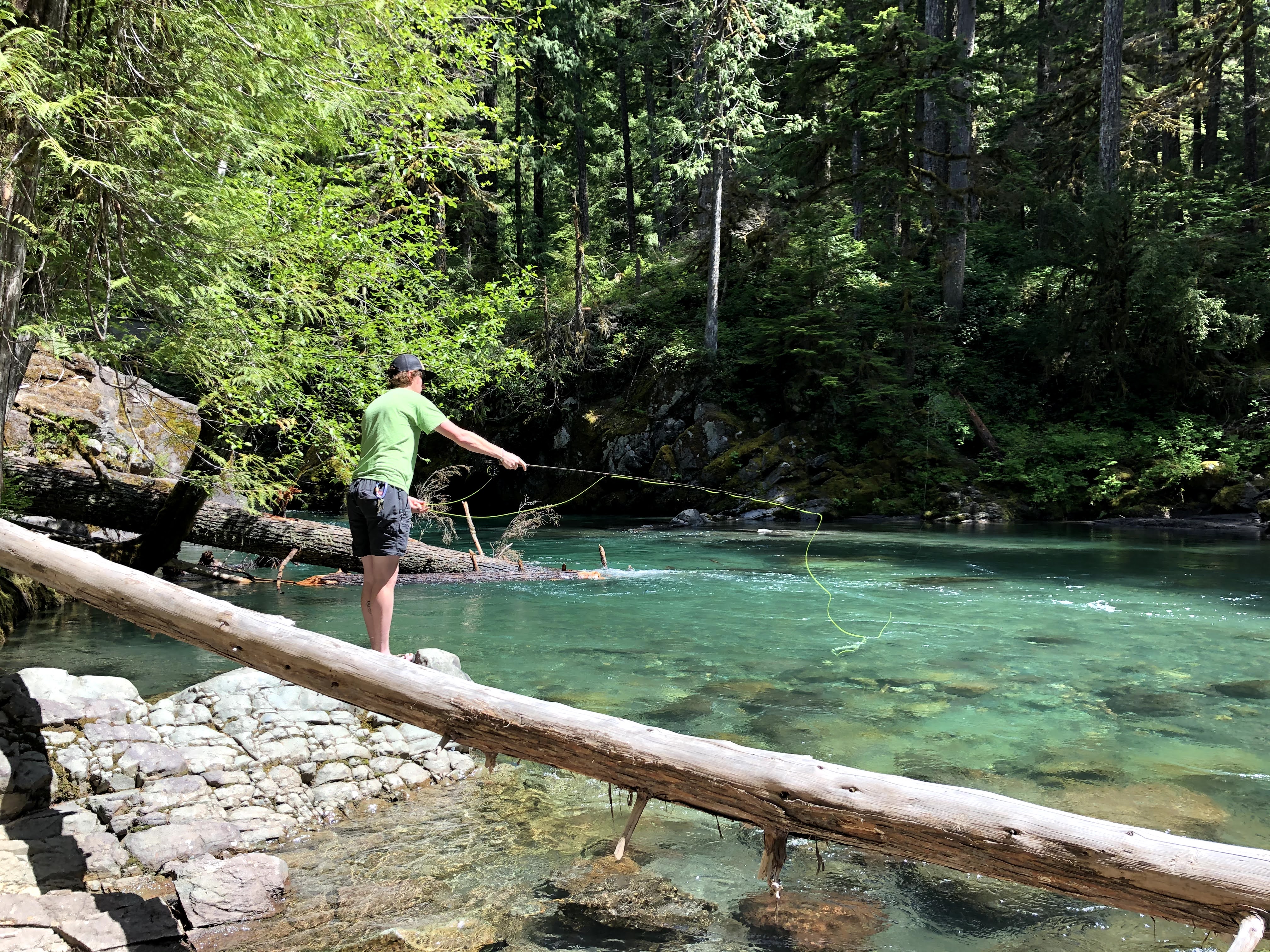
The Ohanapecosh area is a beautiful landscape of old-growth trees, wildlife, and the clear blue waters of the Ohanapecosh River. Places for quiet reflection and recreational opportunities abound. If you find yourself in the Ohanapecosh area with some time to spend in nature, consider taking advantage of the endless recreational opportunities.
Hot Springs Trail
Perhaps the most family friendly of the list is the 0.4 mile long Hot Springs Trail. This short loop trail is perfect for those who would like to stretch their legs but want to stay close to their campsite or vehicle. Walk beneath massive old-growth trees and meander through the remnants of an early hot springs resort. Stay on trail and do not enter the hot springs.
Fly Fish the Ohanapecosh
There are few things better than casting a line into a clear mountain river on a warm summer morning. Open to fly fishing from the first Saturday in June until October 31, the Ohanapecosh River is home to rainbow, brook, and cutthroat trout. This river isn’t considered a fishing destination to most, but experienced anglers enjoy the relaxing blue waters and surrounding old-growth trees.
Silver Falls to the Grove of the Patriarchs
Silver Falls and the Grove of the Patriarchs are two of the most popular hikes in the area, but many people chose to hike them separately. Combine the two by beginning your hike at the Ohanapecosh Campground. Hike until you reach Silver Falls and continue on the Eastside Trail for 0.5 mile until you reach the Grove of the Patriarchs Trailhead. Hike through the magnificent old-growth trees before returning the way you came.
Ohanapecosh to Chinook Pass
Not for the faint of heart, this 13.3 mile hike from Ohanapecosh to Chinook Pass has it all. For those looking for a challenge, hike from Ohanapcosh to Chinook Pass, gaining 3,532 feet along the way. Begin in the massive old-growth forest of the Ohanapecosh area and make your way north, passing old giants, countless raging waterfalls, and the Ohanapecosh River. Towards the end of your hike, you will enter the subalpine area of Tipsoo Lake and Chinook Pass.
PROTIP : Take two cars and park on opposite ends of the trail to cut your hiking time in half.
Accessibility Hikes vary in difficulty and none are wheelchair accessible. Trails are dirt, often broken by rocks, tree roots, logs, or steps. These trails can have significant elevation gain and loss. For anglers wanting to fish the Ohanapecosh River, there are challenges in getting down to the shore that may include bushwhacking or walking on uneven terrain on unmaintained trails.
Trailhead Skyline Trailhead 5,429 ft Drive there
Backcountry camps
Along the way Snow Lake Backcountry Campsites
Trailhead Snow and Bench Lake Trailhead 4,545 ft Drive there
Trailhead Sourdough Ridge Trail 6,398 ft Drive there
2-8 Hours · no dogs · entrance fee applies · Summer
Start Sunrise
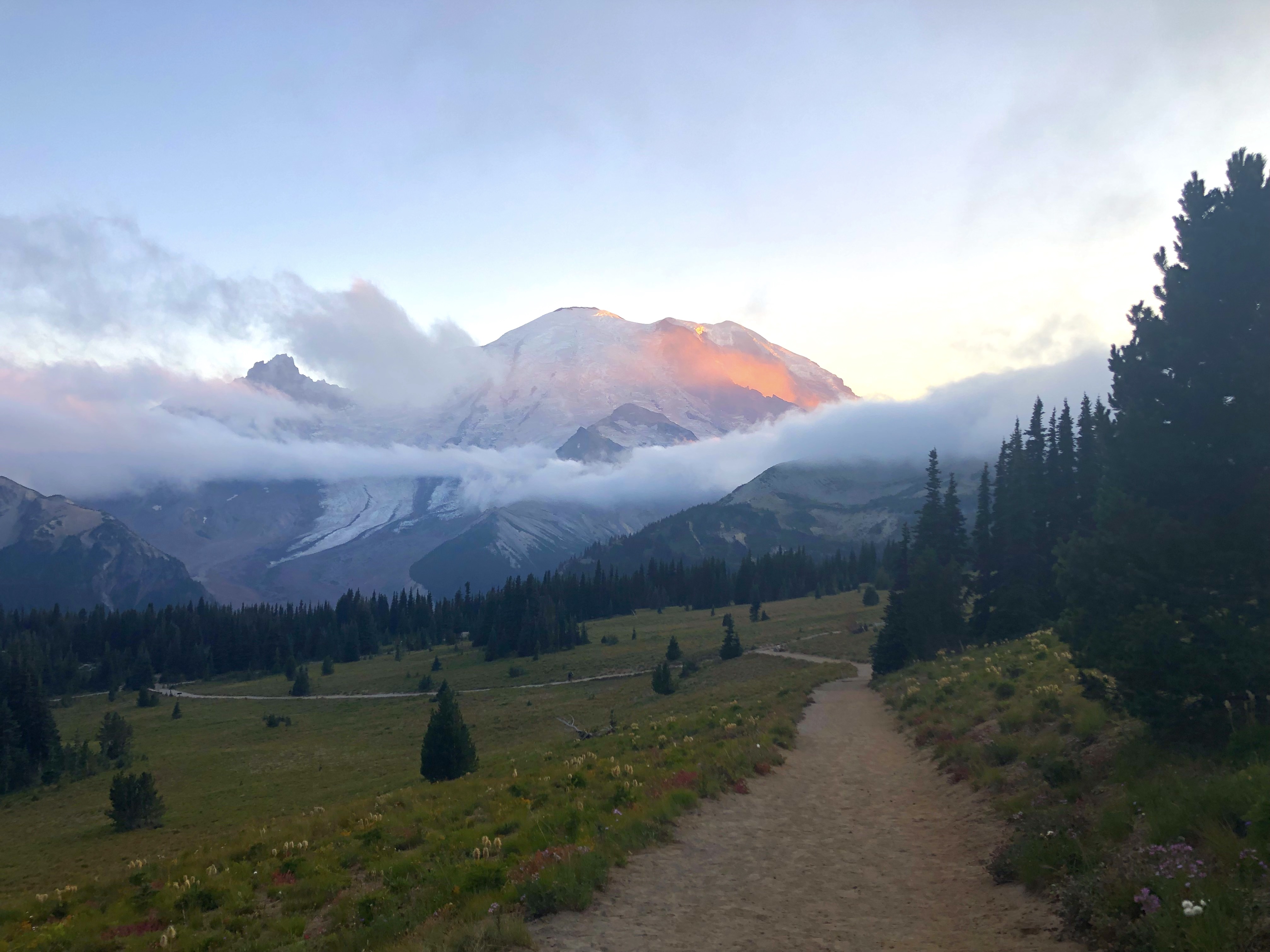
Located at an elevation of 6,400 feet, Sunrise is home to the highest visitor center in Mount Rainier National Park and is the highest point that can be reached by vehicle. The Sunrise area is only open for about 3 months each year (early July to late September). In its short season, Sunrise offers stunning views of Mount Rainier, numerous hiking opportunities, wildflower meadows, wildlife viewing, fascinating history, and more! Use this guide to help you decide what to do for your day in Sunrise.
Always check trail and road conditions with a park ranger and online before hiking. Many trails may be partially or entirely covered in snow and can be dangerous. Roads may be closed due to snow conditions. Pet are not allowed on trails.
Don’t Be a Meadow Stomper
Don’t step off trail to get a closer look! Stepping off trail can lead to erosion and kill fragile plant life, even in areas that appear to just be soil.
Do enjoy the wildflowers from a distance.
Don’t pick the wildflowers. Leave them for other visitors to enjoy too!
Do take plenty of pictures!
Don’t hike on social trails. These are trails created by hikers who strayed away from designated trails. These trails once had alpine and subalpine vegetation growing on them but have been stomped away by lots of foot traffic.
Do enjoy the trails while staying safe. Make sure to wear proper clothing and footwear and pack extra food and water.
Don’t feed the wildlife. Keep wildlife wild!
Mountain Views
Open seasonally, typically early July to late September. Weather dependent.
Mount Rainier can be seen from many locations in Sunrise. You can see the mountain from the parking lot, the observation deck outside the visitor center, and most of the trails when skies are clear. There is no single best spot to view the mountain. The following trails offer wonderful views:
Emmons Vista Overlooks (Easy) (1 mile round trip, 100 feet elevation gain, 30 minutes) - The trailhead is located south of the parking lot. Follow the Sunrise Rim Trail, then head east on the Silver Forest Trail to the two overlooks. From these overlooks, enjoy the spectacular views of Mount Rainier, the Emmons Glacier, and the White River Valley.
Sunrise Nature Trail (Easy) (1.5 miles round-trip, 300 feet elevation gain, 45 minutes) - The trailhead is located at the upper end of the picnic area. This self-guided loop offers stunning views of Mount Rainier and the Cascade Range north of the park.
Silver Forest Trail (Easy) (2 miles round-trip, 150 feet elevation gain, 1 hour) - The trailhead is located south of the parking lot. Follow the Sunrise Rim Trail, then head east on the Silver Forest Trail until you reach the end of the maintained trail. The trail leads to spectacular views of Mount Rainier and the Emmons Glacier from the Emmons Vista Overlooks (0.5 miles one way) and then continues through stunning seasonal wildflower meadows and an old burn area.
Sourdough Ridge Trail East to Dege Peak (Moderate) (4.2 miles, 800 feet elevation gain, 2.5 hours) - The trailhead is located at the upper end of the picnic area on the north side of the parking lot. Follow the nature trail to the right, then head east on the Sourdough Ridge Trail to the Dege Peak spur trail. This trail offers beautiful views of Mount Rainier, Mount Baker, Glacier Peak, the Cascade Range, and Mount Adams when weather permits. From the summit look down into the White River Park, Sunrise Lake, and Clover Lake.
Mount Fremont Lookout Trail (Strenuous) (5.6 miles, 900 feet elevation gain, 3.5 hours) - The trail head is located at the upper end of the picnic area on the north side of the parking lot. Follow the Sourdough Ridge Trail to the junction at Frozen lake, then take the Mount Fremont Trail to the old fire lookout. This trail offers wonderful views of Mount Rainier and the Cascade Range, including Mount Baker and Glacier Peak.
Burroughs Mountain Trail Loop via Sunrise Rim Trail (Strenuous) (5.2 miles, 1000 feet elevation gain, 3.5 hours) - The trailhead is located on the south side of the parking lot. Follow the Sunrise Rim Trail to Shadow Lake, continue to Glacier Overlook and up First Burroughs Mountain. This trail offers spectacular views of Mount Rainier, the Emmons Glacier, and the Winthrop Glacier. Continue up Second Burroughs Mountain (an additional 1.2 miles, 400 feet elevation gain, 1 hour) for more views of the mountain. Return via the Burroughs Mountain trail towards Frozen Lake, then follow the Sourdough Ridge Trail to the parking lot. Caution: Hazardous travel on icy slopes until late in the season!
Lake Views
Open seasonally, typically early July to late September.
Sunrise Point - At the last hairpin turn before reaching the Sunrise Visitor Center parking lot, take in the views of Mount Rainier, Mount Adams, the Cascade Range, and Sunrise Lake.
Sourdough Ridge Trail West to Frozen Lake (Moderate) (3 miles, 500 feet elevation gain, 1.5 hours) - The trailhead is located at the upper end of the picnic area on the north side of the parking lot. Follow the nature trail to the left, then head west on the Sourdough Ridge Trail towards Frozen Lake. Return to Sunrise back along the Sourdough Ridge Trail or via the Wonderland Trail and the old campground Trail. From the trail, enjoy views of the beautifully blue Frozen Lake. Please stay on the trail! Frozen Lake is surrounded by fragile vegetation. Swimming is NOT permitted in Frozen Lake as it serves as a public water supply.
Shadow Lake via Sunrise Rim and Wonderland Trails (Moderate) (3 miles, 500 feet elevation gain, 1.5 hours) - The trailhead is located on the south side of the parking lot. Follow the Sunrise Rim Trail to the Wonderland Trail. Follow signs for Shadow Lake and Sunrise Camp. The trail offers views of the White River Valley and Mount Rainier through seasonal wildflower meadows as it descends to the beautiful lake. Please stay on the trail and do not swim in the lake! Shadow lake is surrounded by fragile vegetation. Swimming is not permitted in Shadow Lake due to the fragile aquatic ecosystem.
Upper Palisades Lake Trail (Strenuous) (7 miles, 1800 feet elevation gain, 5 hours) - The trailhead is located at Sunrise Point. Follow the Palisades Lake Trail past Clover Lake to Upper Palisades Lake. This trail offers views of seasonal wildflowers and multiple lakes. There are no views of Mount Rainier from this trail.
Historic Buildings
Open seasonally, typically early July to late September.
Sunrise Visitor Center – The Sunrise Visitor Center and Day Lodge are part of the National Historic Landmark District. The visitor center is situated amid colorful subalpine meadows with Mount Rainier and Emmons Glacier as a stunning backdrop. This is Mount Rainier’s highest visitor center, located at 6,400 feet elevation. Inside discover exhibits about the geologic history of the park and the flora and fauna you may encounter.
Sunrise Day Lodge – Opened in 1931, this wood shingled rustic lodge with a steeply pitched roof was built by the Rainier National Park Company. The building was intended to be the first wing of a resort hotel. However, the project did not come to complete fruition, leaving just the one wing to service hungry visitors, offer gifts and supplies, and provide lodging to concessionaire employees. There are no overnight guest rooms.
Wildflowers
Mid-July to Early September.
Sunrise Nature Trail (Easy) (1.5 miles round-trip, 300 feet elevation gain, 45 minutes) - The trailhead is located at the upper end of the picnic area. This self-guided loop offers a stunning walk through wildflower meadows with a backdrop of Mount Rainier.
Silver Forest Trail (Easy) (2 miles round-trip, 150 feet elevation gain, 1 hour) - The trailhead is located south of the parking lot. Follow the Sunrise Rim Trail, then head east on the Silver Forest Trail until you reach the end of the maintained trail. The trail travels through colorfully diverse wildflower meadows and overlooks the White River Valley with views of Mount Rainier.
Shadow Lake via Sunrise Rim and Wonderland Trails (Moderate) (3 miles, 500 feet elevation gain, 1.5 hours) - The trailhead is located on the south side of the parking lot. Follow the Sunrise Rim Trail to the Wonderland Trail. The trail meanders through stunning seasonal wildflower meadows as it descends to the beautiful lake. Please stay on the trail and do not swim in the lake! Shadow lake is surrounded by fragile vegetation. Swimming is not permitted in Shadow Lake due to the fragile aquatic ecosystem.
Scenic Drives
Open seasonally, typically early July to late September.
Sunrise Road (40 minutes) - Starting at the White River Entrance, you will first wind through an old growth forest and then ascend into the subalpine zone of Mount Rainier. Enjoy views of Mount Rainier and roadside wildflower on your drive up. Stop at Sunrise Point for additional views of Mount Adams and the North Cascades. Please only park in designated parking areas and stay on designated sidewalks and roadways. Do NOT walk through the meadows.
Pets Pets are not allowed on any trails. Pets are only allowed in the parking area and picnic area of Sunrise.
Accessibility The main developed area of Sunrise has paved roads and paths. The Sunrise Visitor Center and Sunrise Day Lodge are accessible to wheelchairs. The exhibits, gift store, restrooms, and general services are accessible. The Sunrise Visitor Center exhibits can be explored with an audio description tour. Listening devices for the tour can be checked out at the front desk. Copies of the park brochure in braille are available for check-out. Wheelchairs are available at the Sunrise Visitor Center for short term loan.There are no paved trails in Sunrise. The trails in Sunrise are not wheelchair accessible. Pets are not allowed on trails, but service animals are permitted.
3-6 Hours · no dogs · Summer
Start Sunrise
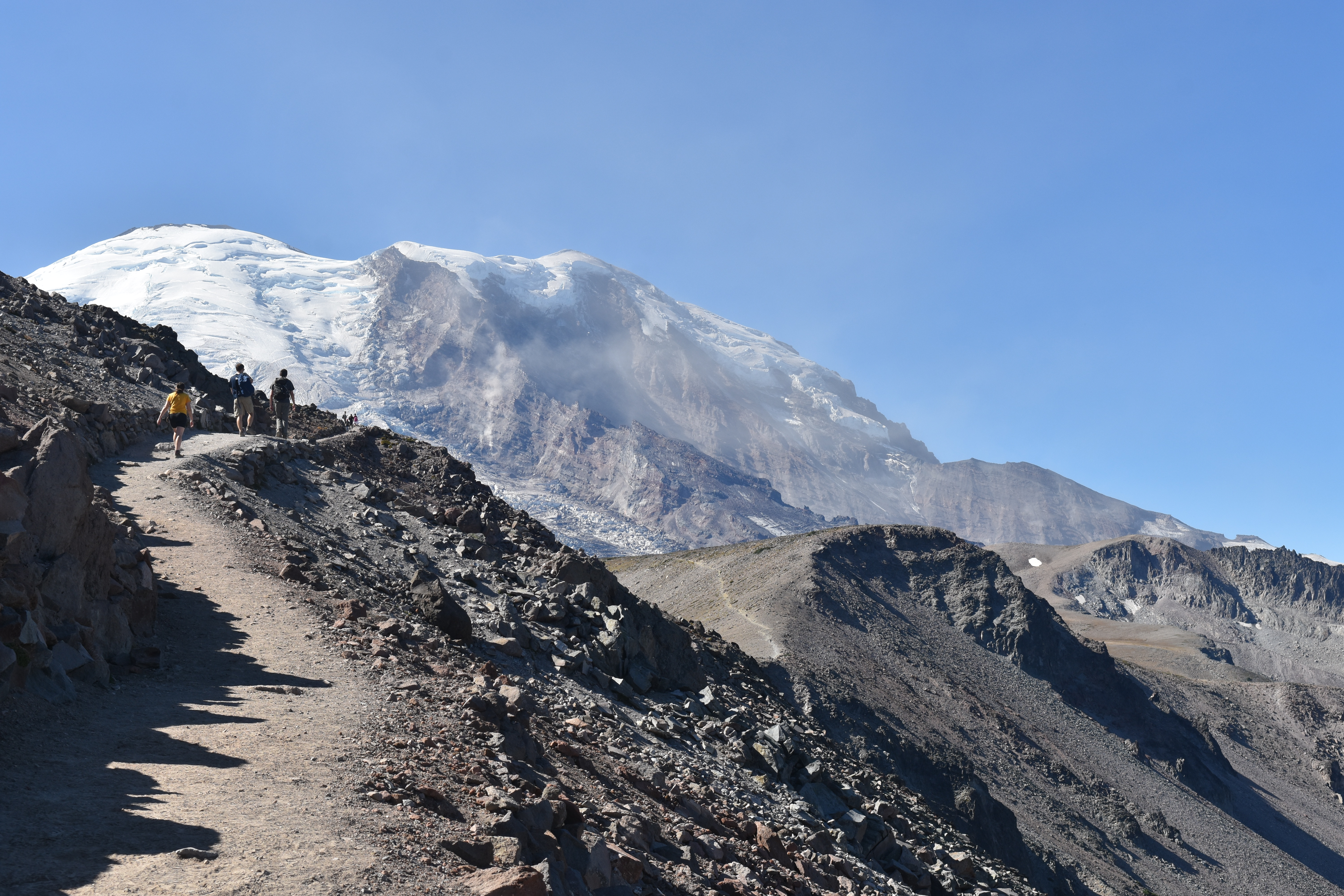
Season: Summer (July–September)
Hike the Burroughs Mountain Trail for outstanding mountain views and to visit the most accessible tundra in the Cascade Range. This series of three peaks on Mount Rainier's northeast slope honors naturalist and essayist John Burroughs. It is a rocky, rounded lava flow formation formed 500-420 thousand years ago during a very active eruptive period. Mats of mountain heather can be hundreds of years old. Look for dwarf versions of plants, like dwarf lupine. While it may look like bare soil between patches of plants, the alpine tundra is fragile so please stay on trail.
The Burroughs Mountains can be reached from the Sourdough Ridge or the Sunrise Rim trails. A loop can be made from First Burroughs Mountain that combines both trails. Taking the Sunrise Rim Trail on ascent or descent is only 0.4 miles longer than the Sourdough Ridge Trail.
The Sunrise Rim trailhead is located on the south side of the Sunrise parking area. Traveling in a clockwise direction, the trail passes Shadow Lake at 1.2 miles on a level grade then climbs sharply to an overlook on the White River and Emmons Glacier at 1.6 miles. Beyond the overlook the route continues 0.9 miles up and onto the wide, flat plateau of First Burroughs Mountain.
To make a loop, turn right and hike 0.75 miles east to the Frozen Lake junction, then follow the Sourdough Ridge Trail another 1.4 miles east back to the Sunrise parking lot. Or, from First Burroughs turn left and head west an additional 0.7 miles up the trail to Second Burroughs Mountain, featuring spectacular views of Mount Rainier and the Emmons Glacier.
For a longer hike and closer views of Mount Rainier, descend from Second Burroughs Mountain across 0.4 miles to a junction with a trail that descends to White River Campground.
The Sunrise Road usually opens in late June or early July and closes in late September to early October. Due to its high elevation, the Burroughs Mountain Trail can remain snow-covered after the road to Sunrise opens. Check trail conditions before hiking early in the season. Pets are not allowed. Wilderness permits are required for camping at Sunrise Camp.
Trail Statistics
Distance, round trip: 4.7 miles to First Burroughs, 7 miles to Second Burroughs
Elevation gain: 900 feet to First Burroughs, 1,150 feet to Second Burroughs
Hiking time, round trip: 3-6 hours
Wilderness Camps: Sunrise
Rules & Regulations
Pets are not allowed on trails
No campfires (backcountry stoves are okay)
No bicycles on trails
Pack out trash
Do not feed or disturb wildlife
Do not disturb any natural, cultural, or archeological features
Permits are required for all overnight wilderness use in the park, and for travel on glaciers above 10,000 feet
Accessibility Burroughs Mountain Trail allows hikers to choose a shorter or longer hike depending on their fitness and preference. Getting to First Burroughs requires hiking uphill on a narrow, rocky trail with areas of steep drop offs. Continuing to Second Burroughs adds 250 feet elevation gain. Due to its high elevation, portions of the Burroughs Mountain trail can remain snow-covered after the road to Sunrise opens. Given the trail’s steep drop offs the presence of snow can make it more hazardous. Check trail conditions before hiking early in the season.
Trailhead Sourdough Ridge Trailhead 6,112 ft Drive there
Backcountry camps
Along the way South Puyallup backcountry campsites
Backcountry camps
Along the way Cataract Valley backcountry campsites Eagle's Roost backcountry campsites
Trailhead Wonderland Trailhead 3,028 ft Drive there
Picnic areas
Along the way Box Canyon
Trailhead Stevens Creek Trailhead 3,069 ft Drive there
Picnic areas
Along the way Tipsoo Lake
0-4 Hours · no dogs · Summer
Start Tipsoo Lake
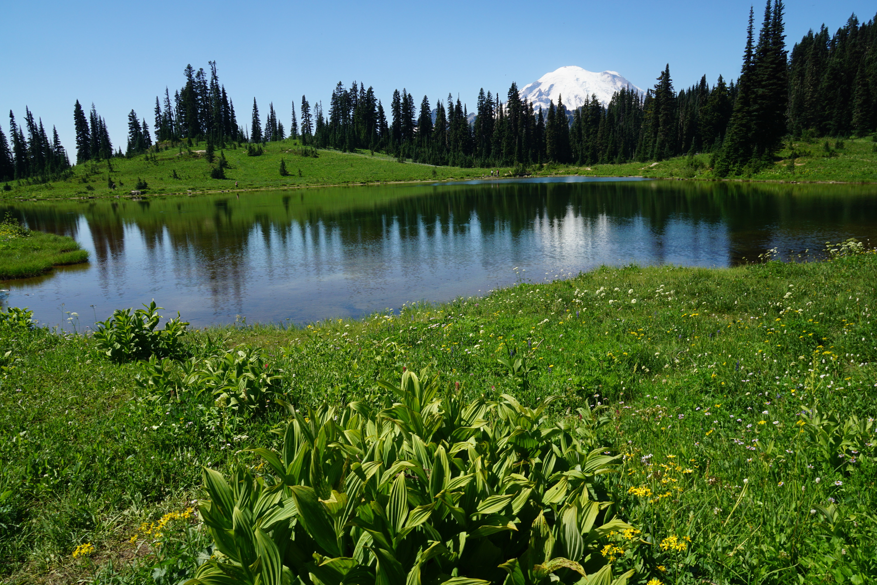
Tipsoo Lake is a fragile habitat both in and around the lake. Remember to stay on the maintained trail and do not pick any flowers no matter how pretty they might be! Tipsoo Lake is also protected amphibian habitat. This means that there is no fishing, wading, or swimming allowed. Make sure to also leave any amphibians you see in the water. Check trail conditions before heading out, as this area is closed in the fall through late spring and is under snow for much of the year.
There are a variety of activities that can be done at Tipsoo lake. Below are some ideas:
Picnic at Tipsoo Lake:
Just off the parking lot at Tipsoo Lake, there are several picnic tables to choose from. Some of these picnic tables are in the sun, while some can be in the shade during certain times of the day. Several of these picnic tables offer a nice view of the trees, as well as some glimpses of Tipsoo Lake. These tables can be a great place to enjoy a meal.
Walk around Tipsoo Lake:
0.5 mile/ 0.8 km loop: Enjoy a stroll around Tipsoo Lake. On clear, calm days, the surface of the lake can reflect Mount Rainier. During wildflower season (late July-early August), wildflowers can be viewed around the lake. Remember, pets are not allowed on trails in the National Park.
Hike in the Tipsoo Lake area:
Naches Peak Loop: 3.4 miles/ 5.5 km loop trail, 500’ elevation gain. Average hiking time: 2 hours. The Naches Peak Loop Trail starts from Tipsoo Lake. From the main parking area, walk towards the lake. The Naches Peak Loop Trail will start on your left going uphill. This will start you in the clockwise direction on the trail, which will maximize your views of the mountain. This trail will also bring you across an arch bridge that welcomes you to Mount Rainier National Park. Part of this trail is in the National Park, and part of this trail is outside the park on the Pacific Crest Trail. Remember, pets are not permitted on the section of the trail in the National Park.
Photograph Tipsoo Lake and more:
Tipsoo Lake can provide some fun opportunities for picture taking. Just remember to stay on the trail when taking pictures. There are many popular photography subjects, including Mount Rainier, wildflowers, amphibians, sunrise and sunset, and the night sky.
Practice Identification Skills:
Tipsoo Lake has a variety of different plants and amphibians that one can practice their identification skills with. Bring along a guidebook or an identification app to see how many different species you can find! Wildlife varies throughout the year, so there will always be a new challenge.
Pets Pets are not allowed on trails.
Accessibility Trails mentioned are typically dirt and broken up by rock or log steps and often have some form of elevation gain. Tipsoo Lake is only open to vehicles June-October. Snow might still be present in the area in June and sometimes into July, impacting the accessibility of some activities. Make sure to check trail conditions for the area before heading out. The picnic tables are by the parking lot in a clear gravel or dirt section which can be uneven. The parking lot is paved but has a slope. There is an accessible vault toilet that has a paved ramp.
History
Along the way Tolmie Peak Lookout
Trailheads Trail of the Shadows Trailhead 2,740 ft Drive there · Wonderland Trailhead 2,749 ft Drive there
Trailhead Twin Firs Trailhead 2,464 ft Drive there
2 Hours · no dogs · Spring, Summer, Fall
Start Ohanapecosh Campground
In 2026, the Silver Falls Trailhead in the Ohanapecosh Campground is CLOSED due to the Ohanapecosh Construction Project . Please note:
Silver Falls can be accessed from the Grove of the Patriarchs parking lot via the Eastside Trail .
The portion of the trail connecting to the Ohanapecosh Campground is closed and the Silver Falls Trail cannot be hiked as a loop . The two sides of the trail on either bank of the Ohanapecosh River can be hiked as out-and-back routes only.
The Silver Falls Loop Trail is a moderately-strenuous round trip loop trail, heading up one side of the Ohanapecosh River and returning down the other side. It gains 500 feet of elevation, making it popular with families and an excellent option for many ages and abilities. Starting at Ohanapecosh Campground, choose your own adventure by going clockwise or counterclockwise. Hikers can begin their journey from Loop B (near the visitor center), or across the river near the campground amphitheater.
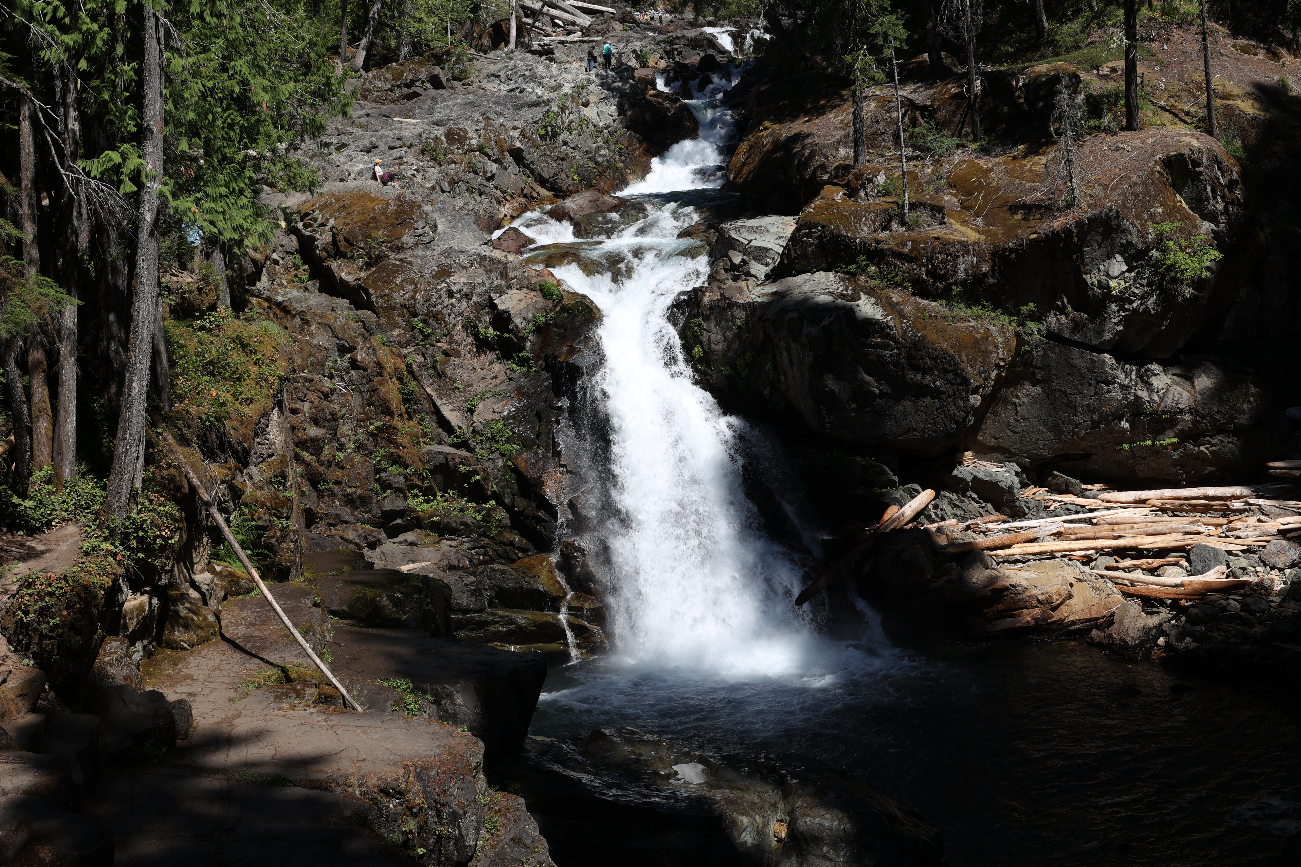
The trail runs parallel to the Ohanapecosh River before crossing it, leading hikers to a bridge with a stunning view of Silver Falls. The turquoise water churns below, turning white as the water rushes around rocks, and between the eroded walls of the small canyon. The trail continues along the other side of the Ohanapecosh River, leading hikers back to the campground.
Caution : Do not approach the river’s edge or jump in near the falls. Rocks along the river are slippery and the water is turbulent and dangerously cold. Supervise children closely and stay behind barriers.
Although there is no wilderness camp in the area surrounding Silver Falls, the Ohanapecosh Campground is available for visitors who wish to camp in the vicinity. For those who prefer to hike to a trailside camp rather than stay in a drive-in campground, wilderness camping permits are required. Permits, backpacking information, fishing regulations, and current trail conditions for the area are available from the Ohanapecosh Visitor Center. Permits and information are also available park-wide from wilderness information centers, ranger stations, and visitor centers.
Trail Statistics
Distance, round trip: 3 miles
Elevation gain: 500 feet
Hiking time, round trip: 2 hours
Wilderness Camps: None
Rules & Regulations
Pets are not allowed on trails
No campfires (backcountry stoves are okay)
No bicycles on trails
Pack out trash
Do not feed or disturb wildlife
Do not disturb any natural, cultural, or archeological features
Permits are required for all overnight wilderness use in the park, and for travel on glaciers above 10,000 feet
Accessibility The Silver Falls trail is relatively flat but has some small hills. It is made up of sections of smooth dirt path, as well as sections with boardwalk, bridges, small rocks, and tree roots.
2-3 Hours · no dogs · Summer
Start Spray Park Trail
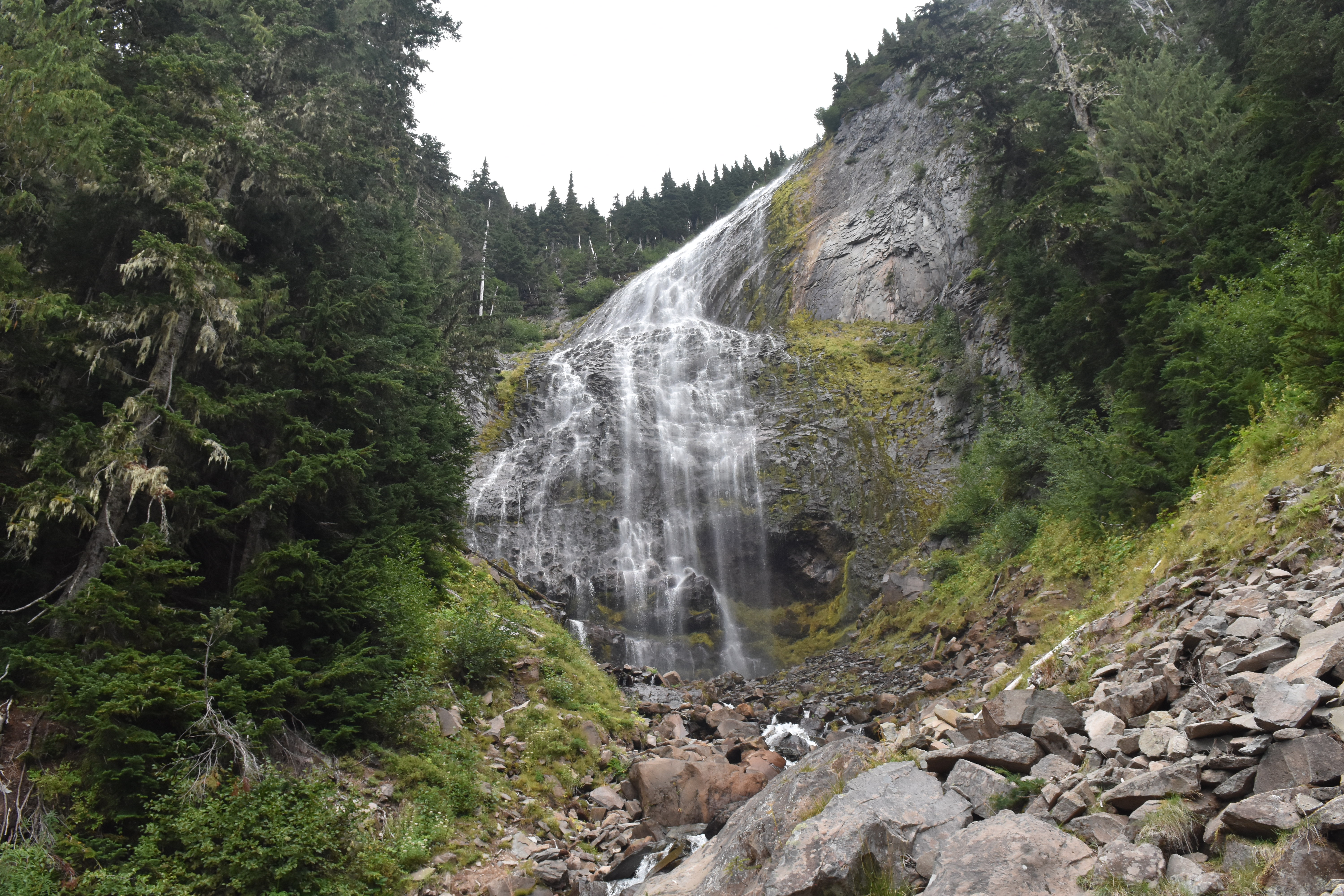
Season: Summer (July – mid-October)
Spray Park and Falls were likely named in 1883 by a trail construction crew who noted how the cascading water of the falls broke "into a mass of spray." Spray Creek drops 354 feet over a lava cliff in a magnificent, veil-like waterfall. The remains of the Flett Glacier provide a reliable source of water for this impressive waterfall.
The trailhead is located on the southeast side of Mowich Lake walk-in campground at the end of the Mowich Lake Road. The Mowich Lake area is generally open mid-July to mid-October, accessible via SR 165. The Mowich Lake Road is unpaved after the first three miles and may be rough. NOTE: Due to the closure of the SR165/Fairfax Bridge outside of the park, there is no public access to Carbon River & Mowich Lake from SR165 . This trail can still be reached with long-distance hiking via the Wonderland Trail inside the park.
From the trailhead, follow the Wonderland Trail 0.25 miles to a junction with the Spray Park Trail. Follow the Spray Park Trail east, as it weaves up and down through forested terrain and crosses Lee Creek. 1.5 miles from the trailhead, the Eagle Cliff viewpoint offers a spectacular view of Mount Rainier and the Mowich Glacier on a clear day. Continue 0.3 miles to the junction with Eagle’s Roost Camp, keeping left and continuing for 0.1 mile to the junction with a turn off for Spray Falls. Continue 0.1 miles on this spur trail to view Spray Falls. Use caution if crossing Spray Creek to get a better view of the falls as it requires scrambling over slippery rocks.
For a longer, more challenging hike, return the way you came and follow the spur trail 0.1 miles back to the main trail, and continue uphill to the subalpine meadows of Spray Park. It is an additional mile and 735 feet of elevation gain to reach Spray Park, including a steep climb up a series of switchbacks before reaching the meadows. For a multi-day hike, the Spray Park trail continues, climbing into Seattle Park, before descending into the Carbon River Valley. Pets are not allowed. Wilderness permits are required for backcountry camping.
Trail Statistics
Distance, round trip: 4 miles
Elevation gain: 545 feet
Hiking time, round trip: 3 hours
Wilderness Camps: Eagle’s Roost
Rules & Regulations
Pets are not allowed on trails
No campfires (backcountry stoves are okay)
No bicycles on trails
Pack out trash
Do not feed or disturb wildlife
Do not disturb any natural, cultural, or archeological features
Permits are required for all overnight wilderness use in the park, and for travel on glaciers above 10,000 feet
Accessibility This dirt singletrack trail has rolling up and down hills, gaining 545 feet over 2 miles. It has stairs, roots, and bridges over creeks. To get a full view of the falls requires scrambling over rocks on uneven footing to cross the creek.
Trailhead Westside Road Trailhead 2,877 ft Drive there
no dogs · entrance fee applies · Summer, Fall
Start Westside Road at Dry Creek
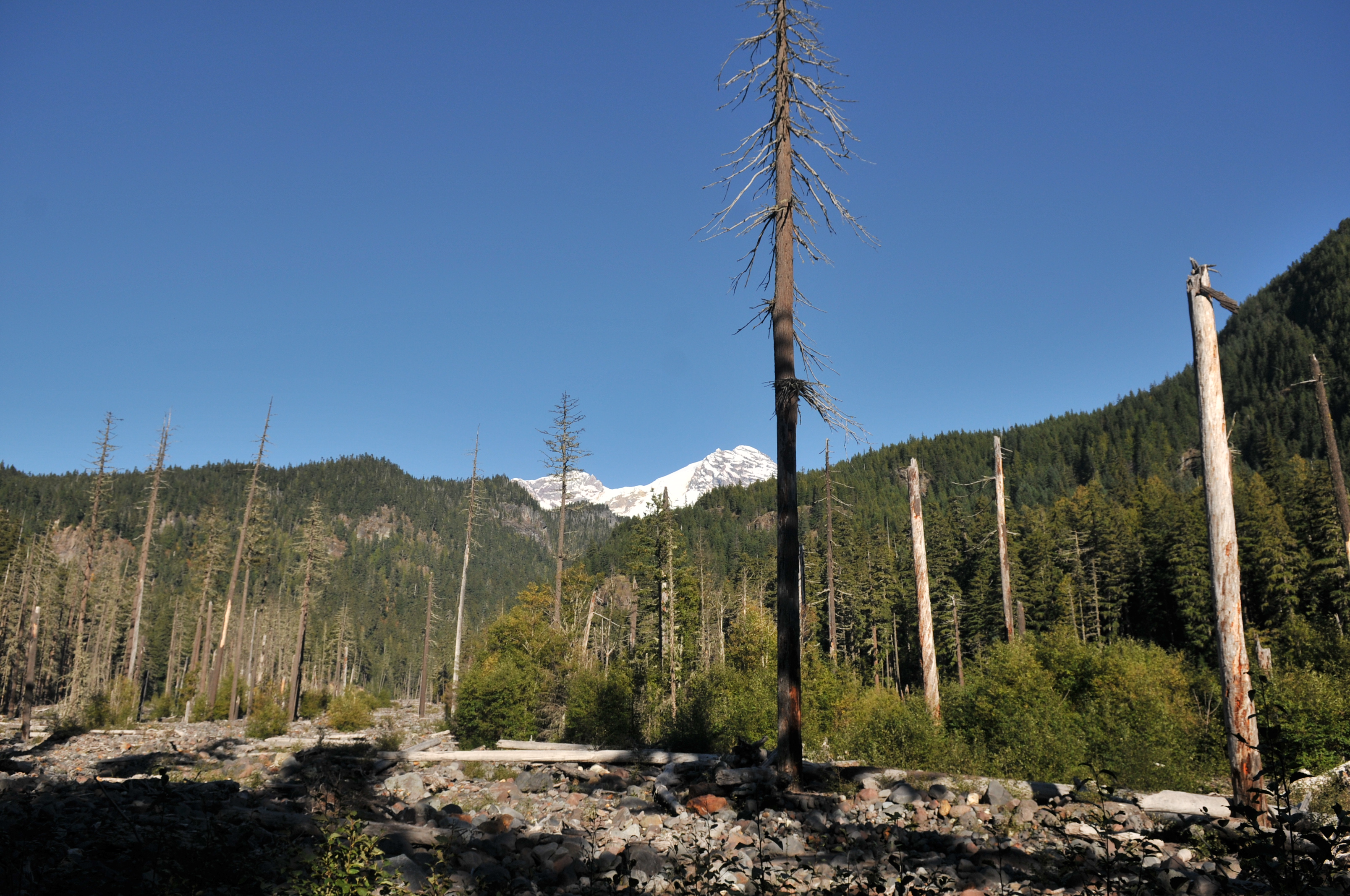
Discover both human and natural history on Westside Road. Trails lead to natural wonders, including subalpine meadows, glacier-fed lakes and streams, glacier-carved ridges, and lava rock formations. Don't forget to look up at the cliffs and slopes that line the road for possible glimpses of mountain goats.
Many of the structures you’ll see in this area were built by the Civilian Conservation Corps (CCC) from 1933–1941, including Gobblers Knob Fire Lookout. The CCC also built many stone bridges, walls and abutments.
Drive three miles from the junction with Nisqually Road to the road closure at Dry Creek to begin your hike or bike. Walk or bike the road for views of this dynamic landscape. Area trails tend to be strenuous. Ride your bike to trailheads (leave bicycles at trailheads) to shorten hiking times.
Geohazard Area Note that this is a geohazard area. Move immediately uphill at least 150 feet if the ground shakes and/or you hear a rumbling noise.
Westside Road Trails:
Gobblers Knob 13 miles, 7 hours round-trip. Spectacular view of Mount Rainier and picturesque Lake George from Gobblers Knob Fire Lookout. Hike 3.7 miles on the road to trailhead from the road closure.
Klapatche Park 19 miles, 11 hours round-trip. Take this hike for spectacular views of Mount Rainier and the South Tahoma Glacier. Klapatche Park features a serene mountain lake, meadows abundant with subalpine wildflowers, and grand views of Mount Rainier. Access the trail from the Westside Road closure, approximately 4 miles to the trailhead.
Emerald Ridge 16 miles, 8 hours round-trip. Enjoy spectacular views of Mount Rainier and South Tahoma Glacier on this trail that meanders past andesite columns to emerald-green meadows. Hike the road 9 miles from the road closure to the trailhead.
Read about other trails at Mount Rainer
Pets Pets are not allowed beyond the closure. Service animals are allowed.
Accessibility The roadbed is dirt, often rutted with holes, and a rocky, uneven surface. Service animals are allowed.
WaterfallsBackcountry campsCampgroundsPicnic areasVisitor centersTunnels
Along the way Devils Dream backcountry campsites Klapatche Park backcountry campsites Maple Creek backcountry campsites Nickel Creek backcountry campsites North Puyallup River backcountry campsites Paradise River backcountry campsites Pyramid Creek backcountry campsites South Mowich River backcountry campsites Mowich Lake Walk-in Campground Mowich Lake Box Canyon Tunnel Longmire Museum and 3 more
Trailheads Louise Lake Trailhead 4,672 ft Drive there · Pinnacle Peak Trailhead 4,886 ft Drive there · Trail of the Shadows Trailhead 2,740 ft Drive there · Wonderland Trail 4,943 ft Drive there · Wonderland Trail 4,888 ft Drive there · Wonderland Trail 4,999 ft Drive there · Wonderland Trailhead 4,146 ft Drive there · Wonderland Trailhead 3,027 ft Drive there · Wonderland Trailhead 3,828 ft Drive there · Wonderland Trailhead 4,291 ft Drive there · Wonderland Trailhead 2,833 ft Drive there · Wonderland Trailhead 4,863 ft Drive there · Wonderland Trailhead 3,028 ft Drive there · Wonderland Trailhead 3,180 ft Drive there · Wonderland Trailhead 2,749 ft Drive there · Wonderland Trailhead 4,857 ft Drive there
2-8 Hours · no dogs · entrance fee applies
Start Longmire
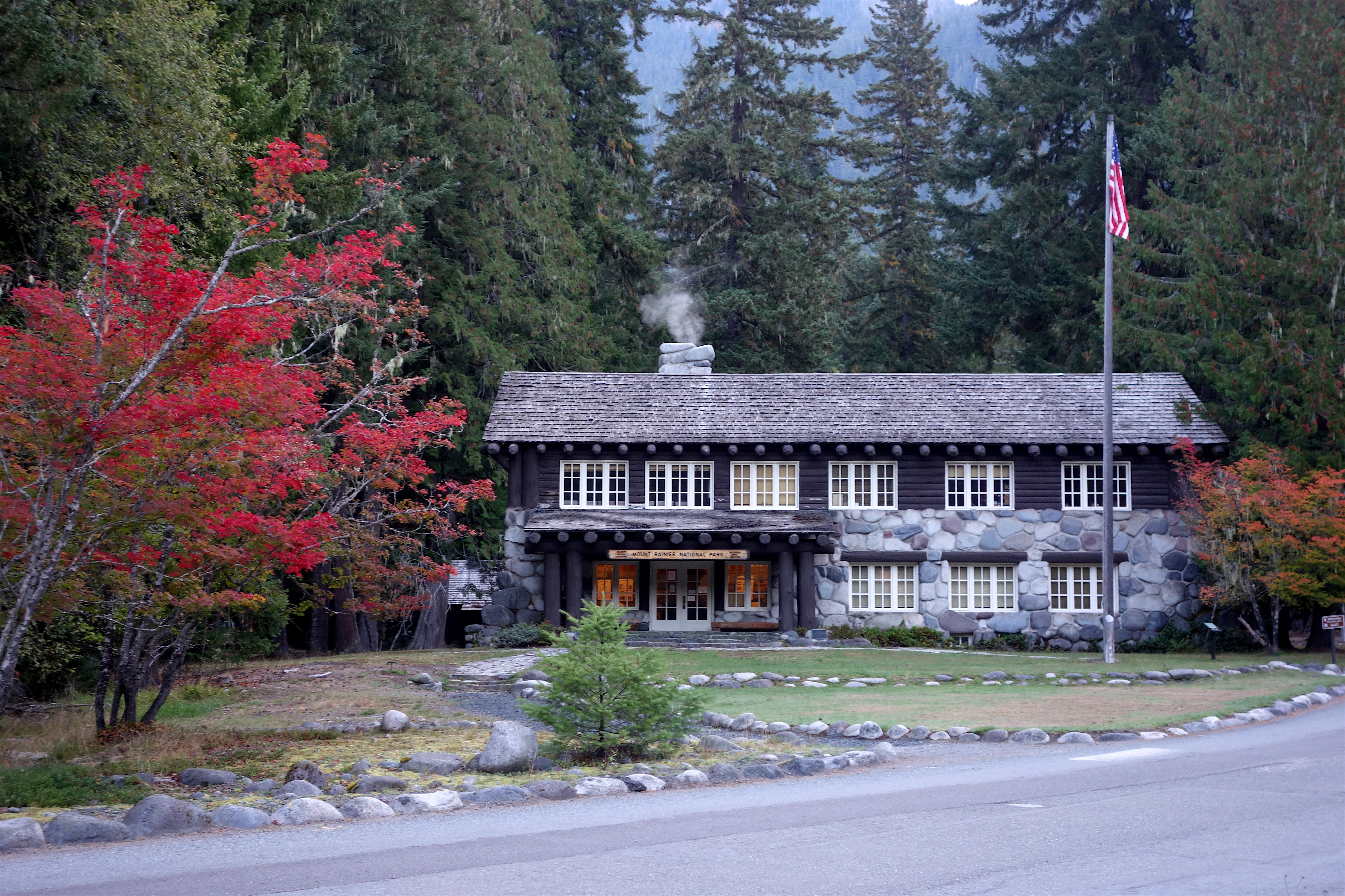
Longmire is an area steeped in history with so much to offer. There are countless opportunities to learn, explore, recreate, and enjoy Mount Rainier National Park here. Longmire has lots of historic buildings and scenic hiking trails. Stop at the historic Nisqually Bridge or the Trail of the Shadows to take in some history, or stretch your legs by hiking Rampart Ridge or Eagle Peak. This is a great place to visit year round. The National Park Inn is a nice place to take a break after a long drive, and the Longmire Museum provides information to visitors. Always check trail and road conditions with a park ranger or online before hiking. Many trails may be partially or totally covered in snow and can be dangerous. Roads may be closed due to snow conditions. Plan your day in Longmire by mixing and matching the options below.
Mountain Views
Year-round and weather dependent.
Trail of the Shadows (0.7 miles round-trip, 30 minutes) - Trail of the Shadows begins across the main park road from the Longmire Museum. A short spur trail will take you into the meadow and offer a view of the mountain. For your safety, do not drink the water from the springs!
Longmire Community Building Viewpoint (1 mile round-trip, 40 minutes) - Follow the side road towards all the buildings and through the employee housing area. The road will make two switchbacking turns before crossing the Nisqually River on a wooden suspension bridge. Cross the bridge and follow the road to the Community Building on the left. Enjoy the views of Mount Rainier! NOTE: The Nisqually Suspension Bridge has a weight limit of 3 tons (6,000 pounds or 2721 kilograms ). Vehicles over this weight limit CANNOT cross the bridge, including recreational vehicles (campers/trailers/motorhomes), maintenance trucks, box trucks, and medium trucks/SUVs pulling campers or trailers. Large trucks/SUVS can exceed the weight limit even without trailers. If your vehicle cannot cross the bridge, park in the main Longmire parking area near the National Park Inn and cross the bridge on foot.
Rampart Ridge (4.6 mile loop, 1339 feet elevation gain, 2.5 hours) - Beginning from the Trail of the Shadows, this is a steep loop trail traveling through forests with vistas from the top.
Waterfalls
Carter Falls Trail (2.2 miles round-trip, 500 feet elevation gain, 2 hours) - The trail begins at the paved pullout 100 yards below Cougar Rock Campground. To add 1.4 miles one-way to the hike, start in Longmire rather than Cougar Rock Campground. Look for the Wonderland Trail sign in Longmire to start your hike.
Christine Falls - Located 4.5 miles east of Longmire. Use the pullout just beyond the stone bridge. The trail descends 100 feet to a view of Christine Falls framed by the bridge. For your safety, please don’t stop your car or walk on the bridge— drivers distracted by the scenery may hit you!
Historic Buildings
Longmire Historic Walking Tour - Follow the self-guided walking tour pamphlet to explore the National Park Service rustic architecture in Longmire. The pamphlet can also be picked up at the Longmire Museum.
Longmire Museum - Completed in 1928 and is now primarily used as a visitor center. However, many of the original exhibits are still on display.
Administration Building - Built in 1928 and still stands as a treasured example of National Park Service Rustic architecture.
National Park Inn - Opened in 1906 and is still enjoyed by guests today. Feel free to explore the inside and enjoy a meal at the restaurant.
Old-Growth Forest
Twin Firs Trail (0.4 mile loop, 15 minutes) Located 2 miles west of Longmire (towards the Nisqually Entrance). This short loop is a quick and easy opportunity to enjoy a beautiful old-growth forest and gaze up at towering giant trees.
Trail of the Shadows ( 0.7 miles round-trip, 30 minutes) - Trail of the Shadows begins across the main park road from the Longmire Museum. The farthest side of the loop boasts some large old-growth trees. For your safety, do not drink the water from the springs!
Pets Pets are allowed only on the paved roads and paths in the developed area of Longmire. Pets are not allowed on any trails, including the Trail of the Shadows.
Accessibility The main developed area of Longmire has paved road and paths. In winter, paths can be snow covered and often icy. Buildings and restrooms are accessible year-round. Approximately half of the un-paved Trail of the Shadows (roughly 0.3 miles) is wheelchair accessible, though the trail can be covered in deep snow in winter. Other trails in the area can be steep and challenging.
no dogs · Spring
Start Longmire
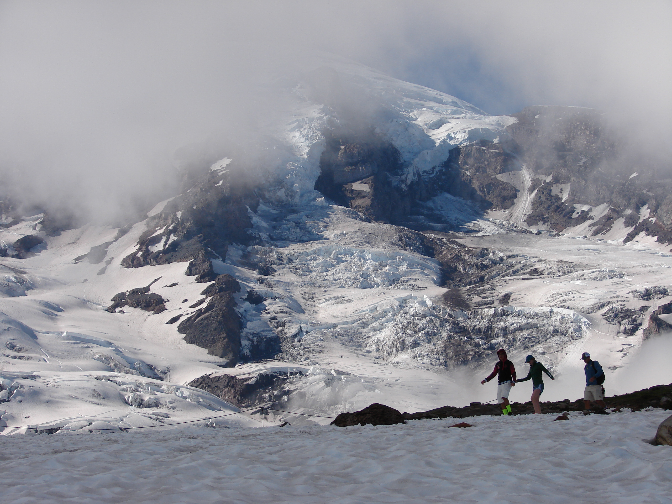
Enjoy Spring at Mount Rainier
With its tremendous amount of snowfall, Mount Rainier is a winter wonderland often into early summer, especially at higher elevations such as Paradise and Sunrise. Don’t let the amount of snow you encounter during your trip take you by surprise. Be prepared for snow well into June and early July.
For your spring visit bring along the appropriate clothes and footwear for recreating in snowy conditions. Don’t forget a warm hat, jacket, and gloves! Also, remember that snow can mean adverse road conditions. All vehicles are required to carry tire chains in the park until May 1. The road between Longmire and Paradise could close restricting access to Paradise if required by road conditions.
Plan for snow-covered trails throughout the park. Trails at lower elevations may be mostly snow-free between mid-May and early June. At higher elevations trails can be snow-covered into July or longer! Check trail conditions prior to setting out on a hike. To protect vegetation, hike only on trails or deep patches of snow.
Visitor centers, wilderness information centers, and ranger stations may still be closed for the winter. Check for hours of operation when planning your visit and be prepared to bring your own supplies, like food and water.
While there may be snow, there are plenty of opportunities to enjoy your spring visit. This time of year you’ll want to explore to Longmire and Paradise . Besides glaciers, rivers, and forests, this area is rich in history, offers plenty of hiking, and has breathtaking vistas. Plan to visit mid-week, and early or late in the day, to avoid crowds and traffic.
Whether you’re visiting for a few hours or the entire day, there is plenty to do at Longmire and Paradise. Take a hike, enjoy the views, hunt for elusive forest wildflowers in the lowlands, or enjoy the snowy landscape at Paradise.
Enter through the Nisqually Entrance via SR706 from Ashford, WA. Enjoy the drive through beautiful old-growth forests. You’ll reach Longmire in about 15 minutes of driving.
Longmire
Visit Longmire to walk in the footsteps of those who first founded the area and learn about the history of the park. Enjoy trails leading through meadows, old-growth forest, and for the more adventurous, amazing views.
Walk the Trail of Shadows . 0.7 miles round-trip. Average hiking time: 30 minutes. A self-guiding loop around Longmire Meadow explores the early history of the Longmire Springs Resort. The trail begins across the main park road from the Longmire Museum. For your safety, do not drink the water from the springs!
Drive the 30 minutes up to Paradise making some of the scenic stops along the way.
Christine Falls - Follow the short path down to the viewpoint of the waterfall.
Ricksecker Point - Enjoy magnificent views of Mount Rainier and the Tatoosh Range!
Narada Falls - A quick but steep trail will bring you down to the base of the waterfall. If snow is present it is not recommended to walk on this trail.
Paradise
Expect snow-covered trails well into June. This area receives several feet of snow during the winter and it will linger well into spring. Look for trail information and rangers near the visitor center.
A network of hiking trails provides access to outstanding views of Mount Rainier and its glaciers, and routes for skilled climbers attempting to reach the mountain’s summit. See the posted snow cover trail map at Paradise to avoid snow-covered trails. Photographers appreciate the high-country scenery at Inspiration Point and Reflection Lakes. Consider Nisqually Vista or Myrtle Falls for young hikers, or Alta Vista or Glacier Vista for the more ambitious. Take lots of water and sunscreen!
For snow-free hiking in June, consider the Longmire and Ohanapecosh areas.
Ohanapecosh
Once SR123 opens in late spring-early summer the Ohanapecosh area is a must see! Camp at the Ohanapecosh campground or hike one of the many trails in the area. Enjoy wandering through old-growth forests of giant western red cedar and hemlock, along the brilliant turquoise waters of the Ohanapecosh River, to thundering waterfalls and peaceful sanctuaries.
Spring Hiking Safety
Roads and facilities on the east side of the park are closed well into spring and early summer. Check the road status on the park website.
End-of-season snow conditions create hazards specific to this time of year. The following information will help you prepare for current conditions:
Winter storms can hit here any month of the year. Spring and early summer are notorious for unpredictable and rapidly changing weather. Know the current condition of the trail and obtain a current weather forecast. Be prepared for winter-like weather even in June. Unprepared hikers increase their risk of getting lost or being injured.
Notify a responsible person of your plans so they can contact rangers if you fail to return.
Before starting your hike, check the posted snow-cover map for current trail conditions.
Hypothermia and frostbite are cold weather hazards which can lead to serious injury or death. If you are spending time outside, dress sensibly, drink lots of fluids, and take warm-up breaks indoors.You will need a reliable map and compass skills in many areas of the park because snow-covered trails can be difficult to follow.
Avoid crossing steep, snow-covered slopes where a fall could be disastrous. Turn around instead. Comet Falls and Pinnacle Peak trails often have hazardous slopes. Take an ice axe if you know how to use it.
Falling through thin snow bridges is a hazard anywhere streams remain snow-covered. Stay alert for the muffled sound of running water.
Falling into snow moats around trees, and adjacent to logs and rocks, can cause injury. Avoid getting too close.
Avoid stepping on wet, slippery rocks, especially near rivers and waterfalls.
Avoid stepping onto snow cornices. They may collapse under your weight.
Beware of avalanches! Avalanches occur with frightening regularity. Check the maps for avalanche zones and ask a ranger for the forecast before you start. Backcountry travel is not recommended when avalanche conditions are high to extreme.
Carry the Ten Essentials and know how to use them: map of the area & compass; extra food & water; first aid kit; headlamp or flashlight; extra bulb & batteries; sunglasses & sunscreen; pocketknife; extra clothing & rain gear; emergency shelter, and; matches in a waterproof container––for emergency use only; fires are not allowed in Mount Rainier’s wilderness.
Learn more about Spring Hiking Safety .
Pets Service animals are permitted.
Accessibility The main developed areas have paved roads and paths. In spring, paths can be snow-covered and sometimes icy. Buildings and restrooms are accessible year-round. Service animals are permitted on trails and in buildings.
Write-ups that name no single mapped trail, in the Service's words.
The lines are the National Park Service's public trails layer, the trailheads and the waterfalls, views, peaks and historic places along them the Service's public points of interest, read 2026-10-14 and simplified for the map. The write-ups are the Service's own "things to do", unedited. Heights come from USGS 3DEP through Terrain Tiles on AWS (Mapzen/Tilezen), read along each line and rounded; a short trail on steep ground can be off by a few tens of feet. Closures change: check the park's own site before you go.