
Waterfall Trail
Hike to Silver Falls the Park Service's write-up
2 Hours · no dogs · Spring, Summer, Fall · season <p>This trail is typically hikeable from May to October. The Ohanapecosh area is not accessible by vehicle during the winter months.</p>
Start Ohanapecosh Campground
In 2026, the Silver Falls Trailhead in the Ohanapecosh Campground is CLOSED due to the Ohanapecosh Construction Project . Please note:
Silver Falls can be accessed from the Grove of the Patriarchs parking lot via the Eastside Trail .
The portion of the trail connecting to the Ohanapecosh Campground is closed and the Silver Falls Trail cannot be hiked as a loop . The two sides of the trail on either bank of the Ohanapecosh River can be hiked as out-and-back routes only.
The Silver Falls Loop Trail is a moderately-strenuous round trip loop trail, heading up one side of the Ohanapecosh River and returning down the other side. It gains 500 feet of elevation, making it popular with families and an excellent option for many ages and abilities. Starting at Ohanapecosh Campground, choose your own adventure by going clockwise or counterclockwise. Hikers can begin their journey from Loop B (near the visitor center), or across the river near the campground amphitheater.
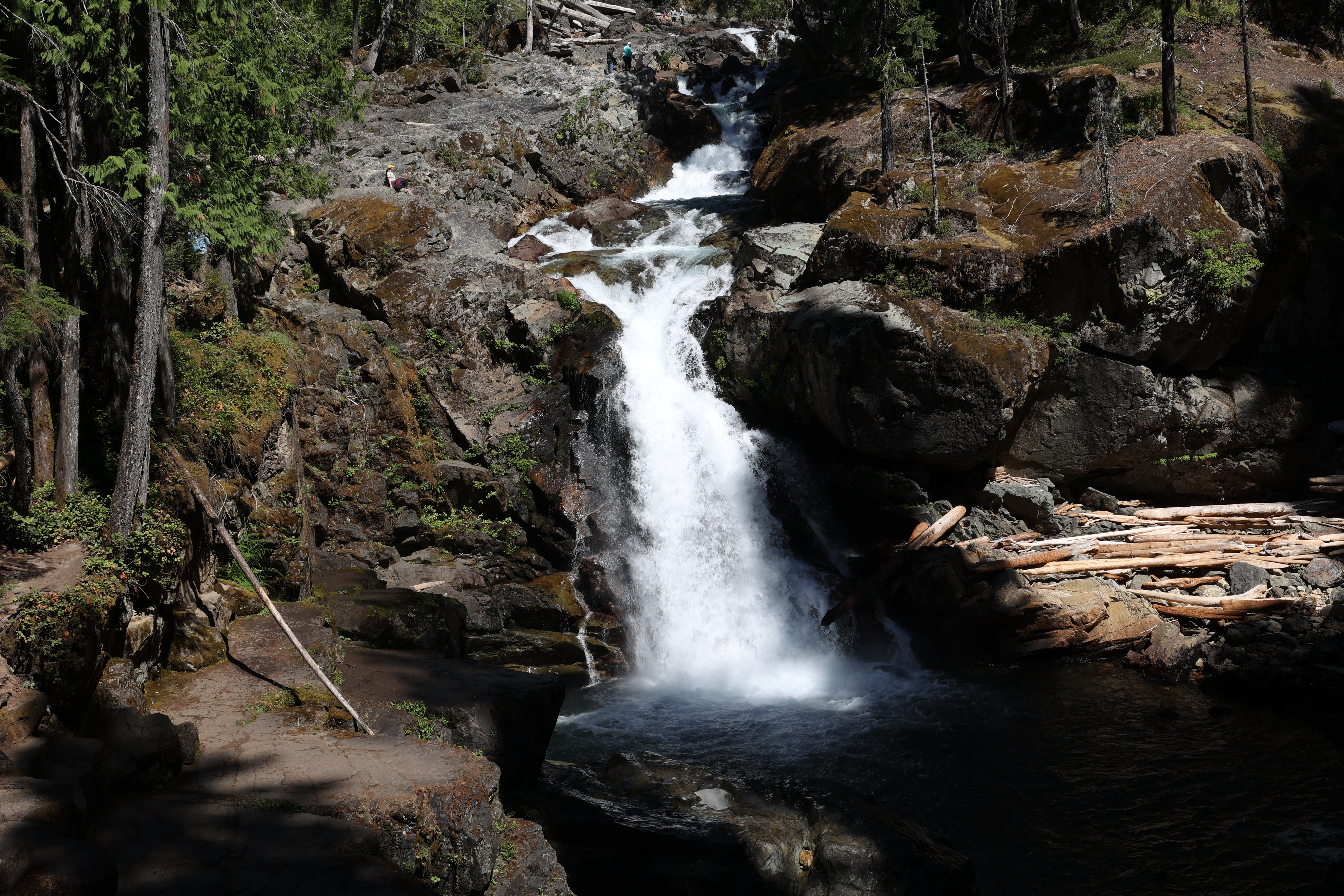
The trail runs parallel to the Ohanapecosh River before crossing it, leading hikers to a bridge with a stunning view of Silver Falls. The turquoise water churns below, turning white as the water rushes around rocks, and between the eroded walls of the small canyon. The trail continues along the other side of the Ohanapecosh River, leading hikers back to the campground.
Caution : Do not approach the river’s edge or jump in near the falls. Rocks along the river are slippery and the water is turbulent and dangerously cold. Supervise children closely and stay behind barriers.
Although there is no wilderness camp in the area surrounding Silver Falls, the Ohanapecosh Campground is available for visitors who wish to camp in the vicinity. For those who prefer to hike to a trailside camp rather than stay in a drive-in campground, wilderness camping permits are required. Permits, backpacking information, fishing regulations, and current trail conditions for the area are available from the Ohanapecosh Visitor Center. Permits and information are also available park-wide from wilderness information centers, ranger stations, and visitor centers.
Trail Statistics
Distance, round trip: 3 miles
Elevation gain: 500 feet
Hiking time, round trip: 2 hours
Wilderness Camps: None
Rules & Regulations
Pets are not allowed on trails
No campfires (backcountry stoves are okay)
No bicycles on trails
Pack out trash
Do not feed or disturb wildlife
Do not disturb any natural, cultural, or archeological features
Permits are required for all overnight wilderness use in the park, and for travel on glaciers above 10,000 feet
Accessibility The Silver Falls trail is relatively flat but has some small hills. It is made up of sections of smooth dirt path, as well as sections with boardwalk, bridges, small rocks, and tree roots.
Hike to Spray Falls the Park Service's write-up
2-3 Hours · no dogs · Summer · season The Mowich Lake area is generally open mid-July to mid-October, accessible via SR 165. The Mowich Lake Road is unpaved after the first three miles and may be rough.
Start Spray Park Trail
Season: Summer (July – mid-October)
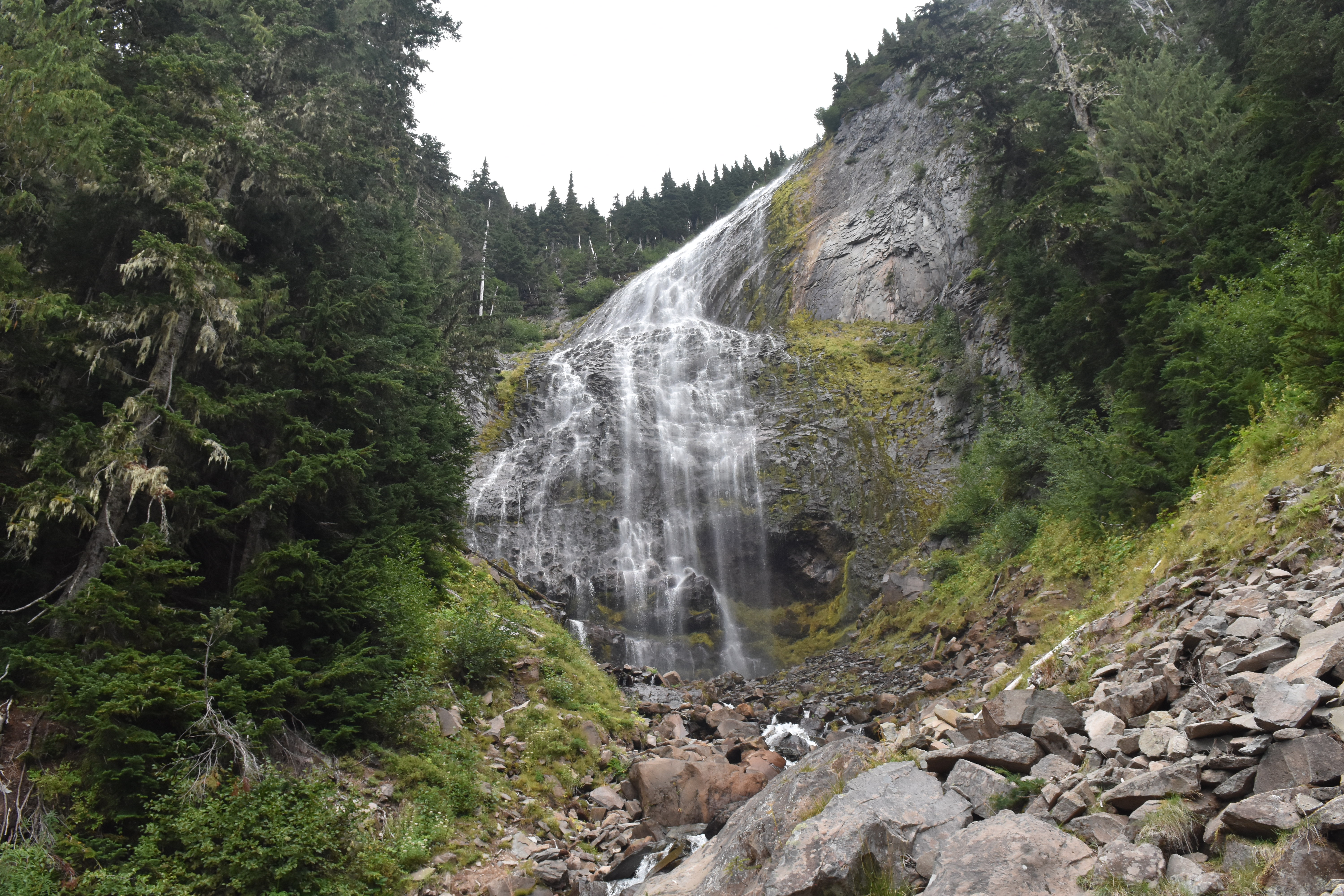
Spray Park and Falls were likely named in 1883 by a trail construction crew who noted how the cascading water of the falls broke "into a mass of spray." Spray Creek drops 354 feet over a lava cliff in a magnificent, veil-like waterfall. The remains of the Flett Glacier provide a reliable source of water for this impressive waterfall.
The trailhead is located on the southeast side of Mowich Lake walk-in campground at the end of the Mowich Lake Road. The Mowich Lake area is generally open mid-July to mid-October, accessible via SR 165. The Mowich Lake Road is unpaved after the first three miles and may be rough. NOTE: Due to the closure of the SR165/Fairfax Bridge outside of the park, there is no public access to Carbon River & Mowich Lake from SR165 . This trail can still be reached with long-distance hiking via the Wonderland Trail inside the park.
From the trailhead, follow the Wonderland Trail 0.25 miles to a junction with the Spray Park Trail. Follow the Spray Park Trail east, as it weaves up and down through forested terrain and crosses Lee Creek. 1.5 miles from the trailhead, the Eagle Cliff viewpoint offers a spectacular view of Mount Rainier and the Mowich Glacier on a clear day. Continue 0.3 miles to the junction with Eagle’s Roost Camp, keeping left and continuing for 0.1 mile to the junction with a turn off for Spray Falls. Continue 0.1 miles on this spur trail to view Spray Falls. Use caution if crossing Spray Creek to get a better view of the falls as it requires scrambling over slippery rocks.
For a longer, more challenging hike, return the way you came and follow the spur trail 0.1 miles back to the main trail, and continue uphill to the subalpine meadows of Spray Park. It is an additional mile and 735 feet of elevation gain to reach Spray Park, including a steep climb up a series of switchbacks before reaching the meadows. For a multi-day hike, the Spray Park trail continues, climbing into Seattle Park, before descending into the Carbon River Valley. Pets are not allowed. Wilderness permits are required for backcountry camping.
Trail Statistics
Distance, round trip: 4 miles
Elevation gain: 545 feet
Hiking time, round trip: 3 hours
Wilderness Camps: Eagle’s Roost
Rules & Regulations
Pets are not allowed on trails
No campfires (backcountry stoves are okay)
No bicycles on trails
Pack out trash
Do not feed or disturb wildlife
Do not disturb any natural, cultural, or archeological features
Permits are required for all overnight wilderness use in the park, and for travel on glaciers above 10,000 feet
Accessibility This dirt singletrack trail has rolling up and down hills, gaining 545 feet over 2 miles. It has stairs, roots, and bridges over creeks. To get a full view of the falls requires scrambling over rocks on uneven footing to cross the creek.