
Tipsoo Lake Trail
Picnic areas
Along the way Tipsoo Lake
Explore Tipsoo Lake the Park Service's write-up
0-4 Hours · no dogs · Summer · season Snow may still linger in early summer, impacting what activities at Tipsoo Lake can be done.
Start Tipsoo Lake
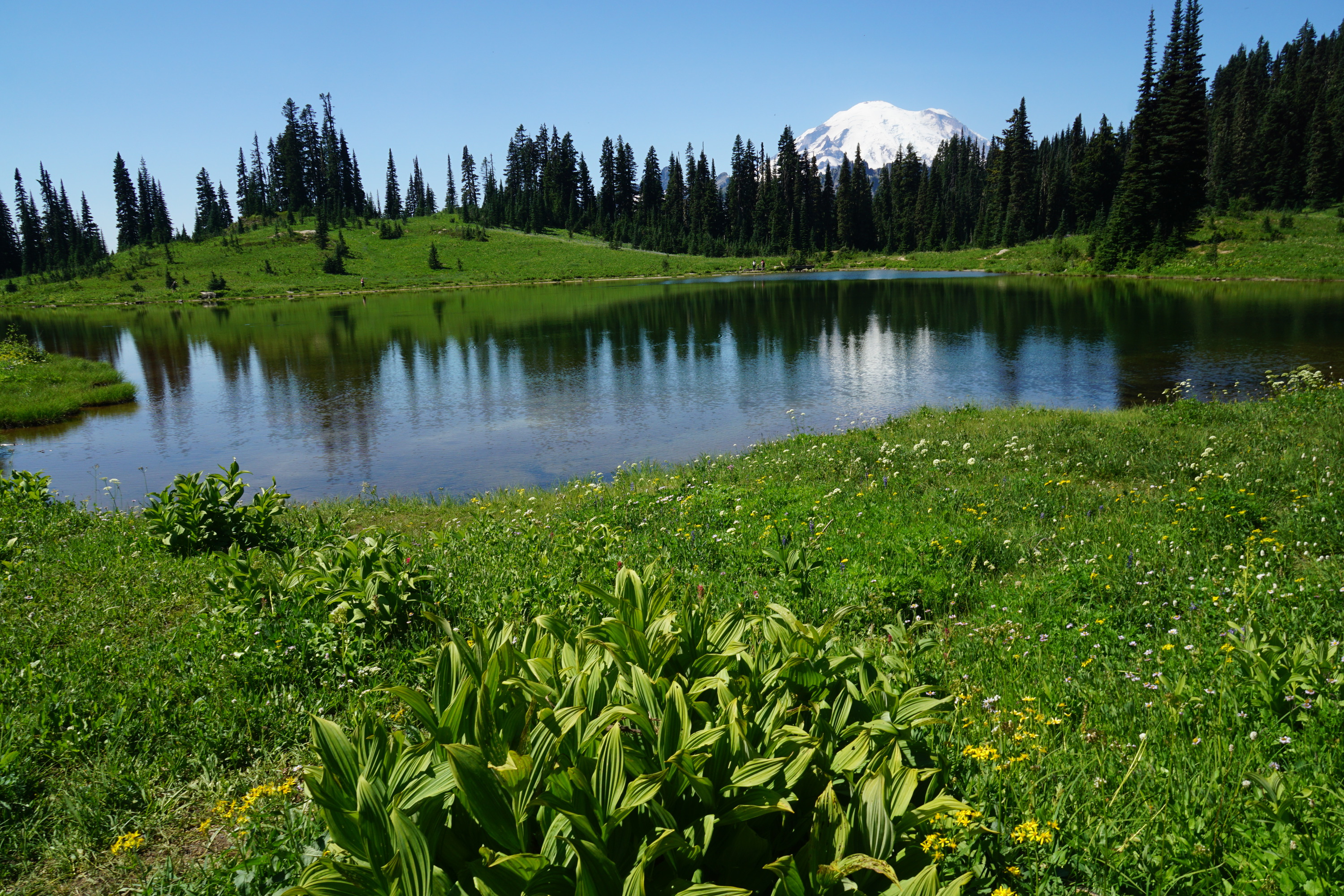
Tipsoo Lake is a fragile habitat both in and around the lake. Remember to stay on the maintained trail and do not pick any flowers no matter how pretty they might be! Tipsoo Lake is also protected amphibian habitat. This means that there is no fishing, wading, or swimming allowed. Make sure to also leave any amphibians you see in the water. Check trail conditions before heading out, as this area is closed in the fall through late spring and is under snow for much of the year.
There are a variety of activities that can be done at Tipsoo lake. Below are some ideas:
Picnic at Tipsoo Lake:
Just off the parking lot at Tipsoo Lake, there are several picnic tables to choose from. Some of these picnic tables are in the sun, while some can be in the shade during certain times of the day. Several of these picnic tables offer a nice view of the trees, as well as some glimpses of Tipsoo Lake. These tables can be a great place to enjoy a meal.
Walk around Tipsoo Lake:
0.5 mile/ 0.8 km loop: Enjoy a stroll around Tipsoo Lake. On clear, calm days, the surface of the lake can reflect Mount Rainier. During wildflower season (late July-early August), wildflowers can be viewed around the lake. Remember, pets are not allowed on trails in the National Park.
Hike in the Tipsoo Lake area:
Naches Peak Loop: 3.4 miles/ 5.5 km loop trail, 500’ elevation gain. Average hiking time: 2 hours. The Naches Peak Loop Trail starts from Tipsoo Lake. From the main parking area, walk towards the lake. The Naches Peak Loop Trail will start on your left going uphill. This will start you in the clockwise direction on the trail, which will maximize your views of the mountain. This trail will also bring you across an arch bridge that welcomes you to Mount Rainier National Park. Part of this trail is in the National Park, and part of this trail is outside the park on the Pacific Crest Trail. Remember, pets are not permitted on the section of the trail in the National Park.
Photograph Tipsoo Lake and more:
Tipsoo Lake can provide some fun opportunities for picture taking. Just remember to stay on the trail when taking pictures. There are many popular photography subjects, including Mount Rainier, wildflowers, amphibians, sunrise and sunset, and the night sky.
Practice Identification Skills:
Tipsoo Lake has a variety of different plants and amphibians that one can practice their identification skills with. Bring along a guidebook or an identification app to see how many different species you can find! Wildlife varies throughout the year, so there will always be a new challenge.
Pets Pets are not allowed on trails.
Accessibility Trails mentioned are typically dirt and broken up by rock or log steps and often have some form of elevation gain. Tipsoo Lake is only open to vehicles June-October. Snow might still be present in the area in June and sometimes into July, impacting the accessibility of some activities. Make sure to check trail conditions for the area before heading out. The picnic tables are by the parking lot in a clear gravel or dirt section which can be uneven. The parking lot is paved but has a slope. There is an accessible vault toilet that has a paved ramp.