
Shriner Peak Trail
HistoryBackcountry camps
Along the way Shriner Peak backcountry campsites Shriner Peak Lookout
Trailhead Shriner Peak Trailhead 2,431 ft Drive there
Hike to Shriner Peak Fire Lookout 8 mi round trip · the Park Service's write-up
5-6 Hours · no dogs · Spring, Summer, Fall · season <p>The road to access Shriner Peak Trailhead, SR 123, closes in the winter from the north via SR 410 at Chinook Pass to the south at the junction of SR 123 and Stevens Canyon Road.</p>
Start Shriner Peak Trailhead
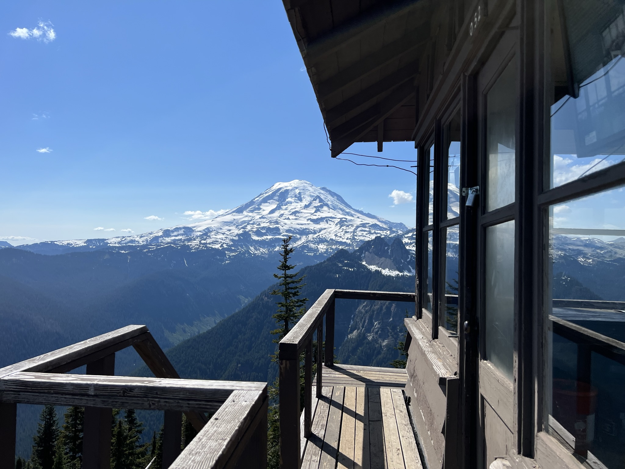
Panoramic views make Shriner Peak Trail worth the strenuous hike to the Shriner Peak Fire Lookout . The view from the top offers commanding views of Mount Rainier, Ohanapecosh Valley, and the Cascade Range. Along the trail, you’ll find brilliant fall foliage, colorful summer wildflowers, and wild strawberries in the fire-exposed meadows. At 2.5 miles in, there is a view of Mount Rainier's east side.
Although this trail begins in the forest, it soon climbs into an old burn area that is open and shadeless. The trail climbs steeply through open burn areas that offer little shade from the summer sun. Be sure to bring plenty of water and start your hike early in the day to avoid the hottest afternoon hours.
For 2.5 miles the trail continues its steep ascent to the top of the ridge. Still no shade, but a slight breeze sometimes makes the hike more bearable from here on. After a 0.5 mile walk along the ridge top, the route becomes a series of steep switchbacks for the final climb to the lookout.
The trail continues south of the fire lookout to Shriner Peak Camp, a wilderness camping area with two individual campsites (with a capacity of five people each) at an elevation of 5,355 feet. Wilderness permits are required for all overnight stays in the backcountry.
Trail Statistics
Distance: 8 miles roundtrip
Elevation gain: 3,434 feet
Hiking time: ~5 hours
Difficulty Level: Strenuous
Wilderness Camp: Shriner Peak
Rules & Regulations
Pets are not allowed on trails
No campfires (backcountry stoves are okay)
No bicycles on trails
Pack out trash
Do not feed or disturb wildlife
Do not disturb any natural, cultural, or archeological features
Permits are required for all overnight wilderness use in the park, and for travel on glaciers above 10,000 feet
Accessibility The Shriner Peak Trail is a steep, narrow dirt path with several switchbacks.