
Moraine Trail
Hike Emmons Moraine Trail 3 mi round trip · the Park Service's write-up
1-2 Hours · no dogs · Summer, Fall · season The White River area is typically open late June to late September depending on weather and road conditions.
Start White River Campground
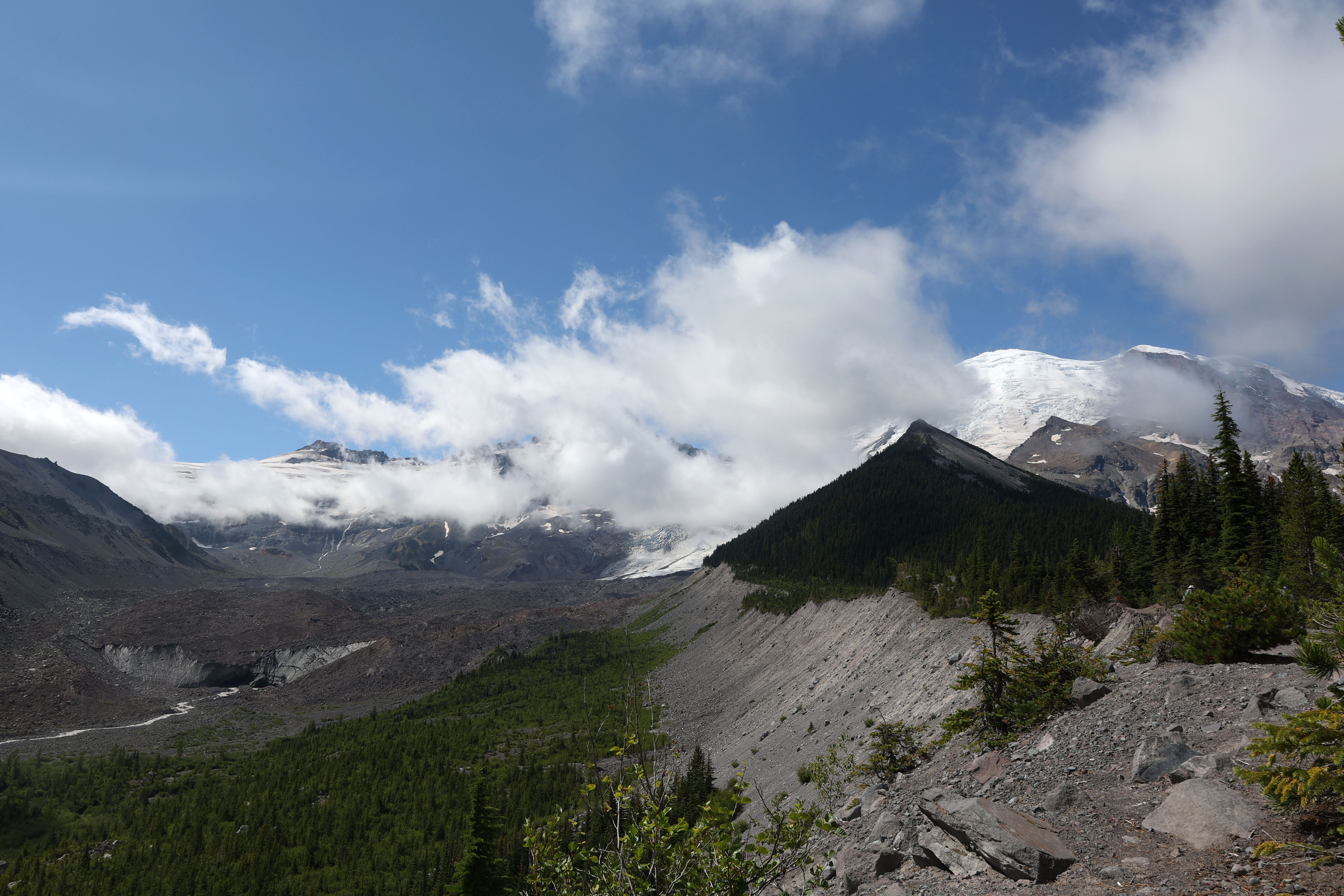
The Emmons Moraine Trail is a short hike that features a view of the Emmons Glacier and its terminus, along with a beautiful turquoise lake colored by glacial silt. Enjoy a walk through the forest along the Glacier Basin Trail until you reach a spur trail to the Emmons Moraine, a rocky ridge of rocks deposited by the glacier.
To get to the trailhead, drive through the White River Entrance Station and continue five miles to the White River Campground. Be sure to park in the hiker/climber parking area and not in a campsite. The trail to Emmons Moraine begins at the Glacier Basin trailhead, located in Loop D of the White River Campground .
The Glacier Basin trail was once an old mining road and follows the Inter Fork of the White River. One mile beyond the trailhead is a junction with the Emmons Moraine Trail to the left. This spur trail continues for a half mile to a viewpoint which overlooks the Emmons Glacier, the largest glacier in the contiguous United States.
From the turn off from the Glacier Basin Trail, the trail becomes rocky and uneven as it crosses boulders to get to the river crossing. There is a bridge but depending on conditions, the water crossing may be challenging. From here, the trail climbs up steep, loose dirt in a small set of switchbacks. Poles could be helpful here to maintain balance on ascent and descent.
Along the ridge, there are viewpoints of the lake. The lake is unnamed and was formed when a moraine blocked glacier melt from the retreating Emmons Glacier. From the lake viewpoints, return the way you came to the main trail. Unofficial spur trails from here can be narrow and hazardous with steep drop offs. Note that there is no official trail to reach the lake.
The maintained trail ends a half mile past the junction with Glacier Basin Trail. It is not recommended to continue beyond the “End of Maintained Trail” sign due to hazardous trail conditions. Enjoy the views from this spot of the glacier and return the way you came.
Trail Statistics
Distance: 3.0 miles round trip
Elevation gain: 600 feet
Hiking time, round trip: 1-2 hours
Wilderness Camps: None
Rules & Regulations
Pets are not allowed on trails
No campfires (backcountry stoves are okay)
No bicycles on trails
Pack out trash
Do not feed or disturb wildlife
Do not disturb any natural, cultural, or archeological features
Permits are required for all overnight wilderness use in the park, and for travel on glaciers above 10,000 feet
Accessibility The Glacier Basin trail starts out on a relatively flat, smooth, dirt path that gradually ascends through the forest. The spur trail to the Emmons Moraine is more rocky and narrow, with a bridge over the river and a short switchback climbs up loose dirt.