
Gobblers Knob Trail
HistoryBackcountry campsShelters
Along the way Lake George backcountry campsites Gobblers Knob Lookout Lake George Shelter
Hike to Gobblers Knob Fire Lookout 11.2 mi round trip · the Park Service's write-up
6-7 Hours · no dogs · Spring, Summer, Fall · season <p>Westside Road to the Dry Creek Trailhead is open to vehicles during the summer season only, typically May-November. During the winter, snowshoers and cross-country skiers can still use the closed road.</p>
Start Westside Road
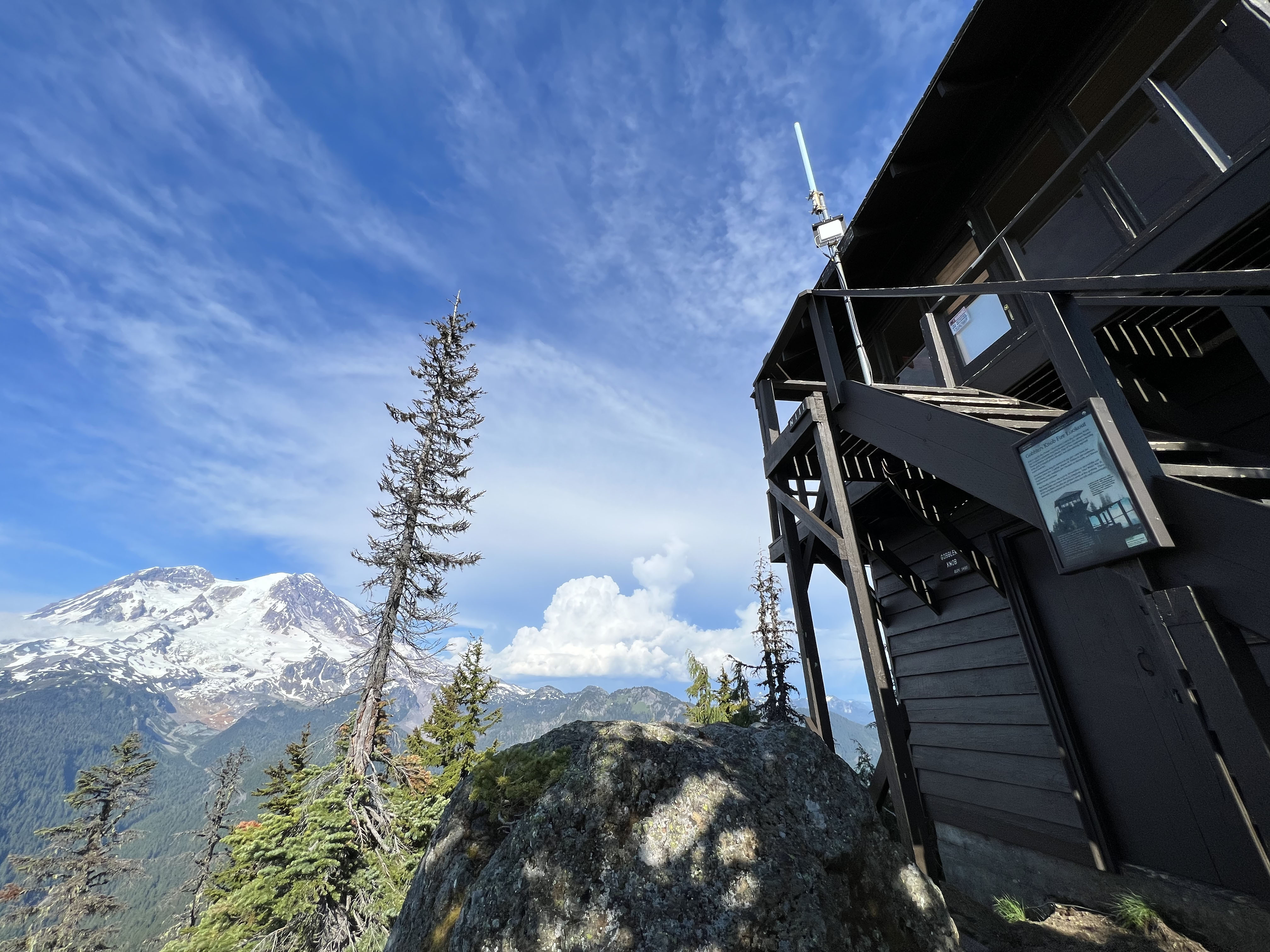
Gobblers Knob Fire Lookout , one of four historic fire lookouts in the park, sits on a rocky outcrop and offers panoramic views of Mount Rainier and the surrounding area.
To access the trailhead, take the Westside Road to the gate at Dry Creek (approximately 3 miles from the start of the road). Due to danger from rock fall, vehicles must park south of the barricade at Dry Creek. Hikers and bicyclists should travel through the area with caution and avoid lingering in the rock fall hazard zone. Visitors are also advised that Westside Road is an active geohazard zone .
Hike or bike up the closed portion of the road to Round Pass (3.8 miles). The Lake George/Gobblers Knob trailhead is on the left of the road by the wide parking area at Round Pass. A bike rack is next to the trailhead. Bikes are not allowed on any trails. The hike to Lake George is easy with a gradual incline over 0.8 miles. Lake George has a historic patrol cabin and backcountry campsites. Wilderness permits are required for all overnight stays in the backcountry. The hike to Gobblers Knob Lookout is an additional 1.0 mile from Lake George and much steeper.
Once you reach the lookout, enjoy views of Mount Rainier and the Tahoma Glacier from Gobblers Knob. On a clear day the peaks of Mount St. Helens, Mount Hood, Mount Adams, and the Olympic Mountains are visible. The fire lookout has been in use since the 1930s.
Trail Statistics
Distance: 11.2 miles roundtrip
Elevation gain: 2,585 feet
Hiking time: 6-7 hours
Difficulty Level: Strenuous
Wilderness Camp: Lake George
Rules & Regulations
Pets are not allowed on trails or on Westside Road past Dry Creek
No campfires (backcountry stoves are okay)
No bicycles on trails
Pack out trash
Do not feed or disturb wildlife
Do not disturb any natural, cultural, or archeological features
Permits are required for all overnight wilderness use in the park, and for travel on glaciers above 10,000 feet
Accessibility The hike along the closed portion of Westside Road up to Round Pass is a gradual incline, gaining 1,100 feet in 3.8 miles, along a wide, dirt road. From Round Pass, the hike to Lake George gains 390 feet in 0.8 miles, along a narrow, dirt trail with occasional rocks, roots, and boardwalk sections. The hike to Gobblers Knob Lookout from Lake George is similar terrain but much steeper, gaining approximately 1,095 feet in 1.0 mile.