
Kings Creek Trail
Waterfalls
Along the way Kings Creek Falls
Trailheads Kings Creek Falls Trailhead 7,287 ft Drive there · Kings Creek Trailhead 7,386 ft Drive there
Hike to Kings Creek Falls 2.3 mi loop · the Park Service's write-up
90 Minutes · no dogs · Summer, Fall · season The Kings Creek Trailhead is located at high elevation (7,300 feet). The park highway must be open to through traffic to reach the trailhead. The park highway closes to through traffic in the winter and early spring seasons (approximately December through May) due to snow. Snow can linger on the Kings Creek Trail well into June or July. Hikers may benefit from snowshoes, snow/ice traction devices, and/or trekking poles when snow is present.
Start Kings Creek Falls Trailhead
Start : Kings Creek Falls Trailhead
Round Trip Distance : 2.3 miles (3.7 km) loop
Round Trip Time : 2 hours
Terrain : Gradual 700 foot descent along Upper Cascades section; steep, narrow stone staircase for one-way, uphill return via Cascades Foot Trail.
Elevation Start / Loss : 7,286 feet (2220m) / 486 ft (148 m)
Season : Approximately June through October
Stock Use: Stock are not permitted on the Cascades Foot section
Kings Creek Falls is partily open - park staff will continue with repairs.
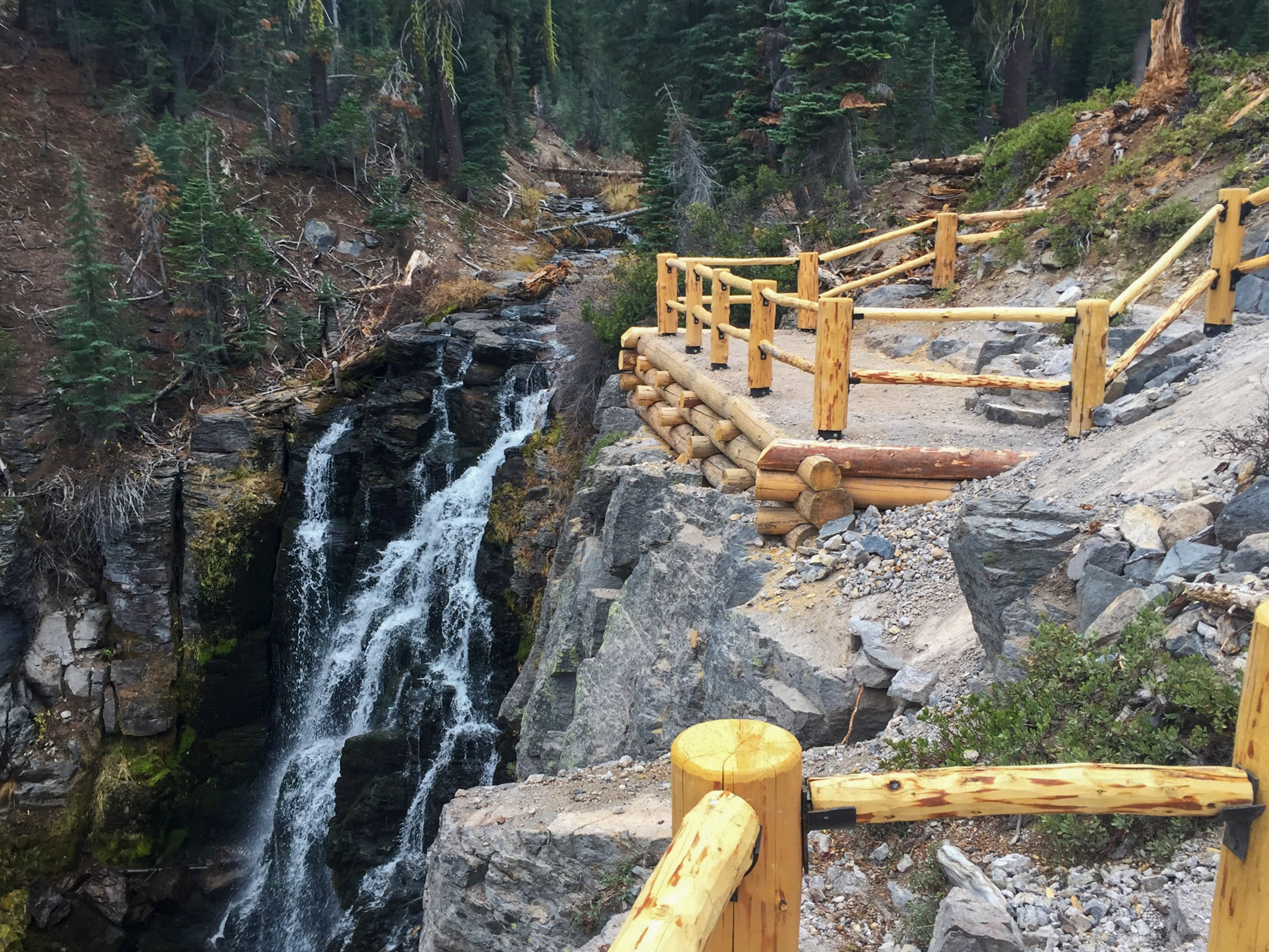
Kings Creek Falls can be accessed via a loop or an out-and-back hike. The first half mile passes along Lower Kings Creek Meadow. The loop then begins to the left (clockwise) along the Upper Cascades section, which offers expansive vistas as it steadily descends towards Kings Creek Falls. A fenced overlook provides a clear view of the 30-foot waterfall. Hikers can return to the trailhead on the same Upper Cascades section or loop back on the Cascades Foot section. Please travel uphill only on this narrow, steep section alongside the cascades to help improve your safety and the safety of others.
How to Hike This Trail Safely
Hiking the Kings Creek Fall Trail involves risk. Learn more about general hiking safely in this high elevation and remote park. Special considerations for this trail include:
Winter conditions can persist through the summer months, especially in the forested sections of the trail. Wear proper footwear and consider using trekking poles to help maintain balance.
Hiking at high elevation can aggravate preexisting medical conditions. Know the effects of altitude. Carry plenty of water, take breaks often, and do not exceed your abilities.
Bears are occasionally sighted in this area. Learn more about how to be bear aware to protect yourself and wildlife.
Traveling off-trail around the waterfall is strongly discouraged. For your safety, please stay behind the overlook railings. Snow melt significantly increases water flow in the spring season and increases the danger of drowning or being swept over the falls.
Creek crossings can be hazardous during the spring snow melt season. Use caution when crossing, wear proper footwear and carry extra clothing.
Pets Pets are not permitted on park trails, including in a carrier. This regulation does not apply to service animals assisting a person with a disability.
Accessibility The Kings Creek Falls Trail is primarily comprised of hardpacked dirt. A staircase provides access to the trail from the parking area along the park highway. There are numerous slopes along the trail and some sections can be dusty and slippery, especially in the dry season. There is at least one seasonal marsh crossing that requires crossing a log bridge. The one-way cascades foot section includes steep, rock steps that climb parallel to the creek. This trail is not recommended for hikers with mobility impairments. Service animals assisting a person with a disability are permitted on park trails.