Bathtub Lake Trail
Trailheads Bathtub Lake Trailhead 6,092 ft Drive there · Butte Lake East Trailhead 6,079 ft Drive there

National Park · California
67 named trails · 167 miles · 36 trailheads · 6 with the Park Service's own write-up. The lines, trailheads and points are the Park Service's; the write-ups are the Service's own words; the climbing is read from USGS elevation along each line.
67 trails, A to Z.
Trailheads Bathtub Lake Trailhead 6,092 ft Drive there · Butte Lake East Trailhead 6,079 ft Drive there
Trailhead Brokeoff Mountain Trailhead 6,640 ft Drive there
Views
Along the way Bumpass Hell Trail Viewpoint
Trailhead Bumpass Hell Trailhead 8,186 ft Drive there
90 Minutes · no dogs · Summer, Fall
Start Bumpass Hell Trail and Basin
Bumpass Hell Trail
Start : Bumpass Hell parking area, 7 miles from the Southwest Entrance
Round-trip Distance : 3 miles
Round-trip Time : 2 hours
Terrain : Gradual climb first mile then 200-foot descent into basin
Elevation : 8,200 - 8,400 feet
Trail Surface: Packed gravel
Width: 48" to basin overlook; trails into basin are narrow
Season: Approximately late July through October
360-degree photos of the basin
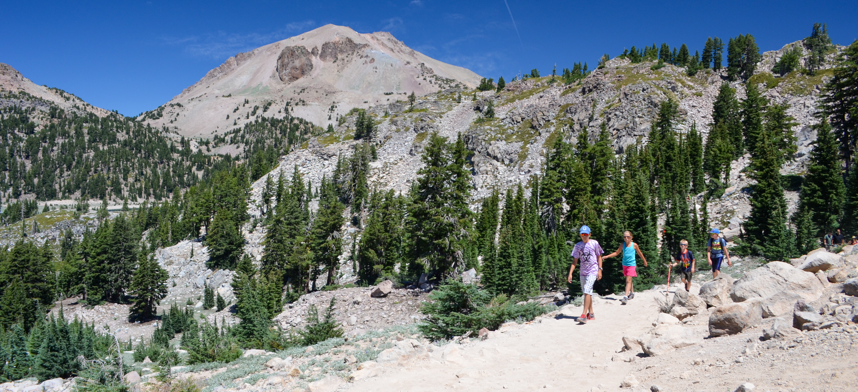
Bumpass Hell Trail provides access to the largest hydrothermal area in the park. The trail is open in the late summer and fall only. Learn more about the winter/spring closure . Parking for this popular trail is limited and is often full mid-morning to early afternoon, especially on weekends. The three-mile, round-trip hike is easy to moderate in difficulty and is popular with hikers of all ages. Vault toilets are available only at the trailhead, there are no restrooms on the trail or in the basin. Pets are not permitted on any park trails.
How to Hike This Trail Safely
Hiking the Bumpass Hell Trail involves risk. Learn more about general hiking safely in this high-elevation and remote park. Special considerations for this hydrothermal area include:
Shade is limited on this trail. Hikers are encouraged to wear or bring a hat and carry water.
Winter conditions can persist through the summer months, especially in the forested sections of the trail. Wear proper footwear (good tread, ankle support, closed toe) and consider using trekking poles to help maintain balance. Knee and ankle injuries are the most common visitor injury in the park.
Stay on established trails and boardwalks in/around the basin . Ground in hydrothermal areas can look solid but may actually be a thin crust hiding pools of acidic boiling water or mud. Visitors have been severely injured by traveling off-trail in these areas.
Water and mud in hydrothermal areas is acidic. Do not put water or mud from park hydrothermal areas on your skin. Even water that is cool to the touch is acidic and can irritate or burn your skin with prolonged exposure.
Hiking at high elevation can aggravate preexisting medical conditions. Know the effects of altitude. Carry plenty of water, take often, and do not exceed your abilities.
Pets Pets are not permitted on park trails, including in a carrier. This regulation does not apply to service animals assisting a person with a disability.
Accessibility The Bumpass Hell Trail is hardpacked dirt and rock. Most of the first mile is four feet wide, with minimal slope. The last half mile descends 300 feet into the basin and includes some rock steeps and steeper slopes. Service animals assisting a person with a disability are permitted on the trail.
Trailheads Bathtub Lake Trailhead 6,092 ft Drive there · Butte Lake East Trailhead 6,079 ft Drive there
Trailhead Crags Lake Trailhead 5,920 ft Drive there
15-30 Minutes · no dogs · Spring, Summer, Fall
Start Reflection Lake Trail
Start : Lily Pond/Reflection Lake Trailhead, across highway from Loomis Museum
Round Trip Distance : 0.5 miles
Round Trip Time : half-hour
Elevation: 5,890 ft
Elevation Change : Negligible
Surface: Dirt with tree roots and exposed rock in places, may be soft/wet in spots.
Season: May through October (when snow-free)
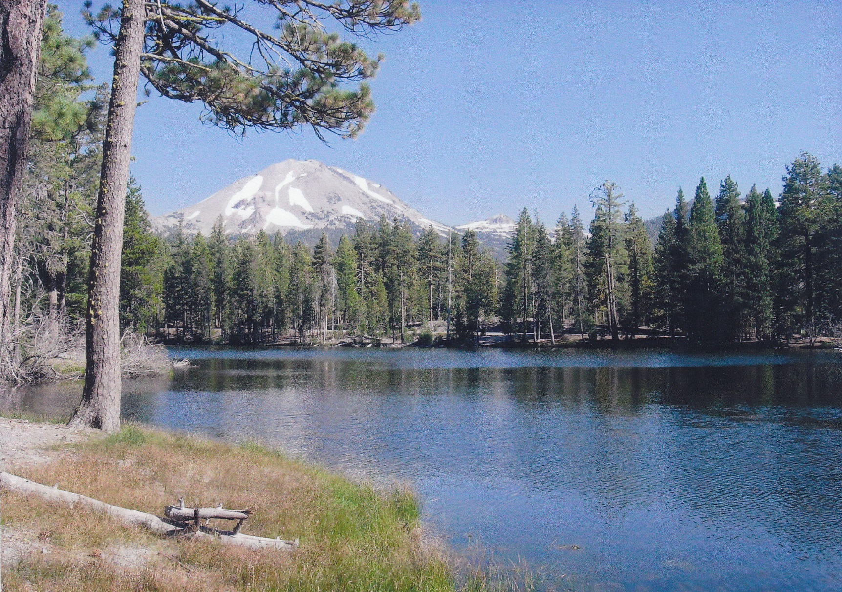
This half-mile loop hike circles Reflection Lake leading to spectacular views of Lassen Peak and Chaos Crags on its northern shore often seen reflecting in the water. It is ideal for families with young children or anyone looking for a short and relatively flat walk with rewarding views. Water birds such as Canada geese, coot and mallard ducks are often on the water. A portion of the trail overlaps the Lily Pond Interpretive Trail, which offers an opportunity to learn about the rich diversity of plant and animal life along the loop.
Reflection Lake Recreation
Recreation on Reflection Lake is limited. Please note:
boats , rafts and other floatation devices are not permitted on Reflection Lake.
Swimming is not advised due to bacterial contaminates, algae, water plants and excessive fallen logs and other obstacles along the shoreline.
Fishing opportunities are limited on Reflection Lake. Excesive water plants and lakeshore debris are sure to snag line and hook. Only tiu chub fish live in Reflection Lake.
Parking is available across the highway at the Loomis Plaza, although the parking area is often full in the summer season. Additional parking is available at the Manzanita Lake Day Use Area , which connects to the Loomis Plaza via a short section of the Manzanita Lake Trail . Bikes and pets are not permitted on park trails. Strollers and wheelchairs are not recommended as the trail is rocky and narrow in some sections.
How to Hike This Trail Safely
Walking any park trail involves risk. This trail is appropriate for all ages, however all visitors should be familiar with general hiking safety in this high-elevation and remote park, including:
Wear proper footwear (good tread, ankle support, closed toe). Knee and ankle injuries are the most common visitor injury in the park.
Hiking at high elevation can aggravate preexisting medical conditions. Know the effects of altitude. Carry plenty of water, take breaks often, and do not exceed your abilities.
Pets Pets are not permitted on park trails, including in a carrier. Learn more about visiting with pets . This regulation does not apply to service animals assisting a person with a disability. A service animal, as described by the ADA (Americans with Disabilities Act) performs a specific task for a disabled person.
Accessibility The composition of the trail is dirt and rock. Most of the trail is flat with the exception of some hilly areas and narrow sections. There is one short and shallow wet crossing during spring and early summer. Service animals assisting a person with a disability are permitted on park trails. A service animal, as described by the ADA (Americans with Disabilities Act) performs a specific task for a disabled person.
Trailhead Cinder Cone Trailhead 6,071 ft Drive there
Trailhead Cluster Lakes Trailhead 6,671 ft Drive there
Waterfalls
Along the way Mill Creek Falls
Trailhead Crystal Lake Trailhead 6,833 ft Drive there
Picnic areas
Along the way Devastated Area Picnic Area
Trailhead Drakesbad Trailhead 5,683 ft Drive there
Trailhead Summit Lake North Trailhead 6,687 ft Drive there
Visitor centers
Along the way Kohm Yah-mah-nee Visitor Center
Trailhead Mill Creek Falls Trailhead 6,713 ft Drive there
Trailhead Horseshoe Lake Trailhead 6,774 ft Drive there
Boat launches
Along the way Juniper Lake Boat Launch
Trailhead Inspiration Point Trailhead 6,775 ft Drive there
CampgroundsBoat launches
Along the way Juniper Lake Boat Launch Juniper Lake Campground
Trailheads Horseshoe Lake Trailhead 6,774 ft Drive there · Juniper Lake Loop-North Trailhead 6,804 ft Drive there · Juniper Lake Loop-South Trailhead 6,756 ft Drive there · Mount Harkness Trailhead 6,795 ft Drive there
Trailheads Juniper Lake Loop-North Trailhead 6,804 ft Drive there · Juniper Lake Loop-South Trailhead 6,756 ft Drive there
Trailhead Horseshoe Lake Trailhead 6,774 ft Drive there
Trailhead Kelly Camp Trailhead 5,317 ft Drive there
Waterfalls
Along the way Kings Creek Falls
Trailheads Kings Creek Falls Trailhead 7,287 ft Drive there · Kings Creek Trailhead 7,386 ft Drive there
90 Minutes · no dogs · Summer, Fall
Start Kings Creek Falls Trailhead
Start : Kings Creek Falls Trailhead
Round Trip Distance : 2.3 miles (3.7 km) loop
Round Trip Time : 2 hours
Terrain : Gradual 700 foot descent along Upper Cascades section; steep, narrow stone staircase for one-way, uphill return via Cascades Foot Trail.
Elevation Start / Loss : 7,286 feet (2220m) / 486 ft (148 m)
Season : Approximately June through October
Stock Use: Stock are not permitted on the Cascades Foot section
Kings Creek Falls is partily open - park staff will continue with repairs.
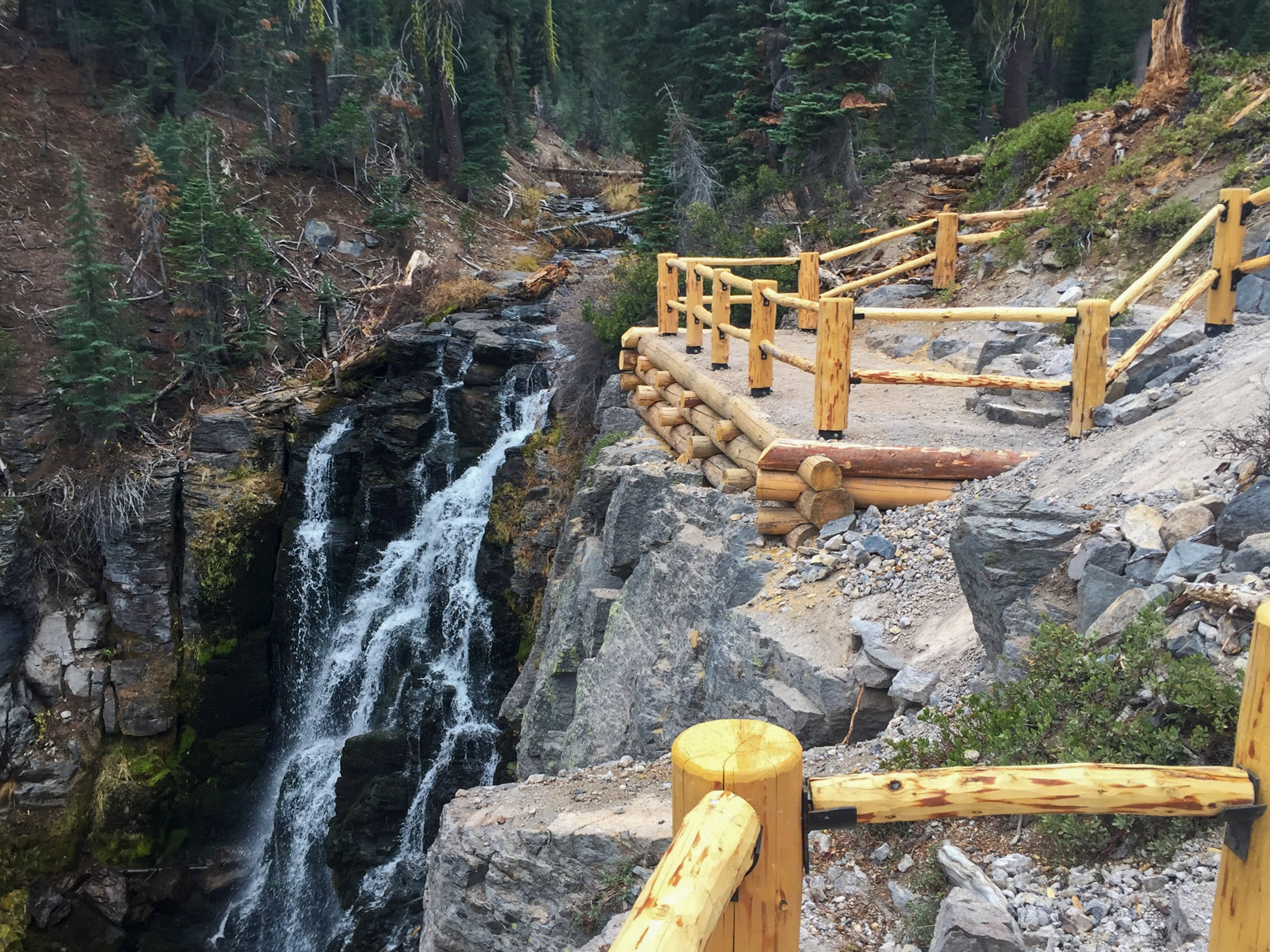
Kings Creek Falls can be accessed via a loop or an out-and-back hike. The first half mile passes along Lower Kings Creek Meadow. The loop then begins to the left (clockwise) along the Upper Cascades section, which offers expansive vistas as it steadily descends towards Kings Creek Falls. A fenced overlook provides a clear view of the 30-foot waterfall. Hikers can return to the trailhead on the same Upper Cascades section or loop back on the Cascades Foot section. Please travel uphill only on this narrow, steep section alongside the cascades to help improve your safety and the safety of others.
How to Hike This Trail Safely
Hiking the Kings Creek Fall Trail involves risk. Learn more about general hiking safely in this high elevation and remote park. Special considerations for this trail include:
Winter conditions can persist through the summer months, especially in the forested sections of the trail. Wear proper footwear and consider using trekking poles to help maintain balance.
Hiking at high elevation can aggravate preexisting medical conditions. Know the effects of altitude. Carry plenty of water, take breaks often, and do not exceed your abilities.
Bears are occasionally sighted in this area. Learn more about how to be bear aware to protect yourself and wildlife.
Traveling off-trail around the waterfall is strongly discouraged. For your safety, please stay behind the overlook railings. Snow melt significantly increases water flow in the spring season and increases the danger of drowning or being swept over the falls.
Creek crossings can be hazardous during the spring snow melt season. Use caution when crossing, wear proper footwear and carry extra clothing.
Pets Pets are not permitted on park trails, including in a carrier. This regulation does not apply to service animals assisting a person with a disability.
Accessibility The Kings Creek Falls Trail is primarily comprised of hardpacked dirt. A staircase provides access to the trail from the parking area along the park highway. There are numerous slopes along the trail and some sections can be dusty and slippery, especially in the dry season. There is at least one seasonal marsh crossing that requires crossing a log bridge. The one-way cascades foot section includes steep, rock steps that climb parallel to the creek. This trail is not recommended for hikers with mobility impairments. Service animals assisting a person with a disability are permitted on park trails.
ViewsPeaks
Along the way Lassen Peak Grand View
Trailhead Lassen Peak Trailhead 8,457 ft Drive there
4-5 Hours · no dogs · Summer, Fall
Start Lassen Peak
Start: Lassen Peak Trailhead
Level of Difficulty: Strenuous
Round-Trip Distance: 5 miles (8 km)
Time: 4-5 hours
Elevation Start/Gain: 8,500 ft (2591 m) / 1,957 ft (596 m)
Surface: Packed dirt with some lose rock from erosion
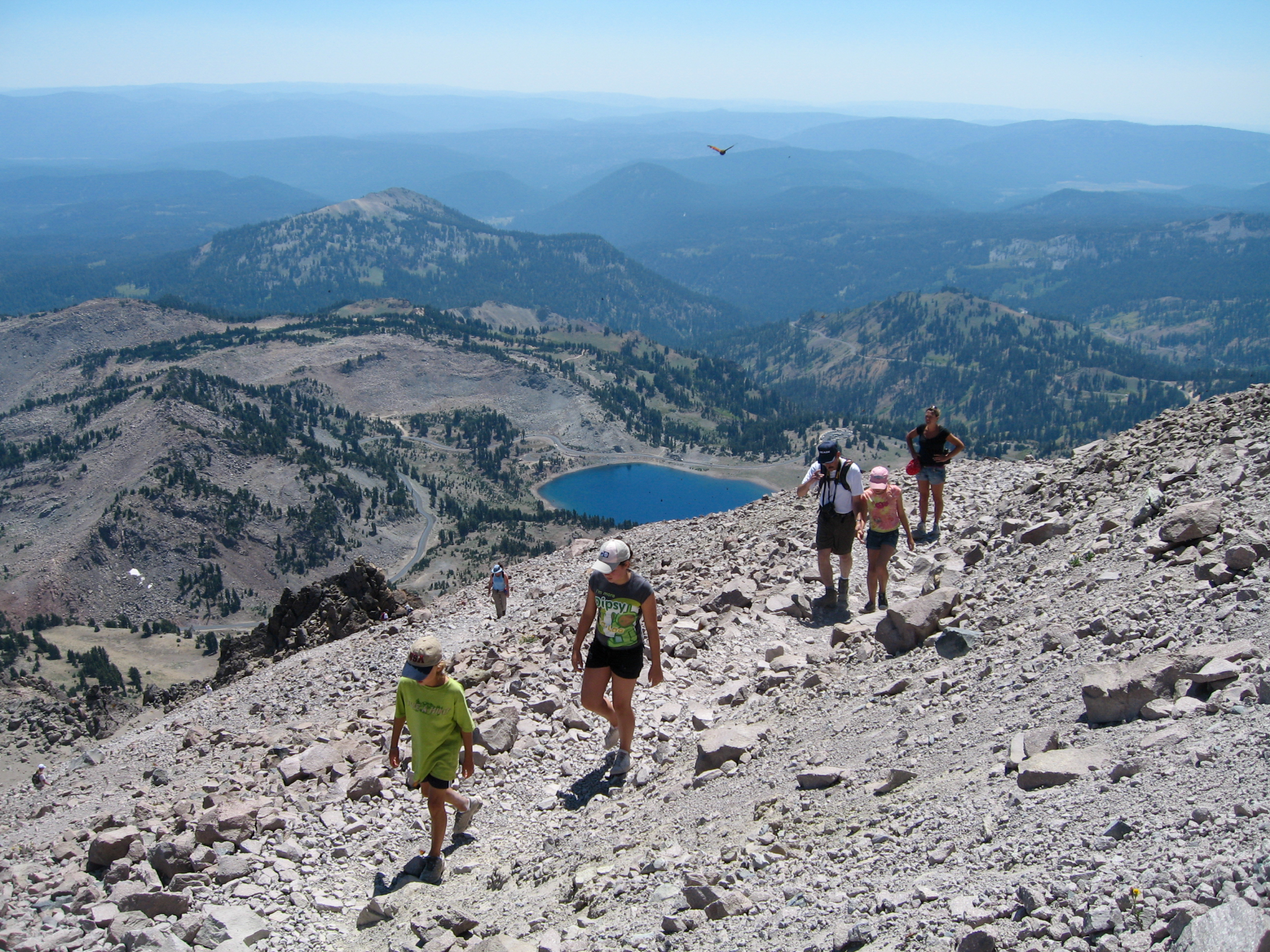
Lassen Peak Trail climbs to the summit of one of the largest plug dome volcanoes in the world. Beginning at the Lassen Peak parking area, the trail climbs through twisted mountain hemlock and whitebark pine trees on sand-like cinders. As the trees begin to thin and vistas of the park come into view, the trail steepens into series of switchbacks along a rocky ridge to the summit. The maintained trail ends at the first summit where hikers can read interpretive signs, rest, and enjoy the panoramic view. From there, hikers may continue up the steep route to the true summit or descend into the interior of the crater to explore the remnants of the dramatic eruptions that have rocked this volcano.
How to Hike This Trail Safely
Hiking Lassen Peak Trail involves risk. Learn more about general hiking safety in this high-elevation and remote park. Special considerations for this trail include:
Snow Conditions can persist through the summer months. Wear proper footwear and consider using trekking poles to help maintain balance. Travel in the winter months requires winter backcountry travel knowledge and equipment.
Sun Exposure is considerable on Lassen Peak Trail. Tree shade may be found in the first mile after which limited shade is available.
Sudden Changes in weather occur frequently and snow is possible any month of the year. Get an early start to avoid afternoon storms and lightning. Carry extra layers for warmth.
Hiking at High Elevation can aggravate pre-existing medical conditions. Know the effects of altitude. Carry plenty of water, take breaks often, and do not exceed your abilities.
Yield to Uphill Hikers
Please carefully step off to the side of trail to allow uphill hikers to pass or to stop for a break.
Please Stay on the Trail Do Not Cut Switchbacks
You can enjoy and help preserve one of the park’s oldest and most popular trails by simply staying on it. Traveling off-trail causes damage. Your footsteps can push rocks onto the trail, create pathways for water erosion, and undermine the supporting slope. See hikers straying from the trail? Speak up! A courteous reminder about why it’s important to stay on the trail is usually enough. If not, please report destructive behavior to a park ranger.
Pets Service animal allowed. No pets.
Accessibility Not accessible to wheelchairs.
15-30 Minutes · no dogs · Spring, Summer, Fall
Start Reflection Lake Trail
Start : Lily Pond/Reflection Lake Trailhead, across highway from Loomis Museum
Round Trip Distance : 0.5 miles
Round Trip Time : half-hour
Elevation: 5,890 ft
Elevation Change : Negligible
Surface: Dirt with tree roots and exposed rock in places, may be soft/wet in spots.
Season: May through October (when snow-free)
This half-mile loop hike circles Reflection Lake leading to spectacular views of Lassen Peak and Chaos Crags on its northern shore often seen reflecting in the water. It is ideal for families with young children or anyone looking for a short and relatively flat walk with rewarding views. Water birds such as Canada geese, coot and mallard ducks are often on the water. A portion of the trail overlaps the Lily Pond Interpretive Trail, which offers an opportunity to learn about the rich diversity of plant and animal life along the loop.
Reflection Lake Recreation
Recreation on Reflection Lake is limited. Please note:
boats , rafts and other floatation devices are not permitted on Reflection Lake.
Swimming is not advised due to bacterial contaminates, algae, water plants and excessive fallen logs and other obstacles along the shoreline.
Fishing opportunities are limited on Reflection Lake. Excesive water plants and lakeshore debris are sure to snag line and hook. Only tiu chub fish live in Reflection Lake.
Parking is available across the highway at the Loomis Plaza, although the parking area is often full in the summer season. Additional parking is available at the Manzanita Lake Day Use Area , which connects to the Loomis Plaza via a short section of the Manzanita Lake Trail . Bikes and pets are not permitted on park trails. Strollers and wheelchairs are not recommended as the trail is rocky and narrow in some sections.
How to Hike This Trail Safely
Walking any park trail involves risk. This trail is appropriate for all ages, however all visitors should be familiar with general hiking safety in this high-elevation and remote park, including:
Wear proper footwear (good tread, ankle support, closed toe). Knee and ankle injuries are the most common visitor injury in the park.
Hiking at high elevation can aggravate preexisting medical conditions. Know the effects of altitude. Carry plenty of water, take breaks often, and do not exceed your abilities.
Pets Pets are not permitted on park trails, including in a carrier. Learn more about visiting with pets . This regulation does not apply to service animals assisting a person with a disability. A service animal, as described by the ADA (Americans with Disabilities Act) performs a specific task for a disabled person.
Accessibility The composition of the trail is dirt and rock. Most of the trail is flat with the exception of some hilly areas and narrow sections. There is one short and shallow wet crossing during spring and early summer. Service animals assisting a person with a disability are permitted on park trails. A service animal, as described by the ADA (Americans with Disabilities Act) performs a specific task for a disabled person.
Visitor centers
Along the way Loomis Museum
Trailhead Lily Pond Trailhead 5,905 ft Drive there
Trailhead Little Willow Lake Trailhead 6,099 ft Drive there
Trailhead Manzanita Creek Trailhead 5,931 ft Drive there
Boat launches
Along the way Manzanita Lake Boat Launch
Trailhead Manzanita Lake Campground Trailhead 5,884 ft Drive there
Picnic areasVisitor centersRanger stationsBoat launches
Along the way Manzanita Lake Boat Launch Manzanita Lake Picnic Area Loomis Ranger Station Loomis Museum
Trailheads Manzanita Lake Trailhead 5,895 ft Drive there · Nobles Emigrant-Summertown Trailhead 5,871 ft Drive there
30-90 Minutes · no dogs
Start Manzanita Lake
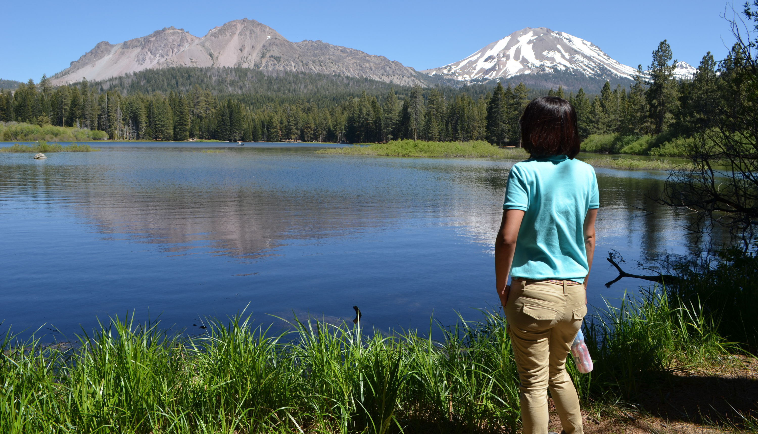
Start : Loomis Plaza / Manzanita Lake Day Use Area
Round Trip Distance : 1.7 miles
Round Trip Time : 1 hour
Elevation: 5,890 ft
Elevation Change : Negligible
Surface: Firm dirt with tree roots and exposed rock in places
360-degree photos from the trail
Manzanita Lake Trail is one of a handful of walks in the park with scenic views of the iconic Lassen Peak. Begin the dirt trail around the lake from the Manzanita Lake Day Use Area or Loomis Plaza (between the restrooms and museum). Parking is easiest at the boat launch; Loomis Plaza parking is often full in the summer season. Restrooms are available at the boat launch and the Loomis Plaza. Lassen Peak and Chaos Crags are visible from a large section of the western shore, which is most easily accessed from the boat launch trailhead. Please note that bikes and pets are not permitted on park trails. Strollers and wheelchairs are not recommended as the trail is rocky and narrow in some sections.
Manzanita Lake is a popular habitat for songbirds, raptors, and waterbirds. Black-tailed deer, Douglas squirrels, and golden-mantled ground squirrels are also frequently spotted on the trail. Help keep wild animals wild by never feeding wildlife. The trail offers excellent sunset views. The picnic area provides a clear view across the lake to the west. From the western shore, hikers can enjoy alpenglow cast by the setting sun on Lassen Peak and Chaos Crags.
How to Hike This Trail Safely
Walking the Manzanita Lake Trail involves risk. Learn more about general hiking safety in this high-elevation and remote park. Special considerations for this trail include:
Shade can be limited. We recommend all hikers wear or bring a hat and carry water.
Wear proper footwear (good tread, ankle support, closed toe). Knee and ankle injuries are the most common visitor injury in the park.
Hiking at high elevation can aggravate preexisting medical conditions. Know the effects of altitude. Carry plenty of water, take breaks often, and do not exceed your abilities.
Pets Pets are not permitted on park trails, including in a carrier. This regulation does not apply to service animals assisting a person with a disability. A service animal, as described by the ADA (Americans with Disabilities Act) performs a specific task for a disabled person.
Accessibility The trail is not recommended for wheelchair use. The trail is narrow in places with numerous obstacles including tree roots and exposed rocks. Individuals in wheelchairs can access the Manzanita Lake Picnic Area/Boat Launch to enjoy lake access, bird watching, wildlife viewing, and sunset watching. Service animals assisting a person with a disability are permitted on park trails. A service animal, as described by the ADA (Americans with Disabilities Act) performs a specific task for a disabled person.
Waterfalls
Along the way Mill Creek Falls
Trailhead Mill Creek Falls Trailhead 6,713 ft Drive there
Trailheads Mount Harkness Trailhead 6,795 ft Drive there · Mt Harkness-Warner Valley Trailhead 5,262 ft Drive there
Boat launches
Along the way Butte Lake Boat Launch
Trailheads Cinder Cone Trailhead 6,071 ft Drive there · Nobles Emigrant Trail Trailhead 5,638 ft Drive there · Nobles Emigrant-Hat Creek Trailhead 6,472 ft Drive there · Nobles Emigrant-Summertown Trailhead 5,871 ft Drive there
CampgroundsPicnic areas
Along the way Warner Valley Campground Warner Valley Picnic Area
Trailheads PCT-Warner Valley Campground Trailhead 5,688 ft Drive there · Warner Valley Trailhead 5,646 ft Drive there
Trailheads Hat Lake Trailhead 6,435 ft Drive there · Terrace Lake-Park Highway Trailhead 8,053 ft Drive there
Visitor centers
Along the way Loomis Museum
Trailhead Lily Pond Trailhead 5,905 ft Drive there
15-30 Minutes · no dogs · Spring, Summer, Fall
Start Reflection Lake Trail
Start : Lily Pond/Reflection Lake Trailhead, across highway from Loomis Museum
Round Trip Distance : 0.5 miles
Round Trip Time : half-hour
Elevation: 5,890 ft
Elevation Change : Negligible
Surface: Dirt with tree roots and exposed rock in places, may be soft/wet in spots.
Season: May through October (when snow-free)
This half-mile loop hike circles Reflection Lake leading to spectacular views of Lassen Peak and Chaos Crags on its northern shore often seen reflecting in the water. It is ideal for families with young children or anyone looking for a short and relatively flat walk with rewarding views. Water birds such as Canada geese, coot and mallard ducks are often on the water. A portion of the trail overlaps the Lily Pond Interpretive Trail, which offers an opportunity to learn about the rich diversity of plant and animal life along the loop.
Reflection Lake Recreation
Recreation on Reflection Lake is limited. Please note:
boats , rafts and other floatation devices are not permitted on Reflection Lake.
Swimming is not advised due to bacterial contaminates, algae, water plants and excessive fallen logs and other obstacles along the shoreline.
Fishing opportunities are limited on Reflection Lake. Excesive water plants and lakeshore debris are sure to snag line and hook. Only tiu chub fish live in Reflection Lake.
Parking is available across the highway at the Loomis Plaza, although the parking area is often full in the summer season. Additional parking is available at the Manzanita Lake Day Use Area , which connects to the Loomis Plaza via a short section of the Manzanita Lake Trail . Bikes and pets are not permitted on park trails. Strollers and wheelchairs are not recommended as the trail is rocky and narrow in some sections.
How to Hike This Trail Safely
Walking any park trail involves risk. This trail is appropriate for all ages, however all visitors should be familiar with general hiking safety in this high-elevation and remote park, including:
Wear proper footwear (good tread, ankle support, closed toe). Knee and ankle injuries are the most common visitor injury in the park.
Hiking at high elevation can aggravate preexisting medical conditions. Know the effects of altitude. Carry plenty of water, take breaks often, and do not exceed your abilities.
Pets Pets are not permitted on park trails, including in a carrier. Learn more about visiting with pets . This regulation does not apply to service animals assisting a person with a disability. A service animal, as described by the ADA (Americans with Disabilities Act) performs a specific task for a disabled person.
Accessibility The composition of the trail is dirt and rock. Most of the trail is flat with the exception of some hilly areas and narrow sections. There is one short and shallow wet crossing during spring and early summer. Service animals assisting a person with a disability are permitted on park trails. A service animal, as described by the ADA (Americans with Disabilities Act) performs a specific task for a disabled person.
Trailhead Ridge Lakes Trailhead 7,000 ft Drive there
Trailhead Ridge Lakes Trailhead 7,000 ft Drive there
Trailhead Summit Lake South Trailhead 6,692 ft Drive there
Picnic areas
Along the way Summit Lake Picnic Area
Trailhead Cluster Lakes Trailhead 6,671 ft Drive there
Trailhead Terrace Lake-Summit Lake Trailhead 6,665 ft Drive there
Trailhead Kings Creek Trailhead 7,386 ft Drive there
The lines are the National Park Service's public trails layer, the trailheads and the waterfalls, views, peaks and historic places along them the Service's public points of interest, read 2026-10-14 and simplified for the map. The write-ups are the Service's own "things to do", unedited. Heights come from USGS 3DEP through Terrain Tiles on AWS (Mapzen/Tilezen), read along each line and rounded; a short trail on steep ground can be off by a few tens of feet. Closures change: check the park's own site before you go.