
Goldstrike Canyon
Trailhead Goldstrike Canyon Trailhead 1,662 ft Drive there
Hike the Goldstrike Canyon Trail the Park Service's write-up
4-8 Hours · dogs allowed · entrance fee applies · Winter, Spring, Fall · season Remember heat kills, be summer-smart and opt to hike when temperatures are cooler. If you do choose to hike during the summer, rangers recommend starting early in the morning or later in the evening when the weather is slightly cooler. Remember to pack enough water for your entire trip.
To help keep visitors and first responder staff safe from dangerously high temperatures during the hottest time of year, Lake Mead National Recreation Area institutes an annual seasonal closure of certain strenuous trails from May 15 to September 30.
Temporary closures will take place outside of these dates when temperatures are forecasted to reach 95 Fahrenheit or higher at Willow Beach (AZ), or if flash floods are possible.
The hot springs remain open and accessible by water on Lake Mohave.
-----
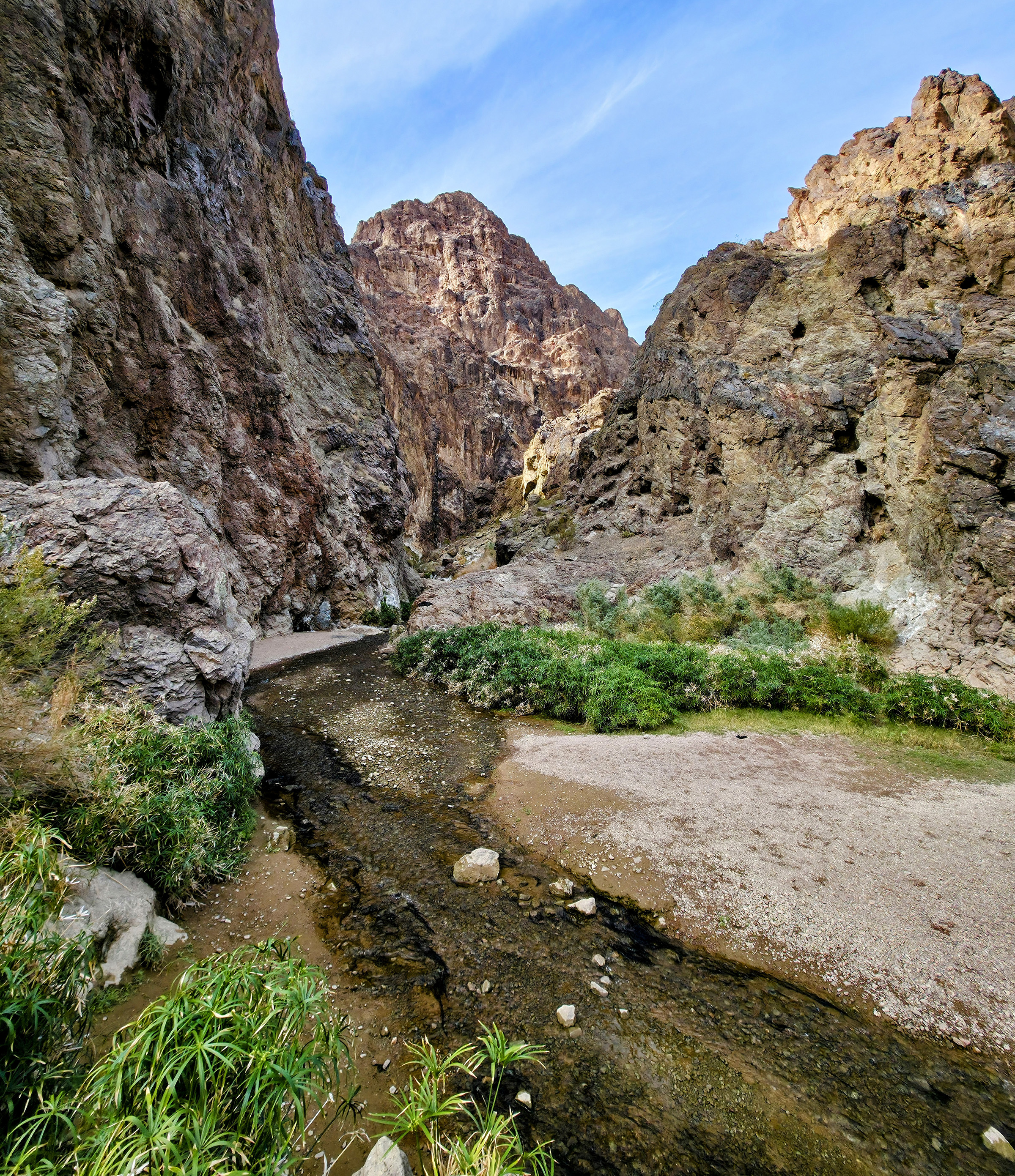
The Gold Strike Canyon trail is a challenging hike that takes you through a beautiful canyon to natural hot springs with stunning views of the Colorado River and Hoover Dam. The trail has around 1,000 feet of elevation change and includes seven dry falls of varying heights, making it a Class 2 canyoneering route. To get through, you'll need to scramble using both hands and feet to navigate the steep sections. Because of how technical this route is, this is not a trail to take a pet on.
Scroll to the bottom of this page for images of one of the pouroffs and some of the ropes you may see that were left by others that should not be trusted as safe.
Trail Information
Parking: Free parking off Goldstrike road. Near Boulder City, shortly before the Mike O’Callaghan-Pat Tillman Memorial Bridge.
Distance: 5.3 miles/8.5km round trip
Elevation Change: 1,200 ft/366m
Difficulty: Very Strenuous, Grade 2 Canyoneering Route
THIS ROUTE IS NOT MAINTAINED, INCLUDING THE ROPES. Ropes are not provided by the park. These were installed by hikers and left behind. Use at your own risk.
Services: Only toilets at the parking lot. Please bring Wag-bags to carry out all of your human waste and dispose of it properly.
Good to Know:
Always lock your car and take valuables with you.
Do not leave pets in cars while you are away! This route is not recommended for pets.
Because of flash flood dangers, do not hike in wash or canyon areas if thunderstorms are threatening.
It is illegal to remove plants, wildlife, geologic features (rocks), and archeological artifacts as they are protected under federal law.
Warning!
The water is not tested and may contain high levels of fecal matter. Do Not Drink! Carry plenty of water for each person to complete the roundtrip hike (at least 2 + liters per person).
The hike starts from the parking lot, following a dirt road past a gate before entering the canyon, which alternates between narrow and wide sections as different washes come together. The dry falls require strength, balance, and coordination to climb down—and then back up. You might see ropes at some of the more difficult spots, but these are not maintained by the National Park Service and should not be relied upon. Before sliding down a dry fall, ask yourself: Can I climb back up without a rope? Every year, hikers underestimate the difficulty of this trail, leading to injuries and death.
Thousands of people visit this trail each year. Please do your part to keep it beautiful by following Leave No Trace principles, including packing out all trash and human waste. There are toilets at the trailhead, but none at the hot springs. If nature calls while you’re hiking, bring a wag bag to pack out waste—just like you would for your dog.
Health Warning:
The hot springs flow naturally, and altering their flow by blocking water with sandbags or other objects can increase health risks. Past testing has found high levels of bacteria, including fecal coliform, E. coli, and enterococci, when the water is pooled. Additionally, the springs can contain amoebas, such as Naegleria , which in rare cases can cause serious illness if they enter the body. The park does not regularly test the water, and the springs are not designated swim areas, so visitors should use their own judgment before soaking. Never drink the water . Failure to follow these recommendations has resulted in significant health impacts or death.
Stay safe, be prepared, and enjoy this unique adventure responsibly!
Disclaimer: The ropes along the route are not managed, maintained, or inspected by the National Park Service. Visitors who choose to rappel do so at their own risk. The National Park Service assumes no responsibility for injuries, accidents, or damages resulting from these activities. Please use caution and sound judgment.
Accessibility This trail is an unmaintained route through a normally dry desert wash. The wash is made of soft sand, gravel, rocks, and boulders its entire length and wading through water and over slippery rocks. There are steep grades, rope descents, and rock ledges that must be climbed down.