
Sakakawea Trail
Exhibits
Along the way Fish Of Knife River Floodplain Gardens Lewis & Clark Trail River-Centered
Walk the Village Trail the Park Service's write-up
15-90 Minutes · dogs allowed
Start Knife River Indian Villages National Historic Site
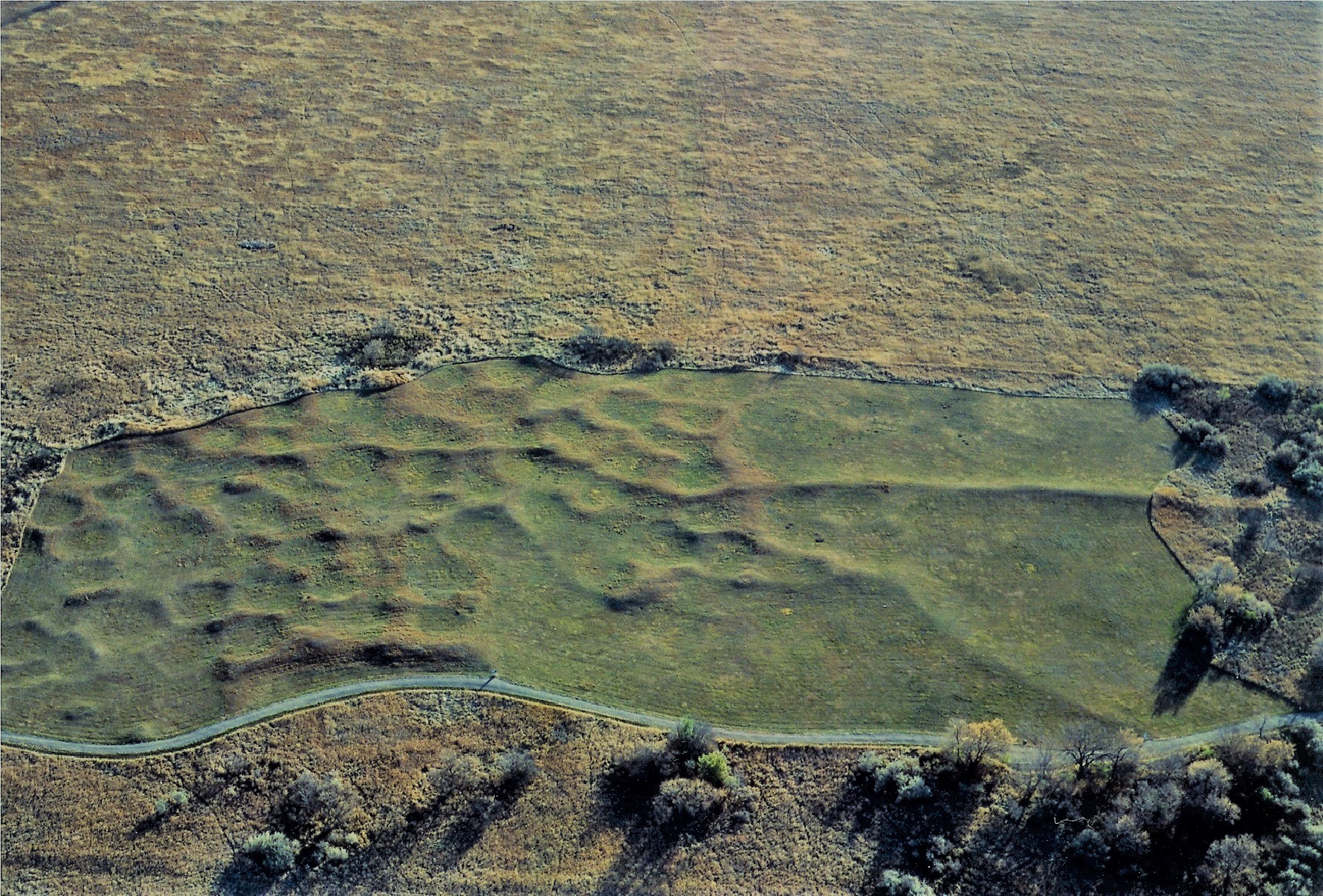
Walk down the Village Trail and see the remains of the Awatixa Xi'e Village (Lower Hidatsa Site) and Awatixa Village (Sakakawea Site). Starting at the Visitor Center, this flat, gravel trail is 1.3mi/2.1km long passing two village sites, restored prairie grassland, and has a loop at the second village site that includes a walk along the Knife River. Interpretive signs along the trail explain the history of the sites.
At these sites, circular depressions were left in the ground by the earth lodge homes that the Hidatsa lived in. Lower Hidatsa Site was occupied from about 1525 to the 1780s when the first smallpox epidemic forced them to leave their village.
Sakakawea Site is where Sakakawea was living when Lewis and Clark arrived in 1804 and stayed the winter. Sakakawea (Sacagawea/Sacajawea) gave birth to her son Jean Baptiste (Pomp) that winter and then left with Lewis and Clark on their journey. This site was occupied from 1790s until 1837 when smallpox returned a second time.
Accessibility The Village Trail is flat and made of gravel between the villages. The section of trail beside the river is mowed grass. Stairs lead down to the section of trail beside the river. There is a fishing hole with a small dirt parking lot at the end of the trail. The Village Trail is 1.3 miles round trip. To see just the Lower Hidatsa Site is a .5 mile round trip hike. Service animals are allowed.