
Nāhuku Trail
Halemaʻumaʻu Trail 0.8 mi one way · the Park Service's write-up
1-2 Hours · no dogs
Start Halemaʻumaʻu Trailhead along Crater Rim Trail
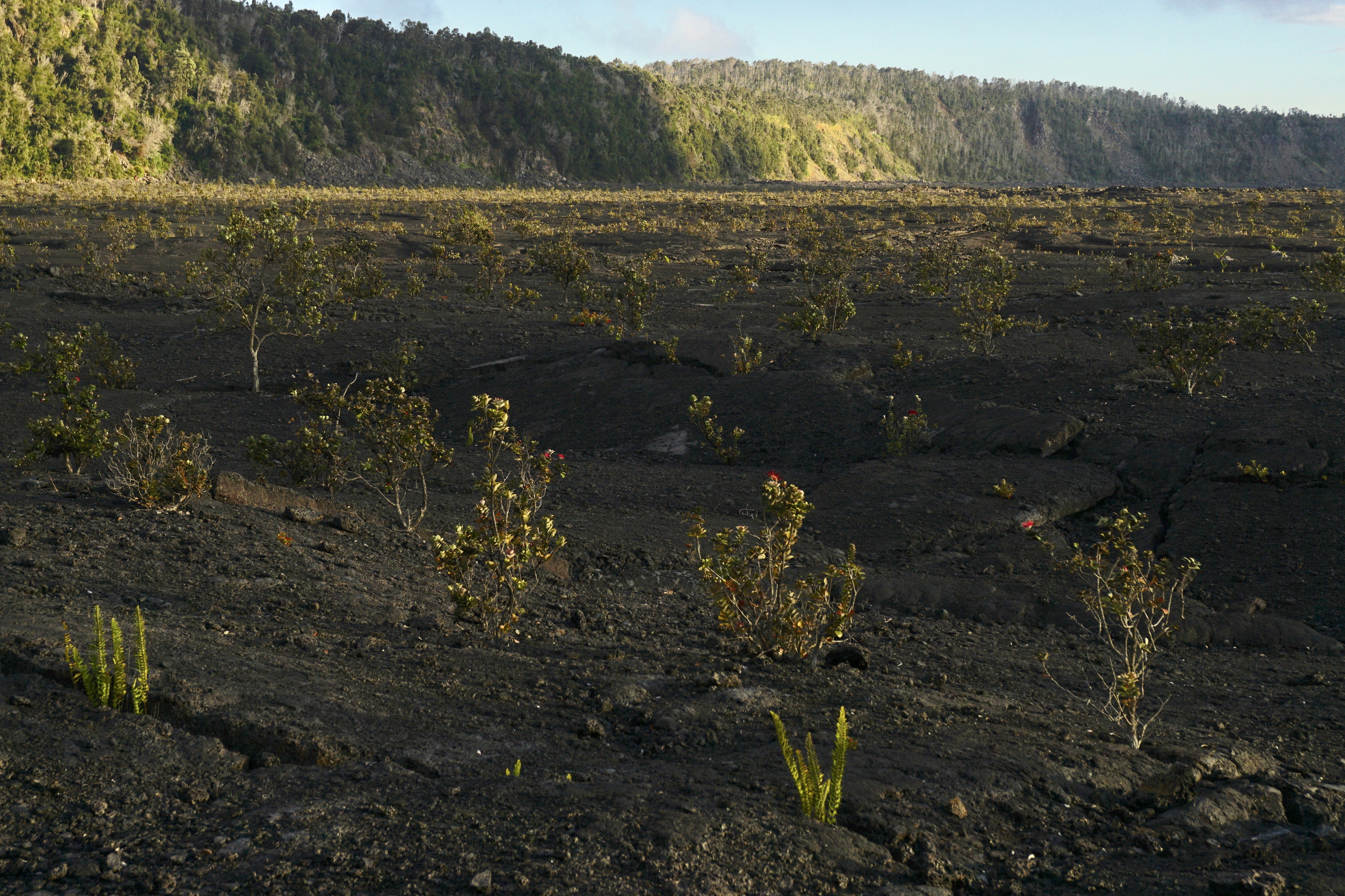
Descend 425 feet (130m) through a rain forest that has been re-established numerous times to a panoramic view on the floor of Kaluapele (Kīlauea caldera).
Difficulty: Moderate
Distance and hiking time:
0.8 miles (1.3 km) one-way from Crater Rim Trail to the floor of Kīlauea caldera
1.3 miles (2.1 km) one-way from Crater Rim Trail to the top of Byron Ledge, allowing for longer hikes to Kīlauea Iki and Nāhuku (Thurston Lava Tube)
Trail begins: Behind the Volcano House off Crater Rim Trail.
View the Halema‘uma‘u Trail Guide (pdf 2.98MB) .
Accessibility Trail is steep, uneven and occasionally narrow, descending nearly 425 feet (130m).
Nāhuku Lava Tube Trail 1.5 mi round trip · the Park Service's write-up
30-90 Minutes · no dogs
Start Nāhuku parking area or several trailheads in the Kīlauea summit area
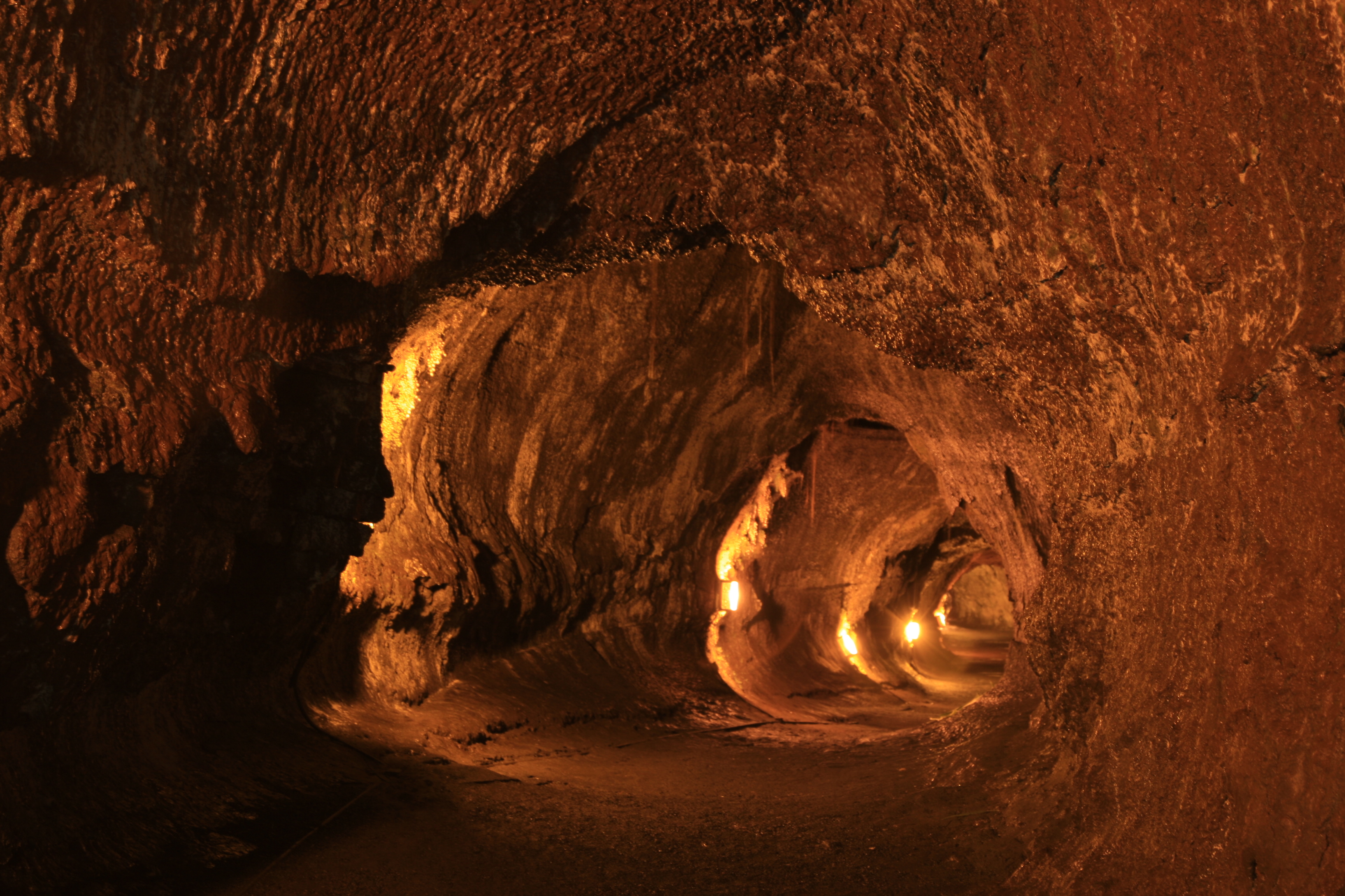
Walk through a verdant rainforest and listen for the calls of native birds before entering a 500-year old lava tube where a river of 2000 degree fahrenheit (1093° celsius) lava once flowed. Its Hawaiian name, Nāhuku, means "the protuberances," which possibly refers to the lava drippings that once hung from the ceiling. Unfortunately, those disappeared due to souvenir collectors after the tube was discovered in 1913. Entire ecosystems of creatures live in these fragile environments found throughout the Island of Hawaiʻi. Please be respectful and do not touch the walls or any hanging roots.
For a longer and more scenic adventure, explore Devastation Trail, Byron Ledge, the Kīlauea Iki loop, and Nāhuku all in one hike by parking at the Devastation Trailhead or Puʻupuaʻi. Parking at the lava tube and Kīlauea Iki Overlook is extremely limited and is likely to be full during peak hours. Want to avoid the crowds? Start your lava tube adventure before 9 a.m. or after 4 p.m.
Trailheads: Kīlauea Iki Overlook, Devastation Trailhead, or Puʻupuaʻi
Difficulty: Moderate
Distance: 1.5 mi (2.4 km) round-trip walk from Kīlauea Iki Overlook, 6.0 mi (9.7 km) round-trip from Devastation Trailhead (including the Kilauea Iki loop), an additional 1.0 mi (1.6 km) from Puʻupuaʻi
Bring: Water, snacks, sturdy footwear, and rain gear
The lava tube is lit 8 a.m. to 8 p.m. Flashlights are recommended outside of those hours.
Help protect this incredible resource by not touching the walls or delicate tree root systems hanging down. Use only your eyes to experience the lava tube.
Enter the lava tube at your own risk. Potential hazards include:
Rockfall
Low ceilings
Standing water
Tripping hazards
Low light or no light - lava tube is lit 8 a.m. to 8 p.m. daily
Accessibility Trail in and out of the lava tube is steep, and often slippery. There are also low ceilings, standing water, and tripping hazards