
National Park · Hawaii
Trails in Hawaiʻi Volcanoes National Park
50 named trails · 147 miles · 2 trailheads · 15 with the Park Service's own write-up. The lines, trailheads and points are the Park Service's; the write-ups are the Service's own words; the climbing is read from USGS elevation along each line.
50 trails, A to Z.
Ainapo Trail
Byron Ledge Spur
Byron Ledge Trail
Halemaʻumaʻu Trail the Park Service's write-up
1-2 Hours · no dogs
Start Halemaʻumaʻu Trailhead along Crater Rim Trail
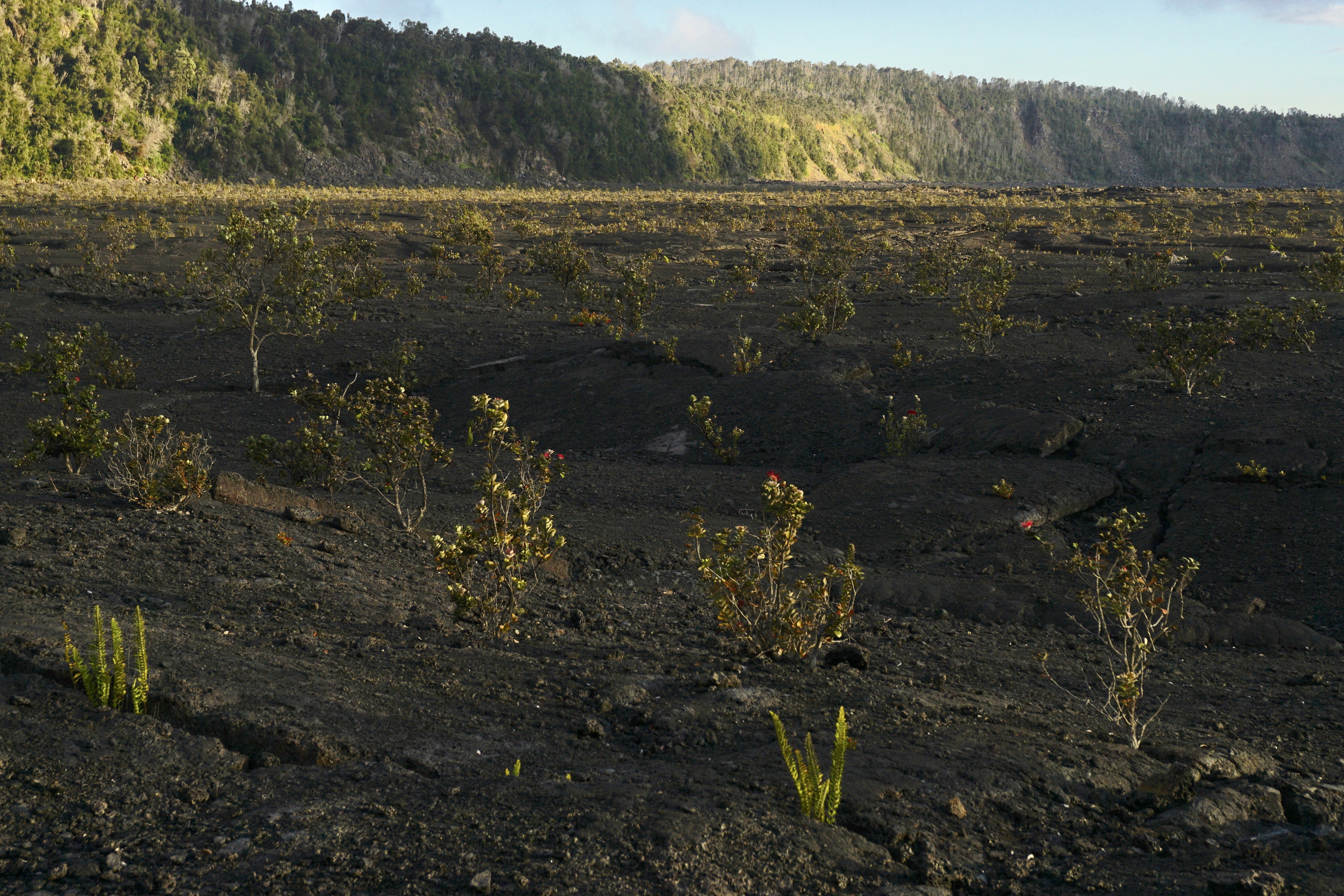
Descend 425 feet (130m) through a rain forest that has been re-established numerous times to a panoramic view on the floor of Kaluapele (Kīlauea caldera).
Difficulty: Moderate
Distance and hiking time:
0.8 miles (1.3 km) one-way from Crater Rim Trail to the floor of Kīlauea caldera
1.3 miles (2.1 km) one-way from Crater Rim Trail to the top of Byron Ledge, allowing for longer hikes to Kīlauea Iki and Nāhuku (Thurston Lava Tube)
Trail begins: Behind the Volcano House off Crater Rim Trail.
View the Halema‘uma‘u Trail Guide (pdf 2.98MB) .
Accessibility Trail is steep, uneven and occasionally narrow, descending nearly 425 feet (130m).
Crater Rim Trail closed
Views
Along the way Kilauea Iki Crater Kilauea Overlook
Crater Rim Trail the Park Service's write-up
1-6 Hours · no dogs
Start Several trailheads in the Kīlauea summit area
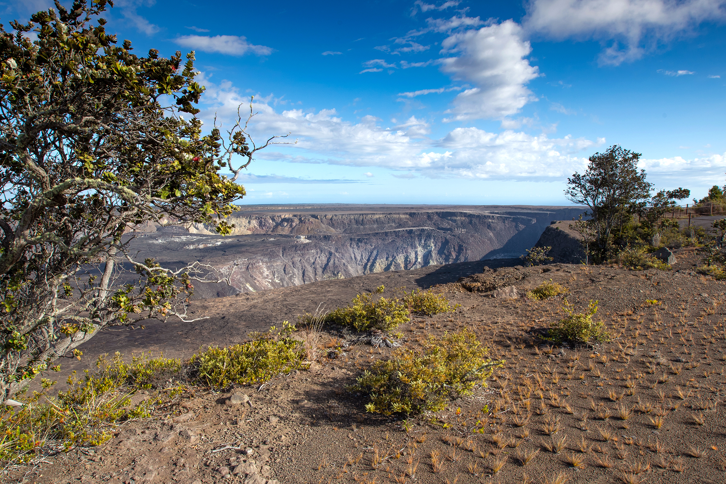
Crater Rim Trail traverses the edge of Kaluapele, the summit caldera of Kīlauea from Uēkahuna to just past Keanakākoʻi Crater. The trail is an awe inspiring journey around the summit of one of the most active volcanoes in the world. See the dramatic aftermath of the 2018 summit collapse, steam vents, and lush rainforest.
Difficulty: Easy
Distance is variable. Trail stretches from Uēkahuna on the north side of the caldera to just past Keanakākoʻi Crater on the south side. The trail includes Kūpinaʻi Pali (Waldron Ledge) .
Hikers may access the trail from many several locations along Crater Rim Drive, including Uēkahuna, Kīlauea Overlook, Steam Vents, and Volcano House.
Bring water and food. Be prepared for hot and dry, and wet and windy weather. Scorching sun, biting winds and pelting rain can occur in the same hour.
STAY ON MARKED TRAILS
Cliffs, earthcracks, and steam vents have unstable and slippery edges. Keep well back for your safety.
Accessibility Portions of Crater Rim Trail are paved, but much of it is on gravel or uneven surfaces with occasional steep inclines or stairs
Keanakākoʻi the Park Service's write-up
1-2 Hours · no dogs
Start Crater Rim Drive near the Devastation Trailhead Parking Lot
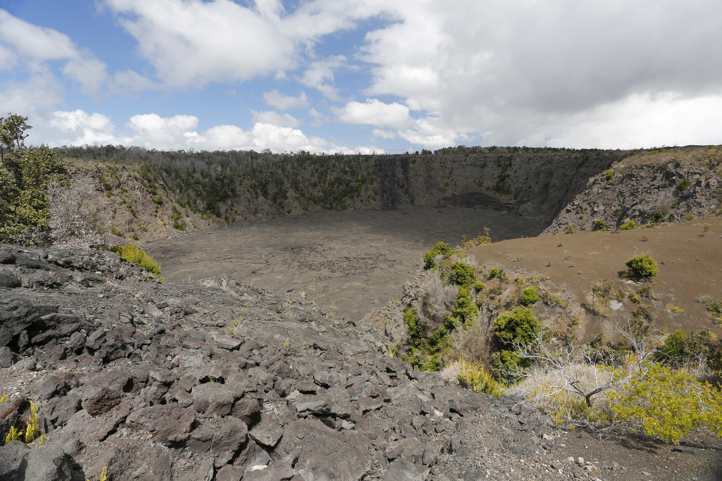
Keanakākoʻi, meaning "cave of the adzes", likely formed during the 1400s, during the great summit collapses of Kīlauea. Until 1877, Hawaiian kahuna kākoʻi (carving experts) sought the crater's superior and rare basaltic rock for making koʻi, or adze heads. Bound to a sturdy ʻau koʻi (wooden handle), this valuable tool was used to carve vital objects like canoes and houses. But the famous adze quarry was covered by lava, first in 1877, and again during the fissure eruption in July 1974. Today, the crater floor is 115 feet deep.
The park closed portions of Crater Rim Drive for public safety after Halemaʻumaʻu began to erupt in March 2008. During the summit collapses of 2018, the road was damaged further. A portion of Old Crater Rim Drive is now open to foot and bicycle traffic to a point just beyond Keanakākoʻi.
To hike the portion of Old Crater Rim Drive to Keanakākoʻi Crater:
Difficulty: Easy
Distance and hiking time: 1 mile (1.6 km) one way, 2 miles (3.2 km) roundtrip. Estimated time is 1 - 1 1/2 hours.
Trailhead: Park at the Devastation Trailhead parking lot. Trail begins near the parking lot exit on Crater Rim Drive.
Bring: Water, hat, sun protection & raingear. Be prepared for hot, dry, wet, and windy weather conditions.
Kūpinaʻi Pali (Waldron Ledge) the Park Service's write-up
45-60 Minutes · no dogs
Start Trailhead to the east of Volcano House
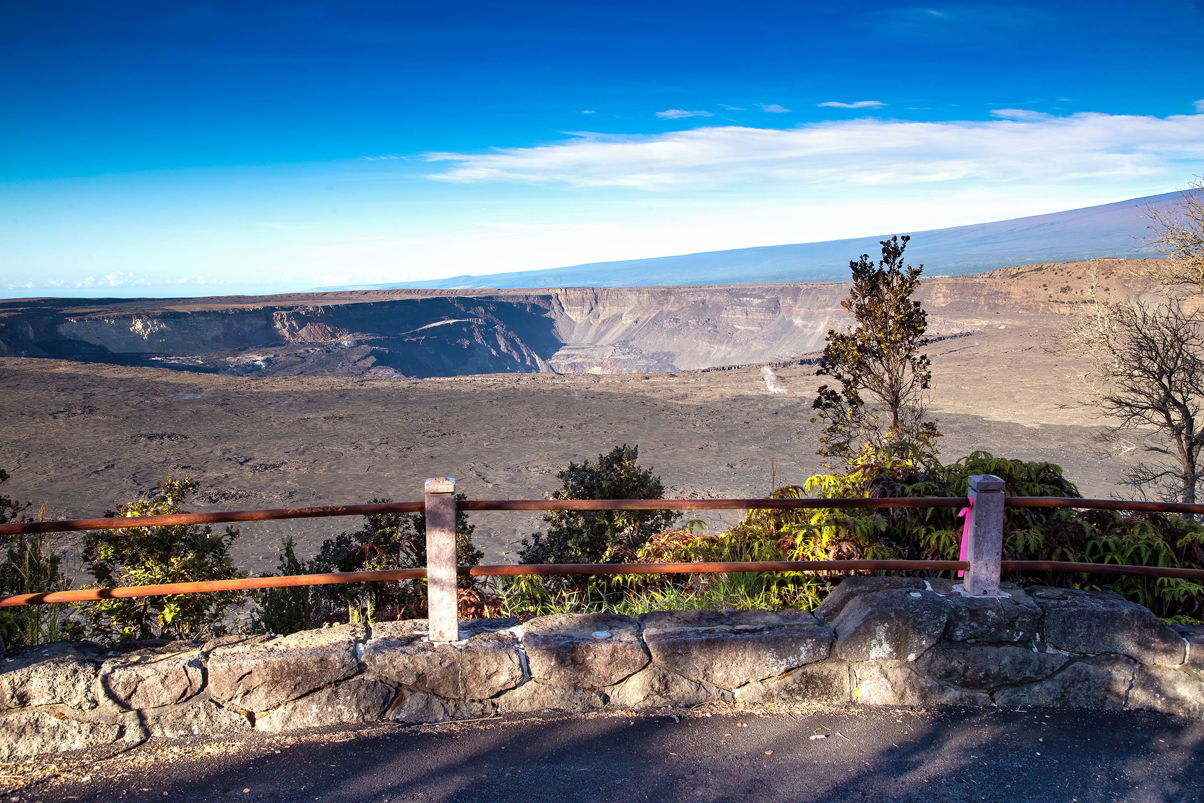
The Kūpinaʻi Pali (Waldron Ledge) portion of Crater Rim Trail is a gentle walk through history, leading to a panoramic view of Kaluapele (Kīlauea caldera) and Halemaʻumaʻu crater, which dramatically collapsed in 2018.
At one point in time, this stretch of trail was part of Crater Rim Drive, the road that encircled the summit caldera. However, on November 16th, 1983, a magnitude 6.7 earthquake struck the island, decimating parts of the road. Large chunks collapsed and deep cracks developed, rendering it impassable. As part of repairs from the seismic event, the road was re-routed to its current path and the portions left behind were converted to the trail you see today. Look for the painted road lines on the trail, a reminder of its history. Locally, this area may still sometimes be referred to as "Earthquake Trail."
Difficulty: Easy - wheelchair accessible.
Distance & hiking time: About one mile (1.6 km) round-trip to the overlook, approximately 45 minutes - 1 hour.
Trail begins: Across the street from Kīlauea Visitor Center, to the left of the Volcano House.
Stroller friendly - trail is over a paved road surface.
This section of trail includes some cracked and tilted sections. The first small overlook past the Volcano House on the right has a very steep descent, but the larger overlook is wheelchair accessible.
Accessibility Wheelchair and stroller accessible, though some sections of trail have a steep grade and may have cracks. The first small overlook past the Volcano House on the right has a very steep descent, but the larger overlook is wheelchair accessible.
Devastation Trail
Devastation Trail the Park Service's write-up
30-60 Minutes · no dogs
Start Puʻupuaʻi or Devastation Trailhead
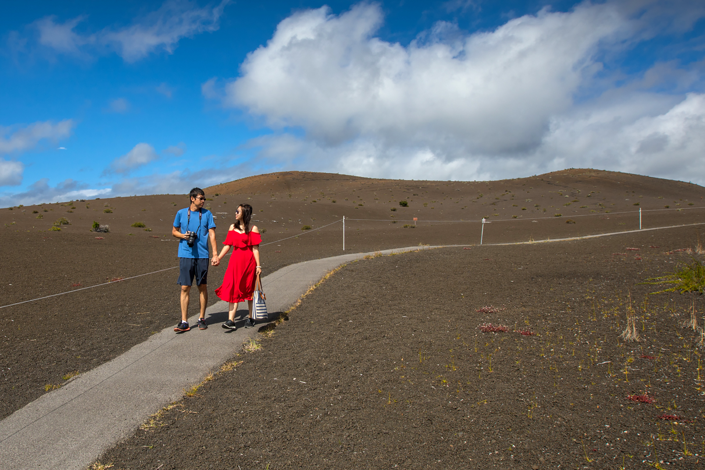
Stroll on a paved path through a starkly beautiful recovering landscape that was buried by falling cinder from the spectacular lava fountains of the 1959 Kīlauea Iki eruption. Witness life returning to this once devastated area.
Difficulty: Easy - Wheelchair and stroller accessible, though there are sections of this paved trail that have grades greater than eight percent (8%).
Distance and hiking time: 1 mile (1.6km) round trip, approximately 1.0 hour.
Trail begins: Either at the Pu'upua'i parking lot or the Devastation Trail parking lot, both off of Crater Rim Drive.
Stay on the paved trail. Do not climb the Pu‘upua‘i cinder cone.
Bring: Water, hat, sunscreen and rain gear. Be prepared for hot, dry, wet, windy weather conditions.
The threatened and federally protected nēnē (Hawaiian geese) frequent this area. Please use caution when parking. Don't feed the nēnē.
Accessibility Wheelchair and stroller accessible, though there are sections of this paved trail that have grades greater than eight percent (8%).
Escape Road
Fuel Break
Kīpukapuaulu Trail the Park Service's write-up
60-90 Minutes · no dogs
Start Kipukapuaulu Trailhead

This 1.2 mile (1.9km) loop trail reveals a story of struggle and survival for some of the rarest plants and animals in Hawaiʻi.
The walk will take you through a " kīpuka ", an area of older vegetation surrounded by a more recent lava flow from Mauna Loa.
Difficulty: Easy
Distance and hiking time: 1.2 mile (1.9km) loop, 1.0 - 1.5 hours.
Trailhead: Kīpukapuaulu, located approximately 5.0 miles (8.0km). South on Highway 11, turn right on Mauna Loa Road and travel 1.5 miles (2.4km) to the Kīpukapuaulu parking area.
The trail is a dirt path with gentle inclines and declines. Note: dogs, horses and bicycles are prohibited on this trail.
Bring: Water, hat, sunscreen and rain gear. Be prepared for sometimes hot, wet or windy weather conditions.
Restrooms (pit toilets) are available nearby at the picnic area.
Kīpukapuaulu Trail Guide (pdf 6.18MB)
Accessibility The trail is a narrow dirt path with gentle inclines and declines. Note: dogs, horses and bicycles are prohibited on this trail.
Halape Trail
Halapē Trail
Halemaumau Trail
Hiking Trail
Hilina Pali Trail
Ka'aha Trail
Kahuku Glover Trail
Visit Kahuku: Glover Trail the Park Service's write-up
3-5 Hours · no dogs
Start Upper Paddocks Above the Rapid ʻŌhiʻa Death (ROD) Quarantine Gate
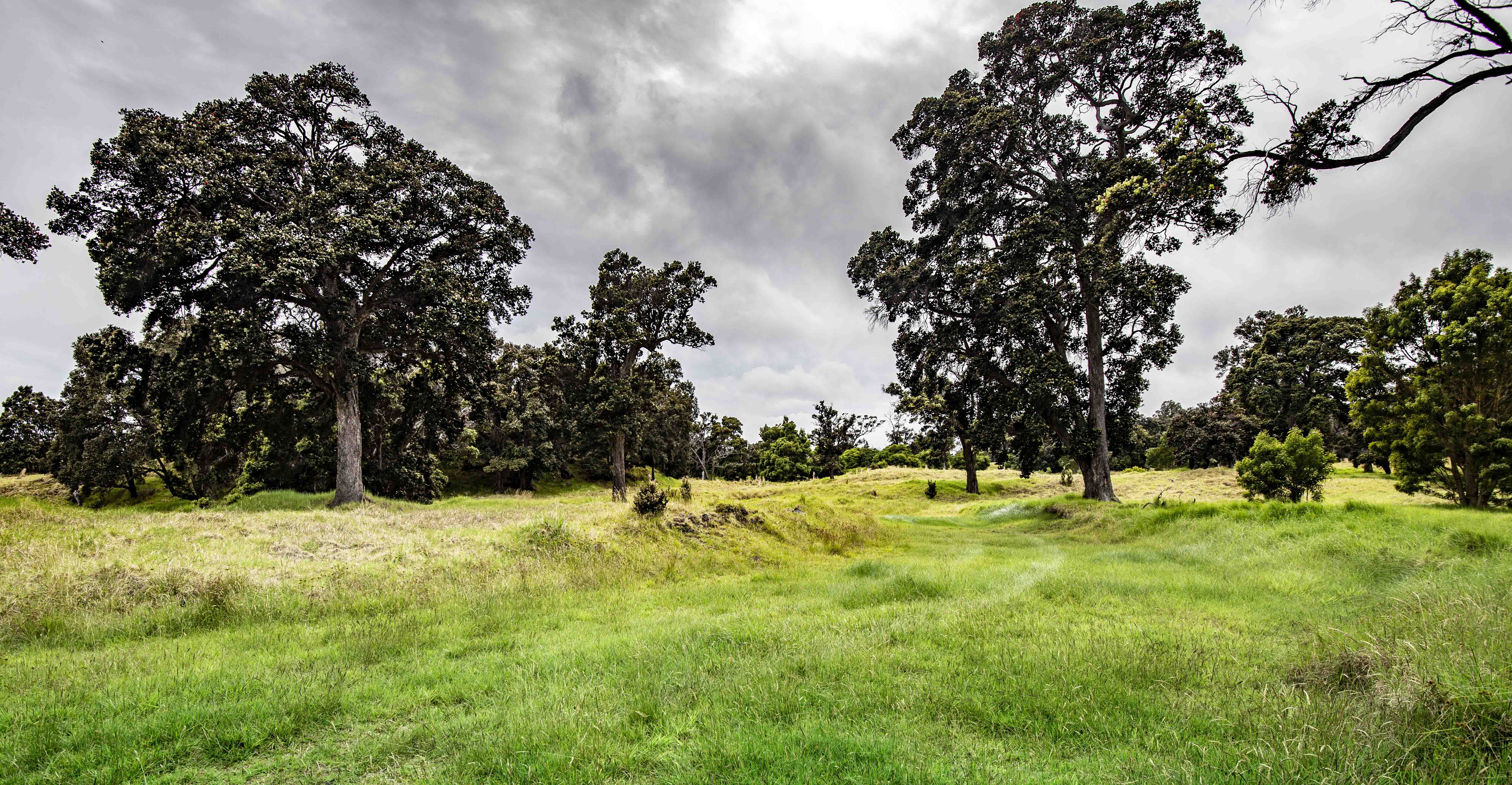
This part of Kahuku was once a vast wilderness, thick with vines and towering trees. At the beginning of the ranching era, forests were cleared and replaced with grass for herds of cattle. This hike takes you through scenic pastureland and culminates on the edge of a huge pit crater that provides a glimpse into the past. The crater shelters a pristine Hawaiian rainforest protected by its sheer walls.
Trailhead : ROD Quarantine Gate. Hikers need to account for the 1.2-mile (1.9 km) one-way walk from the ROD Quarantine Gate to the Glover trailhead.
Distance : 3.2-mile (5 km) loop with a 320-foot (98 m) elevation change. Add in the 2.4 miles (3.8 km) to and from the trail head for a total of 5.6 miles (8.8 km) round trip.
Difficulty : Strenuous
Duration: 3 - 5 hours
Bring : Water, snacks, sturdy footwear, and be prepared for sun, rain, heat or cold.
You must spray the soles of your shoes with rubbing alcohol (provided) at the ROD (Rapid ʻŌhiʻa Death) decontamination station.
Accessibility Trail is on uneven grassy terrain, with significant elevation gain.
Visit Kahuku: Kona Trail the Park Service's write-up
3-5 Hours · no dogs
Start Upper Paddocks Above the Rapid ʻŌhiʻa Death (ROD) Quarantine Gate
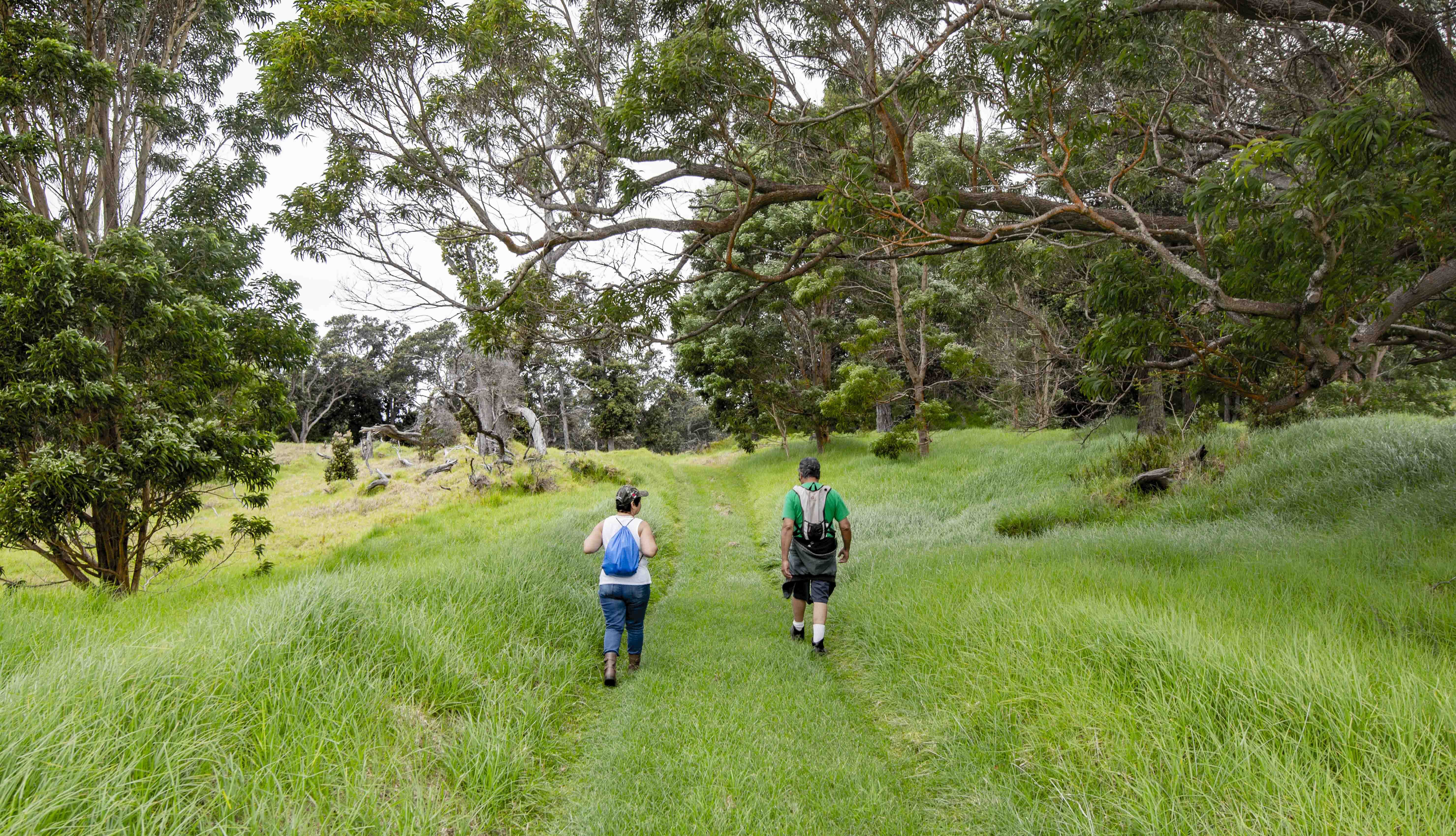
A day hike on the Kona Trail takes you through scenic pasturelands scattered with large ʻōhiʻa trees and other vegetation. The trail also traverses the 1887 lava flow from Mauna Loa where lava flows reached the ocean in less than a day. Relics of Kahuku’s ranching era, pasture land and the 1887 lava flow define this trek.
Trailhead : ROD Quarantine Gate. Hikers need to account for the 1.2-mile (1.9 km) one-way walk from the ROD Quarantine Gate to the Kona trailhead.
Distance : 4.6-mile (7.3 km) loop with 520-foot (158 m) elevation change. Add in the 2.4 miles (3.8 km) to and from the trail head for a total of 7 miles (11.1 km) round trip.
Difficulty : Strenuous
Duration: 3 - 5 hours
Bring : Water, snacks, sturdy footwear, and be prepared for sun, rain, heat or cold.
You must spray the soles of your shoes with rubbing alcohol (provided) at the ROD (Rapid ʻŌhiʻa Death) decontamination station.
Accessibility Trail is on uneven grassy terrain, with significant elevation gain.
Kahuku Kona Trail
Kahuku Palm Trail
Visit Kahuku: Forested Pit Crater the Park Service's write-up
3-6 Hours · no dogs
Start Pali o Kaʻeo Trailhead
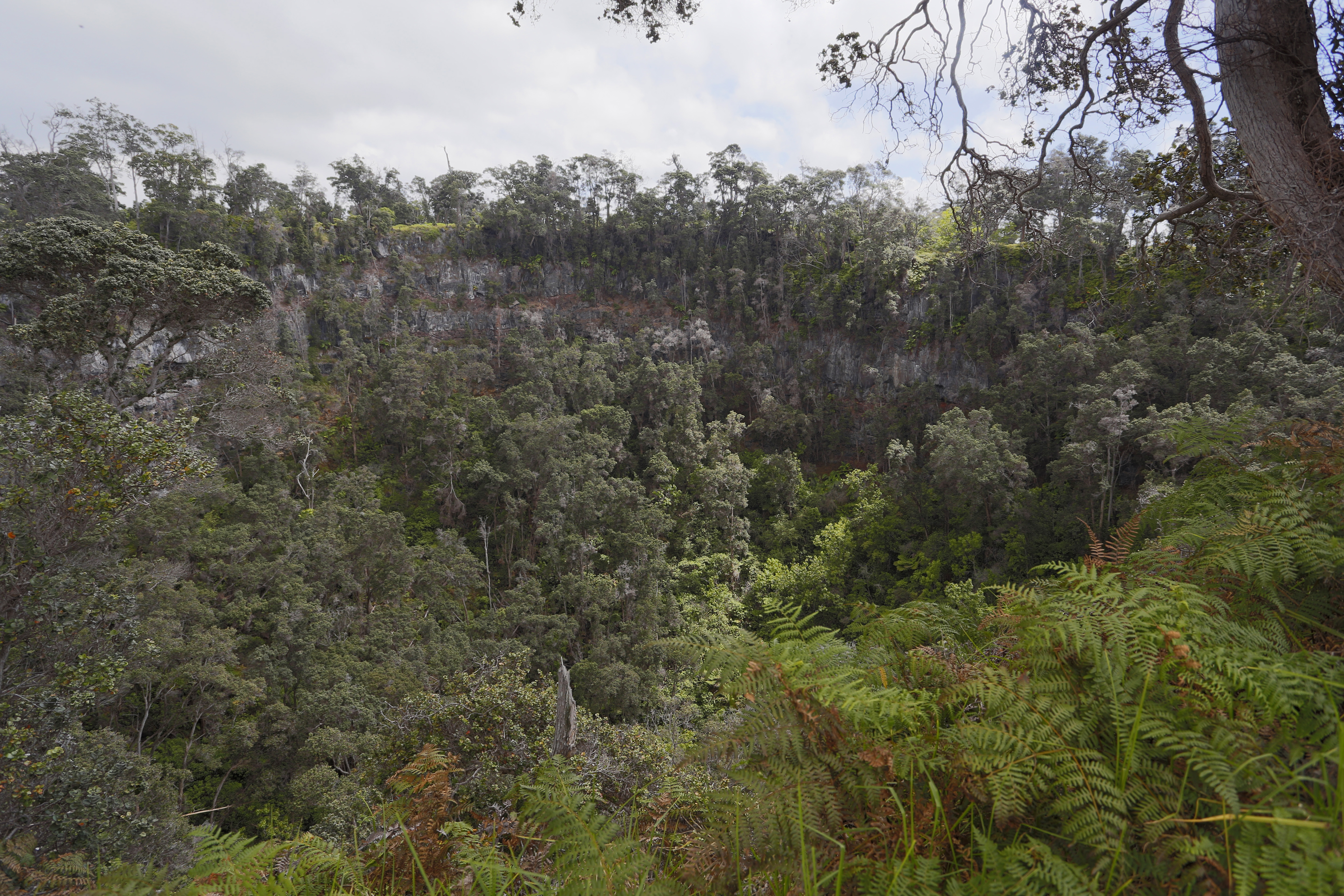
No matter which trailhead you start from, this is a steep, strenuous hike in the Kahuku Unit. Walk though brilliant green pasture-land, past magnificent koa and ʻōhiʻa lehua trees, to the edge of a huge collapsed crater . The 250-foot (76 m) vertical walls have protected the unspoiled native rain forest within from cattle, pigs and people. With an astonishing array of Hawaiian species, many rare and endangered, this magical place affords us a glimpse into the distant past, before human-caused transformation that affected the surrounding ranch land. For your safety, stay away from the pit crater edge.
Trailheads: Begin and end at the Pit Crater Trailhead or at the Pali o Kaʻeo Trailhead
Distance: Round trip from Pit Crater Trailhead to the pit crater: 4.8 miles (7.8 km). Very steep start from this trailhead.
For a less rigorous, more scenic start to the hike, begin at the Pali o Kaʻeo Trailhead. Add 2.4 miles (3.9 km) to the above figures.
Difficulty: Strenuous
Elevation change: 1,165 feet (335 m) from Pit Crater Trailhead
Duration : 3-hour minimum
Bring: Water, snacks, wear sturdy footwear, and be prepared for sun, rain, heat or cold!
You must spray the soles of your shoes with rubbing alcohol (provided) at the ROD (Rapid ʻŌhiʻa Death) decontamination station
Accessibility Trail is on uneven grassy terrain, with significant elevation gain
Kahuku Road (Pedestrian Access)
Kaʻū Desert Trail
Trailhead Kau Desert 3,045 ft Drive there
Footprints Area the Park Service's write-up
1-2 Hours · no dogs
Start Kaʻū Desert Trailhead
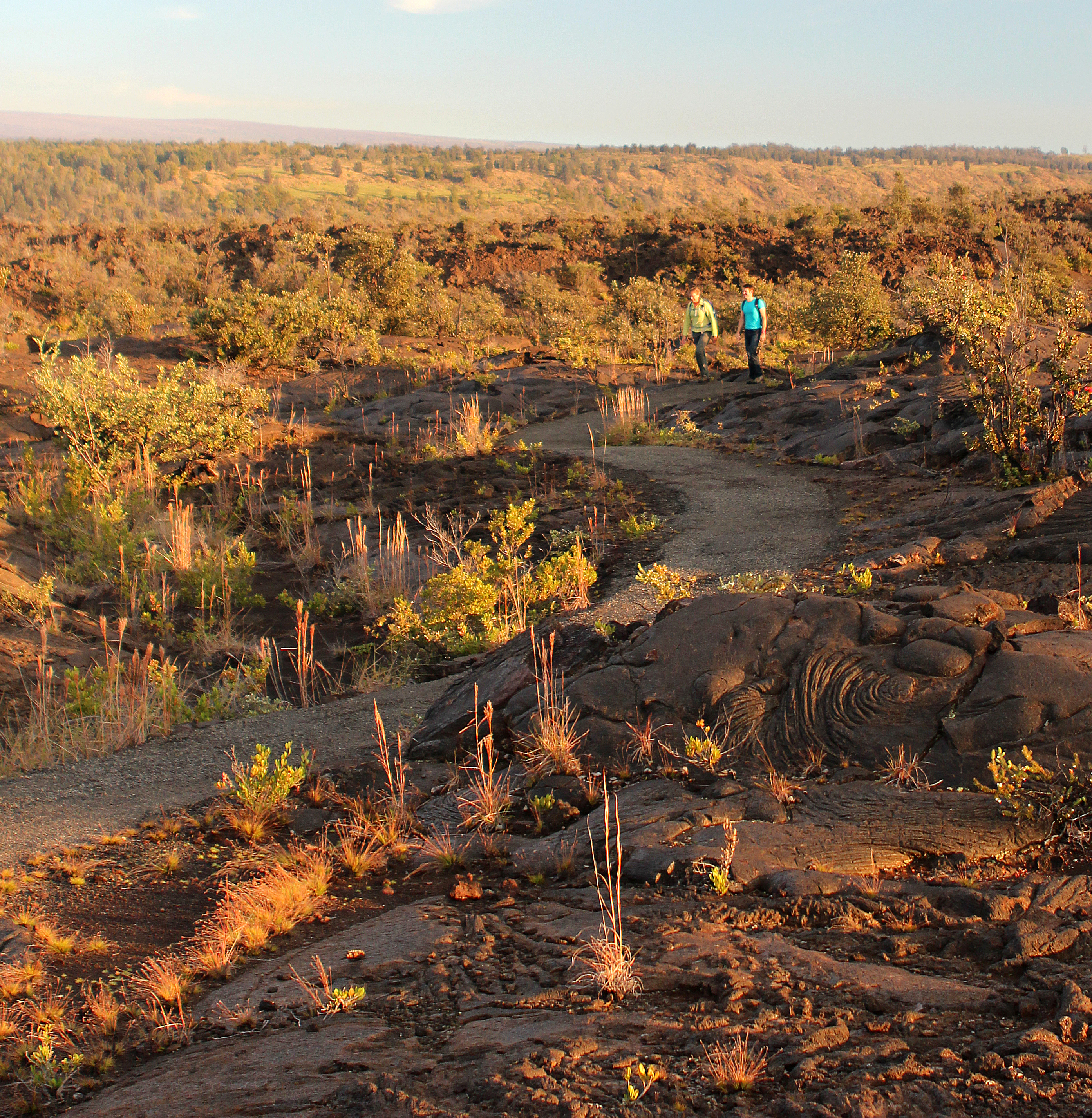
In 1790, a dramatic explosion occured at the summit of Kīlauea. The eruption involved a torrent of hot gas, ash, and sand that rained down on the Kaʻū Desert. Caught in the middle of this deadly, suffocating storm were groups of Native Hawaiians travelling through the region on long-used trails. In the newly fallen layer of ash, these groups left behind footprints that we can still see today— a reminder that Hawaiians have beared witness to the geological drama of this island for centuries.
A shelter with an exhibit about these footprints is accessible via an easy walk about .8 miles (1.3 km) from the Kaʻū Desert Trailhead on Highway 11.
Read more about the story of the Footprints area
Trailhead: the Kaʻū Desert Trailhead on Highway 11
Difficulty: Easy walk between the Kaʻū Desert Trailhead on Highway 11 and the Footprints shelter
Distance: .8 mi (1.3 km) from the Kaʻū Desert Trailhead to Footprints shelter
Bring water, food, hat, sun protection and rain gear.
Accessibility Sections of trail are paved, but with steep inclines and occasional deep sand and uneven surfaces.
Kalapana Emergency Access Road
Kalapana Trail
Kalapana Trail (unmaintained)
Kamakapaʻa Trail
Visit Kahuku: Kamakapaʻa Trail the Park Service's write-up
20-30 Minutes · no dogs
Start Kamakapaʻa Trailhead
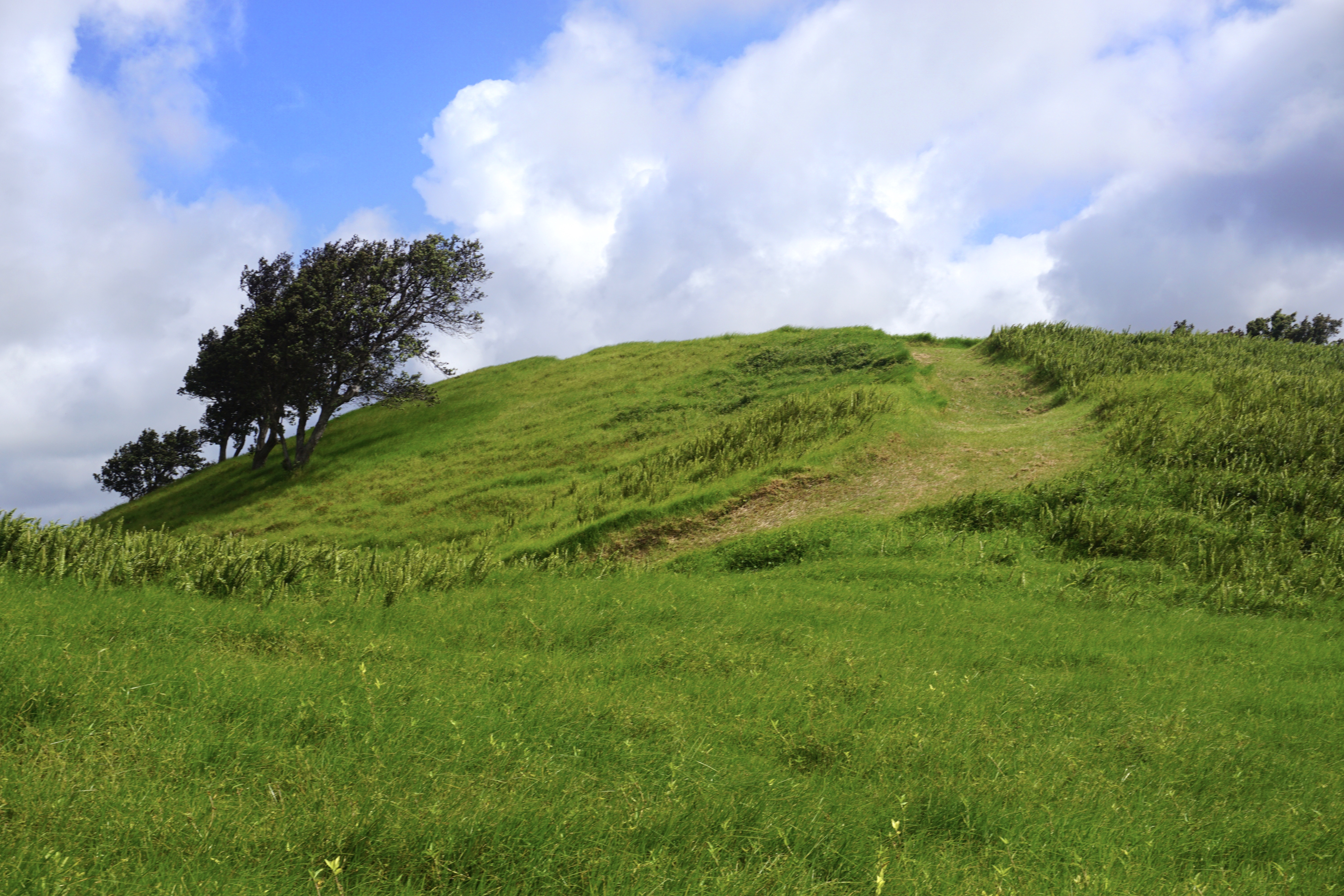
Follow this easy trail in the Kahuku Unit through grassy meadows to the top of a small cinder cone. Sweeping views from the top take in the full breadth of lower Ka‘ū.
Trailhead : Kamakapaʻa Trailhead
Distance: 0.5 mi (0.8 km) roundtrip
Difficulty : Easy
Elevation Change: 40 feet (12 m) from trailhead
Duration: 20-30 min
Accessibility Uneven trail through a grassy area with a steep gain in elevation
Kau Desert Trail
Keauhou Trail
Kilauea Iki Spur
Kilauea Iki Trail
Kīlauea Iki Trail the Park Service's write-up
2-4 Hours · no dogs
Start Several trailheads in the Kīlauea summit area
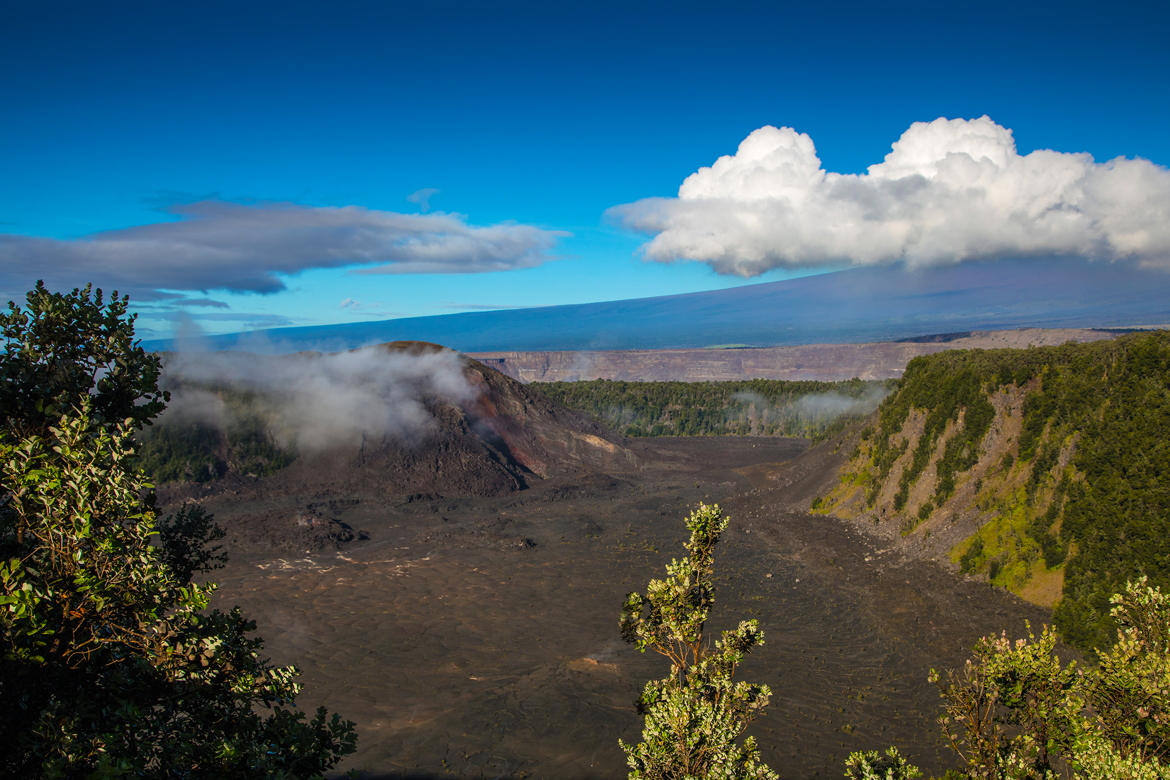
Descend through a lush rainforest to the solidified lava lake on the floor of Kīlauea Iki crater. Peer into the vent that erupted to a height of 1900 feet during the eruption of 1959 located below Puʻupua‘i cinder cone.
Difficulty: Moderate to challenging - Steep and rocky, descent & ascent 400 feet (122 m).
Parking : Parking at Kīlauea Iki Overlook is extremely limited. During peak hours, there may be no parking available. If you are interested in a longer hike, you are strongly encouraged to begin your hike at Kīlauea Visitor Center, Devastation Trailhead, or Puʻupuaʻi Parking Area.
Distance and hiking time:
From Kīlauea Iki Overlook : 3.3 mile (5.3 km) loop. Plan for approximately 2 to 3 hours. Note: parking is extremely limited.
From Kīlauea Visitor Center: 5.3 miles (8.5 km) round-trip "cherry stem" and loop. Plan for approximately 3 to 4 hours. Take Crater Rim Trail towards Kūpinaʻi Pali (Waldron Ledge) from Kīlauea Visitor Center to access Kīlauea Iki Trail loop. Connections from the Halemaʻumaʻu Trail near the visitor center are also possible.
From Devastation Trailhead: 6.0 mi (9.7 km) round-trip. Plan for 4 to 5 hours. Parking at Devastation Trailhead allows for a more scenic experience, letting you explore Uēaloha (Byron Ledge), the Kīlauea Iki loop, and Nāhuku Lava Tube all in one hike. Consider adding the 0.5 mile (0.8 km) Devastation Trail to the hike by parking at Puʻupuaʻi.
Bring: Water, food, hat, sunscreen and rain gear. Be prepared for hot, dry, wet, windy weather conditions and steep and rocky terrain.
Safety: Hiking on flow fields can be hazardous due to deep earth cracks, uneven and unstable terrain, and razor-sharp lava.
Download the Kīlauea Iki Trail Guide (pdf 921KB)
Accessibility Moderate to challenging trail. Steep and rocky with a 400' descent and ascent.
Kilauea Military Camp Spur
Kipukapuaulu
Trailhead Kīpukapuaulu 3,929 ft Drive there
Mauna Iki Trail
Mauna Loa Cabin Trail
Mauna Loa Trail
Visit Kahuku: Palm Trail the Park Service's write-up
1-2 Hours · no dogs
Start Lower Palm Trailhead
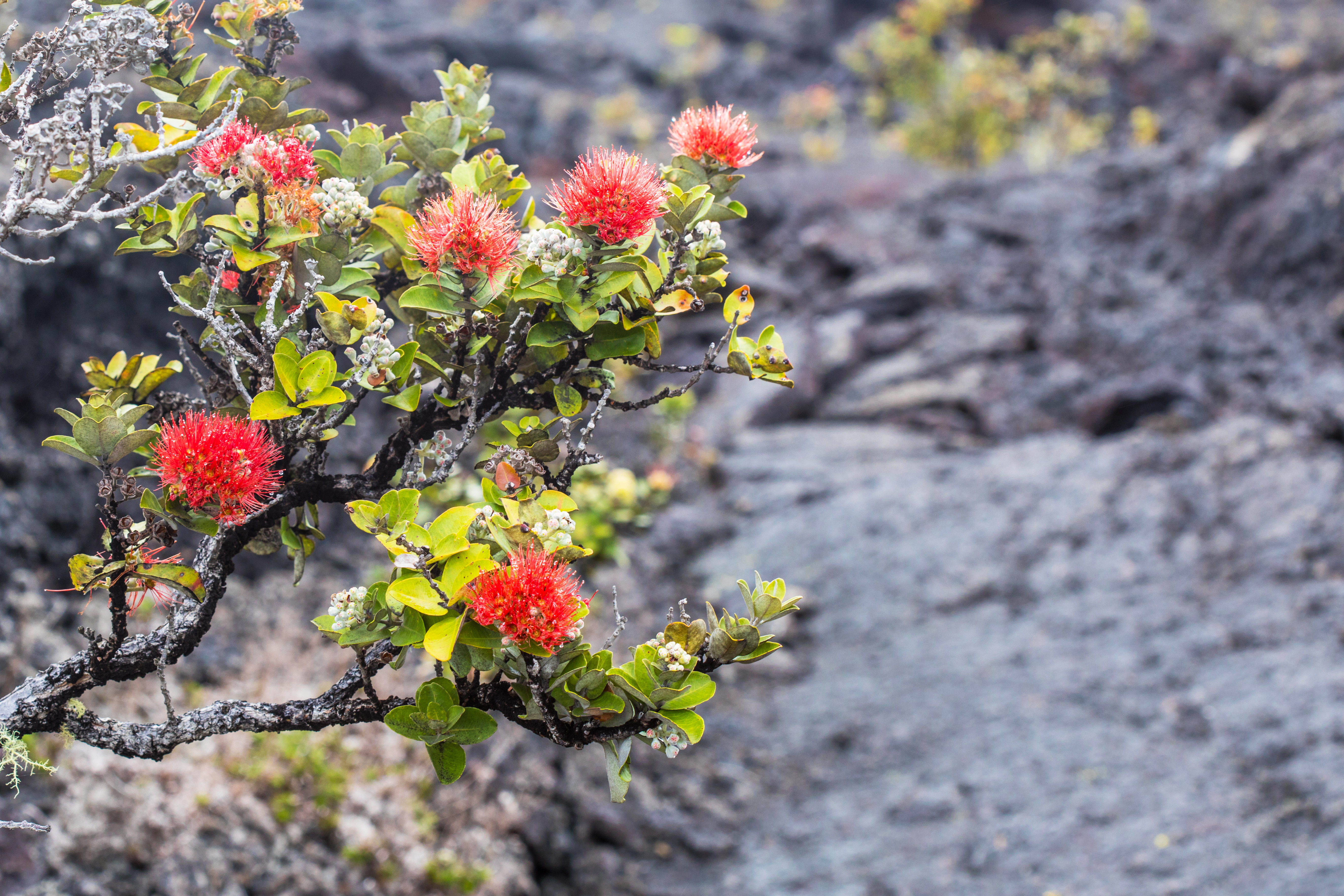
Hike or ride your bike through scenic pastures and along the eruption fissure from the devastating 1868 eruption of Mauna Loa .
Trailhead: Begin at the Lower Palm Trailhead and hike up the trail. Once you arrive at the upper trailhead, follow the road downhill to your vehicle.
Distance and hiking time: 2.6 mile (4.2 km) loop, 1-2 hours.
Difficulty: moderate
Bring: Water, snacks, wear sturdy footwear, and be prepared for sun, rain, heat or cold
Safety: Hiking on flow fields can be hazardous due to deep earth cracks, uneven and unstable terrain, and razor-sharp lava.
Accessibility Trail is on uneven rock and grass, with significant hills and slope
Nāhuku Trail
Halemaʻumaʻu Trail the Park Service's write-up
1-2 Hours · no dogs
Start Halemaʻumaʻu Trailhead along Crater Rim Trail
Descend 425 feet (130m) through a rain forest that has been re-established numerous times to a panoramic view on the floor of Kaluapele (Kīlauea caldera).
Difficulty: Moderate
Distance and hiking time:
0.8 miles (1.3 km) one-way from Crater Rim Trail to the floor of Kīlauea caldera
1.3 miles (2.1 km) one-way from Crater Rim Trail to the top of Byron Ledge, allowing for longer hikes to Kīlauea Iki and Nāhuku (Thurston Lava Tube)
Trail begins: Behind the Volcano House off Crater Rim Trail.
View the Halema‘uma‘u Trail Guide (pdf 2.98MB) .
Accessibility Trail is steep, uneven and occasionally narrow, descending nearly 425 feet (130m).
Nāhuku Lava Tube Trail the Park Service's write-up
30-90 Minutes · no dogs
Start Nāhuku parking area or several trailheads in the Kīlauea summit area
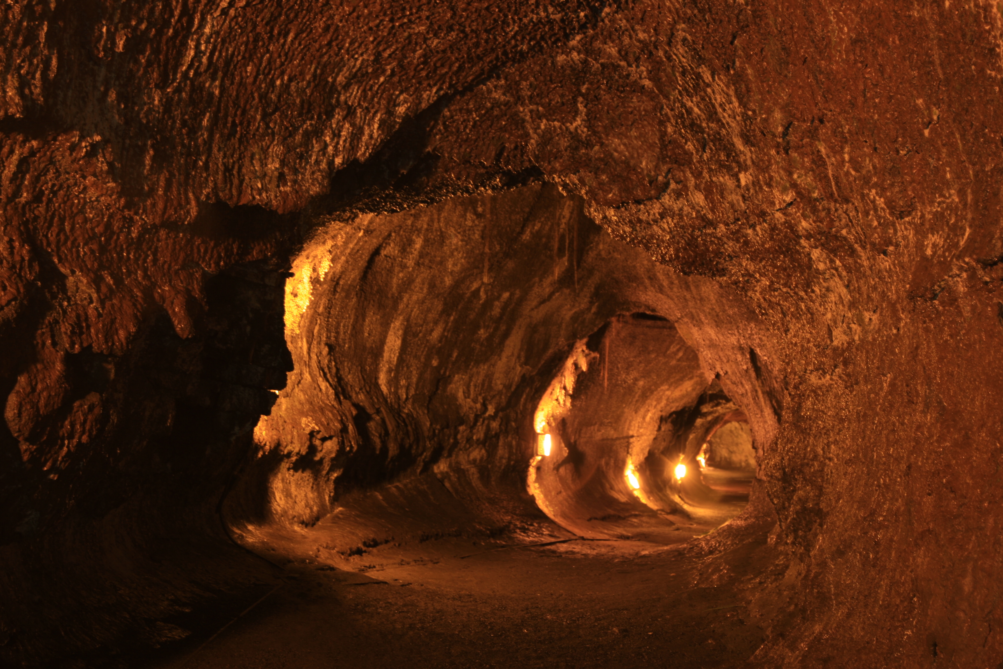
Walk through a verdant rainforest and listen for the calls of native birds before entering a 500-year old lava tube where a river of 2000 degree fahrenheit (1093° celsius) lava once flowed. Its Hawaiian name, Nāhuku, means "the protuberances," which possibly refers to the lava drippings that once hung from the ceiling. Unfortunately, those disappeared due to souvenir collectors after the tube was discovered in 1913. Entire ecosystems of creatures live in these fragile environments found throughout the Island of Hawaiʻi. Please be respectful and do not touch the walls or any hanging roots.
For a longer and more scenic adventure, explore Devastation Trail, Byron Ledge, the Kīlauea Iki loop, and Nāhuku all in one hike by parking at the Devastation Trailhead or Puʻupuaʻi. Parking at the lava tube and Kīlauea Iki Overlook is extremely limited and is likely to be full during peak hours. Want to avoid the crowds? Start your lava tube adventure before 9 a.m. or after 4 p.m.
Trailheads: Kīlauea Iki Overlook, Devastation Trailhead, or Puʻupuaʻi
Difficulty: Moderate
Distance: 1.5 mi (2.4 km) round-trip walk from Kīlauea Iki Overlook, 6.0 mi (9.7 km) round-trip from Devastation Trailhead (including the Kilauea Iki loop), an additional 1.0 mi (1.6 km) from Puʻupuaʻi
Bring: Water, snacks, sturdy footwear, and rain gear
The lava tube is lit 8 a.m. to 8 p.m. Flashlights are recommended outside of those hours.
Help protect this incredible resource by not touching the walls or delicate tree root systems hanging down. Use only your eyes to experience the lava tube.
Enter the lava tube at your own risk. Potential hazards include:
Rockfall
Low ceilings
Standing water
Tripping hazards
Low light or no light - lava tube is lit 8 a.m. to 8 p.m. daily
Accessibility Trail in and out of the lava tube is steep, and often slippery. There are also low ceilings, standing water, and tripping hazards
Nāpau Trail
Maunaulu via Nāpau Trail the Park Service's write-up
1-2 Hours · no dogs
Start Maunaulu Parking Lot
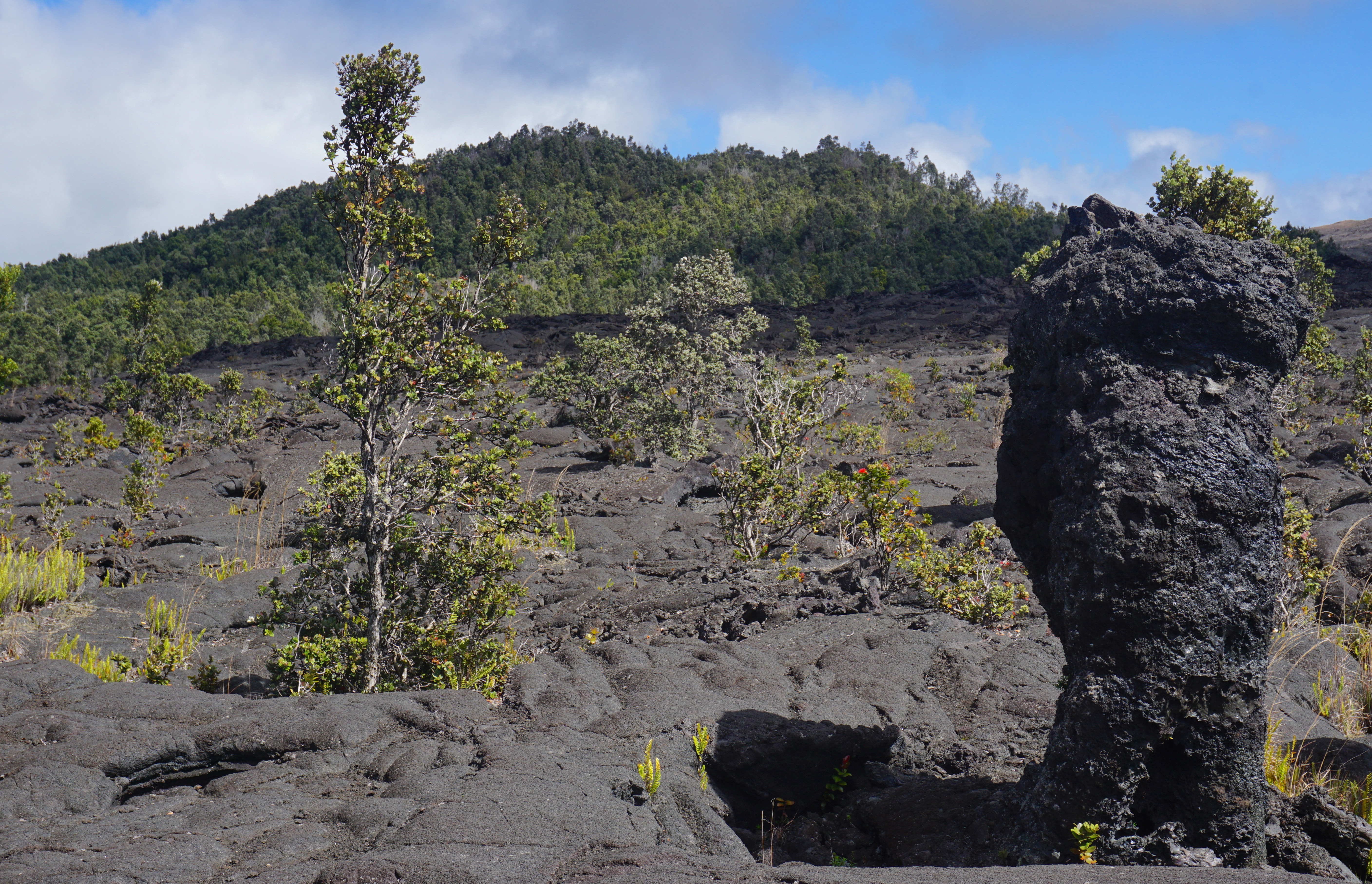
Experience a lava landscape from the 1969-1974 Maunaulu flow . Walk by lava tree molds and climb 210 feet (64 m) to the top of a forested cinder cone, Pu‘uhuluhulu (hairy hill). View the Maunaulu lava shield, which is similar to the now inactive Pu‘uʻō‘ō cone in the far distance. On a clear day you can see Mauna Loa, Mauna Kea and the Pacific Ocean.
Difficulty: Moderate - Most of the route is easy, but includes a 1/4 mile steep climb up Pu‘uhuluhulu cone.
Distance and hiking time: 2.5 miles (4.0km) roundtrip, Approximately 2.0 - 3.0 hours.
Trail Begins: Approximately 100 yards (91.4m) from the Maunaulu parking area. Ahu (stacked rocks) mark the trail across the lava flows. Please do not disturb them or build new ones. Stay on the trail .
Bring water, food, hat, sun protection and rain gear.
Safety: Hiking on flow fields can be hazardous due to deep earth cracks, uneven and unstable terrain, and razor-sharp lava.
Protect delicate lava formations. Surface patterns and lava trees are fragile. Reduce your impact. Please do not touch these formations.
Download the Maunaulu Trail Guide (pdf 2.3MB)
Accessibility Rough and uneven terrain with steep incline up Puʻuhuluhulu cinder cone.
Nāulu Trail
North Pit Trail
Observatory Trail
Old Crater Rim Drive
Pu'u Loa Petroglyphs Trail
Puʻu Huluhulu Trail
Puʻu o Lokuana Trail
Visit Kahuku: Puʻu o Lokuana the Park Service's write-up
30-120 Minutes · no dogs
Start Puʻu o Lokuana Trailhead
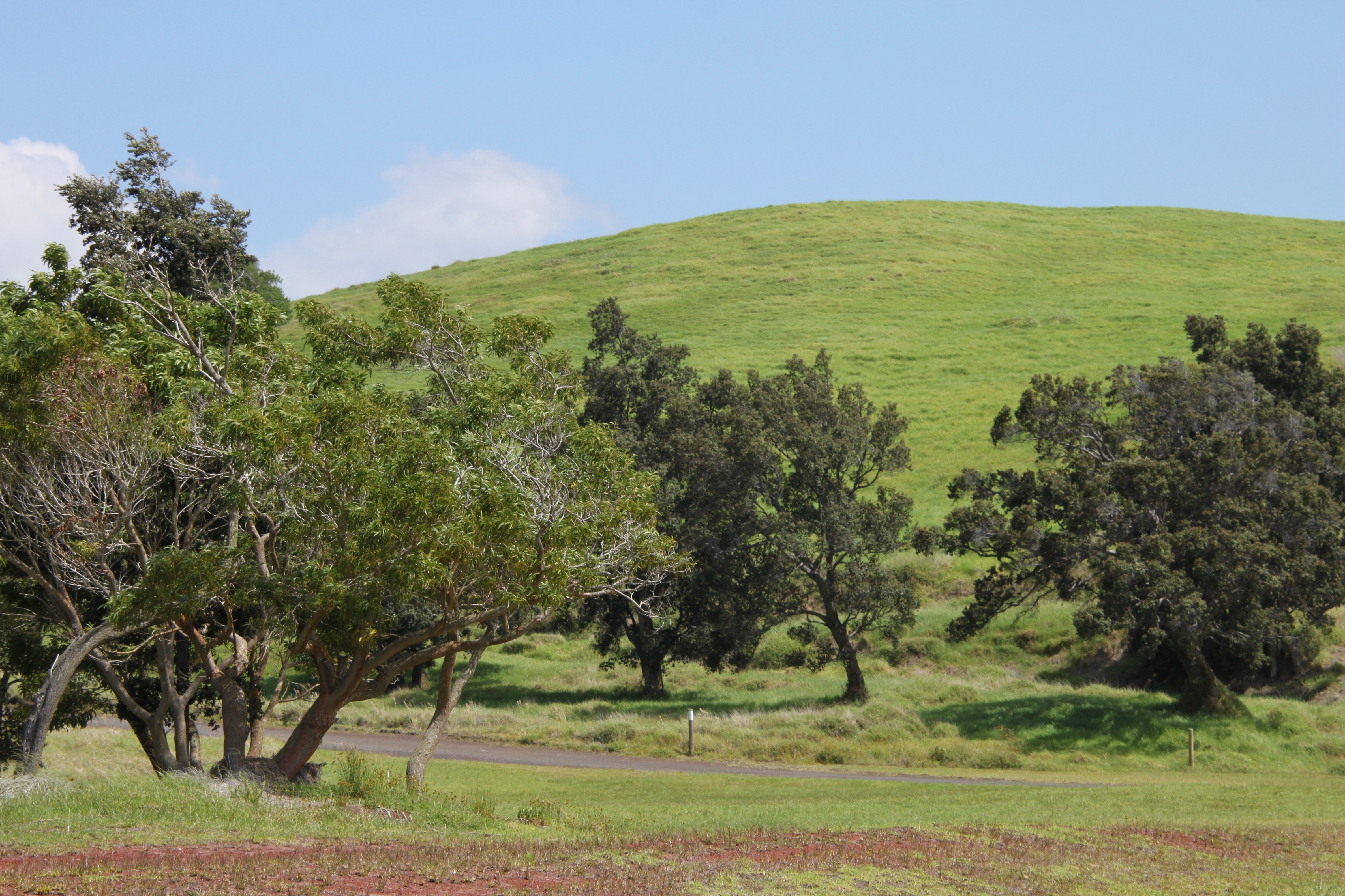
Puʻu o Lokuana in the Kahuku Unit can be hiked in two different ways.
A shorter loop that takes you directly to the top of the iconic Puʻu o Lokuana cinder cone and loops back: this steep trail is appoximately a 130 foot (40 m) elevation change over a short distance. You then can continue along the grassy path into the red heart of Puʻu o Lokuana. Walk through the historic cinder quarry to the top of the hill and enjoy a panoramic view of Kahuku and the Kaʻū coastline.
Trailhead: Trail starts and ends at the base of the cinder cone.
Difficulty: Moderate
Distance: 0.4 mile (0.64 km) loop
Duration: 30-45 minutes. Recommended if you have only a short time for a visit
Or, a longer version that takes you along old ranch roads, through pasture land, across the cataclysmic 1868 lava flow , down an old airstrip, and to the top of cinder cone included above. Walk down the old airstrip and look for tiny green olivine crystals along its length. At the end of the airstrip, cross the road, walk into the red heart of the historic cinder quarry, and then hike to the crest of Puʻu o Lokuana with its breathtaking views of Kahuku.
Trailhead: Trail starts and ends at the base of the cinder cone.
Difficulty: Moderate
Distance: 2-mile (3.2 km) loop, 130 feet (40 m) elevation change.
Duration: 1- 1.5 hours
Bring: water, sturdy footwear, and be prepared for sun, rain, heat or cold
Accessibility Very steep elevation gain and uneven, grassy and rocky terrain
Puʻukaone Trail
Puna Coast Trail
Puʻuloa Petroglyphs Trail the Park Service's write-up
60-90 Minutes · no dogs
Start Puʻuloa Trailhead on Chain of Craters Road
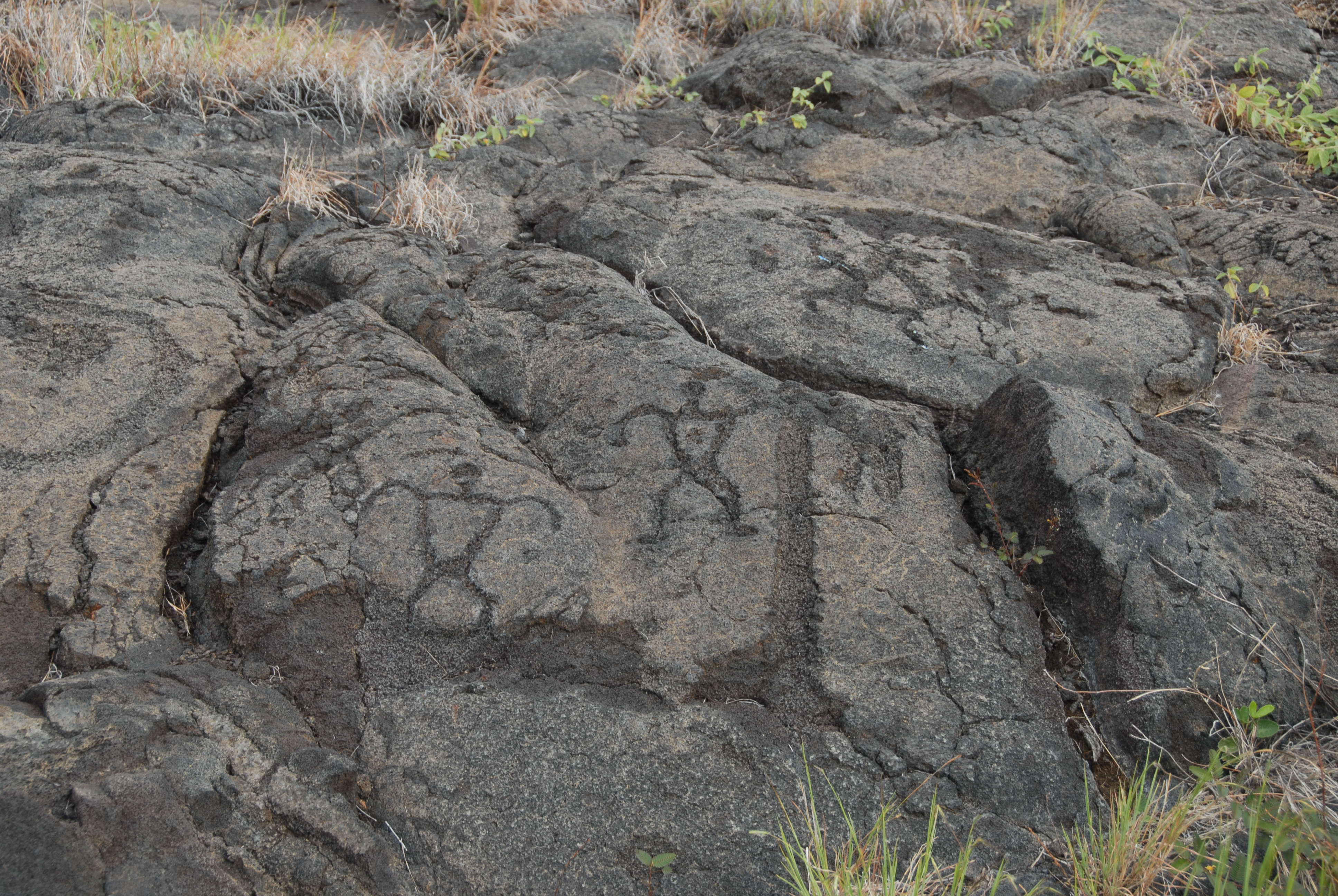
Walk in the footsteps of the kūpuna (elders) to Pu`uloa (hill of long life), a sacred and awe-inspiring gallery of ki`i pōhaku (images carved in stone). These simple etchings document the life and culture of the native Hawaiian people. It brought with hopes of receiving the blessings of a long and prosperous life.
This coastal trail traverses a 500-550 year old lava field to one of Hawai`i's most extensive petroglyph fields. A site that has approximately 23,000 petroglyphs, many viewable at a boardwalk constructed for this purpose
Difficulty: Moderate
Distance and hiking time: 1.4 miles (2.25km) round trip. Approximately 1.0 - 1.5 hours.
Trail begins: Pu'uloa parking area on Chain of Craters Road.
Safety: Hiking on flow fields can be hazardous due to deep earth cracks, uneven and unstable terrain, and razor-sharp lava.
The petroglyphs are very fragile. Stay on the boardwalk. Walking on the lava surface will fragment the delicate petroglyphs and destroy them.
Accessibility Trail is over uneven, solidified lava fields
Puu Ulaula Trail
Research Center Road Trail
Spur
Steam Vents Trail
Sulphur Banks Trail
Haʻakulamanu via Sulphur Banks Trail the Park Service's write-up
30-45 Minutes · no dogs
Start Kīlauea Visitor Center or Steam Vents Parking Lot
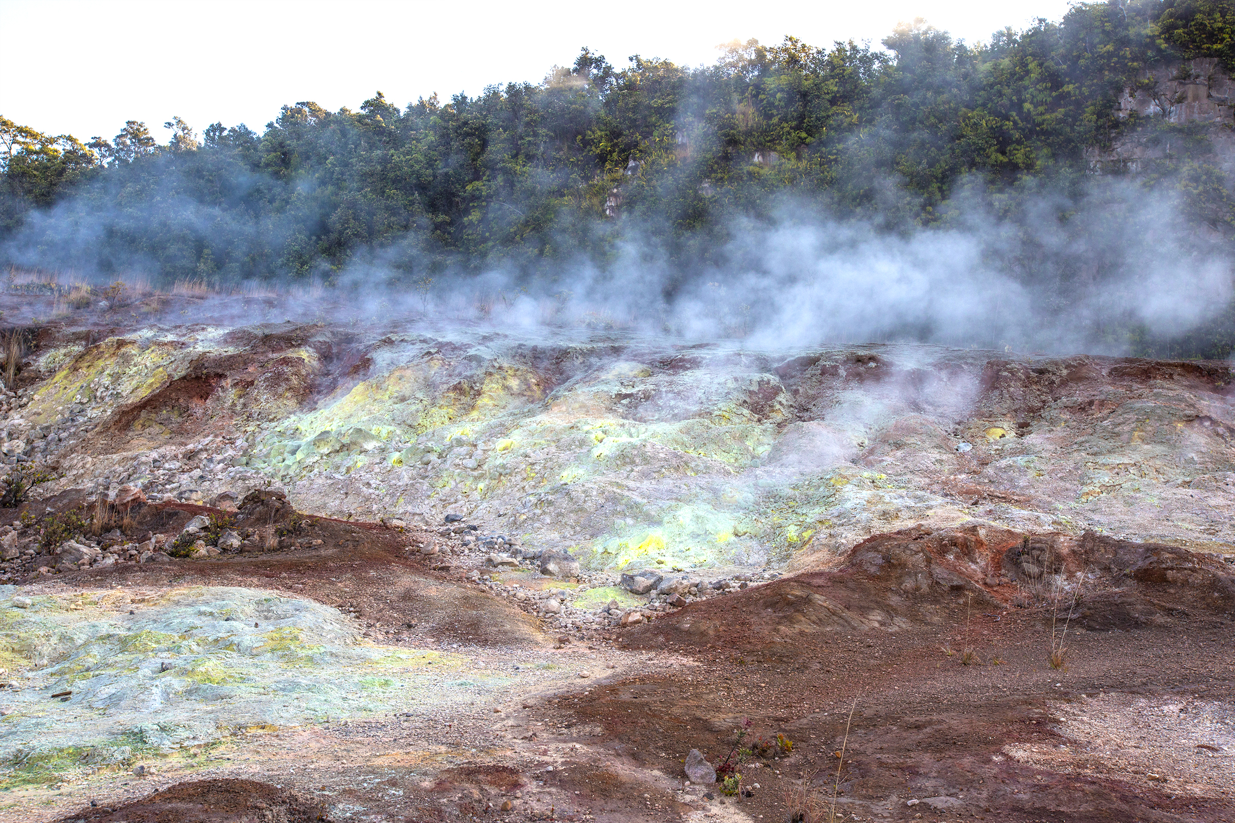
Due to underground heat, this dramatic volcanic thermal area has very few trees. Known as Ha'akulamanu, this unusual place has been famous for birds, colorful deposits, and billowing vapors.
Difficulty: Easy
Distance: 1.2 mile (2 km) round trip from Kīlauea Visitor Center
Trail begins next to Kīlauea Visitor Center parking lot toward the Volcano Art Center Gallery (The other end of the trail, which is wheelchair accessible, can be picked up across the street from the Steam Vents)
At Ha'akulamanu (Sulphur Banks), volcanic gases seep out of the ground along with groundwater steam. These gases are rich in carbon dioxide, sulfur dioxide and hydrogen sulfide -- the gas that smells like rotten eggs. Some sulfur gases deposit pure crystals at Sulphur Banks. Other sulfur gases form sulfuric acid which breaks down the lava to clay. This clay is stained red and brown with iron oxide.
Visitors with heart or respiratory problems (such as asthma), pregnant women, infants, or young children should avoid this walk.
Learn more about the phenomenon of Steam Vents and Sulphur Banks
Accessibility A wheelchair accessible trail to the Sulphur Banks area is located across the street from the Steam Vents parking lot.
Summit Trail
Volcano House Trail
14 more mapped segments without a name are on the map, not in the list.
More hikes the Park Service describes
Write-ups that name no single mapped trail, in the Service's words.
- Hōlei Sea Arch · 20-30 Minutes · no dogs
Walk a short distance to a view of dramatic sea cliffs and a 90-foot high arch sculpted by the sea.
About these trails
The lines are the National Park Service's public trails layer, the trailheads and the waterfalls, views, peaks and historic places along them the Service's public points of interest, read 2026-10-14 and simplified for the map. The write-ups are the Service's own "things to do", unedited. Heights come from USGS 3DEP through Terrain Tiles on AWS (Mapzen/Tilezen), read along each line and rounded; a short trail on steep ground can be off by a few tens of feet. Closures change: check the park's own site before you go.