Hawaiʻi Volcanoes National Park · Hawaii

Byron Ledge Trail

1.6 mi of trail, end to end · Halemaʻumaʻu Trail: 0.8 mi one way in the Service's write-up · about 100 ft of climbing · 250 ft of descent · 3,559 ft–3,771 ft · native surface · trail class Developed · hiking

3,663 ft 3,716 ft · 0.6 mi high 3,771 ft

Halemaʻumaʻu Trail 0.8 mi one way · the Park Service's write-up

1-2 Hours · no dogs

Start Halemaʻumaʻu Trailhead along Crater Rim Trail
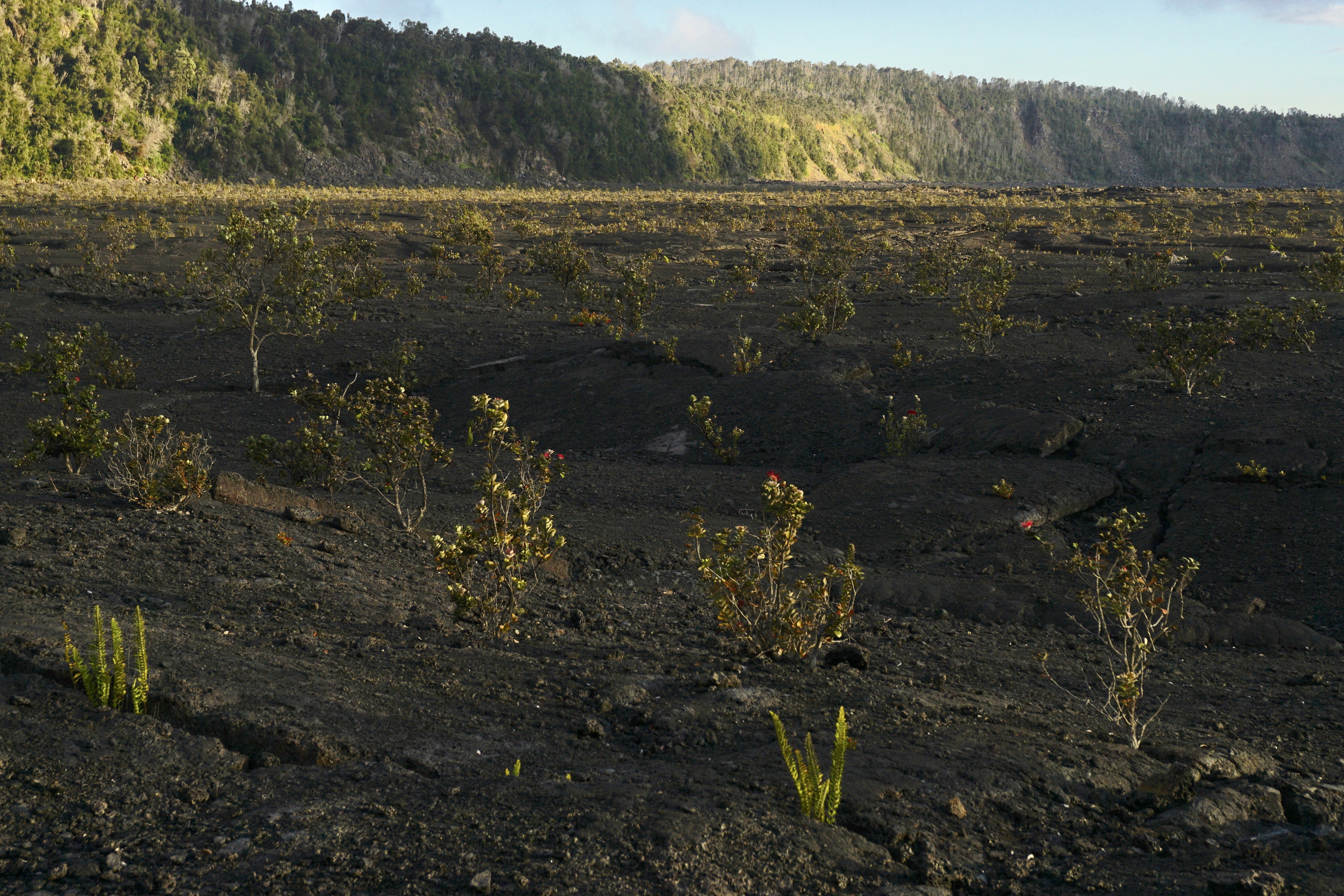
Floor of a volcanic crater with small trees growing out of lava at sunset

Descend 425 feet (130m) through a rain forest that has been re-established numerous times to a panoramic view on the floor of Kaluapele (Kīlauea caldera).

Difficulty: Moderate

Distance and hiking time:

0.8 miles (1.3 km) one-way from Crater Rim Trail to the floor of Kīlauea caldera

1.3 miles (2.1 km) one-way from Crater Rim Trail to the top of Byron Ledge, allowing for longer hikes to Kīlauea Iki and Nāhuku (Thurston Lava Tube)

Trail begins: Behind the Volcano House off Crater Rim Trail.

View the Halema‘uma‘u Trail Guide (pdf 2.98MB) .

Accessibility Trail is steep, uneven and occasionally narrow, descending nearly 425 feet (130m).

This hike on nps.gov

All 50 trails in Hawaiʻi Volcanoes National ParkFind a trailOn the parks mapPark on nps.gov

About this trail's facts

The lines are the National Park Service's public trails layer, the trailheads and the waterfalls, views, peaks and historic places along them the Service's public points of interest, read 2026-10-16 and simplified for the map; the length is the line's, end to end. The write-ups are the Service's own "things to do" text, unedited. Heights come from USGS 3DEP through Terrain Tiles on AWS (Mapzen/Tilezen), read along each line and rounded; a short trail on steep ground can be off by a few tens of feet. Closures change: check the park's own site before you go.