
McKittrick Ridge Trail
ViewsPicnic areas
Along the way The Grotto Picnic Area The Notch
McKittrick Ridge 15.2 mi round trip · the Park Service's write-up
8-12 Hours · no dogs · entrance fee applies
Start McKittrick Ridge
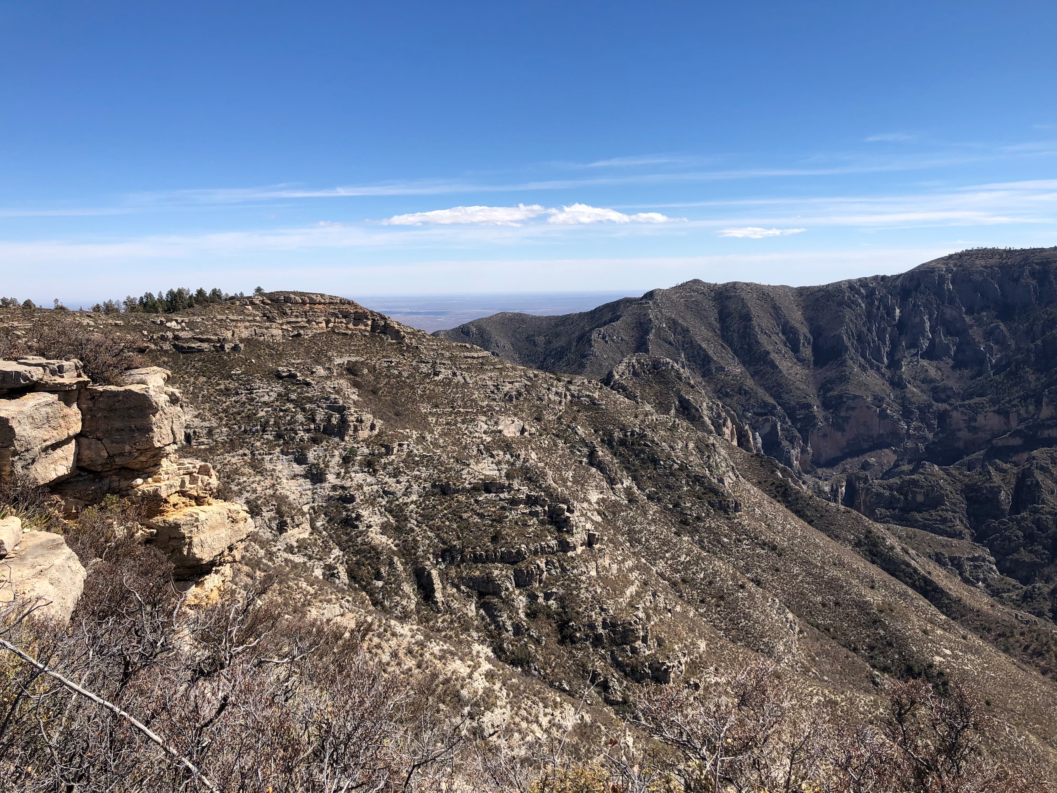
The journey to the top of McKittrick Ridge is "the toughest hike in Texas." This very strenuous hike is best enjoyed as an overnight experience. This route takes you through MicKittrick Canyon up the steepest trail in the park. At the halfway point to the ridge is "The Notch", where there is a spectacular view of the canyon both directions. As you continue, don't be fooled by the false summits that make you think you've nearly reached the top!
This is an extremely rewarding trail, offering both the variety of McKittrick Canyon and the grandeur of the high ridges that surround it. The floor of McKittrick Canyon provides a panoramic experience through the unique environments of the canyon; to protect this special habitat, visitors are asked to stay on the trail and stay ouf of the water.
If you'd like to visit this beautiful ridge without quite the workout, begin instead at Dog Canyon. The trail ascends up to the area of Lost Peak where you pass through many grassy areas that define the northern portion of the park. The trail gradually ascends from the McKittrick Canyon junction to a high point of 7,916 feet before descending along the ridge above South McKittrick Canyon where views are spectacular into the canyon and ridges that border it.
Overnight backpacking is recommended at the McKittrick Ridge Wilderness Campground.
Distance: 15.2 miles (24.5 km) round-trip, out and back starting from the McKittrick Canyon Trailhead. 14.8 miles (23.8 km) round-trip, out and back starting from the Dog Canyon Trailhead.
For more detailed information on trails, check our trail descriptions page.
Elevation Change: 2,700 feet from McKittrick Canyon Trailhead. 1,900 feet from the Dog Canyon Trailhead.
Time Estimate: 4-6 hours to reach the campsites
Difficulty: Strenuous
Duration: Minimum of one day, but two days and one night recommended.
Trailheads: McKittrick Canyon or Dog Canyon Trailheads. The drive between the two trailheads is two hours. No shuttle service runs between the two trailheads.
Pets Pets disturb wildlife and are not allowed on trails. Your pets should remain at home as opportunities for pets are very limited in the park.
Accessibility Trail surfaces are loose rock or hardened rock surfaces. Hiking or trekking poles are highly recommended. Trail widths vary from two to six feet depending on the trail. Parking All trailhead areas have accessible parking available. Service animals Only service animals that have been individually trained to perform specific tasks for the benefit of persons with disabilities are allowed in the park and on trails.
The Notch 9 mi round trip · the Park Service's write-up
5-7 Hours · no dogs · entrance fee applies · season McKittrick Canyon is beautiful all year but is especially well known for fall colors in late October.
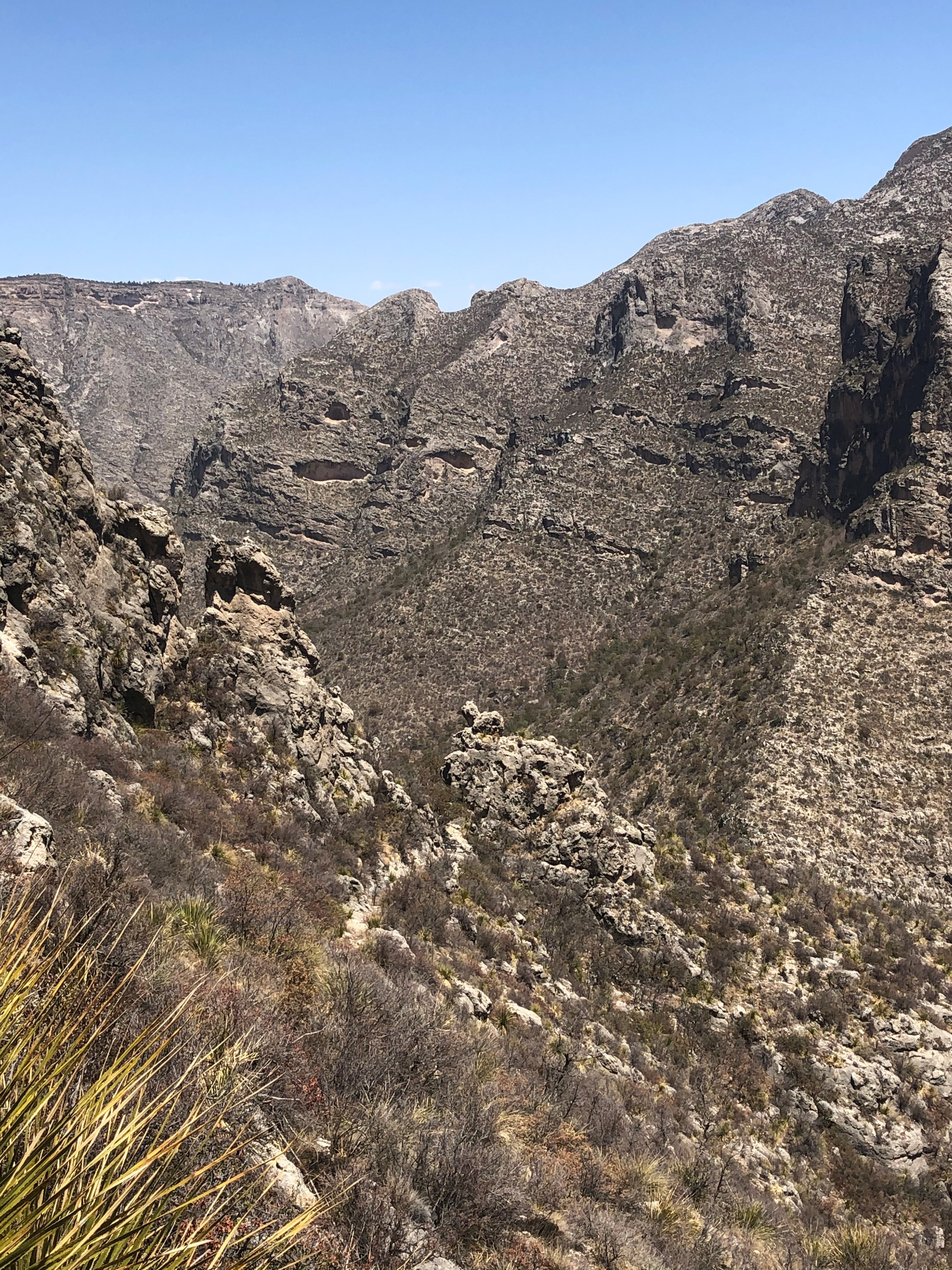
The hike to "the Notch" is a challenging day hike that proceeds through McKittrick Canyon to a dramatic viewpoint about half way up toward McKittrick Ridge. For most hikers this destination makes a dramtic turn-around point for an excellent day hike in McKittrick Canyon.
Distance: 9.0 miles (14.5 km) round-trip, out and back
Elevation Change: 1,092 feet
Time Estimate: 5-7 hours
Difficulty: Difficult, past the Grotto
Pets Pets disturb wildlife and are not allowed on trails. Your pets should remain at home as opportunities for pets are very limited in the park.
Accessibility Trail surfaces are loose rock or hardened rock surfaces. Hiking or trekking poles are highly recommended. Trail widths vary from two to six feet depending on the trail. Parking All trailhead areas have accessible parking available. Service animals Only service animals that have been individually trained to perform specific tasks for the benefit of persons with disabilities are allowed in the park and on trails.