
National Park · Texas
Trails in Guadalupe Mountains National Park
43 named trails · 83 miles · 7 trailheads · 19 with the Park Service's own write-up. The lines, trailheads and points are the Park Service's; the write-ups are the Service's own words; the climbing is read from USGS elevation along each line.
43 trails, A to Z.
Bear Canyon Trail
Hunter Peak the Park Service's write-up
6-8 Hours · no dogs · entrance fee applies
Start Loop hike to the Hunter Peak Summit
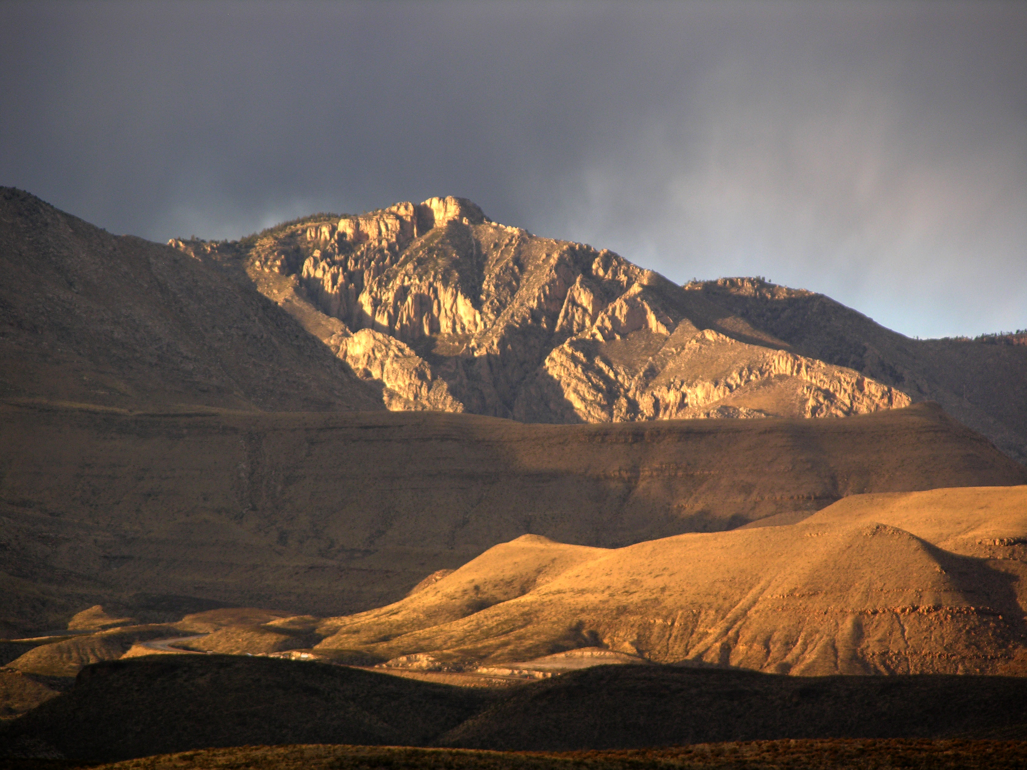
The hike to Hunter Peak is a challenging day hike done as a loop up the Bear Canyon Trail and down the Tejas Trail that provides solitude, stunning views, and opportunities for side trails into the Bowl area.
Distance: 8.7 miles (14.0 km) round-trip, loop
Elevation Change: 2,700 feet
Time Estimate: 6-8 hours
Difficulty: Strenous
Hunter Peak is at an elevation of 8,368 feet above sea level, rising 2,700 feet above Pine Springs. Hunter Peak was named after ranchers J. C. Hunter and J. C. Hunter, Jr., who owned much of the land now included in the park.
The summit of Hunter Peak may have among the best views in the park—half the panorama is of the vast desert to the south, and the remainder is of other mountains and the sheltered pine forest of the Bowl to the north, as well as an unparalleled view across Pine Springs Canyon at Guadalupe Peak.
The hike to the summit involves climbing 2,540 feet, along two trails—either the first 3.6 miles of the Tejas Trail up the side of Pine Spring Canyon, or the Bear Canyon Trail along the next ravine to the east of Hunter Peak. These two routes are linked by the Bowl Trail, from which a short spur leads to the Hunter Peak summit, hence the trip can be done as a loop up one trail and down the other, a total hike of 8.7 miles.
Which Way Up?
While the climb is steep, rangers recommend that hikers ascend Bear Canyon, rather than hike down it. Bear Canyon gains 2,000 feet in just under two miles, while the Tejas Trail takes the twice the distance to climb the same elevation.
Pets Pets disturb wildlife and are not allowed on trails. Your pets should remain at home as opportunities for pets are very limited in the park.
Accessibility Trail surfaces are loose rock or hardened rock surfaces. Hiking or trekking poles are highly recommended. Trail widths vary from two to six feet depending on the trail. Parking All trailhead areas have accessible parking available. Service animals Only service animals that have been individually trained to perform specific tasks for the benefit of persons with disabilities are allowed in the park and on trails.
Blue Ridge
Campgrounds
Along the way Blue Ridge Campground
Blue Ridge Campground Access
Campgrounds
Along the way Blue Ridge Campground
Bowl Trail
Hunter Peak the Park Service's write-up
6-8 Hours · no dogs · entrance fee applies
Start Loop hike to the Hunter Peak Summit
The hike to Hunter Peak is a challenging day hike done as a loop up the Bear Canyon Trail and down the Tejas Trail that provides solitude, stunning views, and opportunities for side trails into the Bowl area.
Distance: 8.7 miles (14.0 km) round-trip, loop
Elevation Change: 2,700 feet
Time Estimate: 6-8 hours
Difficulty: Strenous
Hunter Peak is at an elevation of 8,368 feet above sea level, rising 2,700 feet above Pine Springs. Hunter Peak was named after ranchers J. C. Hunter and J. C. Hunter, Jr., who owned much of the land now included in the park.
The summit of Hunter Peak may have among the best views in the park—half the panorama is of the vast desert to the south, and the remainder is of other mountains and the sheltered pine forest of the Bowl to the north, as well as an unparalleled view across Pine Springs Canyon at Guadalupe Peak.
The hike to the summit involves climbing 2,540 feet, along two trails—either the first 3.6 miles of the Tejas Trail up the side of Pine Spring Canyon, or the Bear Canyon Trail along the next ravine to the east of Hunter Peak. These two routes are linked by the Bowl Trail, from which a short spur leads to the Hunter Peak summit, hence the trip can be done as a loop up one trail and down the other, a total hike of 8.7 miles.
Which Way Up?
While the climb is steep, rangers recommend that hikers ascend Bear Canyon, rather than hike down it. Bear Canyon gains 2,000 feet in just under two miles, while the Tejas Trail takes the twice the distance to climb the same elevation.
Pets Pets disturb wildlife and are not allowed on trails. Your pets should remain at home as opportunities for pets are very limited in the park.
Accessibility Trail surfaces are loose rock or hardened rock surfaces. Hiking or trekking poles are highly recommended. Trail widths vary from two to six feet depending on the trail. Parking All trailhead areas have accessible parking available. Service animals Only service animals that have been individually trained to perform specific tasks for the benefit of persons with disabilities are allowed in the park and on trails.
Bush Mountain Campground Access
Campgrounds
Along the way Bush Mountain Campground
Bush Mountain Trail
PeaksCampgrounds
Along the way Marcus Campground Pine Top Campground Bush Mountain
Marcus Overlook the Park Service's write-up
3-5 Hours · no dogs · entrance fee applies · Winter, Spring, Fall
Start Begin at the Dog Canyon Trailhead
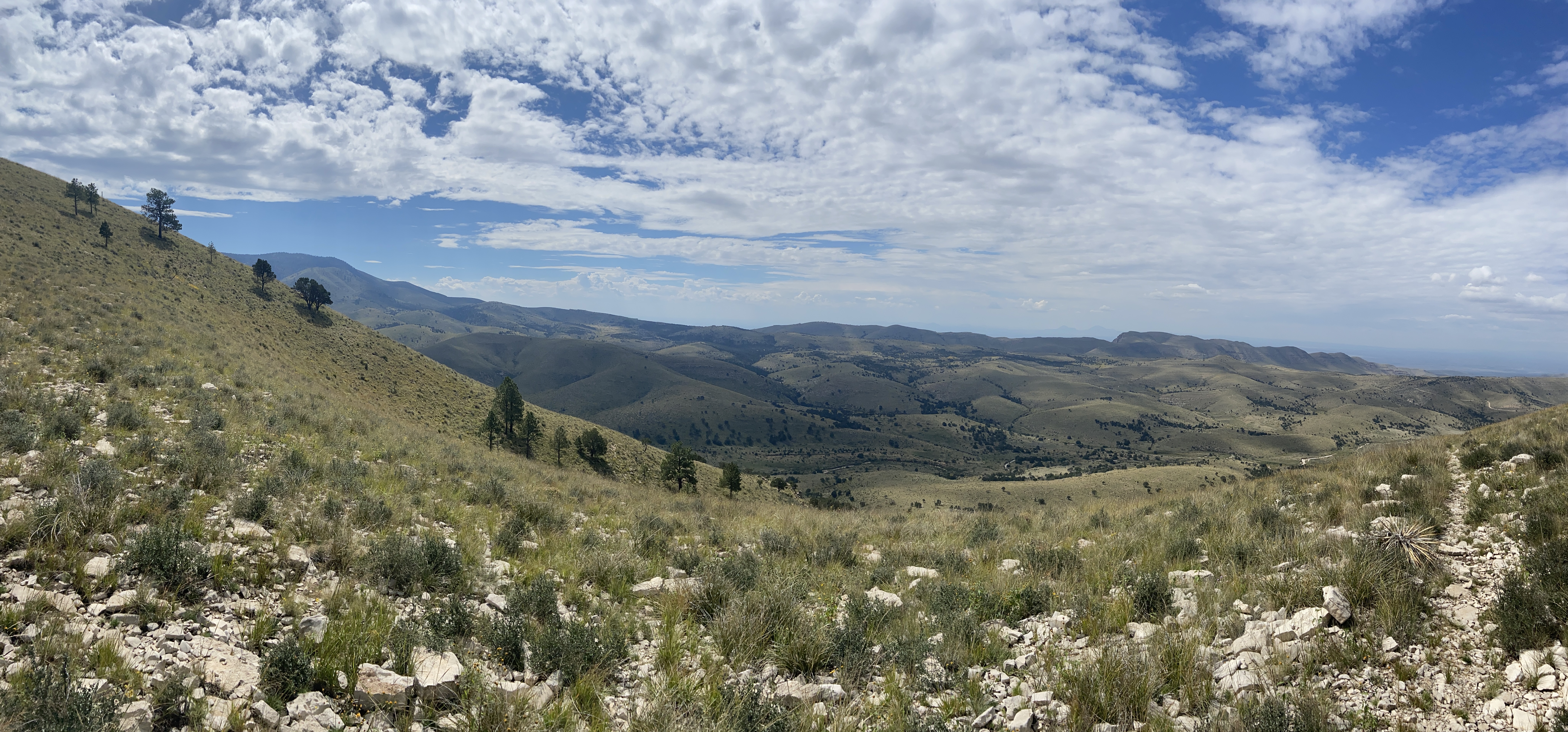
Hiking the Bush Mountain Trail from Dog Canyon out to the Marcus Overlook and back makes an excellent and usually solitary day hike in the Guadalupe Mountains. From the Marcus Overlook, there are commanding views south into the Guadalupe Mountains and westward.
Distance: 5.2 miles (8.4 km) round-trip, out and back
Elevation Change: 825 feet
Time Estimate: 3-5 hours
Difficulty: Moderate
Pets Pets disturb wildlife and are not allowed on trails. Your pets should remain at home as opportunities for pets are very limited in the park.
Accessibility Trail surfaces are loose rock or hardened rock surfaces. Hiking or trekking poles are highly recommended. Trail widths vary from two to six feet depending on the trail. Parking All trailhead areas have accessible parking available. Service animals Only service animals that have been individually trained to perform specific tasks for the benefit of persons with disabilities are allowed in the park and on trails.
Butterfield Stage Ruins Trail
Devil's Hall Trail
Devil's Hall the Park Service's write-up
3-5 Hours · no dogs · entrance fee applies
Start Start at the Pine Springs Trailhead
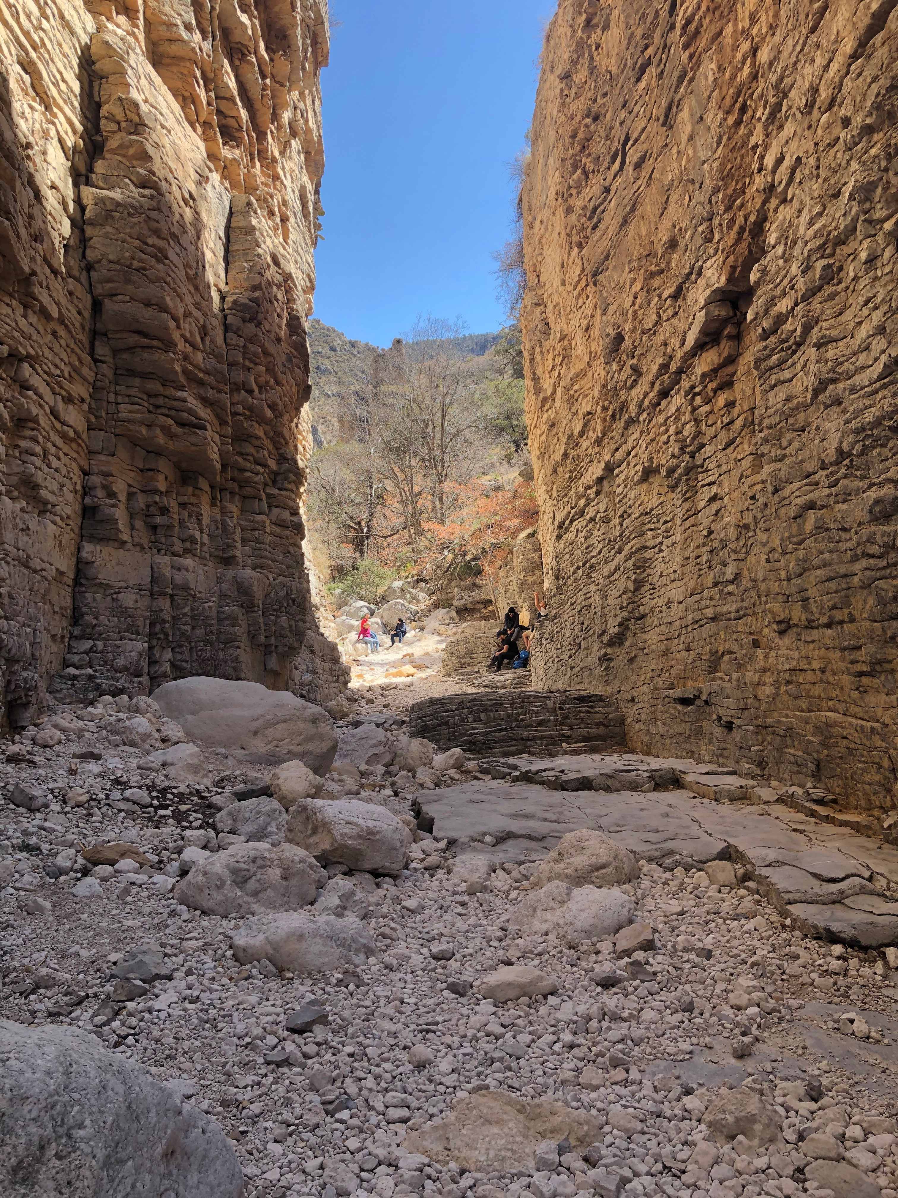
The route to Devil's Hall departs from the Pine Springs Trailhead and is 4.2 miles round-trip. After the first mile the trail leads to a rocky wash which takes hikers to an impressive natural rock staircase leading to a "hallway" formed by steep canyon walls. The wash portion of the route requires the hiker to scramble over large boulders and other debris. This route offers spectacular views of geologic formations, steep canyon walls, tall trees, and mountaintops.
Distance: 4.2 miles (6.8 km) round-trip, out and back
Elevation Change: 548 feet
Time Estimate: 3-5 hours
Difficulty: Strenuous , with rock scrambling and loose rock surfaces.
CAUTION:
Due to increasingly frequent heavy rain events in the late summers, the portion of the Devil's Hall trail in the wash is covered in loose rocks, boulders, and other debris. Visitors should exercise caution, use proper footwear, and trekking poles. Do not attempt to climb in the wash or canyon walls in wet or rainy conditions.
At two places the route enters and exits desert washes; proceed with caution and carefully observe the landscape. Some visitors struggle to find the trail after dark or if they are unprepared.
Pets Pets disturb wildlife and are not allowed on trails. Your pets should remain at home as opportunities for pets are very limited in the park.
Accessibility Trail surfaces are loose rock or hardened rock surfaces. Hiking or trekking poles are highly recommended. Trail widths vary from two to six feet depending on the trail. Parking All trailhead areas have accessible parking available. Service animals Only service animals that have been individually trained to perform specific tasks for the benefit of persons with disabilities are allowed in the park and on trails.
Dunes Trail
Picnic areas
Along the way Gypsum Dunes Picnic Area
Trailhead Gypsum Dunes Trailhead 3,646 ft Drive there
Salt Basin Dunes Trail the Park Service's write-up
1-3 Hours · no dogs · entrance fee applies · Winter, Spring, Fall
Start Start at the Salt Basin Dunes Trailhead
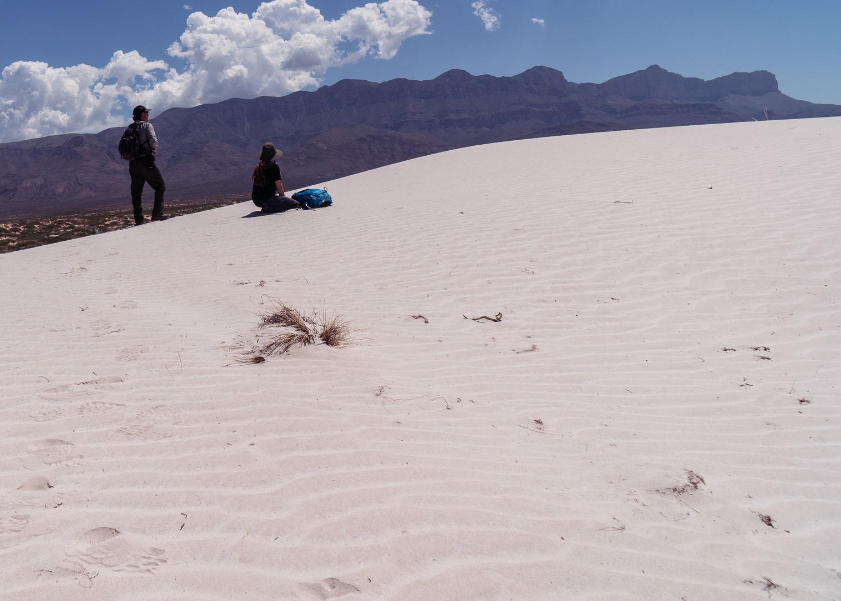
The white gypsum sands of the Salt Basin Dunes rise 100 feet from the desert floor and provide a brilliant contrast to the dark, towering cliffs of the Guadalupe Mountains.
Distance: 3-4 miles (5-7 km) round-trip, out and back
Time Estimate: 1-3 hours
Difficulty: Moderate. Some dunes are 60 feet high and require scrambling.
To the west are barren salt flats that are the source of these beautiful dunes. When rain runs off the highly soluble limestone rock in the adjacent mountains, salts are leached. This runoff pools in the desert basin and as it evaporates, large grains of mineral salts are left behind. The wind carries the salt grains northeast toward the Guadalupe Mountains and deposits them at the base of the western Guadalupe escarpment to form gypsum dunes.
The dune landscape is geologically young. It developed over the past few thousand years as dissolved salts and gypsum from an adjacent lake bed were deposited by wind into ever changing sculpted hill, swale, and ripple formations. The mesquite coppice dunes form stabilized spots where wildlife abounds.
The dunes environment is home to gypsum-loving plant and animal life such as gypsum scalebroom, a white variant of the lesser earless spiny lizard, and five of the park’s seven species of scorpions.
Pets Pets disturb wildlife and are not allowed on trails. Your pets should remain at home as opportunities for pets are very limited in the park.
Accessibility Trail surfaces are loose rock or hardened rock surfaces. Hiking or trekking poles are highly recommended. Trail widths vary from two to six feet depending on the trail. Parking All trailhead areas have accessible parking available. Service animals Only service animals that have been individually trained to perform specific tasks for the benefit of persons with disabilities are allowed in the park and on trails.
El Capitan Trail
Trailhead Williams Ranch Trailhead 5,000 ft Drive there
Foothills Trail
Foothills Loop the Park Service's write-up
2-4 Hours · no dogs · entrance fee applies
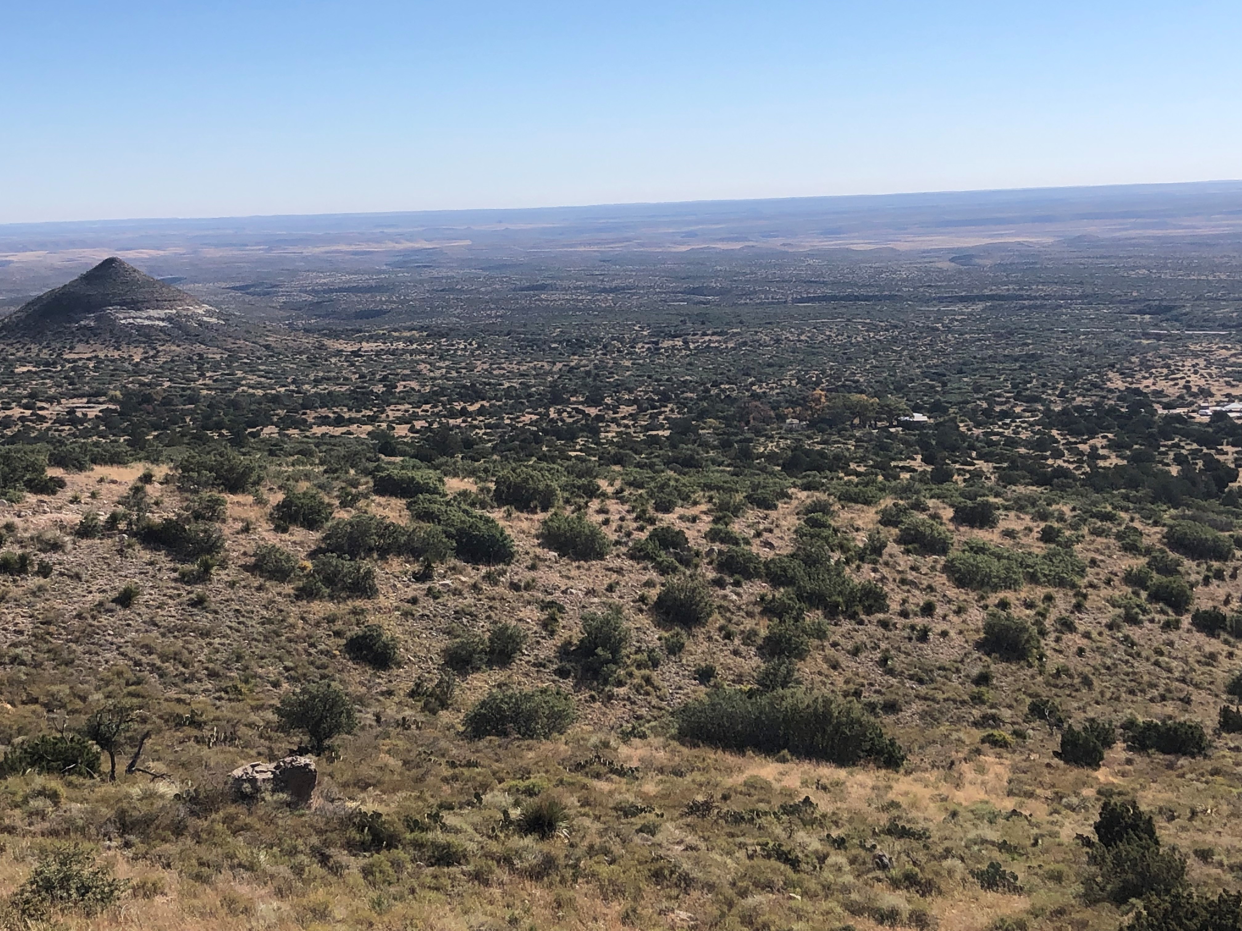
This moderate loop route uses the Frijole Trail and the Foothills Trail to make a loop below the eastern escarpment of the Guadalupe Mountains. Excellent views up Bear Canyon and toward El Capitan can be found along the trail. It's not unusual to spot deer along the trail. This trail can be hiked high to low (Frijole Trail first) or low to high (Foothills Trail first).
Distance: 4.5 miles (7.2 km) round-trip from Frijole Ranch; 5.5 miles (8.9 km) round-trip from Pine Springs
Elevation Change: 800 feet
Time Estimate: 2-4 hours
Difficulty: Moderate
Trailheads: This loop can begin either at Pine Springs or the Frijole Ranch.
Trails: Portions of the Foothills and Frijole Trails are used to make a loop.
Pets Pets disturb wildlife and are not allowed on trails. Your pets should remain at home as opportunities for pets are very limited in the park.
Accessibility Trail surfaces are loose rock or hardened rock surfaces. Hiking or trekking poles are highly recommended. Trail widths vary from two to six feet depending on the trail. Parking All trailhead areas have accessible parking available. Service animals Only service animals that have been individually trained to perform specific tasks for the benefit of persons with disabilities are allowed in the park and on trails.
Frijole Ranch Trail
Picnic areas
Along the way Frijole Ranch Picnic Area
Trailhead Frijole Ranch Trailhead 5,537 ft Drive there
Manzanita Spring the Park Service's write-up
20-30 Minutes · no dogs · entrance fee applies
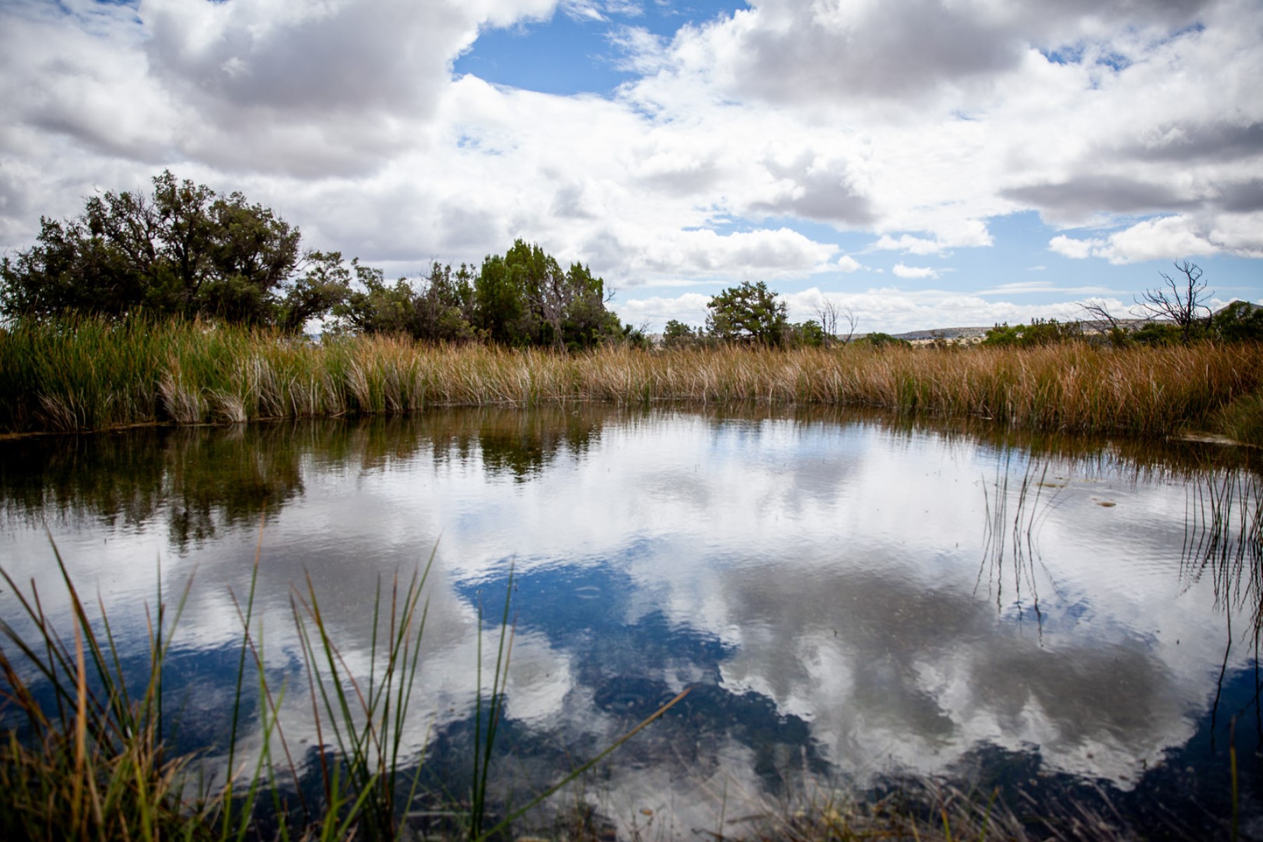
The Manzanita Spring Trail is a 0.5 mile (0.8 km) out and back trail that begins adjacent the Frijole Ranch. Manzanita Spring is a wide pool that provides excellent bird watching opportunities. Past this spring the Smith Spring Trail continues in a dirt surface.
Pets Pets disturb wildlife and are not allowed on trails. Your pets should remain at home as opportunities for pets are very limited in the park.
Accessibility To the Frijole Ranch buildings and the Manzanita Spring the trail is a paved surface. Trail surfaces past Manzanita Spring are loose rock or hardened rock surfaces. Hiking or trekking poles are highly recommended. Trail widths vary from two to six feet depending on the trail. Parking All trailhead areas have accessible parking available. Service animals Only service animals that have been individually trained to perform specific tasks for the benefit of persons with disabilities are allowed in the park and on trails.
Frijole Trail
Foothills Loop the Park Service's write-up
2-4 Hours · no dogs · entrance fee applies
This moderate loop route uses the Frijole Trail and the Foothills Trail to make a loop below the eastern escarpment of the Guadalupe Mountains. Excellent views up Bear Canyon and toward El Capitan can be found along the trail. It's not unusual to spot deer along the trail. This trail can be hiked high to low (Frijole Trail first) or low to high (Foothills Trail first).
Distance: 4.5 miles (7.2 km) round-trip from Frijole Ranch; 5.5 miles (8.9 km) round-trip from Pine Springs
Elevation Change: 800 feet
Time Estimate: 2-4 hours
Difficulty: Moderate
Trailheads: This loop can begin either at Pine Springs or the Frijole Ranch.
Trails: Portions of the Foothills and Frijole Trails are used to make a loop.
Pets Pets disturb wildlife and are not allowed on trails. Your pets should remain at home as opportunities for pets are very limited in the park.
Accessibility Trail surfaces are loose rock or hardened rock surfaces. Hiking or trekking poles are highly recommended. Trail widths vary from two to six feet depending on the trail. Parking All trailhead areas have accessible parking available. Service animals Only service animals that have been individually trained to perform specific tasks for the benefit of persons with disabilities are allowed in the park and on trails.
Manzanita Spring the Park Service's write-up
20-30 Minutes · no dogs · entrance fee applies
The Manzanita Spring Trail is a 0.5 mile (0.8 km) out and back trail that begins adjacent the Frijole Ranch. Manzanita Spring is a wide pool that provides excellent bird watching opportunities. Past this spring the Smith Spring Trail continues in a dirt surface.
Pets Pets disturb wildlife and are not allowed on trails. Your pets should remain at home as opportunities for pets are very limited in the park.
Accessibility To the Frijole Ranch buildings and the Manzanita Spring the trail is a paved surface. Trail surfaces past Manzanita Spring are loose rock or hardened rock surfaces. Hiking or trekking poles are highly recommended. Trail widths vary from two to six feet depending on the trail. Parking All trailhead areas have accessible parking available. Service animals Only service animals that have been individually trained to perform specific tasks for the benefit of persons with disabilities are allowed in the park and on trails.
Guadalupe Peak Campground Access
Campgrounds
Along the way Guadalupe Peak Campground
Guadalupe Peak Horse Trail
Guadalupe Peak Trail
PeaksPicnic areas
Along the way Guadalupe Peak Pine Springs Trailhead Picnic Area
Trailhead Pine Springs Trailhead 5,838 ft Drive there
Guadalupe Peak the Park Service's write-up
6-8 Hours · no dogs · entrance fee applies
Start Trail Summary
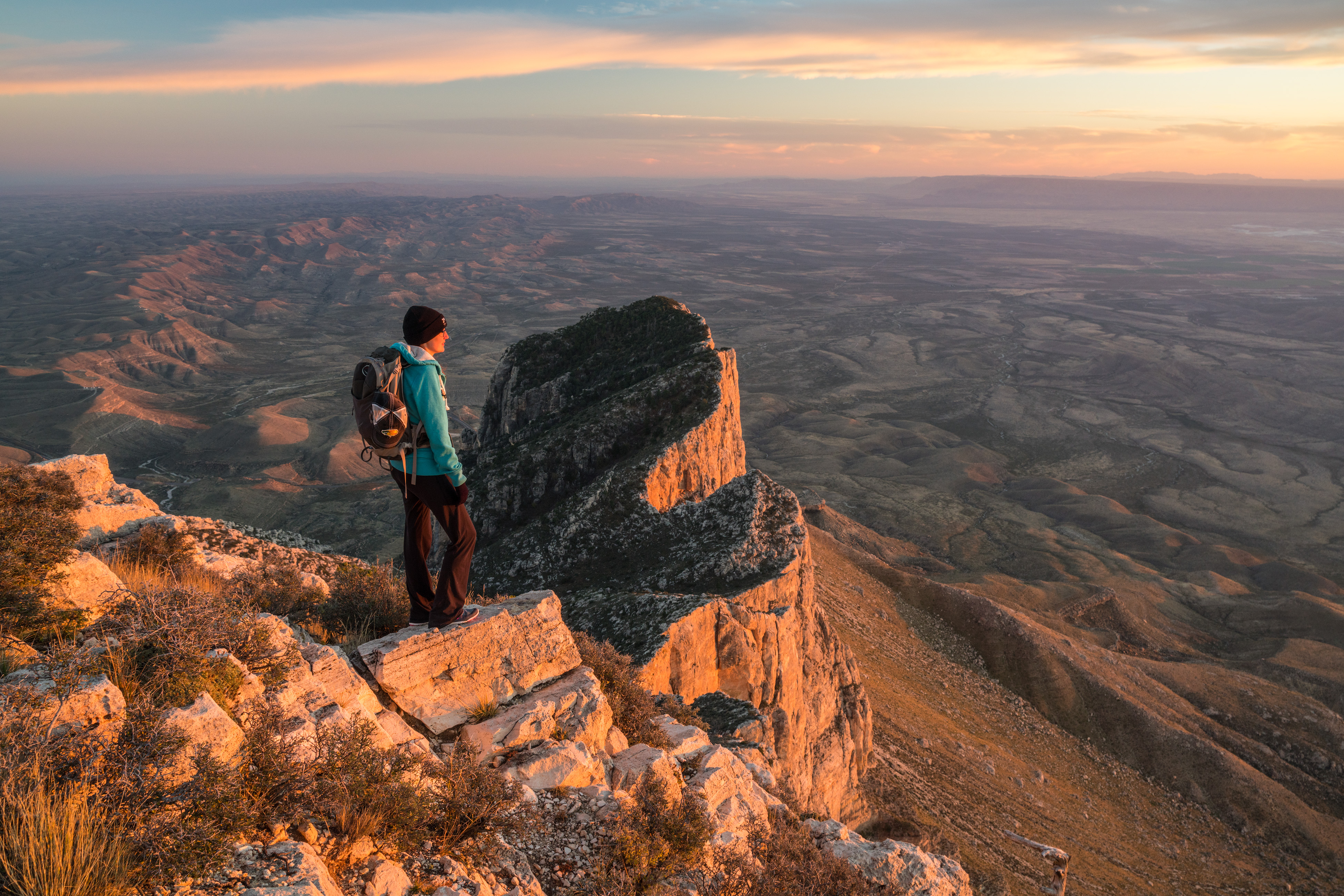
Climb to the "Top of Texas" with a hike up Guadalupe Peak. Guadalupe Peak is a rewarding, although very strenuous, 8.4 mile round trip hike with a 3,000 foot elevation gain. It will take from six to eight hours to complete the hike.
The peak provides fantastic views from the highest point in the state of Texas (8,751 feet / 2,667 meters). It also introduces hikers to several of the park’s ecosystems including the high desert and the high elevation forests. On a clear day you will be rewarded with a tremendous view of the surrounding mountains and desert. Stop for a while and enjoy the view before beginning the hike back down.
Be Prepared:
Make sure you are prepared for the hike with the Eleven Essential items . Carrying the Ten Essentials (plus one) with you can help you be prepared for minor injuries, sudden weather changes, or unexpected delays.
This is a strenuous hike which begins at a mile above sea level and gains 3,000 feet. Do you have a medical conditions that could be worsened by certain activities or changes in altitude (asthma, heart condition)?
While the stock trail adds a mile to the hike each direction, it is significantly less steep than the main trail, and may be useful if backpacking.
When you consume half of the water you are carrying, turn around.
The descent is often more difficult than the climb to the peak due to the rocky trail surface and fatigue. Hiking poles help!
The top of Texas is not a toilet. Make sure to bring a commercial toilet bag system with you to protect the environment you are hiking in. Pack out all of your trash.
Layers and sunscreen are important to protect you from the elements.
At the top of the peak expect temperatures at least ten degrees cooler and wind speeds at least ten miles per hour faster than Pine Springs.
In areas more than a quarter of a mile from restroom facilities, and all areas inside the Wilderness boundary, all solid human waste, feminine hygiene products, and toilet paper must be carried out in a landfill-safe commercial toilet bag .
Much of the trail is over steep, rocky terrain. Hikers should wear comfortable hiking boots with good traction , and that are well broken in. Trekking poles aid in stability and can be a useful addition.
Hikers should carefully monitor the weather. Afternoon thunderstorms are common through the summer months. Lightning can be especially dangerous at high elevations on the exposed peak. Watch the sky. If storms develop, seek a lower elevation .
Winds can be severe on the peak , especially in winter months. Winds in excess of 40 miles per hour are not uncommon. When hiking during high winds, you should always be prepared to turn around. You should prioritize your own safety above all else in windy conditions.
There is little shade along the trail. Summer temperatures can be quite hot. Bring plenty of water, at least one gallon per person, per day. Also come prepared with sunscreen, a hat, and protective clothing.
The 8.4 mile hike to the summit and back takes the average hiker from six to eight hours round trip . Plan to start the hike early in the morning, especially in the summer when high temperatures and afternoon thunderstorms are a concern.
Bring enough warm clothing. Even in the hottest weather, thunderstorms can cause the temperature to drop significantly.
If you intend to make the peak for sunrise or sunset, make sure you have a light source, either a head lamp or a flashlight.
Pets Pets disturb wildlife and are not allowed on trails. Your pets should remain at home as opportunities for pets are very limited in the park.
Accessibility Trail surfaces are loose rock or hardened rock surfaces. Hiking or trekking poles are highly recommended. Trail widths vary from two to six feet depending on the trail. Parking All trailhead areas have accessible parking available. Service animals Only service animals that have been individually trained to perform specific tasks for the benefit of persons with disabilities are allowed in the park and on trails.
Hunter Peak Trail
Peaks
Along the way Hunter Peak
Hunter Peak the Park Service's write-up
6-8 Hours · no dogs · entrance fee applies
Start Loop hike to the Hunter Peak Summit
The hike to Hunter Peak is a challenging day hike done as a loop up the Bear Canyon Trail and down the Tejas Trail that provides solitude, stunning views, and opportunities for side trails into the Bowl area.
Distance: 8.7 miles (14.0 km) round-trip, loop
Elevation Change: 2,700 feet
Time Estimate: 6-8 hours
Difficulty: Strenous
Hunter Peak is at an elevation of 8,368 feet above sea level, rising 2,700 feet above Pine Springs. Hunter Peak was named after ranchers J. C. Hunter and J. C. Hunter, Jr., who owned much of the land now included in the park.
The summit of Hunter Peak may have among the best views in the park—half the panorama is of the vast desert to the south, and the remainder is of other mountains and the sheltered pine forest of the Bowl to the north, as well as an unparalleled view across Pine Springs Canyon at Guadalupe Peak.
The hike to the summit involves climbing 2,540 feet, along two trails—either the first 3.6 miles of the Tejas Trail up the side of Pine Spring Canyon, or the Bear Canyon Trail along the next ravine to the east of Hunter Peak. These two routes are linked by the Bowl Trail, from which a short spur leads to the Hunter Peak summit, hence the trip can be done as a loop up one trail and down the other, a total hike of 8.7 miles.
Which Way Up?
While the climb is steep, rangers recommend that hikers ascend Bear Canyon, rather than hike down it. Bear Canyon gains 2,000 feet in just under two miles, while the Tejas Trail takes the twice the distance to climb the same elevation.
Pets Pets disturb wildlife and are not allowed on trails. Your pets should remain at home as opportunities for pets are very limited in the park.
Accessibility Trail surfaces are loose rock or hardened rock surfaces. Hiking or trekking poles are highly recommended. Trail widths vary from two to six feet depending on the trail. Parking All trailhead areas have accessible parking available. Service animals Only service animals that have been individually trained to perform specific tasks for the benefit of persons with disabilities are allowed in the park and on trails.
Indian Meadows Nature Loop
CampgroundsPicnic areas
Along the way Dog Canyon Campground Dog Canyon Picnic Area
Trailhead Indian Meadow Nature Trail 6,261 ft Drive there
Indian Meadow Nature Trail the Park Service's write-up
30-45 Minutes · no dogs · entrance fee applies
Start Indian Meadow Nature Trail
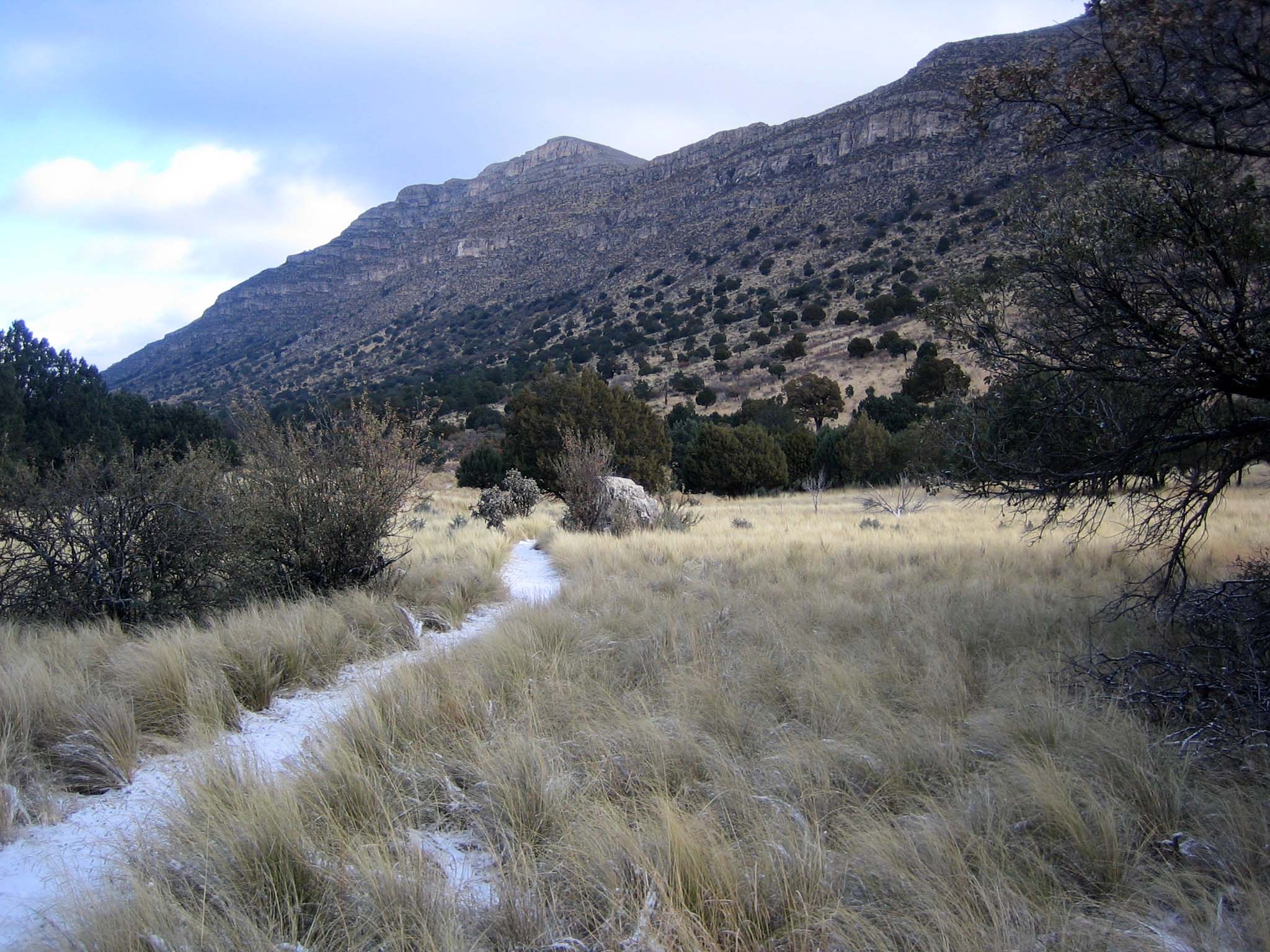
Named for the once abundant black-tailed prairie dog, Dog Canyon is home to a surprising variety of plant and animal species and was a traditional occupation site for the Mescalaro Apache. The Indian Meadow Nature Trail is an easy 0.6 mile loop that begins across the road from the ranger station and next to the group campsite, offering good views of the landscape. At a leisurely pace it takes 30-45 minutes. The trail is rated easy as it remains almost level after crossing an arroyo.
Wildlife is abundant due to the variety of habitat types found here: arid grassland, juniper-oak woodlands, pine forest, and riparian (streamside) areas of maples and oaks.
Pets Pets disturb wildlife and are not allowed on trails. Your pets should remain at home as opportunities for pets are very limited in the park.
Accessibility Trail surfaces are loose rock or hardened rock surfaces. Hiking or trekking poles are highly recommended. Trail widths vary from two to six feet depending on the trail. Parking All trailhead areas have accessible parking available. Service animals Only service animals that have been individually trained to perform specific tasks for the benefit of persons with disabilities are allowed in the park and on trails.
Juniper Trail
Marcus Campground Access
Campgrounds
Along the way Marcus Campground
Marcus Trail
Marcus Overlook the Park Service's write-up
3-5 Hours · no dogs · entrance fee applies · Winter, Spring, Fall
Start Begin at the Dog Canyon Trailhead
Hiking the Bush Mountain Trail from Dog Canyon out to the Marcus Overlook and back makes an excellent and usually solitary day hike in the Guadalupe Mountains. From the Marcus Overlook, there are commanding views south into the Guadalupe Mountains and westward.
Distance: 5.2 miles (8.4 km) round-trip, out and back
Elevation Change: 825 feet
Time Estimate: 3-5 hours
Difficulty: Moderate
Pets Pets disturb wildlife and are not allowed on trails. Your pets should remain at home as opportunities for pets are very limited in the park.
Accessibility Trail surfaces are loose rock or hardened rock surfaces. Hiking or trekking poles are highly recommended. Trail widths vary from two to six feet depending on the trail. Parking All trailhead areas have accessible parking available. Service animals Only service animals that have been individually trained to perform specific tasks for the benefit of persons with disabilities are allowed in the park and on trails.
McKittrick Canyon Nature Loop
Visitor centers
Along the way McKittrick Canyon Contact Station
Trailhead McKittrick Canyon Trailhead 5,015 ft Drive there
McKittrick Canyon Trail
Picnic areasVisitor centers
Along the way Pratt Cabin Picnic Area The Grotto Picnic Area McKittrick Canyon Contact Station
Trailhead McKittrick Canyon Trailhead 5,015 ft Drive there
McKittrick Canyon Nature Trail the Park Service's write-up
30-60 Minutes · no dogs · entrance fee applies
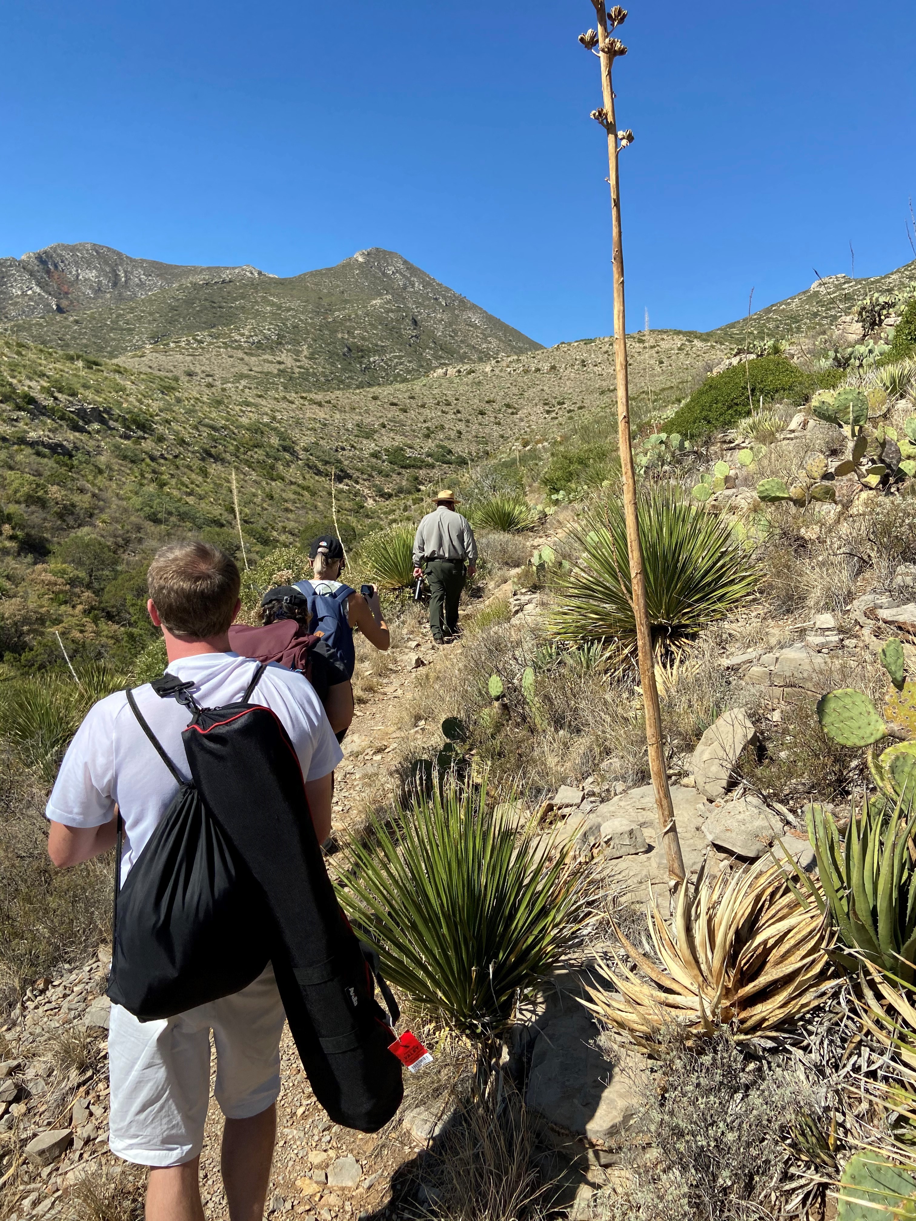
Traveling clockwise, this fascinating, short trail passes an intermittent seep that lies hidden in junipers, then wanders up a southwest slope along an arroyo. Here, plants and animals tolerate true desert conditions. Trailside exhibits describe common plants, and reference wildland fire. At the top of the trail you can look down at the mouth of McKittrick Canyon and read about Permian Reef geology. As the trail continues down northeast slope you will probably recognize that less sun exposure makes this side a little more lush.
Distance: 0.9 miles (1.4 km) round-trip, loop
Time Estimate: 1 hour
Difficulty: moderate
Pets Pets disturb wildlife and are not allowed on trails. Your pets should remain at home as opportunities for pets are very limited in the park.
Accessibility Trail surfaces are loose rock or hardened rock surfaces. Hiking or trekking poles are highly recommended. Trail widths vary from two to six feet depending on the trail. Parking All trailhead areas have accessible parking available. Service animals Only service animals that have been individually trained to perform specific tasks for the benefit of persons with disabilities are allowed in the park and on trails.
McKittrick Canyon to Dog Canyon the Park Service's write-up
8-12 Hours · no dogs · entrance fee applies
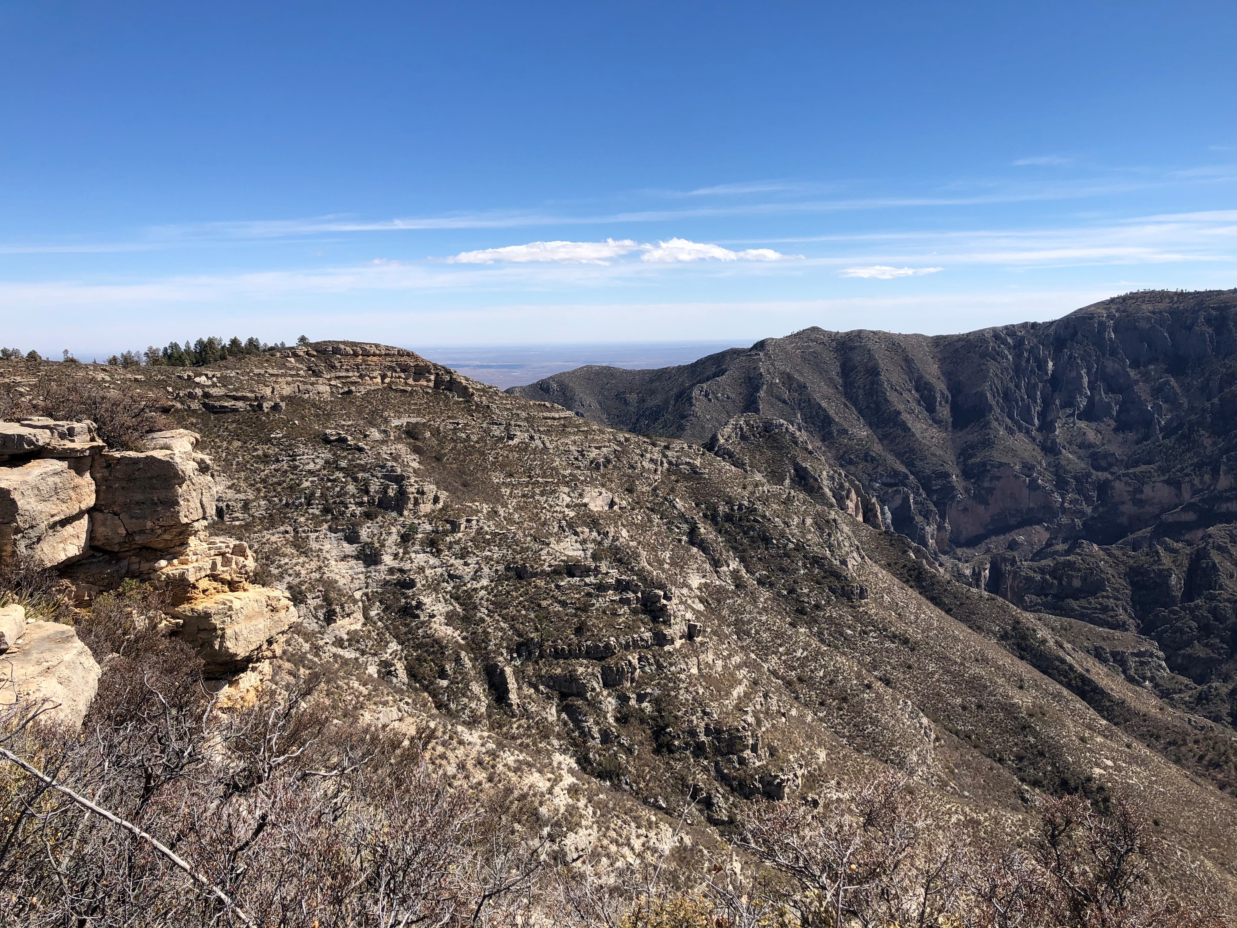
This is an extremely rewarding trail, offering both the variety of McKittrick Canyon and the grandeur of the high ridges that surround it. The floor of McKittrick Canyon provides a panoramic experience through the unique environments of the canyon; to protect this special habitat, visitors are asked to stay on the trail and stay out of the water.
The McKittrick Canyon Trail follows the floor of South McKittrick Canyon for four miles before climbing steeply to gain the ridge on the north side of the canyon. This is an arduous climb of 2,380 feet in about two miles and provides spectacular views into the canyon and to the ridges that border it. The trail continues along the ridge above South McKittrick Canyon, ascending to a high point of 7,916 feet and gradually descending to a junction with the Tejas Trail.
The route passes the saddle at Lost Peak. No trail leads to the summit itself. Descending from the area of Lost Peak the trail passes through the grassy areas that define the northern portion of the park.
Overnight backpacking is recommended at the McKittrick Ridge Wilderness Campground.
Distance: 15.0 miles (24.1 km) one way. For more detailed information on trails, check our trail descriptions page.
Time Estimate: 8-12 hours
Difficulty: Strenuous
Duration: Minimum of one night, two days.
Trailheads: McKittrick Canyon and Dog Canyon Trailheads. The drive between the trailheads is two hours. No shuttle service runs between the two trailheads.
Pets Pets disturb wildlife and are not allowed on trails. Your pets should remain at home as opportunities for pets are very limited in the park.
Accessibility Trail surfaces are loose rock or hardened rock surfaces. Hiking or trekking poles are highly recommended. Trail widths vary from two to six feet depending on the trail. Parking All trailhead areas have accessible parking available. Service animals Only service animals that have been individually trained to perform specific tasks for the benefit of persons with disabilities are allowed in the park and on trails.
Permian Reef Trail the Park Service's write-up
5-7 Hours · no dogs · entrance fee applies · Winter, Spring, Fall
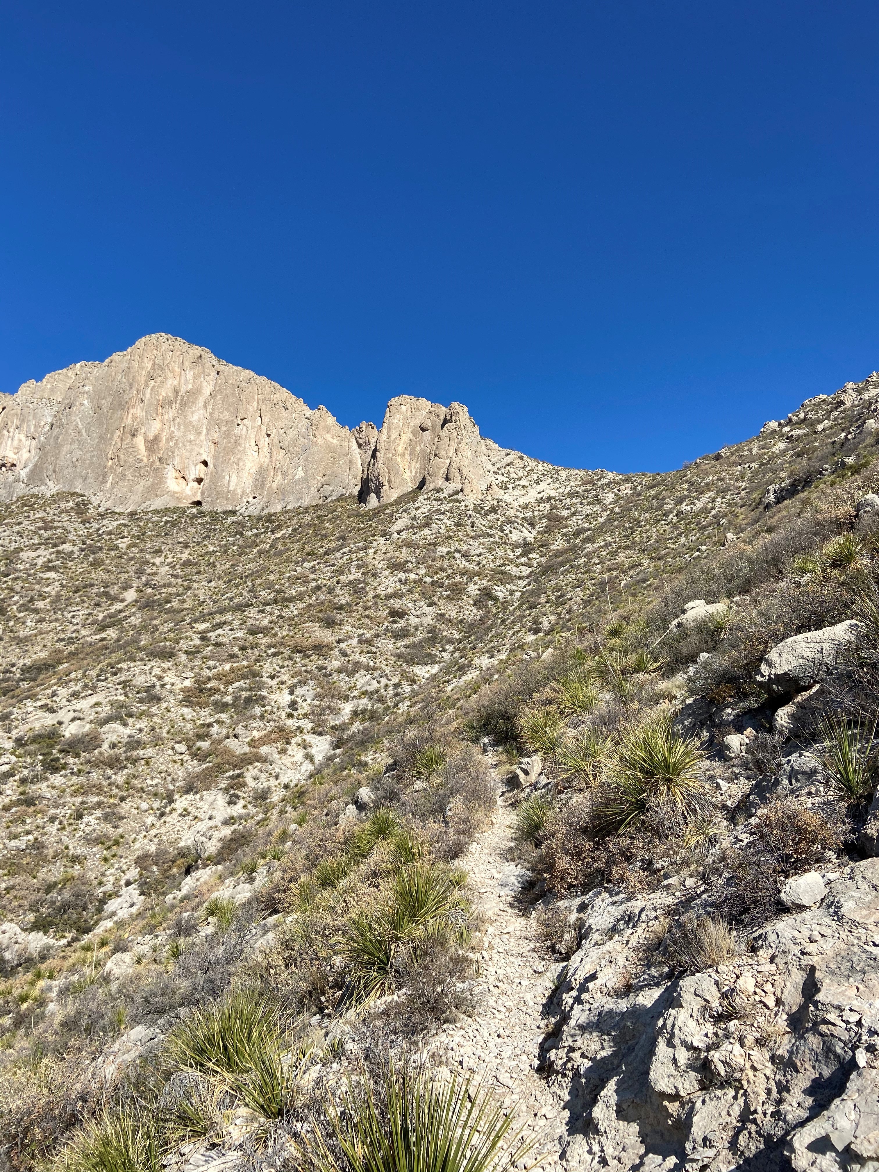
The Permian Reef Trail climbs the north side of McKittrick Canyon to the top of Wilderness Ridge, providing sweeping views into South McKittrick Canyon. At the park boundary, and state line, the trail continues into New Mexico and the Lincoln National Forest. The slopes above the canyon face south, thereby receiving full sun all day, hence the hike is best avoided during hot periods in summer.
Distance: 4.0 miles (6.4 km) to top of ridge; 4.5 miles (7.2 km) to Wilderness Ridge Campground; 4.8 miles (7.7 km) to park boundary (one way distances)
Elevation Change: 2,000 feet
Time Estimate: 5-7 hours
Difficulty: Strenuous
In addition to providing sweeping views of the landscape, the trail was designed to showcase the Permian age geologic and fossil features preserved in the park. For those with a serious interest in Geology, a detailed guidebook for the features seen along the trail from the Texas Bureau of Economic Geology can be purchased at the visitor center.
Pets Pets disturb wildlife and are not allowed on trails. Your pets should remain at home as opportunities for pets are very limited in the park.
Accessibility Trail surfaces are loose rock or hardened rock surfaces. Hiking or trekking poles are highly recommended. Trail widths vary from two to six feet depending on the trail. Parking All trailhead areas have accessible parking available. Service animals Only service animals that have been individually trained to perform specific tasks for the benefit of persons with disabilities are allowed in the park and on trails.
Pine Springs to McKittrick Canyon the Park Service's write-up
12-16 Hours · no dogs · entrance fee applies
The Tejas Trail is the primary north/south through trail within the park, connecting the Pine Springs Trailhead with the Dog Canyon Trailhead at the park's northern boundary. This major artery can be used to connect to numerous other trails to make a variety of loops.
Headed north the trail climbs out of Pine Springs Canyon into the Wilderness high country. The central portion of the trail from Pine Top until the McKittrick Canyon Trail junction is forested, passing through the Bowl and numerous drainages.
The trail gradually ascends from the McKittrick Canyon junction to a high point of 7,916 feet before descending along the ridge above South McKittrick Canyon. The descent of 2,380 feet in about two miles provides spectacluar views into the canyon and the ridges that border it. The trail follows the floor of South McKittrick Canyon for the last four miles before returning to the McKittrick Canyon Trailhead.
This is an extremely rewarding trail, offering both the variety of McKittrick Canyon and the grandeur of the high ridges that surround it. The floor of McKittrick Canyon provides a panoramic experience through the unique environments of the canyon; to protect this special habitat, visitors are asked to stay on the trail and stay out of the water.
Overnight backpacking is recommended at Pine Top, Tejas, Mescalero, and/or McKittrick Ridge Wilderness Campgrounds.
Distance: Total distance from the Pine Springs Trailhead to the McKittrick Canyon Trailhead is 18.8 miles (30.4 km).
For more detailed information on trails, check our trail descriptions page.
Elevation Change: Accumulation of 3,200 feet
Time Estimate: 12-16 hours
Difficulty: Strenuous
Duration: Minimum of one night, two days.
Trailheads: Pine Springs and McKittrick Canyon Trailheads. The drive between the trailheads is 20-30 minutes. No shuttle service runs between the two trailheads.
Pets Pets disturb wildlife and are not allowed on trails. Your pets should remain at home as opportunities for pets are very limited in the park.
Accessibility Trail surfaces are loose rock or hardened rock surfaces. Hiking or trekking poles are highly recommended. Trail widths vary from two to six feet depending on the trail. Parking All trailhead areas have accessible parking available. Service animals Only service animals that have been individually trained to perform specific tasks for the benefit of persons with disabilities are allowed in the park and on trails.
Pratt Cabin the Park Service's write-up
2-4 Hours · no dogs · entrance fee applies
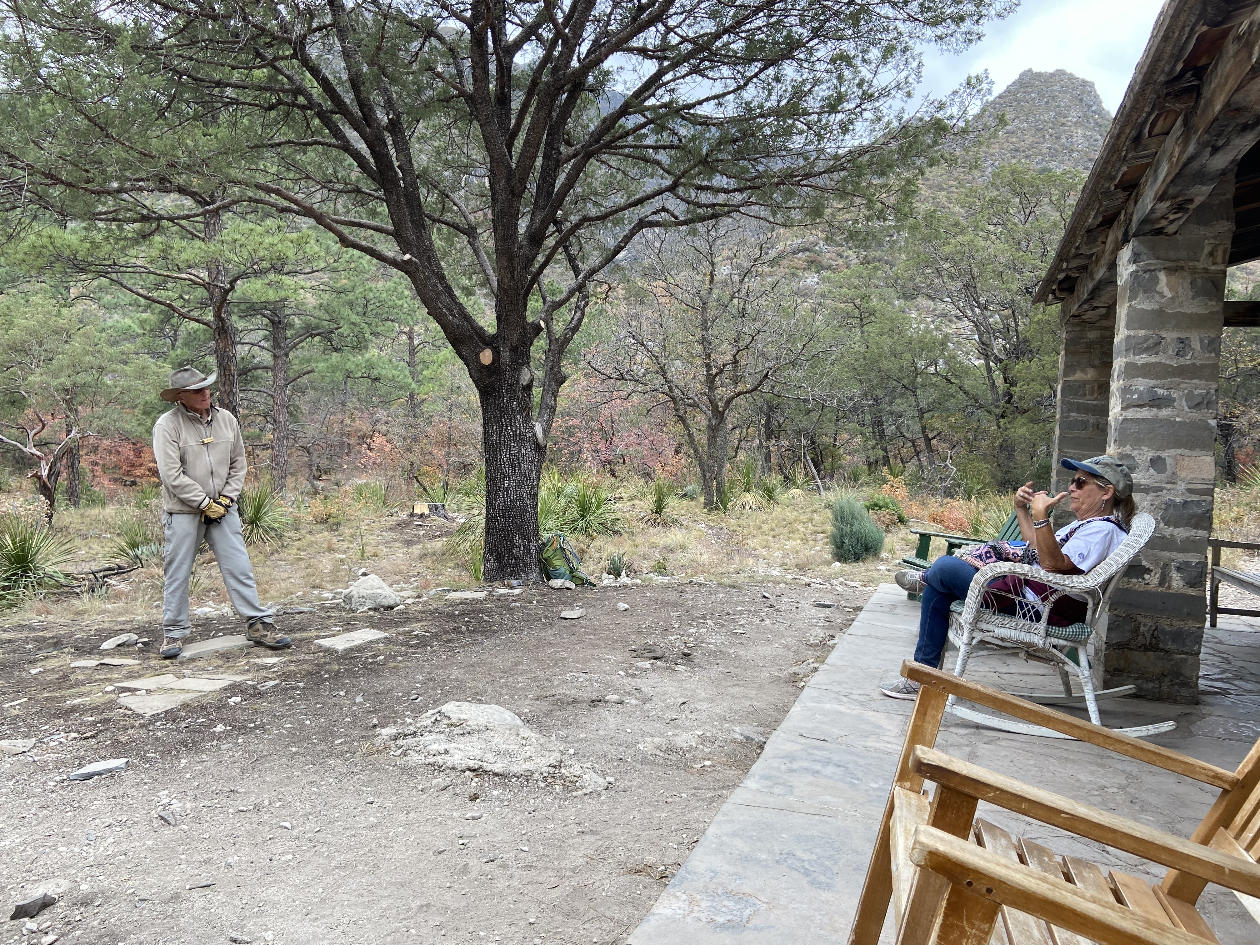
Enjoy the shortest distance into the heart of the canyon by hiking to Pratt Cabin and return (a distance of 4.8 miles). Along this walk you will cross the stream twice before arriving at the historic structure. Enjoy a snack or lunch at the picnic tables near or at Pratt Cabin, or sit for a spell on the porch. Volunteers staff Pratt Cabin on occasion; take a look inside the stone structure.
Distance: 4.8 miles (7.7 km) round-trip, out and back
Time Estimate: 2-4 hours
Difficulty: Moderate due to length
Pets Pets disturb wildlife and are not allowed on trails. Your pets should remain at home as opportunities for pets are very limited in the park.
Accessibility Trail surfaces are loose rock or hardened rock surfaces. Hiking or trekking poles are highly recommended. Trail widths vary from two to six feet depending on the trail. Parking All trailhead areas have accessible parking available. Service animals Only service animals that have been individually trained to perform specific tasks for the benefit of persons with disabilities are allowed in the park and on trails.
The Grotto and Hunter Line Shack the Park Service's write-up
3-5 Hours · no dogs · entrance fee applies
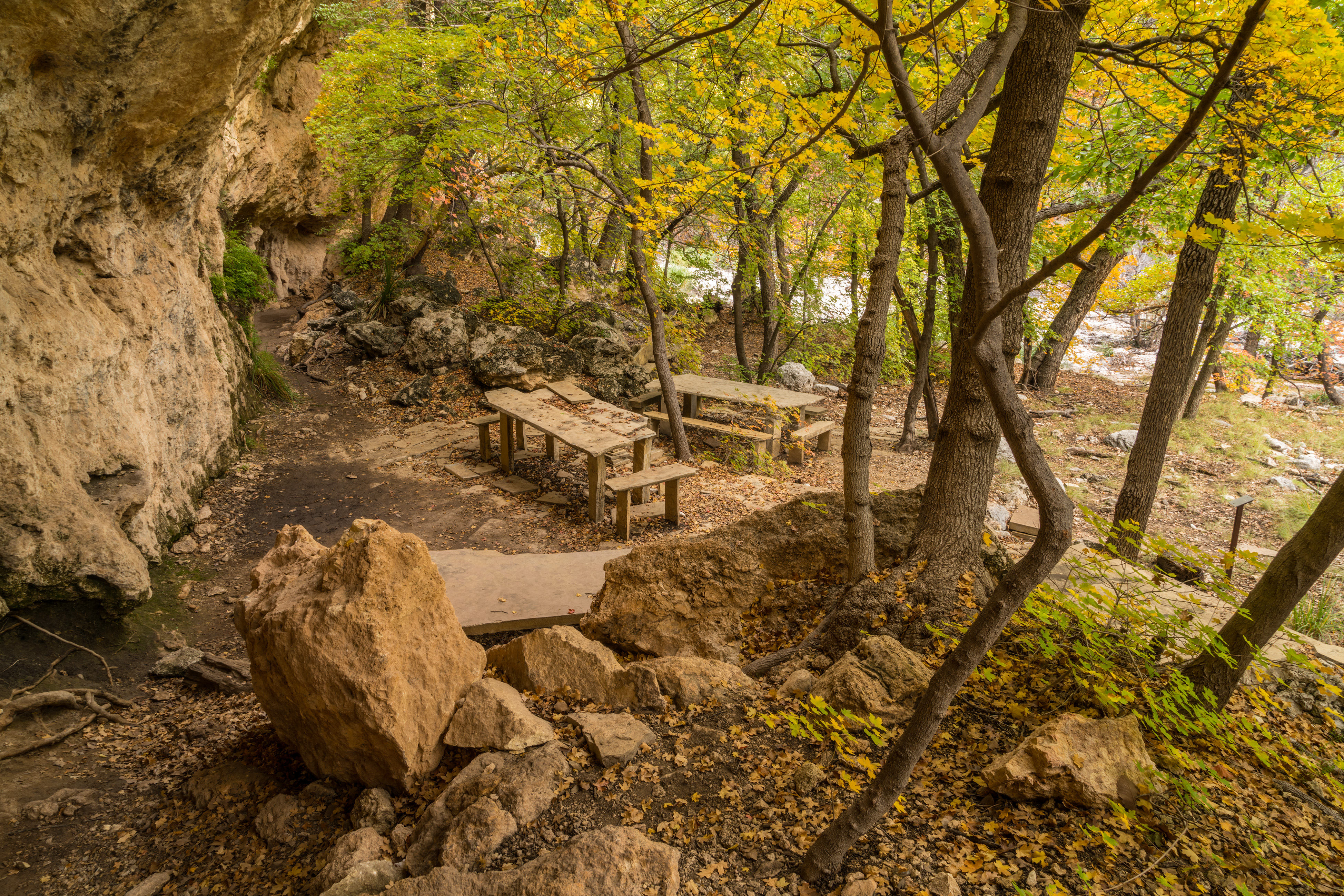
Stretch out your day hike into McKittrick Canyon by hiking to the Grotto. Elevation gain doubles as you travel further up canyon, but is still mild at less then 600 feet gained from the trailhead. Exposed cave features and stone picnic tables near the Hunter Line Shack make for a fabulous lunch destination. A short distance past the Grotto is the Hunter Line Shack, part of a 1920s ranching operaiton in the mountains.
Distance: 7.0 miles (11.3 km) round-trip, out and back
Time Estimate: 3-5 hours
Difficulty: Moderate due to length
Pets Pets disturb wildlife and are not allowed on trails. Your pets should remain at home as opportunities for pets are very limited in the park.
Accessibility Trail surfaces are loose rock or hardened rock surfaces. Hiking or trekking poles are highly recommended. Trail widths vary from two to six feet depending on the trail. Parking All trailhead areas have accessible parking available. Service animals Only service animals that have been individually trained to perform specific tasks for the benefit of persons with disabilities are allowed in the park and on trails.
The Notch the Park Service's write-up
5-7 Hours · no dogs · entrance fee applies
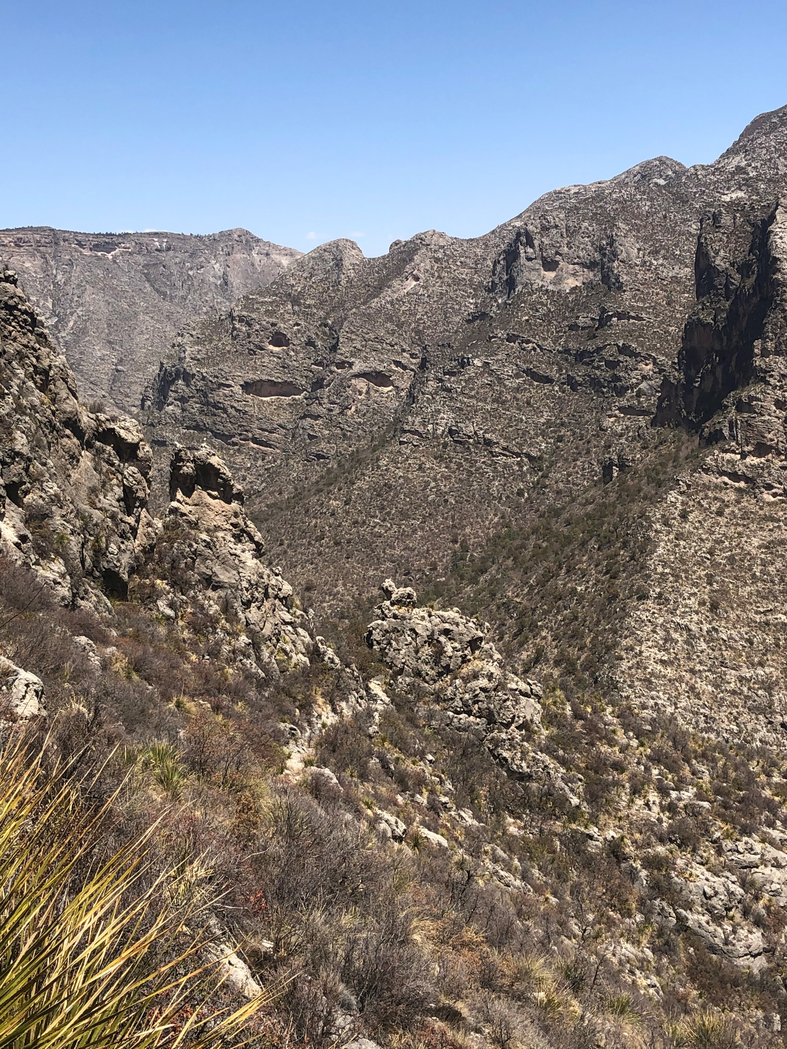
The hike to "the Notch" is a challenging day hike that proceeds through McKittrick Canyon to a dramatic viewpoint about half way up toward McKittrick Ridge. For most hikers this destination makes a dramtic turn-around point for an excellent day hike in McKittrick Canyon.
Distance: 9.0 miles (14.5 km) round-trip, out and back
Elevation Change: 1,092 feet
Time Estimate: 5-7 hours
Difficulty: Difficult, past the Grotto
Pets Pets disturb wildlife and are not allowed on trails. Your pets should remain at home as opportunities for pets are very limited in the park.
Accessibility Trail surfaces are loose rock or hardened rock surfaces. Hiking or trekking poles are highly recommended. Trail widths vary from two to six feet depending on the trail. Parking All trailhead areas have accessible parking available. Service animals Only service animals that have been individually trained to perform specific tasks for the benefit of persons with disabilities are allowed in the park and on trails.
McKittrick Ridge Campground Access
Campgrounds
Along the way McKittrick Ridge Campground
McKittrick Ridge Trail
ViewsPicnic areas
Along the way The Grotto Picnic Area The Notch
McKittrick Ridge the Park Service's write-up
8-12 Hours · no dogs · entrance fee applies
Start McKittrick Ridge
The journey to the top of McKittrick Ridge is "the toughest hike in Texas." This very strenuous hike is best enjoyed as an overnight experience. This route takes you through MicKittrick Canyon up the steepest trail in the park. At the halfway point to the ridge is "The Notch", where there is a spectacular view of the canyon both directions. As you continue, don't be fooled by the false summits that make you think you've nearly reached the top!
This is an extremely rewarding trail, offering both the variety of McKittrick Canyon and the grandeur of the high ridges that surround it. The floor of McKittrick Canyon provides a panoramic experience through the unique environments of the canyon; to protect this special habitat, visitors are asked to stay on the trail and stay ouf of the water.
If you'd like to visit this beautiful ridge without quite the workout, begin instead at Dog Canyon. The trail ascends up to the area of Lost Peak where you pass through many grassy areas that define the northern portion of the park. The trail gradually ascends from the McKittrick Canyon junction to a high point of 7,916 feet before descending along the ridge above South McKittrick Canyon where views are spectacular into the canyon and ridges that border it.
Overnight backpacking is recommended at the McKittrick Ridge Wilderness Campground.
Distance: 15.2 miles (24.5 km) round-trip, out and back starting from the McKittrick Canyon Trailhead. 14.8 miles (23.8 km) round-trip, out and back starting from the Dog Canyon Trailhead.
For more detailed information on trails, check our trail descriptions page.
Elevation Change: 2,700 feet from McKittrick Canyon Trailhead. 1,900 feet from the Dog Canyon Trailhead.
Time Estimate: 4-6 hours to reach the campsites
Difficulty: Strenuous
Duration: Minimum of one day, but two days and one night recommended.
Trailheads: McKittrick Canyon or Dog Canyon Trailheads. The drive between the two trailheads is two hours. No shuttle service runs between the two trailheads.
Pets Pets disturb wildlife and are not allowed on trails. Your pets should remain at home as opportunities for pets are very limited in the park.
Accessibility Trail surfaces are loose rock or hardened rock surfaces. Hiking or trekking poles are highly recommended. Trail widths vary from two to six feet depending on the trail. Parking All trailhead areas have accessible parking available. Service animals Only service animals that have been individually trained to perform specific tasks for the benefit of persons with disabilities are allowed in the park and on trails.
The Notch the Park Service's write-up
5-7 Hours · no dogs · entrance fee applies
The hike to "the Notch" is a challenging day hike that proceeds through McKittrick Canyon to a dramatic viewpoint about half way up toward McKittrick Ridge. For most hikers this destination makes a dramtic turn-around point for an excellent day hike in McKittrick Canyon.
Distance: 9.0 miles (14.5 km) round-trip, out and back
Elevation Change: 1,092 feet
Time Estimate: 5-7 hours
Difficulty: Difficult, past the Grotto
Pets Pets disturb wildlife and are not allowed on trails. Your pets should remain at home as opportunities for pets are very limited in the park.
Accessibility Trail surfaces are loose rock or hardened rock surfaces. Hiking or trekking poles are highly recommended. Trail widths vary from two to six feet depending on the trail. Parking All trailhead areas have accessible parking available. Service animals Only service animals that have been individually trained to perform specific tasks for the benefit of persons with disabilities are allowed in the park and on trails.
Mescalero Campground Access
Campgrounds
Along the way Mescalero Campground
Old McKittrick Canyon Road
Permian Reef Geology Loop Trail
Permian Reef Trail
Visitor centers
Along the way McKittrick Canyon Contact Station
Trailhead McKittrick Canyon Trailhead 5,015 ft Drive there
Permian Reef Trail the Park Service's write-up
5-7 Hours · no dogs · entrance fee applies · Winter, Spring, Fall
The Permian Reef Trail climbs the north side of McKittrick Canyon to the top of Wilderness Ridge, providing sweeping views into South McKittrick Canyon. At the park boundary, and state line, the trail continues into New Mexico and the Lincoln National Forest. The slopes above the canyon face south, thereby receiving full sun all day, hence the hike is best avoided during hot periods in summer.
Distance: 4.0 miles (6.4 km) to top of ridge; 4.5 miles (7.2 km) to Wilderness Ridge Campground; 4.8 miles (7.7 km) to park boundary (one way distances)
Elevation Change: 2,000 feet
Time Estimate: 5-7 hours
Difficulty: Strenuous
In addition to providing sweeping views of the landscape, the trail was designed to showcase the Permian age geologic and fossil features preserved in the park. For those with a serious interest in Geology, a detailed guidebook for the features seen along the trail from the Texas Bureau of Economic Geology can be purchased at the visitor center.
Pets Pets disturb wildlife and are not allowed on trails. Your pets should remain at home as opportunities for pets are very limited in the park.
Accessibility Trail surfaces are loose rock or hardened rock surfaces. Hiking or trekking poles are highly recommended. Trail widths vary from two to six feet depending on the trail. Parking All trailhead areas have accessible parking available. Service animals Only service animals that have been individually trained to perform specific tasks for the benefit of persons with disabilities are allowed in the park and on trails.
Pine Springs Campground Trail
Picnic areasVisitor centers
Along the way Pine Springs Picnic Area Pine Springs Headquarters and Visitor Center
Pine Top Campground Access
Campgrounds
Along the way Pine Top Campground
Pinery Trail
Visitor centers
Along the way Pine Springs Headquarters and Visitor Center
Campground Connector Trail the Park Service's write-up
10-20 Minutes · dogs allowed · entrance fee applies
Start Start at the Visitor Center Parking Lot
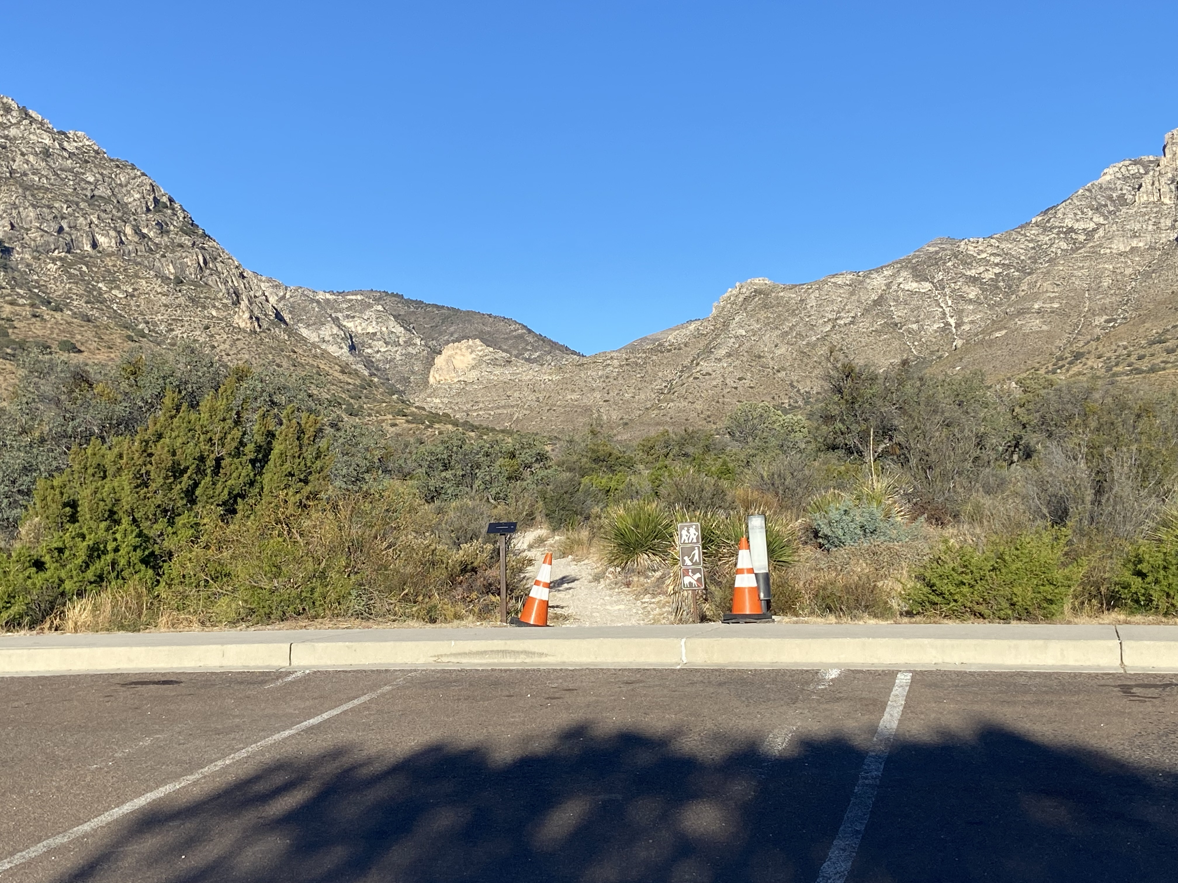
This short trail connects the visitor center to the campground and the trailhead area at Pine Springs. During peak periods, many hikers will use this to travel from the visitor center parking lot to the trailhead and on to their day hike destinations.
Distance: 0.2 miles (0.3 km) from the visitor center to the campground; 0.4 miles (0.6 km) from the visitor center parking lot to the upper trailhead.
Elevation Change: 102 feet
Time Estimate: 10 minutes
Difficulty: Easy
Leashed pets are allowed on this trail.
Accessibility Trail surfaces are loose rock or hardened rock surfaces. Hiking or trekking poles are highly recommended. Trail widths vary from two to six feet depending on the trail. Parking All trailhead areas have accessible parking available. Service animals Only service animals that have been individually trained to perform specific tasks for the benefit of persons with disabilities are allowed in the park and on trails.
Can I Take My Dog? the Park Service's write-up
1-1 Hours · dogs allowed · entrance fee applies
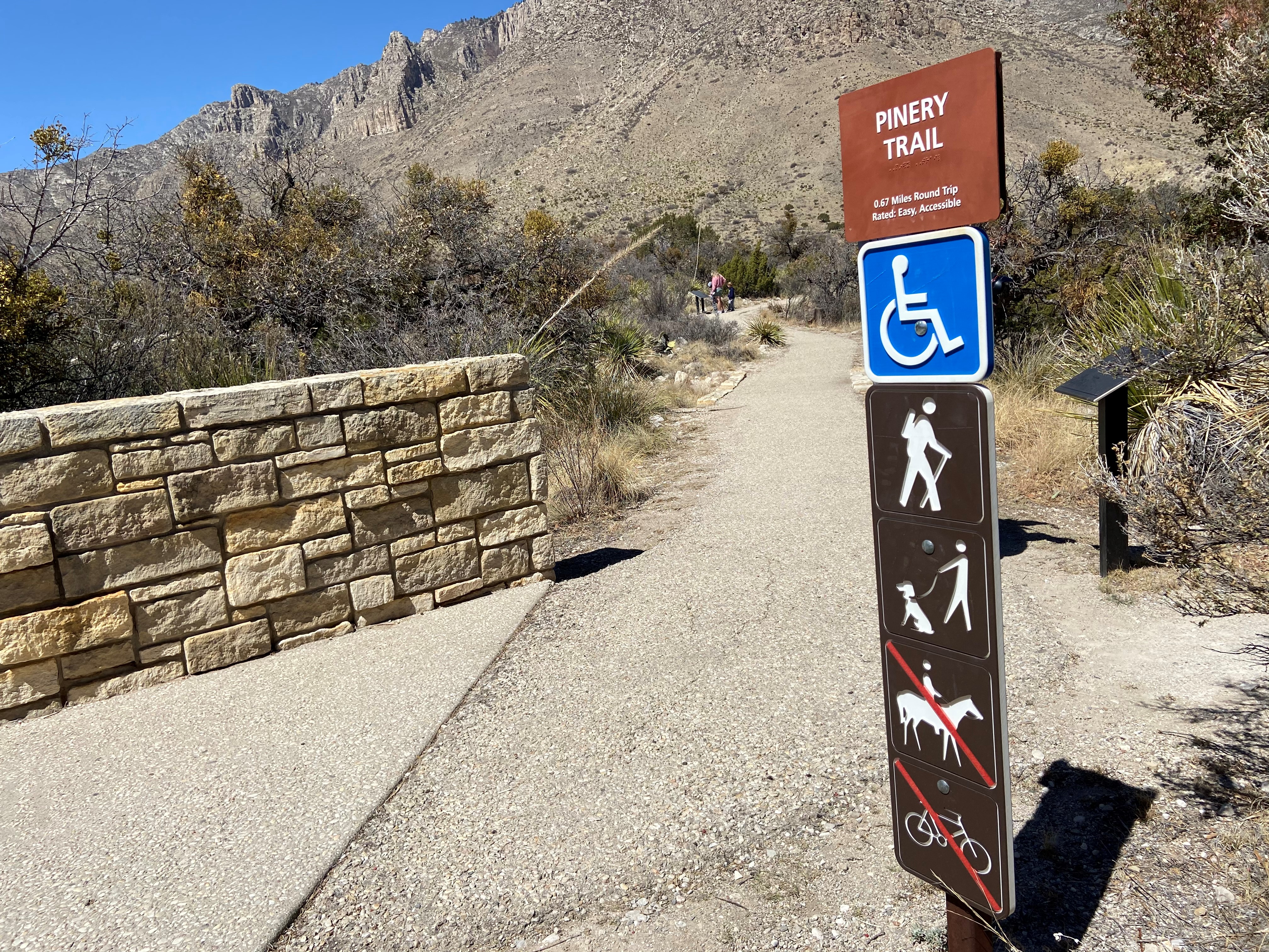
Opportunities for pets are limited. Leashed pets may walk on the short Pine Springs Campground connector trail or along the Pinery Trail from the visitor center to the Butterfield Stage Station.
Leashed pets are allowed:
The Pine Springs Campground connector trail to the Pine Springs Visitor Center or along the Pinery Trail from the visitor center to the Butterfield Stage Station.
On and within 30 feet of paved and unpaved park roads open for public vehicular use.
In parking areas.
In established picnic areas.
In frontcountry developed campgrounds.
At Guadalupe Mountains, pets are prohibited:
in park buildings
in restrooms
at public programs
in the backcountry
on ALL park trails except the Pinery Trail and the Pine Springs Campground connector trail.
Learn more about pet policies and restrictions in the park.
Accessibility Parking All trailhead areas have accessible parking available. Service animals Only service animals that have been individually trained to perform specific tasks for the benefit of persons with disabilities are allowed in the park and on trails.
Pinery Trail the Park Service's write-up
20-30 Minutes · dogs allowed · entrance fee applies
Start Trailhead
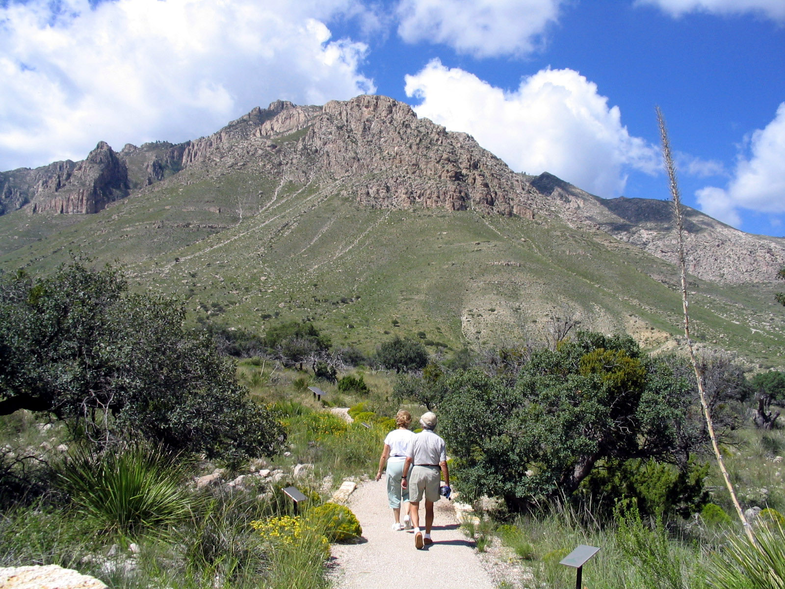
Discover the desert as you walk from the Visitor Center to the ruins of the Pinery Station . The accessible Pinery Trail offers visitors an opportunity to take a quick walk on a paved trail. The trail also features ruins of the Old Butterfield Stagecoach Route Pinery Station built in 1858.
Distance: 0.75 miles (1.2 km) round-trip, out and back
Elevation Change: 40 feet
Time Estimate: 20-30 minutes
Difficulty: Easy
Trail Type: Paved
Leashed pets are allowed on this trail.
Accessibility From the visitor center to the Pinery, this trail is paved and fully accessible. Parking All trailhead areas have accessible parking available. Service animals Only service animals that have been individually trained to perform specific tasks for the benefit of persons with disabilities are allowed in the park and on trails.
Pratt Cabin Access Trail
Picnic areas
Along the way Pratt Cabin Picnic Area
Salt Basin Overlook
Salt Basin Overlook Loop
Views
Along the way Salt Basin Overlook
Shumard Campground Access
Smith Spring Trail
Springs
Along the way Manzanita Spring Smith Spring
Trailhead Frijole Ranch Trailhead 5,537 ft Drive there
Smith Spring Trail Loop the Park Service's write-up
1-2 Hours · no dogs · entrance fee applies
Start Trailhead
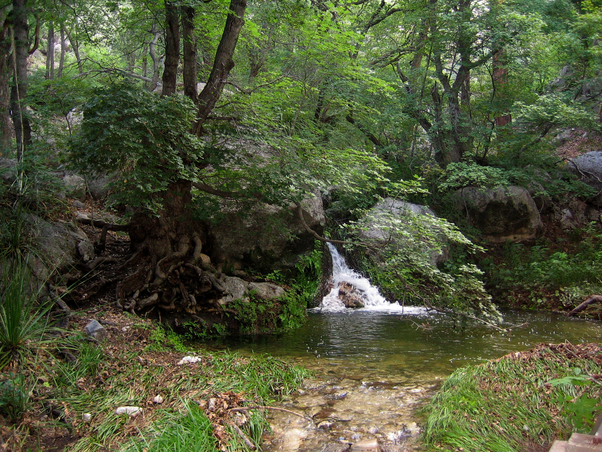
The Smith Spring Loop is paved from Frijole Ranch to Manzanita Spring. It then ascends along a maintained trail to the heavily vegetated Smith Spring. The trail offers dramatic views of the surrounding mountains, foothills, and desert landscape. The spring is a shady oasis of water up against the mountains.
Distance: 2.3 miles (3.7 km) round-trip, loop
Elevation Change: 402 feet
Time Estimate: 1-2 hours
Difficulty: Easy - Moderate
Pets Pets disturb wildlife and are not allowed on trails. Your pets should remain at home as opportunities for pets are very limited in the park.
Accessibility To the Frijole Ranch buildings and the Manzanita Spring the trail is a paved surface. Trail surfaces past Manzanita Spring are loose rock or hardened rock surfaces. Hiking or trekking poles are highly recommended. Trail widths vary from two to six feet depending on the trail. Parking All trailhead areas have accessible parking available. Service animals Only service animals that have been individually trained to perform specific tasks for the benefit of persons with disabilities are allowed in the park and on trails.
Tejas Campground Access
Campgrounds
Along the way Tejas Campground
Tejas Trail
CampgroundsPicnic areas
Along the way Tejas Campground Pine Springs Trailhead Picnic Area
Trailheads Dog Canyon Trailhead 6,298 ft Drive there · Pine Springs Trailhead 5,838 ft Drive there
Hunter Peak the Park Service's write-up
6-8 Hours · no dogs · entrance fee applies
Start Loop hike to the Hunter Peak Summit
The hike to Hunter Peak is a challenging day hike done as a loop up the Bear Canyon Trail and down the Tejas Trail that provides solitude, stunning views, and opportunities for side trails into the Bowl area.
Distance: 8.7 miles (14.0 km) round-trip, loop
Elevation Change: 2,700 feet
Time Estimate: 6-8 hours
Difficulty: Strenous
Hunter Peak is at an elevation of 8,368 feet above sea level, rising 2,700 feet above Pine Springs. Hunter Peak was named after ranchers J. C. Hunter and J. C. Hunter, Jr., who owned much of the land now included in the park.
The summit of Hunter Peak may have among the best views in the park—half the panorama is of the vast desert to the south, and the remainder is of other mountains and the sheltered pine forest of the Bowl to the north, as well as an unparalleled view across Pine Springs Canyon at Guadalupe Peak.
The hike to the summit involves climbing 2,540 feet, along two trails—either the first 3.6 miles of the Tejas Trail up the side of Pine Spring Canyon, or the Bear Canyon Trail along the next ravine to the east of Hunter Peak. These two routes are linked by the Bowl Trail, from which a short spur leads to the Hunter Peak summit, hence the trip can be done as a loop up one trail and down the other, a total hike of 8.7 miles.
Which Way Up?
While the climb is steep, rangers recommend that hikers ascend Bear Canyon, rather than hike down it. Bear Canyon gains 2,000 feet in just under two miles, while the Tejas Trail takes the twice the distance to climb the same elevation.
Pets Pets disturb wildlife and are not allowed on trails. Your pets should remain at home as opportunities for pets are very limited in the park.
Accessibility Trail surfaces are loose rock or hardened rock surfaces. Hiking or trekking poles are highly recommended. Trail widths vary from two to six feet depending on the trail. Parking All trailhead areas have accessible parking available. Service animals Only service animals that have been individually trained to perform specific tasks for the benefit of persons with disabilities are allowed in the park and on trails.
Lost Peak Saddle the Park Service's write-up
3-6 Hours · no dogs · entrance fee applies · Winter, Spring, Fall
Start Begin at the Dog Canyon Trailhead
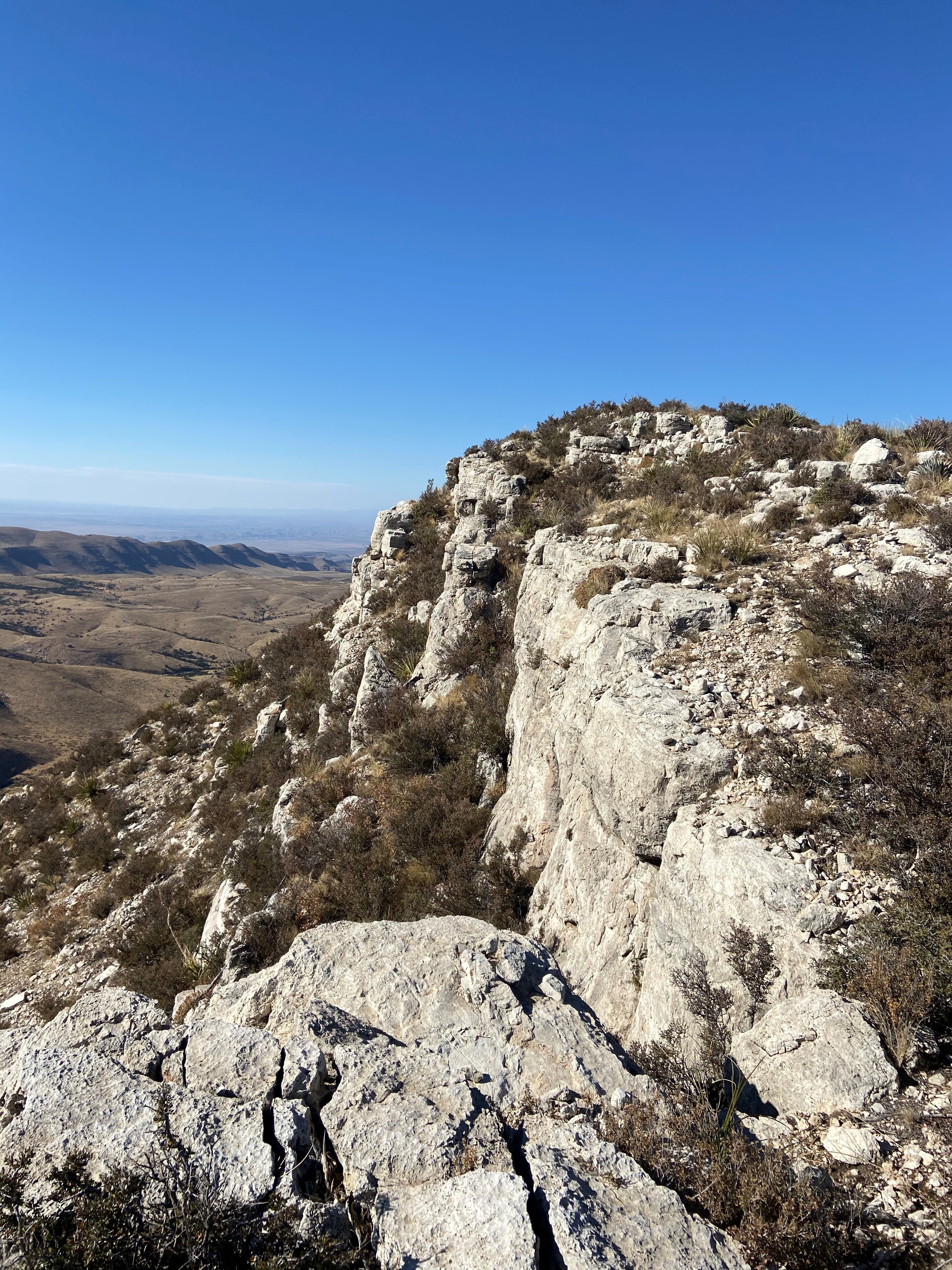
Hiking the Tejas Trail from Dog Canyon out to the Lost Peak Saddle and back makes an excellent day hike in the Guadalupe Mountains. Climbing up through Dog Canyon, this route culminates at the saddle below the Lost Peak Summit. No trail leads to the summit itself. This hike explores the dramatic scenery found in upper Dog Canyon.
Distance: 6.4 miles (10.3 km) round-trip, out and back
Elevation Change: 1,386 feet
Time Estimate: 3-6 hours
Difficulty: Moderate
Pets Pets disturb wildlife and are not allowed on trails. Your pets should remain at home as opportunities for pets are very limited in the park.
Accessibility Trail surfaces are loose rock or hardened rock surfaces. Hiking or trekking poles are highly recommended. Trail widths vary from two to six feet depending on the trail. Parking All trailhead areas have accessible parking available. Service animals Only service animals that have been individually trained to perform specific tasks for the benefit of persons with disabilities are allowed in the park and on trails.
Pine Springs to McKittrick Canyon the Park Service's write-up
12-16 Hours · no dogs · entrance fee applies
The Tejas Trail is the primary north/south through trail within the park, connecting the Pine Springs Trailhead with the Dog Canyon Trailhead at the park's northern boundary. This major artery can be used to connect to numerous other trails to make a variety of loops.
Headed north the trail climbs out of Pine Springs Canyon into the Wilderness high country. The central portion of the trail from Pine Top until the McKittrick Canyon Trail junction is forested, passing through the Bowl and numerous drainages.
The trail gradually ascends from the McKittrick Canyon junction to a high point of 7,916 feet before descending along the ridge above South McKittrick Canyon. The descent of 2,380 feet in about two miles provides spectacluar views into the canyon and the ridges that border it. The trail follows the floor of South McKittrick Canyon for the last four miles before returning to the McKittrick Canyon Trailhead.
This is an extremely rewarding trail, offering both the variety of McKittrick Canyon and the grandeur of the high ridges that surround it. The floor of McKittrick Canyon provides a panoramic experience through the unique environments of the canyon; to protect this special habitat, visitors are asked to stay on the trail and stay out of the water.
Overnight backpacking is recommended at Pine Top, Tejas, Mescalero, and/or McKittrick Ridge Wilderness Campgrounds.
Distance: Total distance from the Pine Springs Trailhead to the McKittrick Canyon Trailhead is 18.8 miles (30.4 km).
For more detailed information on trails, check our trail descriptions page.
Elevation Change: Accumulation of 3,200 feet
Time Estimate: 12-16 hours
Difficulty: Strenuous
Duration: Minimum of one night, two days.
Trailheads: Pine Springs and McKittrick Canyon Trailheads. The drive between the trailheads is 20-30 minutes. No shuttle service runs between the two trailheads.
Pets Pets disturb wildlife and are not allowed on trails. Your pets should remain at home as opportunities for pets are very limited in the park.
Accessibility Trail surfaces are loose rock or hardened rock surfaces. Hiking or trekking poles are highly recommended. Trail widths vary from two to six feet depending on the trail. Parking All trailhead areas have accessible parking available. Service animals Only service animals that have been individually trained to perform specific tasks for the benefit of persons with disabilities are allowed in the park and on trails.
Tejas Thru Hike the Park Service's write-up
7-9 Hours · no dogs · entrance fee applies
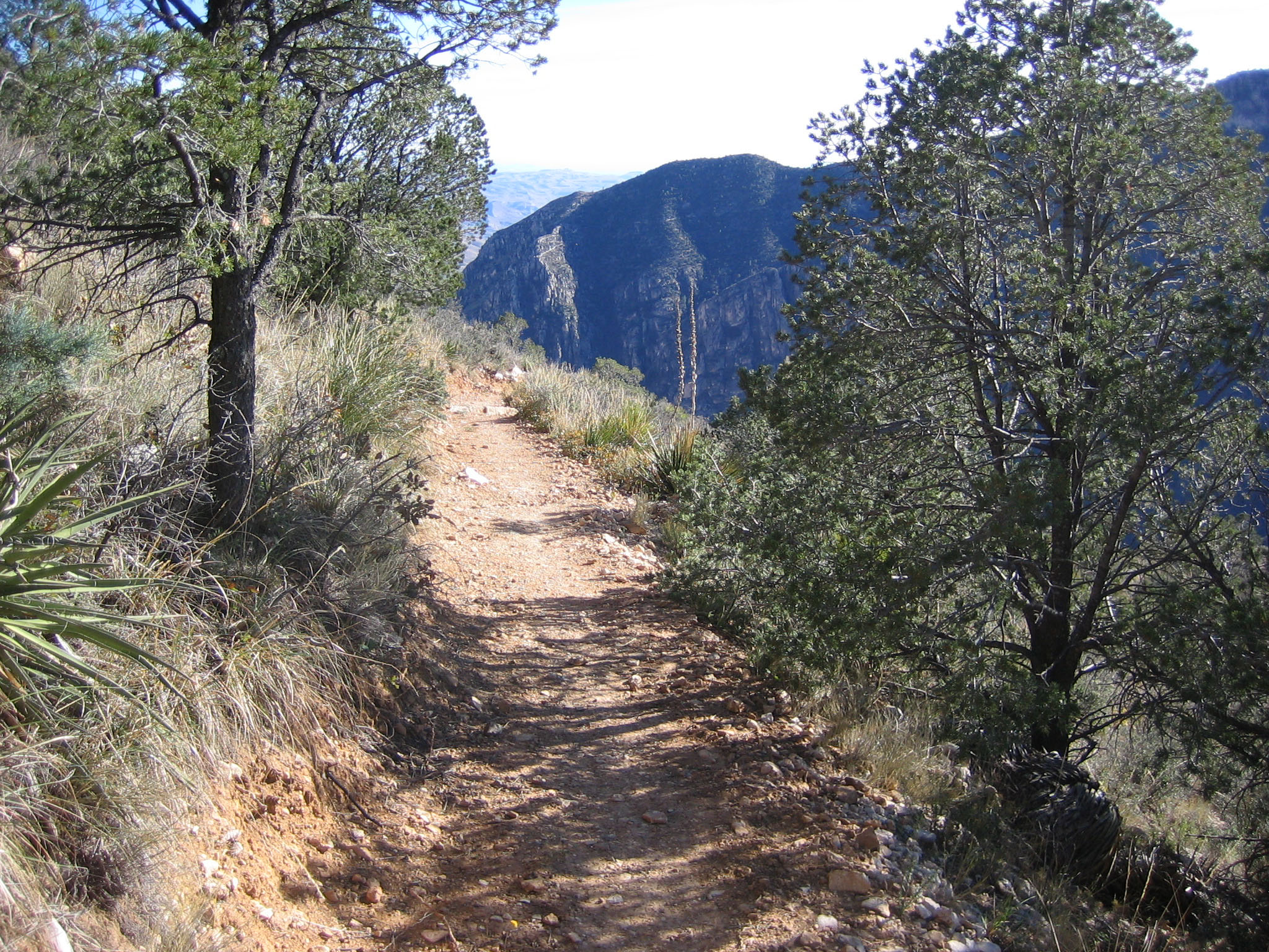
The Tejas Trail is the primary north/south through trail within the park, connecting the Pine Springs Trailhead with the Dog Canyon Trailhead at the park's northern boundary. This major artery can be used to connect to numerous other trails to make a variety of loops.
Headed north the trail climbs out of Pine Springs Canyon into the Wilderness high country. The central portion of the trail from Pine Top until the McKittrick Canyon Trail junction is forested, passing through the Bowl and numerous drainages. The route passes the saddle at Lost Peak. No trail leads to the summit itself. Descending from the area of Lost Peak the trail passes through the grassy areas that define the northern portion of the park.
Overnight backpacking is recommended at Pine Top, Tejas, and/or Mescalero Wilderness Campgrounds.
Distance: 11.8 miles (19.0 km) one way
For more detailed information on trails, check our trail descriptions page.
Elevation Change: Accumulation of 3,000 feet
Time Estimate: 7-9 hours
Difficulty: Strenuous
Duration: Minimum of one night, two days.
Trailhead: Pine Springs and Dog Canyon Trailheads. The drive between the trailheads is two hours. No shuttle service runs between the two trailheads.
Pets Pets disturb wildlife and are not allowed on trails. Your pets should remain at home as opportunities for pets are very limited in the park.
Accessibility Trail surfaces are loose rock or hardened rock surfaces. Hiking or trekking poles are highly recommended. Trail widths vary from two to six feet depending on the trail. Parking All trailhead areas have accessible parking available. Service animals Only service animals that have been individually trained to perform specific tasks for the benefit of persons with disabilities are allowed in the park and on trails.
Visitor Horse Corrals Access
Backcountry camps
Along the way Frijole Corral Group Campground
Wilderness Ridge Campground Trail
Campgrounds
Along the way Wilderness Ridge Campground
Wilderness Ridge Trail
Campgrounds
Along the way Wilderness Ridge Campground
Permian Reef Trail the Park Service's write-up
5-7 Hours · no dogs · entrance fee applies · Winter, Spring, Fall
The Permian Reef Trail climbs the north side of McKittrick Canyon to the top of Wilderness Ridge, providing sweeping views into South McKittrick Canyon. At the park boundary, and state line, the trail continues into New Mexico and the Lincoln National Forest. The slopes above the canyon face south, thereby receiving full sun all day, hence the hike is best avoided during hot periods in summer.
Distance: 4.0 miles (6.4 km) to top of ridge; 4.5 miles (7.2 km) to Wilderness Ridge Campground; 4.8 miles (7.7 km) to park boundary (one way distances)
Elevation Change: 2,000 feet
Time Estimate: 5-7 hours
Difficulty: Strenuous
In addition to providing sweeping views of the landscape, the trail was designed to showcase the Permian age geologic and fossil features preserved in the park. For those with a serious interest in Geology, a detailed guidebook for the features seen along the trail from the Texas Bureau of Economic Geology can be purchased at the visitor center.
Pets Pets disturb wildlife and are not allowed on trails. Your pets should remain at home as opportunities for pets are very limited in the park.
Accessibility Trail surfaces are loose rock or hardened rock surfaces. Hiking or trekking poles are highly recommended. Trail widths vary from two to six feet depending on the trail. Parking All trailhead areas have accessible parking available. Service animals Only service animals that have been individually trained to perform specific tasks for the benefit of persons with disabilities are allowed in the park and on trails.
More hikes the Park Service describes
Write-ups that name no single mapped trail, in the Service's words.
- Day Hike Preparation · no dogs
As with most activities, hikers face potential risks. Knowledge and preparation can increase your comfort level and reduce your chances of injury. Remember, you are ultimately responsible for your own safety. - Dealing with Human Waste · 5-15 Minutes · no dogs
Nothing can spoil a trip in the Guadalupe Mountains Wilderness as quickly as the discovery of human waste or toilet paper at a prime camping spot or along the trail. Always use the restroom before hiking. If you are on the trail for the day or an extended trip, be prepared to pack out human waste, toilet paper, diapers, and hygiene products. Human waste disposal bags are highly recommended to transport solid waste. - Hike to Fall Colors · 2-6 Hours · no dogs · Fall
Bright fall colors of deciduous trees are not common in the southwest, but elevation and environment combine in the Guadalupe Mountains for a seasonally striking display usually from mid-October to Mid-November. A series of short and long hikes of varying degrees of difficulty will bring you to glimpse of this annual splendor. - Hiking off-trail · 1-8 Hours · no dogs · Spring, Fall
A new kind of experience in the Guadalupe Mountains starts where the maintained trail ends. However, off-trail hiking requires planning and preparation and carries a great deal of risk. Any person or persons planning to hike off trail in the park must stop by the Pine Springs Visitor Center and be issued an off-trail hiking permit. - Hiking with a Group · 1-10 Hours · no dogs
In order to protect sensitive ecosystems and limit the impacts on the natural landscape, day-use hiking groups may not be larger than twenty persons on any trails in the park. This page provides suggestions on how to split your group up in order to preserve Wilderness character, and limit adverse impacts on park resources. - Leave No Trace · no dogs
Each of us plays a vital role in protecting our national parks. As we spend time outdoors, in the natural world and in wilderness, it’s important to be conscious of the effects our actions may have on plants, animals, other people, and even entire ecosystems. Following the Leave No Trace Seven Principles, summarized below, can help us minimize those impacts. - Search and Rescue Policy · no dogs
Search and rescue actions are conducted on a discretionary basis. The level and necessity of the response is determined through evaluation of the situation by field personnel. Rescuer safety is always our first priority. This park expects visitors to exhibit a high degree of self-reliance and responsibility for their own safety in line with the difficulty of their chosen activities. There is little to no cell reception in most areas of the park. - Virtual Summit Log · no dogs
When you reach a summit or other destination in the park, take a group photo or selfie in areas of the park and post to social media and include the hashtag #GuadalupeMountains #guadalupepeak #hunterpeak #lostpeak or others hashtags using your device and social media service.
About these trails
The lines are the National Park Service's public trails layer, the trailheads and the waterfalls, views, peaks and historic places along them the Service's public points of interest, read 2026-10-14 and simplified for the map. The write-ups are the Service's own "things to do", unedited. Heights come from USGS 3DEP through Terrain Tiles on AWS (Mapzen/Tilezen), read along each line and rounded; a short trail on steep ground can be off by a few tens of feet. Closures change: check the park's own site before you go.