
Cascade Canyon
Forks of Cascade Canyon the Park Service's write-up
5-9 Hours · no dogs · Summer, Fall · season Cascade Canyon often holds snow until early-mid summer. Check conditions before attempting Cascade Canyon in the spring. Hikers should use caution when traveling over snow and not attempt Cascade Canyon unless they have previous snow experience and the proper equipment.
Start Jenny Lake
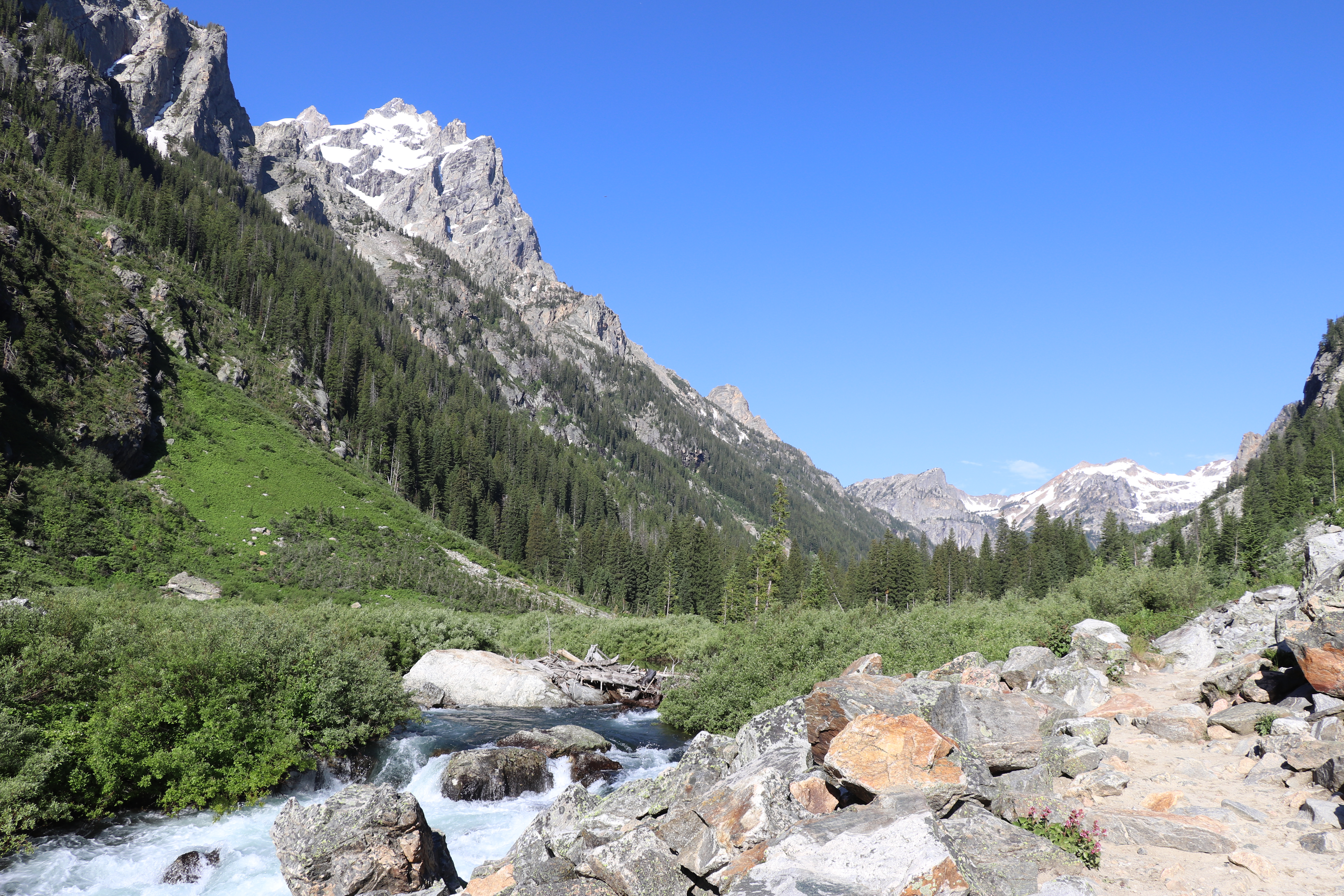
Cascade Canyon, a glacially carved u-shaped canyon, passes between Teewinot and Mount St. John to provide easy access into the Teton backcountry. This out and back trail is a popular option with visitors who want to get into the mountains without gaining a significant amount of elevation. While following Cascade Creek, the trail provides spectacular views of the surrounding peaks, including the Grand Teton, Mount Owen, and Teewinot. This trail also provides an opportunity to spot wildlife like moose and bears, as well as some of our alpine species like pika. While the trail continues several miles back into the canyon before splitting, you may stop and find a turning point at any time, making the trail as long or as short as you would like.
Accessibility Forks of Cascade Canyon Via Shuttle Boat Cascade Canyon is a moderately strenuous, 9.4 mi (15.1 km) RT out and back hike with 1,480 ft (450 m) of elevation gain with an average slope of 9%. Forks of Cascade Canyon Via South Jenny Lake Loop Trail Cascade Canyon is a strenuous, 13.3 mi (21.4 km) RT out and back hike with 1,720 ft (520 m) of elevation gain with an average slope of 9%. The hike to the first bridge with a view of Cascade Creek and its cascading waterfalls is fairly level with a set of stone steps gaining 65 ft over 0.2 mi (0.3 km). The trail to Inspiration Point features multiple sets of stone steps and a bridge crossing from the edge of Jenny Lake to Inspiration Point. No stair rail or handholds are available in the exposed last set of steps to Inspiration Point. Beyond Inspiration Point the trail gradually climbs over 500 ft crossing small streams and rock slides with numerous ups and downs. The trail surface is crushed rock and dirt.
Inspiration Point the Park Service's write-up
2-4 Hours · no dogs · Spring, Summer, Fall · season The trail often contains snow throughout spring and can be slick in spots. Use caution when traveling over snow.
Start Jenny Lake
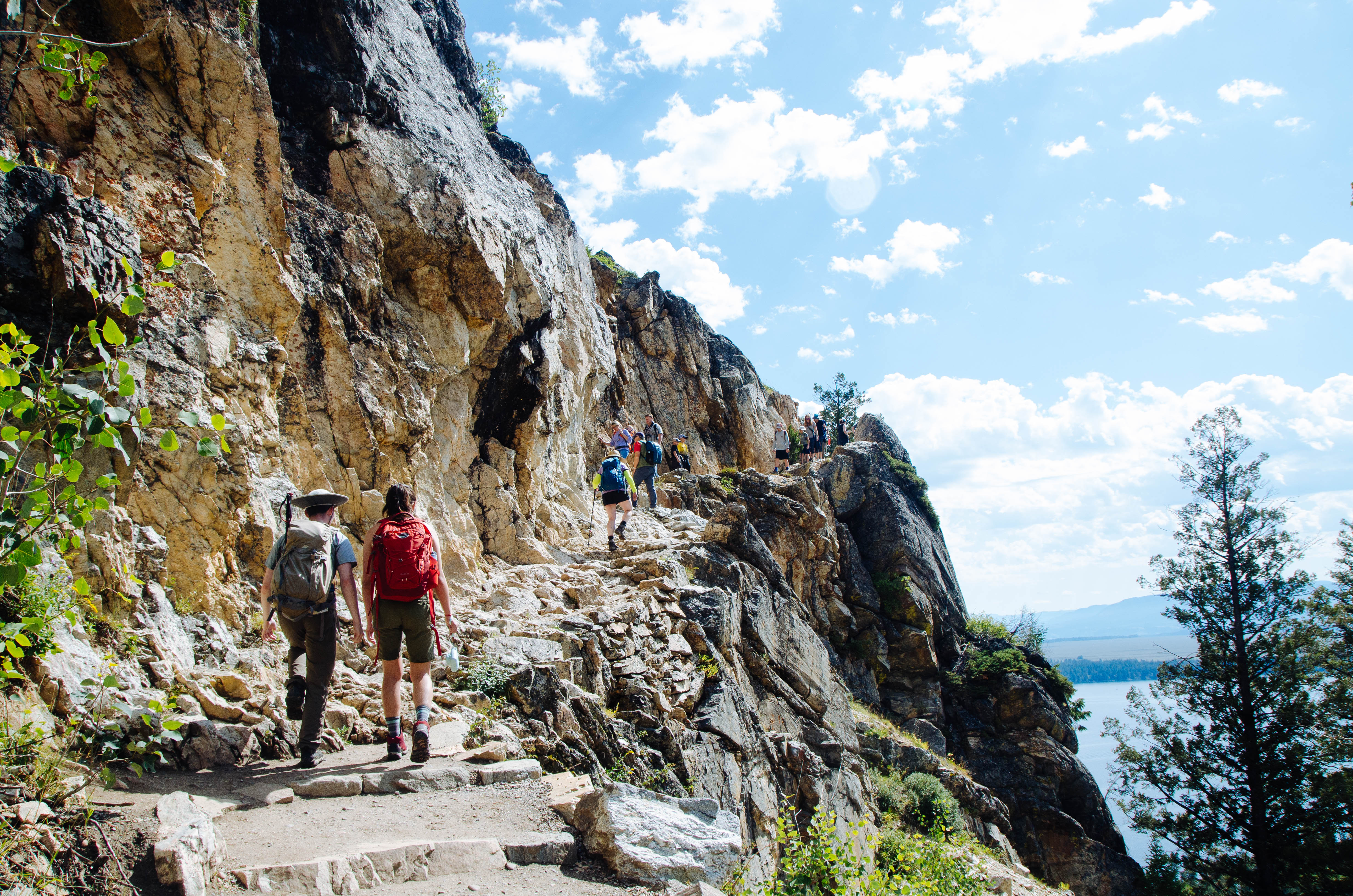
One of the most popular trails within the park, hiking to Hidden Falls and Inspiration Point allows for spectacular views of Jenny Lake, a 100 ft cascading waterfall, and the Jackson Hole Valley. Visitors may choose to walk around the southern lakeshore or utilize the privately-run shuttle boat to cross the lake and shorten the hike. (If you are planning on using the shuttle, be sure to check their hours and prices . Tickets are purchased directly at the boat dock.) Once on the west side, the trail gently slopes up 200 ft in elevation towards Hidden Falls, a 100 ft tall cascade fed by snowmelt. Visitors wishing to hike further can continue up the trail another 0.5 mile to Inspiration Point, which provides a view above Jenny Lake and out into the Jackson Hole Valley, as well as a view of Cascade Canyon and the Cathedral Group: Mount Owen, Teewinot, and the Grand Teton.
Accessibility Inspiration Point Via Shuttle Boat Inspiration Point is an easy, 1.8 mi (2.9 km) RT out and back hike with 550 ft (170 m) of elevation gain with an average slope of 16%. Inspiration Poin Via South Jenny Lake Loop Trail Inspiration Point is a moderate, 5.7 mi (9.2 km) RT out and back hike with 870 ft (270 m) of elevation gain with an average slope of 10%. The trail is dirt with several sections of rock stairs and exposed roots. The trail crosses exposed rock and features several steep switchbacks.
Jenny Lake Loop the Park Service's write-up
3-5 Hours · no dogs · Spring, Summer, Fall
Start Jenny Lake
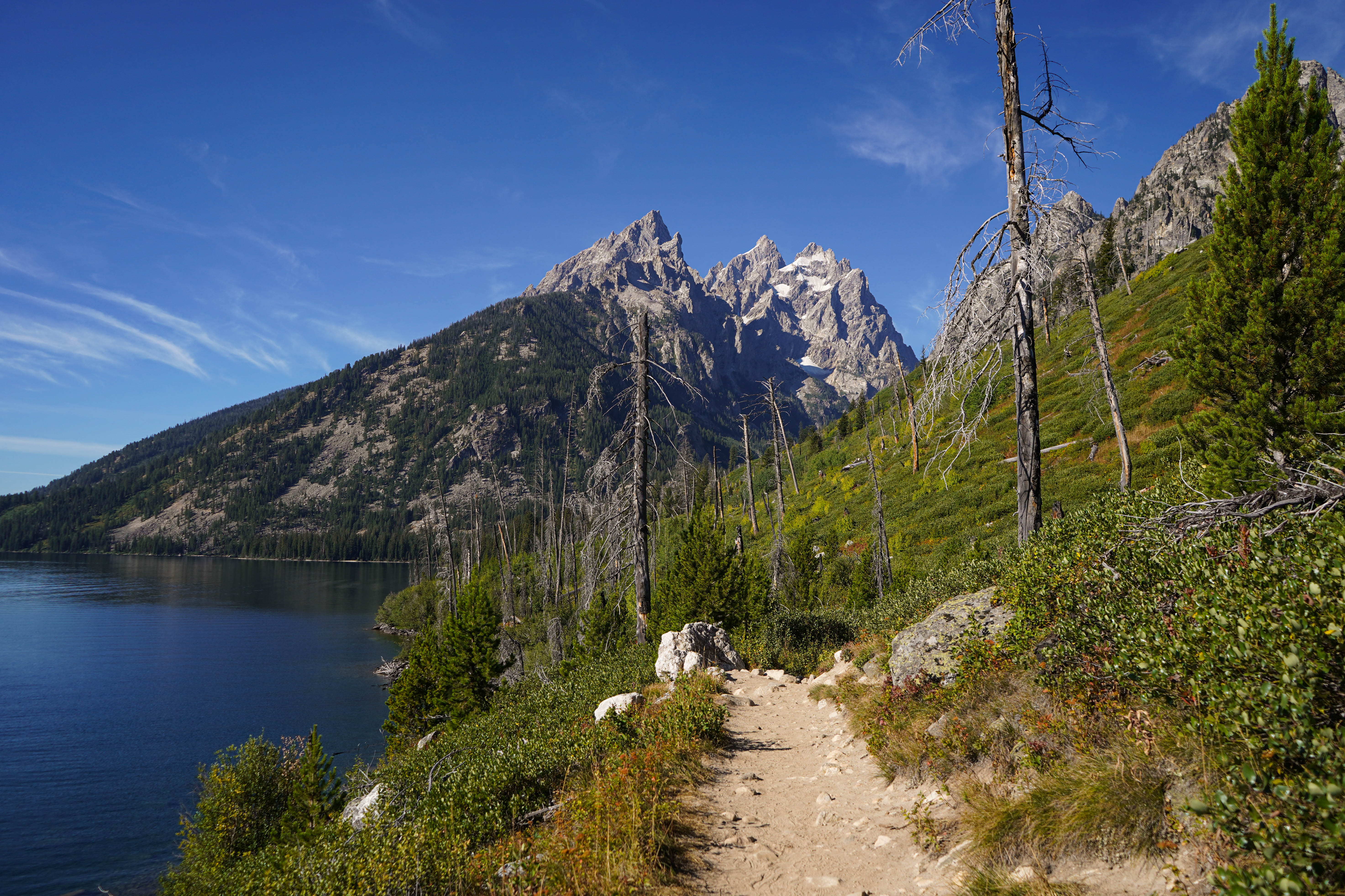
This loop trail provides a plethora of views including Cascade Canyon, the Cathedral Group, and Jenny Lake. From the Jenny Lake Trailhead, follow the trail north, along the east side of the lake, to the south end of String Lake. Cross the bridge to stay around Jenny Lake and spot some incredible views of the Cathedral Group: Mount Owen, the Grand Teton, and Teewinot. Continue south along the west side of Jenny Lake, passing trail junctions for Hidden Falls, Inspiration Point and Cascade Canyon, all of which are great trails that may be added to this hike if wanted. Around the southern shore you will pass Moose Ponds. Here, a short spur trail leading to an overlook where moose and beaver are frequently sighted may be added to the hike if desired. The trail ends back at the Jenny Lake Trailhead, completing the loop. This hike is a great option for visitors who enjoy mountain and lake views and are looking for a longer trail without too much elevation gain.
Accessibility The Jenny Lake Loop is a 7.1 mi (11.4 km) loop hike with 1,040 ft (320 m) of elevation gain with an average slope of 6%. The trail is dirt, narrow in sections, and features obstacles such as roots, exposed rock, and slight elevation change.
Paintbrush Canyon - Cascade Canyon Loop 20 mi loop · the Park Service's write-up
11-14 Hours · no dogs · Summer, Fall · season The Paintbrush-Cascade Loop is best accessed in summer after the snow melts, and in fall before the first snow arrives. Paintbrush Divide is a steep divide and often holds snow until July. Hikers should use caution when traveling over snow and not attempt the Paintbrush-Cascade Loop unless they have previous snow experience and the proper equipment.
Start String Lake
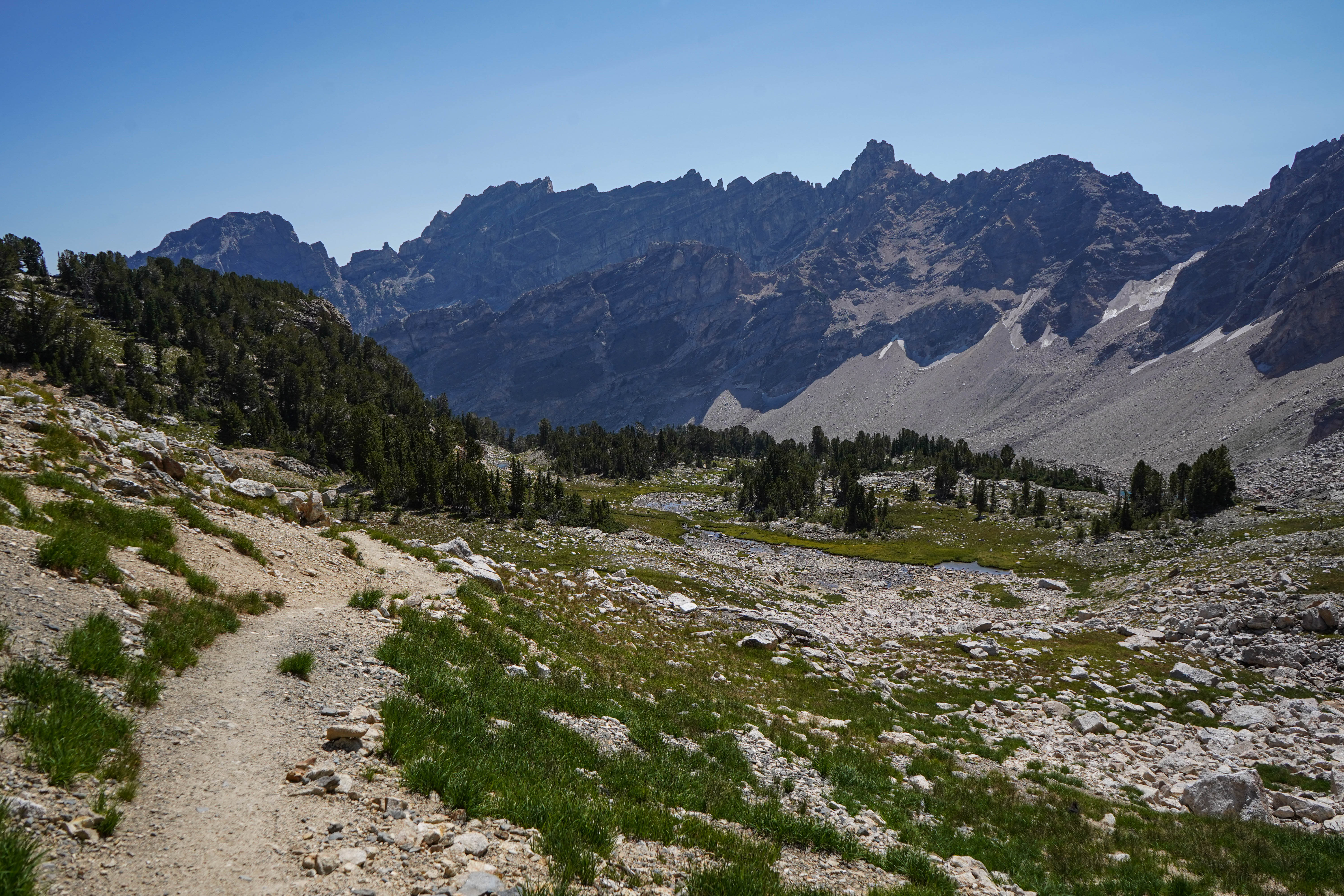
This very strenuous 20 mile loop takes you up Paintbrush Canyon, over Paintbrush Divide to Lake Solitude, and down Cascade Canyon. The trail offers some of the most spectacular views in the park, with the 10,700ft Paintbrush Divide offering panoramic views of Mount Moran, Mount Woodring, and Rockchuck Peak. From Lake Solitude, hikers have a direct view of the Grand Teton and Mount Owen. Hikers should plan on a full day to hike the loop. Before attempting the loop, stop by the Jenny Lake Ranger Station to speak with a ranger about conditions on Paintbrush Divide, as the divide often holds snow until mid-July and can be dangerous if attempted without the proper snow equipment.
Accessibility The Paintbrush Canyon - Cascade Canyon Loop is a very strenuous 19.9 mi (32 km) loop hike with 4,480 ft (1,365 m) elevation gain and an average slope of 9%. Trail obstacles include bridge crossings, steps, exposed roots and rocks, and steep switchbacks. Trail crosses a skree field that holds snow late in the year.