
National Park · Wyoming
Trails in Grand Teton National Park
122 named trails · 264 miles · 18 trailheads · 29 with the Park Service's own write-up. The lines, trailheads and points are the Park Service's; the write-ups are the Service's own words; the climbing is read from USGS elevation along each line.
122 trails, A to Z.
Alaska Basin Trail
Static Peak Divide Trail the Park Service's write-up
9-11 Hours · no dogs · Summer, Fall
Start Death Canyon Trailhead
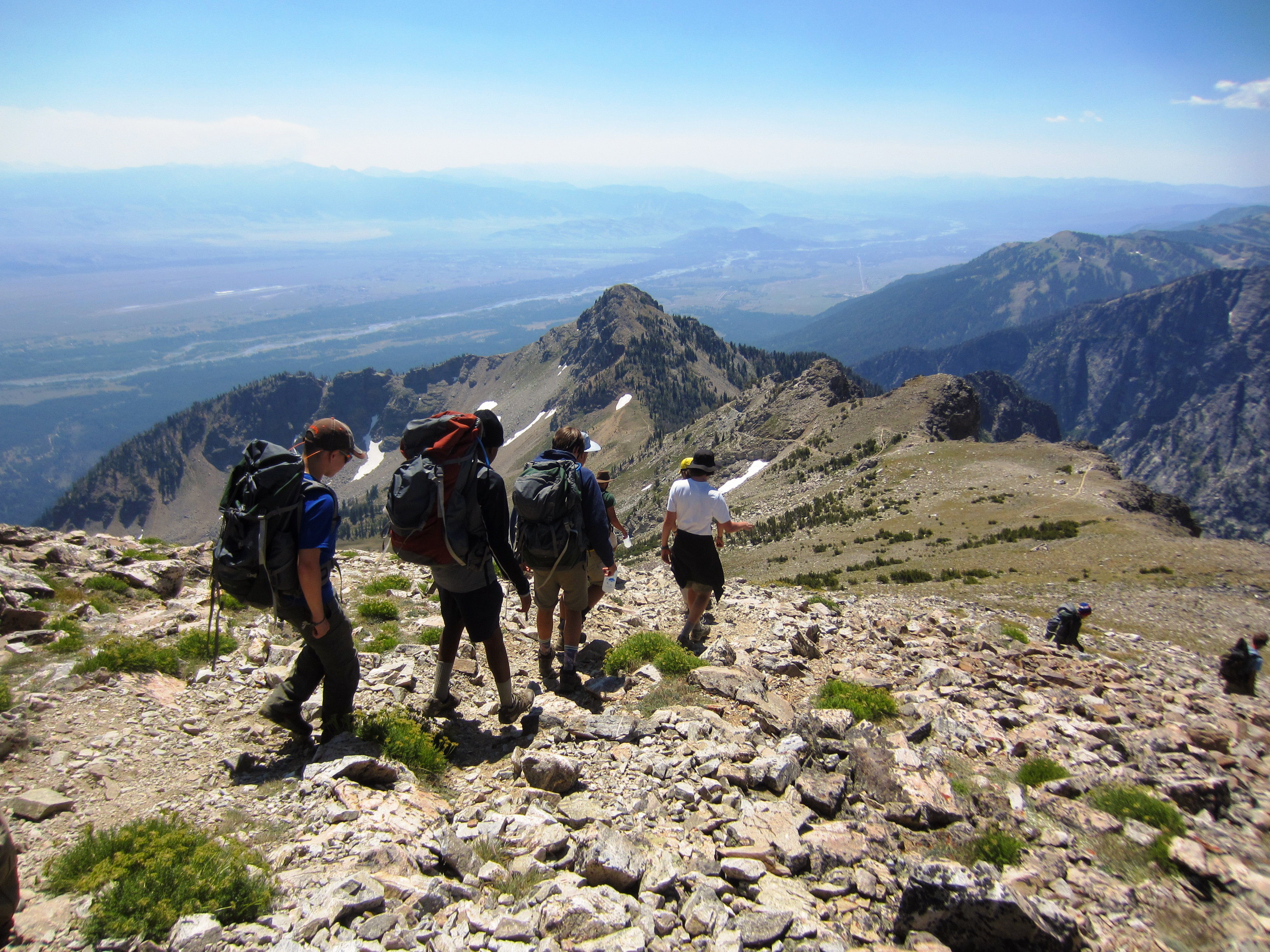
Static Peak Divide is a very strenuous hike that takes a full day to complete. After heading into Death Canyon, take the split to Static Peak Divide. The trail switchbacks up the side of the canyon, gaining significant elevation over the next few miles. This can be hazardous for those not acclimated to high altitude. The best cure for altitude sickness is to retreat to a lower elevation. Once at the divide, hikers will have stunning views of the Teton Range and Alaska Basin. Static Peak Divide often holds snow until July. Those planning to hike the divide should stop by the Craig Thomas Discovery and Visitor Center or the Jenny Lake Ranger Station before attempting the hike. Ice axes and crampons – along with the knowledge of how to use them – may be necessary until mid-summer.
Accessibility Static Peak Divide is a very strenuous, 16 mi (25.7 km) RT out and back hike with 5,590 ft (1,700 m) of elevation gain and an average slope of 15%. The trail is often narrow and steep, with exposed roots and sections crossing rock faces.
Arizona Creek
Aspen Ridge Trail
Aspen Ridge - Boulder Ridge the Park Service's write-up
3-5 Hours · no dogs · Spring, Summer, Fall
Start Laurance S. Rockefeller Preserve
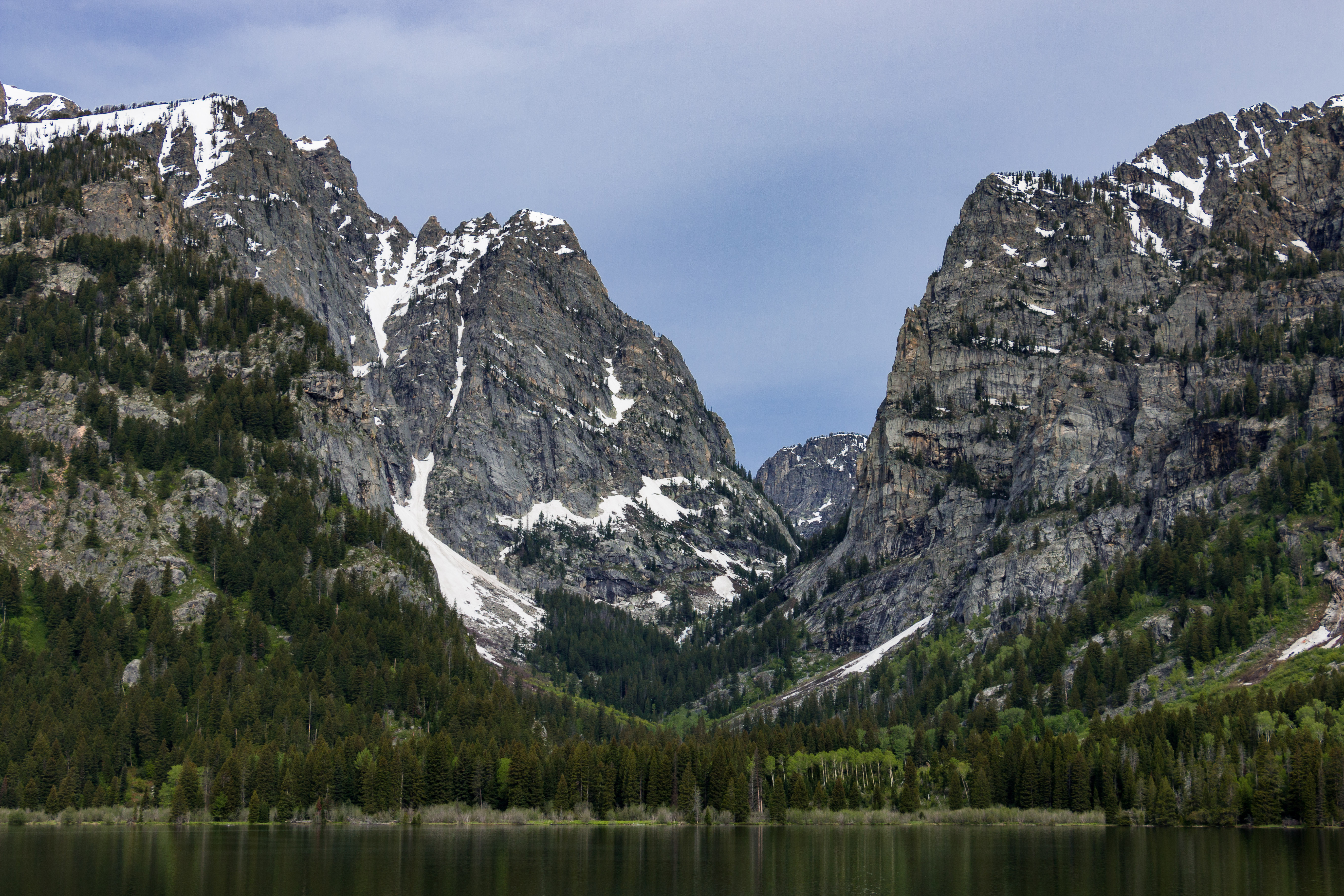
Hikers looking for a longer trail to Phelps Lake will enjoy this moderate loop. Leaving from the Laurance S. Rockefeller Preserve, follow the Aspen Ridge Trail. The trail takes hikers through aspen groves and boulder fields before reaching Phelps Lake. Once at the lake, the forest opens up to reveal the lake and views into Death Canyon. Follow the Boulder Ridge Trail to complete the loop back.
Accessibility The Aspen Ridge-Boulder Ridge Loop is a moderate, 6.2 mi (10 km) RT loop hike with 1,140 ft (350 m) of elevation gain with an average slope of 8%. The trail passes through a boulder field that can require boulder hopping and small climbs up and down. A seating bench is located at Phelps Lake.
Avalanche Divide Trail
Bearpaw Lake Trail
Backcountry camps
Along the way South District Lakes Bearpaw Lake 17B
Berry Creek Trail
Blacktail Ponds Trail
Views
Along the way Blacktail Ponds Overlook
Boat Dock
Boulder Ridge Trail
Aspen Ridge - Boulder Ridge the Park Service's write-up
3-5 Hours · no dogs · Spring, Summer, Fall
Start Laurance S. Rockefeller Preserve
Hikers looking for a longer trail to Phelps Lake will enjoy this moderate loop. Leaving from the Laurance S. Rockefeller Preserve, follow the Aspen Ridge Trail. The trail takes hikers through aspen groves and boulder fields before reaching Phelps Lake. Once at the lake, the forest opens up to reveal the lake and views into Death Canyon. Follow the Boulder Ridge Trail to complete the loop back.
Accessibility The Aspen Ridge-Boulder Ridge Loop is a moderate, 6.2 mi (10 km) RT loop hike with 1,140 ft (350 m) of elevation gain with an average slope of 8%. The trail passes through a boulder field that can require boulder hopping and small climbs up and down. A seating bench is located at Phelps Lake.
Bradley Lake Trail
Taggart Lake - Bradley Lake Loop the Park Service's write-up
2-3 Hours · no dogs
Start Taggart Lake Trailhead
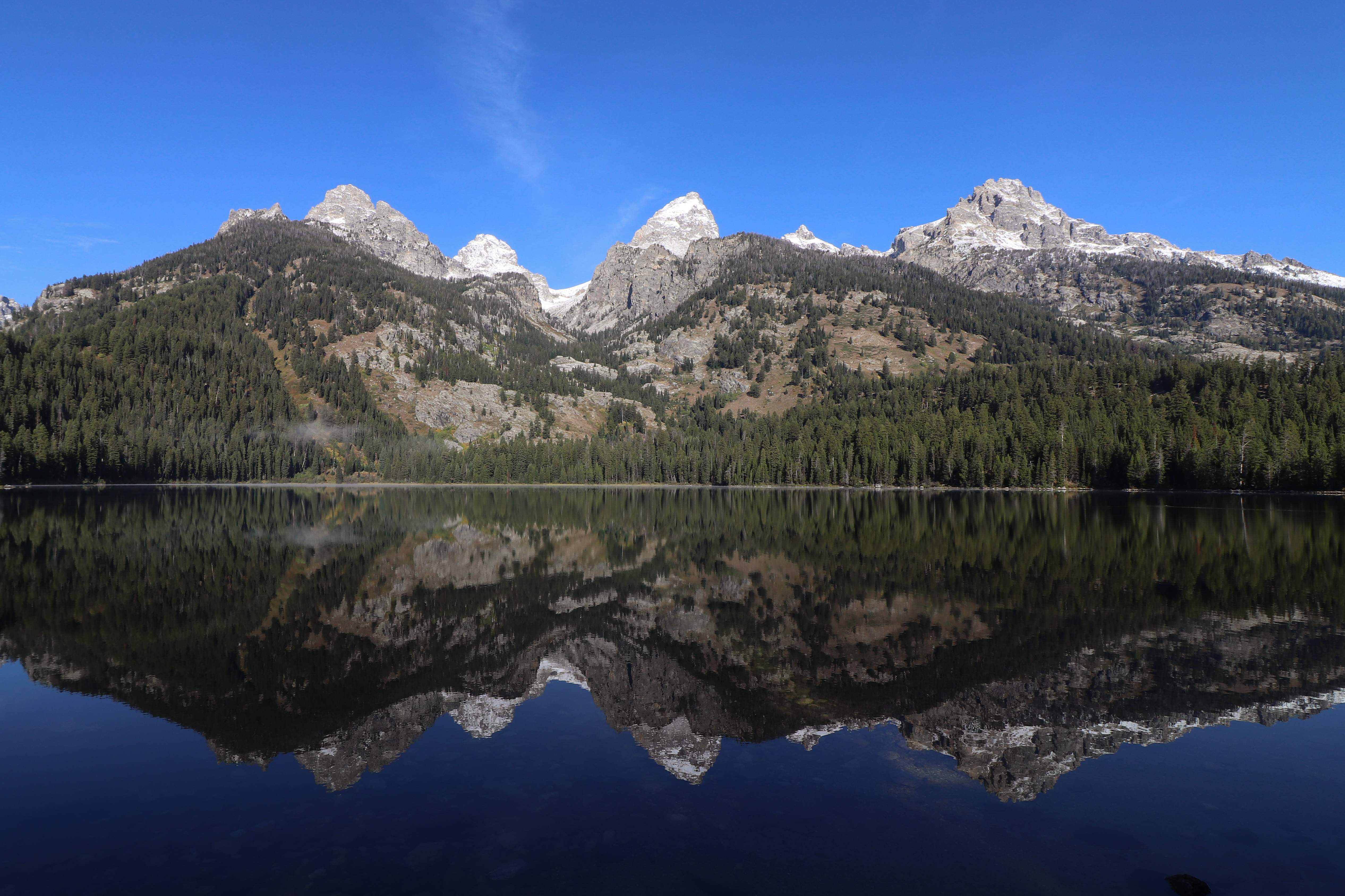
Hike to two alpine lakes on the Taggart Lake - Bradley Lake Loop. Leaving from the Taggart Lake Trailhead, hikers will wind up an aspen-covered moraine before the trail opens up to views of the Tetons. At the Bradley Lake trail split, follow the trail right to Bradley Lake. From Bradley Lake, follow signs to Taggart Lake and complete the loop back to the parking lot. Hikers will find spectacular views of two alpine lakes with the Teton Range behind.
Accessibility The Taggart Lake - Bradley Lake Loop is a 5.6 mile (9 km) roundtrip hike with 890 ft (262 m) of elevation gain and an average slope of 7%. To visit both lakes, the trail gains and loses elevation several times. The trail is ocassionally narrow and passes through dense underbrush. Large rocks can be found on the trail.
Bug Canyon Trail
Cascade Canyon
Forks of Cascade Canyon the Park Service's write-up
5-9 Hours · no dogs · Summer, Fall
Start Jenny Lake
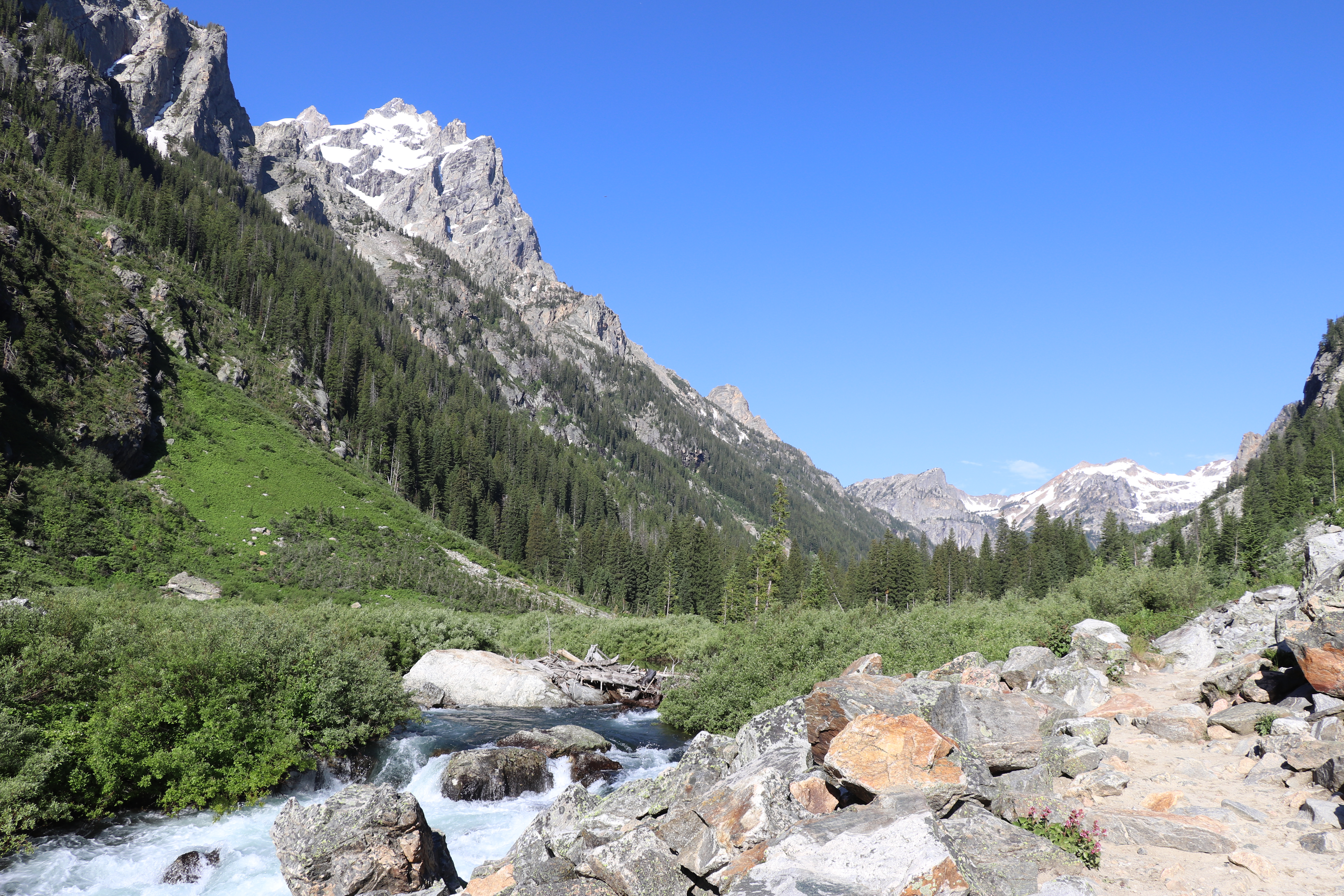
Cascade Canyon, a glacially carved u-shaped canyon, passes between Teewinot and Mount St. John to provide easy access into the Teton backcountry. This out and back trail is a popular option with visitors who want to get into the mountains without gaining a significant amount of elevation. While following Cascade Creek, the trail provides spectacular views of the surrounding peaks, including the Grand Teton, Mount Owen, and Teewinot. This trail also provides an opportunity to spot wildlife like moose and bears, as well as some of our alpine species like pika. While the trail continues several miles back into the canyon before splitting, you may stop and find a turning point at any time, making the trail as long or as short as you would like.
Accessibility Forks of Cascade Canyon Via Shuttle Boat Cascade Canyon is a moderately strenuous, 9.4 mi (15.1 km) RT out and back hike with 1,480 ft (450 m) of elevation gain with an average slope of 9%. Forks of Cascade Canyon Via South Jenny Lake Loop Trail Cascade Canyon is a strenuous, 13.3 mi (21.4 km) RT out and back hike with 1,720 ft (520 m) of elevation gain with an average slope of 9%. The hike to the first bridge with a view of Cascade Creek and its cascading waterfalls is fairly level with a set of stone steps gaining 65 ft over 0.2 mi (0.3 km). The trail to Inspiration Point features multiple sets of stone steps and a bridge crossing from the edge of Jenny Lake to Inspiration Point. No stair rail or handholds are available in the exposed last set of steps to Inspiration Point. Beyond Inspiration Point the trail gradually climbs over 500 ft crossing small streams and rock slides with numerous ups and downs. The trail surface is crushed rock and dirt.
Inspiration Point the Park Service's write-up
2-4 Hours · no dogs · Spring, Summer, Fall
Start Jenny Lake
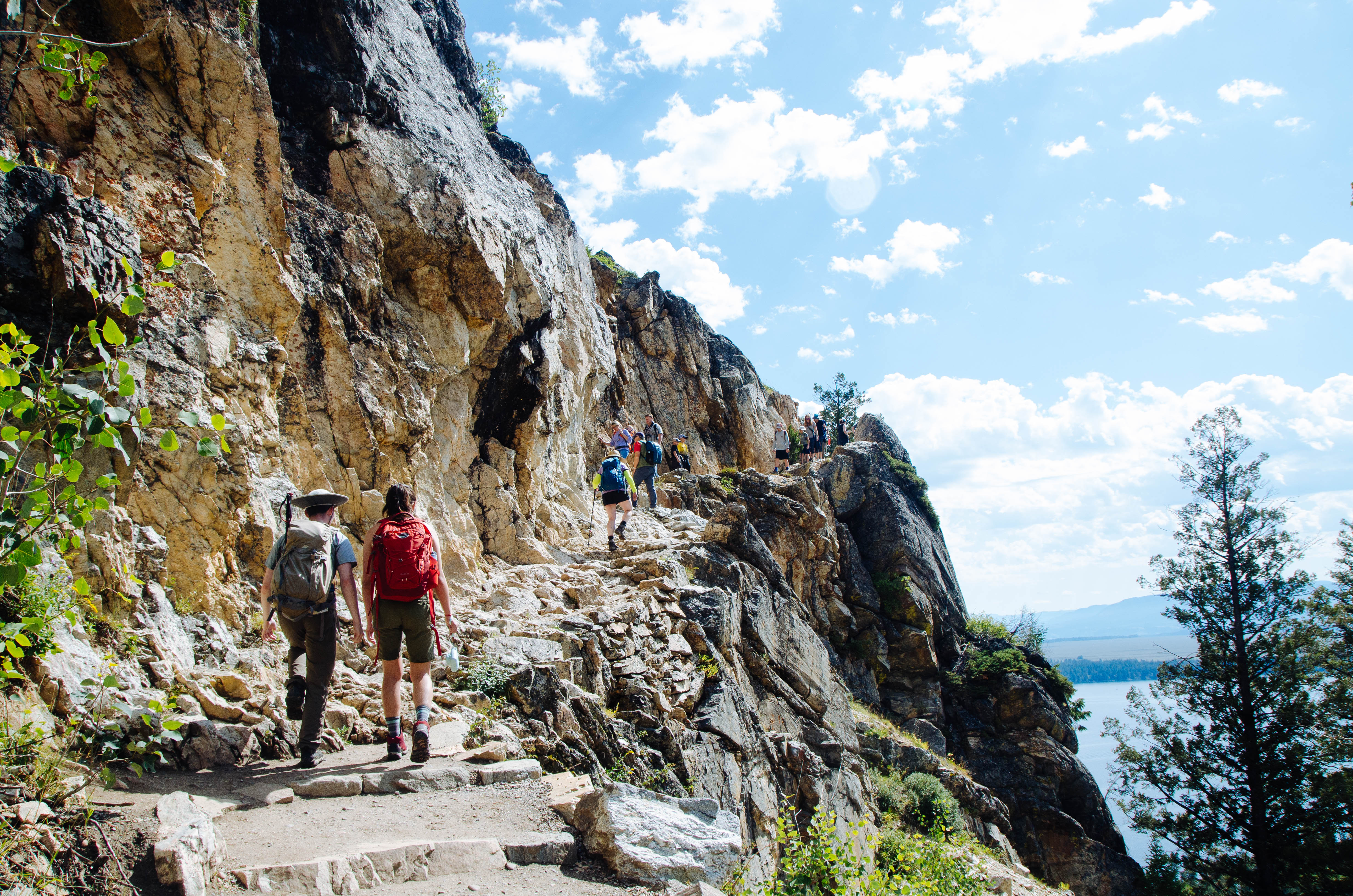
One of the most popular trails within the park, hiking to Hidden Falls and Inspiration Point allows for spectacular views of Jenny Lake, a 100 ft cascading waterfall, and the Jackson Hole Valley. Visitors may choose to walk around the southern lakeshore or utilize the privately-run shuttle boat to cross the lake and shorten the hike. (If you are planning on using the shuttle, be sure to check their hours and prices . Tickets are purchased directly at the boat dock.) Once on the west side, the trail gently slopes up 200 ft in elevation towards Hidden Falls, a 100 ft tall cascade fed by snowmelt. Visitors wishing to hike further can continue up the trail another 0.5 mile to Inspiration Point, which provides a view above Jenny Lake and out into the Jackson Hole Valley, as well as a view of Cascade Canyon and the Cathedral Group: Mount Owen, Teewinot, and the Grand Teton.
Accessibility Inspiration Point Via Shuttle Boat Inspiration Point is an easy, 1.8 mi (2.9 km) RT out and back hike with 550 ft (170 m) of elevation gain with an average slope of 16%. Inspiration Poin Via South Jenny Lake Loop Trail Inspiration Point is a moderate, 5.7 mi (9.2 km) RT out and back hike with 870 ft (270 m) of elevation gain with an average slope of 10%. The trail is dirt with several sections of rock stairs and exposed roots. The trail crosses exposed rock and features several steep switchbacks.
Jenny Lake Loop the Park Service's write-up
3-5 Hours · no dogs · Spring, Summer, Fall
Start Jenny Lake
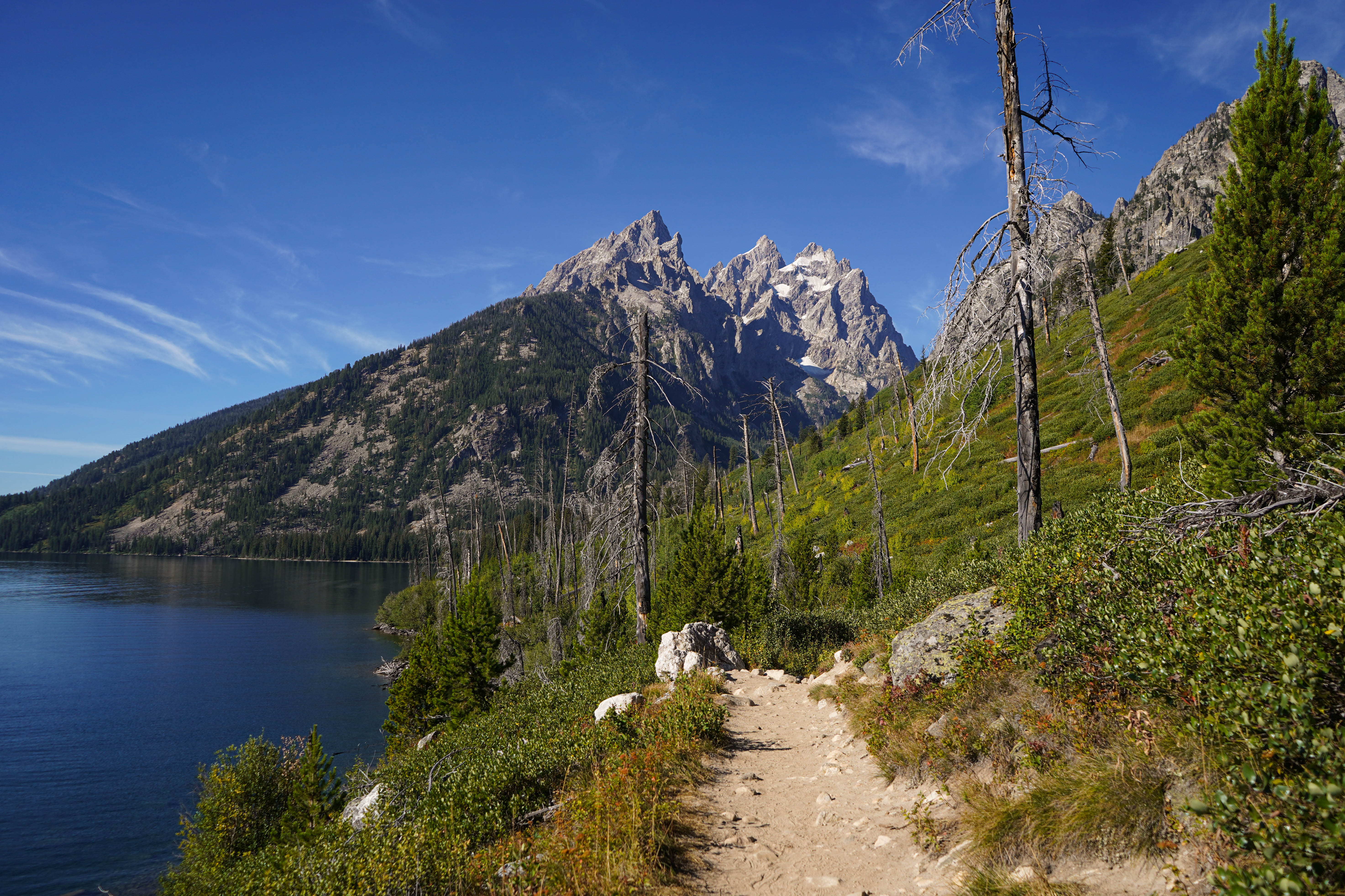
This loop trail provides a plethora of views including Cascade Canyon, the Cathedral Group, and Jenny Lake. From the Jenny Lake Trailhead, follow the trail north, along the east side of the lake, to the south end of String Lake. Cross the bridge to stay around Jenny Lake and spot some incredible views of the Cathedral Group: Mount Owen, the Grand Teton, and Teewinot. Continue south along the west side of Jenny Lake, passing trail junctions for Hidden Falls, Inspiration Point and Cascade Canyon, all of which are great trails that may be added to this hike if wanted. Around the southern shore you will pass Moose Ponds. Here, a short spur trail leading to an overlook where moose and beaver are frequently sighted may be added to the hike if desired. The trail ends back at the Jenny Lake Trailhead, completing the loop. This hike is a great option for visitors who enjoy mountain and lake views and are looking for a longer trail without too much elevation gain.
Accessibility The Jenny Lake Loop is a 7.1 mi (11.4 km) loop hike with 1,040 ft (320 m) of elevation gain with an average slope of 6%. The trail is dirt, narrow in sections, and features obstacles such as roots, exposed rock, and slight elevation change.
Paintbrush Canyon - Cascade Canyon Loop the Park Service's write-up
11-14 Hours · no dogs · Summer, Fall
Start String Lake
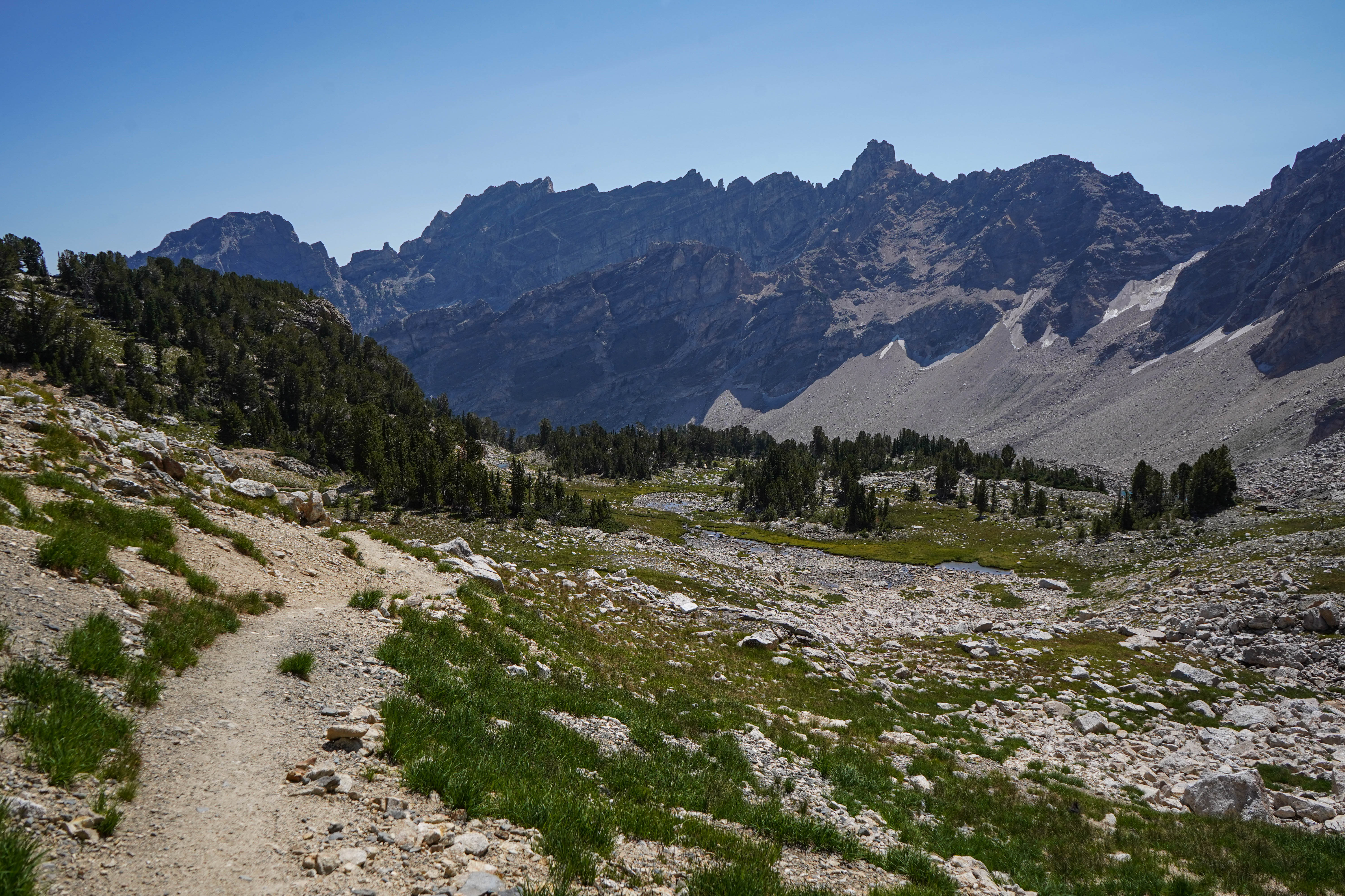
This very strenuous 20 mile loop takes you up Paintbrush Canyon, over Paintbrush Divide to Lake Solitude, and down Cascade Canyon. The trail offers some of the most spectacular views in the park, with the 10,700ft Paintbrush Divide offering panoramic views of Mount Moran, Mount Woodring, and Rockchuck Peak. From Lake Solitude, hikers have a direct view of the Grand Teton and Mount Owen. Hikers should plan on a full day to hike the loop. Before attempting the loop, stop by the Jenny Lake Ranger Station to speak with a ranger about conditions on Paintbrush Divide, as the divide often holds snow until mid-July and can be dangerous if attempted without the proper snow equipment.
Accessibility The Paintbrush Canyon - Cascade Canyon Loop is a very strenuous 19.9 mi (32 km) loop hike with 4,480 ft (1,365 m) elevation gain and an average slope of 9%. Trail obstacles include bridge crossings, steps, exposed roots and rocks, and steep switchbacks. Trail crosses a skree field that holds snow late in the year.
Christian Pond Loop
Christian Pond Loop the Park Service's write-up
1-3 Hours · no dogs · Spring, Summer, Fall
Start Jackson Lake Lodge
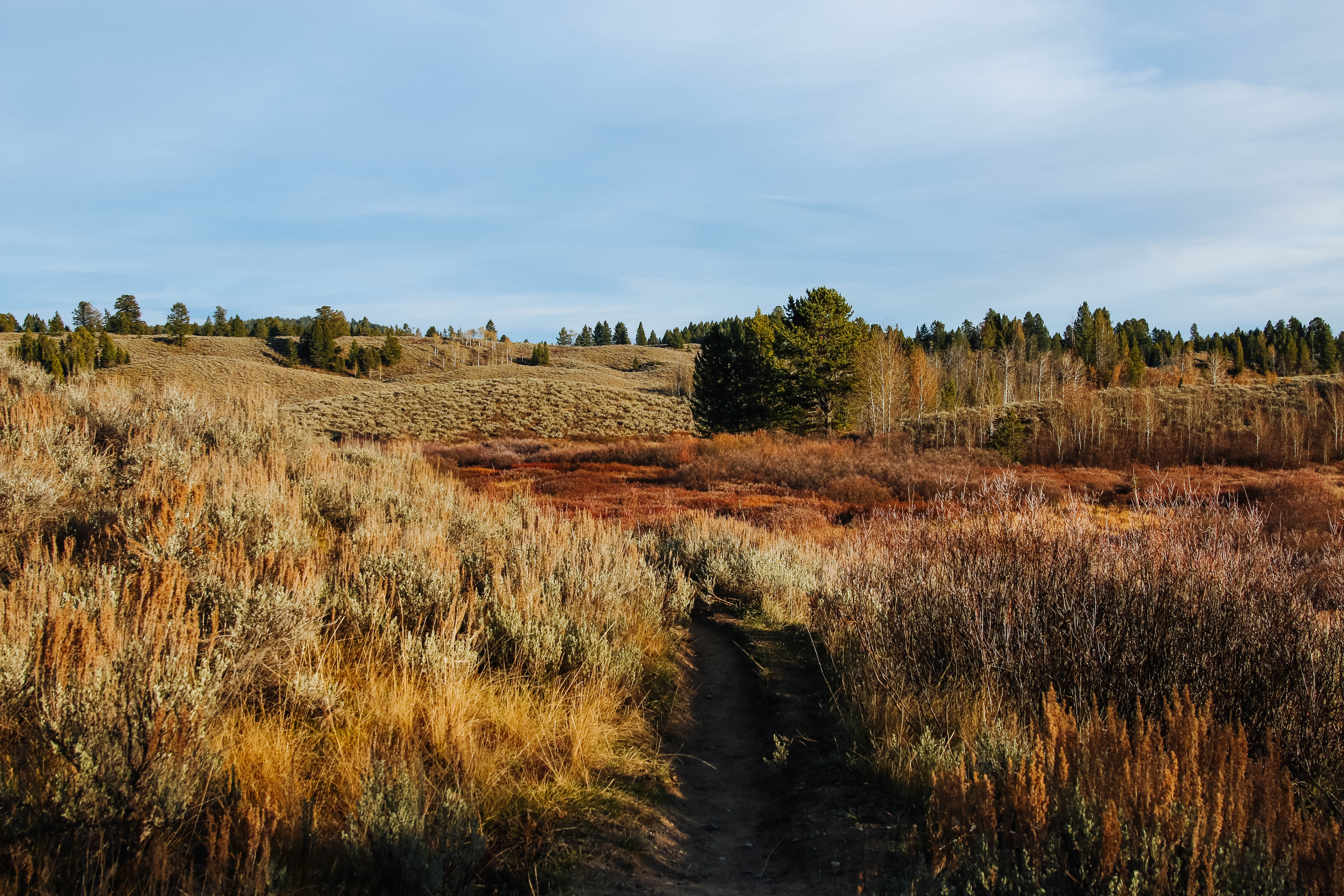
The Christian Pond Loop is a trail that takes hikers through a variety of habitats. Starting from Jackson Lake Lodge, the trail loops the pond and travels through marsh habitat. The trail then climbs a forested ridge and offers views of the Teton Range. When traveling through dense willows, be alert for wildlife.
Accessibility The Christian Pond Loop is an easy, 3.5 mi (5.6 km) loop hike with 490 ft (150 m) of elevation gain and an average slope of 6%. The trail is initially steep leaving the trailhead before it becomes a gentle level path.
Christian Pond Loop Trail
Christian Pond Loop the Park Service's write-up
1-3 Hours · no dogs · Spring, Summer, Fall
Start Jackson Lake Lodge
The Christian Pond Loop is a trail that takes hikers through a variety of habitats. Starting from Jackson Lake Lodge, the trail loops the pond and travels through marsh habitat. The trail then climbs a forested ridge and offers views of the Teton Range. When traveling through dense willows, be alert for wildlife.
Accessibility The Christian Pond Loop is an easy, 3.5 mi (5.6 km) loop hike with 490 ft (150 m) of elevation gain and an average slope of 6%. The trail is initially steep leaving the trailhead before it becomes a gentle level path.
Christian Pond Spur Trail
Christian Pond to Lookout Rock Cutoff
Colter Bay Horse Trail
Conant Pass Trail
Cunningham Cabin Trail
Death Canyon Shelf Trail
Backcountry camps
Along the way South District Group Sites Death Canyon Shelf Group Site
Death Canyon TH Spur Trail
Trailhead Death Canyon Trailhead 6,780 ft Drive there
Death Canyon Trail
Trailhead Death Canyon Trailhead 6,780 ft Drive there
Death Canyon - Static Peak Divide Junction the Park Service's write-up
4-6 Hours · no dogs · Summer, Fall
Start Death Canyon Trailhead
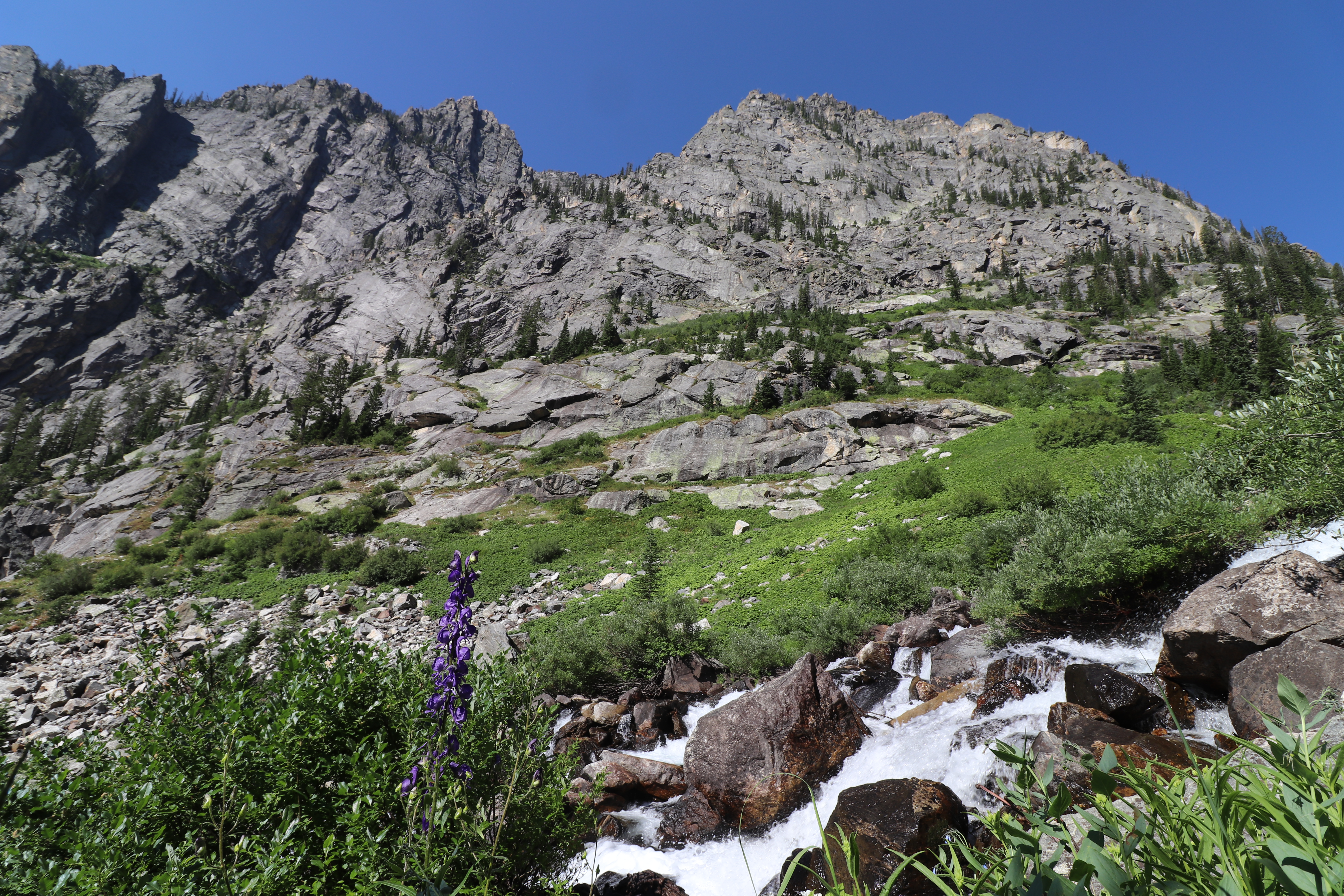
Head into Death Canyon for spectacular views of Phelps Lake and the surrounding peaks. Starting from the Death Canyon Trailhead, hikers will climb to the Phelps Lake Overlook before dropping down to Phelps Lake and then climbing back up into Death Canyon. The trail winds through forests and up rocky slopes before reaching the patrol cabin. From there, hikers have the option to continue into the canyon, split off to the Static Peak Divide Trail, or head back to the trailhead. In spring and early summer the trail is often covered with snow and can be dangerous without experience and the proper equipment. Check conditions at a visitor center before attempting the trail early in the season.
Accessibility The Death Canyon to Static Peak Divide Junction Trail is a strenuous, 7.7 mi (12.4 km) RT out and back trail with 2,400 ft (730 m) of elevation gain and an average slope of 15%. The trail has numerous rocks and small boulders in the pathway.
Phelps Lake Loop the Park Service's write-up
3-5 Hours · no dogs · Spring, Summer, Fall
Start Laurance S. Rockefeller Preserve
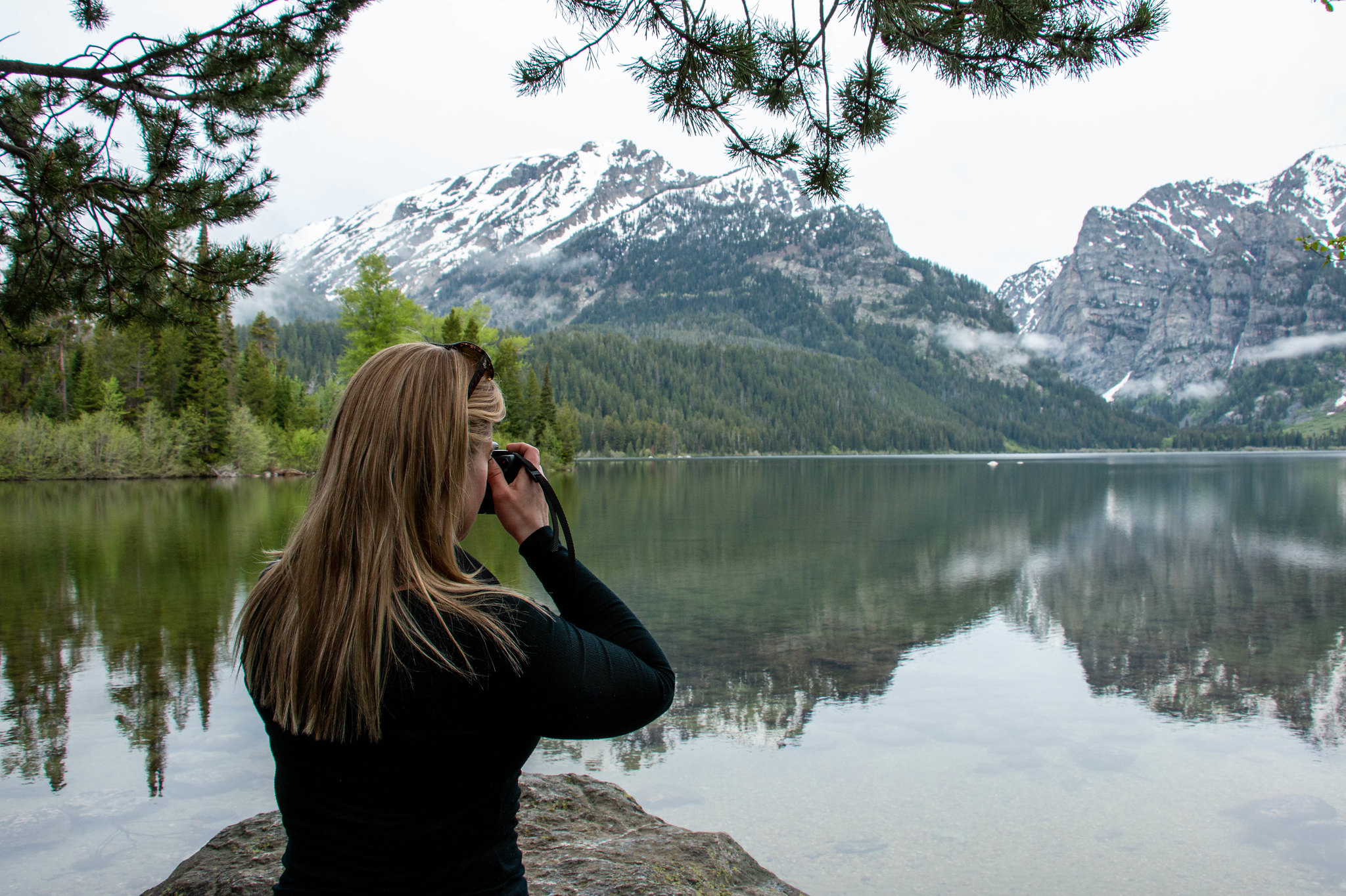
This moderate loop hike provides access to Phelps Lake as well as views into Death Canyon and the southern end of the Teton Range. Start the trail from the Laurance S. Rockefeller Preserve and follow the trail as it loops Phelps Lake. Those looking to extend the hike can add the Aspen Ridge or Boulder Ridge trails on the way to and from the lake.
Accessibility The Phelps Lake Loop Trail is a moderate, 6.4 mi (10.3 km) RT loop hike with 1,060 ft (323 m) of elevation gain with an average slope of 7%. The trail features mild elevation gain, several bridge crossings, and other trail obstacles, such as exposed roots and rocks.
Dornans Rd Pathway
Trailhead Dornans Pathway Access 6,496 ft Drive there
Emma Matilda Loop Trail
Exum
Forellen Divide Trail
Fox Creek Pass Trail
Game Creek Pass Trail
Garnet Canyon Trail
Garnet Canyon the Park Service's write-up
4-6 Hours · no dogs · Summer, Fall
Start Lupine Meadows Trailhead
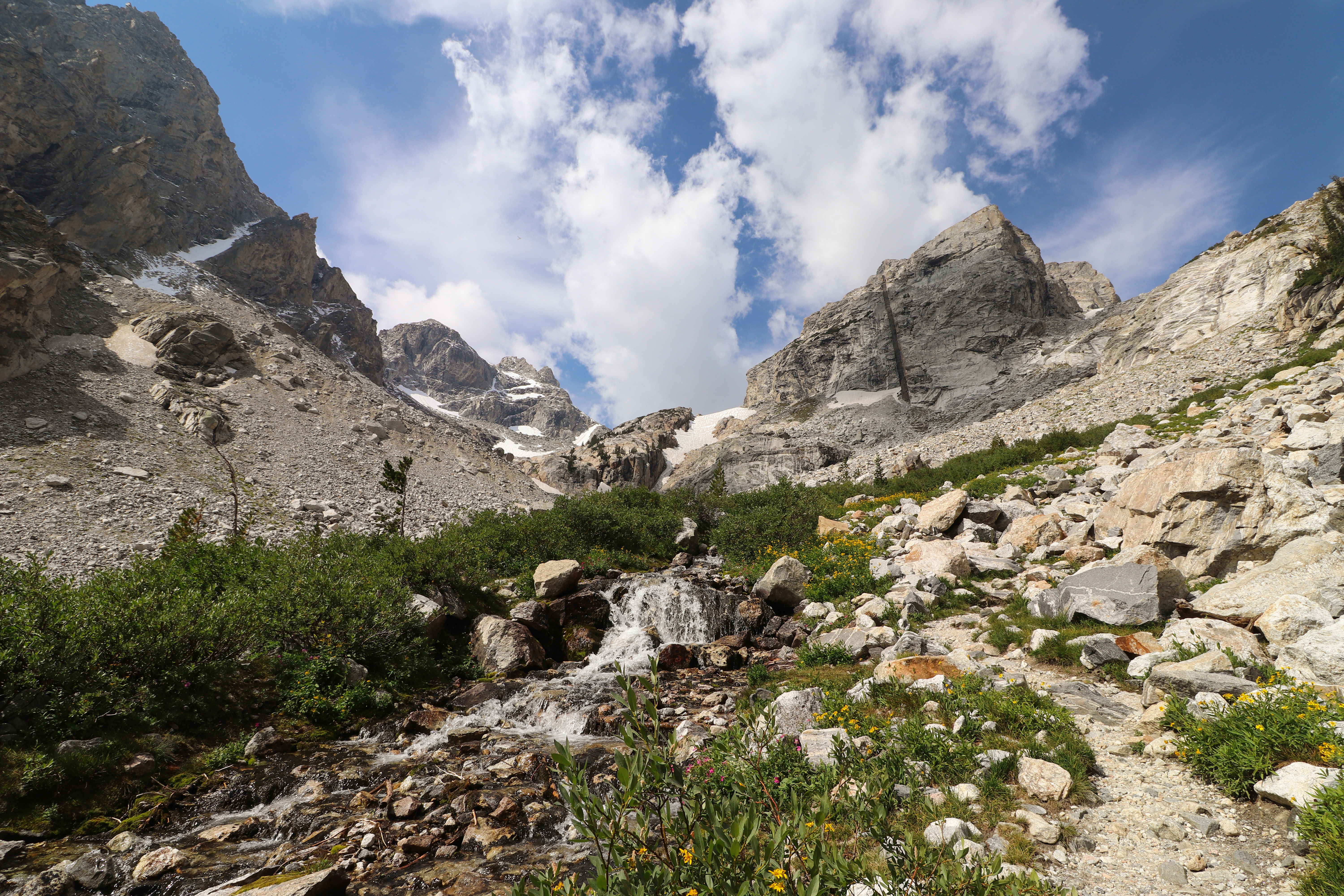
Travel into the heart of the Teton range on this strenuous hike. Leaving from the Lupine Meadows Trailhead, the trail switchbacks up to Three-Mile Junction where it splits. The trail to the left leads to Garnet Canyon. About a mile into the canyon the trail reaches a boulder field. Scrambling is required to cross the boulder field. Visitors should be physically fit and comfortable with route finding before attempting to cross it. Once in the canyon, hikers will find themselves surrounded by some of the more prominent peaks in the range: Nez Perce, South and Middle Teton, the Grand Teton, and Disappointment Peak. Hikers should exercise caution when taking the Garnet Canyon Trail, as boulder field crossings and significant elevation gain can be hazardous. If planning to travel into Garnet Canyon, stop by the Jenny Lake Ranger Station to speak with a backcountry ranger about conditions.
Accessibility Garnet Canyon is a strenuous, 8.2 mi (13.2 km) RT out and back hike with 2,430 ft (740m) of elevation gain and an average slope of 13%. The trail crosses multiple boulder fields that require boulder hopping and wayfinding skills. Steep switchbacks and narrow hiking surfaces exist.
Glade Creek Trail
Grandview Point Trail
Trailhead Grandview Point Trailhead 7,025 ft Drive there
Grandview Point Trail North Spur
Trailhead Grandview Point Trailhead 7,025 ft Drive there
Granite Canyon Trail
Backcountry camps
Along the way South District Group Sites Lower Granite Group Site South District Group Sites Upper Granite Horse Site
Trailhead Granite Canyon Trailhead 6,375 ft Drive there
Granite Canyon the Park Service's write-up
7-11 Hours · no dogs · Summer, Fall
Start Rendezvous Mountain Trailhead, Valley Trail Access, or Granite Canyon Trailhead
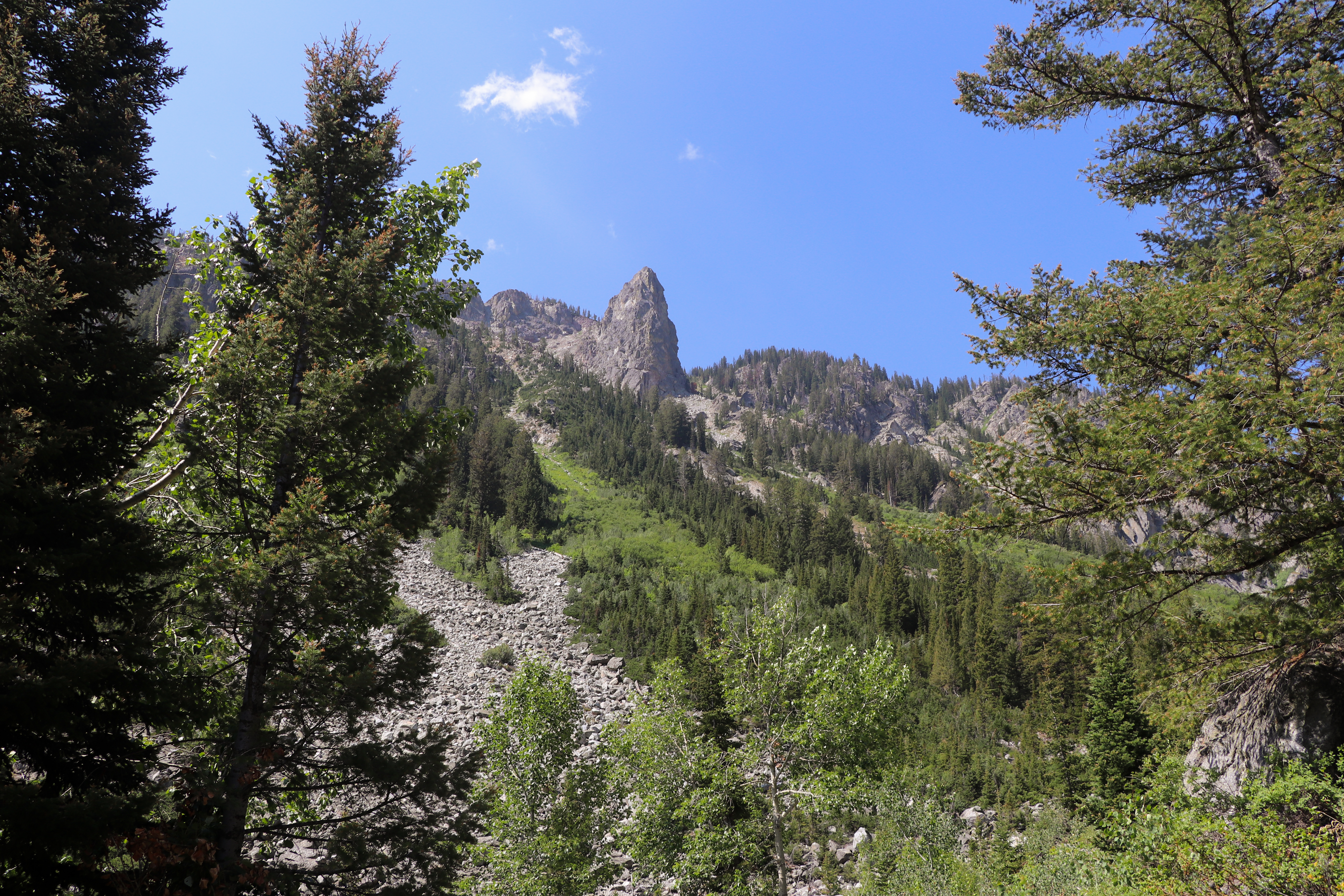
Rendezvous Mountain Trailhead
Hike from the Teton Village base area to the top of Rendezvous Mountain via Jackson Hole Mountain Resort trails , or take the Aerial Tram ( fees apply ), to start this moderate hike down Granite Canyon. From the summit, the trail follows the ridgeline down to the South Fork of Granite Canyon with stunning views of the surrounding peaks. The trail takes visitors through dense forests and open fields that are bright with wildflowers during the growing season as they travel along Granite Creek down the canyon. Trails are not recommended for hiking until snow has melted, usually by late July. Take the Valley Trail and Jackson Hole Moutain Resort trails to return to the Teton Village base area.
Valley Trail Access
For a strenuous out and back hike, hike from the Teton Village base area via Jackson Hole Mountain Resort trails to the start of the Valley Trail. Take the Valley Trail to the Granite Canyon Trail and follow Granite Creek up the canyon through forests and wildflower meadows to the South Fork Granite Canyon trail junction. Return the same way.
Granite Canyon Trailhead
For a strenuous out and back hike, start from the Granite Canyon Trailhead and follow Granite Creek up the canyon through forests and wildflower meadows to the South Fork Granite Canyon trail junction. Return the same way.
Accessibility Rendezvous Mountain Trailhead Granite Canyon is a moderately strenuous, 12.9 mi (20.8 km) one-way point-to-point hike with 1,480 ft (450 m) of elevation gain and 5,520 ft (1,680 m) of elevation loss and an average slope of 13%. Valley Trail Access Granite Canyon is a strenuous, 15.0 mi (24.1 km) RT hike with 3,250 ft (990 m) of elevation gain and an average slope of 11%. Granite Canyon Trailhead Granite Canyon is a strenuous, 13.4 mi (21.6 km) RT hike with 2,190 ft (670 m) of elevation gain and an average slope of 8%. The trail is often narrow, steep, and includes steps and switchbacks.
Marion Lake the Park Service's write-up
9-13 Hours · no dogs · Summer, Fall
Start Granite Canyon Trailhead or Rendezvous Mountain Trailhead
Rendezvous Mountain Trailhead
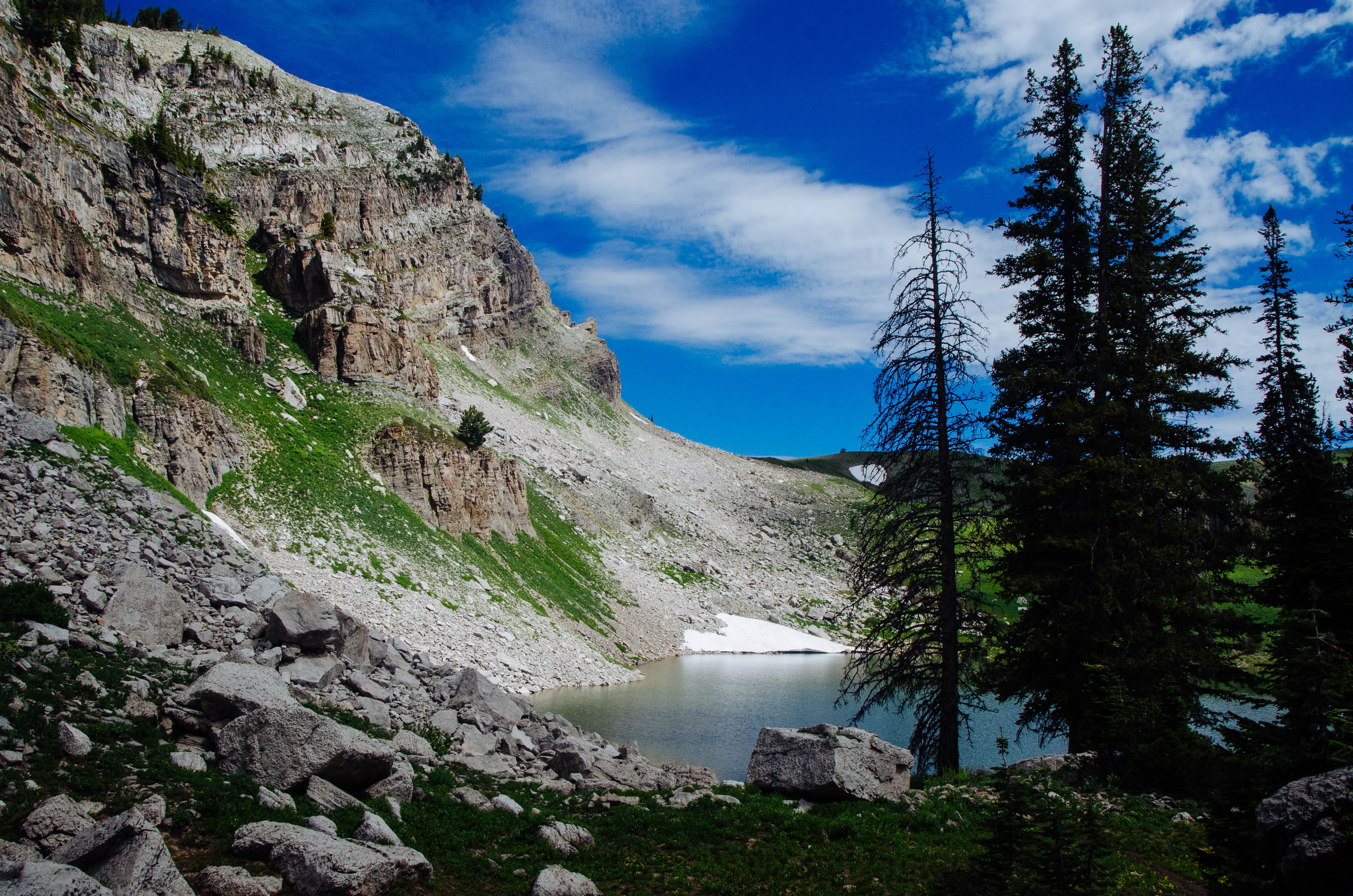
Hike from the Teton Village base area to the top of Rendezvous Mountain via Jackson Hole Mountain Resort trails , or take the Aerial Tram ( fees apply ), to start this strenuous hike to Marion Lake. From the summit, the trail follows the ridgeline down to the Middle Fork of Granite Canyon with stunning views of the surrounding peaks and meadows full of bright wildflowers during the growing season. The trail ascends and descends several ridges before arriving at Marion Lake. Stop and rest at this spectacular alpine lake before making the return trip to the summit of Rendezvous Mountain. Return via the North and South Forks of Granite Canyon to complete this loop hike. Trails are not recommended for hiking until snow has melted, usually by late July.
Granite Canyon Trailhead
Head back into Granite Canyon for a strenuous hike to Marion Lake. Starting from the Granite Canyon Trailhead, hikers will follow Granite Creek as they travel up through the canyon. The trail takes visitors through dense forests and open fields that are bright with wildflowers in early summer. Once in Upper Granite Canyon, the trail opens up to reveal stunning views of the surrounding peaks and canyon below. Stop and rest at Marion Lake – a spectacular alpine lake – before making the return trip.
Accessibility Rendezvous Mountain Trailhead Marion Lake is a very strenuous, 14.7 mi (23.7 km) RT loop hike with 3,990 ft (1,220 m) of elevation gain and an average slope of 11%. Granite Canyon Trailhead Marion Lake is a very strenuous, 18.8 mi (30.3 km) RT out and back hike with 3,510 ft (1,070 m) of elevation gain and an average slope of 8%. The trail is often narrow, steep, and includes steps and switchbacks.
Hermitage Point Cutoff Trail
Hermitage Point Trail
Backcountry campsBoat launches
Along the way North District Lakes Hermitage Point 9 Group Site Colter Bay Boat Launch
Trailhead Hermitage Point Trailhead 6,797 ft Drive there
Hermitage Point the Park Service's write-up
4-7 Hours · no dogs · Spring, Summer, Fall
Start Colter Bay
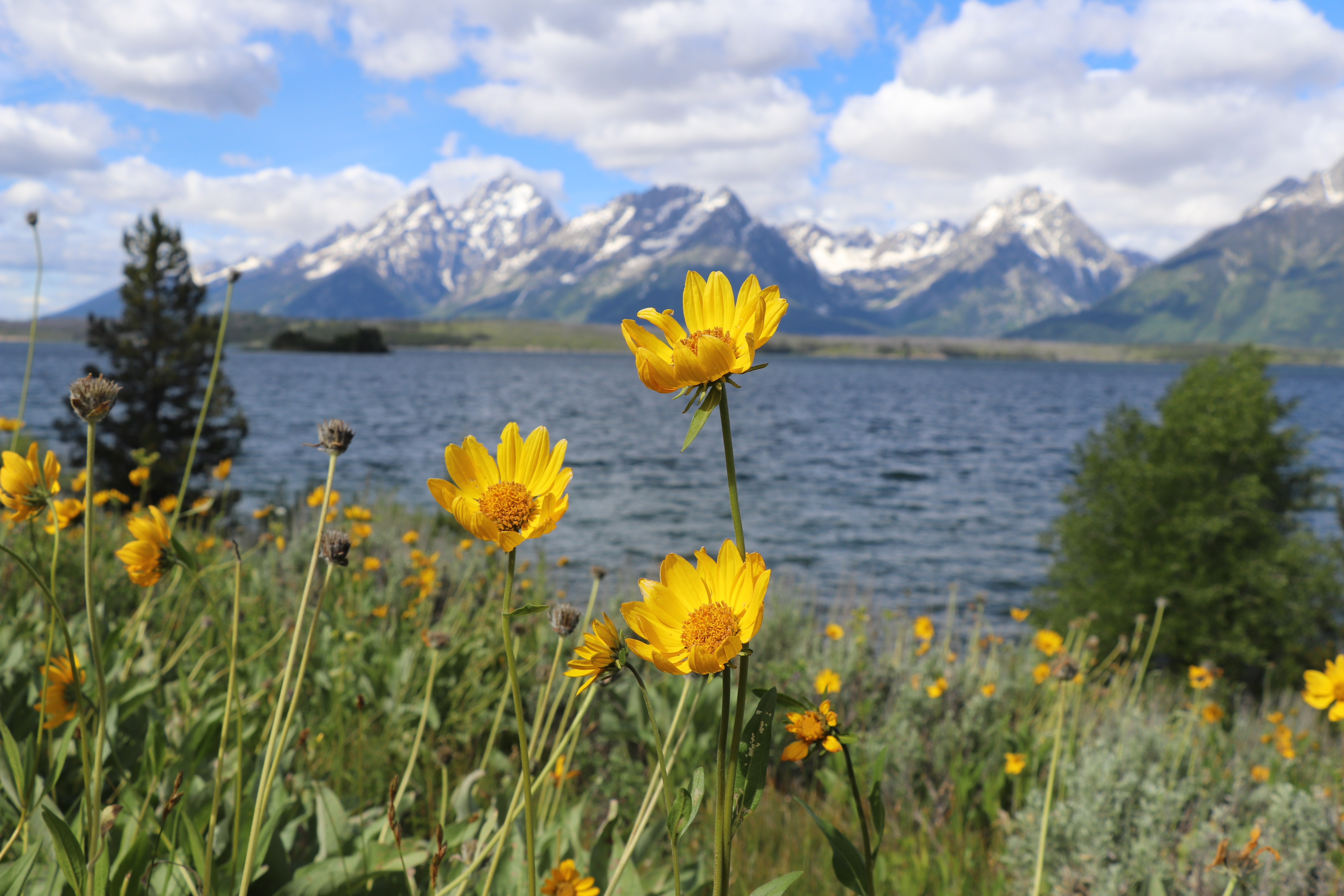
Those looking for a longer, but relatively flat hike, will enjoy treking to Hermitage Point. From Colter Bay, take the trail to Heron Pond, but instead of circling back to Swan Lake, continue on towards Hermitage Point. The trail traverses rolling terrain through forests, meadows, and wetlands. Once at the point, hikers will be greeted by views of Jackson Lake and the Teton Range. Follow signs to continue the loop back to Colter Bay.
Accessibility The Hermitage Point Trail is a moderately strenuous, 9.5 mi (15.3 km) loop hike with 930 ft (280 m) of elevation gain and an average slope of 4%. While relatively flat, the trail is long and contains obstacles, such as branches, roots, and exposed rock.
Holly Lake Campsite Spur
Backcountry camps
Along the way South District Trailed Canyons Holly Lake South District Trailed Canyons Holly Lake
Holly Lake Trail
Backcountry camps
Along the way South District Group Sites Holly Lake Group Site
Holly Lake the Park Service's write-up
7-9 Hours · no dogs · Summer, Fall
Start String Lake
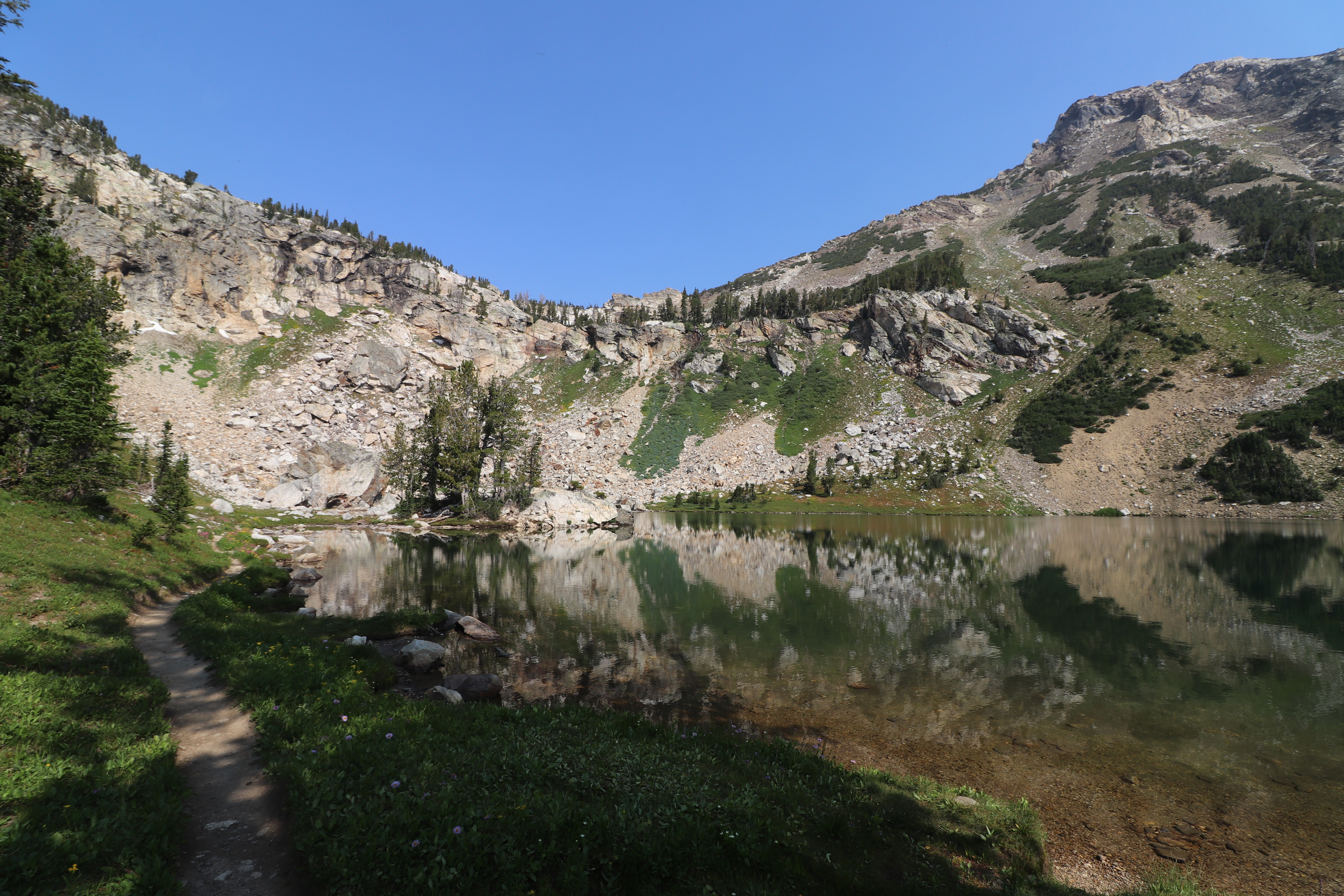
Head into Paintbrush Canyon for a strenuous 13 mile hike to Holly Lake. Starting at the String Lake Trailhead, cross the bridge over the String Lake outlet, and continue along the western side of the lake. Follow Paintbrush Canyon up until you reach the Holly Lake junction. From there, it’s another half mile to the lake. This hike offers panoramic views of Paintbrush Canyon and Leigh and Jackson Lakes below.
Accessibility Holly Lake is a strenuous, 12.8 mi (20.5 km) RT out and back hike with 2,840 ft (870 m) of elevation gain and an average slope of 11%. The trail includes significant elevation gain and obstacles such as exposed roots and rocks, bridge crossings, and steep, narrow sections.
Horse Trail Spur
Horse Trail to String Lake
Huckleberry Point Trail
Hurricane Pass Trail
Hurricane Pass the Park Service's write-up
12-16 Hours · no dogs · Summer, Fall
Start Jenny Lake
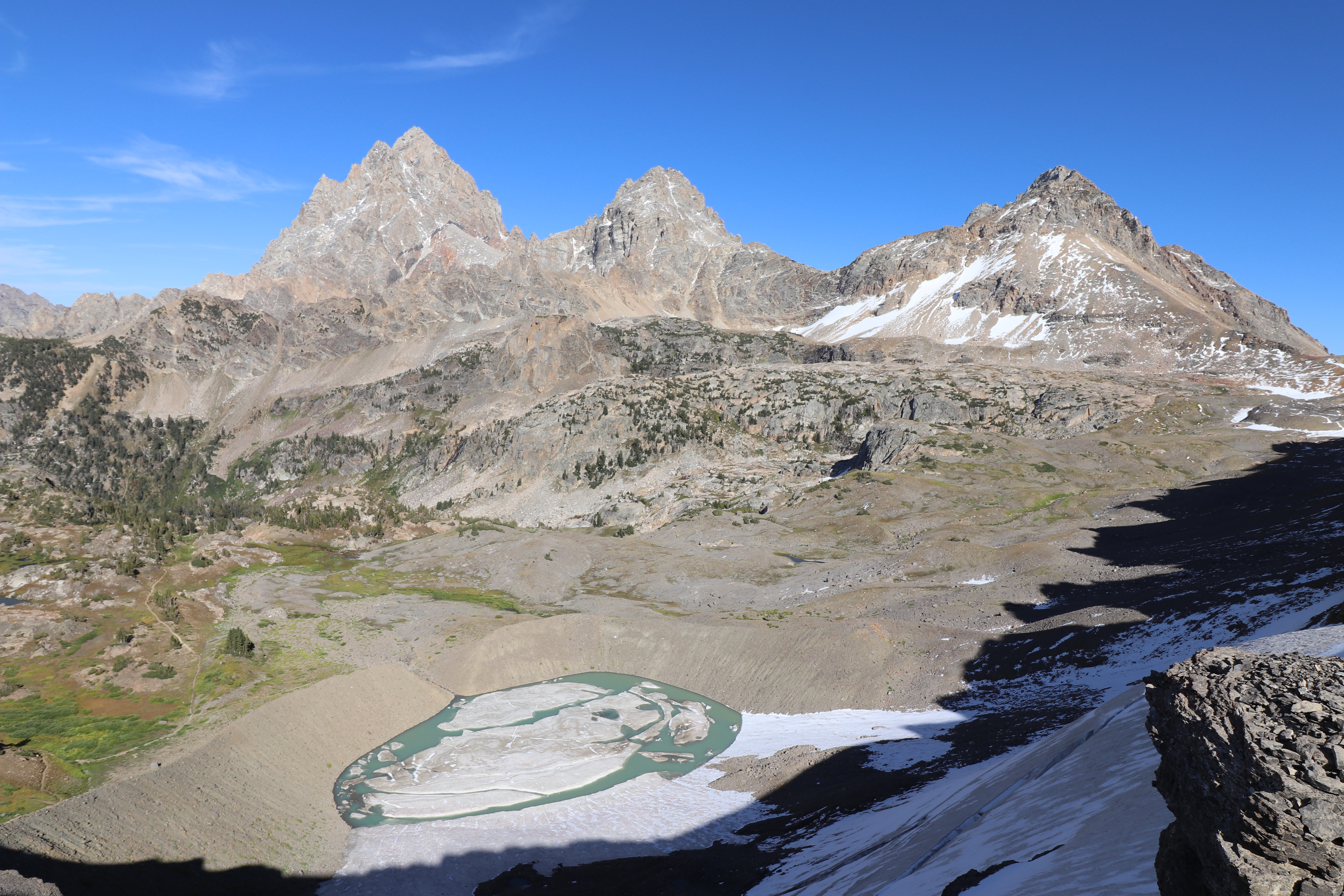
Take a hike down the South Fork of Cascade Canyon for some of the most spectacular views in the park. After starting at the Jenny Lake Trailhead, hikers may either walk around the southern end of the lake or take a shuttle boat across the lake to access Cascade Canyon. Hikers will then head down the relatively flat canyon, before taking a left at the forks of the canyon. From there begins a 5.3 mile uphill climb, passing Schoolroom Glacier, and ending at the 10,400 ft Hurricane Pass. Here, hikers have panoramic views of "Les Trois Tetons" (Grand, Middle, and South Teton), as well as an aerial view of Schoolroom Glacier. Stop by the Jenny Lake Ranger Station to speak with a backcountry ranger before heading out, as the pass can retain snow until mid-July.
Accessibility Hurricane Pass Via Shuttle Boat Hurricane Pass is a very strenuous, 20 mi (32.2 km) RT out and back hike with 4,120 ft (1,260 m) of elevation gain with an average slope of 9%. Hurricane Pass Via South Jenny Lake Loop Trail Hurricane Pass is a very strenuous, 23.9 mi (38.5 km) RT out and back hike with 4,370 ft (1,330 m) of elevation gain with an average slope of 9%. The trail crosses several bridges. Trail obstacles include steps, exposed roots and rocks, narrow sections, and steep switchbacks.
Inspiration Point
Inspiration Point the Park Service's write-up
2-4 Hours · no dogs · Spring, Summer, Fall
Start Jenny Lake
One of the most popular trails within the park, hiking to Hidden Falls and Inspiration Point allows for spectacular views of Jenny Lake, a 100 ft cascading waterfall, and the Jackson Hole Valley. Visitors may choose to walk around the southern lakeshore or utilize the privately-run shuttle boat to cross the lake and shorten the hike. (If you are planning on using the shuttle, be sure to check their hours and prices . Tickets are purchased directly at the boat dock.) Once on the west side, the trail gently slopes up 200 ft in elevation towards Hidden Falls, a 100 ft tall cascade fed by snowmelt. Visitors wishing to hike further can continue up the trail another 0.5 mile to Inspiration Point, which provides a view above Jenny Lake and out into the Jackson Hole Valley, as well as a view of Cascade Canyon and the Cathedral Group: Mount Owen, Teewinot, and the Grand Teton.
Accessibility Inspiration Point Via Shuttle Boat Inspiration Point is an easy, 1.8 mi (2.9 km) RT out and back hike with 550 ft (170 m) of elevation gain with an average slope of 16%. Inspiration Poin Via South Jenny Lake Loop Trail Inspiration Point is a moderate, 5.7 mi (9.2 km) RT out and back hike with 870 ft (270 m) of elevation gain with an average slope of 10%. The trail is dirt with several sections of rock stairs and exposed roots. The trail crosses exposed rock and features several steep switchbacks.
Jackass Pass Trail
Jackson Lake Dam Trail
Views
Along the way Jackson Lake Dam Overlook
Jackson Lake Lodge Promenade Trail
Lodges
Along the way Jackson Lake Lodge
Jackson Lake Lodge Spur
Trailhead Christian Pond Trailhead 6,860 ft Drive there
Jackson to Moose Junction
Bridges
Along the way Gros Ventre Bridge
Jenny Lake Horse
Jenny Lake Horse Bypass
Jenny Lake Lodge
Views
Along the way Alder Fire Overlook
Jenny Lake Loop
ViewsBoat launches
Along the way Jenny Lake Boat Launch Jenny Lake Boating Dock Alder Fire Overlook Jenny Lake Overlook
Trailhead Jenny Lake Loop Trailhead 6,797 ft Drive there
Jenny Lake Loop the Park Service's write-up
3-5 Hours · no dogs · Spring, Summer, Fall
Start Jenny Lake
This loop trail provides a plethora of views including Cascade Canyon, the Cathedral Group, and Jenny Lake. From the Jenny Lake Trailhead, follow the trail north, along the east side of the lake, to the south end of String Lake. Cross the bridge to stay around Jenny Lake and spot some incredible views of the Cathedral Group: Mount Owen, the Grand Teton, and Teewinot. Continue south along the west side of Jenny Lake, passing trail junctions for Hidden Falls, Inspiration Point and Cascade Canyon, all of which are great trails that may be added to this hike if wanted. Around the southern shore you will pass Moose Ponds. Here, a short spur trail leading to an overlook where moose and beaver are frequently sighted may be added to the hike if desired. The trail ends back at the Jenny Lake Trailhead, completing the loop. This hike is a great option for visitors who enjoy mountain and lake views and are looking for a longer trail without too much elevation gain.
Accessibility The Jenny Lake Loop is a 7.1 mi (11.4 km) loop hike with 1,040 ft (320 m) of elevation gain with an average slope of 6%. The trail is dirt, narrow in sections, and features obstacles such as roots, exposed rock, and slight elevation change.
Lake Creek Trail
ViewsVisitor centers
Along the way Lake Creek Overlook Laurance S. Rockefeller Preserve Center
Trailhead Laurance S. Rockefeller Preserve Trailhead 6,402 ft Drive there
Lake Creek - Woodland Trail Loop the Park Service's write-up
1-3 Hours · no dogs · Spring, Summer, Fall
Start Laurance S. Rockefeller Preserve
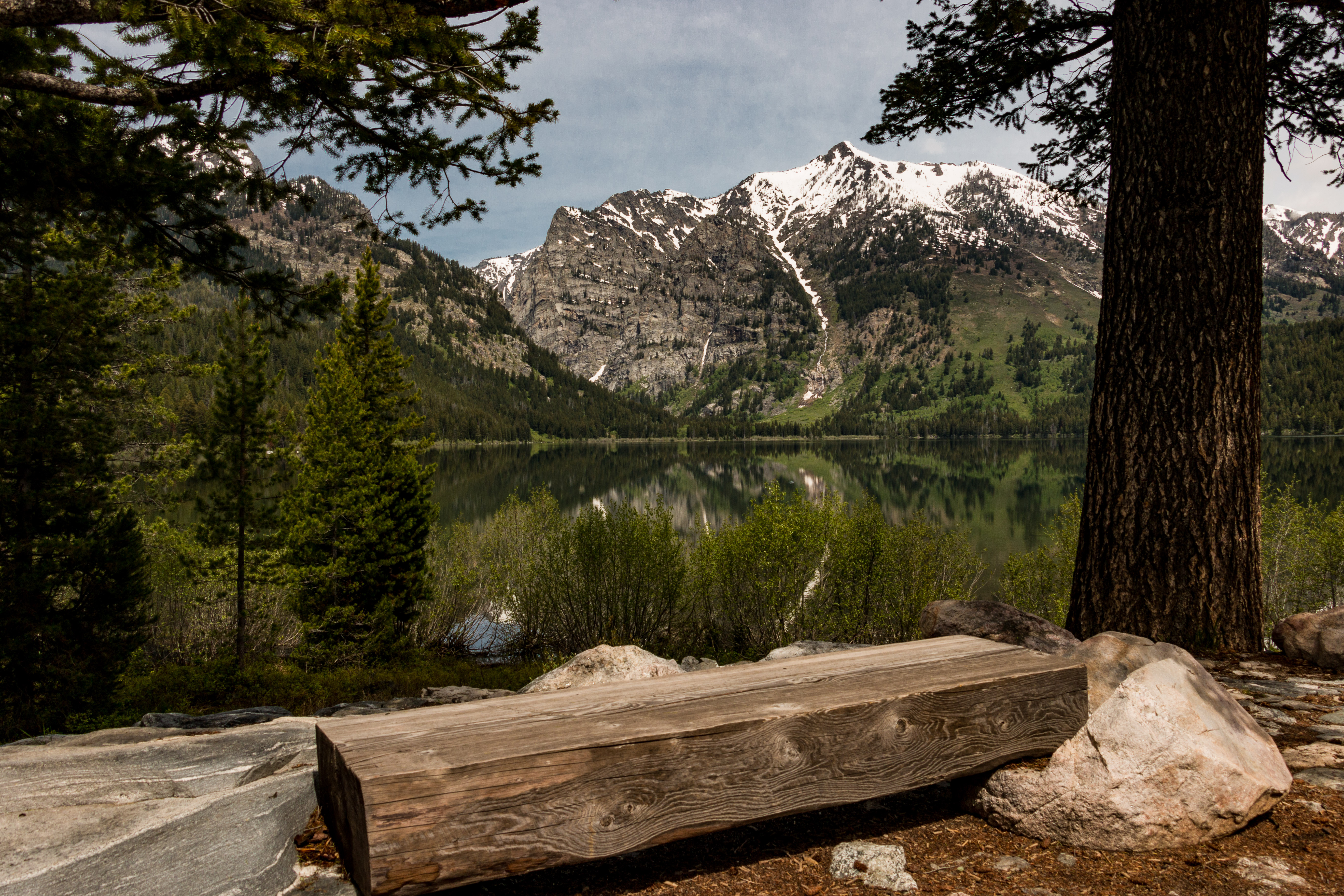
Take an easy hike along Lake Creek to the shore of Phelps Lake. The trail begins at the Laurance S. Rockefeller Preserve and winds through the surrounding forest and along the banks of Lake Creek. Once at Phelps Lake, the forest opens up to reveal the lake and views into Death Canyon. Follow the Woodland Trail to complete the loop back.
Accessibility The Lake Creek-Woodland Trail Loop is an easy, 3 mi (4.8 km) RT loop hike with 770 ft (230m) of elevation gain with an average slope of 7%. The trail is wide and mostly level, although rocks and exposed roots may be found.
Lake Solitude Trail
Lake Solitude the Park Service's write-up
9-13 Hours · no dogs · Summer, Fall
Start Jenny Lake
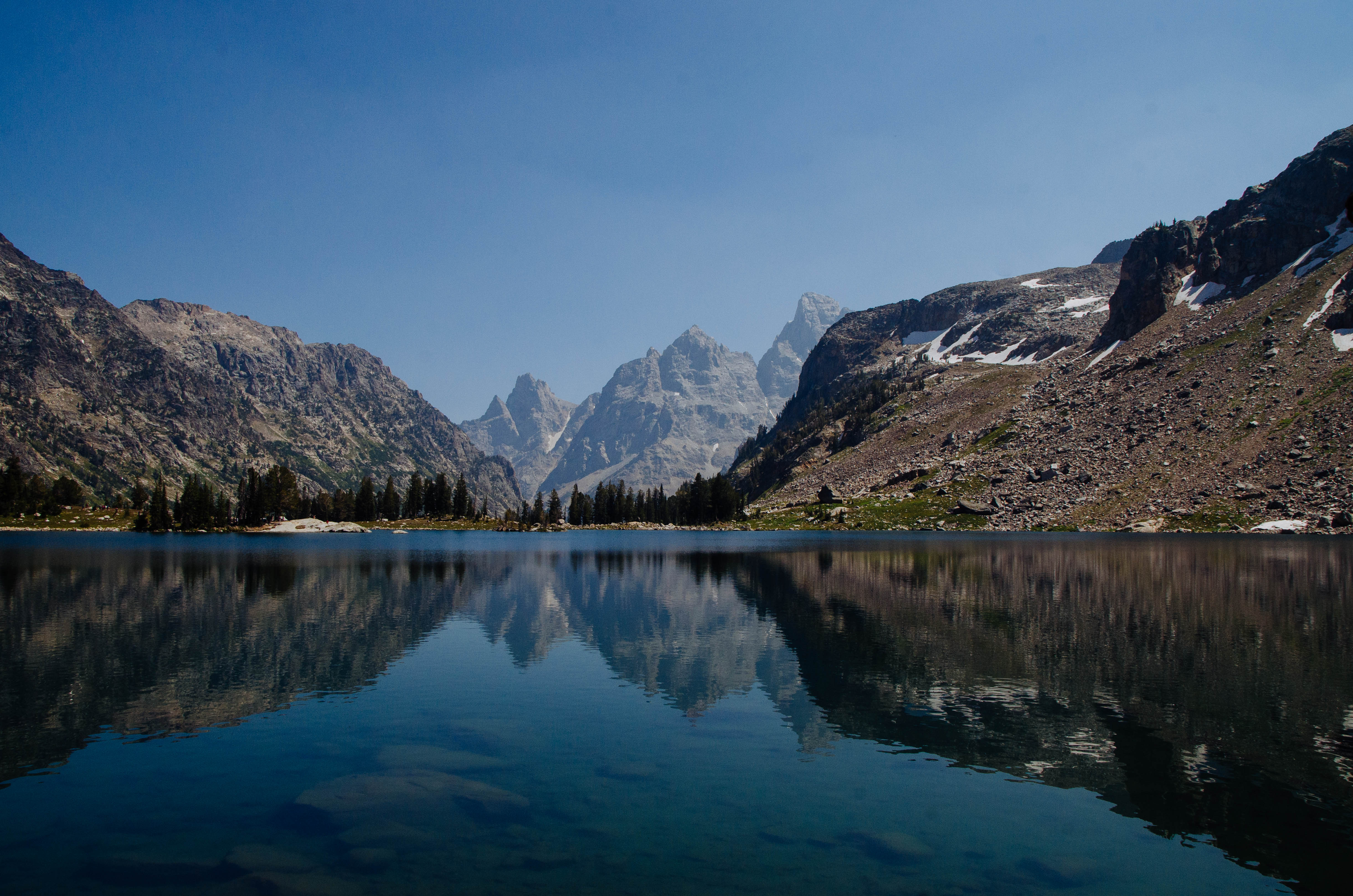
This popular Teton hike offers views of the surrounding peaks, alpine lakes, and ample wildlife viewing opportunities. Starting from the Jenny Lake Trailhead, visitors can hike around the south end of Jenny Lake or take a shuttle boat across for access to Cascade Canyon. Once in the canyon, follow the relatively flat trail to the Forks of Cascade Canyon. At the trail junction, take a right, following the signs for Lake Solitude. Hikers will climb over the next 2.5 miles to arrive at Lake Solitude. From here, hikers may turn around to make this an out and back day hike. The trail does continue from Lake Solitude however, passing over Paintbrush Divide and down Paintbrush Canyon. Those planning to complete the Paintbrush-Cascade Loop should stop by the Jenny Lake Ranger Station to speak with a ranger about conditions on Paintbrush Divide, as the divide often holds snow until mid-July and can be dangerous if attempted without the proper snow equipment.
Accessibility Lake Solitude Via Shuttle Boat Lake Solitude is a strenuous, 14.4 mi (23.2 km) RT out and back hike with 2,670 ft (810 m) of elevation gain with an average slope of 9%. Lake Solitude Via South Jenny Lake Loop Trail Lake Solitude is a very strenuous, 18.3 mi (29.5 km) RT out and back hike with 2,910 ft (890 m) of elevation gain with an average slope of 8%. The trail crosses several bridges. Trail obstacles include steps, exposed roots and rocks, narrow sections, and steep switchbacks.
Lakeshore Trail
Visitor centers
Along the way Colter Bay Visitor Center
Lakeshore Trail the Park Service's write-up
1-2 Hours · no dogs · Spring, Summer, Fall
Start Colter Bay
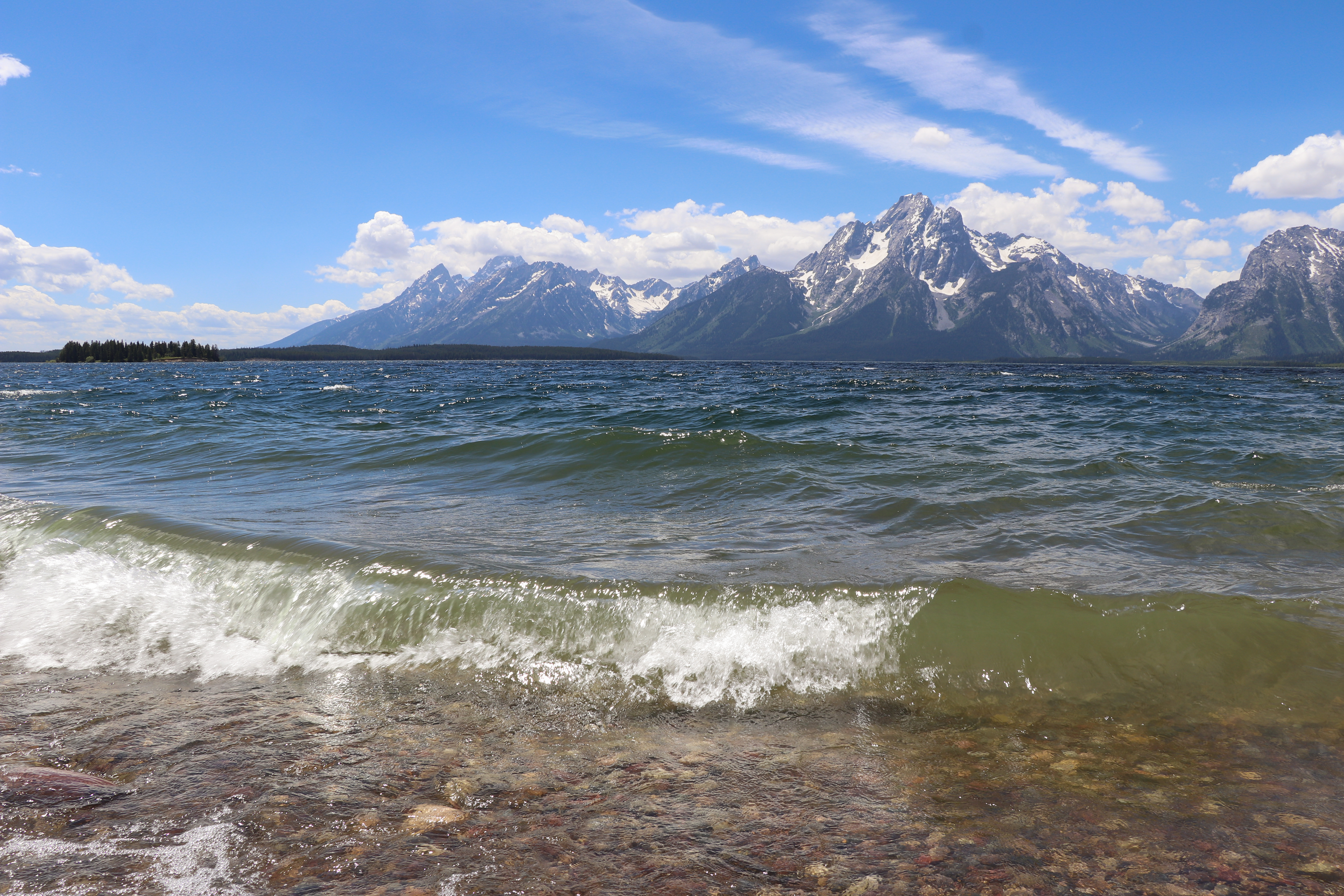
Take an easy hike down the Lakeshore Trail for views of Jackson Lake and the Teton Range. Starting from the Colter Bay Visitor Center, follow signs for the Lakeshore Trail. The trail takes visitors through a forested area and along the shore of Jackson Lake.
Accessibility The Lakeshore Trail is an easy, 2.2 mi (3.5 km) loop hike with 100 ft (30 m) of elevation gain and an average slope of 5%. The trail is relatively flat with the potential for obstacles, such as exposed roots and rocks.
Leigh Lake Parking Access Trail
Picnic areas
Along the way String Lake Picnic Area
Leigh Lake Spur Trail
Leigh Lake Trail
Backcountry camps
Along the way South District Lakes Leigh Lake 12B South District Lakes Leigh Lake 12C South District Lakes Leigh Lake Group Site 12A
Trailhead Leigh Lake Trailhead 6,879 ft Drive there
Bearpaw and Trapper Lakes the Park Service's write-up
4-6 Hours · no dogs · Spring, Summer, Fall
Start String Lake
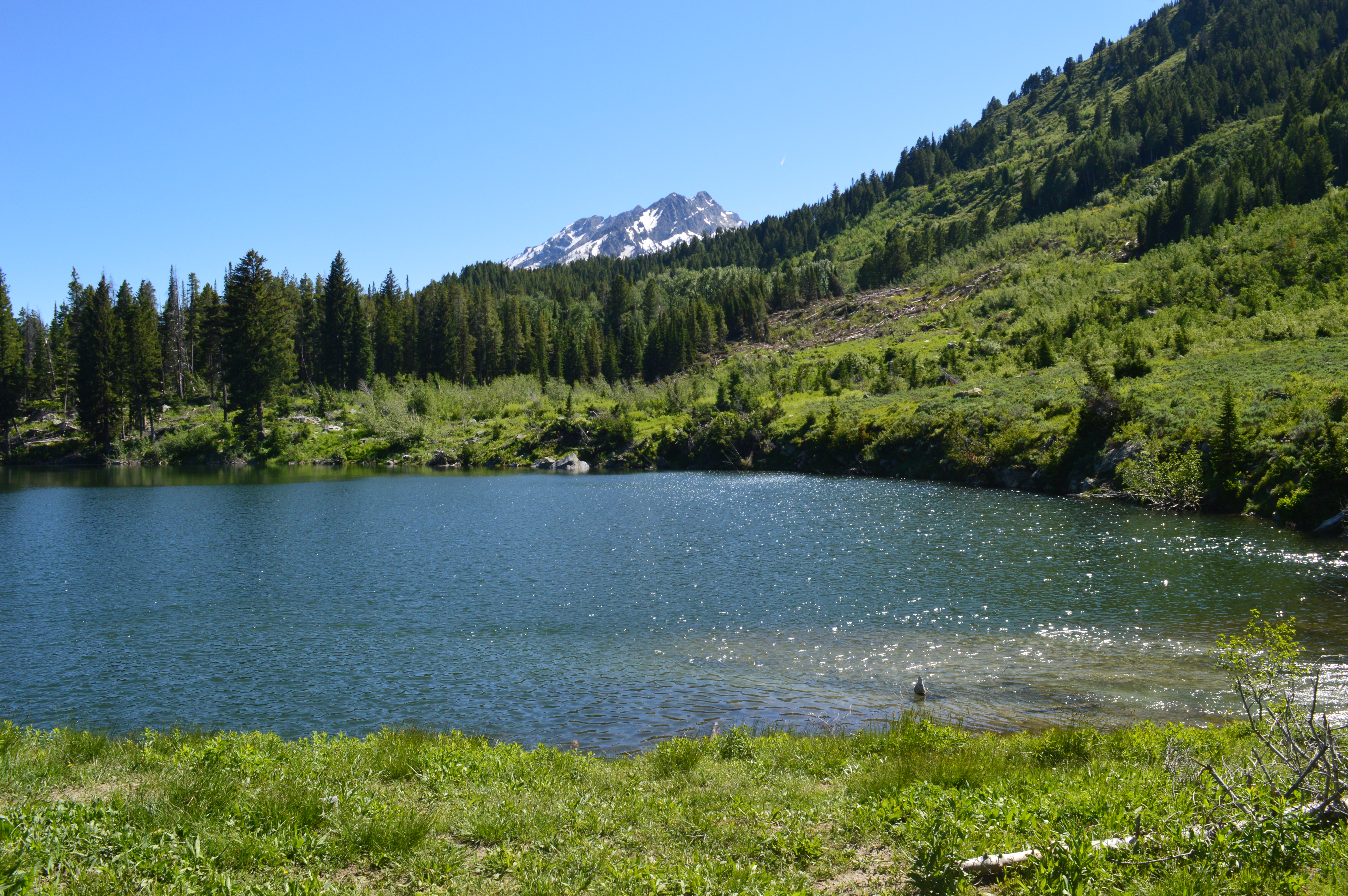
Starting along the eastern shore of String Lake, this trail takes you through the forested shorelines and beyond Leigh Lake to Bearpaw and Trapper Lakes. While the trail is long, there is little elevation change, making it an easy to moderately difficult trail. The trail ends at Trapper Lake, a small lake in an open meadow, and allows for spectacular views of Mount Moran.
Accessibility The Bearpaw and Trapper Lakes Trail is a moderate, 9.2 mi (14.8 km) RT out and back trail with 460 ft (140 m) of elevation gain and an average slope of 4%. While the trail is long, there is little elevation change. Once past the intial 5-6 stairs at the Leigh Lake Trailhead, the trail has numerous small ups and downs and feature obstacbles, such as exposed roots and rocks.
Leigh Lake the Park Service's write-up
1-2 Hours · no dogs · Spring, Summer, Fall
Start String Lake
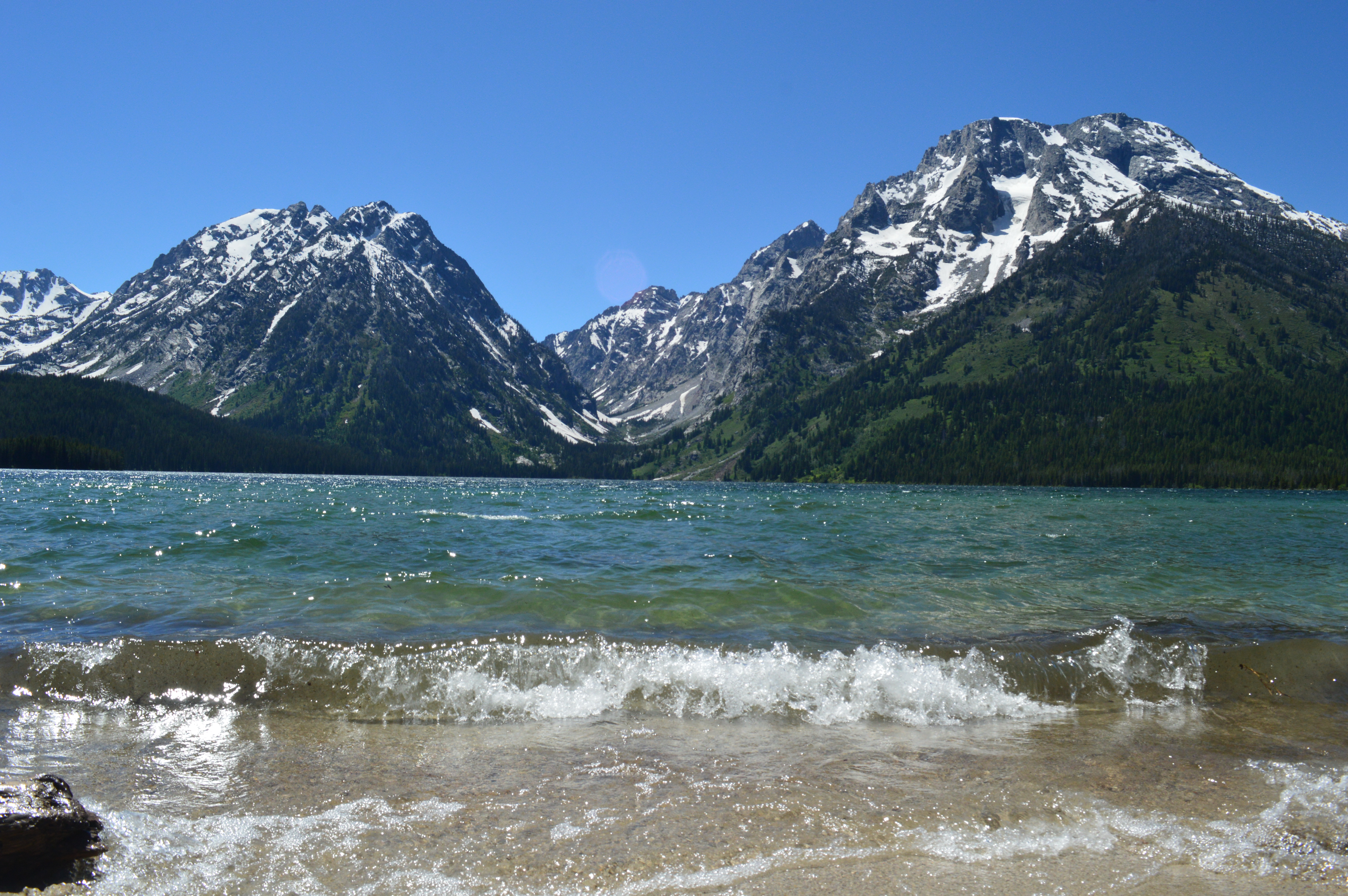
Hiking along the eastern shore of String Lake and beyond brings you to the southern end of Leigh Lake, accessible only by trail or by non-motorized boat. This allows for quieter, less populated lake and mountain views on a relatively flat, easy trail. For a longer hike, head further down the eastern shore of Leigh Lake, providing more beach access and less obstructed views.
Accessibility The Leigh Lake Trail is an easy, 1.8 mi (2.9 km) RT out and back hike with 110 ft (30 m) of elevation gain and an average slope of 5%. 5-6 stairs will take you to the relatively flat Leigh Lake Trail. Roots, branches, and rocks are found along the trail.
Lookout Rock Cutoff Trail
Lookout Rock Spur Trail
Lucas/Fabian Trail
Lunchtree Hill Loop Trail
Menor's Ferry East
Menor's Ferry West
Middle Fork Granite Canyon Trail
Moose Basin Divide Trail
Moose Jct to Antelope Flats Rd
Trailhead Blacktail Butte Trailhead 6,529 ft Drive there
Moose Jct Tunnel Ramp
Moose Pond
Mount Hunt Trail Trail
Multi Use Pathway Gros Ventre Parking
Multi Use Pathway Jackson to Gros Ventrre Jct
ViewsBridges
Along the way Gros Ventre Bridge Gros Ventre River Turnout South Boundary Turnout
Multi Use Pathway Moose to Gros Ventrre Jct
Views
Along the way Albright View Turnout Sleeping Indian Turnout
Multi Use Pathway Sagebrush Lane
Murie Ranch Trail
Visitor centers
Along the way Craig Thomas Discovery and Visitor Center
Murie Ranch Hike the Park Service's write-up
30-60 Minutes · no dogs · Spring, Summer, Fall
Start Moose
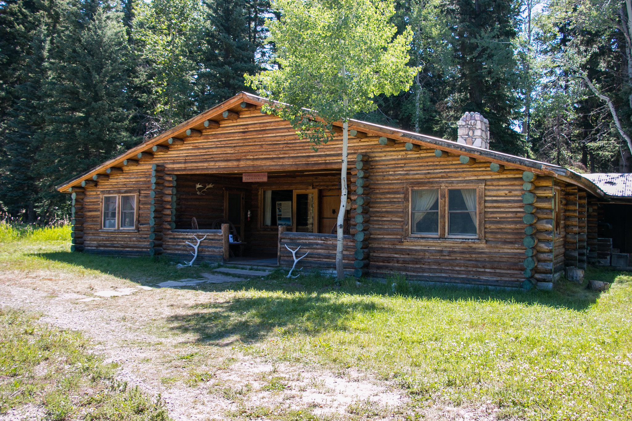
Hike to the historic Murie Ranch on this easy out and back trail. Leaving from the Craig Thomas Discovery and Visitor Center, follow the trail as it winds through the woods and ends at the Murie Ranch. From there, visitors can explore the Murie Ranch or head back to the visitor center.
Park at the Craig Thomas Discovery and Visitor Center to access the trail.
Accessibility The Murie Ranch Hike is a 1.1 mile (1.8 km) roundtrip hike with 50 ft (15 m) of elevation gain and an average slope of 3%. The trail is flat but narrow. Park at the Craig Thomas Discovery and Visitor Center to access the trail.
North Cascade Creek
North Fork Cascade Canyon Trail
Backcountry camps
Along the way South District Group Sites North Fork Cascade Group Site
Open Canyon Cutoff Trail
Open Canyon Trail
Open Canyon the Park Service's write-up
7-14 Hours · no dogs · Summer, Fall
Start Death Canyon Trailhead or Rendezvous Mountain Trailhead

Death Canyon Trailhead
Open Canyon is a very strenuous, out and back trail that winds through alpine forests along the shores of Phelps Lake before ascending into the canyon and transporting hikers to alpine terrain near Mount Hunt Divide. Take in the views at the divide before returning the same way. Before attempting this hike, stop by the Jenny Lake Ranger Station to speak with a ranger about conditions on Mount Hunt Divide, as the divide often holds snow until mid-July and can be dangerous if attempted without the proper snow equipment.
Rendezvous Mountain Trailhead
Hike from the Teton Village base area to the top of Rendezvous Mountain via Jackson Hole Mountain Resort trails , or take the Aerial Tram ( fees apply ), to start this very strenuous point-to-point hike over Mount Hunt Divide and down Open Canyon. Take the Valley Trail and Jackson Hole Moutain Resort trails to return to the Teton Village base area. Before attempting this hike, stop by the Jenny Lake Ranger Station to speak with a ranger about conditions on Mount Hunt Divide, as the divide often holds snow until mid-July and can be dangerous if attempted without the proper snow equipment.
Accessibility Death Canyon Trailhead Open Canyon is a very strenuous, 14.8 mi (23.8 km) RT hike with 3,820 ft (1,160 m) of elevation gain 13%. Rendezvous Mountain Trailhead Open Canyon is a very strenuous, 19.4 mi (31.2 km) one-way point-to-point hike with 3,440 ft (1,050 m) of elevation gain and an average slope of 10%. The trail is often narrow, steep, and includes steps and switchbacks.
Owl Creek Trail
Owl-Berry Cutoff Trail
Oxbow Bend Trail
Paintbrush Canyon Trail
Backcountry camps
Along the way South District Trailed Canyons Outlier Site
Holly Lake the Park Service's write-up
7-9 Hours · no dogs · Summer, Fall
Start String Lake
Head into Paintbrush Canyon for a strenuous 13 mile hike to Holly Lake. Starting at the String Lake Trailhead, cross the bridge over the String Lake outlet, and continue along the western side of the lake. Follow Paintbrush Canyon up until you reach the Holly Lake junction. From there, it’s another half mile to the lake. This hike offers panoramic views of Paintbrush Canyon and Leigh and Jackson Lakes below.
Accessibility Holly Lake is a strenuous, 12.8 mi (20.5 km) RT out and back hike with 2,840 ft (870 m) of elevation gain and an average slope of 11%. The trail includes significant elevation gain and obstacles such as exposed roots and rocks, bridge crossings, and steep, narrow sections.
Paintbrush Canyon - Cascade Canyon Loop the Park Service's write-up
11-14 Hours · no dogs · Summer, Fall
Start String Lake
This very strenuous 20 mile loop takes you up Paintbrush Canyon, over Paintbrush Divide to Lake Solitude, and down Cascade Canyon. The trail offers some of the most spectacular views in the park, with the 10,700ft Paintbrush Divide offering panoramic views of Mount Moran, Mount Woodring, and Rockchuck Peak. From Lake Solitude, hikers have a direct view of the Grand Teton and Mount Owen. Hikers should plan on a full day to hike the loop. Before attempting the loop, stop by the Jenny Lake Ranger Station to speak with a ranger about conditions on Paintbrush Divide, as the divide often holds snow until mid-July and can be dangerous if attempted without the proper snow equipment.
Accessibility The Paintbrush Canyon - Cascade Canyon Loop is a very strenuous 19.9 mi (32 km) loop hike with 4,480 ft (1,365 m) elevation gain and an average slope of 9%. Trail obstacles include bridge crossings, steps, exposed roots and rocks, and steep switchbacks. Trail crosses a skree field that holds snow late in the year.
Phelps Lake Loop Trail
Backcountry camps
Along the way South District Lakes Phelps Lake South District Lakes Phelps Lake South District Lakes Phelps Lake
Phelps Lake Loop the Park Service's write-up
3-5 Hours · no dogs · Spring, Summer, Fall
Start Laurance S. Rockefeller Preserve
This moderate loop hike provides access to Phelps Lake as well as views into Death Canyon and the southern end of the Teton Range. Start the trail from the Laurance S. Rockefeller Preserve and follow the trail as it loops Phelps Lake. Those looking to extend the hike can add the Aspen Ridge or Boulder Ridge trails on the way to and from the lake.
Accessibility The Phelps Lake Loop Trail is a moderate, 6.4 mi (10.3 km) RT loop hike with 1,060 ft (323 m) of elevation gain with an average slope of 7%. The trail features mild elevation gain, several bridge crossings, and other trail obstacles, such as exposed roots and rocks.
Practice Rocks Trail
Trailhead Blacktail Butte Trailhead 6,529 ft Drive there
Rendevous Mtn Trail
Restroom Cutoff Trail
S Jenny Lake Parking Walkways
Visitor centersRanger stations
Along the way Jenny Lake Ranger Station Jenny Lake Visitor Center
S Jenny Lake Trails
Visitor centersRanger stationsBoat launches
Along the way Jenny Lake Boating Dock Jenny Lake Ranger Station Jenny Lake Visitor Center
S Jenny Lake Walkways
Schwabacher Landing Trail
Trailhead Schwabacher Landing Trailhead 6,547 ft Drive there
Signal Mountain Trail
Views
Along the way Jackson Point Overlook
Trailhead Signal Mountain Trailhead 6,850 ft Drive there
Signal Mountain Trail the Park Service's write-up
3-5 Hours · no dogs · Summer, Fall
Start Signal Mountain
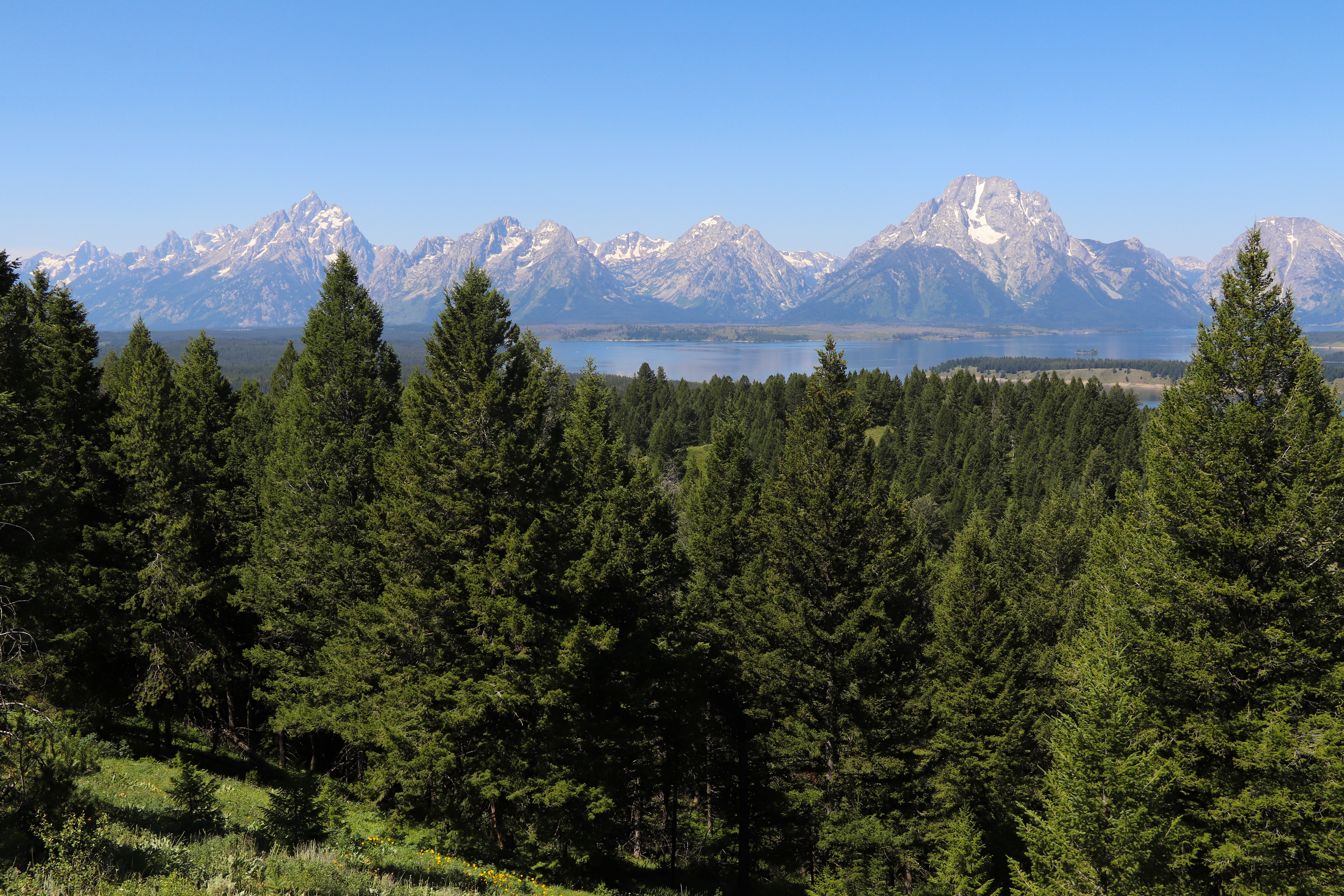
Hike up Signal Mountain for spectacular views of the Teton Range and Jackson Hole. Starting from the Signal Mountain Lodge, cross the Teton Park Road and follow the signs to the trailhead. From there, the trail winds upwards through the forest to the summit of Signal Mountain where hikers are met with panoramic views of the Teton Range and Jackson Hole.
Accessibility The Signal Mountain Trail is a moderate, 6.7 mi (10.8 km) RT out and back hike with 980 ft (300 m) of elevation gain and an average slope of 8%. The trail is narrow and winding with exposed rocks and roots throughout.
Signal Mtn Overlook Trail
Views
Along the way Signal Mountain Summit Overlook
South Cascade Creek
South Fork Cascade Canyon Trail
Backcountry camps
Along the way South District Group Sites South Fork Cascade Group Site
South Fork Cutoff Granite Canyon Trail
South Fork Granite Canyon Trail
South Jenny Lake Walkways
Backcountry campsVisitor centersRanger stationsBoat launches
Along the way Jenny Lake Campground Site 11 Jenny Lake Campground Site 12 Jenny Lake Campground Site 15 Jenny Lake Campground Site 4 Jenny Lake Campground Site 5 Jenny Lake Campground Site 6 Jenny Lake Boating Dock Jenny Lake Ranger Station Jenny Lake Visitor Center
Trailhead Jenny Lake Loop Trailhead 6,797 ft Drive there
South Landing Trail
Backcountry camps
Along the way North District Lakes South Landing 8 North District Lakes South Landing 8 Group Site
String Lake Canoe Launch
String Lake Loop
Views
Along the way Alder Fire Overlook
String Lake Loop Trail
Trailhead String Lake Trailhead 6,877 ft Drive there
String Lake Parking Spur
Views
Along the way Alder Fire Overlook
Trailhead String Lake Trailhead 6,877 ft Drive there
String Lake Trail
ViewsPicnic areas
Along the way String Lake Picnic Area Alder Fire Overlook
Trailheads Leigh Lake Trailhead 6,879 ft Drive there · String Lake Trailhead 6,877 ft Drive there
String Lake the Park Service's write-up
2-3 Hours · no dogs · Spring, Summer, Fall
Start String Lake
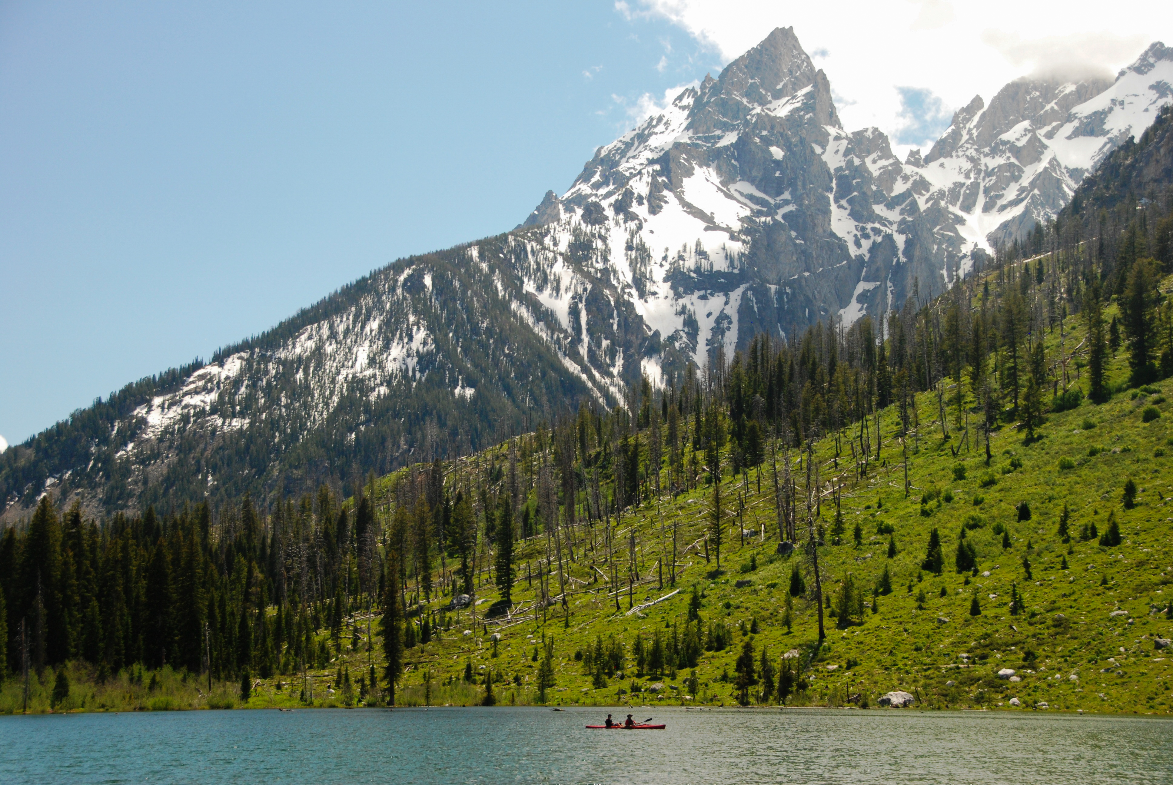
Circle around String Lake for views of Mount St. John, Rockchuck Peak, and the Jackson Hole Valley. Begin by heading south around the east shore of the lake for a more gradual elevation gain. This trail is mostly covered but passes through an older, open burned area below the peaks before ducking back into the trees.
Accessibility The String Lake Loop is an easy 3.7 mi (5.6 km) loop hike with 540 ft (160 m) of elevation gain and an average slope of 6%. The trail on the east side of the lake is relatively flat, with obstacles such as exposed roots and rock. The west side of the trail includes elevation gain to a ridge overlooking String Lake.
String Lake Walkways
Picnic areas
Along the way String Lake Picnic Area
Trailhead Leigh Lake Trailhead 6,879 ft Drive there
Surprise Lake Spur Trail
Surprise/Ampitheater Lakes Trail
Backcountry camps
Along the way South District Trailed Canyons Surprise Lake South District Trailed Canyons Surprise Lake
Survey Peak Trail
Swan Lake Cutoff Trail
Swan Lake Trail
Heron Pond - Swan Lake Loop Trail the Park Service's write-up
1-3 Hours · no dogs · Spring, Summer, Fall
Start Colter Bay
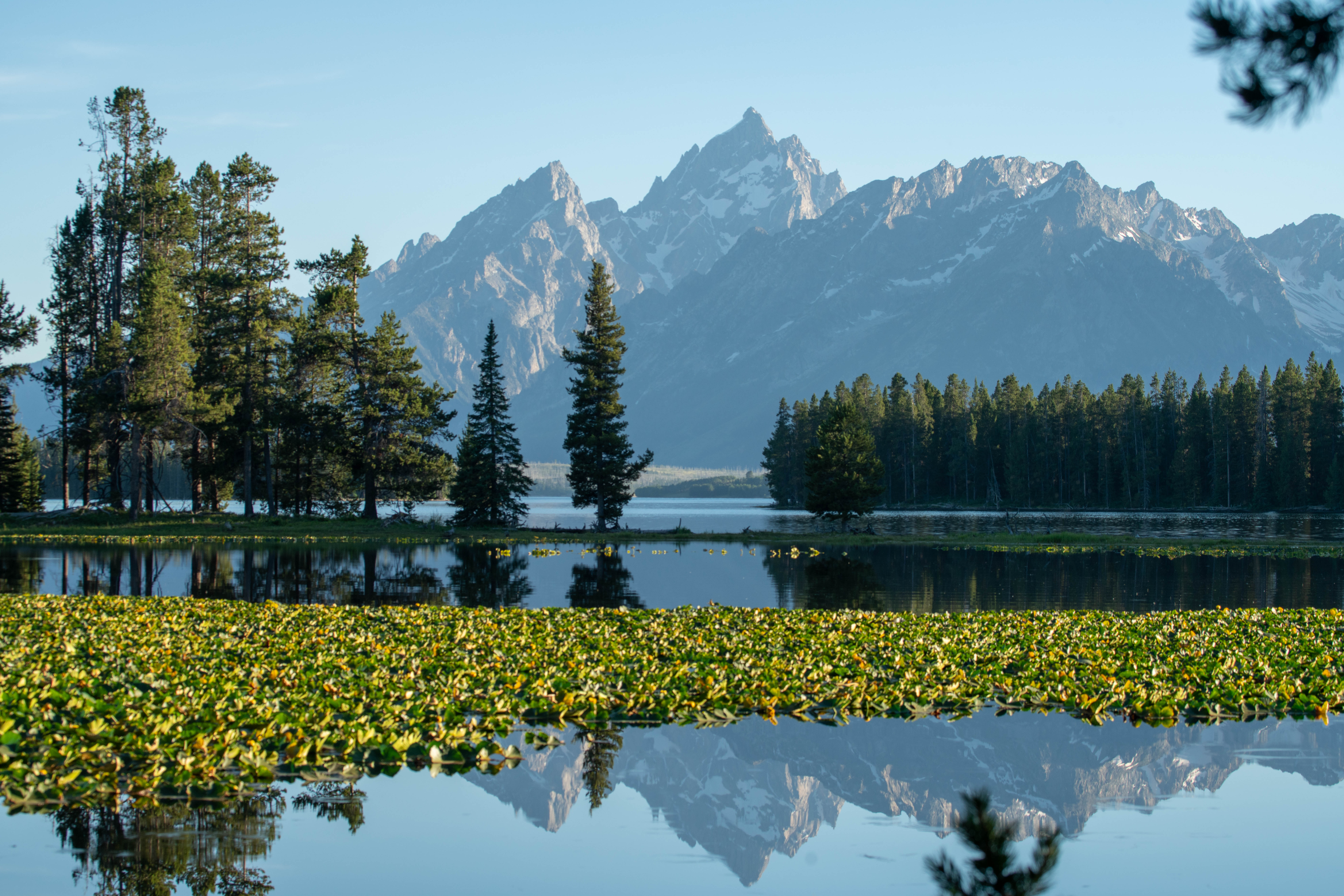
Take an easy loop trail for access to two ponds and views of the Teton Range. From Colter Bay, take the trail to Heron Pond. From there, continue on to Swan Lake before heading back to Colter Bay. The trail winds through forests and wetlands. Swan Lake and Heron pond are both home to birds and other wildlife.
Accessibility The Heron Pond-Swan Lake Loop is an easy, 3.1 mi (5 km) loop hike with 320 ft (100 m) of elevation gain and an average slope of 5%. While the trail is relatively level, trail obstacles, such as exposed roots and rocks, exist.
Taggart Lake Loop Trail
Trailhead Taggart Lake Trailhead 6,632 ft Drive there
Teton Crest Trail
Teton Park Rd
ViewsPicnic areas
Along the way Cottonwood Creek Picnic Area Cottonwood Creek Overlook Teton Glacier Turnout Windy Point Turnout
Trailhead Taggart Lake Trailhead 6,632 ft Drive there
Trapper Lake Trail
Backcountry camps
Along the way South District Lakes Bearpaw Lake 17A South District Lakes Bearpaw Lake 17C South District Lakes Trapper Lake 18A
Two Ocean Lake Trail
Picnic areas
Along the way Two Ocean Lake Picnic Area
Trailhead Two Ocean Lake Trailhead 6,922 ft Drive there
Emma Matilda Lake the Park Service's write-up
5-7 Hours · no dogs · Summer, Fall
Start Two Ocean Lake
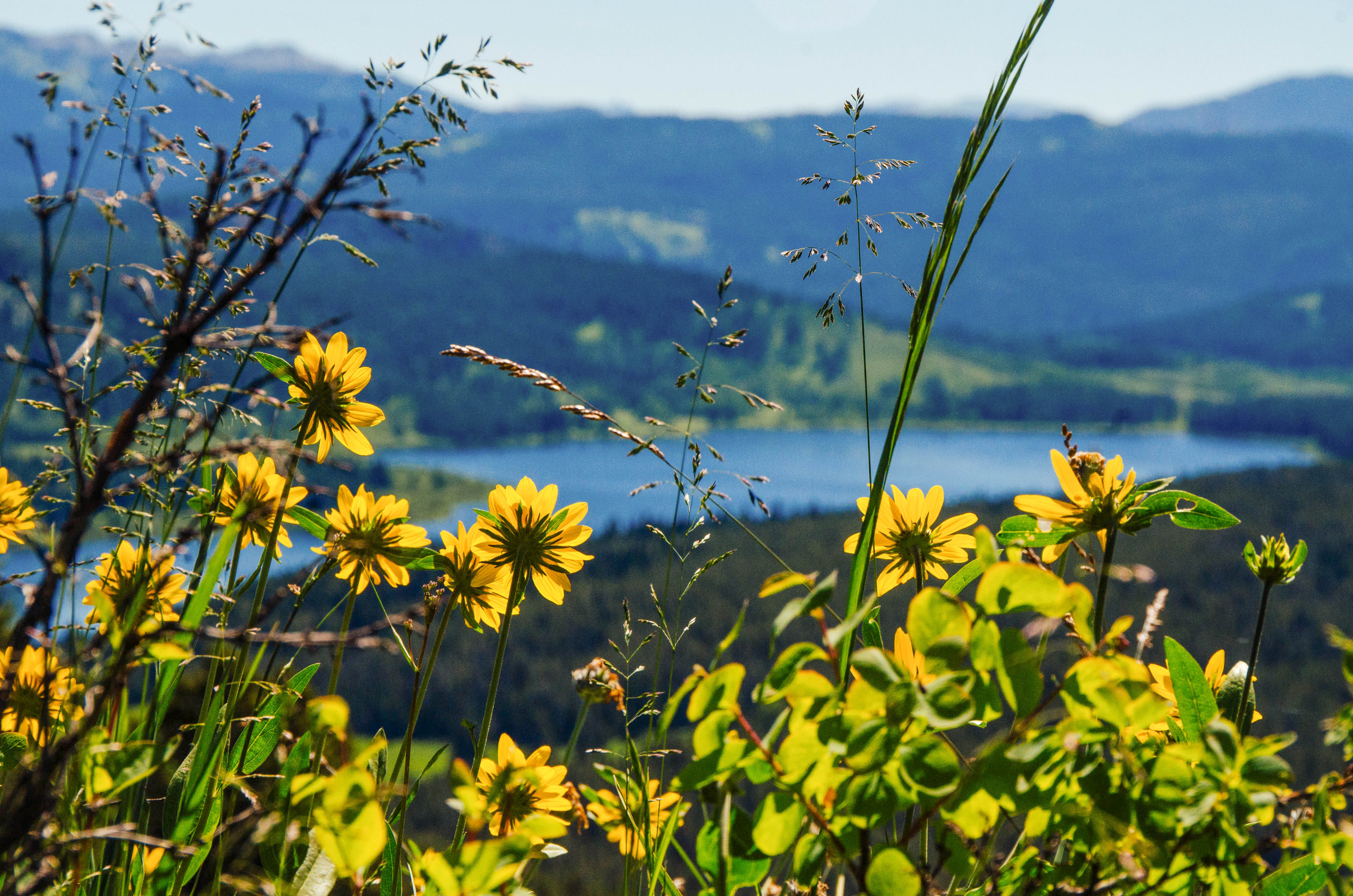
Those looking for a longer trail can drop down to Emma Matilda Lake for a 10.7 mile loop. Heading around the lakeshore, hikers will be met with views of the Teton Range. In early to mid-summer, wildflowers populate the area, brightening up the landscape and making for stunning views. Don’t forget the bug spray! Due to the wet, marshy nature of the landscape, Emma Matilda Lake is a popular area for mosquitos.
Accessibility The Emma Matilda Lake Trail is a moderately strenuous, 10.7 mi (17.2 km) loop hike with 1,430 ft (500 m) of elevation gain and an average slope of 5%. Marshy and wet trail surfaces exist due to the proximity to the lake.
Two Ocean Lake the Park Service's write-up
3-5 Hours · no dogs · Summer, Fall
Start Two Ocean Lake
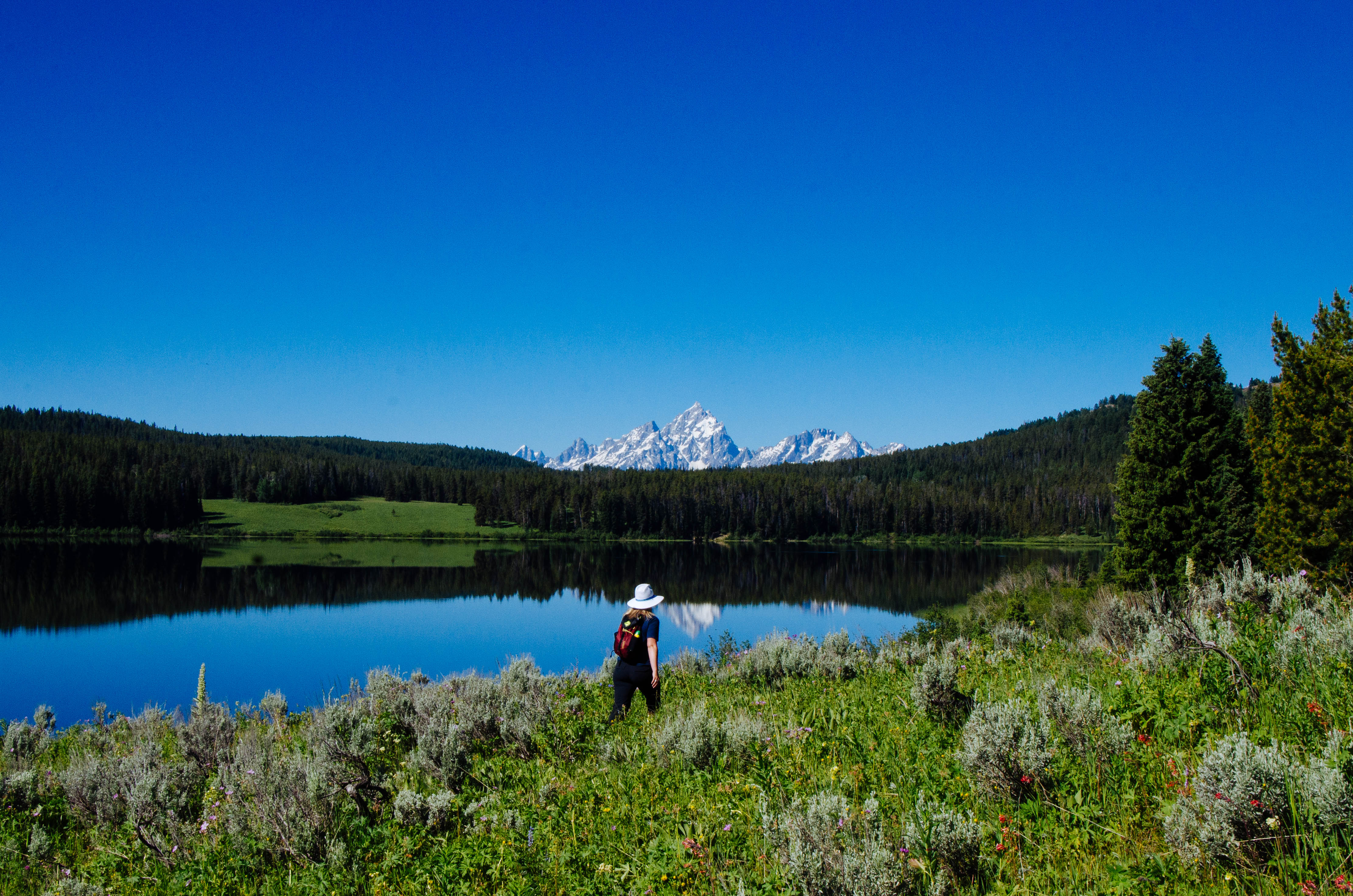
Those looking for a more secluded hike will enjoy looping Two Ocean Lake. Leaving from the Two Ocean Lake Trailhead, hikers can head around the lakeshore for views of the Teton Range. In early to mid-summer, wildflowers populate the area, brightening up the landscape and making for stunning views. Don’t forget the bug spray! Due to the wet, marshy nature of the landscape, Two Ocean Lake is a popular area for mosquitos.
Accessibility The Two Ocean Lake Trail is a moderate, 6.4 mi (10.3 km) loop hike with 700 ft (210 m) of elevation gain and an average slope of 4%. The trail features elevation gain and other obstacles. Many sections of the trail are narrow and pass through dense fields and forests.
Two Ocean Lake - Emma Matilda Lake Loop the Park Service's write-up
7-9 Hours · no dogs · Summer, Fall
Start Two Ocean Lake
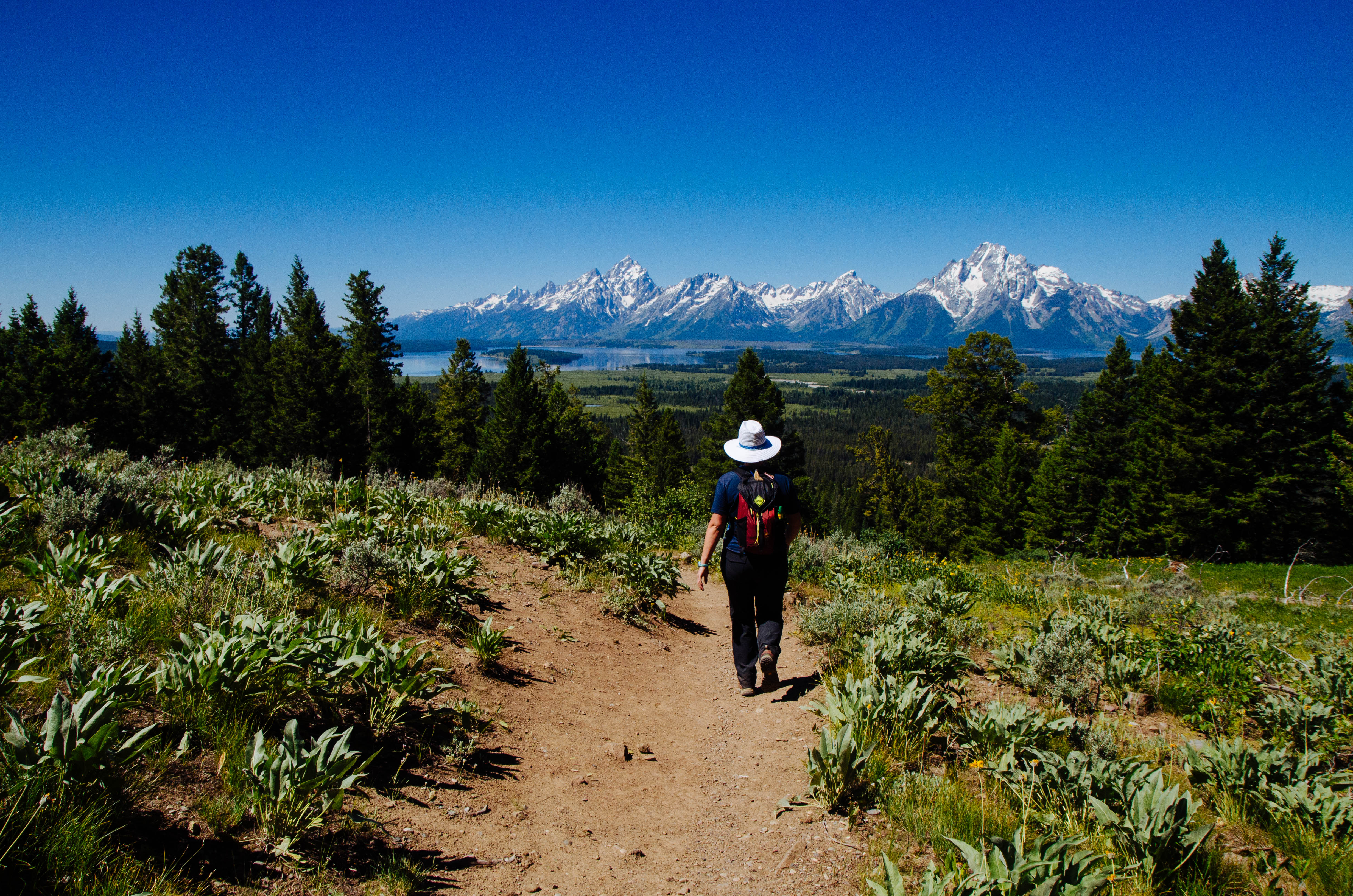
Hikers hoping to view both Two Ocean and Emma Matilda Lakes can make a 13.2 mile loop around them both. Starting from the Two Ocean Lake Trailhead, the trail leads hikers around the north shore of Two Ocean Lake. The trail then crests at Grand View Point, which offers panoramic views of both lakes and Jackson Hole. The trail then goes downhill to Emma Matilda Lake to complete the loop. In early to mid-summer, wildflowers populate the area, brightening up the landscape and making for stunning views. Don’t forget the bug spray! Due to the wet, marshy nature of the landscape, this s a popular area for mosquitos.
Accessibility The Two Ocean Lake-Emma Matilda Lake Loop is a moderately strenuous, 13.2 mi (21.2 km) loop hike with 1,960 ft (600 m) of elevation gain and an average slope of 5%. The trail has various obstacles and a narrow path through dense underbrush.
Two Ocean-Emma Matilda Cutoff Trail
Valley Trail
ViewsBackcountry camps
Along the way South District Lakes Bradley Lake Phelps Lake Overlook
Trailhead Lupine Meadows Trailhead 6,736 ft Drive there
Valley Trail - Phelps Lake Overlook the Park Service's write-up
7-9 Hours · no dogs · Spring, Summer, Fall
Start Valley Trail Trailhead
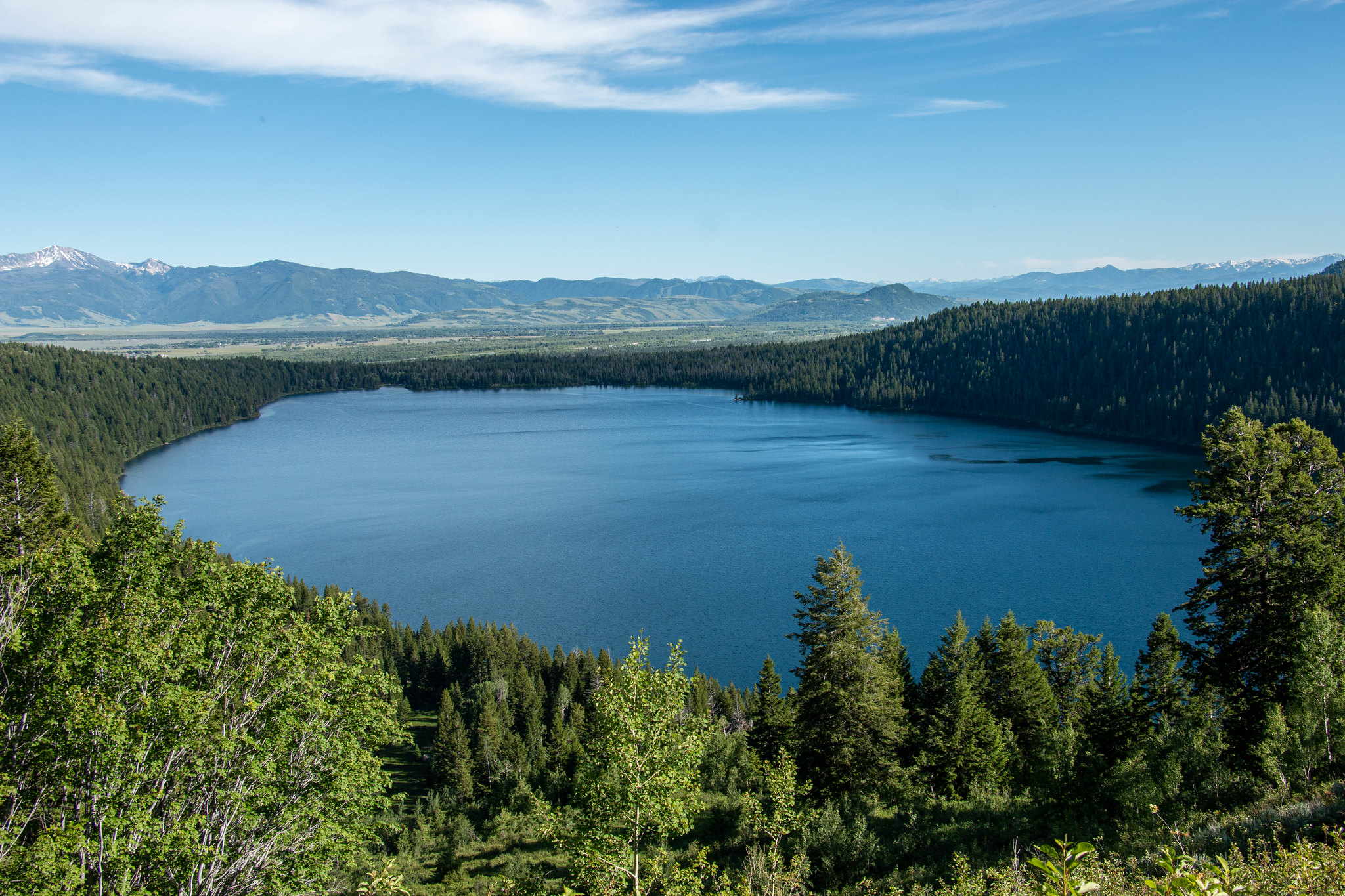
The Valley Trail is a strenuous, out and back trail that winds through alpine forests, connecting Teton Village to Grand Teton National Park's valley lakes. Start the trail from the Teton Village base area. After an initial ascent to the start of the Valley Trail via Jackson Hole Mountain Resort trails , follow the trail across rolling terrain before ascending to the Phelps Lake Overlook. Return the same way or continue on for a longer hike.
Accessibility The Valley Trail is a strenuous, 13.2 mi (21.3 km) RT hike with 2,360 ft (720 m) of elevation gain and an average slope of 17%. The trail features trail obstacles, such as exposed roots and rocks.
Webb Canyon Trail
Willow Flats Trail
Wister Draw Trail
Woodland Trail
Lake Creek - Woodland Trail Loop the Park Service's write-up
1-3 Hours · no dogs · Spring, Summer, Fall
Start Laurance S. Rockefeller Preserve
Take an easy hike along Lake Creek to the shore of Phelps Lake. The trail begins at the Laurance S. Rockefeller Preserve and winds through the surrounding forest and along the banks of Lake Creek. Once at Phelps Lake, the forest opens up to reveal the lake and views into Death Canyon. Follow the Woodland Trail to complete the loop back.
Accessibility The Lake Creek-Woodland Trail Loop is an easy, 3 mi (4.8 km) RT loop hike with 770 ft (230m) of elevation gain with an average slope of 7%. The trail is wide and mostly level, although rocks and exposed roots may be found.
15 more mapped segments without a name are on the map, not in the list.
More hikes the Park Service describes
Write-ups that name no single mapped trail, in the Service's words.
- Flagg Canyon · 2-4 Hours · no dogs · Spring, Summer, Fall
Explore the northern stretch of the Snake River on this hike through Flagg Canyon. - Grand View Point · 1-4 Hours · no dogs · Summer, Fall
Hike to Grand View Point for panoramic views of the Teton Range and Jackson Hole. - Hidden Falls · 1-3 Hours · no dogs · Spring, Summer, Fall
Visit the only accessible waterfall in Grand Teton on this easy-moderate hike to Hidden Falls. - Lunch Tree Hill · 20-45 Minutes · no dogs · Spring, Summer, Fall
Lunch Tree Hill is an easy walk with spectacular views of the Teton Range. - Moose Ponds · 1-3 Hours · no dogs
Be on the lookout for moose on this hike to Moose Ponds. - Phelps Lake · 1-3 Hours · no dogs · Summer, Fall
Travel to the Phelps Lake Overlook and down to the shore of Phelps Lake on this moderate hike. - Phelps Lake Overlook · 1-2 Hours · no dogs · Spring, Summer, Fall
Gain a vantage point above Phelps Lake on this easy hike. - Polecat Creek Loop · 1-2 Hours · no dogs · Spring, Summer, Fall
Keep an eye out for birds and wildlife on the Polecat Creek Loop hike. - Surprise and Amphitheater Lakes · 5-7 Hours · no dogs · Summer, Fall
Travel to Surprise and Amphitheater Lakes on this strenuous hike. - Taggart Lake · 1-2 Hours · no dogs
Get spectacular views of the Teton Range on this easy hike to Taggart Lake. - Taggart Lake - Beaver Creek Loop · 2-3 Hours · no dogs
Take a easy loop hike to Taggart Lake for some of the most stunning views of the Teton Range.
About these trails
The lines are the National Park Service's public trails layer, the trailheads and the waterfalls, views, peaks and historic places along them the Service's public points of interest, read 2026-10-14 and simplified for the map. The write-ups are the Service's own "things to do", unedited. Heights come from USGS 3DEP through Terrain Tiles on AWS (Mapzen/Tilezen), read along each line and rounded; a short trail on steep ground can be off by a few tens of feet. Closures change: check the park's own site before you go.