Grand Teton National Park · Wyoming

Bradley Lake Trail

1.0 mi of trail, end to end · about 250 ft of climbing · 6,906 ft–7,131 ft · native surface · trail class Moderately Developed · hiking, horse

6,906 ft 7,046 ft · 0.9 mi high 7,131 ft

Taggart Lake - Bradley Lake Loop the Park Service's write-up

2-3 Hours · no dogs · season In winter, the Taggart Lake-Bradley Lake Loop is accessible with snowshoes or cross-country skis.

Start Taggart Lake Trailhead
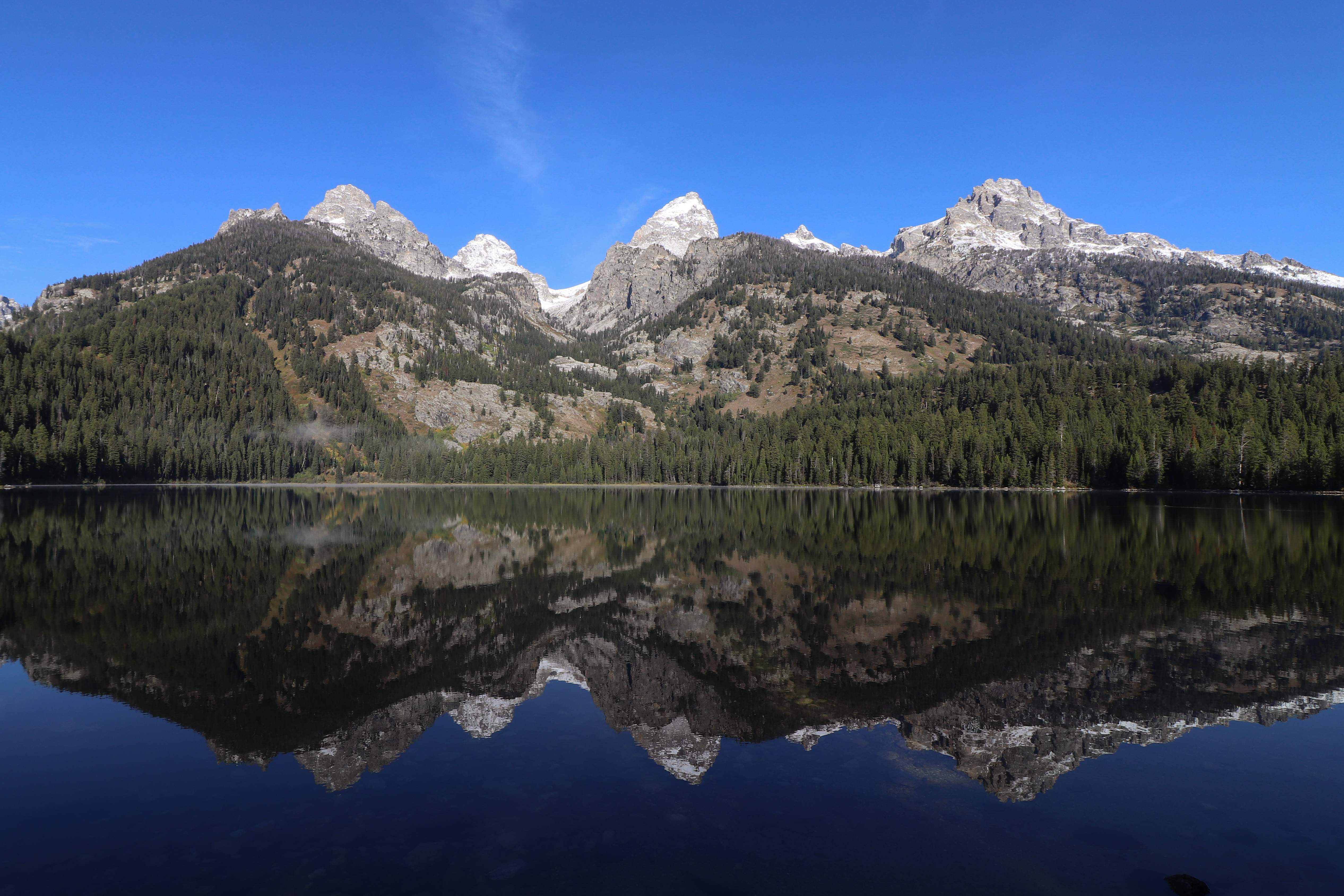
A lake sits at the base of a mountain range with a near perfect reflection on its calm surface.
A near perfect reflection on Bradley Lake on a calm, fall morning. Photo: NPS Photo/A. Falgoust

Hike to two alpine lakes on the Taggart Lake - Bradley Lake Loop. Leaving from the Taggart Lake Trailhead, hikers will wind up an aspen-covered moraine before the trail opens up to views of the Tetons. At the Bradley Lake trail split, follow the trail right to Bradley Lake. From Bradley Lake, follow signs to Taggart Lake and complete the loop back to the parking lot. Hikers will find spectacular views of two alpine lakes with the Teton Range behind.

Accessibility The Taggart Lake - Bradley Lake Loop is a 5.6 mile (9 km) roundtrip hike with 890 ft (262 m) of elevation gain and an average slope of 7%. To visit both lakes, the trail gains and loses elevation several times. The trail is ocassionally narrow and passes through dense underbrush. Large rocks can be found on the trail.

This hike on nps.gov

All 122 trails in Grand Teton National ParkFind a trailOn the parks mapPark on nps.gov

About this trail's facts

The lines are the National Park Service's public trails layer, the trailheads and the waterfalls, views, peaks and historic places along them the Service's public points of interest, read 2026-10-16 and simplified for the map; the length is the line's, end to end. The write-ups are the Service's own "things to do" text, unedited. Heights come from USGS 3DEP through Terrain Tiles on AWS (Mapzen/Tilezen), read along each line and rounded; a short trail on steep ground can be off by a few tens of feet. Closures change: check the park's own site before you go.