Great Sand Dunes National Park & Preserve · Colorado

Medano Lake Trail

3.5 mi of trail, end to end · about 1,900 ft of climbing · 9,636 ft–11,536 ft · hiking

9,636 ft 11,532 ft · 3.4 mi high 11,536 ft

Hike Medano Lake and Mount Herard the Park Service's write-up

8-12 Hours · dogs allowed · Summer, Fall · season Medano Pass Primitive Road access is seasonal, and depends on snowpack and creek levels. On average, the pass opens around late May, and closes by November. There are typically snowdrifts on the trail and tundra through at least mid-June, and often into July.

Start Summit of Mount Herard
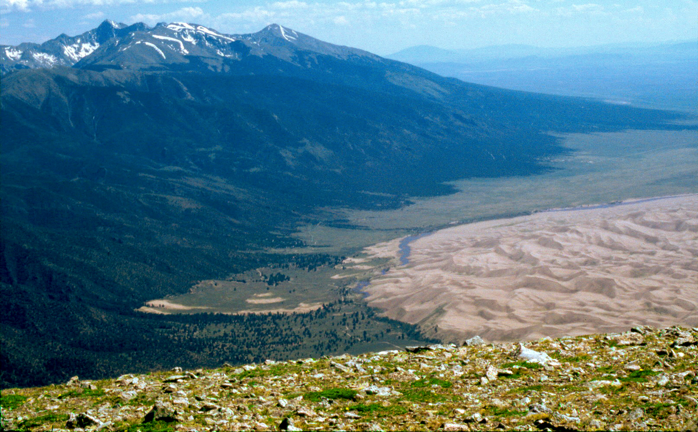
Alpine tundra in foreground, part of the dunefield at right, and snow-capped Blanca Peak
The incredible 360 degree views from the summit of Mount Herard include the dunefield and more. Photo: NPS/Patrick Myers

Take your 4WD vehicle around the dunes and up to Medano Pass, hike to a small alpine lake, then continue to the summit of 13,297 ft (4,053 m) Mount Herard for an aerial perspective on the entire dunefield! This is a physically demanding but incredibly rewarding way to experience many of Great Sand Dunes National Park and Preserve's ecoystems, from desert dunes to alpine tundra. Watch the high-energy 40-second video to get a glimpse of this unique experience!

Accessibility While Medano Pass Primitive Road is accessible by driving with a high-clearance 4WD vehicle, the hiking trail and ascent to the summit are steep and rocky.

This hike on nps.gov

All 24 trails in Great Sand Dunes National Park & PreserveFind a trailOn the parks mapPark on nps.gov

About this trail's facts

The lines are the National Park Service's public trails layer, the trailheads and the waterfalls, views, peaks and historic places along them the Service's public points of interest, read 2026-10-16 and simplified for the map; the length is the line's, end to end. The write-ups are the Service's own "things to do" text, unedited. Heights come from USGS 3DEP through Terrain Tiles on AWS (Mapzen/Tilezen), read along each line and rounded; a short trail on steep ground can be off by a few tens of feet. Closures change: check the park's own site before you go.