2 Track Road
Backcountry camps
Along the way Sand Creek Backcountry Campsite

National Park & Preserve · Colorado
24 named trails · 41 miles · 10 trailheads · 3 with the Park Service's own write-up. The lines, trailheads and points are the Park Service's; the write-ups are the Service's own words; the climbing is read from USGS elevation along each line.
24 trails, A to Z.
Backcountry camps
Along the way Sand Creek Backcountry Campsite
Trailhead Dunes Access Trailhead 8,232 ft Drive there
Trailheads Dunes Access Trailhead 8,154 ft Drive there · Interpretive Loop Trailhead 8,166 ft Drive there
Views
Along the way Dunes Overlook
Visitor centers
Along the way Great Sand Dunes
Trailheads Dunes Access Trailhead 8,154 ft Drive there · Interpretive Loop Trailhead 8,166 ft Drive there
10-15 Hours · dogs allowed · Summer, Fall
Start Lower Sand Creek Lake
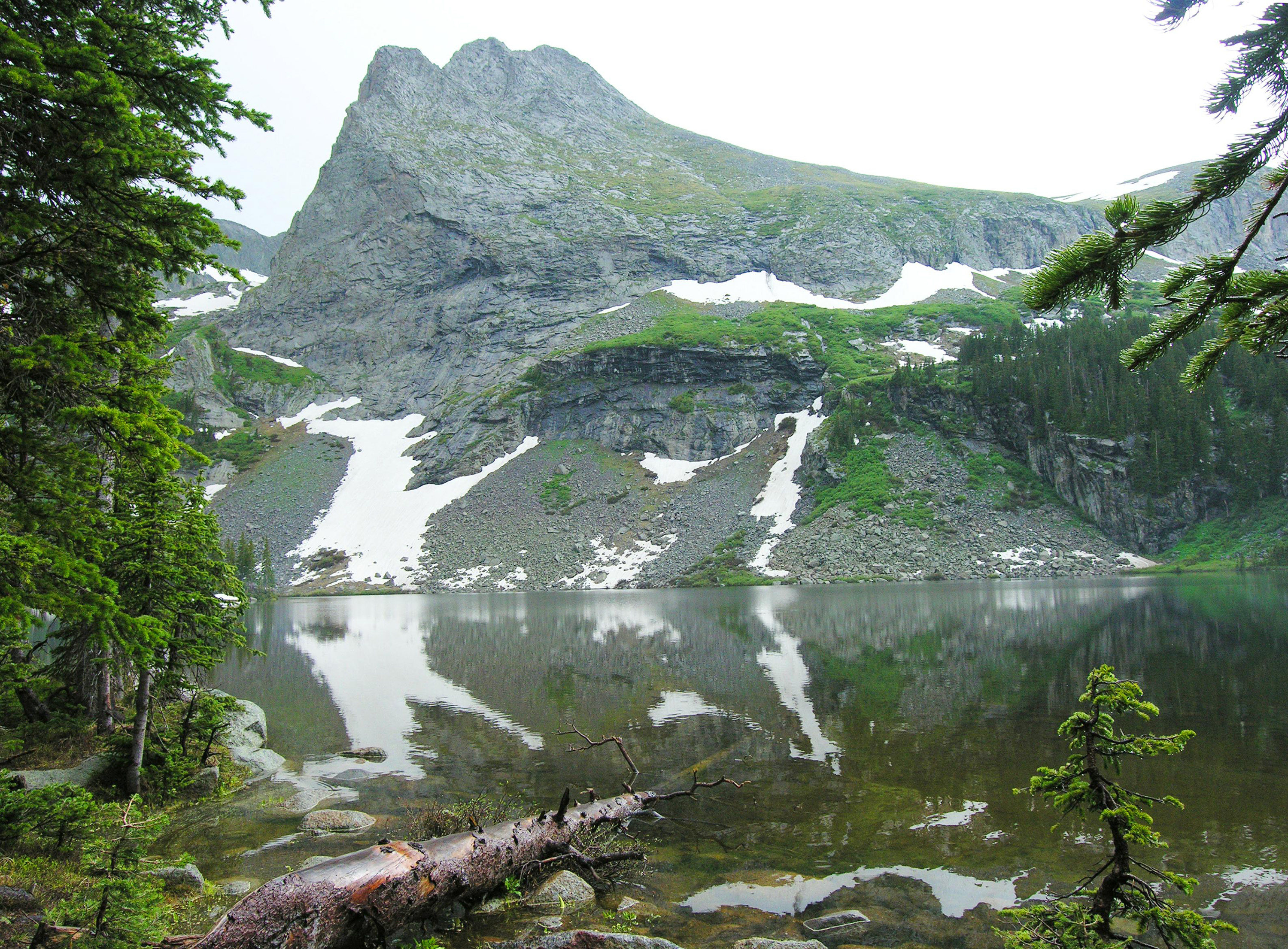
Sand Creek Lakes are part of the alpine watershed of Great Sand Dunes National Preserve. A longer drive and hike is required to reach these lakes, but the mountain scenery is worth the effort. Check with a ranger for conditions before travel. Snow may block these trails from November into June.
Music Pass Trailhead is accessed from Highway 69 on the east side of the Sangre de Cristo Mountains, 4.5 miles south of Westcliffe. Turn off Highway 69 to the west at the sign for Music Pass and South Colony Lakes Trailhead. At the "T" junction, turn left onto South Colony Road. At the end of the ranch fence on the right, you'll see another sign for Music Pass.
2WD vehicles should park where the Rainbow Trail crosses Music Pass Road. This lower trailhead will add 2.5 miles (4 km) each way to the hike..
4WD vehicles may continue another 2.5 miles to Music Pass Trailhead at the end of the road. From here, it is a steep 1 mile (1.6 km) hike to the pass at treeline, with a great view of Upper Sand Creek basin. From the pass, hike farther to the alpine lakes, or to any one of the 13,000' peaks above the basin.
Round Trip Hiking Mileages From Music Pass Trailhead
Lower Sand Creek Lake: 8 miles (12.8 km), 2000 feet (610 m) elevation gain
Upper Sand Creek Lake: 9 miles (14.4 km), 2000 feet (610 m) elevation gain
Accessibility High clearance 4WD vehicles can make it to Music Pass Trailhead. After that point, the trail is steep and rocky, unsuitable for wheelchairs.
8-12 Hours · dogs allowed · Summer, Fall
Start Summit of Mount Herard
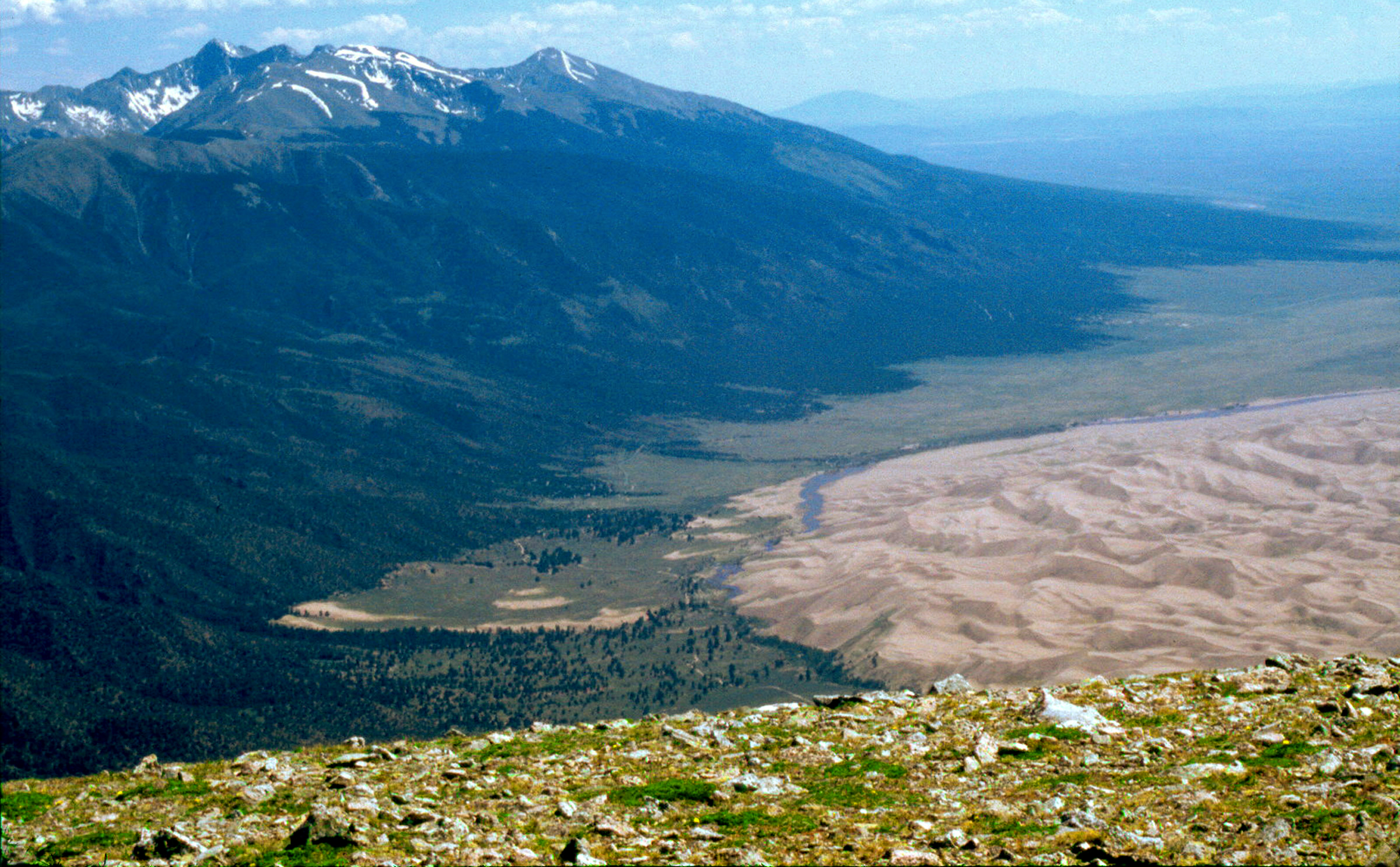
Take your 4WD vehicle around the dunes and up to Medano Pass, hike to a small alpine lake, then continue to the summit of 13,297 ft (4,053 m) Mount Herard for an aerial perspective on the entire dunefield! This is a physically demanding but incredibly rewarding way to experience many of Great Sand Dunes National Park and Preserve's ecoystems, from desert dunes to alpine tundra. Watch the high-energy 40-second video to get a glimpse of this unique experience!
Accessibility While Medano Pass Primitive Road is accessible by driving with a high-clearance 4WD vehicle, the hiking trail and ascent to the summit are steep and rocky.
Trailhead Montville Nature Loop Trailhead 8,252 ft Drive there
Trailheads Montville Nature Loop Trailhead 8,252 ft Drive there · Mosca Pass Trailhead 8,174 ft Drive there
Trailhead Mosca Pass Trailhead 8,174 ft Drive there
30-240 Minutes · dogs allowed
Start Montville and Mosca Pass Trailhead
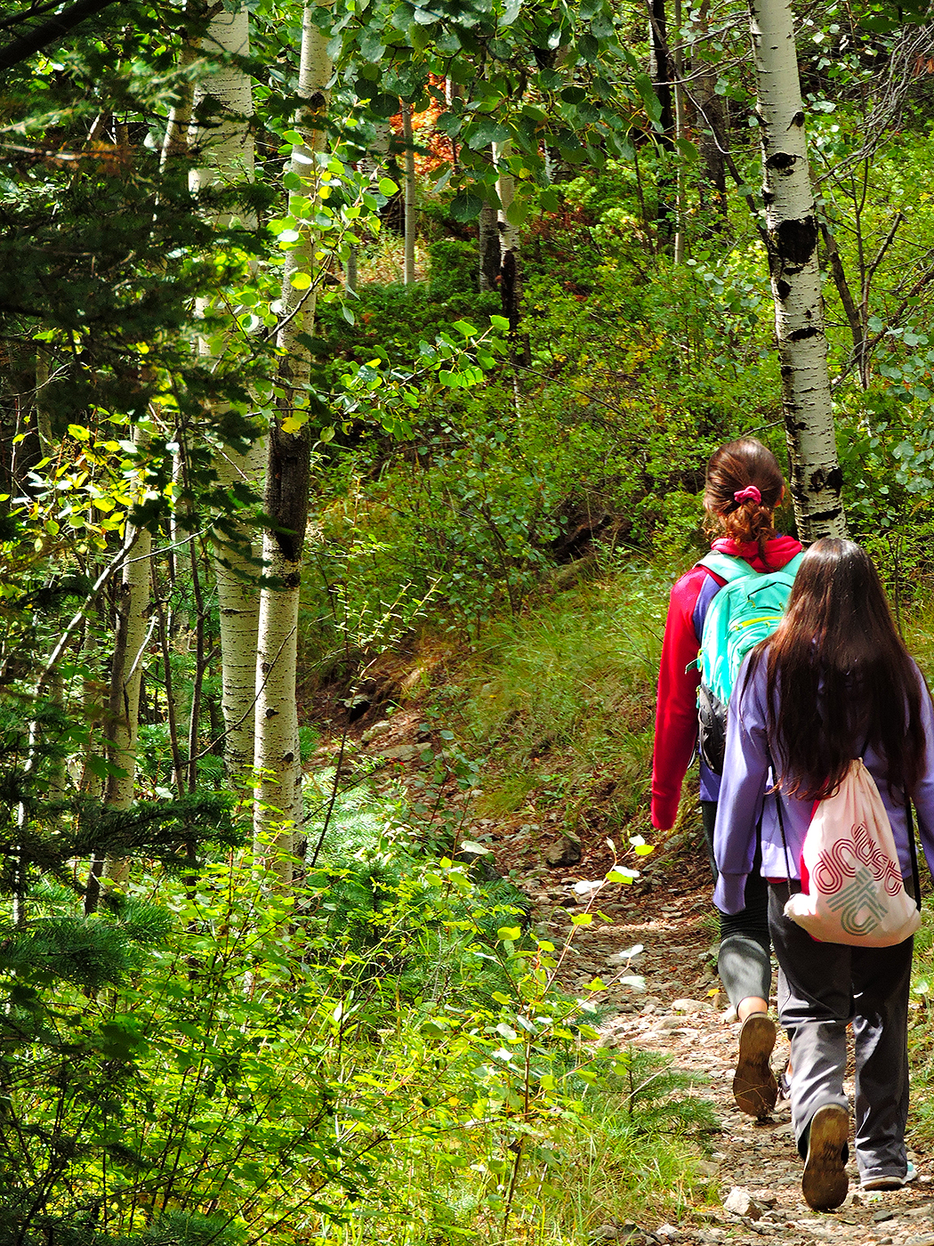
Just above the dunefield are montane woodlands of pinon and ponderosa pine, subalpine aspen and conifer forests, alpine lakes and rugged mountains over 13,000 feet (4,000 m) in elevation. The easiest hiking access to forest in the national park is on the Montville Nature Trail and Mosca Pass Trail.
Watch a short video showing Mosca Pass Trail in the fall season on the Great Sand Dunes YouTube Channel.
Montville Nature Trail
This is the easiest, most popular forest hike in the park. In summer, keep this hike as an option for afternoon as an escape from the heat of the dunes. Walk along a shady forested trail named for a late 1800s settlement, comprising 20 houses in its heydey. Rest near the trail's highpoint, where you'll find views of Mt. Herard, the dunes and the valley. A booklet available at the trailhead provides numbered stops to learn about this historic community and the mountain pass above it.
Round Trip Hike: 0.5 mile (1 km)
Elevation Gain: 200 feet (60 m)
Average Time: 30 minutes
Mosca Pass Trail
This trail continues past Montville Nature Trail, following a small creek to the summit of a low pass in the Sangre de Cristo mountains. Though views are limited, it has shady aspen and evergreen forests. Indigenous tribes and early settlers used this route for travel into the valley.
Round Trip Hike: 7 miles (11 km)
Elevation Gain: 1400 feet (427 m)
Average Time: 3.5 hours
Accessibility Montville Trail and Mosca Pass Trail are not wheelchair-accessible. There are rocks and uneven areas on the trail.
Picnic areas
Along the way Sand Pit
Trailhead Sand Pit Trailhead 8,380 ft Drive there
Backcountry camps
Along the way Aspen Backcountry Campsite Cold Creek Backcountry Campsite Sand Creek Backcountry Campsite Sawmill Canyon Accessible Backcountry Campsi
Trailheads Sand Pit Trailhead 8,380 ft Drive there · Sand Ramp Trailhead 8,526 ft Drive there · Sand Ramp Trailhead 8,298 ft Drive there
Backcountry camps
Along the way Aspen Backcountry Campsite
Backcountry camps
Along the way Cold Creek Backcountry Campsite
Backcountry camps
Along the way Escape Dunes Backcountry Campsite
Backcountry camps
Along the way Indian Grove Backcountry Campsite
Backcountry camps
Along the way Little Medano Backcountry Campsite
Backcountry camps
Along the way Sawmill Canyon Accessible Backcountry Campsi
Trailhead Sawmill Canyon Access Trailhead 8,358 ft Drive there
Trailhead Wellinton Ditch Trailhead 8,303 ft Drive there
Write-ups that name no single mapped trail, in the Service's words.
The lines are the National Park Service's public trails layer, the trailheads and the waterfalls, views, peaks and historic places along them the Service's public points of interest, read 2026-10-14 and simplified for the map. The write-ups are the Service's own "things to do", unedited. Heights come from USGS 3DEP through Terrain Tiles on AWS (Mapzen/Tilezen), read along each line and rounded; a short trail on steep ground can be off by a few tens of feet. Closures change: check the park's own site before you go.