
Wheeler Peak Summit Trail
Trailhead Summit Trailhead 10,171 ft Drive there
Hike to Wheeler Peak 9 mi round trip · the Park Service's write-up
4-10 Hours · no dogs · Summer, Fall
Start Summit Trailhead
Trail Overview
Total Distance: 8.6 miles / 14.0 kilometers
Starting elevation: 10,160 feet / 3,097 meters
Elevation Gain: 3,100 feet / 945 meters
Difficulty: Strenuous
Time: 4 hours - 10 hours
Begin at : Summit Trailhead
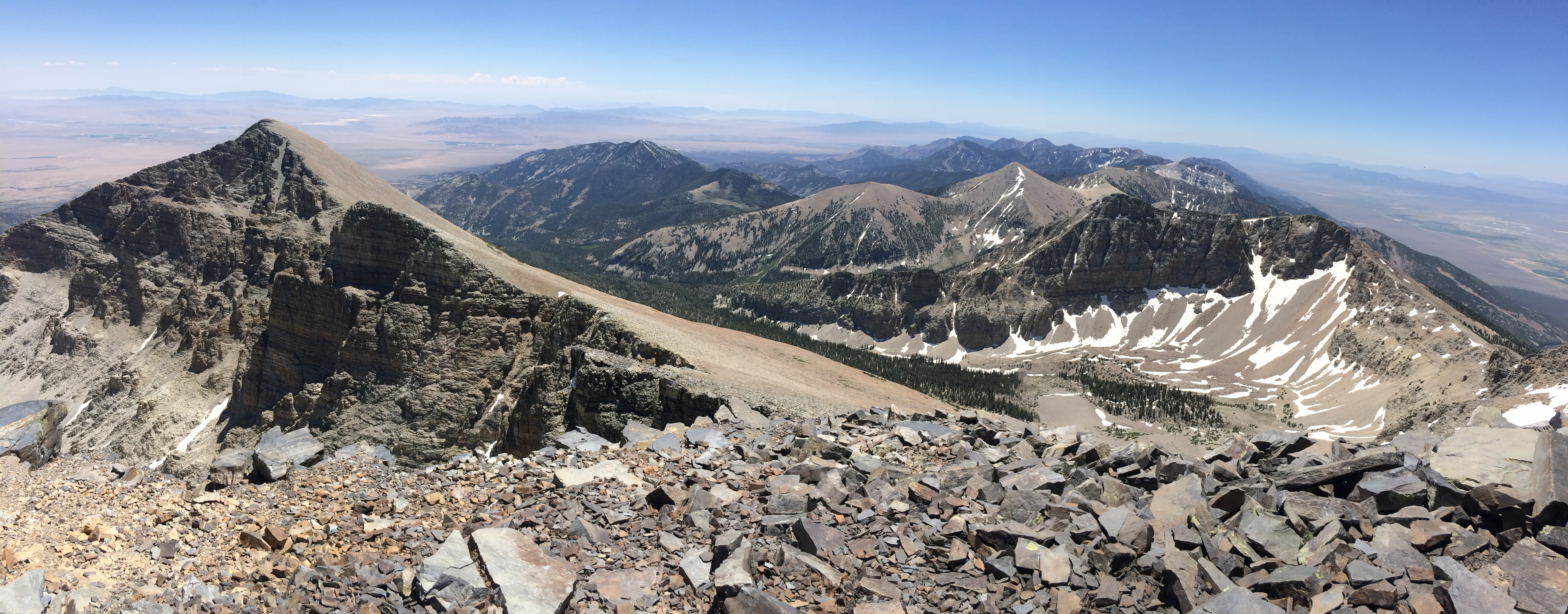
Wheeler Peak stands as the second tallest point in Nevada, and the tallest to have its flanks entirely within the state. This rocky and windy trail is considered one of the hardest in the park, and finishes with the steepest section of trail in the park. Once standing on it's top, Wheeler Peak strikes awe allowing sight of more than 100 miles on a clear day. Hikers should be prepared for a steep and exposed hike where thunderstorms and high winds are common. During the summer, snow still may be on the trail at the higher elevations.
After reaching the saddle between Wheeler and Bald Mt, about 2.5 miles up the trail, hikers get above treeline and become the most prominent features on the hillsides. This means extreme danger when thunderstorms approach. The trail is best done starting around dawn so well prepared and altitude adjusted hikers can return by the late morning or early afternoon.
Beginning at an elevation of about 10,000 feet, these trails provide both a respite from the summer heat of the Snake Valley, but also added dangers in the form of altitude sickness and afternoon thunderstorms. Be prepared with plenty of water and salty snacks, or to return to your vehicle if you become symptomatic of altitude sickness or see thunderclouds rolling in.
This hike starts at the Summit Trailhead near the top of the Wheeler Peak Scenic Drive, 2/3 of a mile short of the Bristlecone Trailhead at the end of the Wheeler Peak Scenic Drive. Parking outside of designated spaces or along the road is prohibited.
No pets permitted on park trails. Trained service animals allowed. Learn more about service animal regulations at this link.
Water
Potable water is not available along the Wheeler Peak Scenic Drive. Pack sufficient water with you, about one gallon per person per day. Water is available year-round at the nearby Lehman Caves Visitor Center or seasonally at the dump station.
Restrooms
The nearest restrooms are pit toilets with no running water at the Bristlecone Trailhead.
Accessibility This trail is not accessible.