35 named trails · 86 miles · 2 trailheads · 20 with the Park Service's own write-up. The lines, trailheads and points are the Park Service's; the write-ups are the Service's own words; the climbing is read from USGS elevation along each line.
2.4 mi one way · about 450 ft of climbing · 9,955 ft–10,428 ft · native surface · hiking
Picnic areas
Along the wayBristlecone Trail Picnic Area
Hike the ADA Sky Island Forest Trail the Park Service's write-up
15-45 Minutes · no dogs · Summer, Fall
Start Bristlecone, Alpine Lake and Sky Island Forest Trailhead
At high elevation explore this loop trail Photo: NPS
Trail Overview
Total Distance: 0.4 miles / 0.6 kilometers
Starting elevation: 9,890 feet / 2,987 meters
Elevation Gain: 20 feet / 6 meters
Difficulty: Easy & Accessible
Time: 15 minutes - 45 minutes
Begin at : Bristlecone Trailhead/End of the Scenic Drive
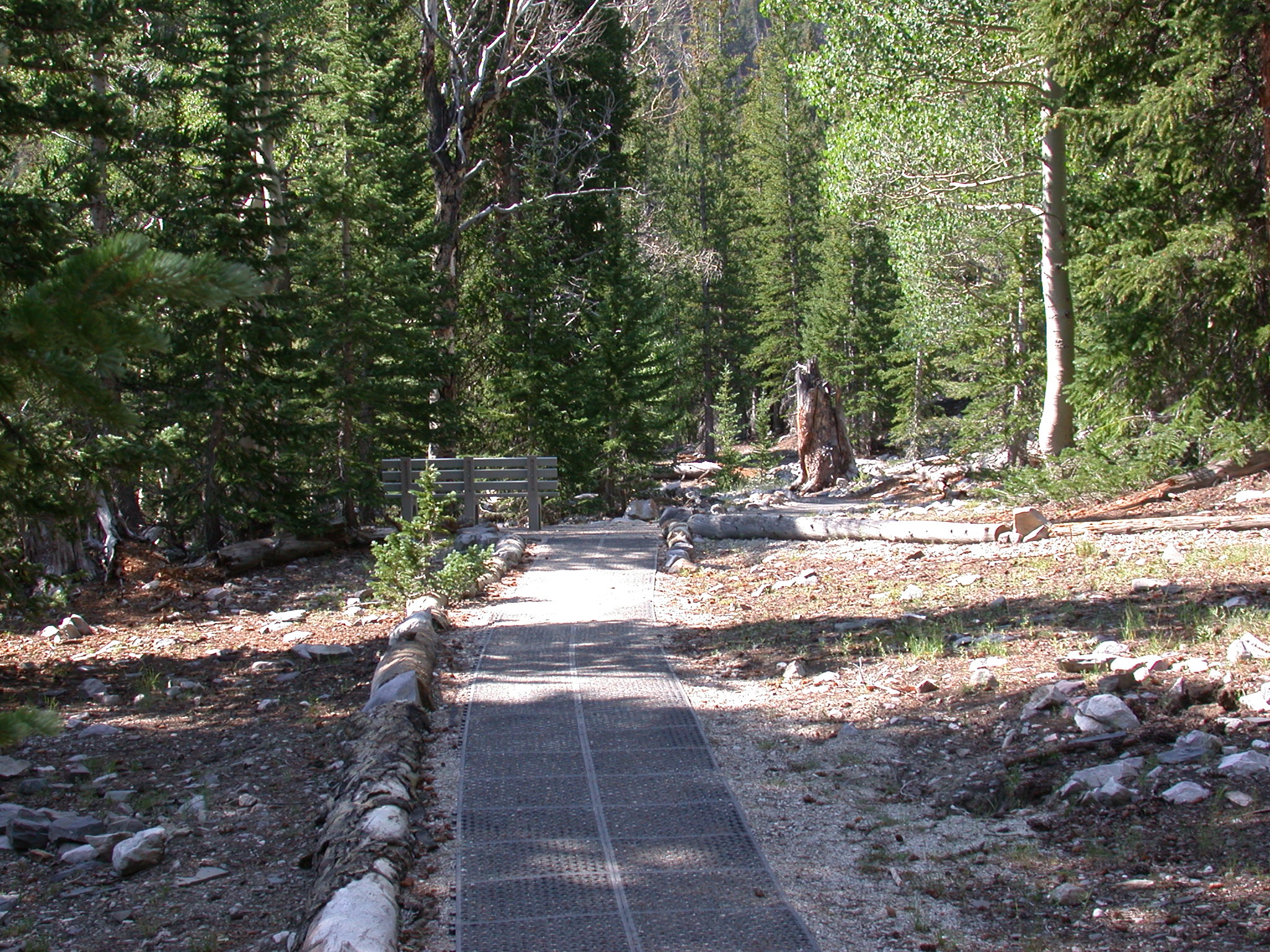
The ADA Accessible Sky Island Forest Trail is the best trail for visitors wanting to take a simple walk through the trees or for those visitors who use wheelchairs. The rubber matted surface makes for fairly even travel until a wooden boardwalk is reached. Interpretive signs along the trail talk about this unique ecosystem, the meaning of a "Sky Island," and the recovery from a wildfire in years past. Steal a view of Wheeler Peak through the trees, view wildflowers near the streams, and enjoy the lower temperatures of high elevation.
Beginning at an elevation of just under 10,000 feet, these trails provide both a respite from the summer heat of the Snake Valley, but also added dangers in the form of altitude sickness and afternoon thunderstorms. Be prepared with plenty of water and salty snacks, or to return to your vehicle if you become symptomatic of altitude sickness or see thunderclouds rolling in.
This hike starts at the Bristlecone Trailhead at the end of the Wheeler Peak Scenic Drive. Parking outside of designated spaces or along the road is prohibited.
No pets permitted on park trails. Trained service animals allowed. Learn more about service animal regulations at this link.
Water
Potable water is not available along the Wheeler Peak Scenic Drive. Pack sufficient water with you, about one gallon per person per day. Water is available year-round at the nearby Lehman Caves Visitor Center or seasonally at the dump station.
Restrooms
The nearest restrooms are pit toilets with no running water at the Bristlecone Trailhead.
Accessibility This trail is accessible with a matted trail surface or wooden boardwalk and ubiquitous benches. Elevation change is a matter of a few feet over the whole distance.
Hike the Alpine Lakes Loop the Park Service's write-up
1-3 Hours · no dogs
Start Bristlecone, Alpine Lake and Sky Island Forest Trailhead
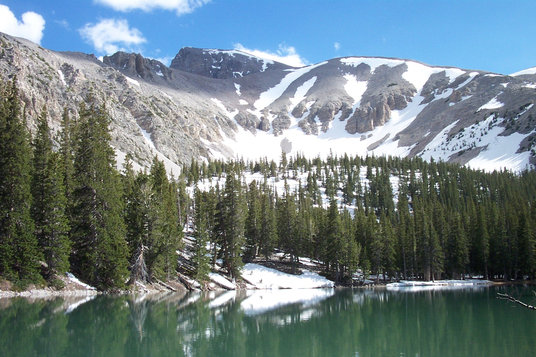
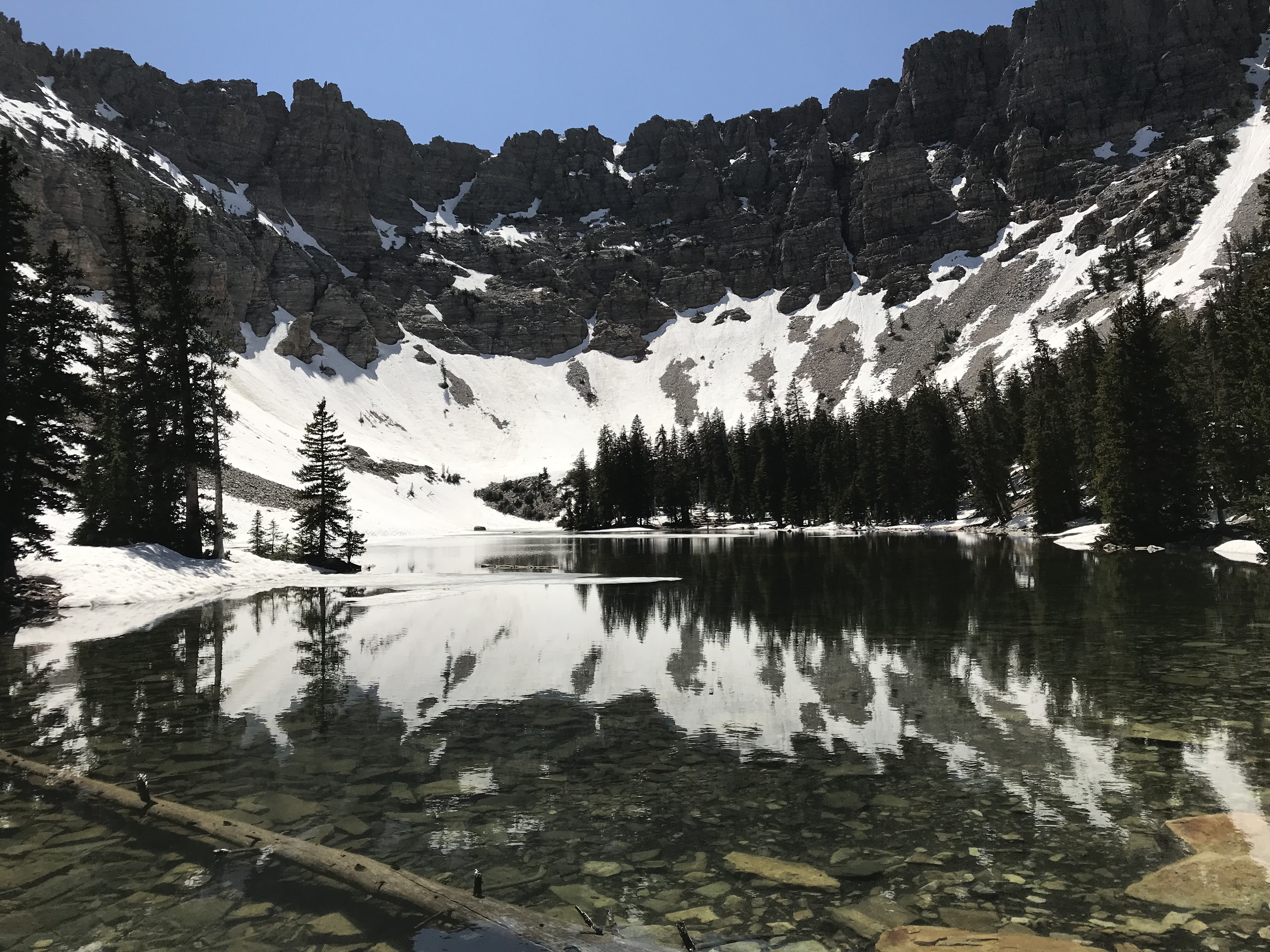
Teresa Lake is one of the two lake you will see on this hike. Photo: NPS
Trail Overview
Total Distance: 2.7 miles / 4.4 kilometers
Starting elevation: 9,890 feet / 2,987 meters
Elevation Gain: 440 feet / 134 meters
Difficulty: Easy
Time: 1.5 hours - 3 hours
Begin at : Bristlecone Trailhead/End of the Scenic Drive
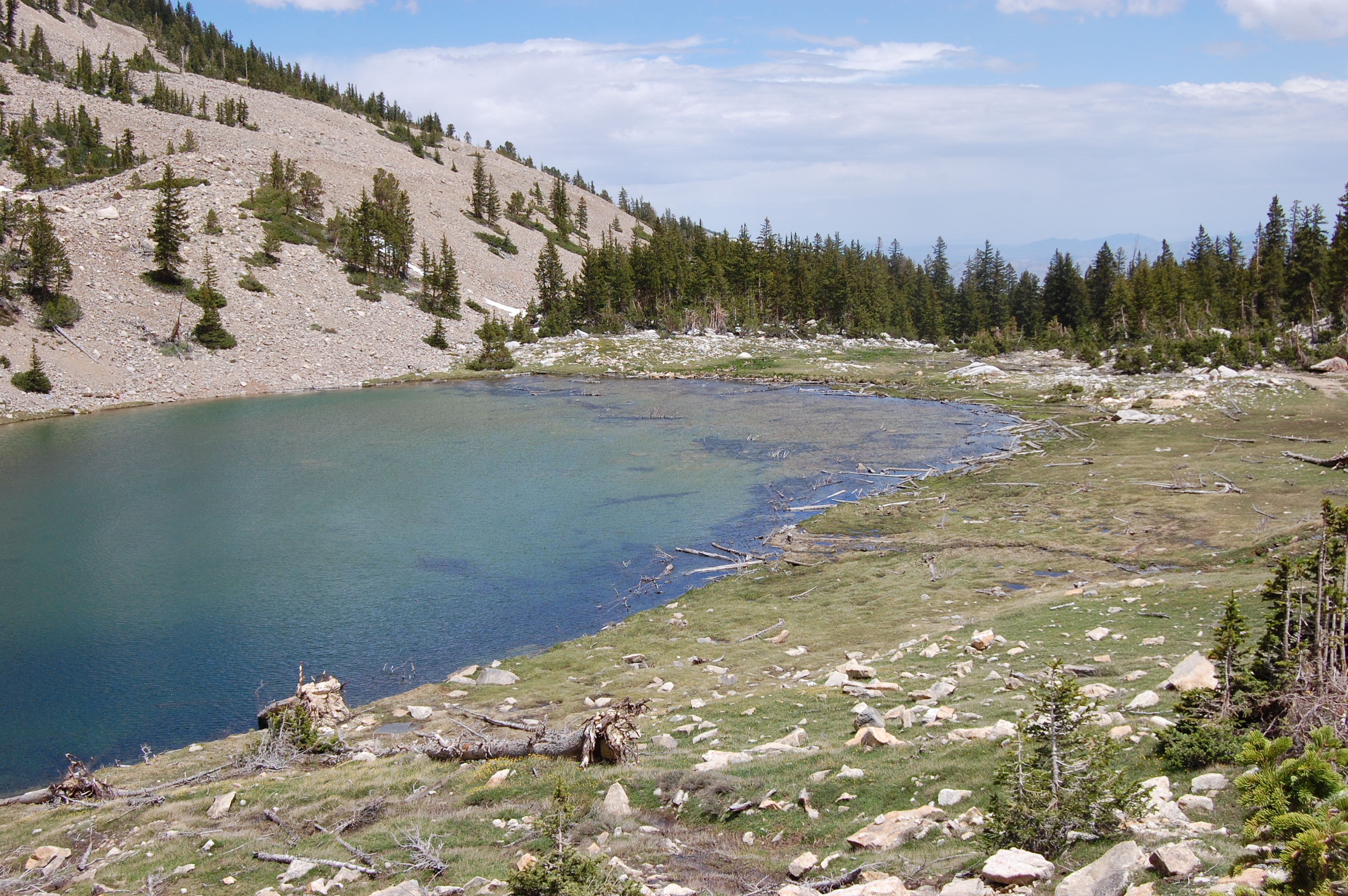
One of the most popular trails in Great Basin National Park, the Alpine Lakes Loop allows folks to get away from the road but not straining too hard. Just under three miles, this loop hike passes by two alpine lakes, Teresa and Stella lakes, all while going through alpine meadows and coniferous forests. Passing in the shadow of the highest peaks of the Snake Range, Wheeler Peak and Doso Doyabi are visible on this trail providing sweeping views of the sheer cliffs and flanks of these mountains. Wildflowers and wildlife are regularly visible during the summer months, and a night hike rewards many with a vast night sky. Winter is a similarly good time to visit, though will need to be linked with the Lehman Creek Trail afer the closure of the Scenic Drive.
The Bristlecone Trail also overlaps the early sections of this trail and can be linked together for a total combined distance of 4.1 miles / 6.6 kilometers. See the trail map below (unavailable on NPS app) for clarification on the overlapping sections.
Beginning at an elevation of just under 10,000 feet, these trails provide both a respite from the summer heat of the Snake Valley, but also added dangers in the form of altitude sickness and afternoon thunderstorms. Be prepared with plenty of water and salty snacks, or to return to your vehicle if you become symptomatic of altitude sickness or see thunderclouds rolling in.
This hike starts at the Bristlecone Trailhead at the end of the Wheeler Peak Scenic Drive. Parking outside of designated spaces or along the road is prohibited.
No pets permitted on park trails. Trained service animals allowed. Learn more about service animal regulations at this link.
Water
Potable water is not available along the Wheeler Peak Scenic Drive. Pack sufficient water with you, about one gallon per person per day. Water is available year-round at the nearby Lehman Caves Visitor Center or seasonally at the dump station.
Restrooms
The nearest restrooms are pit toilets with no running water at the Bristlecone Trailhead.
Accessibility The Alpine Lakes Loop is not accessible
0.4 mi one way · about 50 ft of climbing · 80 ft of descent · 8,846 ft–8,923 ft · native surface · hiking, horse
Hike the Baker Creek Loop the Park Service's write-up
90-180 Minutes · no dogs
Start Baker Creek Trailhead
Meadows provide welcome solace at the top of this trail Photo: B. Mills
Trail Overview
Total Distance: 3.3 miles / 5.3 kilometers
Starting elevation: 8,020 feet / 2,445 meters
Elevation Gain: 850 feet / 259 meters
Difficulty: Easy/Moderate
Time: 1.5 hours - 3 hours
Begin at : Baker Creek Trailhead
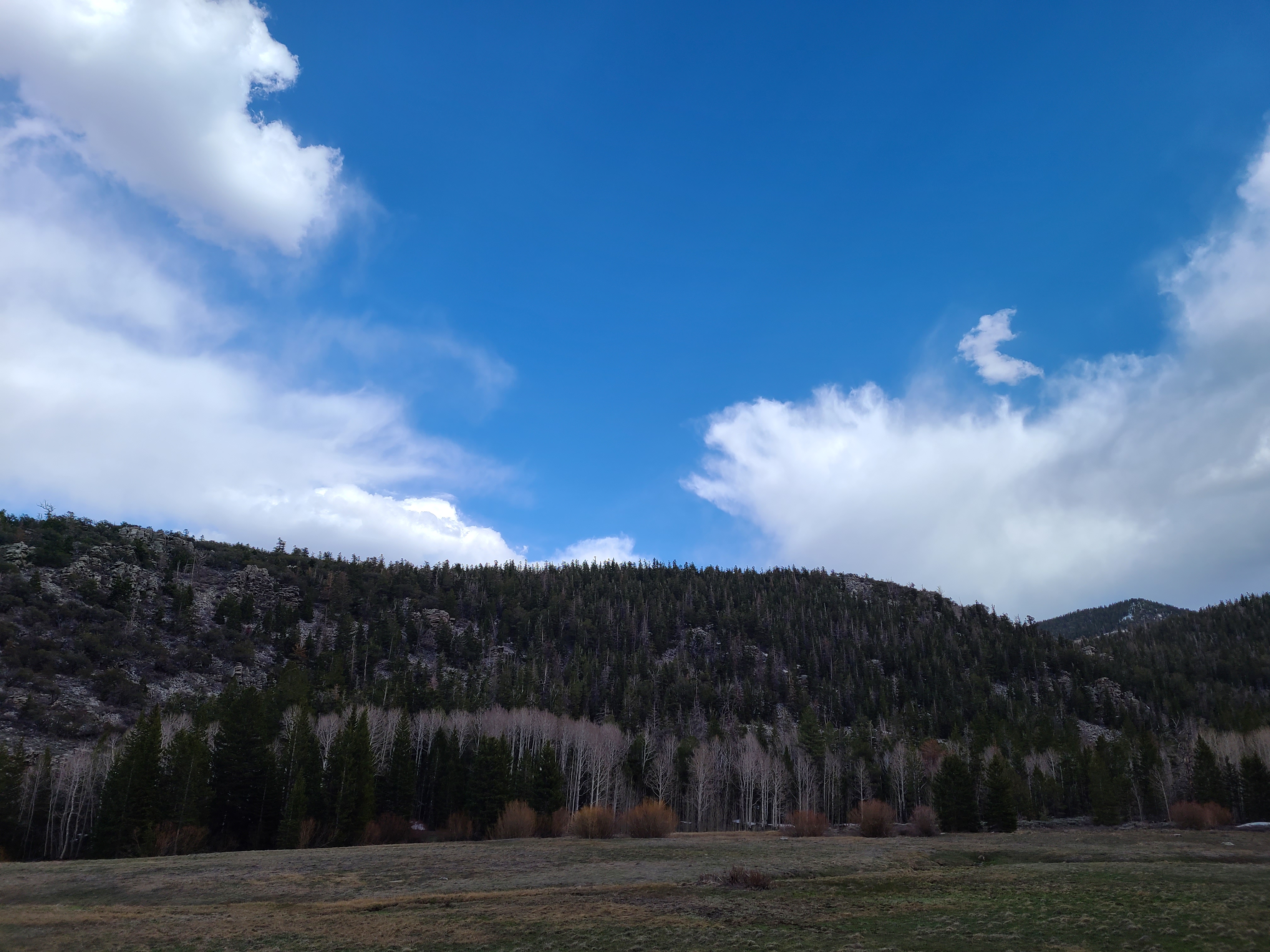
Baker Creek Loop is an upper easy/low moderate trail open for a majority of the year. This forested hike meanders through conifers and low lying sagebrush and grass meadows. The top of the loop greets visitors with the welcome sight of a green meadow in the summer and late spring, or a snow covered pristine surface in winter after a snowshoe. Wildflowers often fill the fields around the trailhead in the springtime, along with the meadows along the trail.
This hike starts at the Baker Creek Trailhead at the end of Baker Creek Road. Parking outside of designated spaces or along the road is prohibited.
No pets permitted on park trails. Trained service animals allowed. Learn more about service animal regulations at this link.
Water
Potable water is not available along Baker Creek Road. Pack sufficient water with you, about one gallon per person per day. Water is available year-round at the nearby Lehman Caves Visitor Center or seasonally at the dump station.
Restrooms
The nearest restrooms are pit toilets with no running water at the Baker Creek Trailhead.
4.8 mi one way · about 2,600 ft of climbing · 8,009 ft–10,624 ft · native surface · hiking, horse
Backpack the Baker & Johnson Lakes Loop the Park Service's write-up
1-14 Days · no dogs · reservation required
Start Baker Creek Trailhead
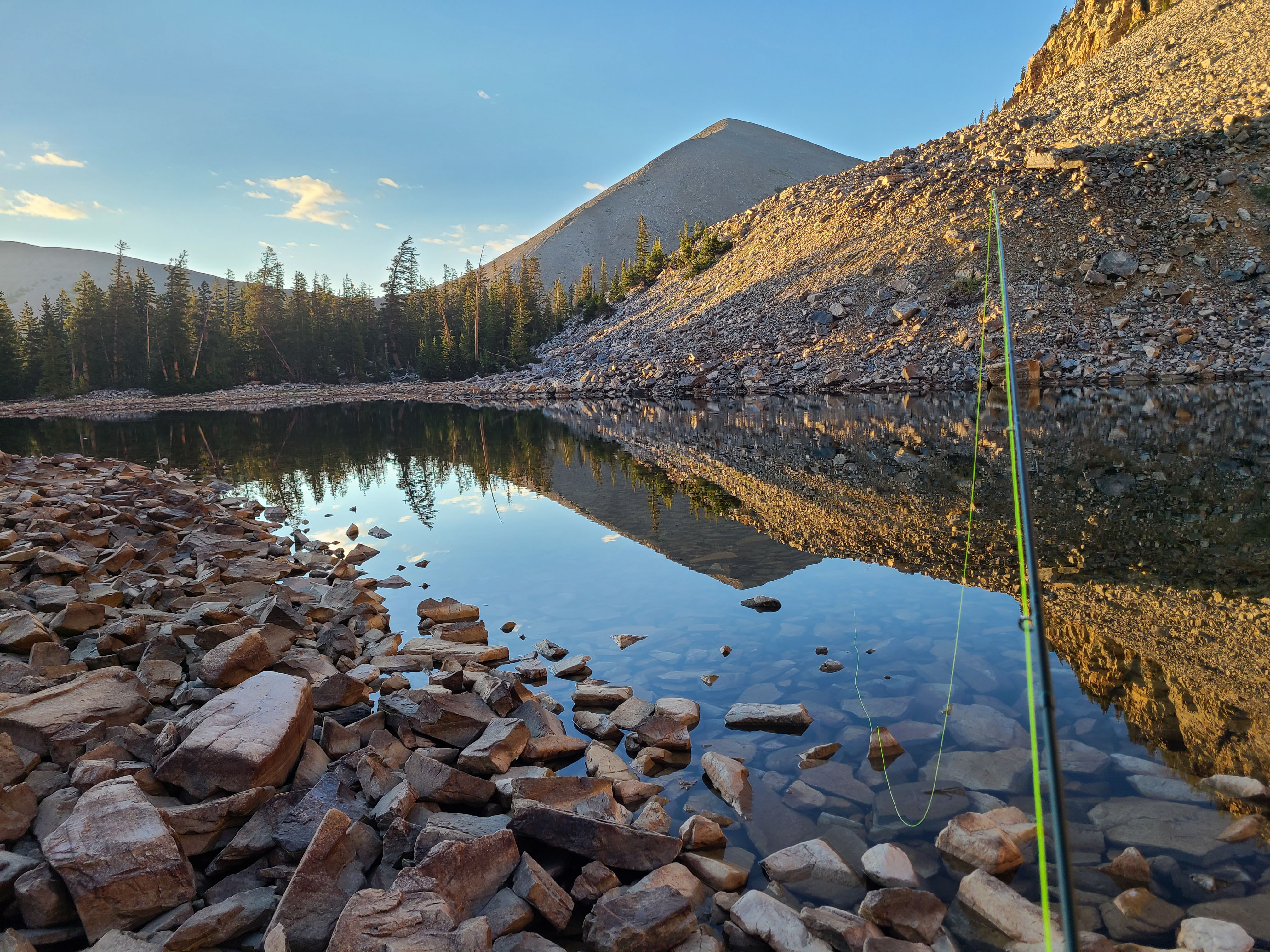
Baker Lake is a popular backpacking destination in the park Photo: J. Reynolds
Trail Overview
Total Distance: 11.7 miles / 18.8 kilometers
Starting elevation: 8,020 feet / 2,445 meters
Elevation Gain: 3,280 feet / 1000 meters
Difficulty: Strenuous
Time: 6 hours - 12 hours, 1 day -14 days if overnight
Begin at : Baker Creek Trailhead
A challenging day hike to Baker Lake rewards visitors with the sight of Baker Lake which few have seen. One of the largest lakes in the park and neastled in a glacial cirque, bristlecone pines dot these mountains and reward the inquisitive and attentive travellers. While making for a challenging day hike, Baker Lake is fairly easy by backpacking standards if done as an overnight trip, but come prepared. Snow often lingers throughout the year on this beautiful lake's rocky banks. Johnson Lake is located deep in the backcountry of Great Basin National Park. Near this mountain lake there are historic buildings and mining equipment, please to not enter or disturb any historic sites.
The Johnson Lake Mining District is a remnant of early 20th century mining efforts. Today a historic landscape in Great Basin National Park, Johnson Lake Mine's story actually begins in the early part of the 1900s, when the mineral tungsten was first discovered in the southern Snake Range. At Johnson Lake Mine tungsten was extracted and milled onsite and then transported a great distance to be refined and then used to make alloy steel. Alloy steel was used to create things like weapons, tanks, and transmitter radios during World War I. Many of the historic cabins still standing have remained through avalanche, blizzard, rockfall, and time for around a century. Efforts have been made to preserve the cultural significance of these structures. Please do not disturb these sites in respect for their cultural value.
Spring time ushers in a bevy of wildflowers of many colors, some years blooming well into the summer. Find yourself surrounded by pine, fir, and aspen trees as you hike through the forest and gain elevation. Johnson Lake remains high throughout the year, partially freezing in the winter time.
This hike starts at the Baker Creek Trailhead at the end of Baker Creek Road. Parking outside of designated spaces or along the road is prohibited.
No pets permitted on park trails. Trained service animals allowed. Learn more about service animal regulations at this link.
Permits
The Baker & Johnson Lakes Loop requires a backcountry permit to camp along. Permits are available for free at either visitor center and are used to track wilderness use and in the event of a lost person. When acquiring a permit, rangers will collect information and supply you with a copy of the backcountry regulations.
Water
Potable water is not available along Baker Creek Road. Pack sufficient water with you, about one gallon per person per day. Water is available year-round at the nearby Lehman Caves Visitor Center or seasonally at the dump station.
Restrooms
The nearest restrooms are pit toilets with no running water at the Baker Creek Trailhead.
5-10 Hours · no dogs · reservation required · Spring, Summer, Fall
Start Baker Creek Trailhead
Hiking to Baker Lake rewards you with great views of one of the largest lake on the park. Photo: C. Reed
Trail Overview
Total Distance: 10.4 miles / 16.8 kilometers
Starting elevation: 8,020 feet / 2,445 meters
Elevation Gain: 2,610 feet / 795 meters
Difficulty: Strenuous
Time: 5 hours - 10 hours
Begin at : Baker Creek Trailhead
A challenging day hike to Baker Lake rewards visitors with the sight of Baker Lake which few have seen. One of the largest lakes in the park and neastled in a glacial cirque, bristlecone pines dot these mountains and reward the inquisitive and attentive travellers. While making for a challenging day hike, Baker Lake is fairly easy by backpacking standards if done as an overnight trip, but come prepared. Snow often lingers throughout the year on this beautiful lake's rocky banks.
This hike starts at the Baker Creek Trailhead at the end of Baker Creek Road. Parking outside of designated spaces or along the road is prohibited.
No pets permitted on park trails. Trained service animals allowed. Learn more about service animal regulations at this link.
Water
Potable water is not available along Baker Creek Road. Pack sufficient water with you, about one gallon per person per day. Water is available year-round at the nearby Lehman Caves Visitor Center or seasonally at the dump station.
Restrooms
The nearest restrooms are pit toilets with no running water at the Baker Creek Trailhead.
Accessibility This hike is not accessible due to rocky terrain.
0.8 mi one way · about 50 ft of climbing · 300 ft of descent · 10,161 ft–10,447 ft · native surface · hiking
Hike to the Wheeler Peak Bristlecone Grove the Park Service's write-up
1-3 Hours · no dogs · Spring, Summer, Fall
Start Bristlecone Trailhead
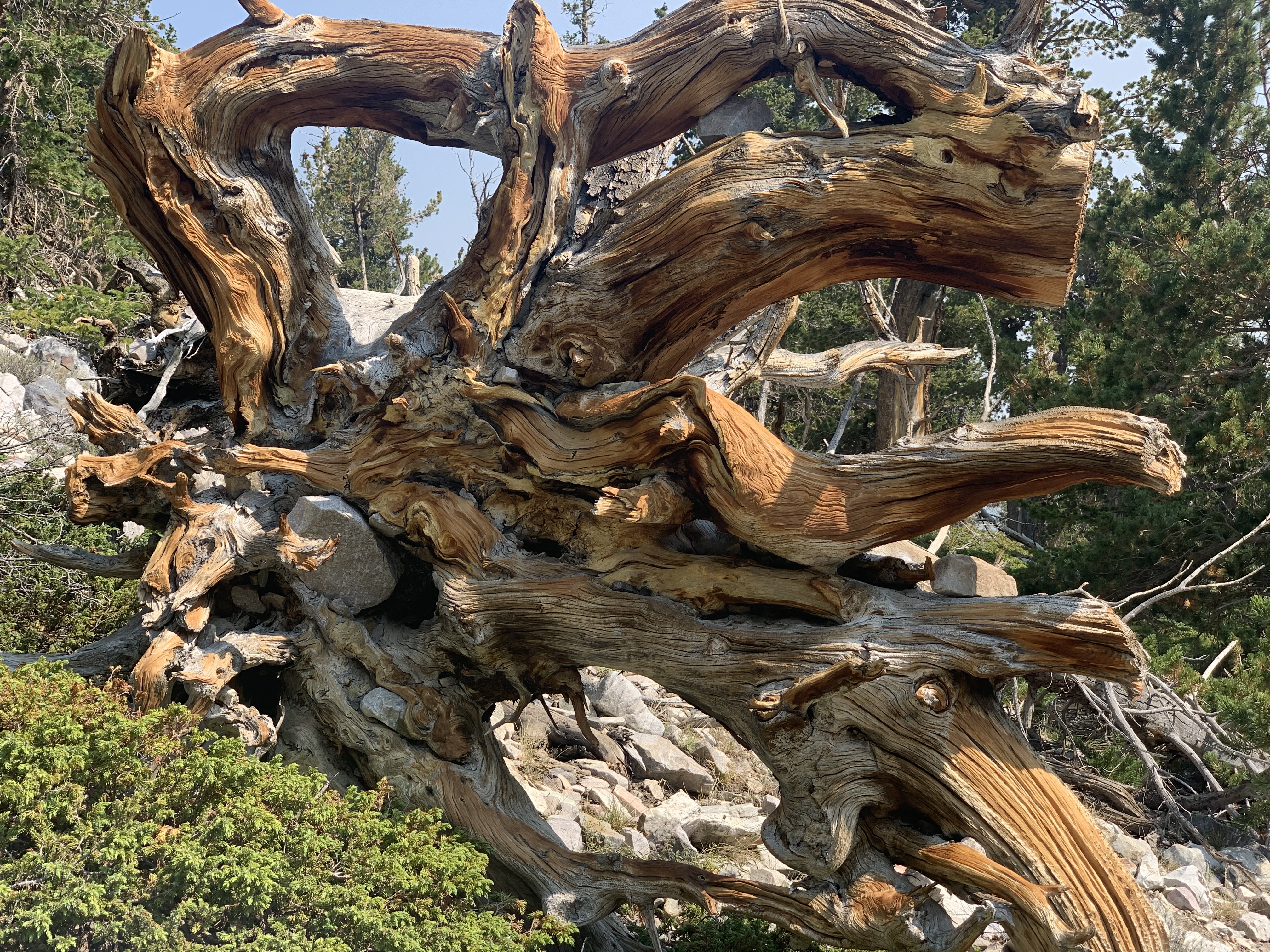
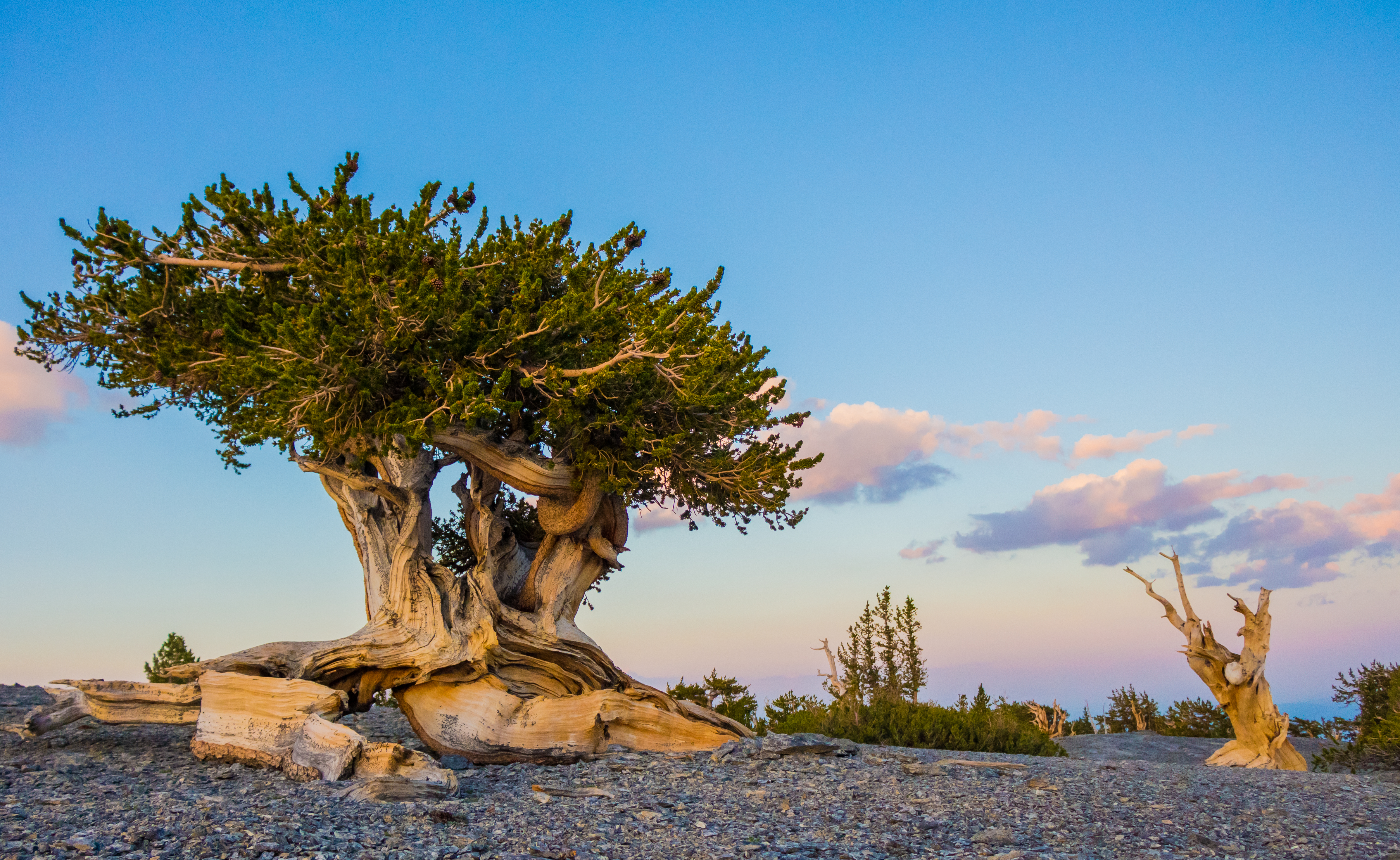
Visit the oldest living organisms in the world Photo: S. Stewart
Trail Overview
Total Distance: 2.8 miles / 4.5 kilometers
Starting elevation: 9,890 feet / 2,987 meters
Elevation Gain: 600 feet / 183 meters
Difficulty: Moderate
Time: 1.5 hours - 3 hours
Begin at : Bristlecone Trailhead/End of the Scenic Drive
Perhaps the most popular trail in Great Basin National Park, the Bristlecone Trail steers visitors up to the Wheeler Peak Bristlecone Grove, the most easily accessible in the park. An interpretive loop with signs talking about these bristlecones and their impressively long lives sits at the end of the trail, with the Glacier Trail beckoning beyond. The grove extends well beyond the loop, and was home to the Prometheus Tree, the oldest non-clonal organism on earth when it was cut down in 1964, prior to the creation of the national park in 1986. These ancient trees have been seen to grow as old at 5,200 years in the case of Prometheus, and have lived in what is now the park for untold millenia.
The Alpine Lakes Loop overlaps the early sections of this trail and can be linked together for a total combined distance of 4.1 miles / 6.6 kilometers. See the trail map below (unavailable on NPS app) for clarification on the overlapping sections.
Beginning at an elevation of just under 10,000 feet, these trails provide both a respite from the summer heat of the Snake Valley, but also added dangers in the form of altitude sickness and afternoon thunderstorms. Be prepared with plenty of water and salty snacks, or to return to your vehicle if you become symptomatic of altitude sickness or see thunderclouds rolling in.
This hike starts at the Bristlecone Trailhead at the end of the Wheeler Peak Scenic Drive. Parking outside of designated spaces or along the road is prohibited.
No pets permitted on park trails. Trained service animals allowed. Learn more about service animal regulations at this link.
Water
Potable water is not available along the Wheeler Peak Scenic Drive. Pack sufficient water with you, about one gallon per person per day. Water is available year-round at the nearby Lehman Caves Visitor Center or seasonally at the dump station.
Restrooms
The nearest restrooms are vault toilets at the Bristlecone Trailhead.
Accessibility The trail is rocky, narrow, has steep sections and is not accessible to wheelchairs.
2.4 mi one way · about 1,500 ft of climbing · 8,192 ft–9,732 ft · native surface · hiking, horse
Hike to Dead Lake the Park Service's write-up
2-5 Hours · no dogs · Spring, Summer, Fall
Start Snake Creek Trailhead
The Dead Lake hike is a great moderate hike in a less visited area of the park. Photo: Byan Petrtyl
Trail Overview
Distance: 5.1 miles / 8.2 kilometers
Starting elevation: 8,200 feet / 2,500 meters
Elevation Gain: 1,520 feet / 463 meters
Difficulty: Moderate
Time: 3 hours - 5 hours
Begin at : Snake Creek Trailhead
A 5.1 mile round trip hike to Dead lake offers trails through aspen groves and views on the snake valley on the way to a lake that comes and goes with the seasons. After heavy snow seasons, the lake is often filled late into the season, but can be totally dry after drier winters.
Spring time ushers in a bevy of wildflowers of many colors, some years blooming well into the summer. Find yourself surrounded by pine, fir, and aspen trees as you hike through the forest and gain elevation.
This hike starts at the Snake Creek Trailhead on Snake Creek Road. Stop to park at the trailhead at the road's end. Parking outside of designated spaces or along the road is prohibited.
No pets permitted on park trails. Trained service animals allowed. Learn more about service animal regulations at this link.
Water
Potable water is not available along Snake Creek Road. Pack sufficient water with you, about one gallon per person per day.
Restrooms
The nearest restrooms are pit toilets with no running water at the Snake Creek Trailhead.
Accessibility This hike is not accessible due to rocky terrain.
1.0 mi one way · about 600 ft of climbing · 10,450 ft–11,035 ft · native surface · hiking
Hike to the Glacier the Park Service's write-up
2-4 Hours · no dogs · Spring, Summer, Fall
Start Bristlecone Trailhead
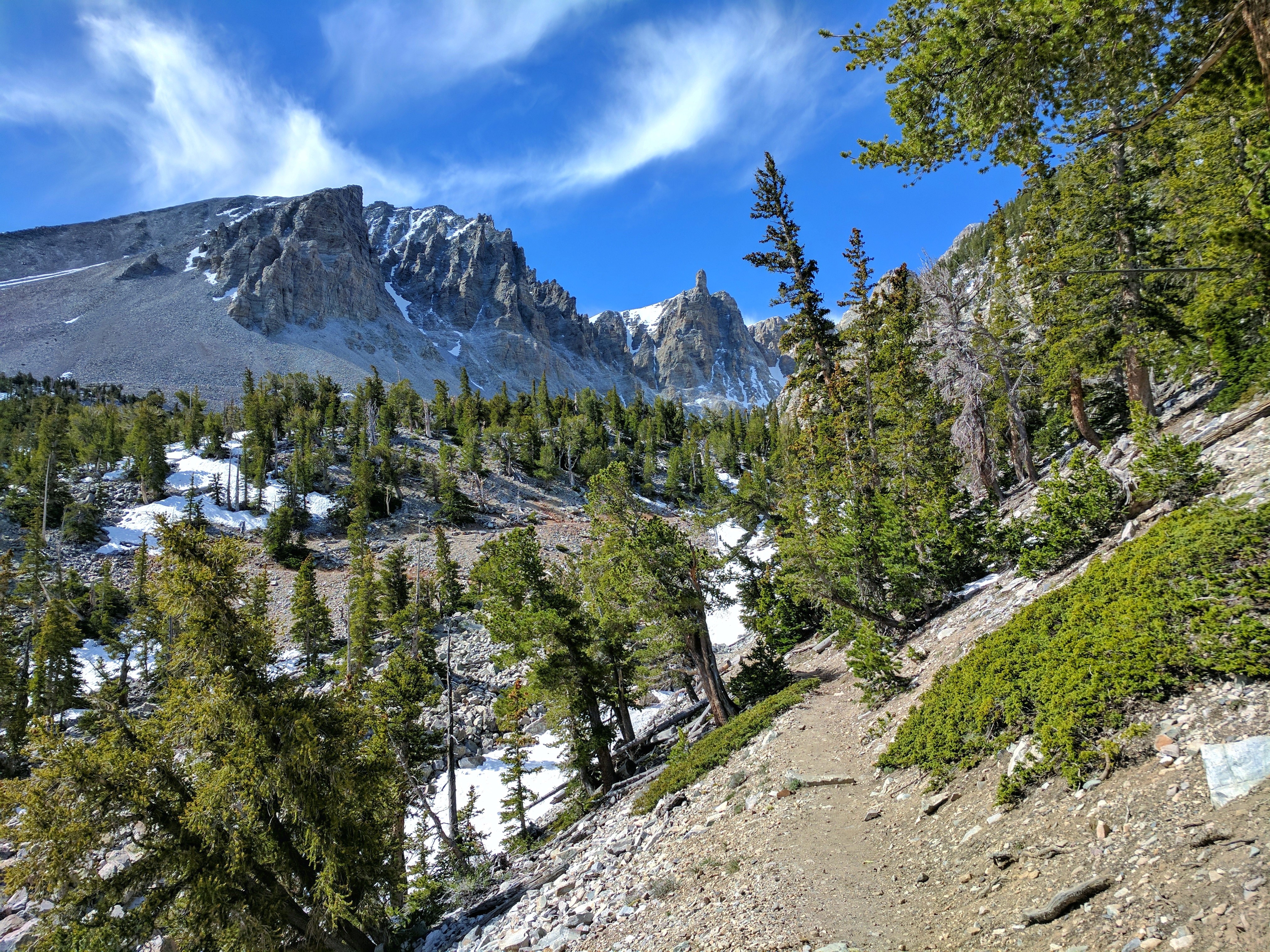
The Glacier Trail provides views of the last glacier in Nevada and the ancient Bristlecone Pines Photo: NPS / B. Mills
Trail Overview
Total Distance: 4.8 miles / 7.7 kilometers
Starting elevation: 9,890 feet / 2,987 meters
Elevation Gain: 1,040 feet / 317 meters
Difficulty: Moderate
Time: 2 hours - 4 hours
Begin at : Bristlecone Trailhead/End of the Scenic Drive
Great Basin National Park is unique for many reasons, but one rare sight in the deserts of the southwest are glaciers. The Wheeler Peak Glacier is the last surviving glacier in Nevada and getting smaller by the year due to the effects of human caused climate change. Nowadays referred to as a "Rock Glacier," The Wheeler Glacier is an amalgamation of rock and ice, slowly drifting down the sides of the Wheeler Cirque, once solid but slowly carved out by glaciers like the surviving one. Follow the trail past the Bristlecone Pine grove to see the glacial remnants and read interpretive signs about this park's long history of glacial formation.
The Bristlecone Trail overlaps the first 1.4 miles of this trail and the total distance above includes the Bristlecone Trail in its calculations. See the trail map below (unavailable on NPS app) for clarification on the overlapping sections.
Beginning at an elevation of just under 10,000 feet, these trails provide both a respite from the summer heat of the Snake Valley, but also added dangers in the form of altitude sickness and afternoon thunderstorms. Be prepared with plenty of water and salty snacks, or to return to your vehicle if you become symptomatic of altitude sickness or see thunderclouds rolling in.
This hike starts at the Bristlecone Trailhead at the end of the Wheeler Peak Scenic Drive. Parking outside of designated spaces or along the road is prohibited.
No pets permitted on park trails. Trained service animals allowed. Learn more about service animal regulations at this link.
Water
Potable water is not available along the Wheeler Peak Scenic Drive. Pack sufficient water with you, about one gallon per person per day. Water is available year-round at the nearby Lehman Caves Visitor Center or seasonally at the dump station.
Restrooms
The nearest restrooms are pit toilets with no running water at the Bristlecone Trailhead.
12 mi one way · about 5,500 ft of climbing · 8,244 ft–11,761 ft · native surface · hiking, horse
Hike the Highland Route the Park Service's write-up
1-2 Days · no dogs · Summer
Start BLM Highland Wilderness Area
The Highland Route is and extremely challenging route that offers amazing views of the whole park. Photo: NPS
The hike along the Highland Route stretches the spine on the South Snake range from Pyramid Peak to Decathon Canyon, 14.6 miles one way with extreme elevation changes through out the hike. This route be started in the Highland Ridge Wilderness BLM area to the south of the park or can be started from Baker Lake.
This route requires wayfinding skills and equipment, including map, compass, GPS and the skills and knowledge to use the equipment.
No pets are permitted on this route.
Accessibility This is not an accessible route as it is a dirt and rock backcountry route.
3.8 mi one way · about 2,600 ft of climbing · 8,189 ft–10,731 ft · native surface · hiking, horse
Backcountry camps
Along the wayShoshone 1
TrailheadSnake Creek Trailhead 8,186 ft Drive there
Hike to Johnson Lake from Baker Creek the Park Service's write-up
5-8 Hours · no dogs
Start Baker Creek Trailhead
Hiking to Johnson lake is a beautiful full day activity Photo: NPS
Trail Overview
Distance: 9.8 miles / 15.8 kilometers
Starting elevation: 8,020 feet / 2,445 meters
Elevation Gain: 2,740 feet / 835 meters
Difficulty: Strenuous
Time: 5 hours - 8 hours
Begin at : Baker Creek Trailhead
Johnson Lake is located deep in the backcountry of Great Basin National Park. Near this mountain lake there are historic buildings and mining equipment, please to not enter or disturb any historic sites.
The Johnson Lake Mining District is a remnant of early 20th century mining efforts. Today a historic landscape in Great Basin National Park, Johnson Lake Mine's story actually begins in the early part of the 1900s, when the mineral tungsten was first discovered in the southern Snake Range. At Johnson Lake Mine tungsten was extracted and milled onsite and then transported a great distance to be refined and then used to make alloy steel. Alloy steel was used to create things like weapons, tanks, and transmitter radios during World War I. Many of the historic cabins still standing have remained through avalanche, blizzard, rockfall, and time for around a century. Efforts have been made to preserve the cultural significance of these structures. Please do not disturb these sites in respect for their cultural value.
Spring time ushers in a bevy of wildflowers of many colors, some years blooming well into the summer. Find yourself surrounded by pine, fir, and aspen trees as you hike through the forest and gain elevation. Johnson Lake remains high throughout the year, partially freezing in the winter time.
This hike starts at the Baker Creek Trailhead at the end of Baker Creek Road. Parking outside of designated spaces or along the road is prohibited.
No pets permitted on park trails. Trained service animals allowed. Learn more about service animal regulations at this link.
Water
Potable water is not available along Baker Creek Road. Pack sufficient water with you, about one gallon per person per day. Water is available year-round at the nearby Lehman Caves Visitor Center or seasonally at the dump station.
Restrooms
The nearest restrooms are pit toilets with no running water at the Baker Creek Trailhead.
Hike to Johnson Lake from Snake Creek the Park Service's write-up
4-8 Hours · no dogs · Summer, Fall
Start Snake Creek Trailhead
Hiking to Johnson lake is a beautiful full day activity Photo: NPS
Trail Overview
Distance: 8.0 miles / 12.9 kilometers
Starting elevation: 8,200 feet / 2,500 meters
Elevation Gain: 2,520 feet / 768 meters
Difficulty: Strenuous
Time: 4 hours - 8 hours
Begin at : Snake Creek Trailhead
Johnson Lake is located deep in the backcountry of Great Basin National Park. Near this mountain lake there are historic buildings and mining equipment, please to not enter or disturb any historic sites.
The Johnson Lake Mining District is a remnant of early 20th century mining efforts. Today a historic landscape in Great Basin National Park, Johnson Lake Mine's story actually begins in the early part of the 1900s, when the mineral tungsten was first discovered in the southern Snake Range. At Johnson Lake Mine tungsten was extracted and milled onsite and then transported a great distance to be refined and then used to make alloy steel. Alloy steel was used to create things like weapons, tanks, and transmitter radios during World War I. Many of the historic cabins still standing have remained through avalanche, blizzard, rockfall, and time for around a century. Efforts have been made to preserve the cultural significance of these structures. Please do not disturb these sites in respect for their cultural value.
Spring time ushers in a bevy of wildflowers of many colors, some years blooming well into the summer. Find yourself surrounded by pine, fir, and aspen trees as you hike through the forest and gain elevation. Johnson Lake remains high throughout the year, partially freezing in the winter time.
This hike starts at the Snake Creek Trailhead on Snake Creek Road. Stop to park at the trailhead at the road's end. Parking outside of designated spaces or along the road is prohibited.
No pets permitted on park trails. Trained service animals allowed. Learn more about service animal regulations at this link.
Water
Potable water is not available along Snake Creek Road. Pack sufficient water with you, about one gallon per person per day.
Restrooms
The nearest restrooms are pit toilets with no running water at the Snake Creek Trailhead.
Accessibility This hike is not accessible due to steep terrain, rocky paths and narrow walking paths.
3.2 mi one way · 2,000 ft of descent · 7,799 ft–9,829 ft · native surface · hiking, horse
Hike the Lehman Creek Trail the Park Service's write-up
3-6 Hours · no dogs
Start Lehman Creek Trailhead
Lehman Creek Trail is the best way to reach high elevation in winter Photo: B. Mills
Trail Overview
Total Distance: 6.4 miles / 10.3 kilometers
Starting elevation: 7,750 feet / 2,362 meters
Elevation Gain: 2,040 feet / 622 meters
Difficulty: Moderate/Strenuous
Time: 3 hours - 6 hours
Begin at : Lehman Creek Trailhead in Upper Lehman Creek Campground
The Lehman Creek Trail takes visitors on a deceptively steep trip up from the Upper Lehman Creek Campground to the Wheeler Peak Campground and Bristlecone Trailhead. Following the creek, passing by meadows, and through dense aspen forest, this trail wows any who travel it year round with fall colors, wildflower blooms, and the babbling of Lehman Creek.
Reaching an elevation of just under 10,000 feet, this trail provide both a respite from the summer heat of the Snake Valley, but also added dangers in the form of altitude sickness and afternoon thunderstorms. Be prepared with plenty of water and salty snacks, or to return to your vehicle if you become symptomatic of altitude sickness or see thunderclouds rolling in. During winter, this is the best route to snowshoe or crosscountry ski to reach the upper trails when the Scenic Drive is closed.
This hike starts at the Lehman Creek Trailhead in the Upper Lehman Creek Campground, three miles up the Wheeler Peak Scenic Drive. Park at the trailhead in summer or at the pullout across from the campground in winter. Parking outside of designated spaces or along the road is prohibited.
No pets permitted on park trails. Trained service animals allowed. Learn more about service animal regulations at this link.
Water
Potable water is not available along the Wheeler Peak Scenic Drive. Pack sufficient water with you, about one gallon per person per day. Water is available year-round at the nearby Lehman Caves Visitor Center or seasonally at the dump station.
Restrooms
The nearest restrooms are pit toilets with no running water in the Upper Lehman Creek Campground
1.8 mi one way · about 1,100 ft of climbing · 7,405 ft–8,456 ft · native surface · hiking
Arches
Along the wayLexington Arch
Hike to Lexington Arch the Park Service's write-up
2-4 Hours · dogs allowed
Start Lexington Arch Trailhead
The hike to Lexington arch rewards hikers with views a over 200 foot tall arch. Photo: C. Lint
Trail Overview
Distance: 5.6 miles / 9.0 kilometers
Starting elevation: 7,050 feet / 2,149 meters
Elevation Gain: 1,220 feet / 372 meters
Difficulty: Moderate
Time: 3 hours - 5 hours
Begin at : Lexington Arch Trailhead
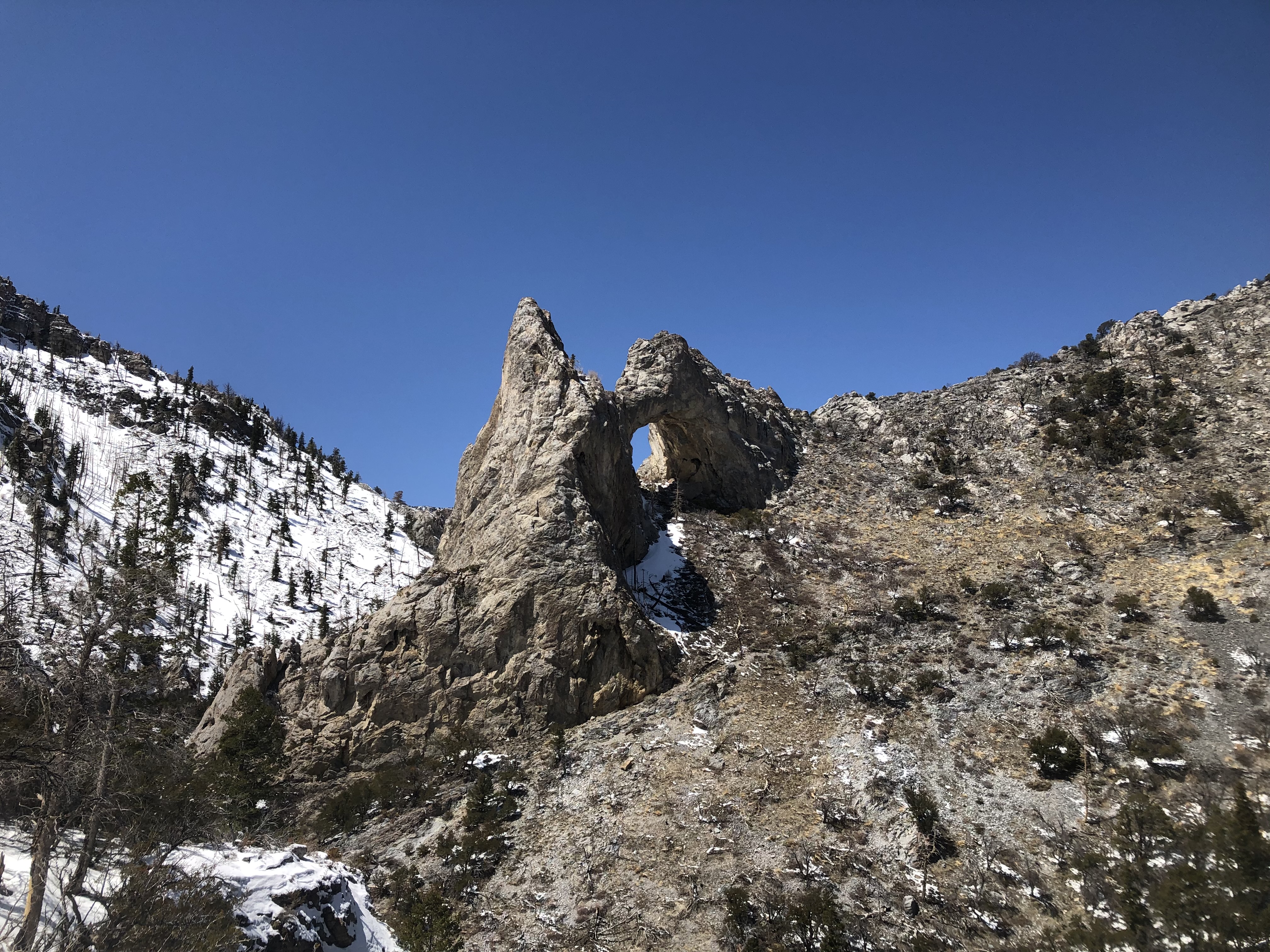
Lexington Arch stands as one of the tallest limestone arches in the world at nearly 200 feet tall. This trail takes visitors from a makeshift trailhead all the way underneath the arch, meandering through shurbland and some old forest. A fire in the early 2010s brought down the road contructed to the original trailhead and burned much of the surrounding hillsides, threatening the arch itself. Since then, a makeshift trailhead has been constructed about 1.0 miles short of the original, making for a ~5.6 mile round trip hike. Due to the fire, the trail is mostly on exposed hillsides with little shade. Live trees emerge as you ascend the trail, allowing for occasional relief from the heat of the summer.
This hike starts at the end of Lexington Creek Road, outside the national park boundary. Stop to park at the trailhead at the road's end. Parking outside of designated spaces or along the road is prohibited. This road is managed by the Bureau of Land Management (BLM). As a result, the park may not close the road even if conditions are hazardous. Exercise caution driving to the arch in spring and fall, as washouts and running water are common.
Lexington Arch is the one and only trail within Great Basin National Park that permits pets. Pet owners must still follow all regulations, including keeping animals on no longer than a six foot leash.
Water
Potable water is not available. Pack sufficient water with you, about one gallon per person per day.
Restrooms
There are no toilets near the Lexington Arch or its trailhead. Pack out any toilet paper or other waste garbage.
Accessibility This hike is not accessible due to rocky terrain.
0.4 mi one way · about 50 ft of climbing · 6,813 ft–6,863 ft · native surface · hiking
Visitor centers
Along the wayLehman Caves Visitor Center
Hike the Mountain View Nature Trail the Park Service's write-up
5-30 Minutes · no dogs
Start Mountain View Nature Trail Trailhead
The Mountain View Nature Trail is a perfect introduction to Great Basin National Park. Photo: NPS / C. Reed
Trail Overview
Total Distance: 0.3 miles / 0.5 kilometers
Starting elevation: 6,825 feet / 2,080 meters
Elevation Gain: 80 feet / 24 meters
Difficulty: Easy
Time: 5 minutes - 30 minutes
Begin at : Lehman Caves Visitor Center/Rhodes Cabin
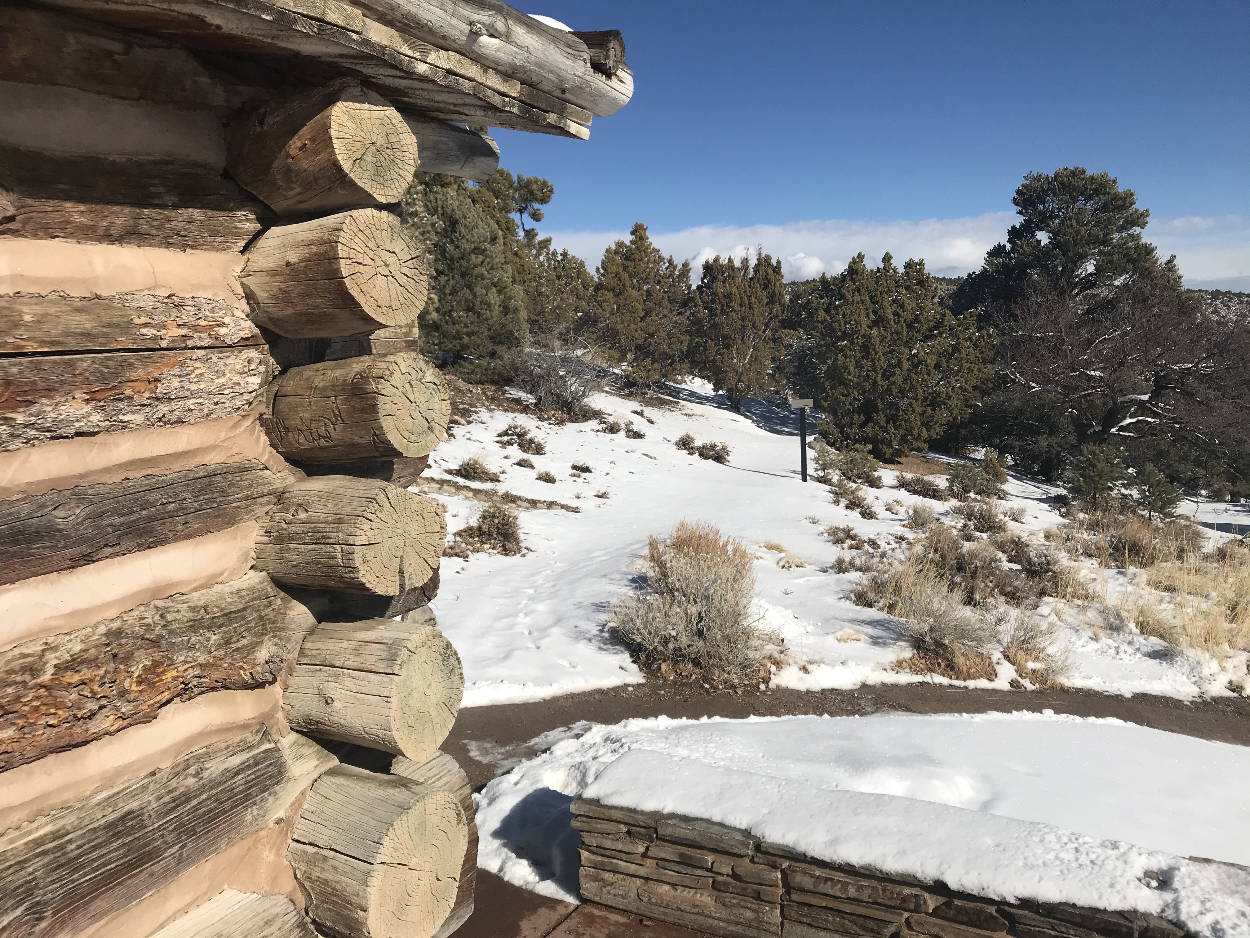
This leisurely walk in the pinyon-juniper communities surrounding the Lehman Caves Visitor Center begins at the Rhodes Cabin and takes visitors by a number of stops relating to the past, present, and future of Lehman Caves and Great Basin National Park. You may pick up a guide to the trail at the Lehman Caves Visitor Center front desk, or access a digital trail guide through the NPS App .
This hike starts to the right of the main entrance to the Lehman Caves Visitor Center, behind the Rhodes Cabin. The trail concludes by the exit to Lehman Caves, with an optional stop at the historic orchard.
No pets permitted on park trails. Trained service animals allowed. Learn more about service animal regulations at this link.
Water
Potable water is available year round at the Lehman Caves Visitor Center.
In summer, the bottle fill station on the north side of the building, a large spigot near the bottle fill station, a water fountain on the east side by the entrance of the visitor center, the Great Basin Cafe, the nearby Picnic Area, and the dump station all have free potable water.
In winter, only the spigot on the north side of the Lehman Caves Visitor Center is available.
Restrooms
The nearest restrooms are restrooms with running water and flush toilets near the front entrance of the Lehman Caves Visitor Center. These are open 24/7, year round.
Accessibility This trail is not wheelchair accessible, though is well suited for those who are only able to comfortably walk short distances.
3.3 mi one way · about 1,600 ft of climbing · 6,871 ft–8,461 ft · native, wood surface · hiking, horse
Picnic areas
Along the wayPole Canyon Picnic Area
Hike Pole Canyon the Park Service's write-up
3-6 Hours · no dogs
Start Pole Canyon Trailhead
At lower elevations pole canyon is great for hike in the off season. Photo: M. Akpinar
Trail Overview
Total Distance: 6.6 miles / 10.6 kilometers
Starting elevation: 6,880 feet / 2,097 meters
Elevation Gain: 1,600 feet / 488 meters
Difficulty: Moderate
Time: 3 hours - 6 hours
Begin at : Pole Canyon Trailhead
Pole Canyon wanders through meadow and forested area leading to a mountain pass. Mixed conifers, stream crossings, spectacular views of Baker Peak means this trail has it all. Located along Baker Creek road, Pole Canyon is easily accessible year round, though sometimes requiring a short snowshoe from the Baker Creek pit toilet to the trailhead.
This hike starts at the Pole Canyon Trailhead off of Baker Creek Road. Make the turn off 1.5 miles down the road towards Grey Cliffs Campground, then stay left at the first split. Down this road several hundred feet is the Pole Canyon Picnic Area and Trailhead. Parking outside of designated spaces or along the road is prohibited.
No pets permitted on park trails. Trained service animals allowed. Learn more about service animal regulations at this link.
Water
Potable water is not available along Baker Creek Road. Pack sufficient water with you, about one gallon per person per day. Water is available year-round at the nearby Lehman Caves Visitor Center or seasonally at the dump station.
Restrooms
The nearest restrooms are pit toilets with no running water at the Pole Canyon Trailhead.
Accessibility This hike is not accessible due to rocky terrain.
1.2 mi one way · about 250 ft of climbing · 7,913 ft–8,170 ft · native, wood surface · hiking, horse
Hike the Sage Steppe Loop the Park Service's write-up
30-90 Minutes · no dogs · Spring, Summer, Fall
Start Strawberry Creek Trailhead
The Sage Steppe Loop is a leisurely hike through meadows and aspens Photo: NPS
Trail Overview
Total Distance: 1.1 miles / 1.8 kilometers
Starting elevation: 7,920 feet / 2,414 meters
Elevation Gain: 250 feet / 76 meters
Difficulty: Easy
Time: 30 minutes - 90 minutes
Begin at : Strawberry Creek Trailhead
The Sage Steppe Loop winds its way through beautiful meadow habitat nestled between two sets of mountain peaks. An easy wind down from a long day of hiking, or a easy trail to get on as the sun rises, the Sage Steppe Loop provides ample opportunities to learn more about the park and its wildlife. Strawberry Creek is a prime area for Bonneville Cutthroat Trout restoration, although hampered by the 2016 Strawberry Fire. The fire raged through the canyon burning more than 4,700 acres. Restoration and monitoring efforts continue to this day, allowing this canyon and its flora and fauna to thrive as the years continue.
Spring, summer, and fall are all excellent times to explore this area. Wildflowers bloom seemingly endlessly through the meadows in spring, summer offers an opportunity to get above the heat and near water, fall brings spectacular fall foliage and colors as the aspens change. The riparian habitat here ensures many creatures thrive, with elk a common sight - especially during the fall rut.
There are wooden foot bridges along this trail, allowing for dry crossings of Strawberry Creek as you travel the south side of the loop.
This hike starts at the Strawberry Creek Trailhead at the end of Strawberry Creek Road. Stop to park at the trailhead at the road's end. Parking outside of designated spaces or along the road is prohibited.
No pets permitted on park trails. Trained service animals allowed. Learn more about service animal regulations at this link.
Water
Potable water is not available along Strawberry Creek Road. Pack sufficient water with you, about one gallon per person per day.
Restrooms
The nearest restrooms are pit toilets with no running water 1.5 miles before the trailhead.
Accessibility This hiking trail is not accessible due to narrow trails and stream crossings.
Hike the Upper Strawberry Trail the Park Service's write-up
2-4 Hours · no dogs · Spring, Summer, Fall
Start Strawberry Creek Trailhead
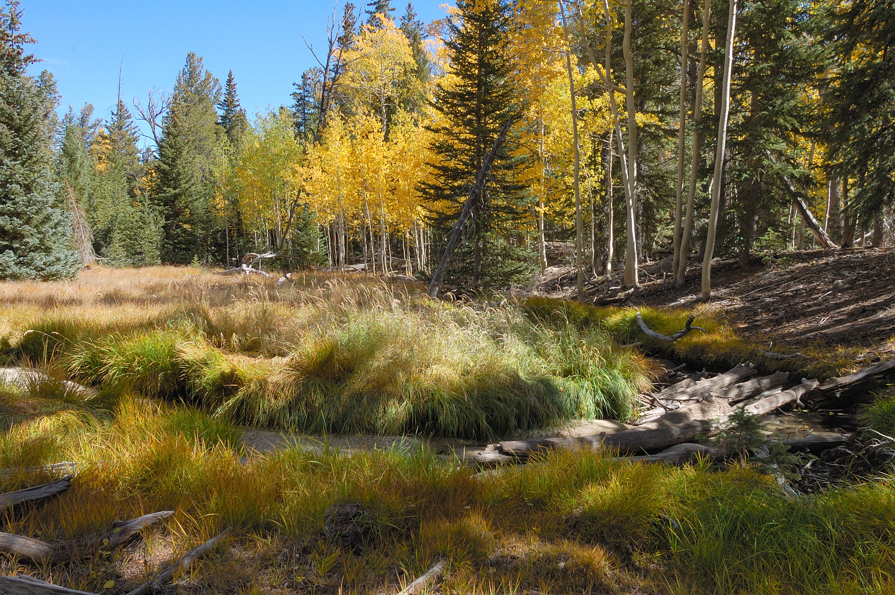
Colors pop in the fall in this aspen heavy area Photo: B. Mills
Trail Overview
Total Distance: 4.0 miles / 6.4 kilometers
Starting elevation: 7,920 feet / 2,414 meters
Elevation Gain: 1,280 feet / 390 meters
Difficulty: Moderate/Strenuous
Time: 2 hours - 4 hours
Begin at : Strawberry Creek Trailhead
Matching the Sage Steppe Loop for it's beginning and end, the Upper Strawberry Loop travels up from the meadows of the loop to the saddle between Bald Mountain and the peaks to the north. The spring fed and snowmelt fed creek runs down parallel to the trail, and a number of natural stream crossings are required to ascend. Most of the elevation gain occurs after the loop and especially on the last half of the upper section.
Strawberry Creek is a prime area for Bonneville Cutthroat Trout restoration, although hampered by the 2016 Strawberry Fire. The fire raged through the canyon burning more than 4,700 acres. Restoration and monitoring efforts continue to this day, allowing this canyon and its flora and fauna to thrive as the years continue.
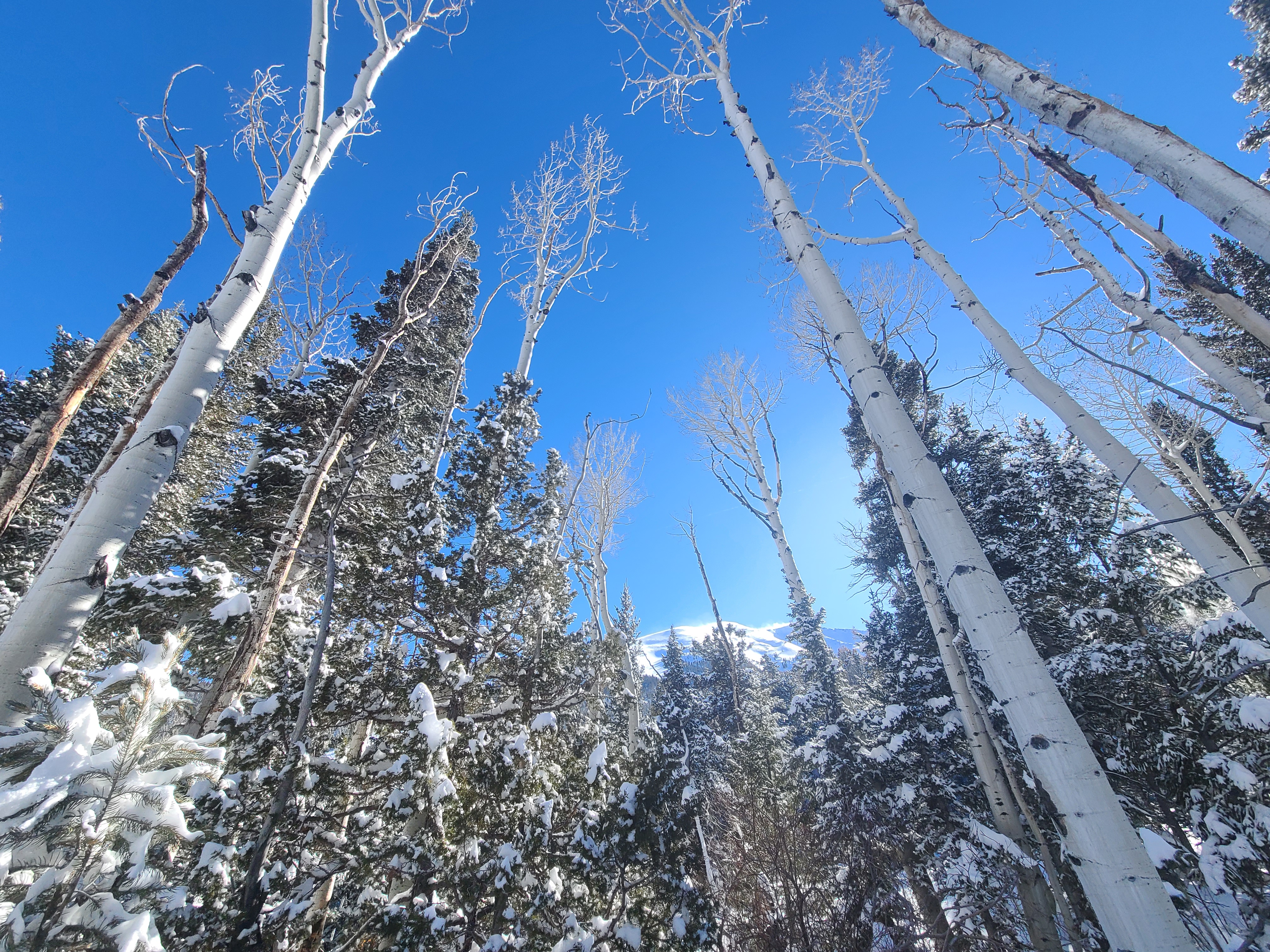
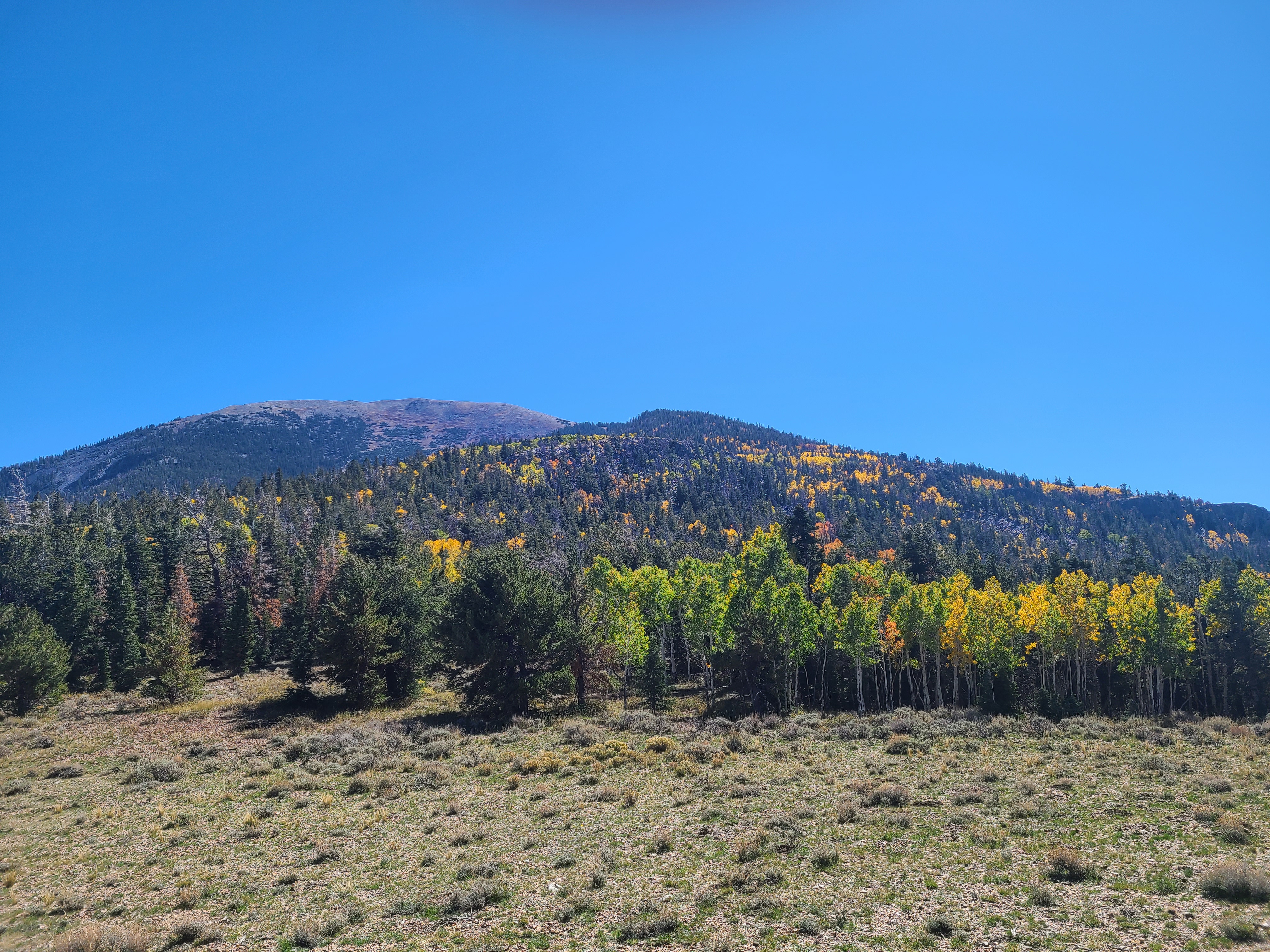
Spring, summer, and fall are all excellent times to explore this area. Wildflowers bloom seemingly endlessly through the meadows in spring, summer offers an opportunity to get above the heat and near water, fall brings spectacular fall foliage and colors as the aspens change. The riparian habitat here ensures many creatures thrive, with elk a common sight - especially during the fall rut.
There are wooden foot bridges along this trail, allowing for dry crossings of Strawberry Creek as you travel the south side of the Sage Steppe Loop.
This hike starts at the Strawberry Creek Trailhead at the end of Strawberry Creek Road. Stop to park at the trailhead at the road's end. Parking outside of designated spaces or along the road is prohibited.
No pets permitted on park trails. Trained service animals allowed. Learn more about service animal regulations at this link.
Water
Potable water is not available along Strawberry Creek Road. Pack sufficient water with you, about one gallon per person per day.
Restrooms
The nearest restrooms are pit toilets with no running water 1.5 miles before the trailhead.
3.1 mi one way · about 700 ft of climbing · 8,042 ft–8,768 ft · native surface · hiking, horse
Hike the Serviceberry Trail the Park Service's write-up
90-150 Minutes · no dogs · Spring, Summer, Fall
Start Serviceberry Trailhead
Spot unique rock intrusions along this scenic loop Photo: E. Lippitt
Trail Overview
Distance: 3.2 miles / 5.2 kilometers
Starting elevation: 8,030 feet / 2,448 meters
Elevation Gain: 657 feet / 200 meters
Difficulty: Moderate
Time: 90 minutes - 150 minutes
Begin at : Serviceberry Trailhead
The 3.2 mile Serviceberry Loop is a wonderful loop trail through serviceberry, rabbitbrush, and sagebrush, giving plentiful views of unique Great Basin geology. This moderate trail is a great introduction to the Snake Creek area and its unique offerings. This loop offers views of Eagle Peak, Granite Peak, and intrusion geology of the Snake Creek area within Great Basin National Park.
This hike starts at the Serviceberry Trailhead on Snake Creek Road. Stop to park at the trailhead 1/3 of a mile short of the road's end, or if parking is limited, park at the small lot at the end of the road and walk the 1/3 of a mile to the trailhead. Parking outside of designated spaces or along the road is prohibited.
No pets permitted on park trails. Trained service animals allowed. Learn more about service animal regulations at this link.
Water
Potable water is not available along Snake Creek Road. Pack sufficient water with you, about one gallon per person per day.
Restrooms
The nearest restrooms are pit toilets with no running water at the Snake Creek Trailhead, 1/3 of a mile beyond the Serviceberry Trailhead
Accessibility This hike is not accessible due to rocky terrain.
2.7 mi one way · about 750 ft of climbing · 1,300 ft of descent · 7,598 ft–8,903 ft · native surface · hiking, horse
TrailheadSnake Creek Trailhead 8,186 ft Drive there
Hike the Shoshone ADA Trail the Park Service's write-up
10-20 Minutes · no dogs · Spring, Summer, Fall
Start Snake Creek Trailhead
The Shoshone ADA trail takes you to a fishing overlook of Snake Creek Photo: NPS
Trail Overview
Distance: 0.1 miles/ 0.2 kilometers
Starting elevation: 8,200 feet / 2,500 meters
Elevation Gain: Negligible/ Nearly zero elevation change
Difficulty: Easy & ADA Accessible
Time: 10 minutes - 20 minutes
Begin at : Snake Creek Trailhead
The Shoshone ADA Trail is a short accessible trail located at the Snake Creek Trailhead. This 0.1 mile trail takes you to a small wooden overlook of Snake Creek. This overlook can be used a fishing area, has interpretive information, and is ADA compliant.
This trail meets standards for accessibility, but is a dirt path that can become rougher as rains and snow affects its quality. Wheelchairs may experience bumps and difficulty reaching the wooden platform. Similarly, Snake Creek Road may be difficult for wheelchair ramp equipped vans or other low clearance vehicles to access. Approach with caution when in modified vehicles .
This hike starts at the Snake Creek Trailhead on Snake Creek Road. Stop to park at the trailhead at the road's end. Parking outside of designated spaces or along the road is prohibited.
No pets permitted on park trails. Trained service animals allowed. Learn more about service animal regulations at this link.
Water
Potable water is not available along Snake Creek Road. Pack sufficient water with you, about one gallon per person per day.
Restrooms
The nearest restrooms are pit toilets with no running water at the Snake Creek Trailhead.
Accessibility This trail is accessible to wheelchairs, but may be rough due to rain and snow altering the dirt path. Snake Creek Road may be difficult for low clearance vehicles such as those modified to carry wheelchairs.
0.7 mi one way · about 250 ft of climbing · 8,255 ft–8,510 ft · native surface · hiking, horse
Backcountry camps
Along the wayShoshone 2Shoshone 3
Hike to Snake Creek Overlook the Park Service's write-up
30-90 Minutes · no dogs · Spring, Summer, Fall
Start Snake Creek Trailhead
Snake Creek valley Photo: B. Mills
Trail Overview
Distance: 1.1 miles / 1.8 kilometers
Starting elevation: 8,200 feet / 2,500 meters
Elevation Gain: 260 feet / 79 meters
Difficulty: Easy
Time: 30 minutes - 90 minutes
Begin at : Snake Creek Trailhead
Snake Creek Overlook is a humble trail branching off the Dead Lake Loop just near its start. Providing a scenic view of the valley below and passing by a walk-in primitive campsite , the trail is an excellent way to wind down a day, or prepare for a longer hike after setting up camp or picnicking.
Spring time ushers in a bevy of wildflowers of many colors, some years blooming well into the summer. Find yourself surrounded by pine, fir, and aspen trees as you hike through the forest and gain elevation.
This hike starts at the Snake Creek Trailhead on Snake Creek Road. Stop to park at the trailhead at the road's end. Parking outside of designated spaces or along the road is prohibited.
No pets permitted on park trails. Trained service animals allowed. Learn more about service animal regulations at this link.
Water
Potable water is not available along Snake Creek Road. Pack sufficient water with you, about one gallon per person per day.
Restrooms
The nearest restrooms are pit toilets with no running water at the Snake Creek Trailhead.
4.1 mi one way · about 2,400 ft of climbing · 8,921 ft–11,154 ft · native surface · hiking, horse
Hike the Snake Divide Route the Park Service's write-up
7-12 Hours · no dogs · Summer
Start Snake Creek Trailhead
Hike the Snake Divide for a rendezvous with many Bristlecone Pines. Photo: C. Reed
Trail Overview
Total Distance: 13.4 miles / 21.6 kilometers
Starting elevation: 8,200 feet / 2,500 meters
Elevation Gain: 3,418 feet / 1,041 meters
Difficulty: Moderate
Time: 7 hours - 12 hours
Begin at : Snake Creek Trailhead
The out and back hike along the Snake Divide route is 13.4 miles round trip through rough terrain, gaining more than 3,000 feet. Following the well defined Shoshone trail, the Snake Divide trail branches and goes west, following the ridge formed by multiple 10,000+ foot peaks. The trail is often only marked by flagging and the occassional rock cairn, so having a GPS, map & compass, and the skills to use them is paramount if you want to remain on track. Do not remove/knock over rock cairns or create your own - they are vital wayfinding tools in the wilderness.
This route leads to two bristlecone groves located deep in the backcountry of Great Basin National Park. The Magic Grove below the rocky Mt Washington, and then above Mt Washington is the aptly named Mt Washington Grove. In these groves, be prepared to see the isolated bristlecone pines standing apart from each other and other species of tree. Some trees in these groves have stood for thousands of years, so please treat them with the respect and reverence they've earned. Collecting or burning of downed bristlecone wood is strictly prohibited , as even remnants of these trees are useful for scientific study and dendrochronology. Some downed trees and limbs could be thousands of years older than even the oldest living bristlecones, so please exercise caution.
If your only aim is to reach the Magic Grove bristlecones, a round trip distance of 12.0 miles is to be expected. If you want to summit Mt Washington, prepare for the full 13.4 miles.
This hike starts at the Snake Creek Trailhead on Snake Creek Road. Stop to park at the trailhead at the road's end. Parking outside of designated spaces or along the road is prohibited.
No pets permitted on park trails. Trained service animals allowed. Learn more about service animal regulations at this link.
Water
Potable water is not available along Snake Creek Road. Pack sufficient water with you, about one gallon per person per day.
Restrooms
The nearest restrooms are pit toilets with no running water at the Snake Creek Trailhead.
Accessibility This is not an accessible route as it gains 3,000 feet over six miles on a dirt and rock route. Not recommended for those unsteady on their feet.
3.1 mi one way · about 1,900 ft of climbing · 8,054 ft–9,876 ft · native surface · hiking, horse
Hike the Timber Creek Trail the Park Service's write-up
3-6 Hours · no dogs
Start Baker Creek Trailhead
Along the Timber Creek trail are rewarding views of the South Snake range Photo: S. Horak
Trail Overview
Total Distance: 5.1 miles / 8.2 kilometers
Starting elevation: 8,020 feet / 2,445 meters
Elevation Gain: 1,610 feet / 491 meters
Difficulty: Strenuous
Time: 3 hours - 6 hours
Begin at : Baker Creek Trailhead
The hike along the Timber Creek trail is a steep hike in a pine forest that opens up to sweeping views over large meadows. With the largest meadow offering great views of Pyramid Peak seen half way through the hike.
This hike starts at the Baker Creek Trailhead at the end of Baker Creek Road. Parking outside of designated spaces or along the road is prohibited.
No pets permitted on park trails. Trained service animals allowed. Learn more about service animal regulations at this link.
Water
Potable water is not available along Baker Creek Road. Pack sufficient water with you, about one gallon per person per day. Water is available year-round at the nearby Lehman Caves Visitor Center or seasonally at the dump station.
Restrooms
The nearest restrooms are pit toilets with no running water at the Baker Creek Trailhead.
Accessibility This hike is not accessible due to rocky terrain.
1.5 mi one way · about 1,000 ft of climbing · 8,173 ft–9,206 ft · native surface · hiking, horse
Hike the Upper Strawberry Trail the Park Service's write-up
2-4 Hours · no dogs · Spring, Summer, Fall
Start Strawberry Creek Trailhead
Colors pop in the fall in this aspen heavy area Photo: B. Mills
Trail Overview
Total Distance: 4.0 miles / 6.4 kilometers
Starting elevation: 7,920 feet / 2,414 meters
Elevation Gain: 1,280 feet / 390 meters
Difficulty: Moderate/Strenuous
Time: 2 hours - 4 hours
Begin at : Strawberry Creek Trailhead
Matching the Sage Steppe Loop for it's beginning and end, the Upper Strawberry Loop travels up from the meadows of the loop to the saddle between Bald Mountain and the peaks to the north. The spring fed and snowmelt fed creek runs down parallel to the trail, and a number of natural stream crossings are required to ascend. Most of the elevation gain occurs after the loop and especially on the last half of the upper section.
Strawberry Creek is a prime area for Bonneville Cutthroat Trout restoration, although hampered by the 2016 Strawberry Fire. The fire raged through the canyon burning more than 4,700 acres. Restoration and monitoring efforts continue to this day, allowing this canyon and its flora and fauna to thrive as the years continue.
Spring, summer, and fall are all excellent times to explore this area. Wildflowers bloom seemingly endlessly through the meadows in spring, summer offers an opportunity to get above the heat and near water, fall brings spectacular fall foliage and colors as the aspens change. The riparian habitat here ensures many creatures thrive, with elk a common sight - especially during the fall rut.
There are wooden foot bridges along this trail, allowing for dry crossings of Strawberry Creek as you travel the south side of the Sage Steppe Loop.
This hike starts at the Strawberry Creek Trailhead at the end of Strawberry Creek Road. Stop to park at the trailhead at the road's end. Parking outside of designated spaces or along the road is prohibited.
No pets permitted on park trails. Trained service animals allowed. Learn more about service animal regulations at this link.
Water
Potable water is not available along Strawberry Creek Road. Pack sufficient water with you, about one gallon per person per day.
Restrooms
The nearest restrooms are pit toilets with no running water 1.5 miles before the trailhead.
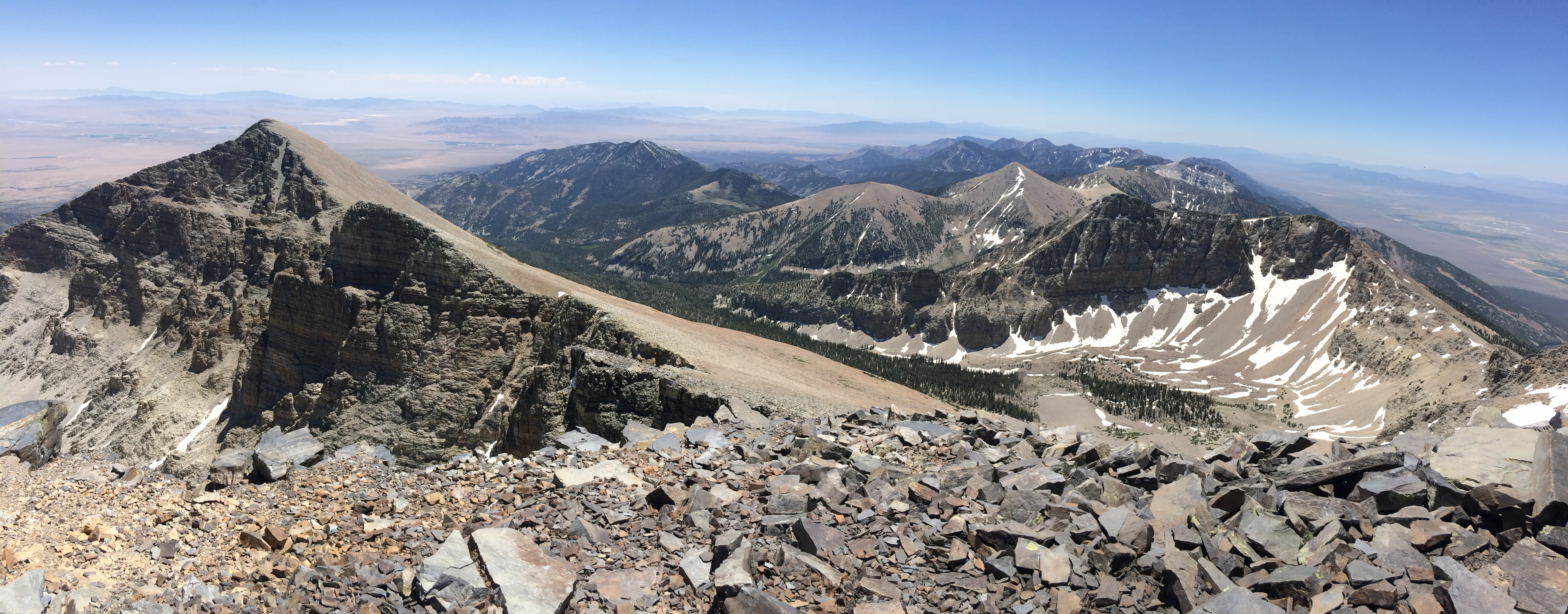
The view from the Wheeler Summit on a clear day allows you to see up to hundreds of miles. Photo: J. Hamilton
Trail Overview
Total Distance: 8.6 miles / 14.0 kilometers
Starting elevation: 10,160 feet / 3,097 meters
Elevation Gain: 3,100 feet / 945 meters
Difficulty: Strenuous
Time: 4 hours - 10 hours
Begin at : Summit Trailhead
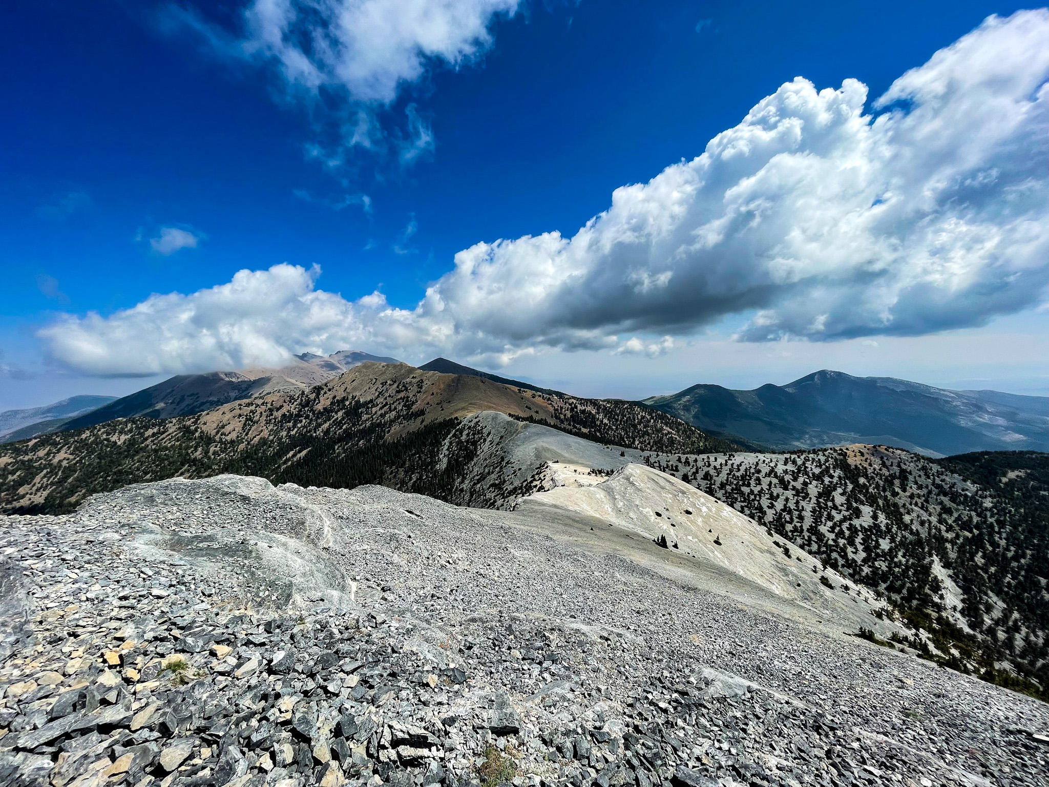
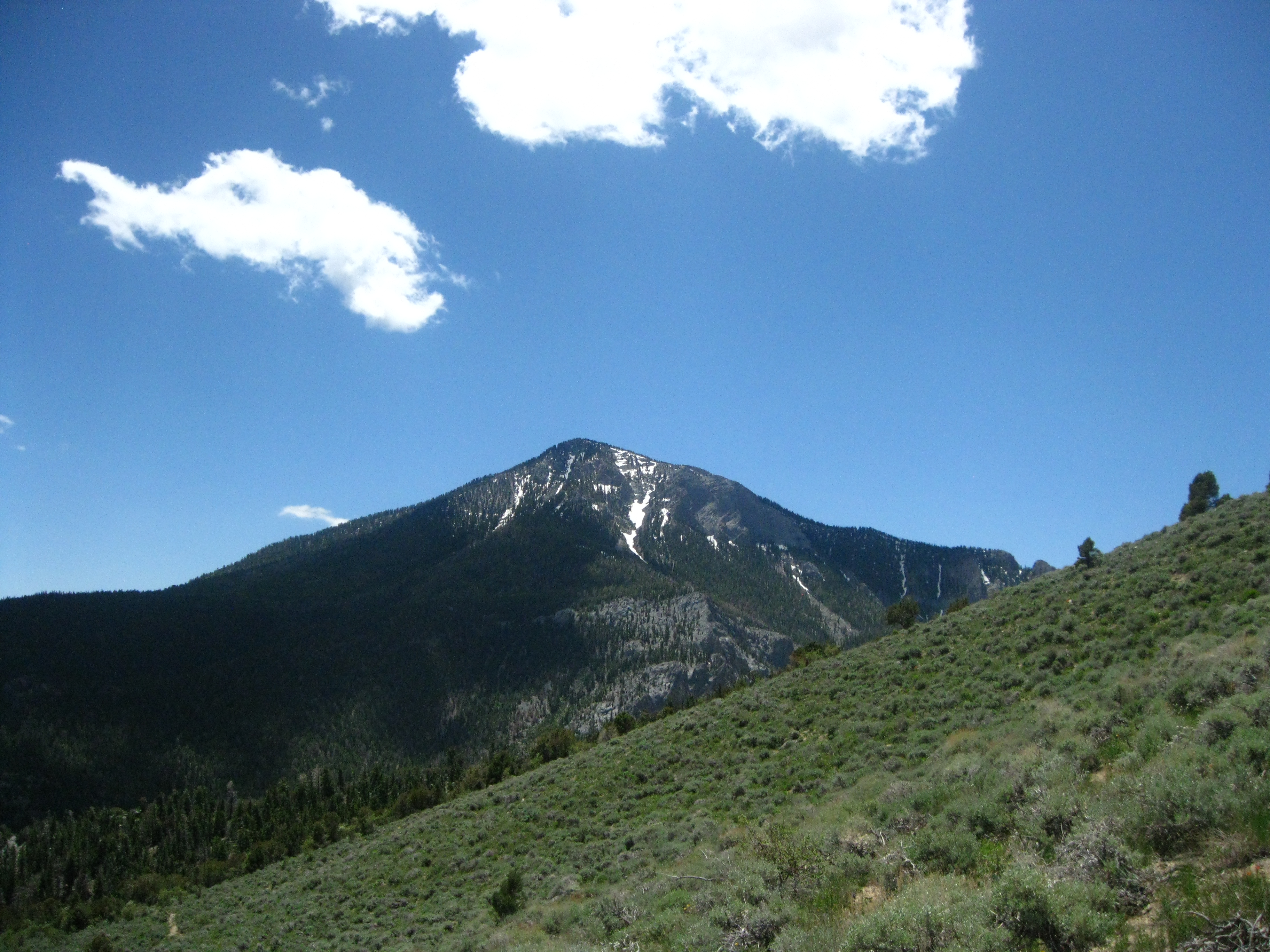
Wheeler Peak stands as the second tallest point in Nevada, and the tallest to have its flanks entirely within the state. This rocky and windy trail is considered one of the hardest in the park, and finishes with the steepest section of trail in the park. Once standing on it's top, Wheeler Peak strikes awe allowing sight of more than 100 miles on a clear day. Hikers should be prepared for a steep and exposed hike where thunderstorms and high winds are common. During the summer, snow still may be on the trail at the higher elevations.
After reaching the saddle between Wheeler and Bald Mt, about 2.5 miles up the trail, hikers get above treeline and become the most prominent features on the hillsides. This means extreme danger when thunderstorms approach. The trail is best done starting around dawn so well prepared and altitude adjusted hikers can return by the late morning or early afternoon.
Beginning at an elevation of about 10,000 feet, these trails provide both a respite from the summer heat of the Snake Valley, but also added dangers in the form of altitude sickness and afternoon thunderstorms. Be prepared with plenty of water and salty snacks, or to return to your vehicle if you become symptomatic of altitude sickness or see thunderclouds rolling in.
This hike starts at the Summit Trailhead near the top of the Wheeler Peak Scenic Drive, 2/3 of a mile short of the Bristlecone Trailhead at the end of the Wheeler Peak Scenic Drive. Parking outside of designated spaces or along the road is prohibited.
No pets permitted on park trails. Trained service animals allowed. Learn more about service animal regulations at this link.
Water
Potable water is not available along the Wheeler Peak Scenic Drive. Pack sufficient water with you, about one gallon per person per day. Water is available year-round at the nearby Lehman Caves Visitor Center or seasonally at the dump station.
Restrooms
The nearest restrooms are pit toilets with no running water at the Bristlecone Trailhead.
Write-ups that name no single mapped trail, in the Service's words.
Hike the Big Wash Trail · 12-24 Hours · no dogs · Summer, Fall Big Wash is perhaps the most difficult and least travelled trail in the park. be prepared for a long 20.6 mile journey through shrubland and heat in the summer, but one of the most incredible experiences available with the isolation it brings.
About these trails
The lines are the National Park Service's public trails layer, the trailheads and the waterfalls, views, peaks and historic places along them the Service's public points of interest, read 2026-10-14 and simplified for the map. The write-ups are the Service's own "things to do", unedited. Heights come from USGS 3DEP through Terrain Tiles on AWS (Mapzen/Tilezen), read along each line and rounded; a short trail on steep ground can be off by a few tens of feet. Closures change: check the park's own site before you go.