Great Basin National Park · Nevada

Highland Ridge Route

12 mi of trail, end to end · Hike the Highland Route: 14.6 mi one way in the Service's write-up · about 5,500 ft of climbing · 8,244 ft–11,761 ft · native surface · trail class Not Applicable · hiking, horse

8,761 ft 11,524 ft · 4.2 mi high 11,524 ft

Hike the Highland Route 14.6 mi one way · the Park Service's write-up

1-2 Days · no dogs · Summer

Start BLM Highland Wilderness Area
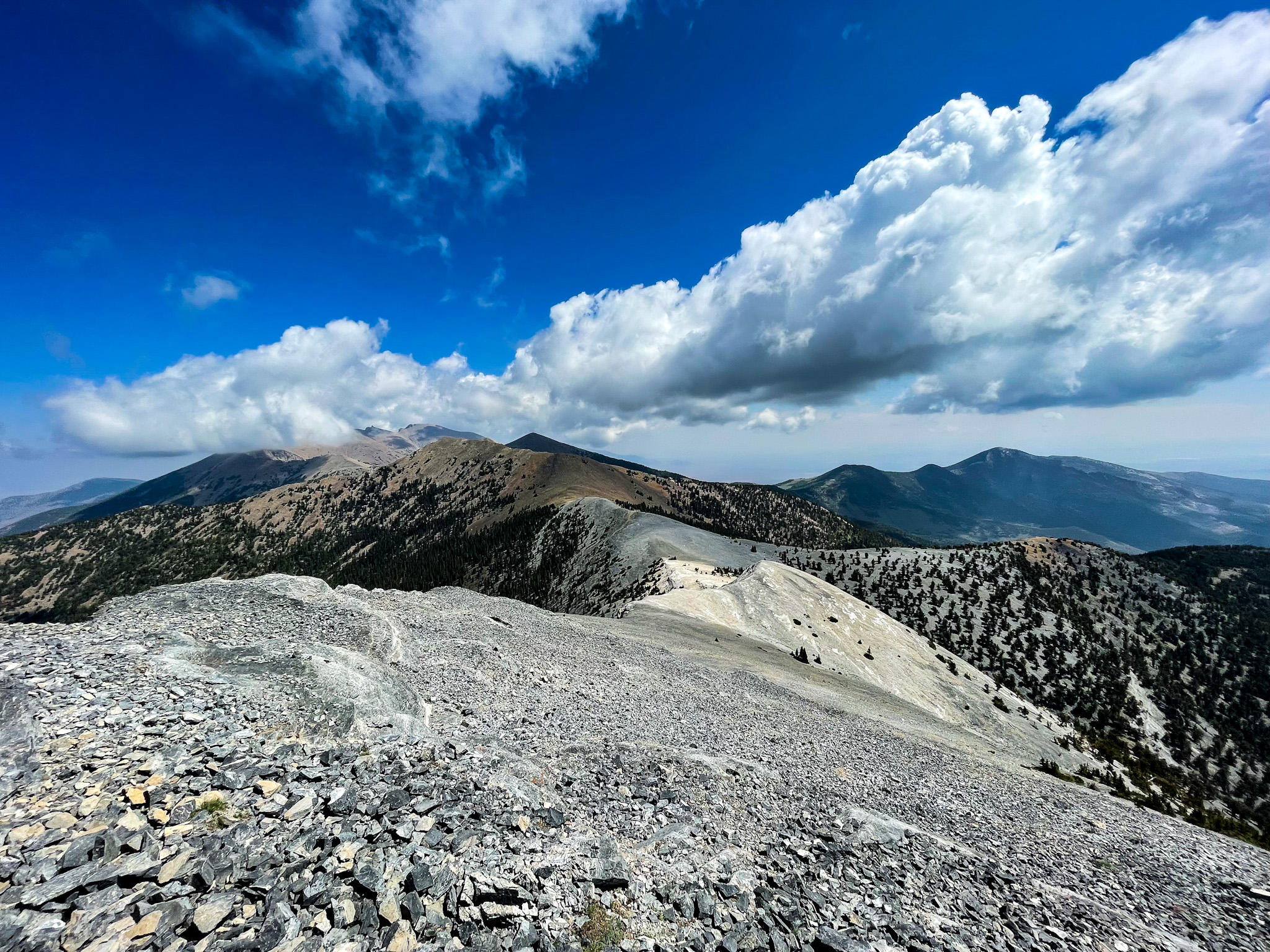
a bare alpine ridge with blue sky and white puffy clouds above.
The Highland Route is and extremely challenging route that offers amazing views of the whole park. Photo: NPS

The hike along the Highland Route stretches the spine on the South Snake range from Pyramid Peak to Decathon Canyon, 14.6 miles one way with extreme elevation changes through out the hike. This route be started in the Highland Ridge Wilderness BLM area to the south of the park or can be started from Baker Lake.

This route requires wayfinding skills and equipment, including map, compass, GPS and the skills and knowledge to use the equipment.

No pets are permitted on this route.

Accessibility This is not an accessible route as it is a dirt and rock backcountry route.

This hike on nps.gov

All 35 trails in Great Basin National ParkFind a trailOn the parks mapPark on nps.gov

About this trail's facts

The lines are the National Park Service's public trails layer, the trailheads and the waterfalls, views, peaks and historic places along them the Service's public points of interest, read 2026-10-16 and simplified for the map; the length is the line's, end to end. The write-ups are the Service's own "things to do" text, unedited. Heights come from USGS 3DEP through Terrain Tiles on AWS (Mapzen/Tilezen), read along each line and rounded; a short trail on steep ground can be off by a few tens of feet. Closures change: check the park's own site before you go.