
Alpine Lakes Loop Trail
Picnic areas
Along the way Bristlecone Trail Picnic Area
Hike the ADA Sky Island Forest Trail the Park Service's write-up
15-45 Minutes · no dogs · Summer, Fall
Start Bristlecone, Alpine Lake and Sky Island Forest Trailhead
Trail Overview
Total Distance: 0.4 miles / 0.6 kilometers
Starting elevation: 9,890 feet / 2,987 meters
Elevation Gain: 20 feet / 6 meters
Difficulty: Easy & Accessible
Time: 15 minutes - 45 minutes
Begin at : Bristlecone Trailhead/End of the Scenic Drive
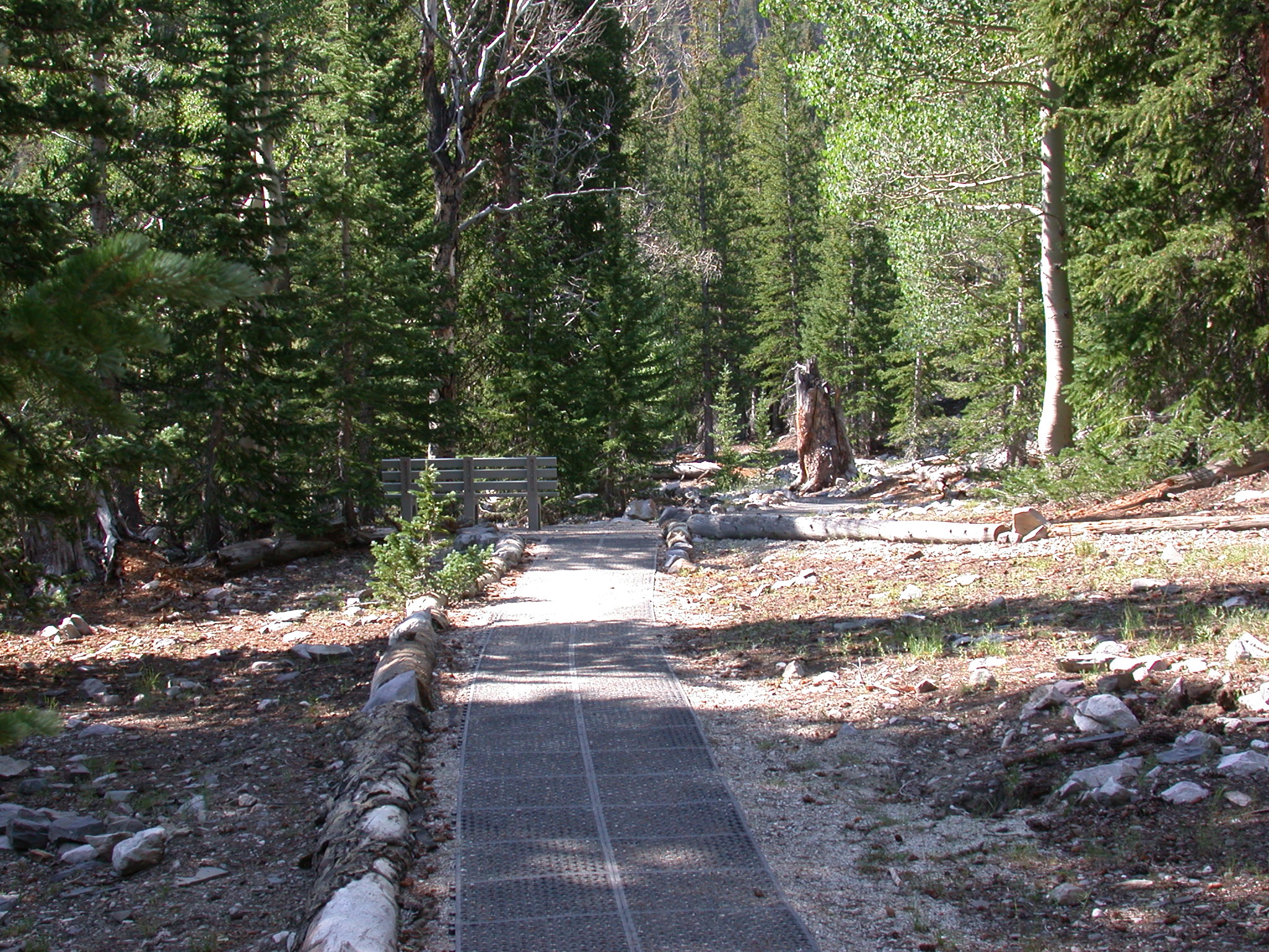
The ADA Accessible Sky Island Forest Trail is the best trail for visitors wanting to take a simple walk through the trees or for those visitors who use wheelchairs. The rubber matted surface makes for fairly even travel until a wooden boardwalk is reached. Interpretive signs along the trail talk about this unique ecosystem, the meaning of a "Sky Island," and the recovery from a wildfire in years past. Steal a view of Wheeler Peak through the trees, view wildflowers near the streams, and enjoy the lower temperatures of high elevation.
Beginning at an elevation of just under 10,000 feet, these trails provide both a respite from the summer heat of the Snake Valley, but also added dangers in the form of altitude sickness and afternoon thunderstorms. Be prepared with plenty of water and salty snacks, or to return to your vehicle if you become symptomatic of altitude sickness or see thunderclouds rolling in.
This hike starts at the Bristlecone Trailhead at the end of the Wheeler Peak Scenic Drive. Parking outside of designated spaces or along the road is prohibited.
No pets permitted on park trails. Trained service animals allowed. Learn more about service animal regulations at this link.
Water
Potable water is not available along the Wheeler Peak Scenic Drive. Pack sufficient water with you, about one gallon per person per day. Water is available year-round at the nearby Lehman Caves Visitor Center or seasonally at the dump station.
Restrooms
The nearest restrooms are pit toilets with no running water at the Bristlecone Trailhead.
Accessibility This trail is accessible with a matted trail surface or wooden boardwalk and ubiquitous benches. Elevation change is a matter of a few feet over the whole distance.
Hike the Alpine Lakes Loop the Park Service's write-up
1-3 Hours · no dogs
Start Bristlecone, Alpine Lake and Sky Island Forest Trailhead
Trail Overview
Total Distance: 2.7 miles / 4.4 kilometers
Starting elevation: 9,890 feet / 2,987 meters
Elevation Gain: 440 feet / 134 meters
Difficulty: Easy
Time: 1.5 hours - 3 hours
Begin at : Bristlecone Trailhead/End of the Scenic Drive
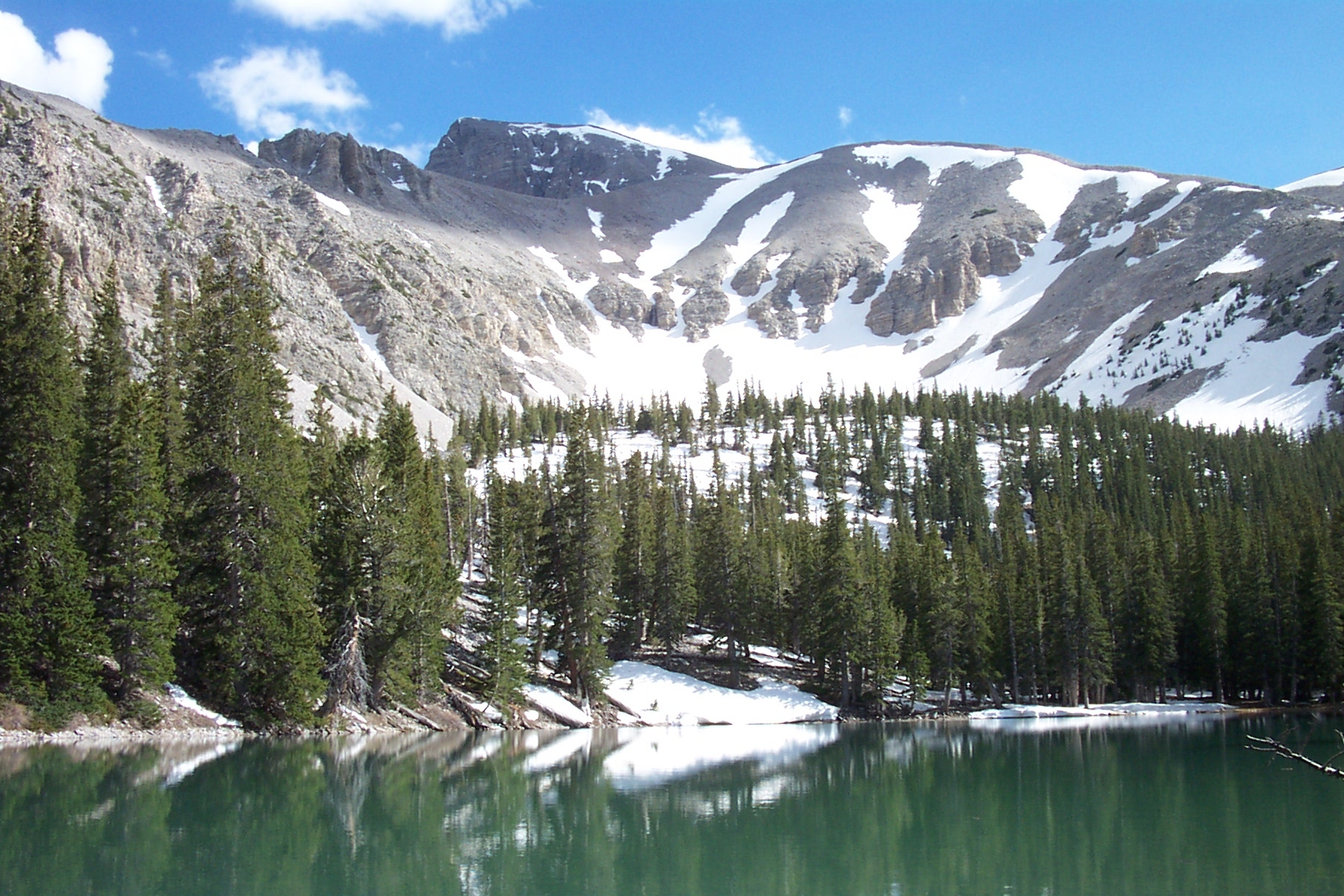
One of the most popular trails in Great Basin National Park, the Alpine Lakes Loop allows folks to get away from the road but not straining too hard. Just under three miles, this loop hike passes by two alpine lakes, Teresa and Stella lakes, all while going through alpine meadows and coniferous forests. Passing in the shadow of the highest peaks of the Snake Range, Wheeler Peak and Doso Doyabi are visible on this trail providing sweeping views of the sheer cliffs and flanks of these mountains. Wildflowers and wildlife are regularly visible during the summer months, and a night hike rewards many with a vast night sky. Winter is a similarly good time to visit, though will need to be linked with the Lehman Creek Trail afer the closure of the Scenic Drive.
The Bristlecone Trail also overlaps the early sections of this trail and can be linked together for a total combined distance of 4.1 miles / 6.6 kilometers. See the trail map below (unavailable on NPS app) for clarification on the overlapping sections.
Beginning at an elevation of just under 10,000 feet, these trails provide both a respite from the summer heat of the Snake Valley, but also added dangers in the form of altitude sickness and afternoon thunderstorms. Be prepared with plenty of water and salty snacks, or to return to your vehicle if you become symptomatic of altitude sickness or see thunderclouds rolling in.
This hike starts at the Bristlecone Trailhead at the end of the Wheeler Peak Scenic Drive. Parking outside of designated spaces or along the road is prohibited.
No pets permitted on park trails. Trained service animals allowed. Learn more about service animal regulations at this link.
Water
Potable water is not available along the Wheeler Peak Scenic Drive. Pack sufficient water with you, about one gallon per person per day. Water is available year-round at the nearby Lehman Caves Visitor Center or seasonally at the dump station.
Restrooms
The nearest restrooms are pit toilets with no running water at the Bristlecone Trailhead.
Accessibility The Alpine Lakes Loop is not accessible