
Swelter Shelter Trail
Exhibits
Along the way Swelter Shelter Interpretive Exhibit
Trailhead Swelter Shelter Trailhead 4,840 ft Drive there
Hike to the Swelter Shelter Petroglyphs the Park Service's write-up
10-30 Minutes · dogs allowed · season This path is short and may be covered with snow during the winter, but the road to this site is typically accessible year round.
Start Cub Creek Road
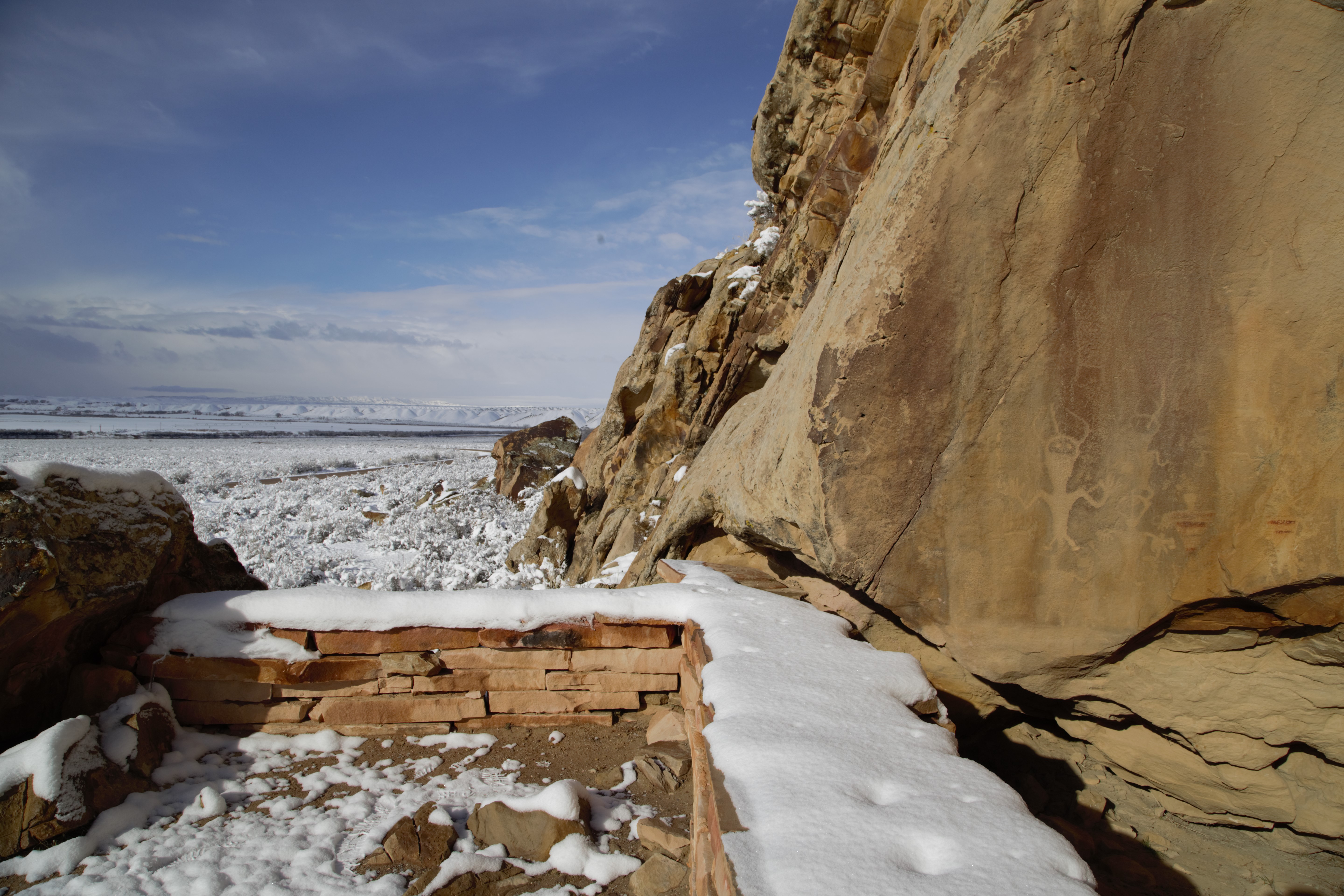
Distance: 400 feet (122 m) round trip
Elevation Change: Minimal, with a few stone stairs
Level of Difficulty: Easy
Type of Trail: Out and back
Trailheads: Cub Creek Road 1 mile (1.6 km) east of the Quarry Visitor Center, Stop #1 on Tour of Tilted Rocks Scenic Drive
This short walk ends at the Swelter Shelter site, which features a variety of petroglyphs (etchings) and pictographs (paintings) created by the ancestral indigenous people of the region. Based on arheological evidence, the shelter was used, but not extensively occupied, by these peoples. It may have been reserved for special purposes and activities. Swelter Shelter has been occupied by older cultures dating to as early as 7000 BCE.
Don't touch! Petroglyphs and pictographs are fragile, irreplaceable records of the past that many still hold sacred. Touching them can leave skin oils behind, and tracings or rubbings can ruin the designs. Federal law protects all artifacts, including these sites. Do your part to respect and protect the past, and report any vandalism you find.
A pamphlet for this trail is available at the Visitor Centers.
Accessibility The path to the Swelter Shelter Petroglyphs is short and relatively level with a few stone stairs at the end. The terrain is unpaved, mostly packed dirt and gravel, and at least 2 feet (0.6 m) wide. It's not wheelchair accessible, but the flat section before the stairs may be possible in a wheelchair with some assistance. The petroglyphs can be seen from the parking area with binoculars. Leashed pets are allowed on this trail.