35 named trails · 31 miles · 32 trailheads · 14 with the Park Service's own write-up. The lines, trailheads and points are the Park Service's; the write-ups are the Service's own words; the climbing is read from USGS elevation along each line.
0.3 mi one way · about 90 ft of climbing · 5,387 ft–5,473 ft · earth surface · hiking
HistoryExhibits
Along the wayJosies Cabin Interpretive ExhibitJosie Morris Homesite
TrailheadsBox Canyon Trailhead 5,384 ft Drive there · Hog Canyon Trailhead 5,367 ft Drive there
Hike the Box Canyon Trail the Park Service's write-up
20-60 Minutes · no dogs
Start Josie Morris Cabin Area
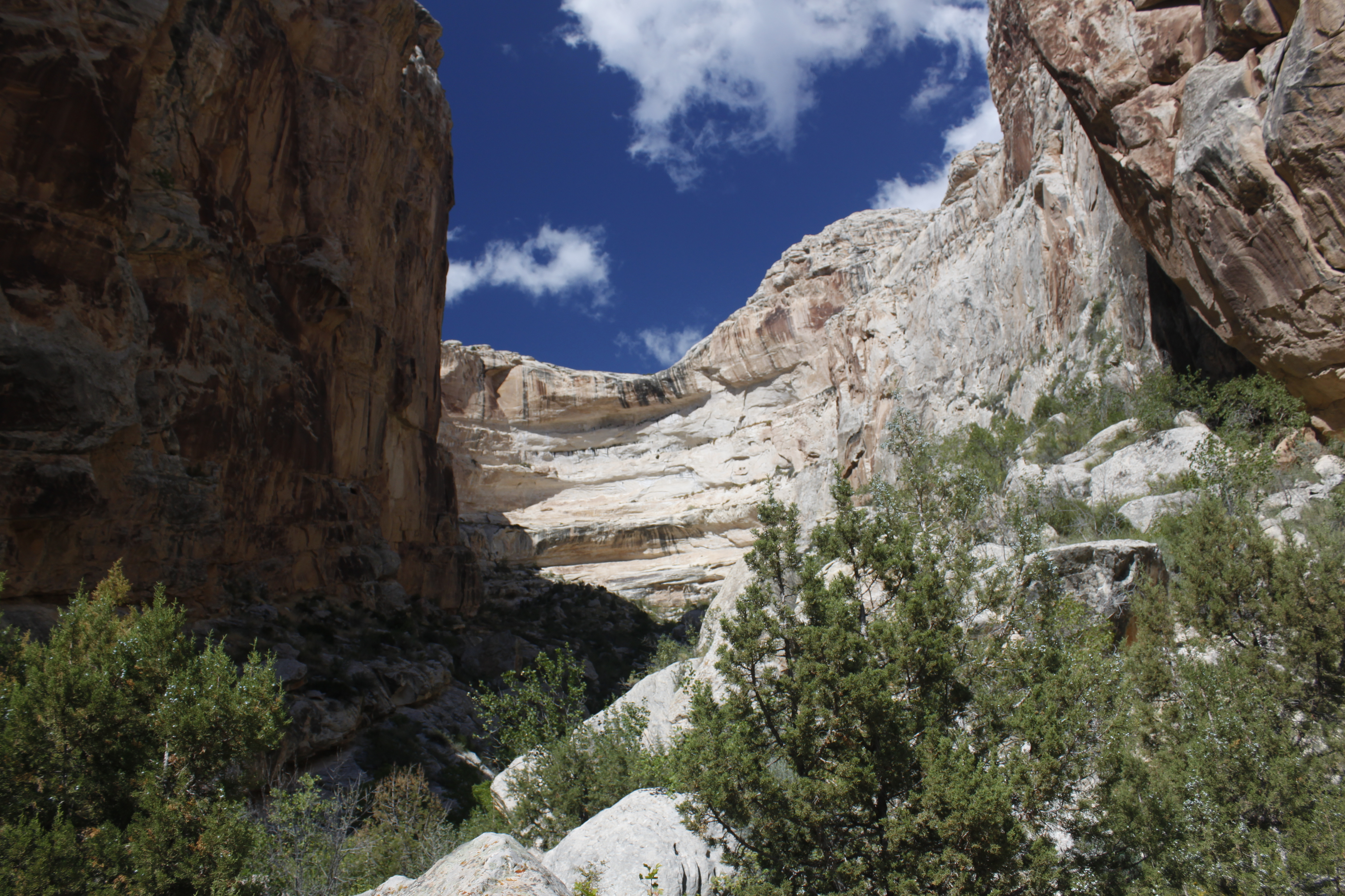
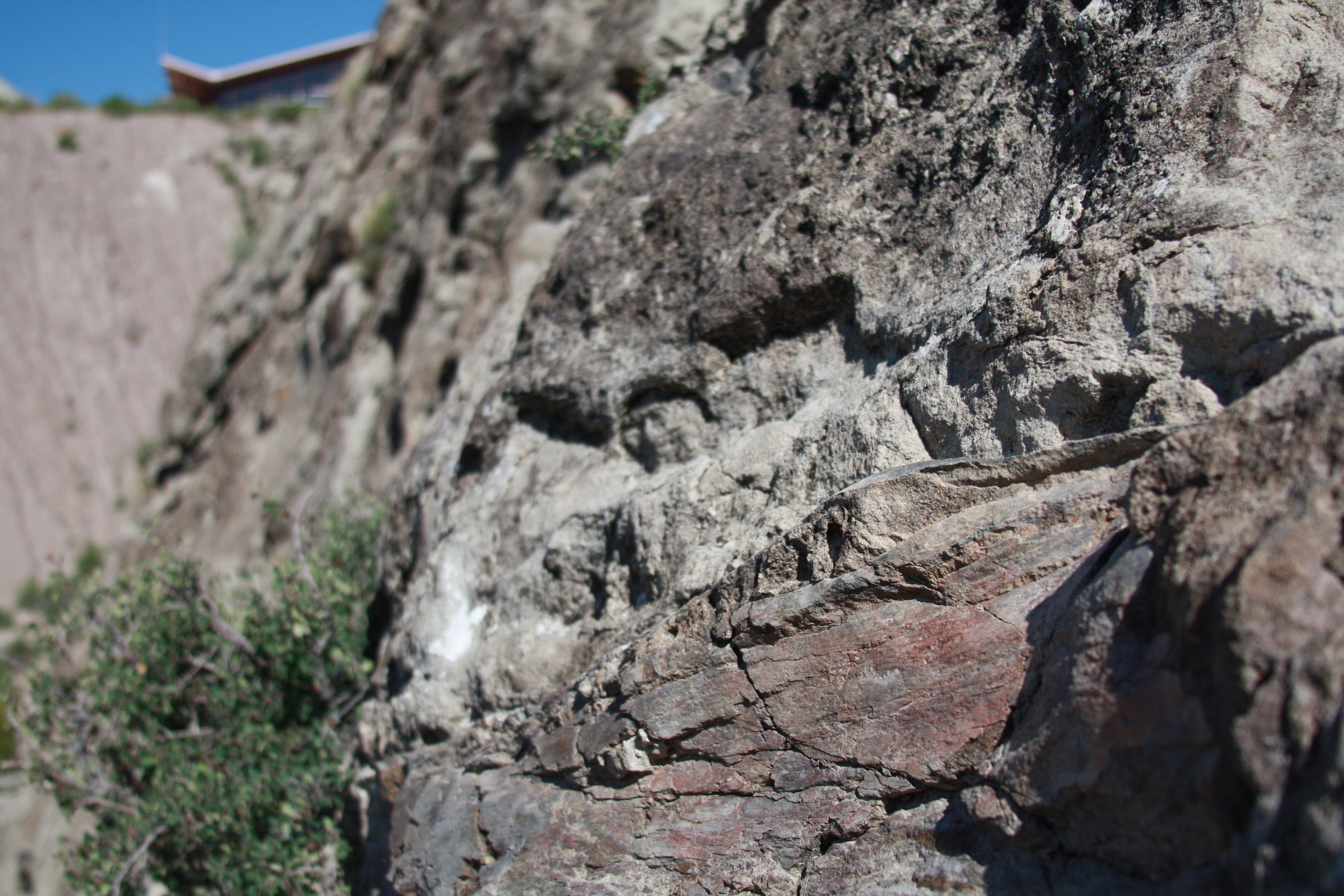
The end of the Box Canyon Trail provides dramatic views of cliffs of Weber sandstone. Photo: NPS
Distance: 0.25 miles (0.4 km) round trip
Elevation Change: Less than 100 feet (30.4 meters)
Level of Difficulty: Easy
Type of Trail: Out and back, not a loop
Trailhead: Josie Morris Cabin Parking Area
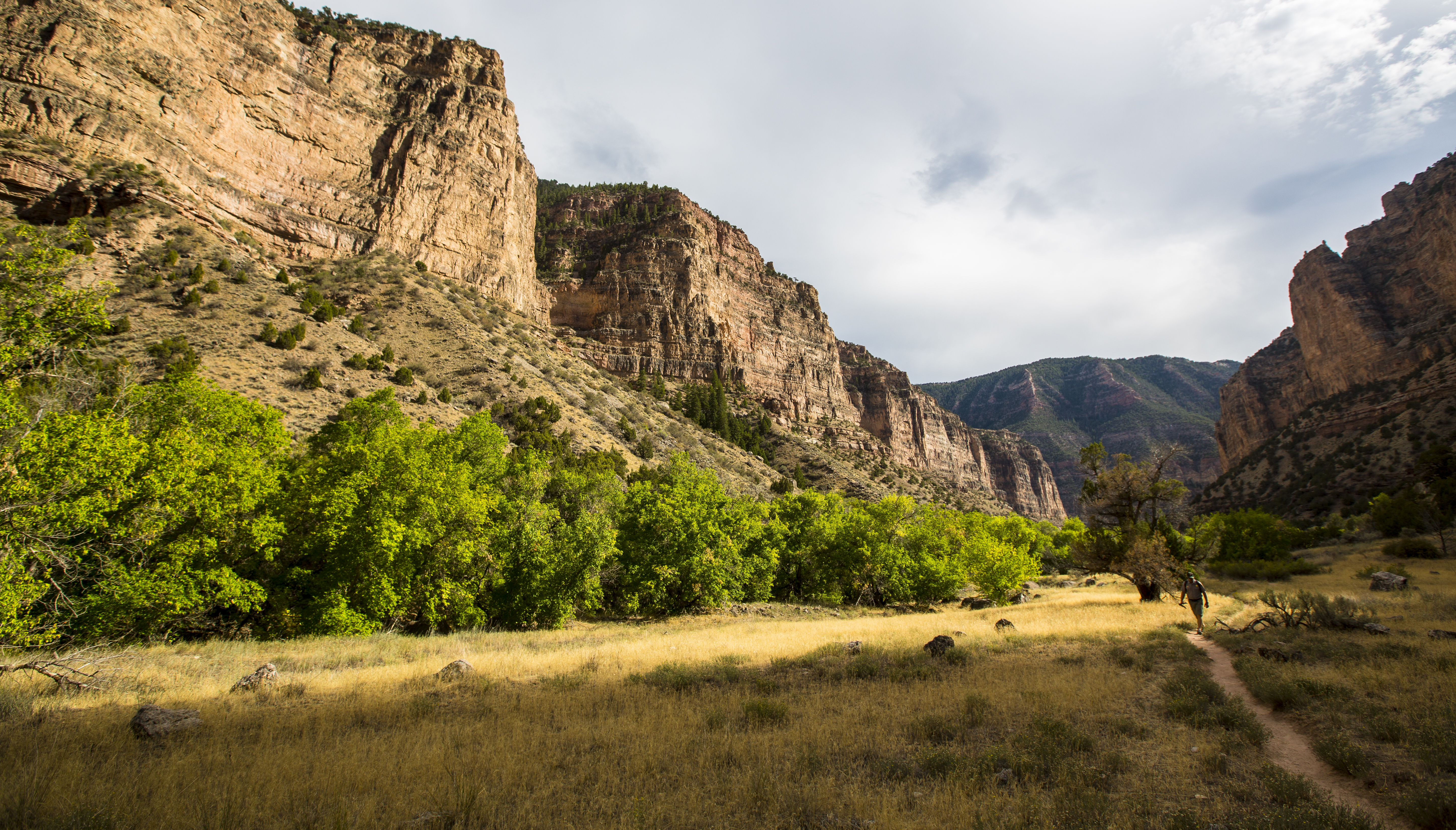
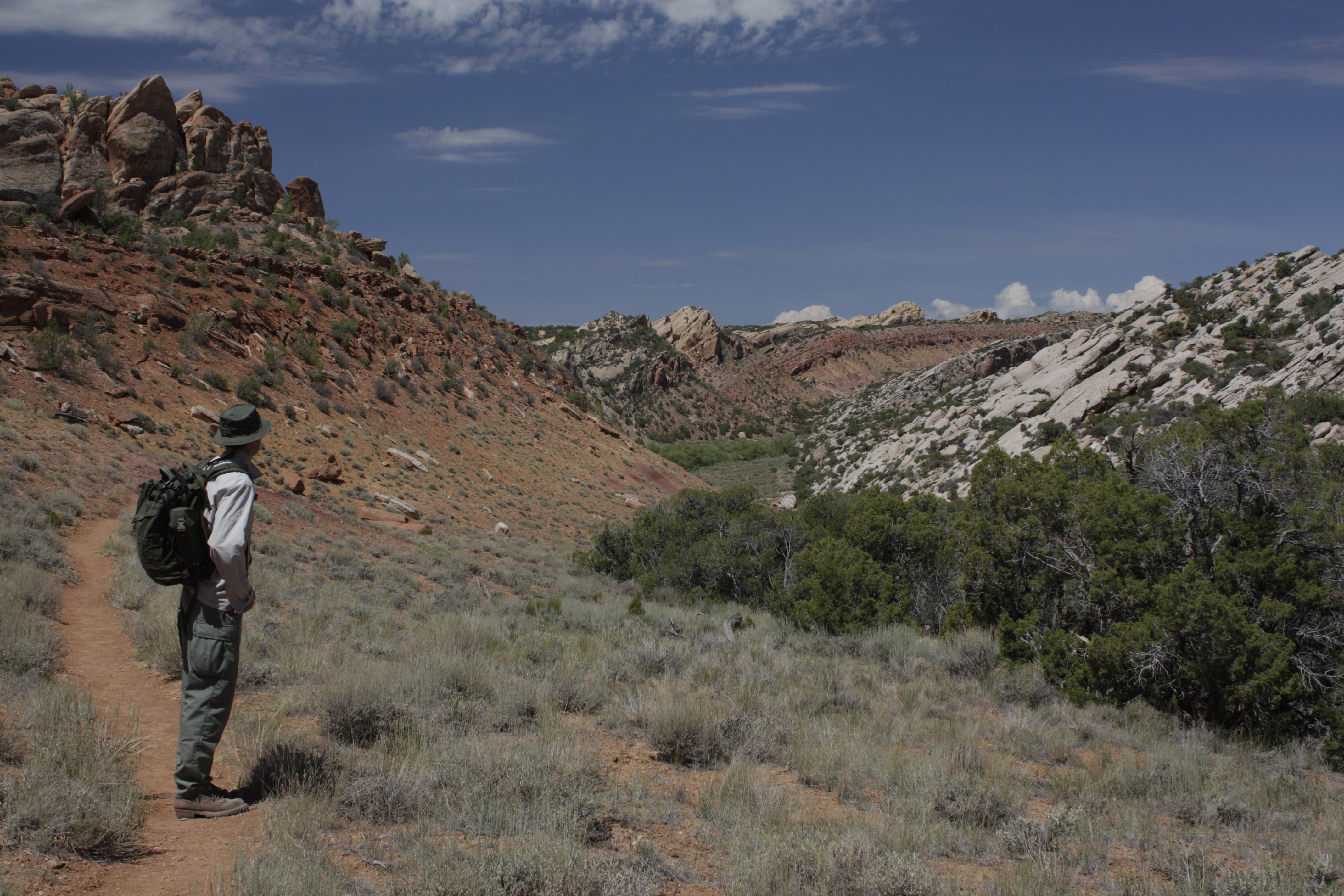
This trail offers a relatively level walk into a shady box canyon. This trail is good to do even on a hot summer day. It features nice exposures of the craggy Weber sandstone of Split Mountain. The canyon served as a natural corral where Josie Bassett Moreis would pen and raise her livestock. It is excellent for small children. Stay on the trail to avoid running into poison ivy.
Hiking brochures are available at the Visitor Centers.
Rules and Regulations
Pets and animals who provide only comfort or emotional support are prohibited on this trail.
Carry out all trash.
Collecting artifacts, fossils, plants, antlers, rocks, or other objects is prohibited.
Do not feed or approach wildlife.
Biking on trails is not permitted in Dinosaur National Monument.
Your Safety
There is some shade on this trail.
Poison ivy is common in this area. Keep small children close and stay on the trail to avoid it.
Be prepared for desert hiking. Wear a hat and sunscreen. Take water. A minimum of 1 gallon (3.8 liters) of water per person is recommended in summer.
Temperatures can exceed 100°F (38°C) in summer. To avoid the heat, hike in the morning or evening. Carry a headlamp if hiking near nightfall.
Let someone know where you are going and when you are due back.
Wear comfortable, sturdy shoes, such as hiking boots or athletic shoes. Open-toed shoes or sandals are not recommended.
Watch for wildlife. This is bear and mountain lion country. Keep small children close.
All natural areas pose risks. Your safety depends on your own good judgement.
Pets Pets and animals who provide only comfort or emotional support are prohibited on this trail. Per the Americans with Disabilities Act, working service dogs may go wherever their handlers go.
Accessibility Trail is primarily a gravel or sand path approximately 30 inches (76 cm) wide. There are a few steps along the route. This trail is not considered wheelchair accessible.
1.1 mi one way · 600 ft of descent · 5,203 ft–5,809 ft · earth surface · hiking
Backcountry camps
Along the wayHarding Hole River Camp 1Harding Hole River Camp 2
TrailheadBull Canyon Trailhead 5,813 ft Drive there
Hike the Bull Canyon Trail the Park Service's write-up
1-5 Hours · no dogs · Spring, Summer, Fall
Start Yampa Bench Road
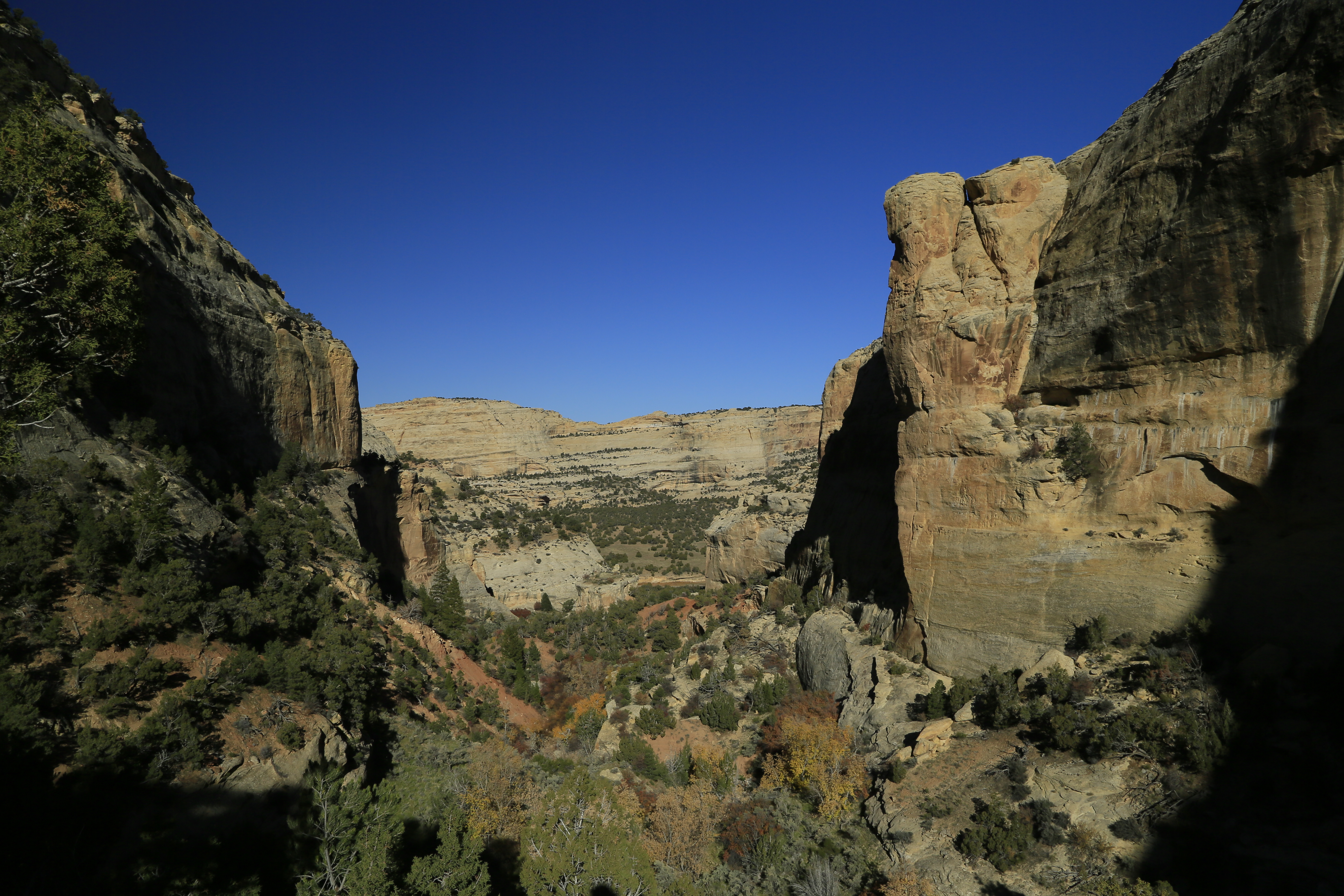
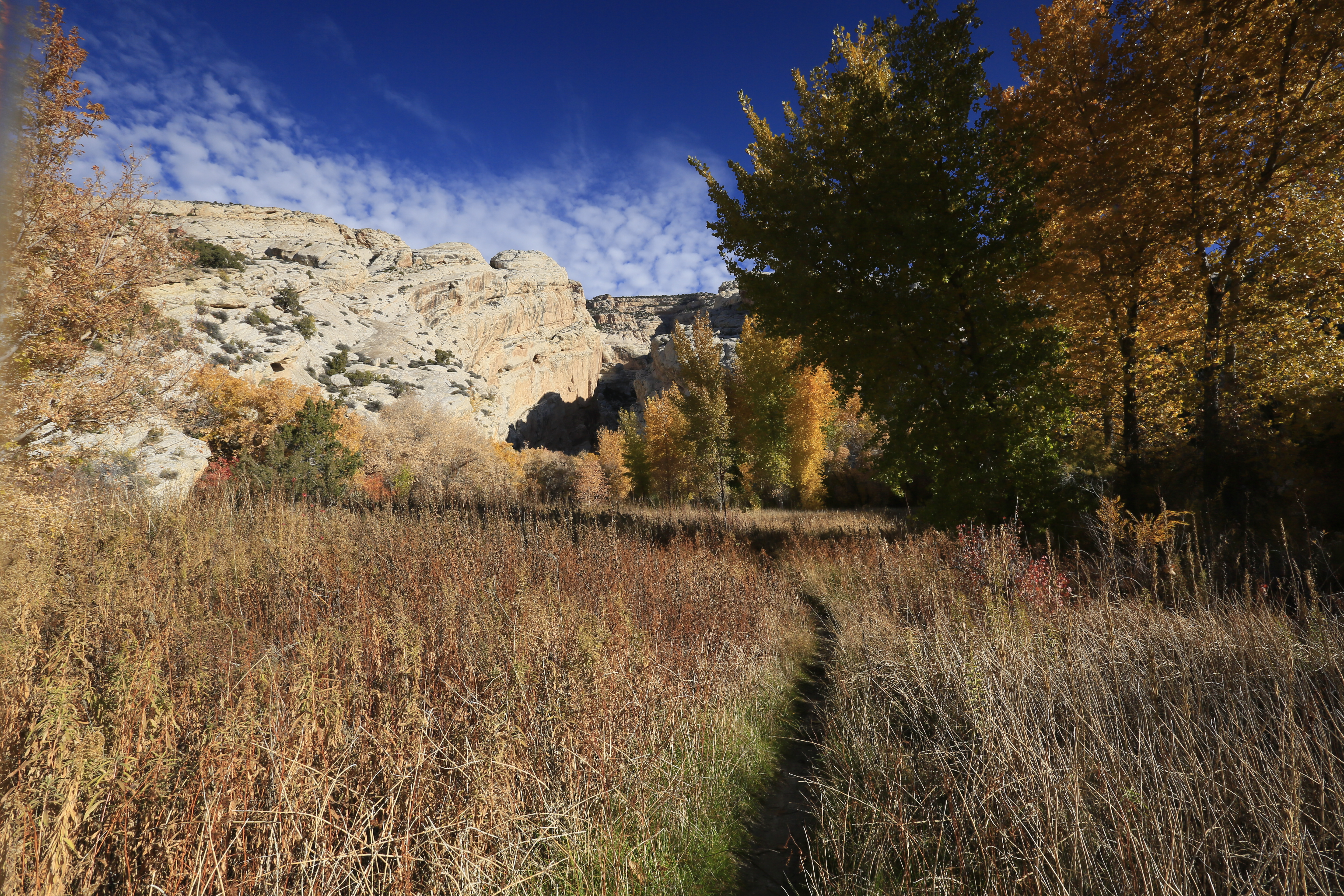
Fall foliage mixes with the colorful cliffs along the Bull Canyon Trail. Photo: NPS Photo
Distance: 3 miles (4.8 km) round trip
Elevation Change: Approximately 1,000 feet (305 meters)
Level of Difficulty: Difficult
Type of Trail: Out and back, not a loop
Trailhead: On the Yampa Bench Road, just east of Wagon Wheel Point Overlook, or from the Harding Hole #1 campsite on the Yampa River.
This steep trail descends from the Yampa Bench Road to the Harding Hole campsites along the Yampa River. The trail provides dramatic views of Bull Canyon and the Yampa River. In addition, river rafters can use this trail to access other sweeping views along the canyon, such as Wagon Wheel Point. Despite its beauty, there are many reasons to use caution when hiking this trail. The are steep drop offs and loose rocks in many areas. Wear closed-toed shoes and watch for cactus along the trail. Additionally, this part of the backcountry is frequented by bears and mountain lions . We strongly recommend brushing up on wilderness safety and hiking in groups!
The Harding Hole campsites are reserved for rivergoers during the high-use river season, but are open to backpackers during the low-use season. Permits are required for all overnight camping in the backcountry. To obtain a permit, contact the Information Desk at (435) 781-7700. Visitors must follow all backcountry camping rules .
Road Conditions:
The Yampa Bench Road is a rugged, unpaved scenic drive on the Colorado side of Dinosaur National Monument. This road required a high-clearance vehicle with four-wheel-drive (4WD). The road is 18 miles (29 km) in length one way, and there are no amenities or restrooms along the entire route. Due to the presence of clay, the road is impassable to all vehicles when wet. The road is typically impassable in winter and spring.
Trail maps of Dinosaur National Monument are available from the park bookstore .
Rules and Regulations
Pets and animals who provide only comfort or emotional support are prohibited on this trail and in the backcountry.
Carry out all trash.
Collecting artifacts, fossils, plants, antlers, rocks, or other objects is prohibited.
Do not feed or approach wildlife.
Biking is not permitted on this trail.
Permits are required for overnight camping in the monument's backcountry. To obtain a permit, call the Information Desk at (435) 781-7700. Visitors must follow all backcountry camping rules .
Your Safety
This trail is difficult to follow in some places. Route finding abilities, such as the ability to use a map and compass, may be necessary in some areas.
The trail is steep and contains several drop-offs along the way. Use caution near the cliffs. Watch for cactus!
There is no shade on this trail.
Be prepared for desert hiking. Wear a hat and sunscreen. Take water. A minimum of 1 gallon (3.8 liters) of water per person is recommended in summer.
Temperatures can exceed 100°F (38°C) in summer. To avoid the heat, hike in the morning or evening. Carry a headlamp if hiking near nightfall.
Let someone know where you are going and when you are due back.
Wear comfortable, sturdy shoes, such as hiking boots or athletic shoes. Open-toed shoes or sandals are not recommended.
Watch for wildlife. This is bear and mountain lion country. Keep small children close.
Pets Pets and animals who provide only comfort or emotional support are prohibited on this trail. Per the Americans with Disabilities Act, working service dogs may go wherever their handlers go.
Accessibility The trail is primarily steep and narrow footpath that in some areas is less than 2 feet (61 cm) wide. The surface is a mixture of dirt and rock. The trail runs along a series of rock ledges with drop offs. Numerous stairs are located along the route. The trail is not wheelchair accessible.
Hike the Confluence Trail the Park Service's write-up
30-120 Minutes · no dogs · Spring, Summer, Fall
Start Echo Park Confluence Trail
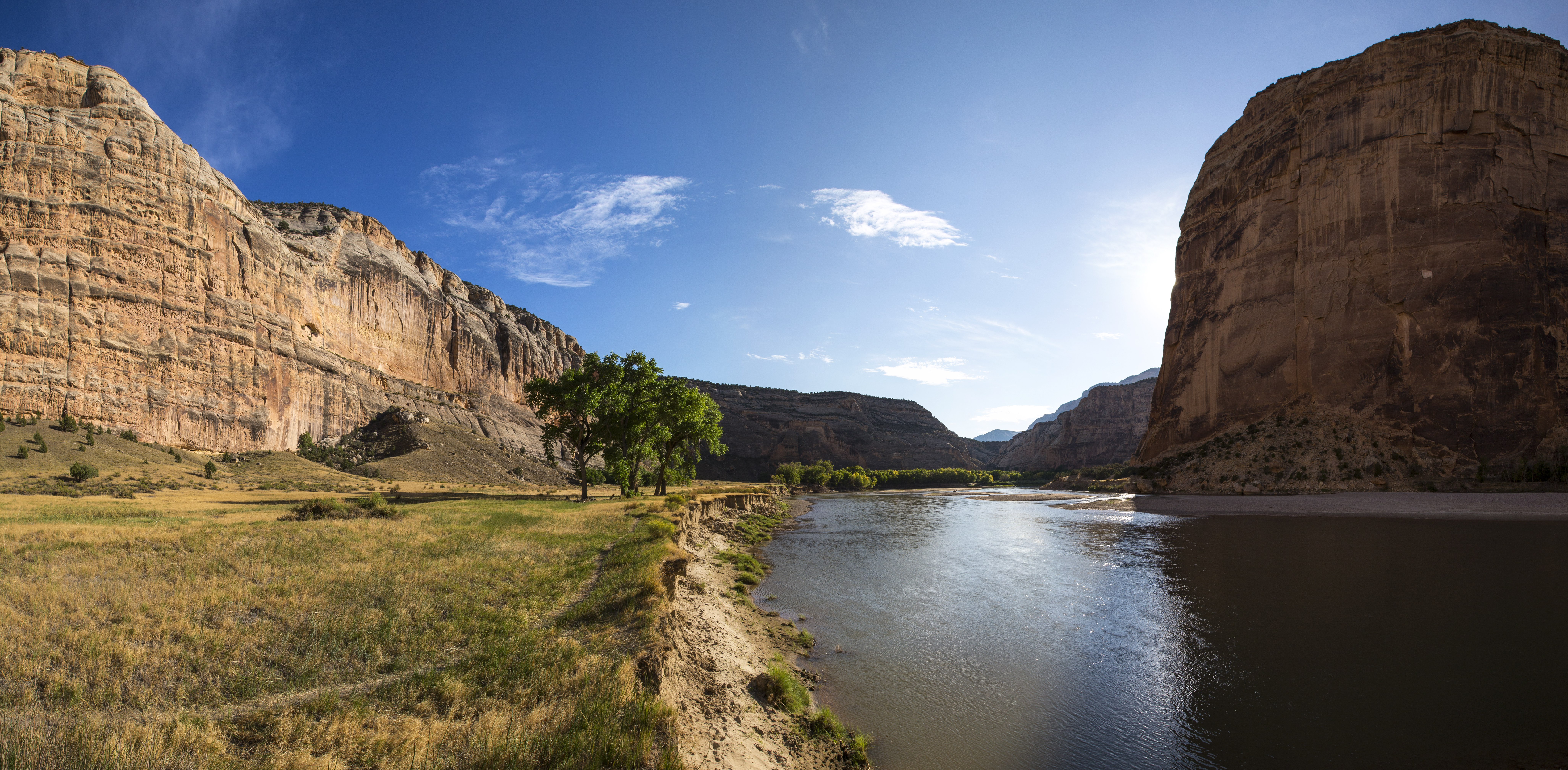
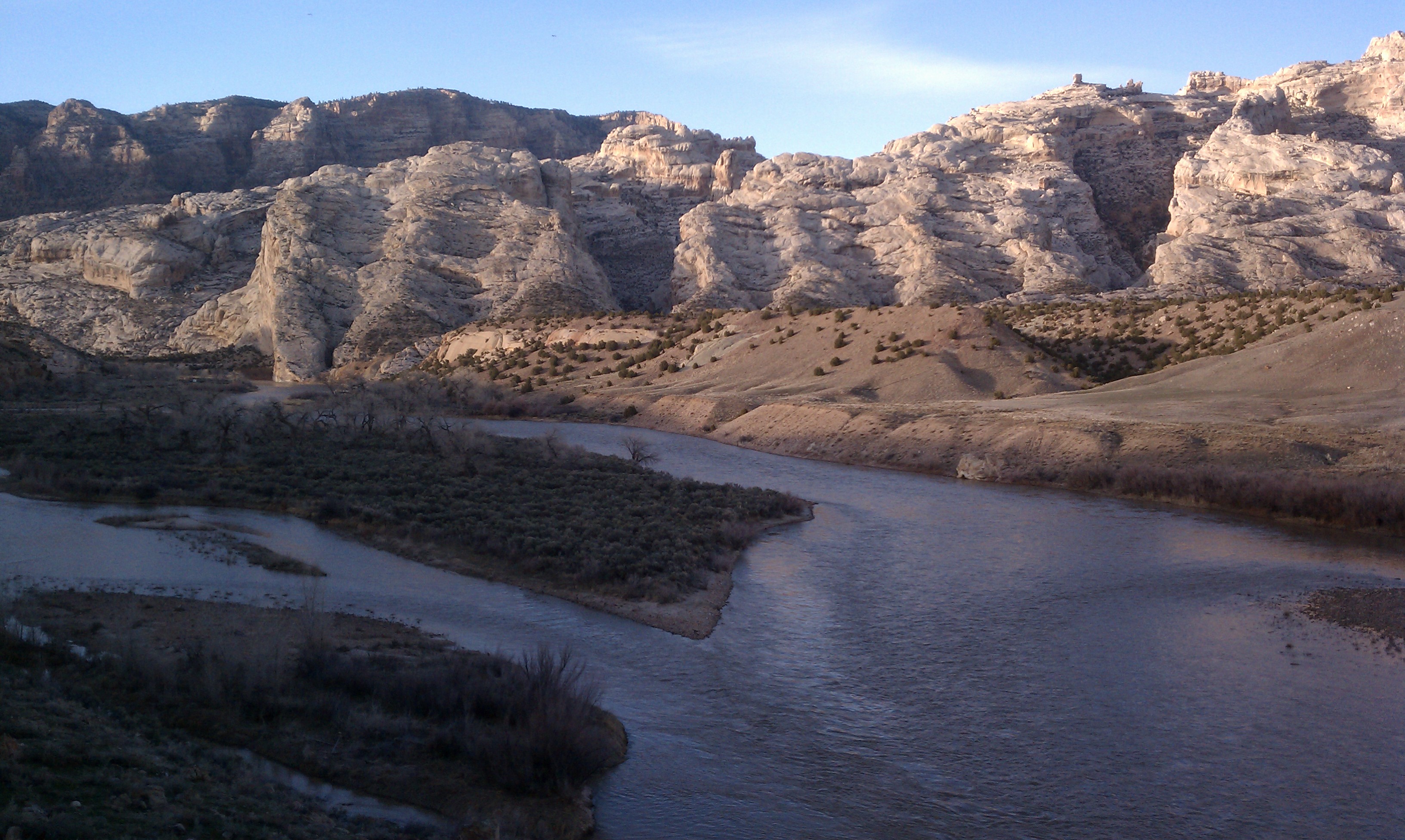
This is the view downstream of the confluence of the Green and Yampa Rivers. Photo: NPS / Jake Frank
Distance: 1.25 miles (2.0 km) round trip
Elevation Change: None
Level of Difficulty: Easy
Type of Trail: Out and back
Trailhead: Echo Park Campground, at the end of the Echo Park Road
This short, easy walk ends with views of the confluence of the Green and Yampa Rivers at Echo Park. The trail is located near the loop at the very end of the Echo Park Road.
Hiking brochures are available at the Visitor Centers.
Road Conditions:
The Harpers Corner and Echo Park roads, which lead to Echo Park campground, are typically closed in winter due to snow and ice. The Echo Park Road is rugged, unpaved, and impassable when wet, regardless of the time of year. High-clearance vehicles with at least all-wheel-drive (AWD) are strongly recommended for the Echo Park Road. RVs and trailers are not permitted on the Echo Park Road.
Rules and Regulations
Pets and animals who provide only comfort or emotional support are prohibited on this trail.
Carry out all trash.
Collecting artifacts, fossils, plants, antlers, rocks, or other objects is prohibited.
Do not feed or approach wildlife.
Biking on trails is not permitted in Dinosaur National Monument.
Your Safety
There is no shade on this trail.
Be prepared for desert hiking. Wear a hat and sunscreen. Take water. A minimum of 1 gallon (3.8 liters) of water per person is recommended in summer.
Temperatures can exceed 100°F (38°C) in summer. To avoid the heat, hike in the morning or evening. Carry a headlamp if hiking near nightfall.
Let someone know where you are going and when you are due back.
Wear comfortable, sturdy shoes, such as hiking boots or athletic shoes. Open-toed shoes or sandals are not recommended.
Watch for wildlife. This is bear and mountain lion country. Keep small children close.
All natural areas pose risks. Your safety depends on your own good judgement.
Pets Pets and animals who provide only comfort or emotional support are prohibited on this trail. Per the Americans with Disabilities Act, working service dogs may go wherever their handlers go.
Accessibility The trail is an unpaved, relatively flat path along the river. The path is about 1 foot (30 cm) wide. The trail is not wheelchair accessible.
TrailheadDesert Voices Trailhead 4,800 ft Drive there
Hike the Desert Voices Trail the Park Service's write-up
1-3 Hours · no dogs
Start Desert Voices Trailhead
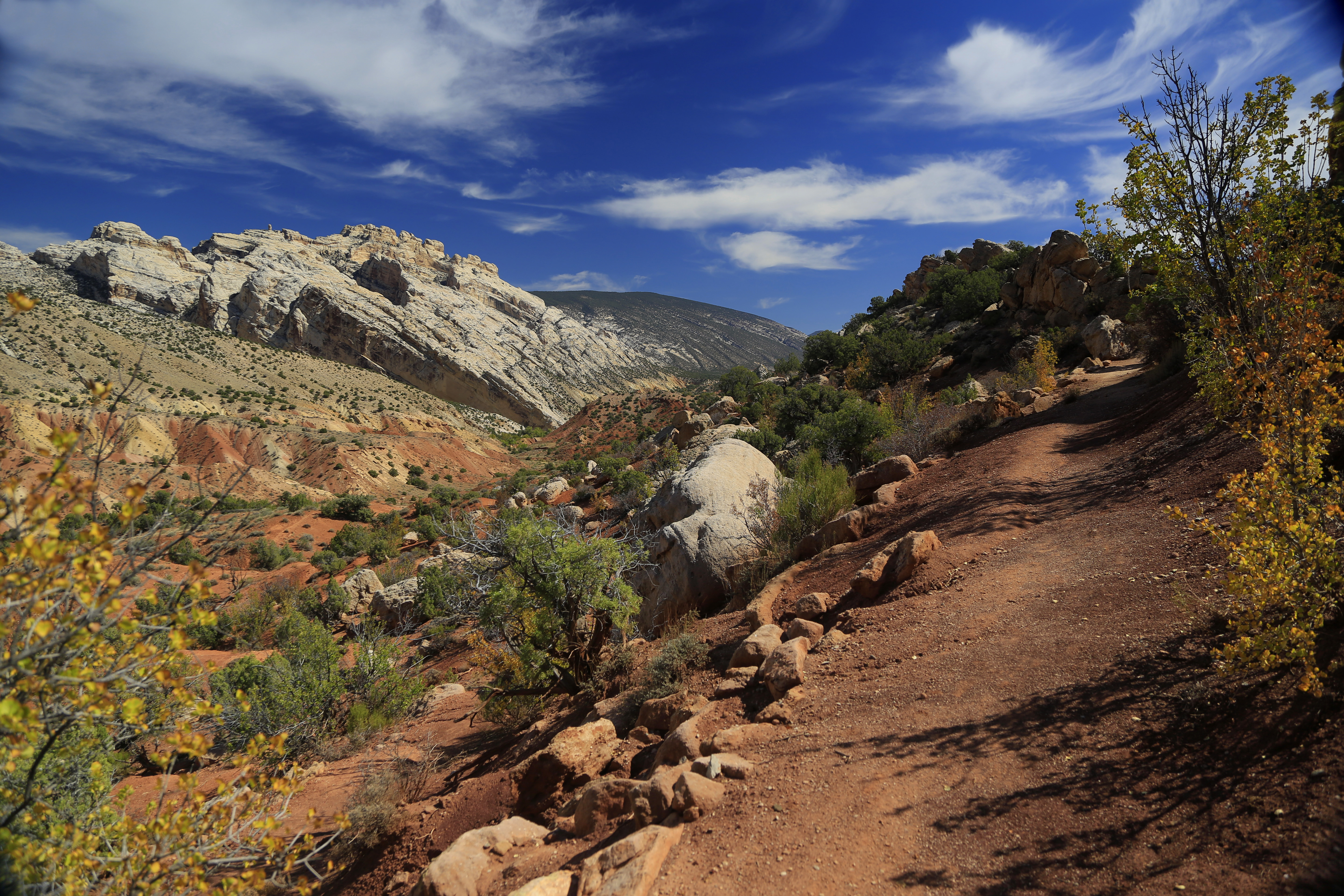
Hiking on the Desert Voices Trail provides dramatic views in any season. Photo: NPS Photo
Distance: 1.7 miles (2.7 km) round trip
Elevation Change: Approximately 300 feet (91 meters)
Level of Difficulty: Moderate
Type of Trail: Loop
Trailhead: Split Mountain Area
The Desert Voices Trail offers spectacular views of Split Mountain and several adjacent rock layers. Trail signs describe the area's geology and ecology. There are also many signs that were written and drawn by children. Trail maps of Dinosaur National Monument are available from the park bookstore .
A 0.25 mile (0.4 km) connector trail allows you to combine this with the Sound of Silence loop trail for an even longer hike.
Rules and Regulations
Pets and animals who provide only comfort or emotional support are prohibited on this trail.
Carry out all trash.
Collecting artifacts, fossils, plants, antlers, rocks, or other objects is prohibited.
Do not feed or approach wildlife.
Biking on trails is not permitted in Dinosaur National Monument.
Your Safety
There is no shade on this trail.
Be prepared for desert hiking. Wear a hat and sunscreen. Take water. A minimum of 1 gallon (3.8 liters) of water per person is recommended in summer.
Temperatures can exceed 100°F (38°C) in summer. To avoid the heat, hike in the morning or evening. Carry a headlamp if hiking near nightfall.
Let someone know where you are going and when you are due back.
Wear comfortable, sturdy shoes, such as hiking boots or athletic shoes. Open-toed shoes or sandals are not recommended.
Watch for wildlife. This is bear and mountain lion country. Your safety depends on your own good judgement.
All natural areas pose risks. Your safety depends on your own good judgement.
Pets Pets and animals who provide only comfort or emotional support are prohibited on this trail. Per the Americans with Disabilities Act, working service dogs may go wherever their handlers go.
Accessibility Trail surface is a mixture of dirt and rock. The trail is minimum of 2 feet (0.6 meters) wide in some areas. There are a few steep areas and some steps.The trail is not wheelchair accessible. While the trail is rugged and may be difficult to traverse for some individuals with mobility disabilities, the terrain does not preclude those who are willing to take on the challenge.
0.9 mi one way · about 150 ft of climbing · 4,801 ft–4,956 ft · earth, native surface · hiking
Visitor centers
Along the way4-3 Lower Visitor Center
TrailheadFossil Discovery Trailhead 4,810 ft Drive there
Hike the Fossil Discovery Trail the Park Service's write-up
30-90 Minutes · no dogs
Start Quarry Area
The Morrison Formation spur of this trail features many unexcavated dinosaur fossils. Photo: NPS Photo
Distance: 1.2 miles (2 km) one way
Elevation Change: Approximately 200 feet (61 meters)
Level of Difficulty: Moderate, some steep and uneven rocky areas. Can be slippery when wet.
Type of Trail: Out and back, not a loop
Trailheads: Either the Quarry Visitor Center or the Quarry Exhibit Hall.
This 1.2 mile (2 km), one-way trail cuts through several tilted rock layers which expose a variety of rocks and three fossil areas as offshoots of the main trail. The Morrison Formation stop features an outcropping of several small fossil fragments and a few large pieces of dinosaur bones in their natural state, just as Earl Douglass found them in 1909. Trailheads are located at both the Quarry Visitor Center or the Quarry Exhibit Hall. When the shuttle is running between the Visitor Center and the Quarry Exhibit Hall, many visitors opt to hike the trail one direction and ride the shuttle the opposite.
A pamphlet for the trail is available at the Visitor Centers.
Rules and Regulations
Pets and animals who provide only comfort or emotional support are prohibited on this trail.
To protect fragile resources, off-trail hiking is not permitted in this area.
Carry out all trash.
Collecting artifacts, fossils, plants, antlers, rocks, or other objects is prohibited.
Do not feed or approach wildlife.
Biking on trails is not permitted in Dinosaur National Monument.
Your Safety
There is no shade on this trail.
This trail is not stroller friendly, and can be extremely slippery when wet.
Be prepared for desert hiking. Wear a hat and sunscreen. Take water. A minimum of 1 gallon (3.8 liters) of water per person is recommended in summer.
Temperatures can exceed 100°F (38°C) in summer. To avoid the heat, hike in the morning or evening. Carry a headlamp if hiking near nightfall.
Let someone know where you are going and when you are due back.
Wear comfortable, sturdy shoes, such as hiking boots or athletic shoes. Open-toed shoes or sandals are not recommended.
Watch for wildlife. This is bear and mountain lion country. Keep small children close.
All natural areas pose risks. Your safety depends on your own good judgement.
Pets Pets and animals who provide only comfort or emotional support are prohibited on this trail. Per the Americans with Disabilities Act, working service dogs may go wherever their handlers go.
Accessibility This trail is a narrow path over a mix of gravel, dirt, and sand. There are numerous steps and dry stream crossings in several areas. There is no shade on the trail, and it can be hot during midday. Due to the presence of clay, this trail is slippery when wet. It is not wheelchair or stroller accessible.
0.4 mi one way · about 80 ft of climbing · 5,360 ft–5,421 ft · earth surface · hiking
TrailheadGates of Lodore Trailhead 5,352 ft Drive there
Hike the Gates of Lodore Trail the Park Service's write-up
45-120 Minutes · no dogs
Start Gates of Lodore Campground
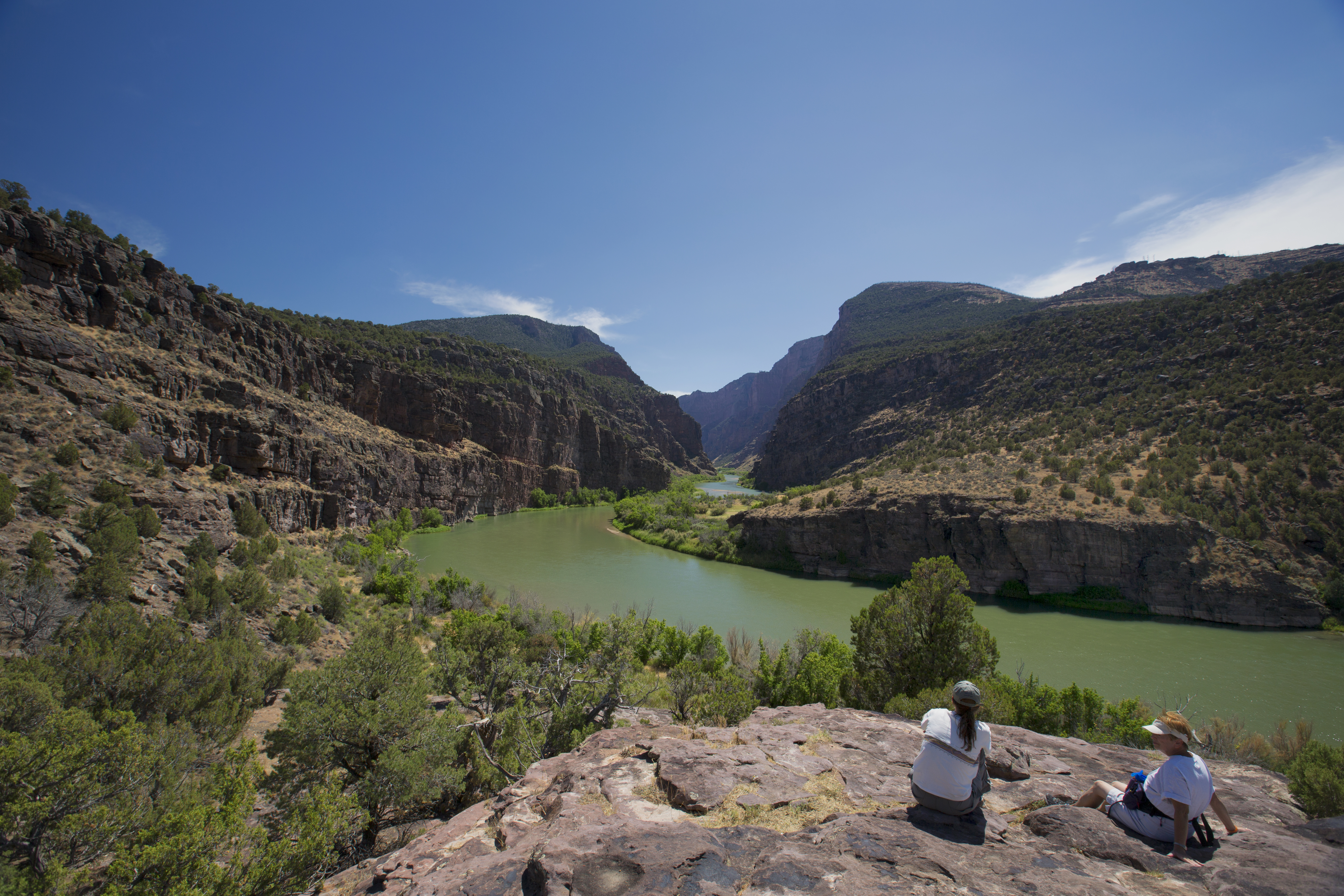
Flat rocks at the end of the Gates of Lodore Trail provide a place to enjoy the scenery. Photo: NPS Photo
Distance: 1 mile (1.6 km) round trip
Elevation Change: Approximately 200 feet (61 meters)
Level of Difficulty: Easy
Type of Trail: Out and back, not a loop
Trailhead: Located at the Gates of Lodore Campground at the north end of the monument, 137 miles (220.4 km) from the Quarry Visitor Center and 101 (162.5 km) miles from the Canyon Visitor Center.
The trail starts up a short incline, then becomes a relatively level walk above the Green River. The trail ends at a dramatic view of the entrance to Lodore Canyon. The trail does not provide access to Lodore Canyon, which is impassable on foot.
Hiking brochures are available at the Visitor Centers. A more detailed guide book for this trail is available at the park bookstore .
Rules and Regulations
Pets and animals who provide only comfort or emotional support are prohibited on this trail.
To protect fragile resources, off trail hiking is not permitted in this area.
Carry out all trash.
Collecting artifacts, fossils, plants, antlers, or other objects is prohibited.
Do not feed or approach wildlife.
Biking on trails is not permitted in Dinosaur National Monument.
Your Safety
There is no shade on this trail. This trail can be extremely slippery when wet. The trail is not stroller-friendly.
Be prepared for desert hiking. Wear a hat and sunscreen. Take water. A minimum of 1 gallon (3.8 liters) of water per person is recommended in summer.
Temperatures can exceed 100°F (38°C) in summer. To avoid the heat, hike in the morning or evening. Carry a headlamp if hiking near nightfall.
Let someone know where you are going and when you are due back.
Wear comfortable, sturdy shoes, such as hiking boots or athletic shoes. Open-toed shoes or sandals are not recommended.
Watch for wildlife. This is mountain lion and black bear country. Keep small children close.
All natural areas pose risks. Your safety depends on your own good judgement.
Pets Pets and animals who provide only comfort or emotional support are prohibited on this trail. Per the Americans with Disabilities Act, working service dogs may go wherever their handlers go.
Accessibility The trail is primarily a narrow footpath approximately 2 feet (0.6 m) wide. The surface is a mixture of dirt and rock. The trail does climb several rock stairs. While the trail is rugged and may be difficult to traverse for some individuals with mobility disabilities, the terrain would not preclude those who are willing to take on the challenge. The trail is not wheelchair accessible.
1.1 mi one way · about 150 ft of climbing · 7,464 ft–7,570 ft · earth surface · hiking
TrailheadHarper's Corner Trailhead 7,574 ft Drive there
Hike the Harpers Corner Trail the Park Service's write-up
1-2 Hours · no dogs · Spring, Summer, Fall
Start Harpers Corner Road
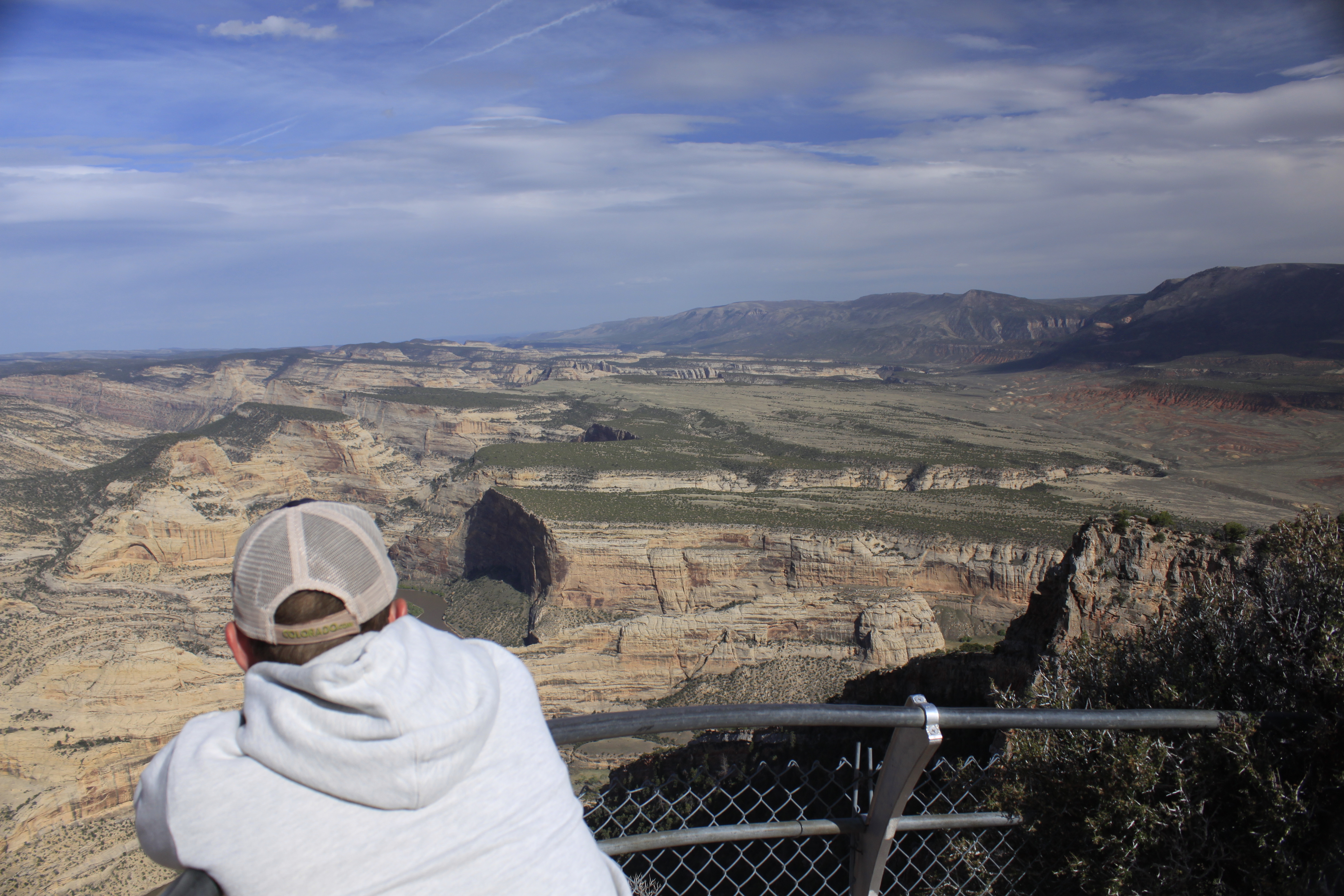
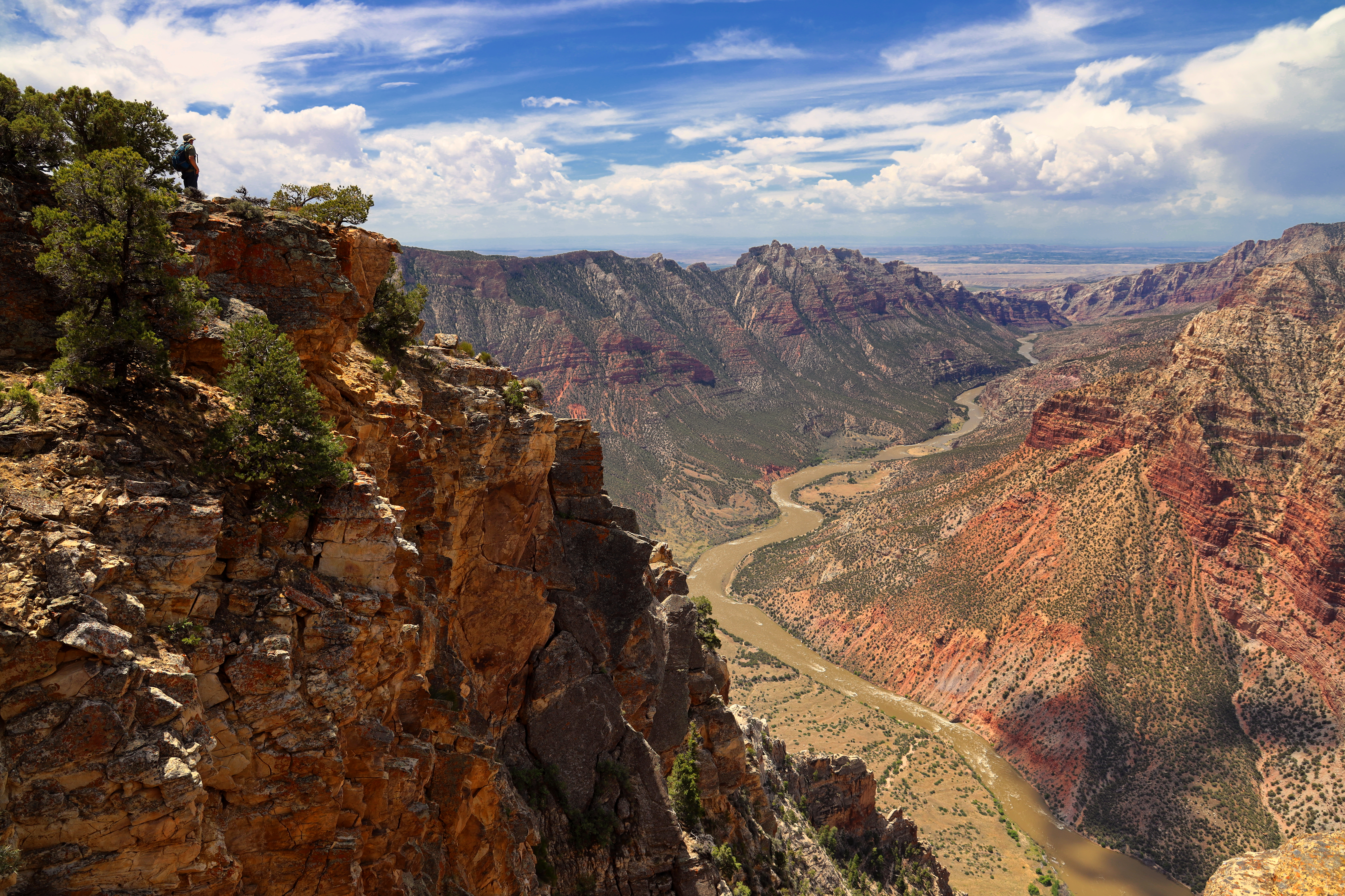
A hiker enjoys the view of the Yampa River Canyon from the end of the Harpers Corner Trail. Photo: NPS Photo
Distance: 2 miles (3.2 km) round trip
Elevation Change: Approximately 100 feet (30.4 meters)
Level of Difficulty: Moderate
Type of Trail: Out and back, not a loop
Trailhead: End of the Harpers Corner Road, 31 miles (33.7 km) north of the Canyon Visitor Center.
The Harpers Corner Trail runs along a narrow ridge to a spectacular viewpoint. Along the way, hikers can gaze across the remote canyon country. The Green River flows through Whirlpool Canyon over 2,500 feet (762 meters) below the trail. The pinyon pine and juniper trees provide shade on hot days and are frequented by a variety of birds. The end of the trail features and overlook with sweeping views of the river canyons.
Hiking brochures are available at the Visitor Centers. A more detailed guide book for this trail is available at the park bookstore .
Rules and Regulations
Pets and animals who provide only comfort or emotional support are prohibited on this trail.
Carry out all trash.
Collecting artifacts, fossils, plants, antlers, rocks, or other objects is prohibited.
Do not feed or approach wildlife.
Biking on trails is not permitted in Dinosaur National Monument.
Your Safety
There is no shade on this trail.
Lighting strikes are more common at high elevations. Don't attempt this trail in a thunderstorm.
Be prepared for desert hiking. Wear a hat and sunscreen. Take water. A minimum of 1 gallon (3.8 liters) of water per person is recommended in summer.
Temperatures can exceed 100°F (38°C) in summer. To avoid the heat, hike in the morning or evening. Carry a headlamp if hiking near nightfall.
Let someone know where you are going and when you are due back.
Wear comfortable, sturdy shoes, such as hiking boots or athletic shoes. Open-toed shoes or sandals are not recommended.
Watch for wildlife. This is bear and mountain lion country. Keep small children close.
All natural areas pose risks. Your safety depends on your own good judgment.
Pets Pets and animals who provide only comfort or emotional support are prohibited on this trail. Per the Americans with Disabilities Act, working service dogs may go wherever their handlers go.
Accessibility The trail is primarily a narrow footpath approximately 2 feet (0.6 meters) wide. The surface is a mixture of dirt and rock. There are some steep grades. While the trail is rugged and may be difficult to traverse for some individuals with mobility disabilities, the terrain would not preclude those who are willing to take on the challenge. The trail is not wheelchair accessible.
0.6 mi one way · about 150 ft of climbing · 5,354 ft–5,474 ft · earth surface · hiking
HistoryExhibits
Along the wayHog Canyon Interpretive ExhibitJosie's Cabin Interpretive ExhibitJosies Cabin Interpretive ExhibitJosies Cabin Interpretive ExhibitJosie Morris Homesite
TrailheadsBox Canyon Trailhead 5,384 ft Drive there · Hog Canyon Trailhead 5,367 ft Drive there
Hike the Hog Canyon Trail the Park Service's write-up
30-90 Minutes · no dogs
Start Josie Morris Cabin Area
The Hog Canyon Trail provides an easy hike in any season. Photo: NPS Photo
Distance: 1.5 miles (2.4 km) round trip
Elevation Change: Approximately 100 feet (30.4 meters)
Level of Difficulty: Easy to moderate
Type of Trail: Out and back, not a loop
Trailhead: Josie Morris Cabin Parking Area
The Hog Canyon Trail is a relatively level walk into a box canyon. This trail is good even on a hot summer day and is excellent for small children. The trail features a spring-fed creek, and nice exposures of the Weber sandstone of Split Mountain. Stay on the trail to avoid running into poison ivy.
Hiking brochures are available at the Visitor Centers.
Rules and Regulations
Pets and animals who only provide comfort or emotional support are prohibited on this trail.
Carry out all trash.
Collecting artifacts, fossils, plants, antlers, rocks, or other objects is prohibited.
Do not feed or approach wildlife.
Biking on trails is not permitted in Dinosaur National Monument.
Your Safety
There is some shade on this trail.
Poison ivy is common in this area. Keep small children close and stay on the trail to avoid it.
Be prepared for desert hiking. Wear a hat and sunscreen. Take water. A minimum of 1 gallon (3.8 liters) of water per person is recommended in summer.
Temperatures can exceed 100°F (38°C) in summer. To avoid the heat, hike in the morning or evening. Carry a headlamp if hiking near nightfall.
Let someone know where you are going and when you are due back.
Wear comfortable, sturdy shoes, such as hiking boots or athletic shoes. Open-toed shoes or sandals are not recommended.
Watch for wildlife. This is bear and mountain lion country. Keep small children close.
All natural areas pose risks. Your safety depends on your own good judgement.
Pets Pets and animals who provide only comfort or emotional support are prohibited on this trail. Per the Americans with Disabilities Act, working service dogs may go wherever their handlers go.
Accessibility This unpaved trail is primarily on dirt and rock. While the trail is relatively flat, it is narrow, rocky, and unsuitable for wheelchairs. There are a few short bridges over a small stream and several rock steps.
3.4 mi one way · about 60 ft of climbing · 550 ft of descent · 5,025 ft–5,528 ft · earth surface · hiking
Backcountry campsCampgrounds
Along the wayJones Hole River Camp 3Jones Hole Campground
TrailheadJones Hole Trailhead 5,513 ft Drive there
Hike the Jones Hole Trail the Park Service's write-up
2-10 Hours · no dogs
Start U.S. Fish and Wildlife Jones Hole Fish Hatchery
Hiker on the Jones Hole Trail as it approaches the Green River Photo: NPS Photo / Jacob W. Frank
Distance: 8.5 miles (13.6 km) round trip. This does not include the side trip to Ely Creek Falls.
Elevation Change: Approximately 400 feet (122 meters)
Level of Difficulty: Moderate
Type of Trail: Out and back, not a loop
Trailheads: Hikers can access the trail from the U.S. Fish and Wildlife Service Jones Hole Fish Hatchery, 47 miles (75.6 km) on paved roads north of the Quarry Visitor Center on the Jensen, Utah, side of the monument. Rivergoers can access the trail north of the Jones Hole River Campsites.
Jones Hole Trail is a pleasant hike along a babbling brook in the bottom of a scenic canyon. The trail is relatively level with a few ups and downs. Even on hot days, there is plentiful shade. However, some sections of the trail are fully exposed to the sun. The trail ends at the Green River. Approximately 1.5 miles (2.4 km) down the trail from the Jones Hole Fish Hatchery, there are several panels of petroglyphs and pictographs at a site known as Deluge Shelter. After 2 miles (3.2 km), the Island Park Trail intersects with the Jones Hole Trail at Ely Creek. A short walk up Island Park Trail takes you to a small waterfall.
Hiking brochures are available at the Visitor Centers.
Fishing and Backcountry Camping:
Jones Hole Creek provides good trout fishing. A Utah State fishing license is required.
All overnight camping outside of a frontcountry campground requires a backcountry permit. The Ely Creek Backcountry Campsite is a designated backcountry campsite near the confluence of Ely Creek and Jones Hole Creek, which requires a reservation. The Jones Hole River Campsites at the end of the trail are reserved for boaters during the high-use river season. They can be used by backcountry campers only during low-use river season with a backcountry permit. To obtain a backcountry camping permit and/or make reservations for the Ely Creek Backcountry Campsite , contact the Information Desk at (435) 781-7700.
Rules and Regulations
Pets and animals who provide only comfort or emotional support are prohibited on this trail, and in the monument's backcountry.
Carry out all trash.
Collecting artifacts, fossils, plants, antlers, rocks, or other objects is prohibited.
Do not feed or approach wildlife.
Biking on trails is not permitted in Dinosaur National Monument.
Camping is only permitted at the Ely Creek Campsite (reservations required) or Jones Hole River Campsites (backcountry permit required) during the low-use river season. Only river rafters may camp at the Jones Hole River Campsites during the high-use river season.
Your Safety
There is intermittent shade on this trail.
Be prepared for desert hiking. Wear a hat and sunscreen. Take water. A minimum of 1 gallon (3.8 liters) of water per person is recommended in summer.
Temperatures can exceed 100°F (38°C) in summer. To avoid the heat, hike in the morning or evening. Carry a headlamp if hiking near nightfall.
Let someone know where you are going and when you are due back.
Wear comfortable, sturdy shoes, such as hiking boots or athletic shoes. Open-toed shoes or sandals are not recommended.
Watch for wildlife. This is bear and mountain lion country. Keep small children close.
All natural areas pose risks. Your safety depends on your own good judgment.
Pets Pets and animals who provide only comfort or emotional support are prohibited on this trail and in the monument's backcountry. Per the Americans with Disabilities Act, working service dogs may go wherever their handlers go.
Accessibility This trail is not wheelchair accessible. The path is narrow and mostly made up of dirt interspersed with roots and rocks. There is a narrow log bridge that crosses the creek, and a few areas with stone stairs. Restrooms are available near the trailhead parking area at Jones Hole Fish Hatchery. Pit-toilets are available at the Ely Creek Backcountry Campsite, approximately 2.6 miles (1.6 km) one-way from the trailhead.
Hike the Plug Hat Trail the Park Service's write-up
15-45 Minutes · dogs allowed · Spring, Summer, Fall
Start Harpers Corner Road
This paved trail offers accessible views of Dinosaur's rugged landscape. Photo: NPS / Molly Swindle
Distance: 0.25 miles (0.4 km) round trip
Elevation Change: None
Level of Difficulty: Easy, paved and flat with benches for resting.
Type of Trail: Loop
Trailhead: Plug Hat pull-out along Harper's Corner Road, about 5 miles (8 km) north of the Canyon Visitor Center.
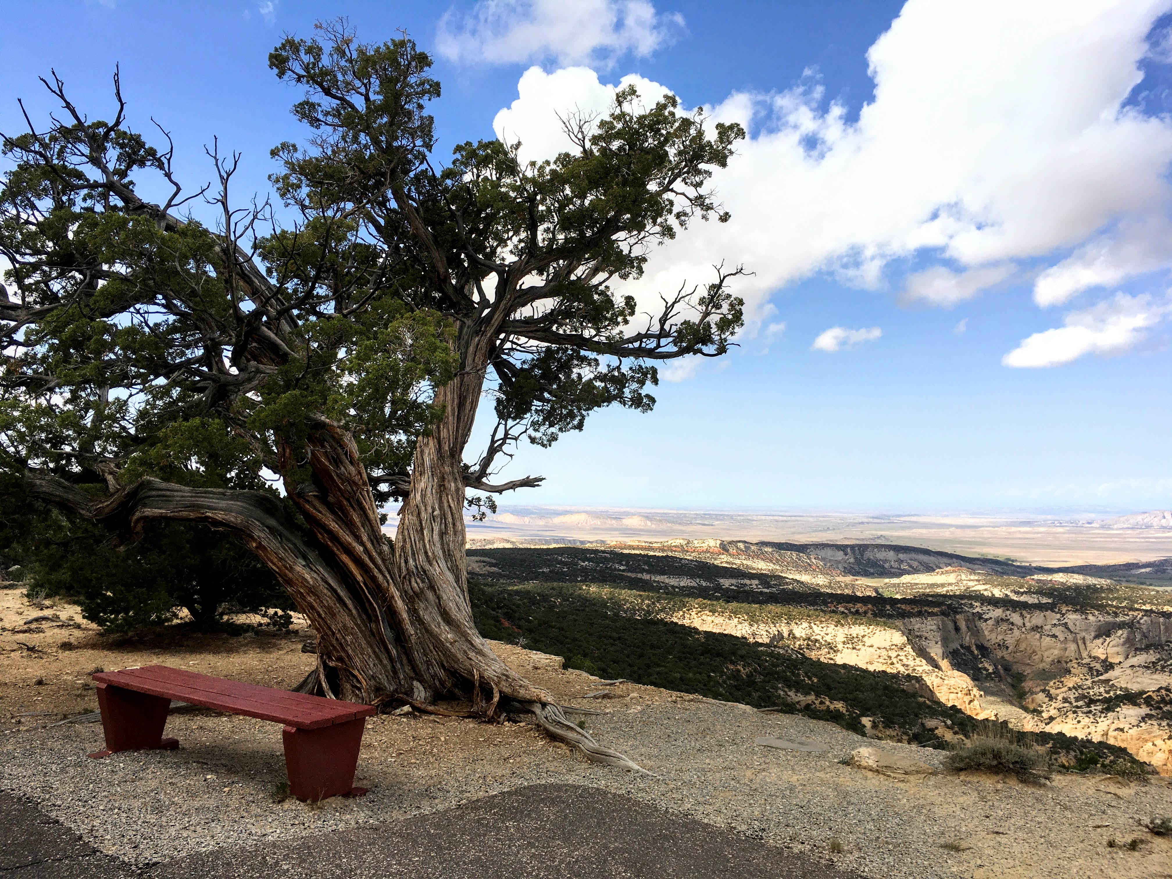
Located on top of a butte, the Plug Hat Trail offers panoramic views of the surrounding landscape. The trail is paved and winds through a forest of pinyon pine and Utah juniper trees. Signs along the way provide information about the local community of plants and animals. Benches are available at scenic areas. Although the trail is wheelchair accessible, some assistance may be needed. A wheelchair accessible picnic area is located across the road from the trailhead. Leashed pets are allowed on this trail.
Hiking brochures are available at the Visitor Centers.
Rules and Regulations
Leashed pets are allowed on this trail. Leashes must be no longer than 6 feet (2 meters) in length. Handlers must clean up and pack out pet waste.
Carry out all trash.
Collecting artifacts, fossils, plants, antlers, rocks, or other objects is prohibited.
Do not feed or approach wildlife.
Biking on trails is not permitted in Dinosaur National Monument.
Your Safety
There is some shade on this trail.
Be prepared for desert hiking. Wear a hat and sunscreen. Take water. A minimum of 1 gallon (3.8 liters) of water per person is recommended in summer.
Temperatures can exceed 100°F (38°C) in summer. To avoid the heat, hike in the morning or evening. Carry a headlamp if hiking near nightfall.
Let someone know where you are going and when you are due back.
Wear comfortable, sturdy shoes, such as hiking boots or athletic shoes. Open-toed shoes or sandals are not recommended.
Watch for wildlife. This is bear and mountain lion country. Keep small children close.
All natural areas pose risks. Your safety depends on your own good judgment.
Accessibility This trail is paved and accessible to wheelchairs, although some assistance may be required. The paved path is about 3 feet (1 m) wide. There are some gentle bumps and cracks in the pavement. The trail is relatively flat the entire way. Benches are located at scenic viewpoints.
1.2 mi one way · about 200 ft of climbing · 4,791 ft–4,922 ft · earth surface · hiking
TrailheadsGreen River Campground Trailhead 4,792 ft Drive there · Split Mountain Campground Trailhead 4,797 ft Drive there
Hike the River Trail at Dinosaur National Monument the Park Service's write-up
1-3 Hours · dogs allowed
Start Green River and Split Mountain Campgrounds
Hikers on the river trail get continual views of the Green River and Split Mountain. Photo: NPS
Distance: 3 miles (4.8 km) round trip
Elevation Change: Approximately 500 feet (152 m)
Level of Difficulty: Moderate
Type of Trail: Out and back, not a loop. Can be done as a through hike you make arrangements to be picked up at the opposite trailhead.
Trailheads: Split Mountain Campground or Loop A of the Green River Campground
This 1.5 mile (2.4 km) one-way trail follows the Green River, connecting the Green River and Split Mountain Campgrounds. The trail climbs to a bench above the river and offers dramatic views of Spilt Mountain, the Green River and Cub Creek Valley. Wildlife is often seen along the river, including mule deer and a variety of birds. In the spring, wildflowers may briefly cover the surrounding slopes.
Hiking brochures are available at the Visitor Centers.
Rules and Regulations
Leashed pets are allowed on this trail. Leashes must be no longer than 6 feet (2 meters) in length. Handlers must clean up and pack out pet waste.
Carry out all trash.
Collecting artifacts, fossils, plants, antlers, rocks, or other objects is prohibited.
Do not feed or approach wildlife.
Biking on trails is not permitted in Dinosaur National Monument.
Your Safety
There is no shade on this trail.
Be prepared for desert hiking. Wear a hat and sunscreen. Take water. A minimum of 1 gallon (3.8 liters) of water per person is recommended in summer.
Temperatures can exceed 100°F (38°C) in summer. To avoid the heat, hike in the morning or evening. Carry a headlamp if hiking near nightfall.
Let someone know where you are going and when you are due back.
Wear comfortable, sturdy shoes, such as hiking boots or athletic shoes. Open-toed shoes or sandals are not recommended.
Watch for wildlife. This is bear and mountain lion country. Keep small children and pets close.
All natural areas pose risks. Your safety depends on your own good judgement.
Accessibility This narrow gravel and rock trail climbs steeply from each end. The north end includes several rock stairs. The trail is not wheelchair accessible. Leashed pets are allowed on this trail.
4.6 mi one way · about 450 ft of climbing · 7,387 ft–7,691 ft · earth surface · hiking
Views
Along the wayIsland Park Overlook
TrailheadRuple Point Trailhead 7,552 ft Drive there
Hike the Ruple Point Trail the Park Service's write-up
4-12 Hours · no dogs · Spring, Summer, Fall
Start Island Park Overlook
From the end of the Ruple Point Trail, hikers are rewarded with a view of Split Mountain Canyon. Photo: NPS Photo
Distance: 9.2 miles (14.8 km) round trip
Elevation Change: Approximately 600 feet (183 meters)
Level of Difficulty: Moderate to difficult
Type of Trail: Out and back, not a loop
Trailhead: Island Park Overlook on the Harpers Corner Road, 27 miles (43.5 km) north of the Canyon Visitor Center.
Ruple Point Trail is one of the longer maintained trails in Dinosaur National Monument. For most of its length, this trail crosses a rolling terrain filled with sagebrush and juniper trees. Towards the end of the trail, a short descent through a pinyon pine forest rewards hikers with cliffs offering breathtaking views of Split Mountain Canyon and the Green River 2,500 feet (762 meters) below. No pets allowed.
Hiking brochures are available at the Visitor Centers.
Rules and Regulations
Pets and animals who provide only comfort or emotional support are prohibited on this trail.
Carry out all trash.
Collecting artifacts, fossils, plants, antlers, rocks, or other objects is prohibited.
Do not feed or approach wildlife.
Biking on trails is not permitted in Dinosaur National Monument.
Permits are required for overnight backcountry camping near this trail. Contact the Information Desk at (435) 781-7700 to request a permit.
Your Safety
There is no shade on this trail.
Use caution near the cliffs at the end of the trail.
Be prepared for desert hiking. Wear a hat and sunscreen. Take water. A minimum of 1 gallon (3.8 liters) of water per person is recommended in summer.
Temperatures can exceed 100°F (38°C) in summer. To avoid the heat, hike in the morning or evening. Carry a headlamp if hiking near nightfall.
Let someone know where you are going and when you are due back.
Wear comfortable, sturdy shoes, such as hiking boots or athletic shoes. Open-toed shoes or sandals are not recommended.
Watch for wildlife. This is bear and mountain lion country. Keep small children close.
All natural areas pose risks. Your safety depends on your own good judgment.
Pets Pets and animals who provide only comfort or emotional support are prohibited on this trail. Per the Americans with Disabilities Act, working service dogs may go wherever their handlers go.
Accessibility The trail is primarily a narrow footpath approximately 2 feet (0.6 meters) wide. The surface is a rugged mixture of dirt and rock. Getting to the viewpoint at the end of the trail requires walking up and down over uneven rock surfaces. This trail is not wheelchair accessible.
3.0 mi one way · about 500 ft of climbing · 4,867 ft–5,130 ft · earth, native surface · hiking
Exhibits
Along the waySound of Silence Trailhead Interpretive Exhibit
TrailheadSound of Silence Trailhead 4,871 ft Drive there
Hike Sound of Silence Trail the Park Service's write-up
1-3 Hours · no dogs
Start Cub Creek Road
A hiker looks towards the area know as "the Racetrack" Photo: NPS Photo
Distance: 3.2 miles (5.1 km) round trip
Elevation Change: Approximately 400 feet (122 meters)
Level of Difficulty: Moderate to difficult. Some rock scrambling required.
Type of Trail: Loop
Trailhead: 2 miles (3.2 km) east of the Quarry Visitor Center
The Sound of Silence Trail introduces hikers to the geologic diversity and desert landscapes of Dinosaur National Monument. The trail wanders through an intermittent stream bed (called a wash), upturned rock layers, desert badlands, and steep slickrock. This trail also offers outstanding views of Split Mountain. Sections of the trail may be difficult to follow. A 0.25 mile (0.4 km) connector trail allows you to combine this with the Desert Voices loop trail for an even longer hike.
A pamphlet for the trail is available at the Visitor Centers. A more detailed guide book for this trail is available at the park bookstore .
Rules and Regulations
Pets and animals who provide only comfort or emotional support are prohibited on this trail.
Carry out all trash.
Collecting artifacts, fossils, plants, antlers, rocks, or other objects is prohibited.
Do not feed or approach wildlife.
Biking on trails is not permitted in Dinosaur National Monument.
Your Safety
There is no shade on this trail.
Be prepared for desert hiking. Wear a hat and sunscreen. Take water. A minimum of 1 gallon (3.8 liters) of water per person is recommended in summer.
Temperatures can exceed 100°F (38°C) in summer. To avoid the heat, hike in the morning or evening. Carry a headlamp if hiking near nightfall.
Let someone know where you are going and when you are due back.
Wear comfortable, sturdy shoes, such as hiking boots or athletic shoes. Open-toed shoes or sandals are not recommended.
All natural areas pose risks. Your safety depends on your own good judgement.
Pets Pets and animals who provide only comfort or emotional support are prohibited on this trail. Per the Americans with Disabilities Act, working service dogs may go wherever their handlers go.
Accessibility This trail is a narrow path on sand and rock. In some areas, the trail follows the stream bed, which may be muddy right after a rain storm. Some areas do require the use of hands to scramble on rocky surfaces. This trail is not wheelchair accessible.
0.1 mi one way · about 30 ft of climbing · 4,840 ft–4,874 ft · earth surface · hiking
Exhibits
Along the waySwelter Shelter Interpretive Exhibit
TrailheadSwelter Shelter Trailhead 4,840 ft Drive there
Hike to the Swelter Shelter Petroglyphs the Park Service's write-up
10-30 Minutes · dogs allowed
Start Cub Creek Road
Swelter Shelter offers a place to see a variety of petroglyphs and pictographs. Photo: NPS / Dan Johnson
Distance: 400 feet (122 m) round trip
Elevation Change: Minimal, with a few stone stairs
Level of Difficulty: Easy
Type of Trail: Out and back
Trailheads: Cub Creek Road 1 mile (1.6 km) east of the Quarry Visitor Center, Stop #1 on Tour of Tilted Rocks Scenic Drive
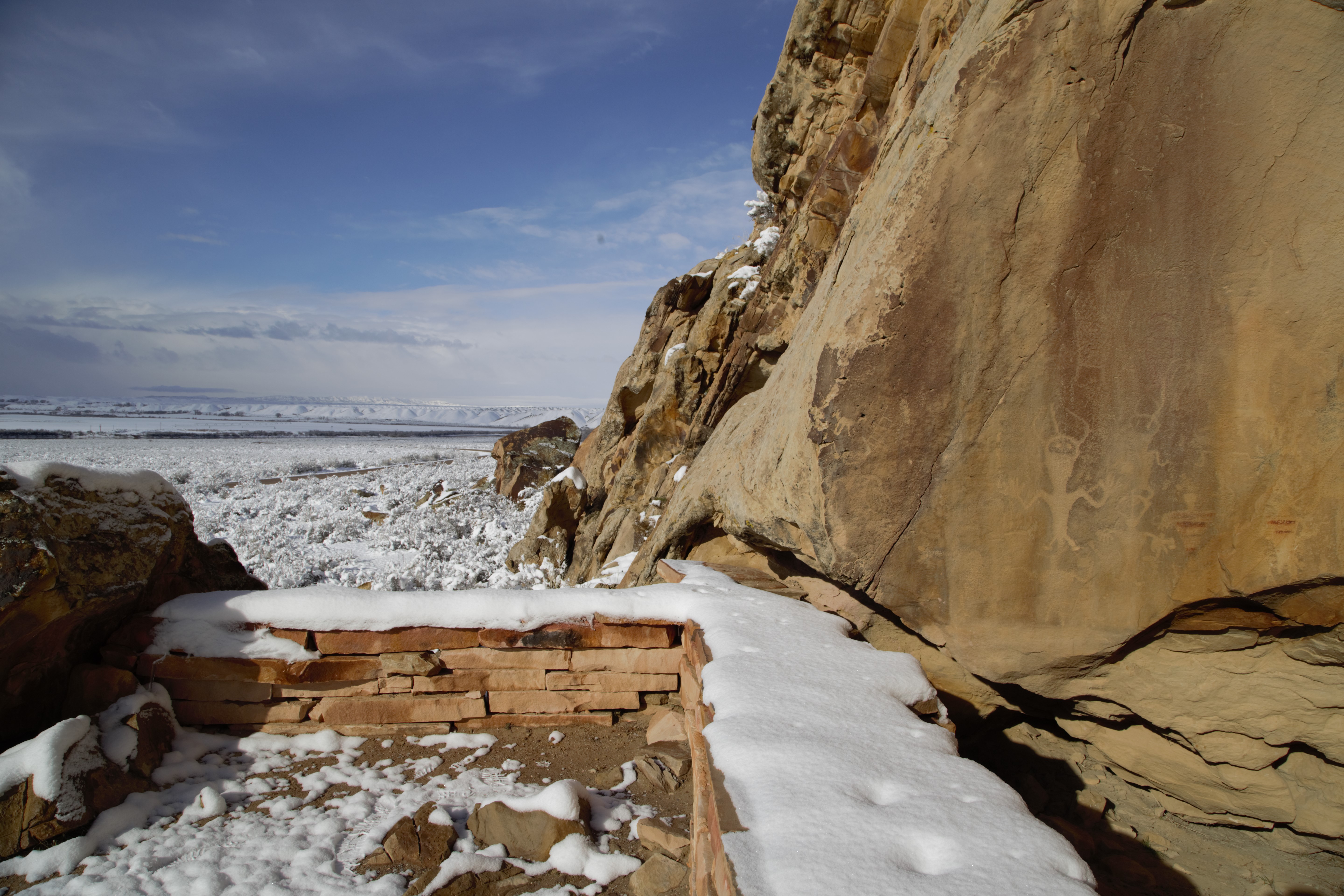
This short walk ends at the Swelter Shelter site, which features a variety of petroglyphs (etchings) and pictographs (paintings) created by the ancestral indigenous people of the region. Based on arheological evidence, the shelter was used, but not extensively occupied, by these peoples. It may have been reserved for special purposes and activities. Swelter Shelter has been occupied by older cultures dating to as early as 7000 BCE.
Don't touch! Petroglyphs and pictographs are fragile, irreplaceable records of the past that many still hold sacred. Touching them can leave skin oils behind, and tracings or rubbings can ruin the designs. Federal law protects all artifacts, including these sites. Do your part to respect and protect the past, and report any vandalism you find.
A pamphlet for this trail is available at the Visitor Centers.
Accessibility The path to the Swelter Shelter Petroglyphs is short and relatively level with a few stone stairs at the end. The terrain is unpaved, mostly packed dirt and gravel, and at least 2 feet (0.6 m) wide. It's not wheelchair accessible, but the flat section before the stairs may be possible in a wheelchair with some assistance. The petroglyphs can be seen from the parking area with binoculars. Leashed pets are allowed on this trail.
The lines are the National Park Service's public trails layer, the trailheads and the waterfalls, views, peaks and historic places along them the Service's public points of interest, read 2026-10-14 and simplified for the map. The write-ups are the Service's own "things to do", unedited. Heights come from USGS 3DEP through Terrain Tiles on AWS (Mapzen/Tilezen), read along each line and rounded; a short trail on steep ground can be off by a few tens of feet. Closures change: check the park's own site before you go.