
Ruple Point Trail
Views
Along the way Island Park Overlook
Trailhead Ruple Point Trailhead 7,552 ft Drive there
Hike the Ruple Point Trail 9.2 mi round trip · the Park Service's write-up
4-12 Hours · no dogs · Spring, Summer, Fall · season The Harpers Corner Road, which leads to this trailhead, may be closed seasonally due to snow and ice.
Start Island Park Overlook
Distance: 9.2 miles (14.8 km) round trip
Elevation Change: Approximately 600 feet (183 meters)
Level of Difficulty: Moderate to difficult
Type of Trail: Out and back, not a loop
Trailhead: Island Park Overlook on the Harpers Corner Road, 27 miles (43.5 km) north of the Canyon Visitor Center.
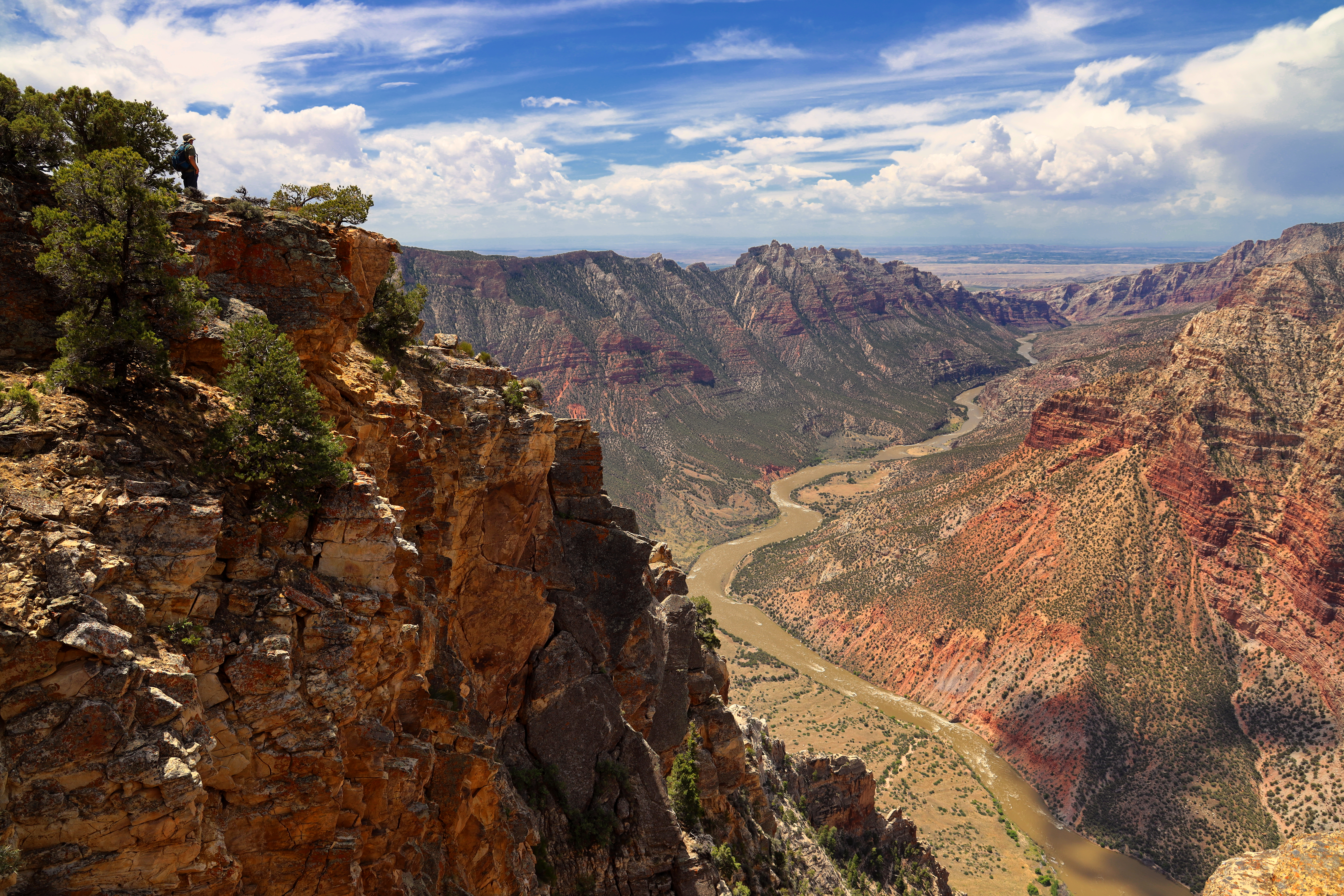
Ruple Point Trail is one of the longer maintained trails in Dinosaur National Monument. For most of its length, this trail crosses a rolling terrain filled with sagebrush and juniper trees. Towards the end of the trail, a short descent through a pinyon pine forest rewards hikers with cliffs offering breathtaking views of Split Mountain Canyon and the Green River 2,500 feet (762 meters) below. No pets allowed.
Hiking brochures are available at the Visitor Centers.
Rules and Regulations
Pets and animals who provide only comfort or emotional support are prohibited on this trail.
Carry out all trash.
Collecting artifacts, fossils, plants, antlers, rocks, or other objects is prohibited.
Do not feed or approach wildlife.
Biking on trails is not permitted in Dinosaur National Monument.
Permits are required for overnight backcountry camping near this trail. Contact the Information Desk at (435) 781-7700 to request a permit.
Your Safety
There is no shade on this trail.
Use caution near the cliffs at the end of the trail.
Be prepared for desert hiking. Wear a hat and sunscreen. Take water. A minimum of 1 gallon (3.8 liters) of water per person is recommended in summer.
Temperatures can exceed 100°F (38°C) in summer. To avoid the heat, hike in the morning or evening. Carry a headlamp if hiking near nightfall.
Let someone know where you are going and when you are due back.
Wear comfortable, sturdy shoes, such as hiking boots or athletic shoes. Open-toed shoes or sandals are not recommended.
Watch for wildlife. This is bear and mountain lion country. Keep small children close.
All natural areas pose risks. Your safety depends on your own good judgment.
Pets Pets and animals who provide only comfort or emotional support are prohibited on this trail. Per the Americans with Disabilities Act, working service dogs may go wherever their handlers go.
Accessibility The trail is primarily a narrow footpath approximately 2 feet (0.6 meters) wide. The surface is a rugged mixture of dirt and rock. Getting to the viewpoint at the end of the trail requires walking up and down over uneven rock surfaces. This trail is not wheelchair accessible.