Curecanti National Recreation Area · Colorado

Mesa Creek Trail

0.7 mi of trail, end to end · about 90 ft of climbing · 6,757 ft–6,819 ft · trail class Developed · hiking

ViewsPicnic areas

6,760 ft 6,785 ft · 0.3 mi high 6,785 ft

Along the way Mesa Creek Picnic Area Morrow Point Dam Picnic Area Morrow Point Dam Overlook Morrow Point Dam Overlook

Trailhead Mesa Creek Trail 6,758 ft Drive there

Hike Mesa Creek Trail the Park Service's write-up

1-2 Hours · dogs allowed · Spring, Summer, Fall

Start Mesa Creek Trailhead
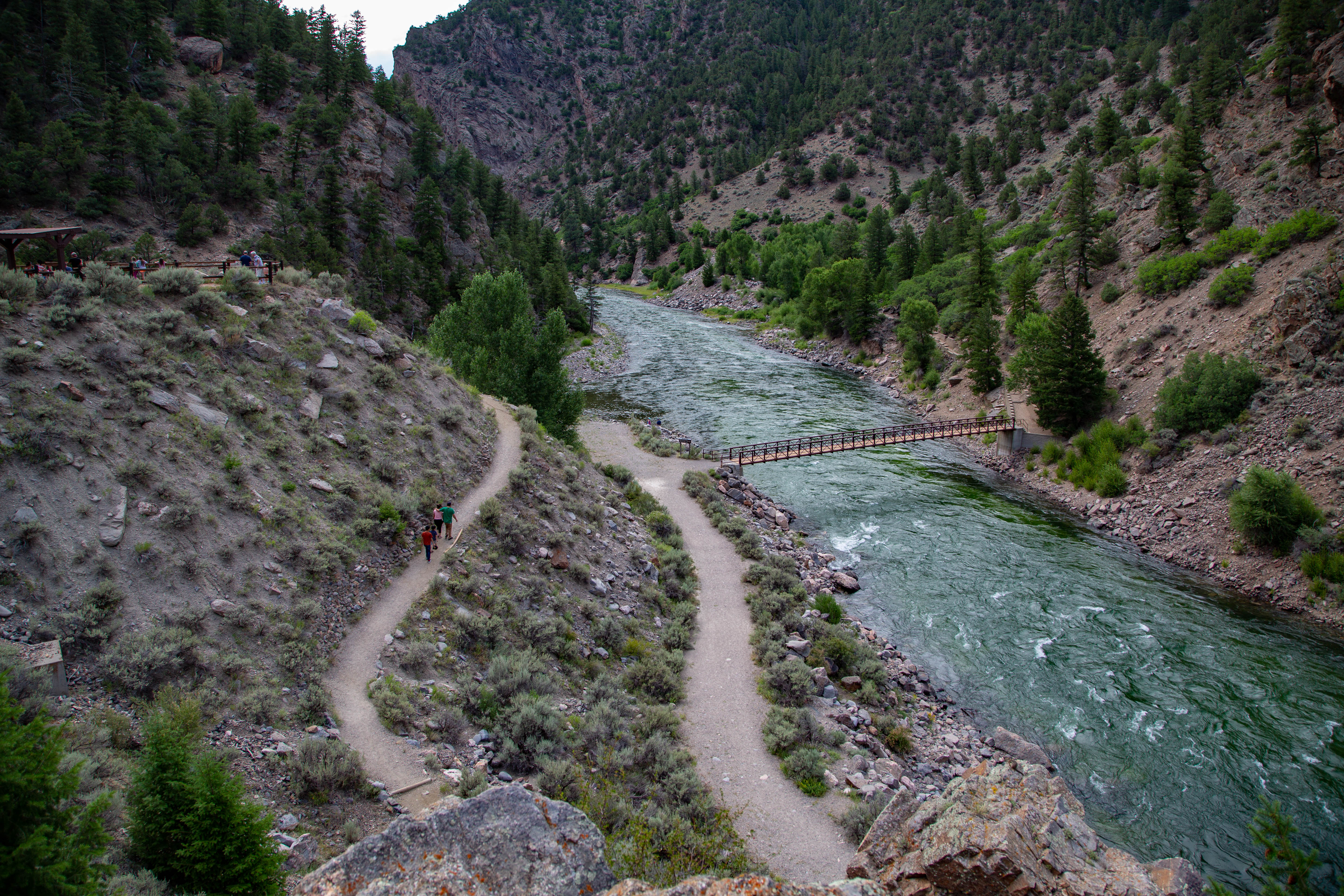
A footpath goes back and forth next to a narrow canyon and river
A footbridge provides access to the north side of Crystal Reservoir. Photo: NPS/Victoria Stauffenberg

This trail crosses Crystal Reservoir and meanders along the river's edge for less than a mile. The sheer walls of the Black Canyon and the base of the Morrow Point Dam can be seen along the way. A footbridge provides access to the north shore of the reservoir.

No boat launching facilities. Small craft must be hand launched into Crystal Reservoir. Releases from Morrow Point Dam can cause strong currents and fluctuating water levels.

Distance (one-way): .9 mi (1.4 km)

Difficulty: Easy to moderately strenuous

Accessibility This trail is not accessible due to the uneven terrain and steep grade of the path before the bridge.

This hike on nps.gov

All 19 trails in Curecanti National Recreation AreaFind a trailOn the parks mapPark on nps.gov

About this trail's facts

The lines are the National Park Service's public trails layer, the trailheads and the waterfalls, views, peaks and historic places along them the Service's public points of interest, read 2026-10-16 and simplified for the map; the length is the line's, end to end. The write-ups are the Service's own "things to do" text, unedited. Heights come from USGS 3DEP through Terrain Tiles on AWS (Mapzen/Tilezen), read along each line and rounded; a short trail on steep ground can be off by a few tens of feet. Closures change: check the park's own site before you go.