Beaver Creek Trail
Picnic areas
Along the way Beaver Creek Picnic Area

National Recreation Area · Colorado
19 named trails · 14 miles · 7 trailheads · 8 with the Park Service's own write-up. The lines, trailheads and points are the Park Service's; the write-ups are the Service's own words; the climbing is read from USGS elevation along each line.
19 trails, A to Z.
Picnic areas
Along the way Beaver Creek Picnic Area
Trailhead Cooper's Ranch Trail 7,554 ft Drive there
ViewsPicnic areas
Along the way Crystal Creek Picnic Area Crystal Creek Trail Overlook Crystal Creek Trail Overlook
Trailhead Crystal Creek Trail 8,653 ft Drive there
2-3 Hours · dogs allowed · Spring, Fall
Start Crystal Creek Trailhead
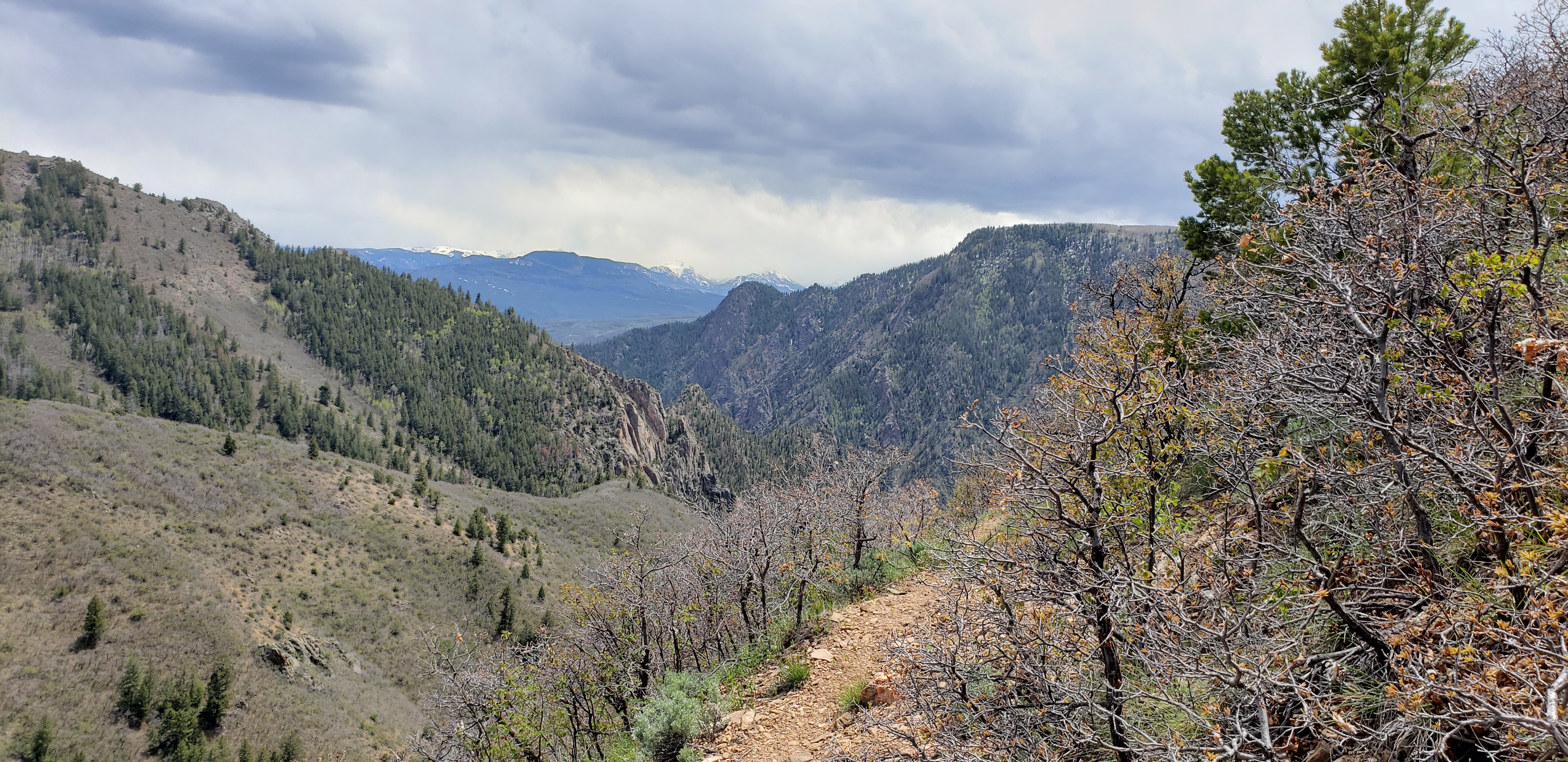
Winding through abundant wildflowers, Gambel oak, aspens, conifers and a recovering burn area, Crystal Creek Trail is ideal for spring or fall hiking. Sweeping views of Cimarron Valley, the West Elk and San Juan Mountains can be viewed along the way. The trail forks and leads to two overlooks, both over 1,000 ft (305 m) above Crystal Reservoir.
Good shoes or boots are recommended. Carry at least 2 quarts of water per person. Check for ticks frequently during the hot summer months.
Distance (one-way): 1.5 mi (2.4 km)
Difficulty: Moderately strenuous. Trail begins at 8900 ft (2703 m) above sea level.
Accessibility This trail has significant elevation change and is not wheelchair accessible.
ViewsPicnic areas
Along the way Pioneer Point Picnic Area Curecanti Creek Trail Overlook Curecanti Needle Overlook West Elk Mt. Overlook
Trailhead Curecanti Creek Trail 8,018 ft Drive there
2-3 Hours · dogs allowed · Spring, Summer, Fall
Start Pioneer Point
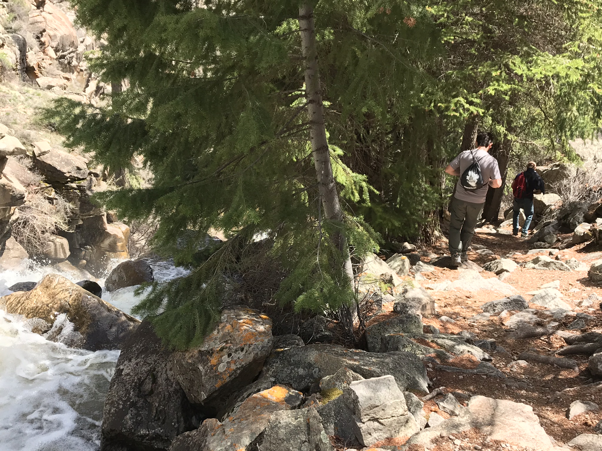
After descending from the high rim of the Upper Black Canyon of the Gunnison, the trail follows Curecanti Creek as it descends toward Morrow Point Reservoir. The Curecanti Needle, a 700 ft (213 m) granite spire, towers above at the trail's end.
The first half of the trail begins in the sun on a southwest facing slope and the second half is partially shaded by fir and spruce trees. Good shoes or boots are recommended. Carry at least 2 quarts of water per person.
Distance (one-way): 2 mi (3.2 km)
Difficulty: Strenuous
Accessibility Curecanti Creek Trail has steep grades with uneven terrain. It is not wheelchair accessible.
Views
Along the way Dillon Pinnacles Trail Overlook Dillon Pinnacles Trail Overlook
2-3 Hours · dogs allowed
Start Dillon Pinnacles Trail
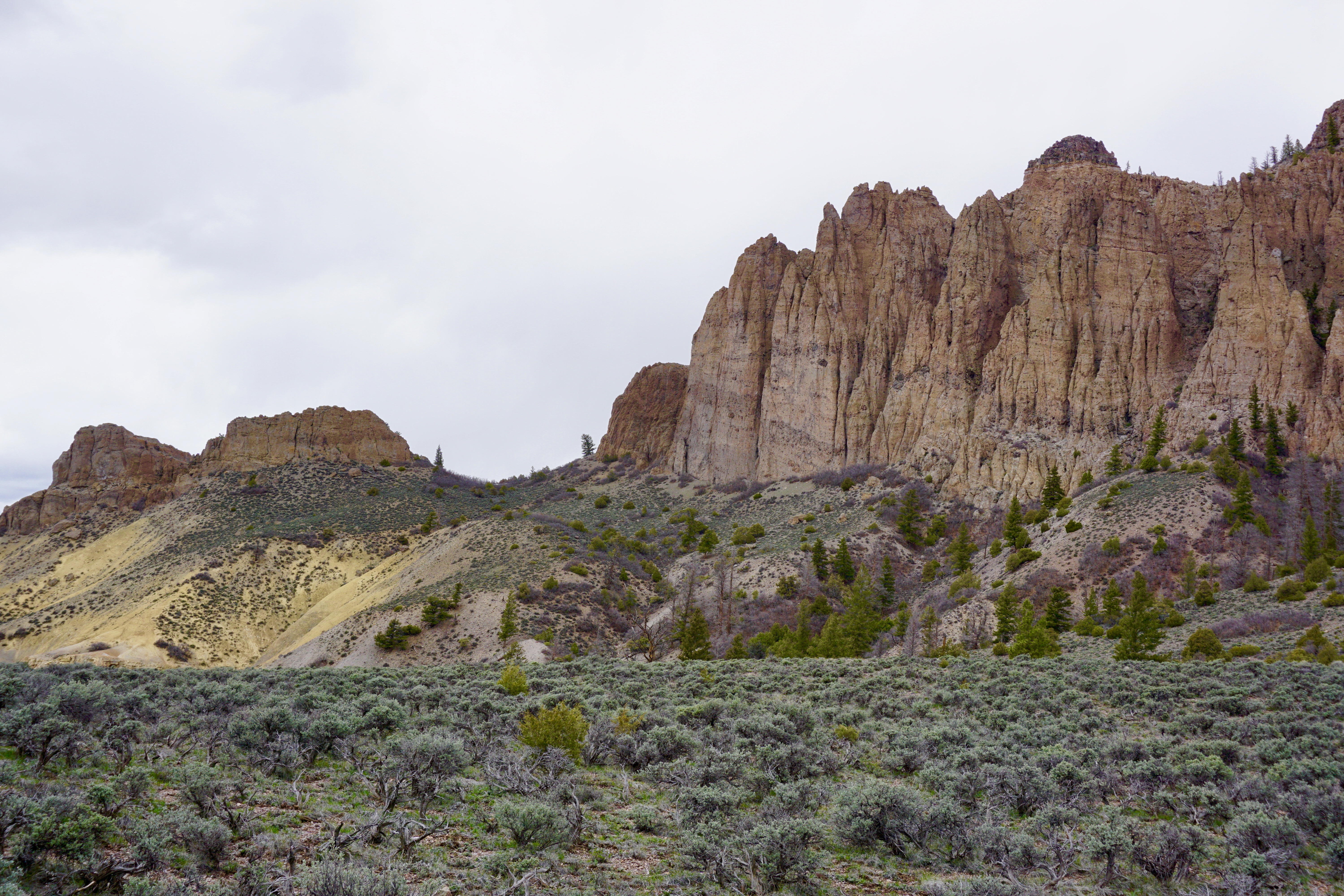
Ascending through sagebrush, ponderosa pine and riparian habitats, this trail offers spectacular views of Blue Mesa Reservoir, the distant San Juan Mountain peaks, and the eroded volcanic Dillon Pinnacles. Along the trail are a few shady places to rest and open sunny vistas with possible glimpses of bighorn sheep.
Horses are permitted. Good shoes or boots are recommended. Carry at least 2 quarts of water per person.
Length: 1.9 miles (3.2 km) one way
Difficulty: Moderately strenuous
Accessibility This trail is not accessible due to steep grades and uneven terrain.
Picnic areas
Along the way Elk Creek Picnic Area
Exhibits
Along the way Gateview Sign
Picnic areas
Along the way Hermits Rest Picnic Area
Trailhead Hermit's Rest Trail 8,960 ft Drive there
2-3 Hours · dogs allowed
Start Hermit's Rest Trailhead
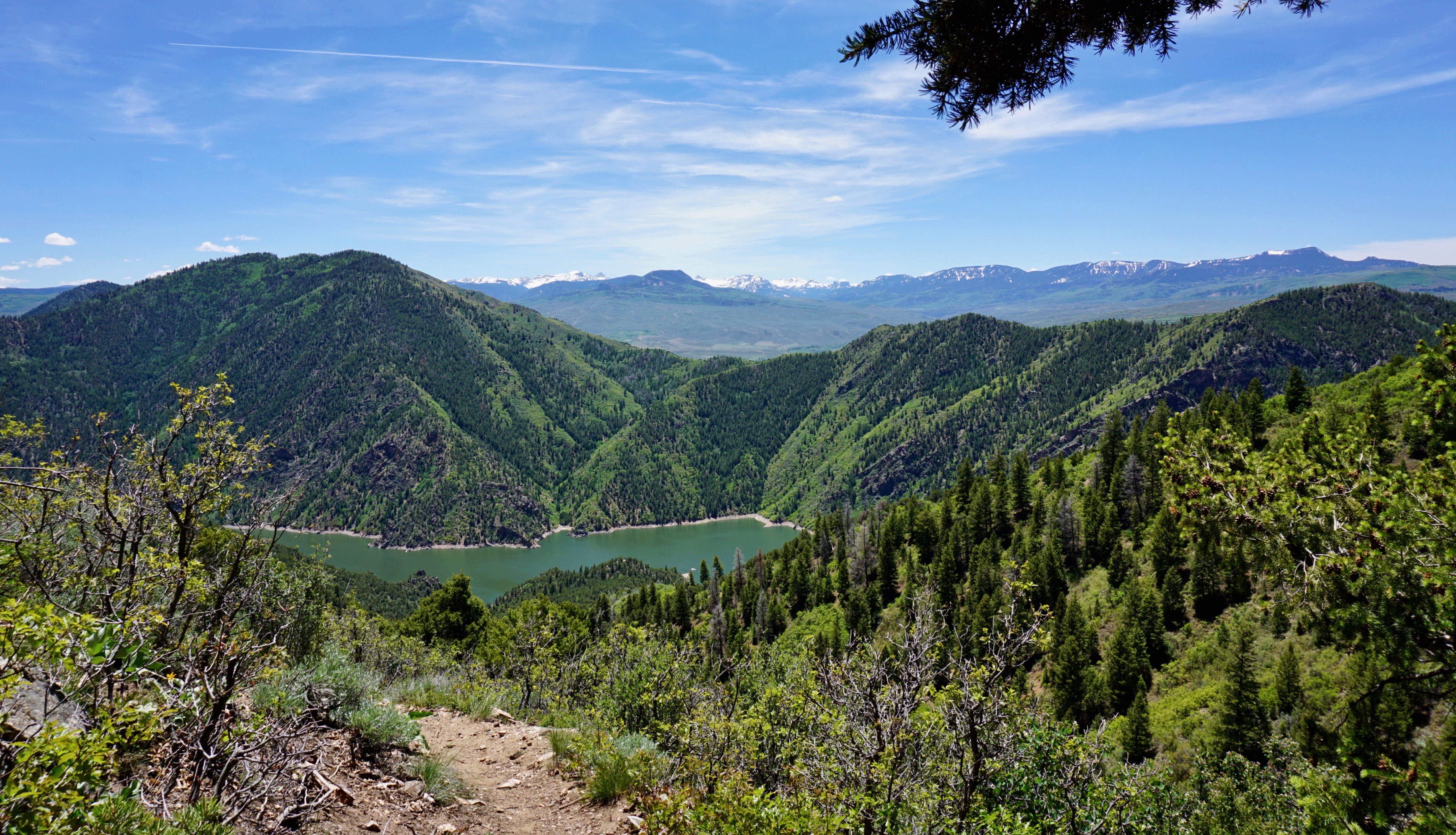
Zigzagging through oak, pine, juniper, and fir, hikers descend 1750 ft (531 m) to wooded camp and picnic sites on the shores of Morrow Point Reservoir. One backcountry campsite , as well as picnic tables, fire grate, and a toilet, are provided at the end of the trail.
Good shoes or boots are recommended. Carry at least 2 quarts of water per person. Check for ticks frequently during the hot summer months.
Distance (one-way): 2.6 mi (4.2 km)
Difficulty: Very strenuous and little shade. Elevation change is 1750 ft (531 m).
Accessibility This trail has uneven terrain, steep decents, and is not wheelchair accessible.
Picnic areas
Along the way Iola Picnic Area
ViewsPicnic areas
Along the way Mesa Creek Picnic Area Morrow Point Dam Picnic Area Morrow Point Dam Overlook Morrow Point Dam Overlook
Trailhead Mesa Creek Trail 6,758 ft Drive there
1-2 Hours · dogs allowed · Spring, Summer, Fall
Start Mesa Creek Trailhead
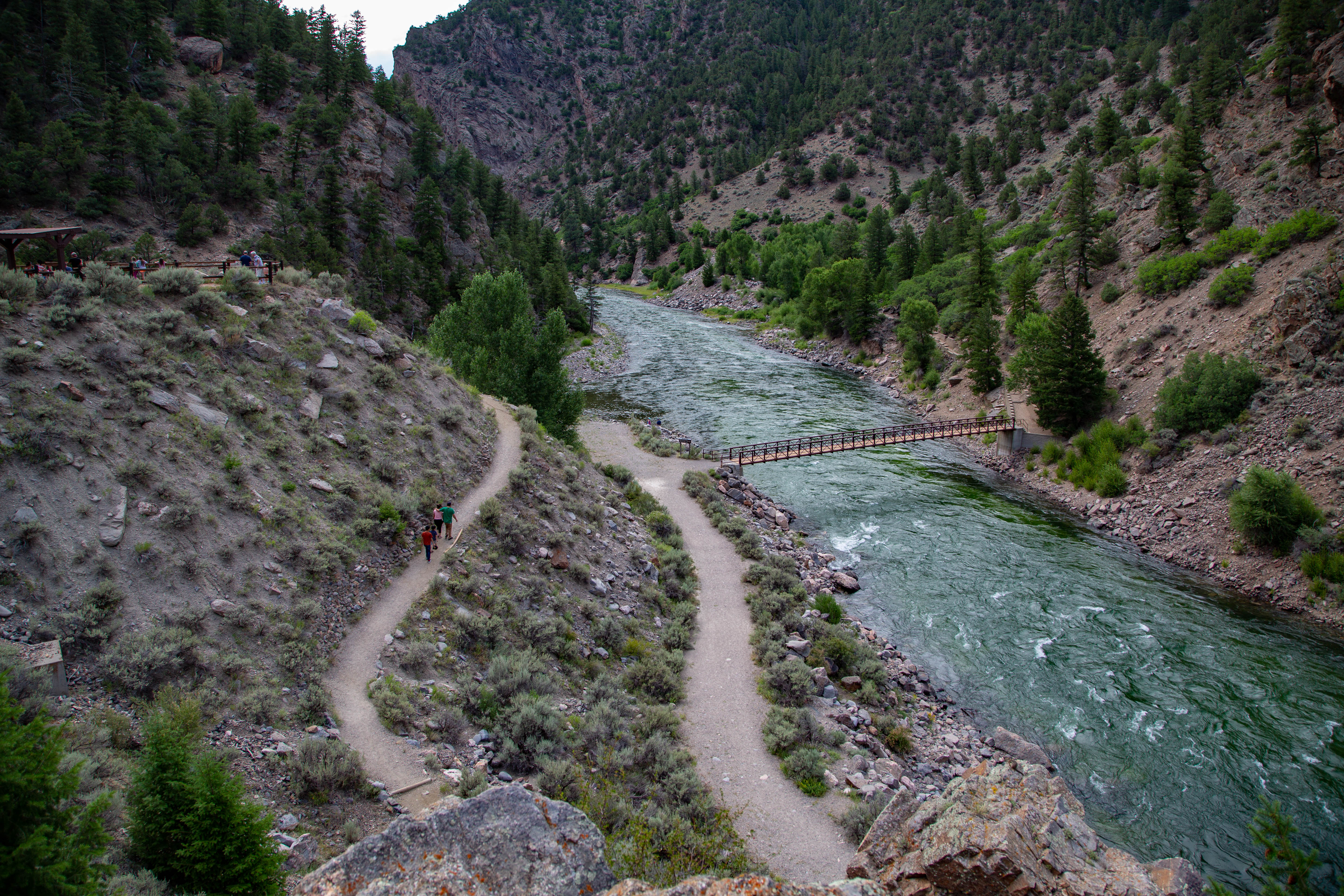
This trail crosses Crystal Reservoir and meanders along the river's edge for less than a mile. The sheer walls of the Black Canyon and the base of the Morrow Point Dam can be seen along the way. A footbridge provides access to the north shore of the reservoir.
No boat launching facilities. Small craft must be hand launched into Crystal Reservoir. Releases from Morrow Point Dam can cause strong currents and fluctuating water levels.
Distance (one-way): .9 mi (1.4 km)
Difficulty: Easy to moderately strenuous
Accessibility This trail is not accessible due to the uneven terrain and steep grade of the path before the bridge.
Picnic areas
Along the way Neversink Picnic Area
Trailhead Neversink Trail 7,545 ft Drive there
30-60 Minutes · dogs allowed
Start Neversink Trailhead
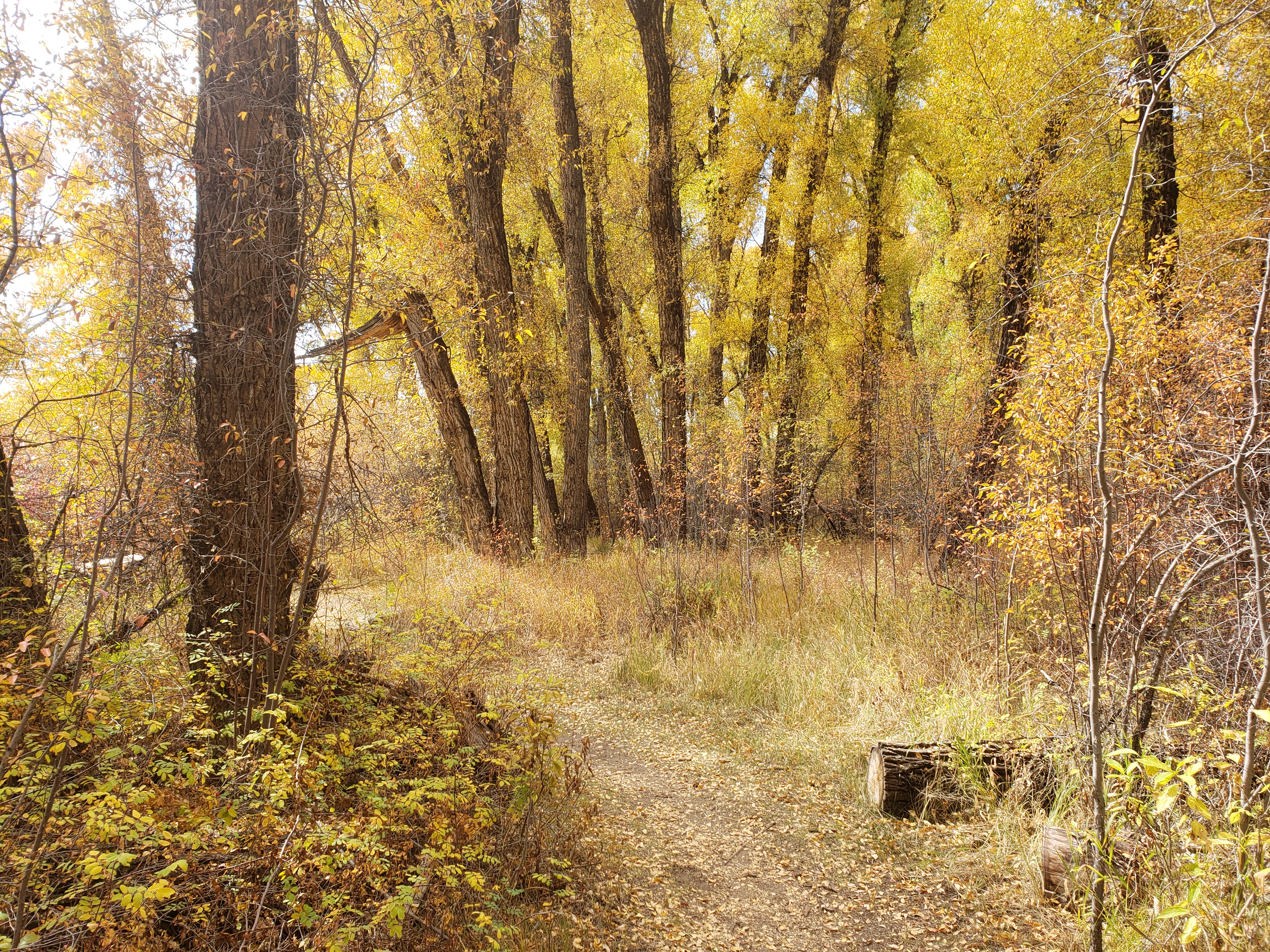
The Neversink Trail is located nearest to Gunnison on the north bank of the Gunnison River near a Great Blue Heron rookery. This streamside habitat with its heavy undergrowth of grasses, flowers, cottonwoods, and willows, is ideal for birdwatching or just a quiet stroll.
Trail can become muddy after heavy precipitation or flooding.
Distance (one-way): .5 mi (.9 km)
Difficulty: Easy
Accessibility This trail is flat and provides easy walking. The beginning of the trail is wheelchair accessible.
Boat launches
Along the way Pine Creek Boat Launch
Trailhead Pine Creek Trail 7,405 ft Drive there
1-2 Hours · dogs allowed · Spring, Summer, Fall
Start Pine Creek Trailhead
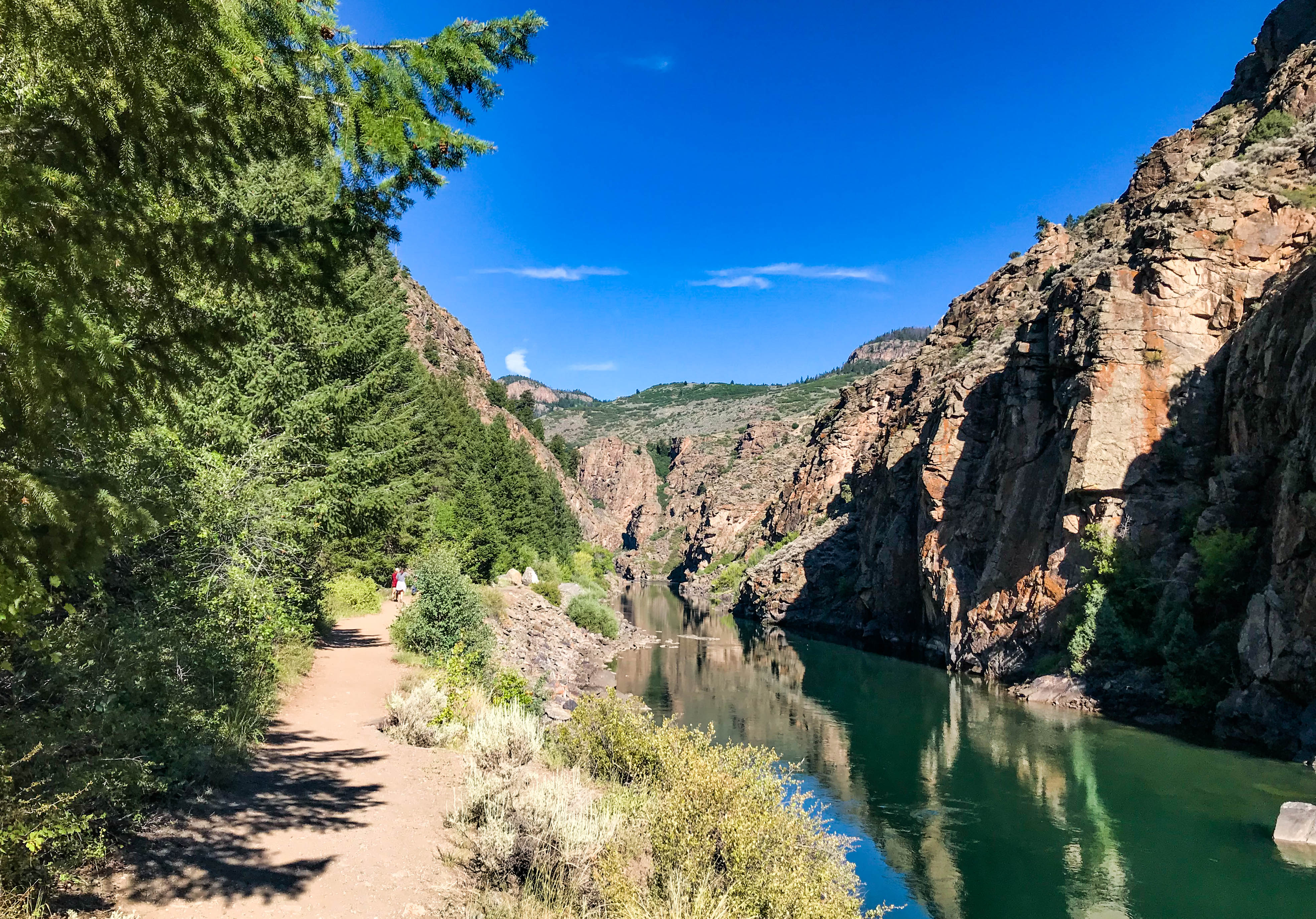
This trail follows Pine Creek as it cascades into the depths of the upper Black Canyon to Morrow Point Reservoir. It follows the old narrow gauge railroad bed along the reservoir.
Pine Creek Trail provides fishing, camping, and boating access for Morrow Point Reservoir. No boat launching facilities. Small hand-carried craft are permitted if carried down the steps (and back up).
Distance (one-way): 1.3 mi (2.1 km)
Difficulty: Moderately strenuous. 200+ ft (65 m) decent into the canyon via maintained steps. Carry at least 1 liter of water per person. Check for ticks during the summer months.
Accessibility This trail is moderately strenuous with a short descent on maintained steps. It is not wheelchair accessible.
Campgrounds
Along the way Ponderosa Campground
2-3 Hours · dogs allowed
Start Dillon Pinnacles Trail
Ascending through sagebrush, ponderosa pine and riparian habitats, this trail offers spectacular views of Blue Mesa Reservoir, the distant San Juan Mountain peaks, and the eroded volcanic Dillon Pinnacles. Along the trail are a few shady places to rest and open sunny vistas with possible glimpses of bighorn sheep.
Horses are permitted. Good shoes or boots are recommended. Carry at least 2 quarts of water per person.
Length: 1.9 miles (3.2 km) one way
Difficulty: Moderately strenuous
Accessibility This trail is not accessible due to steep grades and uneven terrain.
The lines are the National Park Service's public trails layer, the trailheads and the waterfalls, views, peaks and historic places along them the Service's public points of interest, read 2026-10-14 and simplified for the map. The write-ups are the Service's own "things to do", unedited. Heights come from USGS 3DEP through Terrain Tiles on AWS (Mapzen/Tilezen), read along each line and rounded; a short trail on steep ground can be off by a few tens of feet. Closures change: check the park's own site before you go.