
Tidepool Trail
Coastal Trail 1 mi round trip · the Park Service's write-up
30-60 Minutes · dogs allowed · season You can hike the Coast Trail year-round!<br /> <br /> If you are planning to hike the trail to visit the tidepools, please be aware that tidepool access varies with the tides. Best low tide viewing is when sea level drops below 0.7 feet (0.2 m) above sea level. The trail and tidepools are inacessible outside park hours of operation. Please make sure you plan tidepool visits during low tides that occur during normal hours. <a href="https://www.nps.gov/cabr/learn/nature/tidepools.htm">Learn more about visiting the tidepools found in Cabrillo's Rocky Intertidal Zone</a>.
Start Tidepool Parking Lot #1 (Southern Lot)
Length: 1 mi (1.6 km) round-trip
Time: 30 minutes - 1 hour
Difficulty: Easy (Trail is listed as a Class 5 trail at both ends with a Class 3 trail in the middle sections.)
Elevation Change: 50 ft. (100 ft. if traveling to tidepools from Lot #2)
Location: Cabrillo Road, bluffs overlooking the Tidepools
Parking: Tidepool Lot #1 or Tidepool Lot #2
Closest Restroom : Pit Toilet at Tidepool Lot #1
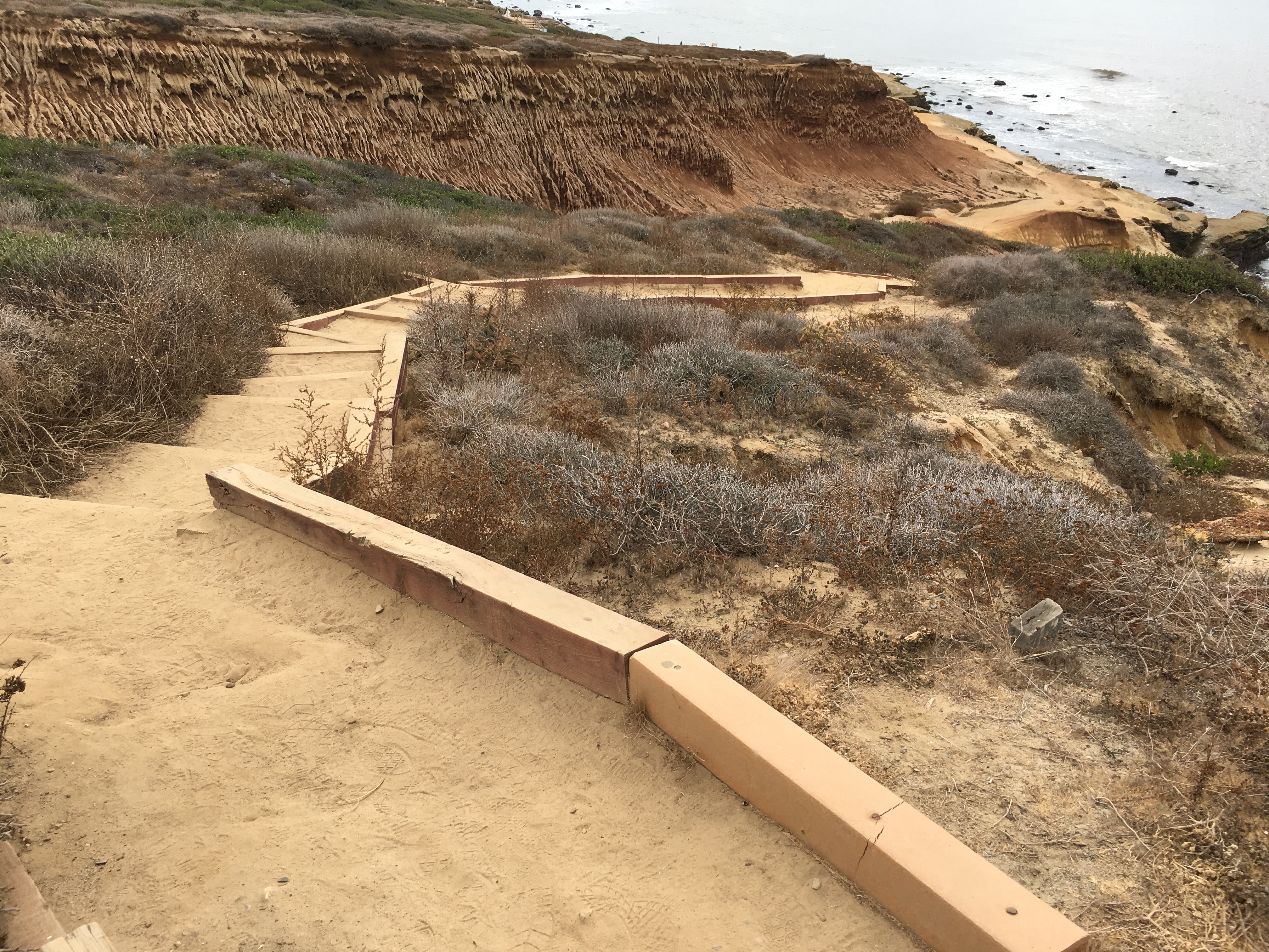
Route: This dirt trail passes along the bluffs overlooking the Cabrillo Tidepools. This trail can be started from the entrances at Tidepool Lot #1 or #2. It is a 1/2 mile (0.8 km) trip from one lot to the other. Portions of the trail contain steps and there are a few steep slopes. A spur from this trail provides access to the tidepools during low tide events. To return to the trailhead, retrace your steps back the trail entrance you started from.
Directions: Once you are in the park, take the turnoff for Cabrillo Rd. and travel down the hill 1 mile (1.6 km) to reach Tidepool Lot #1. Additional parking is available 1/2 mile (0.8 km) further down the road at Tidepool Lot #2.
Safety: There are no water sources along this trail. Hikers should plan to bring water and sun protection, especially during the warm summer months. Beware of slippery terrain and waves when on the tidepool spur trail. As in any natural area, there are environmental hazards to watch out for, including toxic plants, animals (such as rattlesnakes), and fragile cliff faces.
Coasting Along Cabrillo
The Coastal Trail travels along the bluffs on the western side of Cabrillo, just above the tidepools. The path provides an amazing opportunity to take in views of the ocean, delicate bluffs, and the tidepools below (when exposed). The trail near Lot #1 branches in two directions. One portion heads down towards the tidepools while the main trail passes over a small hill and continues along the bluffs towards Lot #2. A spur trail just south of Lot #2 leads to a bluff with additional coastal views.
While much of the trail crosses barren badlands, there are ample opportunities to explore the area’s native plant life as well. At any point, you can look upslope to the east and see native Mediterranean Coastal Sage Scrub and Maritime Chaparral plants. This native vegetation was once abundant in southern California but development has left very little acreage remaining. You can also see a strand of rare Shaw’s Agave just south of Lot #2. You may see rangers and volunteers pulling invasive weeds in this area and working in other parts of the park. This work is invaluable in helping preserve the rare ecosystems found withing the park. For example, one recent project led to the resurgence of native sea dahlia!
There is an also opportunity to examine some World War II history during this hike. Near the top of the stairs towards Lot #2, you will come across Searchlight Shelter, No. 15, an underground structure from World War II. What you see from the trail is the sliding roof. Make sure you stay off the roof as it is very unstable!
Regardless of which parking lot you use to start the hike, you return the way you came to finish it.
Accessibility Service animals are allowed. There are steep steps at various locations along the route and portions of the trail have a moderate grade. Terrain on this trail is uneven, subject to erosion, and is not accessible for wheelchair or strollers.
Oceanside Trail 1 mi round trip · the Park Service's write-up
45-60 Minutes · no dogs
Start Oceanside Trail
Length: 1 mi (.6 km) round-trip
Time: 1 hour
Difficulty: Easy
Elevation Change: 340 feet
Location: Southwest of the Old Point Loma Lighthouse grounds.
Parking: Main Parking Lot by Visitor Center.
Closest Restroom : Old Point Loma Lighthouse Grounds, Tidepools by Lot 1.
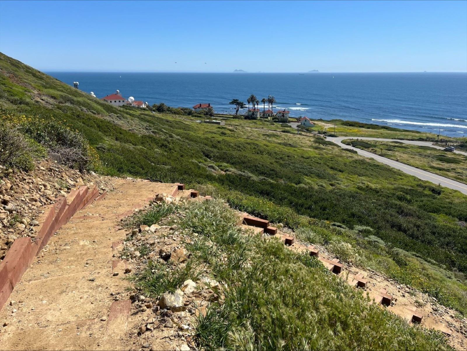
The Oceanside Trail significantly increases recreational opportunities by providing an entirely new trail that increases the park’s trail network by over 20% while also offering a car-free mode of access to the tidepool area. Visitors can now hike with an ocean view and walk to the tidepool area without needing to walk the narrow road shoulder. The trailhead starts at the top of the Whale Watch & Kelp Forest Overlook trail, south of the Old Point Loma Lighthouse. The trail leads down the bluffs and connects to the Coastal Trail and parking lot adjacent to the tide pools area. In addition to overlooking the ocean, this trail will pass by historic coastal defense structures, and give visitors the opportunity to hike in extremely rare undeveloped coastal scrub environments that are home to diverse plant and animal life.
Accessibility Unfortunately, due to the steep gradient of the hill, the trail will not be wheelchair accessible. For wheelchair accessible options, check out the Mobility Services page. The new trail is considered strenuous and will have stair steps, steep areas, uneven surfaces, and switchbacks. It will be narrow with a steep angled slope greater than 15% running slope in some spots. Cell service is not available on the trail or when down in the coastal area. Cell phone service is normally available at the upper trailhead. The trail is very close to the border with Mexico, so many visitors receive international roaming messages on their phones. There is generally no cell phone service at the bottom of the trail or at the tidepool area.